• 3 Mile Walks or Less
  • 4 Mile Walks
  • 5 Mile Walks
  • 6 Mile Walks
  • 7 Mile Walks
  • 8 Mile Walks
  • 9 Mile Walks
  • 10 Mile Walks
  • 11 Mile Walks
  • 12 Mile Walks
  • 14 Mile Walks
  • 15 Mile Walks
  • 20+ Mile Walks

The Wandering Wildflower

Peak District Hikes

  • PEAK DISTRICT WALKS
    • SHORT WALKS UNDER 3 MILES
    • MEDIUM WALKS 4-9 MILES
    • LONG PEAK DISTRICT WALKS 10 MILES +
  • PEAK DISTRICT WALKS WITH PUBS
  • PEAK DISTRICT WALKS WITH KIDS
  • HOLMFIRTH WALKS

Beeley Moor and Harland Edge Trig Point | 9 Miles

May 29, 2022 CIRCULAR WALKS, MEDIUM WALKS 4-9 MILES, PEAK DISTRICT WALKS, PEAK DISTRICT WALKS WITH PUBS

This 9 mile circular walk explores Beeley Moor and the Bronze Age burial cairn of Hob Hursts House, before heading to the Harland Edge trig point.

This is a moorland walk for the most part, using Open Access Land, so there are no paths in places. It’s a great one to do if you’re ticking off the Peak District Ethels or Peak District Trig Point Challenge – we did it at the same time as Birchen Edge, so bagged two trigs in one day.


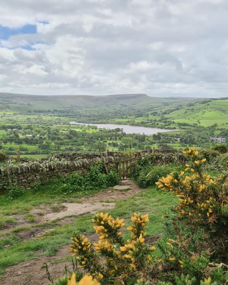
The route starts from the National Trust car park at Birchen Edge and follows the road south-east for a short distance before heading onto Beeley Moor. Following the track for approximately 2.5 miles, you’ll come to Hob Hurst’s House, an unusual square prehistoric burial mound with an earthwork ditch and outer bank. It was named after a local goblin, or giant – bit of a difference sizewise! The site is owned by English Heritage and the stone markers with VR show the extent of the boundary. This was one of the first monuments to be taken into state care. Unfortunately there isn’t much to see but there is an interesting plaque giving the history of the site.


We set off from Hob Hurst’s House over the moors and headed south-east to Harland Edge to bag the Ethel summit. This involves a lot of yomping through heather as there are no proper paths, so we stuck to the shorter patches of heather. Top tip: wear long trousers! The heather was bone dry and thigh-deep in places, and very sharp. I wore shorts and my legs looked like they’d been attacked by a wolf for a few days afterwards!!


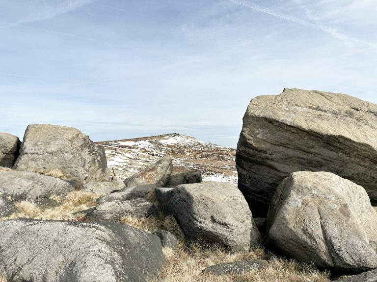
The Ethel summit isn’t really marked by anything but we did find a small stone shelter very close to what the OS App says it the summit, so we’ll go with that!

Small stone shelter at the summit of Beeley Moor

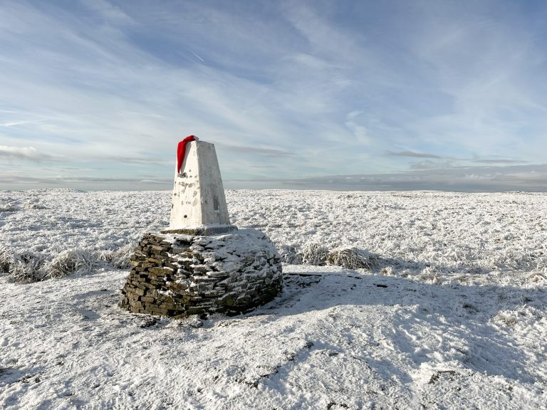
At Harland Edge trig point you have lovely views over the sea of heather (which I imagine looks incredible when the heather is flowering).


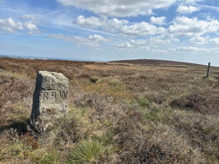
From here you have two options. We followed a faint path to the wall where you used to be able to get out onto the road, which took us past this lovely old waymarker. You can’t get straight out onto the road any more unfortunately as a fence has been erected with barbed wire. You can jump this (taking care not to scratch your nether regions on the barbed wire). Alternatively from the trig point head north-east to pick up the footpath that will take you back out onto the road.

Old stone waymarker obelisk

This stile leads you to the footpath that runs to Hob Hurst’s House and the trig point

We followed the road until the junction with Syda Lane, then turned left and followed the track until it reached the A57 again. Here we walked back along the road to The Robin Hood pub, where they do a lovely Sunday lunch (plus kids under 8 eat free!). This scored very well on Holly’s rankings of pub food.


The Robin Hood at Baslow, a Peak District pub


Harland Edge trig point walk route:


Route Map: 

Walk Route in OS Maps: Beeley Moor and Hob Hursts House

Parking: Birchen Edge car park DE45 1PU next to The Robin Hood pub at Baslow | W3W:///overjoyed.brief.games

Facilities: None on the walk, but The Robin Hood has facilities for customers.

Walk Time: 3-4 hours

Difficulty: ▲▲

Distance: 9 miles (15km)

Trig Points Bagged: Harland Edge

Peak District Peaks Bagged: Beeley Moor

Peak District Ethels Bagged: Harland Edge (Beeley Moor)


Don’t forget to check out some more Peak District trig point walks, or Peak District Ethels walks on the blog!

Tap to share with your hiking friends!

  • Facebook
  • Email
  • WhatsApp
« Black Hill Peak District Walk | 23 Miles
Birchen Edge Walk | 2 Miles »

RELATED POSTS

  • Three Shires HeadHow to Find Three Shires Head
  • Lathkill Dale waterfallLathkill Dale Waterfall Walk | 7 Miles
  • Sheen Hill trig pointSheen Hill Trig Point | 6 Miles
  • Yorkshire Dales Walk from Settle to Long Preston | 5 Miles

Leave a Reply Cancel reply

Your email address will not be published. Required fields are marked *

FIND YOUR NEXT WALK:

ABOUT ME

Y Garn with Kids - Y Garn via the Devil's Kitchen Walk in Ogwen Valley

Hello! I’m Jo! Welcome to The Wandering Wildflower, an outdoors lifestyle blog focusing on family walks in the Peak District, a place we love exploring. I want to share the Peak District hidden gems and show you there’s so much more than the honeypot places. When I’m not dragging my husband and now 11 year old out on Peak District walks or up mountains, I can be found on planning my next moorland walk or plotting a Geocache walk (and seeing where the nearest pub is!). I love the hills but hate the heights, so trig bagging is – er- fun!


I hope this blog will give you some ideas of places to visit in the Peak District and inspire you and your family to head into the great outdoors.  Thanks for stopping by!

CATEGORIES

  • CIRCULAR WALKS (189)
  • HOLMFIRTH WALKS (27)
  • ISLE OF SKYE WALKS (3)
  • LAKE DISTRICT WALKS (26)
  • LANCASHIRE WALKS (2)
  • LONG PEAK DISTRICT WALKS 10 MILES + (42)
  • MEDIUM WALKS 4-9 MILES (137)
  • PEAK DISTRICT SCRAMBLES (16)
  • PEAK DISTRICT WALKS (206)
  • PEAK DISTRICT WALKS WITH KIDS (76)
  • PEAK DISTRICT WALKS WITH PUBS (60)
  • SCOTLAND WALKS (6)
  • SHORT WALKS UNDER 3 MILES (40)
  • SNOWDONIA WALKS (5)
  • UK CAMPING (5)
  • YORKSHIRE WALKS (33)

Peak District Walks

List of Peak District Ethels

Peak District Peak Bagging

Peak District Trig Point Challenge

Peak District Walks with Pubs

Peak District Walks with Kids

Beautiful Walks in Holmfirth

Short Walks in the Peak District

Long Walks in the Peak District

AFFILIATE DISCLOSURE

This blog may contain affiliate links through which, at no additional cost to you, I may earn a small commission. I only recommend products I would use myself and all opinions expressed here are my own. As an Amazon Associate I earn from qualifying purchases. Read full privacy policy here.

ARCHIVES

PEAK DISTRICT WEATHER

Peak District mountain weather on Met Office

Peak District Trig Points

Promo image for a blog post about the Peak District Trig Point Challenge With Map of Peak District Trig Points and Walking Routes by The Wandering Wildflower

Peak District Ethels Challenge

Promo image for a blog post about the Peak District Trig Point Challenge With Map of Peak District Ethels and Walking Routes by The Wandering Wildflower

WALKING ROUTES STRAIGHT TO YOUR INBOX

Want new walks in your inbox? Drop your email below and I'll send you some ideas for walks you can try.

You can unsubscribe anytime. For more details, review our Privacy Policy.

Thank you!

You have successfully joined our subscriber list.

RSS LATEST POSTS

  • How to Find Three Shires Head
  • Peak District Pub Walks
  • Burnbank Fell, Blake Fell and Gavel Fell | 8 Miles
  • Bretton Park Circular Walk | 3 Miles
  • Grasmere Weekend Break

FOLLOW ON PINTEREST

Want new walks in your inbox? Drop your email below and I'll send you some ideas for walks you can try.

You can unsubscribe anytime. For more details, review our Privacy Policy.

Thank you!

You have successfully joined our subscriber list.

jo@thewanderingwildflower.co.uk

The Wandering Wildflower

  • Email
  • Facebook
  • Instagram
  • Pinterest
  • PRIVACY POLICY
  • TERMS & CONDITIONS
  • ABOUT

(c) The Wandering Wildflower. All Rights Reserved.

|| THEME BY ECLAIR DESIGNS