• 3 Mile Walks or Less
  • 4 Mile Walks
  • 5 Mile Walks
  • 6 Mile Walks
  • 7 Mile Walks
  • 8 Mile Walks
  • 9 Mile Walks
  • 10 Mile Walks
  • 11 Mile Walks
  • 12 Mile Walks
  • 14 Mile Walks
  • 15 Mile Walks
  • 20+ Mile Walks

The Wandering Wildflower

Peak District Hikes

  • PEAK DISTRICT WALKS
    • SHORT WALKS UNDER 3 MILES
    • MEDIUM WALKS 4-9 MILES
    • LONG PEAK DISTRICT WALKS 10 MILES +
  • PEAK DISTRICT WALKS WITH PUBS
  • PEAK DISTRICT WALKS WITH KIDS
  • HOLMFIRTH WALKS

Burnbank Fell, Blake Fell and Gavel Fell | 8 Miles

May 16, 2025 LAKE DISTRICT WALKS

More Wainwright walks you might like:
 
Souther Fell, Mungrisdale Common, Bannerdale Crags and Bowscale Pike | 11 Miles
 
Uldale Fells Circular | 8 Miles
 
Rannerdale Knotts [and the Bluebells] | 4 Miles

The Wainwright-bagging continues! This is a 7.6 mile route which ticks off 3 Wainwright fells in the Western Fells: Burnbank Fell (475m), Blake Fell (573m) and Gavel Fell (526m).

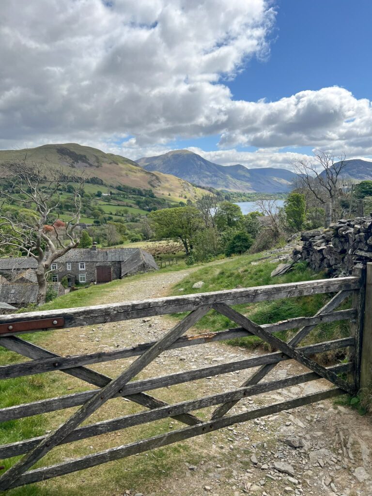
We started at a layby near the north-west corner of Loweswater at Waterend, and picked up a footpath which runs off over the fields to Hudson Place.

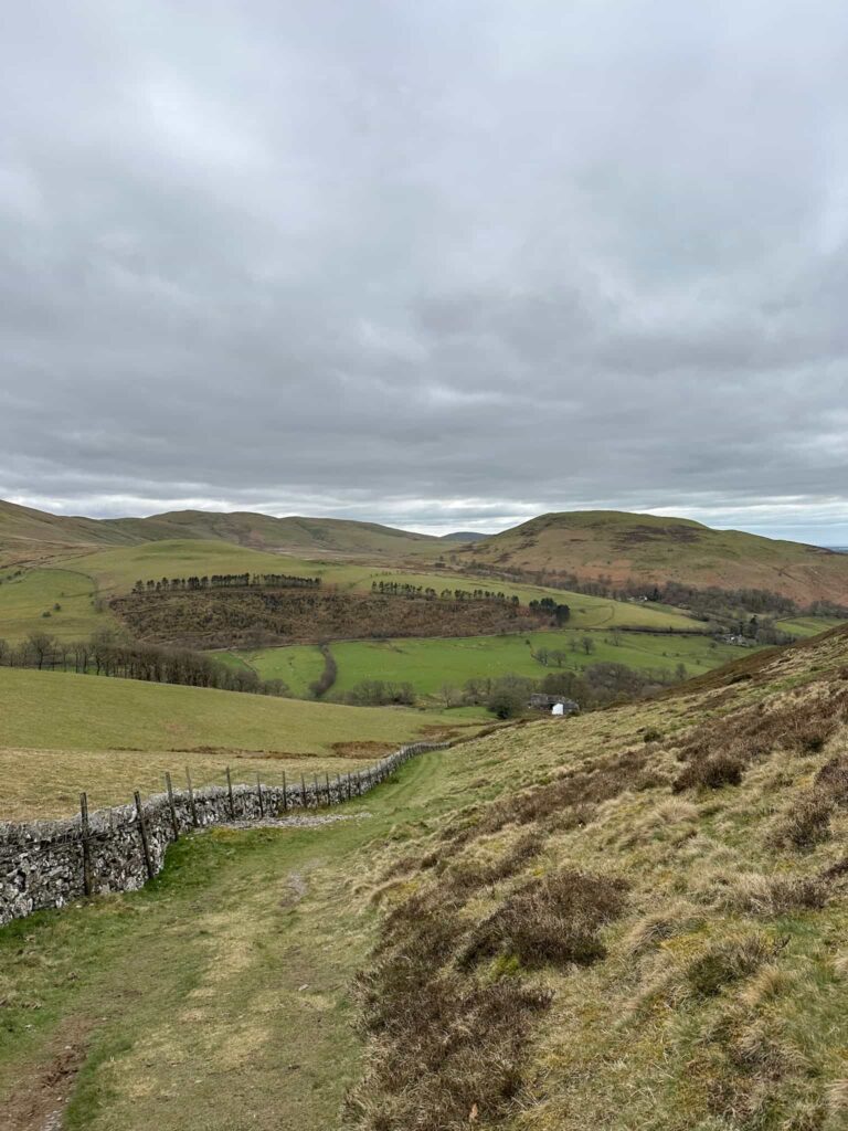
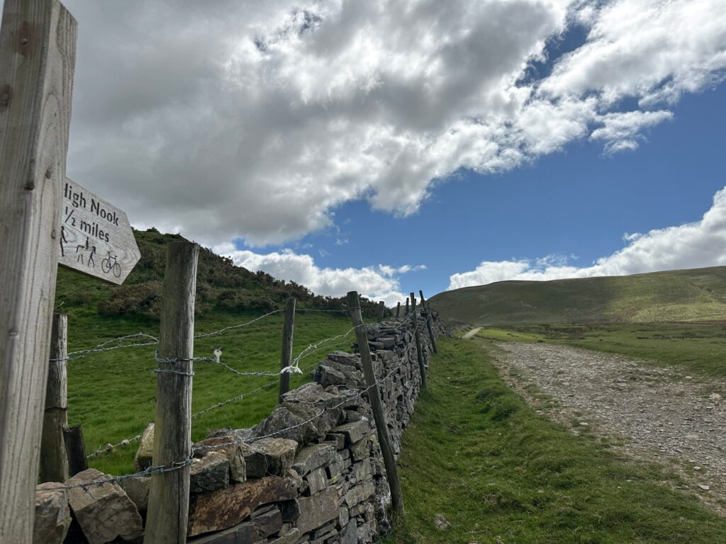
Here we joined a track running up the hill. At the wooden signpost we took the route marked Fangs Brow, and followed the path through the fields.  

Back on a track, we headed past Jenkinson Place and up to Iredale Place, taking the left hand fork and continuing up the hill. The path heads through a gate and alongside the wall before turning left onto another path leading to High Nook. The path forks and we took the right hand fork, climbing up the hillside – it’s quite steep in places.  

The footpath runs up to the left

Looking back down the track we just walked up – beautiful view!

The route levels out and we continued up to the summit of Burnbank Fell, marked by a fence and a cairn. The cairn is on the opposite side of the fence but the actual spot height is on the side we went on.  

Continuing south, it’s a gentle climb up to the summit of Blake Fell which is marked by a summit shelter.  

From Blake Fell the route continues south, heading down past an old sheep pen or barn to a fence with a couple of stiles in it. We climbed over the stile and continued south, heading up the grassy path to Gavel Fell. This summit doesn’t appear to be marked, but there is a nearby cairn so we visited both the summit marker as shown on the OS Map and the cairn just to make sure we’d been to the summit.  

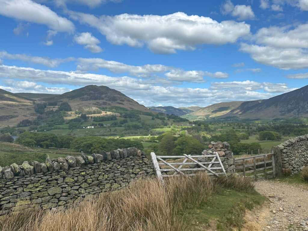
We retraced our steps a short way and climbed the stile in the fence, heading north-east. The route descends via High Nook Farm and joins a track which runs around Loweswater.  

The path heads into Holme Wood, and we followed this until we left Holme Wood and rejoined the track we were on earlier. Next time we go we’ll be sure to check out Holme Force, a beautiful waterfall near the top of the woods.  


We headed back over the fields, over Dub Beck, and back to the car. We went for a drink at the nearby-ish Kirkstile Inn, which I can definitely recommend.


Burnbank Fell, Blake Fell and Gavel Fell Walk Details:
 
Walk Map (Opens in OS Maps): Burnbank Fell, Blake Fell and Gavel Fell Walk
 
Parking: We parked in a free layby near the phone box near Waterend Farm, Loweswater, Cockermouth CA13 0SU. W3W:///wreck.stew.attitudes.
 
Facilities: None – please take all your rubbish away with you, and remember to leave no trace.
 
Dogs: This route passes through farmland and Open Access Land. Dogs are required by law to be on short leads from 1 March to 31 July, and at all times near livestock. Please be a responsible dog owner.
 
Walk Time: 4-5 hours
 
Difficulty: ▲▲▲
 
Distance: 7.7 miles (12.3km)
 
Trig Points Bagged: None
 
Wainwrights Bagged: Burnbank Fell, Blake Fell, Gavel Fell

More Wainwright walks you might like:
 
Souther Fell, Mungrisdale Common, Bannerdale Crags and Bowscale Pike | 11 Miles
 
Uldale Fells Circular | 8 Miles
 
Rannerdale Knotts [and the Bluebells] | 4 Miles

Tap to share with your hiking friends!

  • Facebook
  • Email
  • WhatsApp
Bretton Park Circular Walk | 3 Miles »

RELATED POSTS

  • Cat Bells walking route with High Spy, Dale Head Tarn and Newlands Valley - The Wandering WildflowerCatbells Hiking Route | 8 Miles
  • Views of the Kentmere HorseshoeKentmere Horseshoe | 13 Miles
  • Striding Edge - The Wandering WildflowerHelvellyn via Striding Edge | 8 Miles
  • A stile above Rydal HallFairfield Horseshoe Hiking Route | 11 Miles

Leave a Reply Cancel reply

Your email address will not be published. Required fields are marked *

FIND YOUR NEXT WALK:

ABOUT ME

Y Garn with Kids - Y Garn via the Devil's Kitchen Walk in Ogwen Valley

Hello! I’m Jo! Welcome to The Wandering Wildflower, an outdoors lifestyle blog focusing on family walks in the Peak District, a place we love exploring. I want to share the Peak District hidden gems and show you there’s so much more than the honeypot places. When I’m not dragging my husband and now 11 year old out on Peak District walks or up mountains, I can be found on planning my next moorland walk or plotting a Geocache walk (and seeing where the nearest pub is!). I love the hills but hate the heights, so trig bagging is – er- fun!


I hope this blog will give you some ideas of places to visit in the Peak District and inspire you and your family to head into the great outdoors.  Thanks for stopping by!

CATEGORIES

  • CIRCULAR WALKS (188)
  • HOLMFIRTH WALKS (27)
  • ISLE OF SKYE WALKS (3)
  • LAKE DISTRICT WALKS (24)
  • LANCASHIRE WALKS (2)
  • LONG PEAK DISTRICT WALKS 10 MILES + (42)
  • MEDIUM WALKS 4-9 MILES (136)
  • PEAK DISTRICT SCRAMBLES (16)
  • PEAK DISTRICT WALKS (202)
  • PEAK DISTRICT WALKS WITH KIDS (75)
  • PEAK DISTRICT WALKS WITH PUBS (60)
  • SCOTLAND WALKS (6)
  • SHORT WALKS UNDER 3 MILES (40)
  • SNOWDONIA WALKS (5)
  • UK CAMPING (5)
  • YORKSHIRE WALKS (33)

Peak District Walks

List of Peak District Ethels

Peak District Peak Bagging

Peak District Trig Point Challenge

Peak District Walks with Pubs

Peak District Walks with Kids

Beautiful Walks in Holmfirth

Short Walks in the Peak District

Long Walks in the Peak District

AFFILIATE DISCLOSURE

This blog may contain affiliate links through which, at no additional cost to you, I may earn a small commission. I only recommend products I would use myself and all opinions expressed here are my own. As an Amazon Associate I earn from qualifying purchases. Read full privacy policy here.

ARCHIVES

PEAK DISTRICT WEATHER

Peak District mountain weather on Met Office

Peak District Trig Points

Promo image for a blog post about the Peak District Trig Point Challenge With Map of Peak District Trig Points and Walking Routes by The Wandering Wildflower

Peak District Ethels Challenge

Promo image for a blog post about the Peak District Trig Point Challenge With Map of Peak District Ethels and Walking Routes by The Wandering Wildflower

WALKING ROUTES STRAIGHT TO YOUR INBOX

Want new walks in your inbox? Drop your email below and I'll send you some ideas for walks you can try.

You can unsubscribe anytime. For more details, review our Privacy Policy.

Thank you!

You have successfully joined our subscriber list.

RSS LATEST POSTS

  • Burnbank Fell, Blake Fell and Gavel Fell | 8 Miles
  • Bretton Park Circular Walk | 3 Miles
  • Hathersage Stepping Stones Walk | 7 Miles
  • Ladybower Walk | 6 Miles
  • Derbyshire Peak District Walks

FOLLOW ON PINTEREST

Want new walks in your inbox? Drop your email below and I'll send you some ideas for walks you can try.

You can unsubscribe anytime. For more details, review our Privacy Policy.

Thank you!

You have successfully joined our subscriber list.

jo@thewanderingwildflower.co.uk

The Wandering Wildflower

  • Email
  • Facebook
  • Instagram
  • Pinterest
  • PRIVACY POLICY
  • TERMS & CONDITIONS
  • ABOUT

(c) The Wandering Wildflower. All Rights Reserved.

|| THEME BY ECLAIR DESIGNS