• 3 Mile Walks or Less
  • 4 Mile Walks
  • 5 Mile Walks
  • 6 Mile Walks
  • 7 Mile Walks
  • 8 Mile Walks
  • 9 Mile Walks
  • 10 Mile Walks
  • 11 Mile Walks
  • 12 Mile Walks
  • 14 Mile Walks
  • 15 Mile Walks
  • 20+ Mile Walks

The Wandering Wildflower

Peak District Hikes

  • PEAK DISTRICT WALKS
    • SHORT WALKS UNDER 3 MILES
    • MEDIUM WALKS 4-9 MILES
    • LONG PEAK DISTRICT WALKS 10 MILES +
  • PEAK DISTRICT WALKS WITH PUBS
  • PEAK DISTRICT WALKS WITH KIDS
  • HOLMFIRTH WALKS

Buchaille Etive Beag Walk | 5 Miles

October 8, 2022 SCOTLAND WALKS

Pinterest Image for Buchaille Etive Beag - Easiest Munros in Glencoe - Kid Friendly Munro Hikes - The Wandering Wildflower

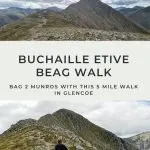
This Buchaille Etive Beag walk is just over 5 miles and involves a steep climb up to the twin summits of Stob Coire Raineach and Stob Dubh. With spectacular views on a clear day down both Glen Coe and Glen Etive, as well as over to Ben Nevis, this is a great walk which bags 2 of the “easiest” Munros in Glencoe.

View of Stob Dubh from the bealach - The Wandering Wildflower

The ridge looks quite formidable from this angle!


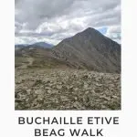
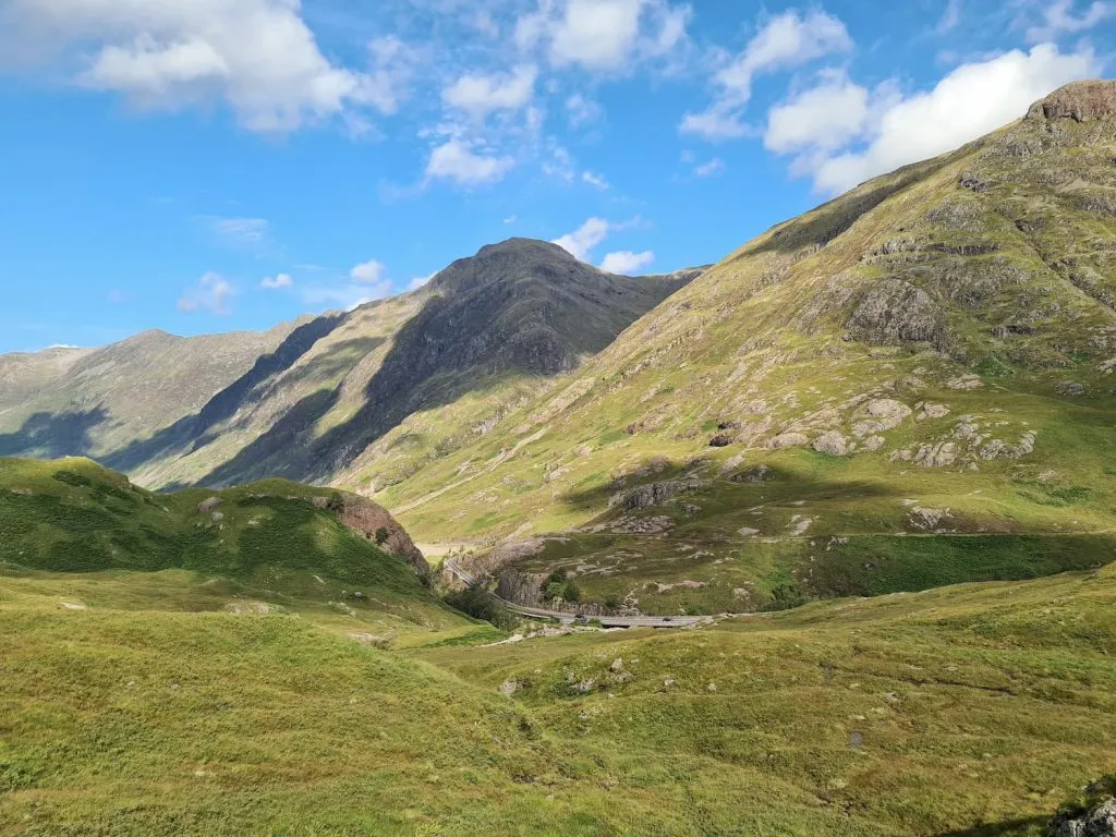
If you’ve driven through Glen Coe ever, you’ll have driven past Buchaille Etive Beag but might not have noticed it as it tends to be overshadowed by the more dominating Buchaille Etive Mor. This is actually two summits (so you can bag two Munros!), Stob Coire Raineach and Stob Dubh. Stob Coire Raineach is 925m above sea level and Stob Dobh is 958m, and both have spectacular views over the surrounding area. The area was formed by the eruption of a super volcano over 10,000 years ago, which has left dramatic landscapes wherever you look!


This is definitely a great hike, well worth doing if you’re looking for the best walks in Glencoe.


Whilst these are some of the easier Munros, and we took Hols up with us (who’s 10), please be sure to check the weather before you go.

You can check the weather for Buchaille Etive Beag here:

  • MWIS – West Highlands forecast

  • Glencoe Mountain Forecast

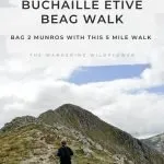
These are mountains, which are rocky in places, and you’ll be a long way from help if you needed it. There are no paths in places and it’s a bit of a ridge walk.

Looking over to Stub Coire Raineach from Stubh Dobh


Buchaille Etive Beag Walk

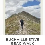
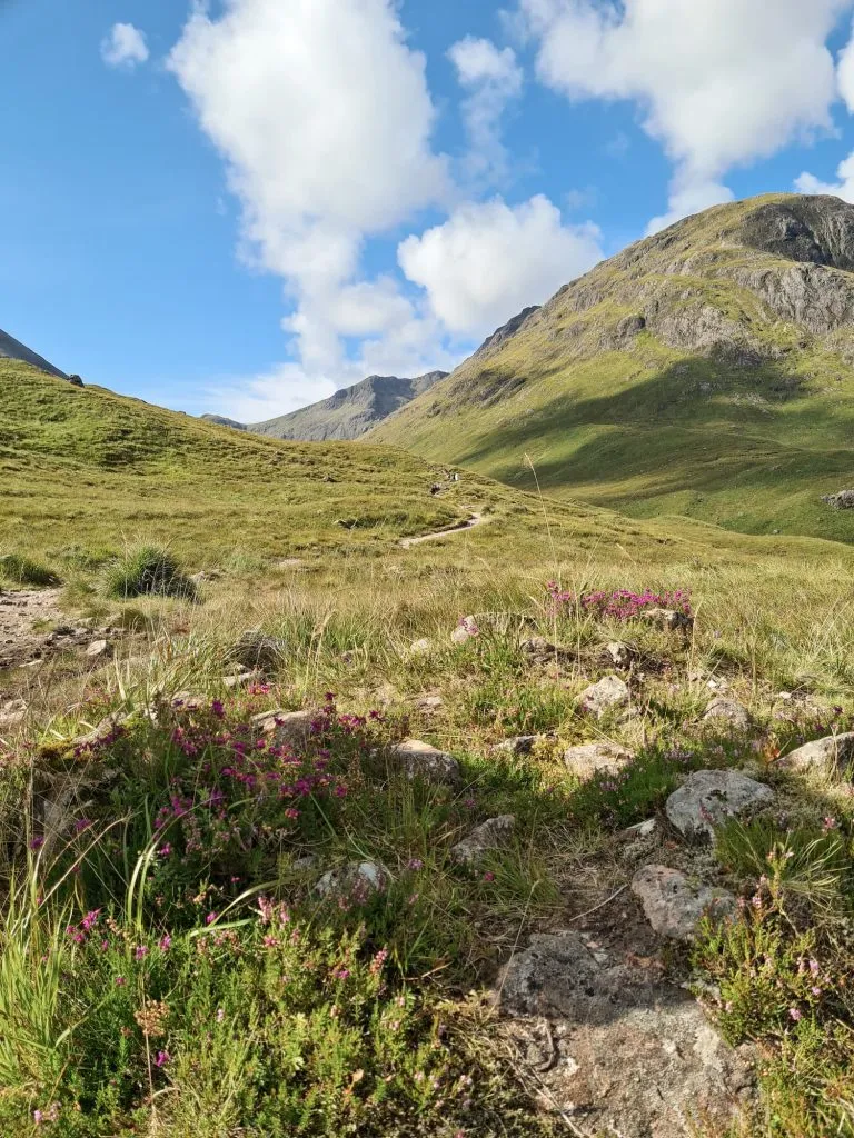
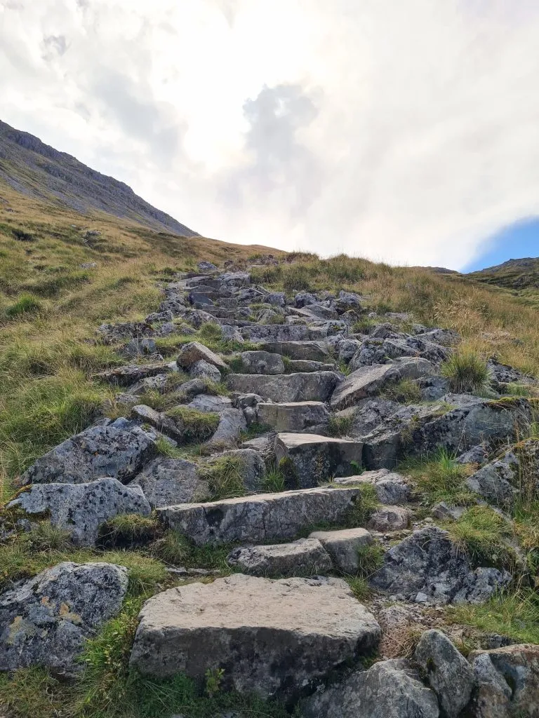
This walk starts in the small car park just off the A82, just across from the beehive cairn. The path itself is relatively easy to follow in good weather, with it being a clear stone path with some steps in places leading up to the bealach between Stob Coire Raineach and Stob Dubh. This makes a great place to stop off for a breather as it’s quite a slog up from the car park! 

Late summer in Glencoe with heather

A view of Glen Coe in summer

Stone steps leading up Buchaille Etive Beag

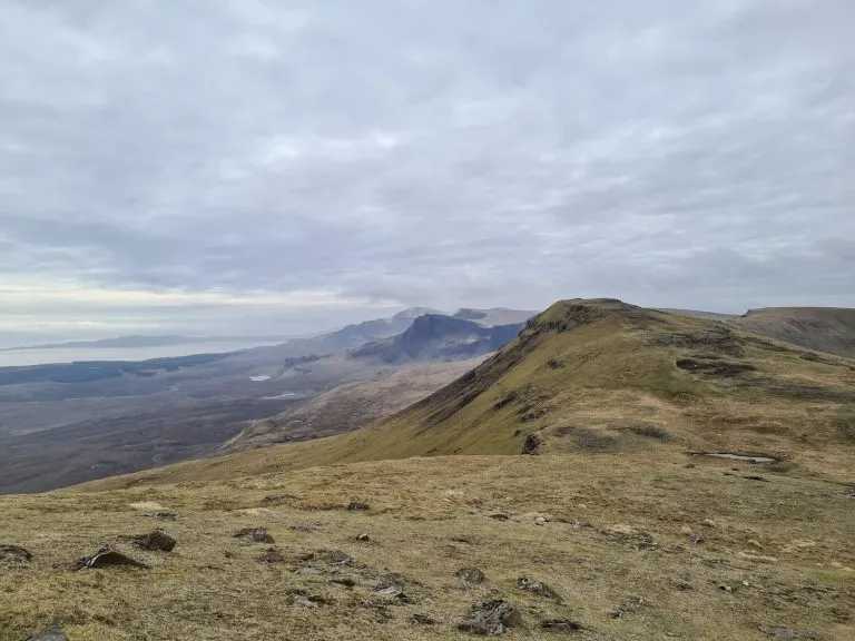
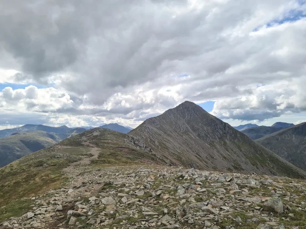
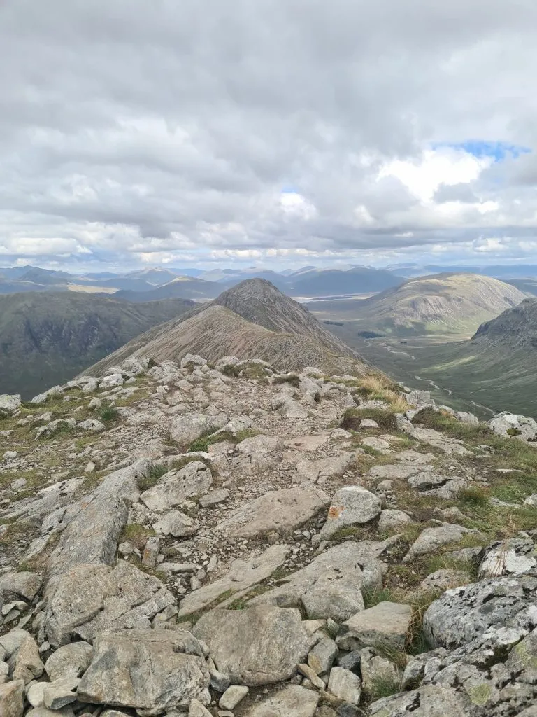
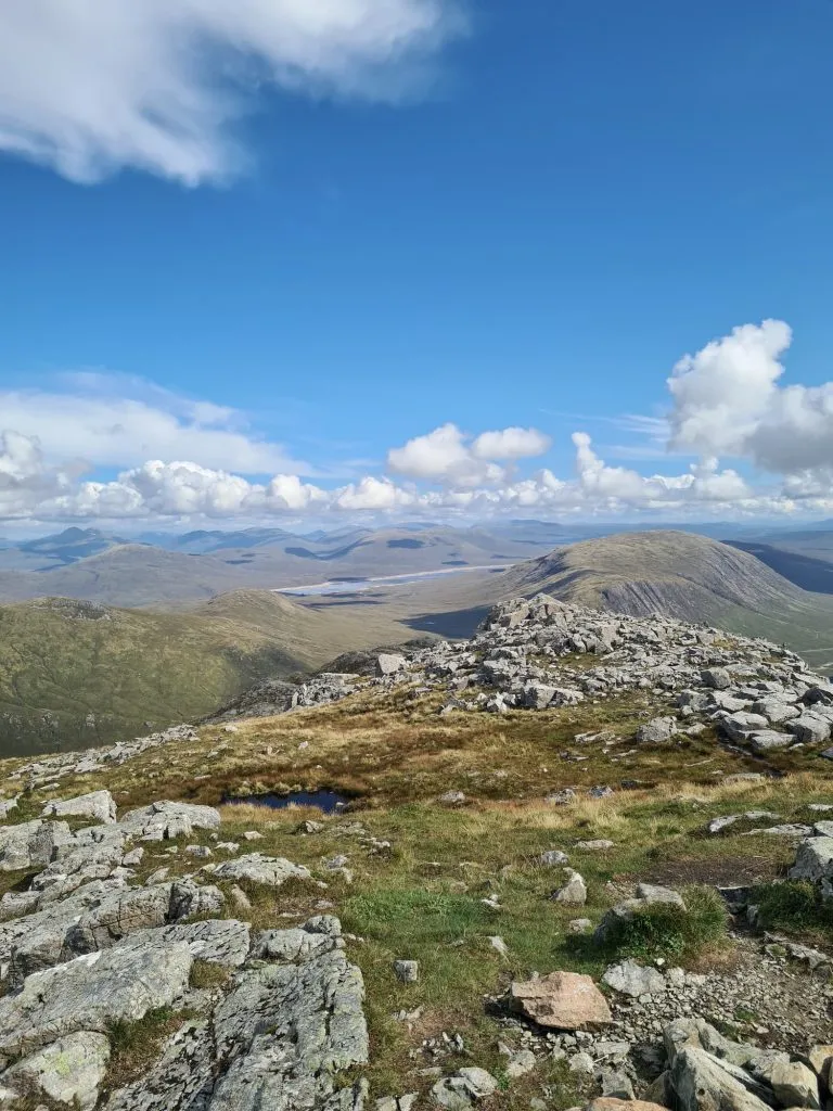
From here, we headed left and climbed up onto Stob Coire Raineach first of all. This is quite straight forward although the path is faint in places, especially in the rocky sections near the top. From the summit there are views for days over to Blackwater Reservoir and the surrounding peaks.

A woman stood on the summit of Stob Coire Raineach

Views over Blackwater Reservoir from Stub Coire Raineach

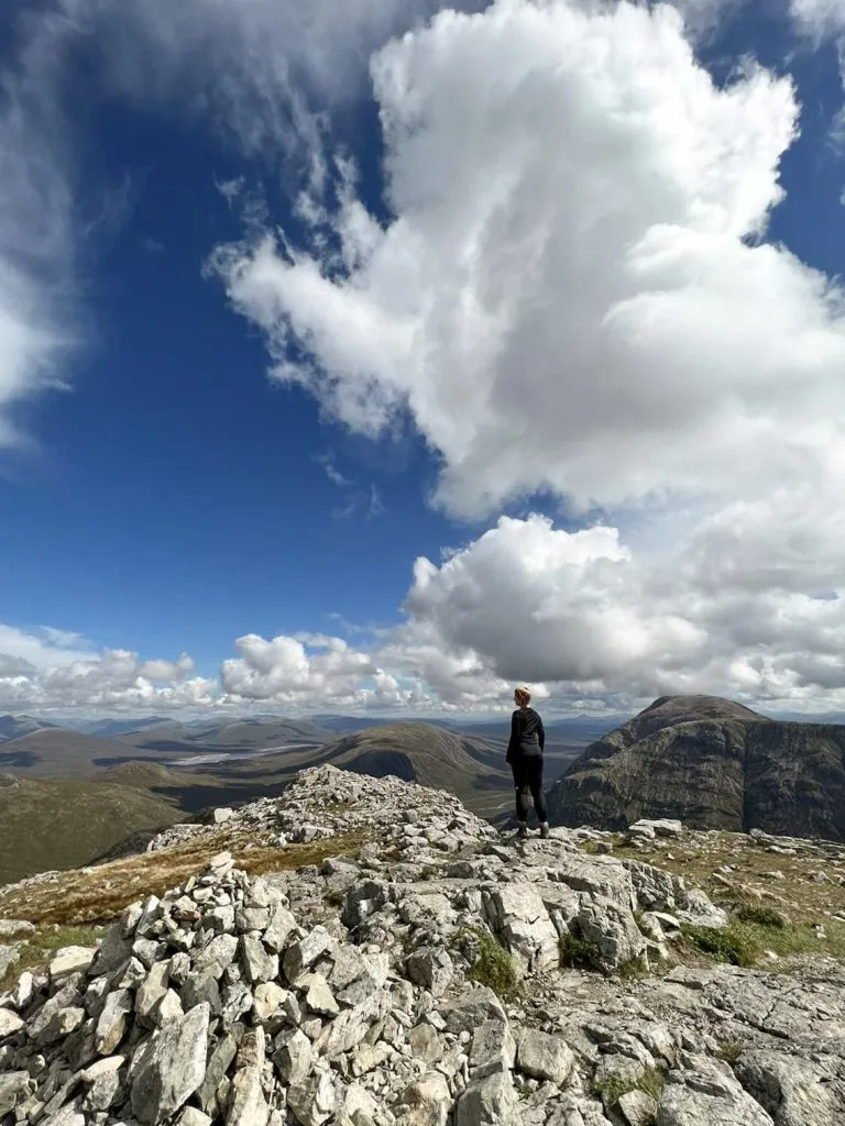
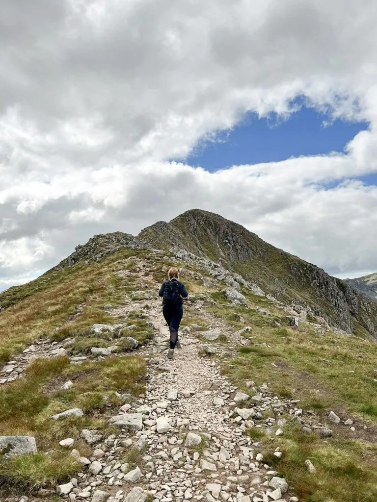
We left the summit and retraced our steps as best we could down the mountain back to the bealach and then followed the ridge north-west to the summit of Stob Dubh. This is bit of a ridge walk, but it’s not as challenging as something like Striding Edge. We were lucky in that it wasn’t too windy though – it might be a very different story on a windy day! I didn’t much like being so exposed, so I couldn’t wait to get onto wider ground.

A woman walking on the ridge between Stobh Dubh and Stobh Coire Raineach

From the summit of Stob Dubh we headed back to the bealach again and then back down the mountain, following the path we came up originally.


This was a great walk, which felt like a challenge at times (especially as I’m not a fan of heights or exposure and I’m even worse when I have Hols with me) but it gave me a lot of confidence to tackle things such as Helvellyn. It’s worth it for the two Munros we bagged, and the incredible views – there’s nothing quite like those Scottish views.


Buchaille Etive Beag Walk Route Information

Buchaille Etive Beag Walk Map:


Walk Map (Opens in OS Maps): Buchaille Etive Beag Walk

Parking: There is a car park across from the beehive cairn on the A82 in Glen Coe (Ballachulish PH49 4HX) (You can open the map here)

Facilities: None

Walk Time: 4-5 hours but allow more time for exploring

Difficulty: ▲▲▲ (steep climb, rocky and ridge walk in places)

Distance: 5.1 miles (8.2km)

Trig Points Bagged: None

Munros Bagged:  Stob Coire Raineach, Stob Dubh


Is Buchaille Etive Beag Two Munros?

Yes! Buchaille Etive Beag is made up of two summits, Stob Coire Raineach (925m above sea level) and Stob Dobh (958m). These summits are also Marilyns, meaning they have a prominence of 150m or more. 


How Long Does it Take to Climb Buchaille Etive Beag?

This walk took us just under 5 hours with a lunch break at the top. Allow 3-4 hours at least.


Tap to share with your hiking friends!

  • Facebook
  • Email
  • WhatsApp
« Ben Nevis Hike | 10 Miles
Torside Clough Scramble | 6 Miles »

RELATED POSTS

  • Steall Falls, the second highest waterfall in the UKSteall Falls – A Waterfall Walk in Glen Nevis | 3 Miles
  • Hiking The Quiraing and Meall Na Suiramach Trig Point | 5 Miles
  • The classic Old Man of Storr photoOld Man of Storr Walk | 5 Miles
  • Gardyloo Gully at Ben Nevis summit - quite a drop!Ben Nevis Hike | 10 Miles

Leave a Reply Cancel reply

Your email address will not be published. Required fields are marked *

FIND YOUR NEXT WALK:

ABOUT ME

Y Garn with Kids - Y Garn via the Devil's Kitchen Walk in Ogwen Valley

Hello! I’m Jo! Welcome to The Wandering Wildflower, an outdoors lifestyle blog focusing on family walks in the Peak District, a place we love exploring. I want to share the Peak District hidden gems and show you there’s so much more than the honeypot places. When I’m not dragging my husband and now 11 year old out on Peak District walks or up mountains, I can be found on planning my next moorland walk or plotting a Geocache walk (and seeing where the nearest pub is!). I love the hills but hate the heights, so trig bagging is – er- fun!


I hope this blog will give you some ideas of places to visit in the Peak District and inspire you and your family to head into the great outdoors.  Thanks for stopping by!

CATEGORIES

  • CIRCULAR WALKS (189)
  • HOLMFIRTH WALKS (27)
  • ISLE OF SKYE WALKS (3)
  • LAKE DISTRICT WALKS (26)
  • LANCASHIRE WALKS (2)
  • LONG PEAK DISTRICT WALKS 10 MILES + (42)
  • MEDIUM WALKS 4-9 MILES (137)
  • PEAK DISTRICT SCRAMBLES (16)
  • PEAK DISTRICT WALKS (206)
  • PEAK DISTRICT WALKS WITH KIDS (76)
  • PEAK DISTRICT WALKS WITH PUBS (60)
  • SCOTLAND WALKS (6)
  • SHORT WALKS UNDER 3 MILES (40)
  • SNOWDONIA WALKS (5)
  • UK CAMPING (5)
  • YORKSHIRE WALKS (33)

Peak District Walks

List of Peak District Ethels

Peak District Peak Bagging

Peak District Trig Point Challenge

Peak District Walks with Pubs

Peak District Walks with Kids

Beautiful Walks in Holmfirth

Short Walks in the Peak District

Long Walks in the Peak District

AFFILIATE DISCLOSURE

This blog may contain affiliate links through which, at no additional cost to you, I may earn a small commission. I only recommend products I would use myself and all opinions expressed here are my own. As an Amazon Associate I earn from qualifying purchases. Read full privacy policy here.

ARCHIVES

PEAK DISTRICT WEATHER

Peak District mountain weather on Met Office

Peak District Trig Points

Promo image for a blog post about the Peak District Trig Point Challenge With Map of Peak District Trig Points and Walking Routes by The Wandering Wildflower

Peak District Ethels Challenge

Promo image for a blog post about the Peak District Trig Point Challenge With Map of Peak District Ethels and Walking Routes by The Wandering Wildflower

WALKING ROUTES STRAIGHT TO YOUR INBOX

Want new walks in your inbox? Drop your email below and I'll send you some ideas for walks you can try.

You can unsubscribe anytime. For more details, review our Privacy Policy.

Thank you!

You have successfully joined our subscriber list.

RSS LATEST POSTS

  • How to Find Three Shires Head
  • Peak District Pub Walks
  • Burnbank Fell, Blake Fell and Gavel Fell | 8 Miles
  • Bretton Park Circular Walk | 3 Miles
  • Grasmere Weekend Break

FOLLOW ON PINTEREST

Want new walks in your inbox? Drop your email below and I'll send you some ideas for walks you can try.

You can unsubscribe anytime. For more details, review our Privacy Policy.

Thank you!

You have successfully joined our subscriber list.

jo@thewanderingwildflower.co.uk

The Wandering Wildflower

  • Email
  • Facebook
  • Instagram
  • Pinterest
  • PRIVACY POLICY
  • TERMS & CONDITIONS
  • ABOUT

(c) The Wandering Wildflower. All Rights Reserved.

|| THEME BY ECLAIR DESIGNS