• 3 Mile Walks or Less
  • 4 Mile Walks
  • 5 Mile Walks
  • 6 Mile Walks
  • 7 Mile Walks
  • 8 Mile Walks
  • 9 Mile Walks
  • 10 Mile Walks
  • 11 Mile Walks
  • 12 Mile Walks
  • 14 Mile Walks
  • 15 Mile Walks
  • 20+ Mile Walks

The Wandering Wildflower

Peak District Hikes

  • PEAK DISTRICT WALKS
    • SHORT WALKS UNDER 3 MILES
    • MEDIUM WALKS 4-9 MILES
    • LONG PEAK DISTRICT WALKS 10 MILES +
  • PEAK DISTRICT WALKS WITH PUBS
  • PEAK DISTRICT WALKS WITH KIDS
  • HOLMFIRTH WALKS

Wibben Hill and Blackstones Low Trig Point Walk | 8 Miles

May 8, 2023 MEDIUM WALKS 4-9 MILES, PEAK DISTRICT WALKS, PEAK DISTRICT WALKS WITH KIDS

Pinterest image for Blackstones Low and Wibben Hill Walk From Tissington - The Wandering Wildflower

This walk through the beautiful Derbyshire Dales starts in the picture perfect village of Tissington and heads out through the surrounding countryside to bag two of the Peak District trig points. Using parts of The Limestone Way, this 8 mile walk is a great one for Spring when the wildflowers are out. 


A wooden sign post and a dry stone wall

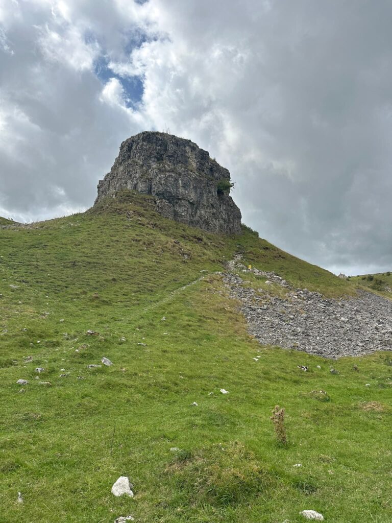
Wibben Hill is a small hill not far from Tissington with a summit at 249m above sea level. Blackstones Low stands at 295m above sea level and is the site of a Bronze Age burial barrow. There is a trig point at each summit which is on the Peak District trig points list. 


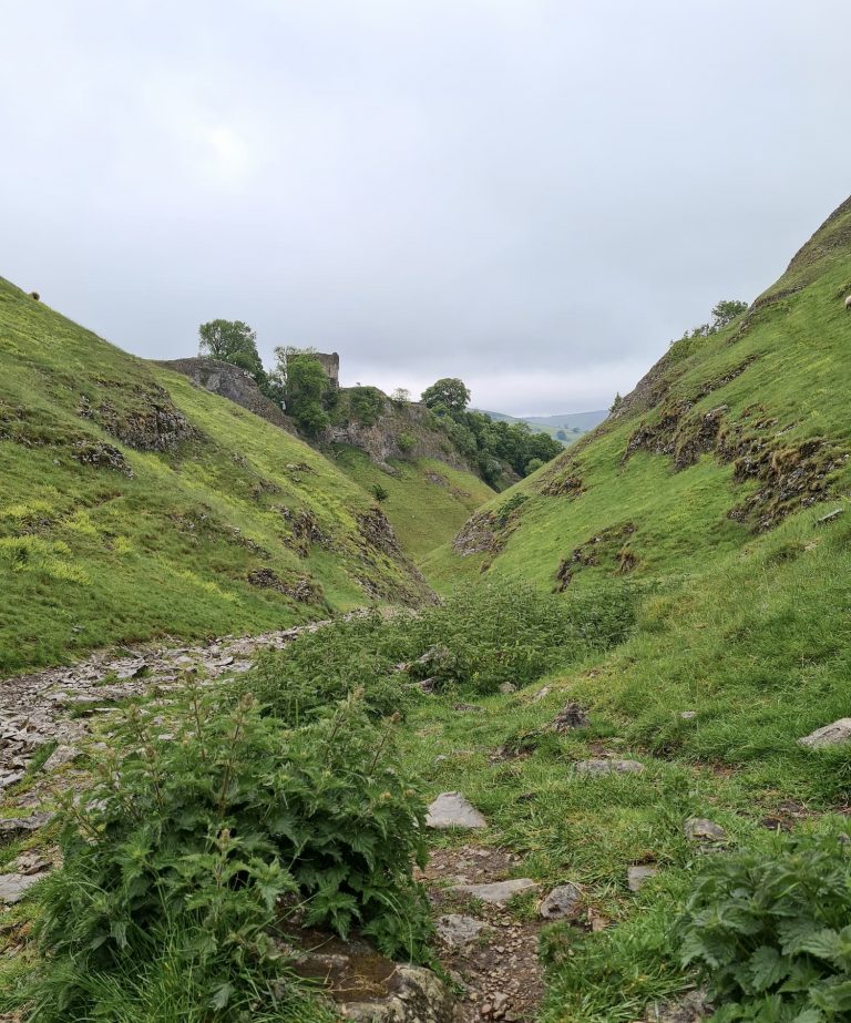
Our walk started from the former train station in Tissington which is now on the Tissington Trail. The Tissington Trail runs from Parsley Hay to Ashbourne and is a former railway line now used as a traffic free trail for runners, hikers and cyclists. We followed the trail for 0.75 miles and then took the path up to the left, crossing the bridge and entering Shaws Farm. The footpath runs from the farm track down the hillside to the stream and then up the other side of the valley, following the path of the Limestone Way into the pretty village of Parwich. 

A wooden fence post with a way marker for the Limestone Way - green with white text and arrow

The Limestone Way runs through the churchyard at Parwich and follows a lane out onto the road. We walked a short distance and then picked up a footpath leading across the fields, near the triangle road junction with Highway Lane. We walked over the field until we reached the road leading into Ballidon village, which is dominated by the huge quarry there. 

A wooden sign post for the Limestone Way pointing to a village scene, with some orange tulips

A close up of some hawthorn blossom


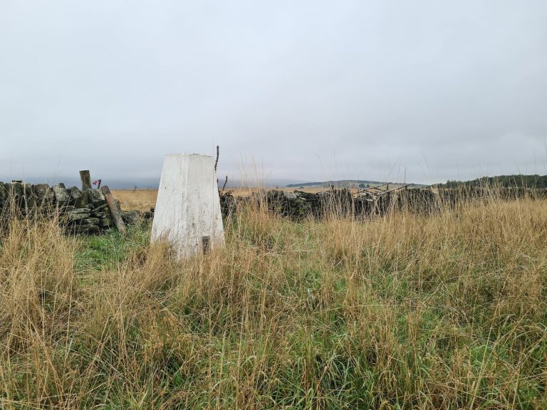
We walked up through a farmyard and out onto the farm track which leads up the hillside. There is a gate leading to the Open Access Land on which Blackstones Low trig point sits – this field had lots of curious cows and calves in which Holly loved but some people may not! We followed the wall through the cows until we reached the trig point which is right up against the wall. 


A Bronze Age burial cairn - some rocks in a green field!

Blackstones Low trig point, a grey concrete pillar in a green field

From here we retraced our steps back through the cow field, through the gate and back down the farm track a short distance then took a footpath off to the south rather than heading through the farmyard again. This path runs through the fields before dropping down the hill to the disused chapel at Ballidon Church. We then followed the track that runs south then south-west and joins the B5056. 

The former Ballidon church, a small stone chapel building


Crossing the road, we followed the footpaths through the fields until we reached All Saints Church, Bradbourne. This Grade 1 listed church was formerly Bradbourne Priory up until the dissolution of the monasteries.


A stone church building in the background with a bush with buds on in the foreground


Passing through the churchyard we joined the road, then took a footpath running off Mill Lane. This path runs over the fields and then crosses the B5056 again, before heading over the fields to where it joins Bent Lane. We walked on Bent Lane for a short distance and then headed up the hillside to Wibben Hill, the summit of which has a small copse and a trig point. The summit is actually on private land but the footpath runs quite close. 


Wibben Hill trig point, a grey concrete pillar under a tree

A small woodland copse on a green hilltop


From the summit we headed west to join the footpath and then followed it through another field to rejoin the Tissington Trail. We set off back along the Trail to the car park and a well deserved cup of tea from the tearooms there. 


Wibben Hill Trig Point Walk Route Map:


Walk Map (Opens in OS Maps): Tissington to Wibben Hill and Blackstone Low Trig Points

Parking: Pay and display car park at Mappleton Road DE6 1FD (What3Words: ///distracts.speeded.tempting)

Facilities: Public toilet and tea rooms in the car park 

Walk Time: 3-4 hours

Difficulty: ▲▲

Trig Points Bagged: Wibben Hill, Blackstones Low

Peak District Peaks Bagged: None

Peak District Ethels Bagged: None

Tap to share with your hiking friends!

  • Facebook
  • Email
  • WhatsApp
« Triple Trig Walk: Soles Hill, Grindon Moor and Martins Low | 8 Miles
Laddow Rocks and Crowden Great Brook Circular | 5 Miles »

RELATED POSTS

  • Three Shires HeadHow to Find Three Shires Head
  • Nelson's Monument on Baslow EdgeThree Monuments Circular Walk From Chatsworth | 7.5 Miles
  • Lathkill Dale waterfallLathkill Dale Waterfall Walk | 7 Miles
  • Thorpe Cloud, DovedaleDovedale and Thorpe Cloud Walk | 7 Miles

Leave a Reply Cancel reply

Your email address will not be published. Required fields are marked *

FIND YOUR NEXT WALK:

ABOUT ME

Y Garn with Kids - Y Garn via the Devil's Kitchen Walk in Ogwen Valley

Hello! I’m Jo! Welcome to The Wandering Wildflower, an outdoors lifestyle blog focusing on family walks in the Peak District, a place we love exploring. I want to share the Peak District hidden gems and show you there’s so much more than the honeypot places. When I’m not dragging my husband and now 11 year old out on Peak District walks or up mountains, I can be found on planning my next moorland walk or plotting a Geocache walk (and seeing where the nearest pub is!). I love the hills but hate the heights, so trig bagging is – er- fun!


I hope this blog will give you some ideas of places to visit in the Peak District and inspire you and your family to head into the great outdoors.  Thanks for stopping by!

CATEGORIES

  • CIRCULAR WALKS (189)
  • HOLMFIRTH WALKS (27)
  • ISLE OF SKYE WALKS (3)
  • LAKE DISTRICT WALKS (26)
  • LANCASHIRE WALKS (2)
  • LONG PEAK DISTRICT WALKS 10 MILES + (42)
  • MEDIUM WALKS 4-9 MILES (137)
  • PEAK DISTRICT SCRAMBLES (16)
  • PEAK DISTRICT WALKS (206)
  • PEAK DISTRICT WALKS WITH KIDS (76)
  • PEAK DISTRICT WALKS WITH PUBS (60)
  • SCOTLAND WALKS (6)
  • SHORT WALKS UNDER 3 MILES (40)
  • SNOWDONIA WALKS (5)
  • UK CAMPING (5)
  • YORKSHIRE WALKS (33)

Peak District Walks

List of Peak District Ethels

Peak District Peak Bagging

Peak District Trig Point Challenge

Peak District Walks with Pubs

Peak District Walks with Kids

Beautiful Walks in Holmfirth

Short Walks in the Peak District

Long Walks in the Peak District

AFFILIATE DISCLOSURE

This blog may contain affiliate links through which, at no additional cost to you, I may earn a small commission. I only recommend products I would use myself and all opinions expressed here are my own. As an Amazon Associate I earn from qualifying purchases. Read full privacy policy here.

ARCHIVES

PEAK DISTRICT WEATHER

Peak District mountain weather on Met Office

Peak District Trig Points

Promo image for a blog post about the Peak District Trig Point Challenge With Map of Peak District Trig Points and Walking Routes by The Wandering Wildflower

Peak District Ethels Challenge

Promo image for a blog post about the Peak District Trig Point Challenge With Map of Peak District Ethels and Walking Routes by The Wandering Wildflower

WALKING ROUTES STRAIGHT TO YOUR INBOX

Want new walks in your inbox? Drop your email below and I'll send you some ideas for walks you can try.

You can unsubscribe anytime. For more details, review our Privacy Policy.

Thank you!

You have successfully joined our subscriber list.

RSS LATEST POSTS

  • How to Find Three Shires Head
  • Peak District Pub Walks
  • Burnbank Fell, Blake Fell and Gavel Fell | 8 Miles
  • Bretton Park Circular Walk | 3 Miles
  • Grasmere Weekend Break

FOLLOW ON PINTEREST

Want new walks in your inbox? Drop your email below and I'll send you some ideas for walks you can try.

You can unsubscribe anytime. For more details, review our Privacy Policy.

Thank you!

You have successfully joined our subscriber list.

jo@thewanderingwildflower.co.uk

The Wandering Wildflower

  • Email
  • Facebook
  • Instagram
  • Pinterest
  • PRIVACY POLICY
  • TERMS & CONDITIONS
  • ABOUT

(c) The Wandering Wildflower. All Rights Reserved.

|| THEME BY ECLAIR DESIGNS