The Most Beautiful Walks in the Peak District
If you’re looking for the most beautiful walks in the Peak District, this is the post for you! I’ve gathered together some of my favourite Peak District walks which have amazing views and scenery. These walks in the Peak District vary in length and difficulty, so there should be a walk to suit everyone here.
I’ve tried to pick walks in the Peak District which are beautiful all year round but some of them are extra special in late summer when the heather is in full bloom and the rugged moorland turns into a haze of purple, or Autumn when the woodland puts on a show of colour. Some of these walks visit stunning viewpoints or points of interest like waterfalls while on others, it’s the surroundings which make them beautiful.
So here goes – my favourite beautiful Peak District walks (in no particular order).
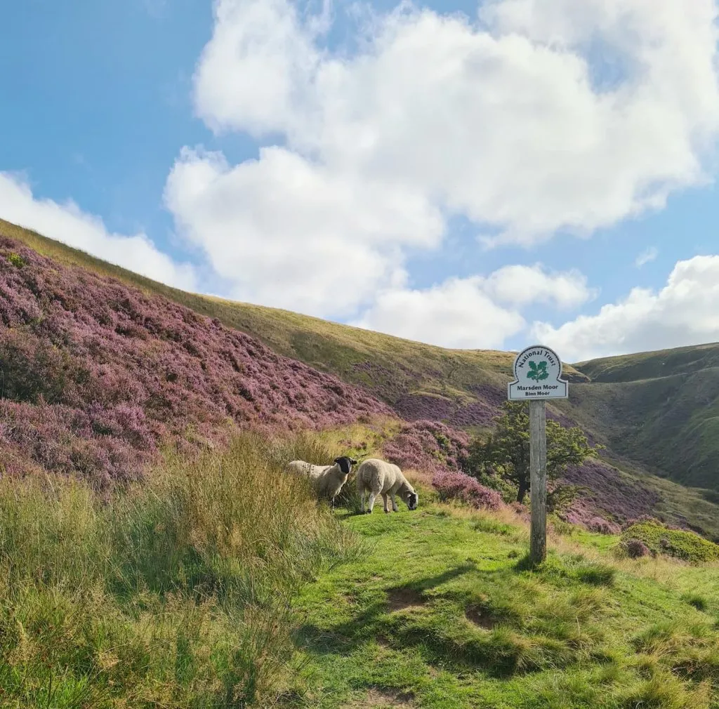
Marsden to Wessenden Head | 6 Miles
The Wessenden Valley was one of the first places we explored as a family and is a bit of an underrated gem. This 6 mile walk starts from Marsden and heads up onto Binn Moor (which looks amazing when the heather is blooming) before dropping back down onto the Pennine Way and following the reservoirs back down into Marsden where there are lots of shops, cafes and a few really good pubs (we like the Riverhead Brewery Tap).
Walk Map (Opens in OS Maps): Marsden to Wessenden Valley
Walk Details: Circular Walk from Marsden to Wessenden Head
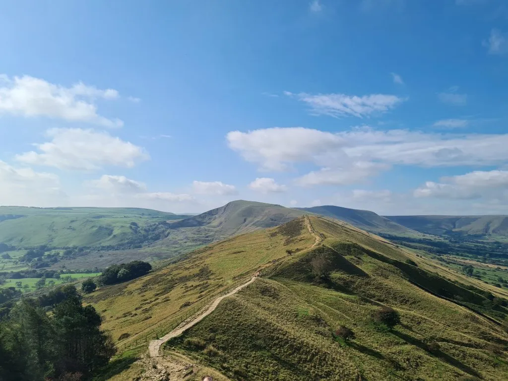
Mam Tor and The Great Ridge Walk | 7 Miles
Castleton to Mam Tor and along the Great Ridge to Lose Hill is a VERY popular walk, and for good reason! After the initial climb up to the Mam Tor summit, it’s a gentler walk along the Great Ridge which has spectacular views down over Edale and Hope. Sunrises are especially beautiful along here, and the area is prone to cloud inversions due to it’s topography. This is a Peak District must-do walk!
Walk Map (Opens in OS Maps): Castleton to Mam Tor and The Great Ridge Walk
Walk Details: Castleton, Mam Tor and The Great Ridge Walk
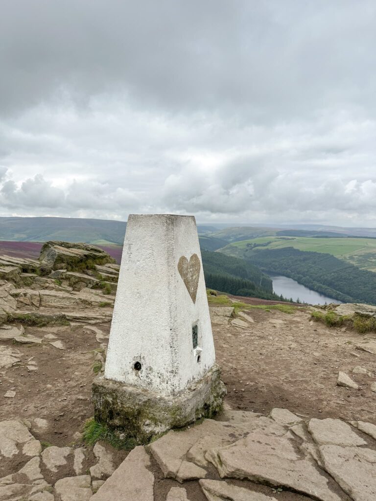
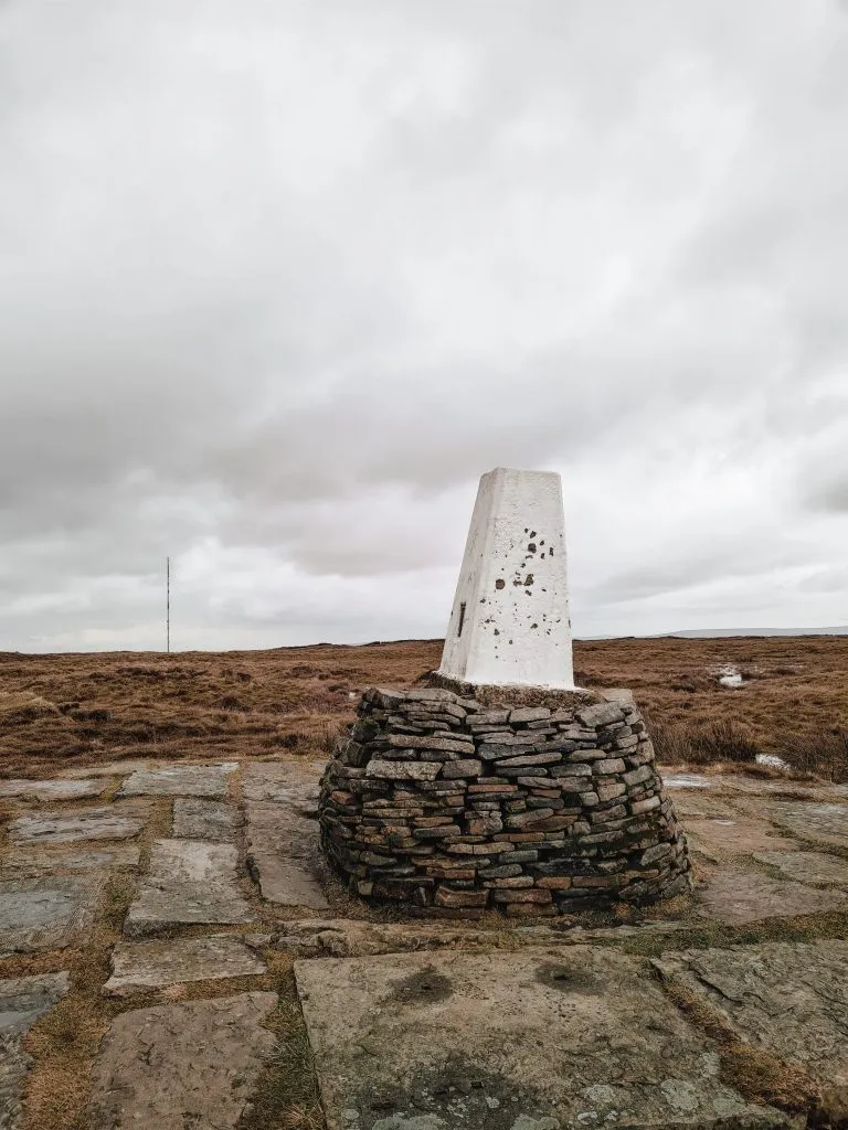
Aldermans Hill and Broadstone Hill Trig Point | 5.5 Miles
This walk explores one of the more underrated parts of the Peak District, a true hidden gem. Whilst most of the masses head off round Dove Stone Reservoir, maybe in search of The Trinnacle, this walk explores the other side of the valley and heads up the formidably steep Aldermans Hill. The climb is well worth it though – the views over towards Dove Stone Reservoir and the Saddleworth Moors are stunning. This walk then heads off over the rugged moorland in search of Broadstone Hill trig point.
Walk Map (Opens in OS Maps): Aldermans Hill and Broadstone Hill Trig Point Walk
Walk Details: Aldermans Hill to Broadstone Hill Trig Point Walk
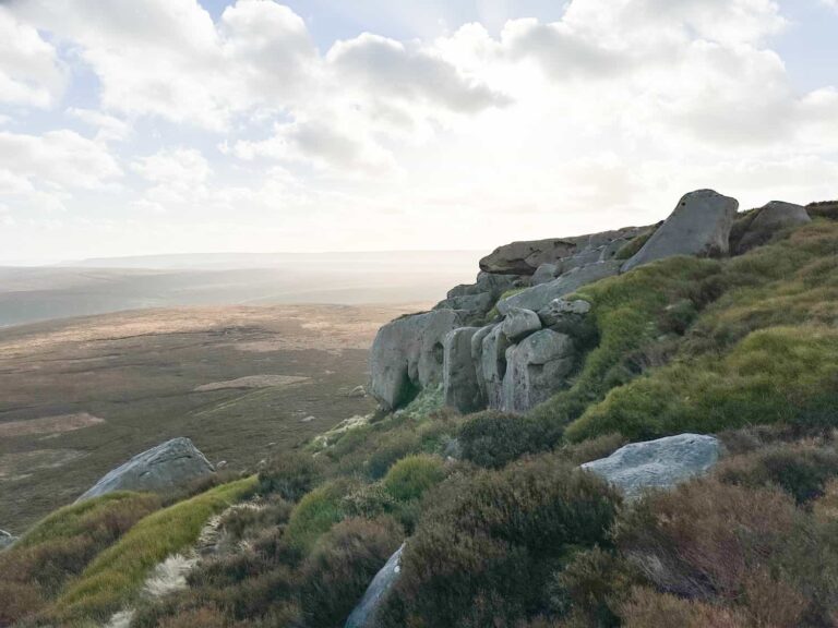
Bamford Edge Short Walk | 2 Miles
Bamford Edge is one of the best places to go if you want a stunning view in the Peak District. For a relatively short walk up onto the moorland, the views down over Ladybower Reservoir and across to Win Hill are rather special. This is a great place to watch the sunset and take the kids for a walk out.
Walk Map (Opens in OS Maps): Bamford Edge Short Walk
Walk Details: Bamford Edge – A Short Walk with Stunning Views
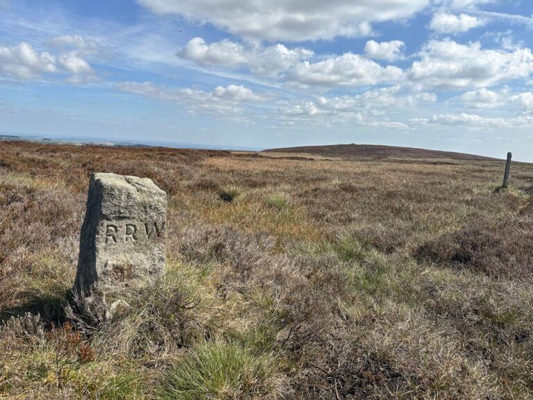
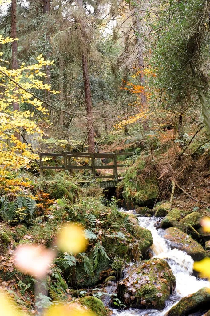
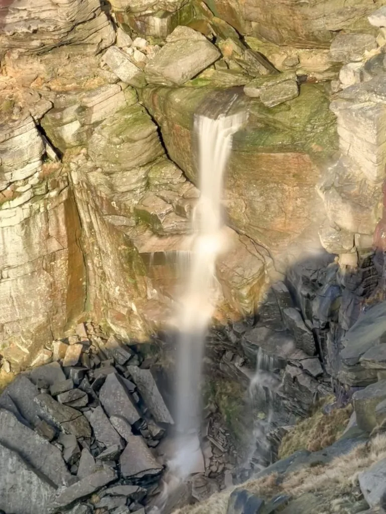
Wyming Brook and Rod Moor Trig Point | 6 Miles
This is one of the best Autumn walks in the Peak District, when the woodland of the Wyming Brook Nature Reserve really puts on a show. It’s a beautiful place to walk! The walk heads down through the nature reserve and then off over the moors to bag Rod Moor trig point, but you could do it as an out-and-back down to the bottom of the nature reserve and back up again.
Walk Map (Opens in OS Maps): Wyming Brook Waterfalls and Rod Moor Trig Point Walk
Walk Details: Wyming Brook Waterfalls Walk
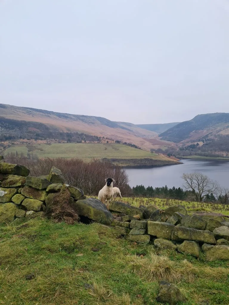
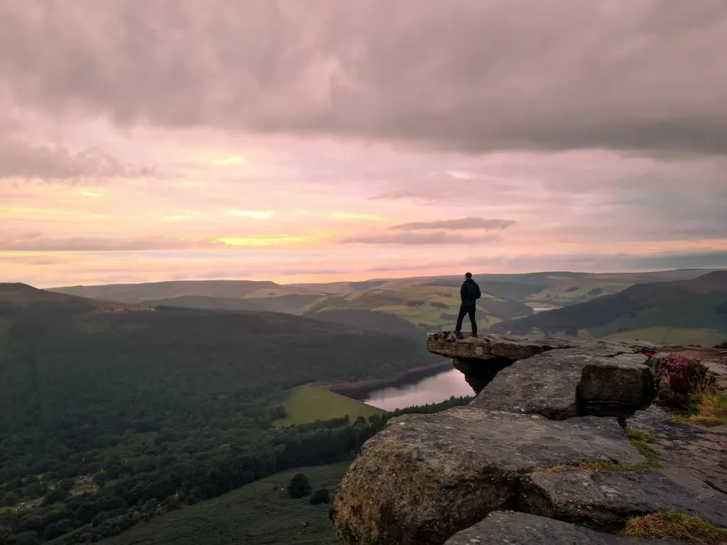
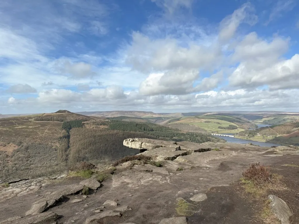
Derwent Edge from Cutthroat Bridge | 8 Miles
This walk is a good one to do with the kids as whilst there is a climb, it’s not too steep. The views at the top definitely make it worthwhile! From Whinstone Lee Tor all along to Back Tor you have stunning views down over Ladybower and Derwent Reservoirs and the rugged wilderness of moorland beyond.

Walk Route in OS Maps: Back Tor and Derwent Edge Walk
Walk Details: Derwent Edge Walk
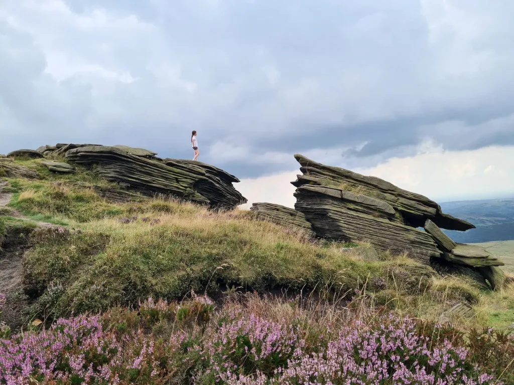
Kinder Scout from Hayfield | 9 Miles
Kinder Scout has to be on my list. In winter it’s a foreboding, challenging place and in summer, well, it’s not much better but it’s generally drier! The scenery on Kinder Scout is spectacular, with views down over the Kinder Reservoir on the south edge and over toward Bleaklow on the north. This walk starts in Hayfield and heads up Kinder Low to the Kinder Downfall, the tallest waterfall in the Peak District, and Edale Cross before dropping back down into Hayfield. It’s a challenging day hike but again, is spectacular in summer with the heather blooming and bees buzzing.
Walk Map (Opens in OS Maps): Kinder Scout from Hayfield
Walk Details: Kinder Scout via Kinder Low
Thor’s Cave Walk from Wetton | 6.5 Miles
Thor’s Cave is a stunning limestone cavern high above the Manifold Valley, which is a great place to walk. The kids will love exploring in the cave itself and the walk along the Manifold Trail is amazing in Spring and Summer when the wildflowers are in bloom. We added on Ecton Hill as well (you know we can’t just hike one hill!) but you could just do a shorter walk to Thor’s Cave and back if you’re short on time.
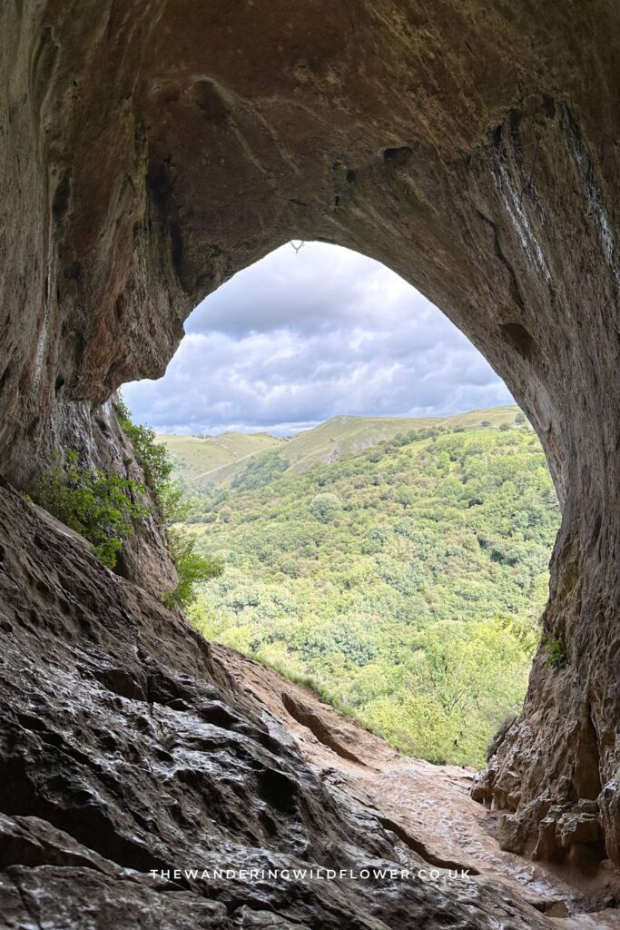
Walk Route (Opens in OS Maps): Thor’s Cave Walk Map
Walk Details: Thor’s Cave Walk
Wolfscote Dale and Biggin Dale | 7 Miles
This walk explores some of Derbyshire’s prettiest Dales and wanders through the limestone gorges and caves of Wolfscote Dale and Biggin Dale. Some of the caves are big enough to explore inside, and the walk along the tranquil River Dove is just beautiful. We visited on a grey day, but it will be stunning in Spring or Summer!
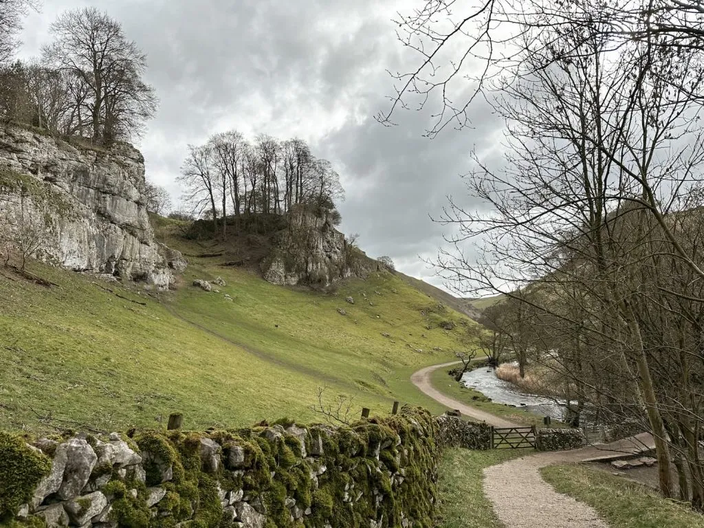
Walk Map (Opens in OS Maps): Wolfscote Hill and Wolfscote Dale Walk
Walk Details: Wolfscote Dale and Biggin Dale Walk
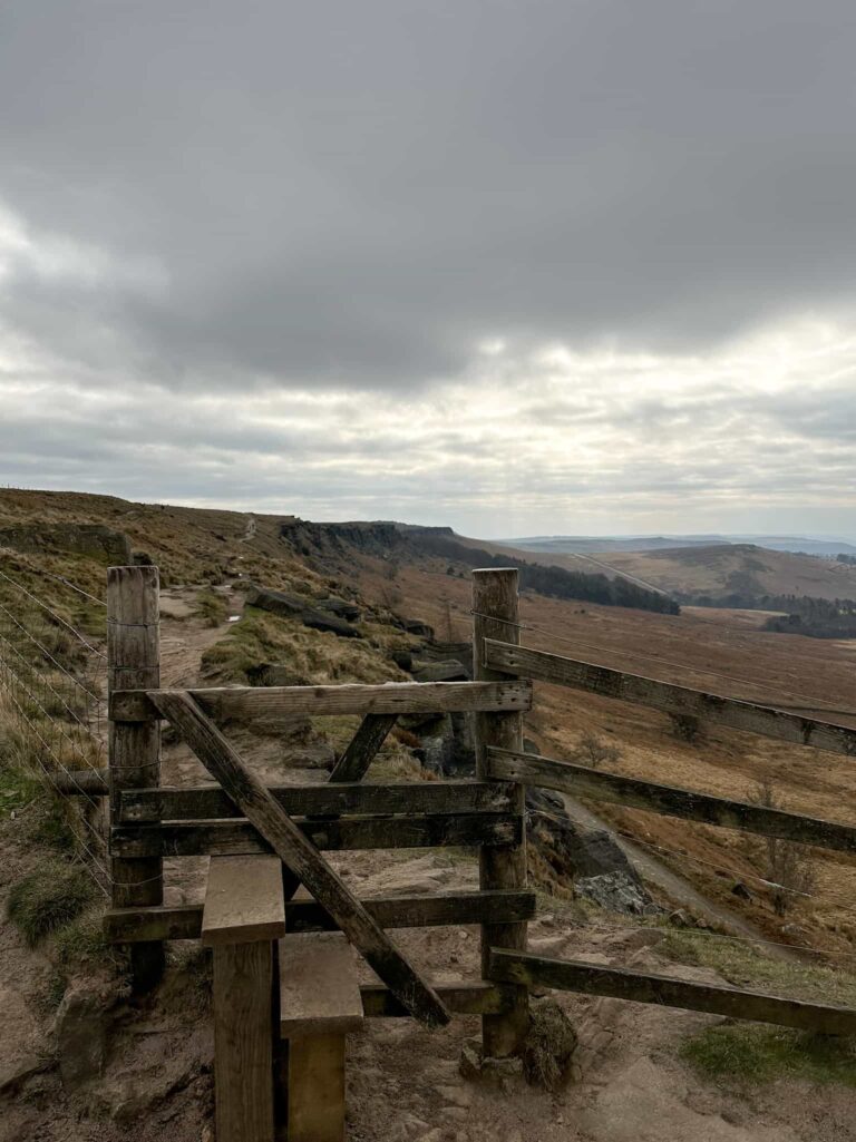
White Edge, Froggatt Edge and Curbar Edge | 6 Miles
This is a relatively gentle walk over the moors above Froggatt, exploring parts of Big Moor. There isn’t a steep climb but the views from Froggatt Edge and Curbar Edge are stunning. If you’re lucky you can spy deer on Big Moor, and there are gritstone outcrops a plenty along the Edges.
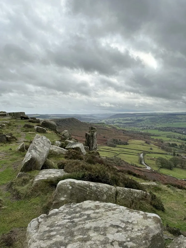
Walk Map (Opens in OS Maps): 3 Edges: Curbar Edge, Froggatt Edge and White Edge Walk
Walk Details: Curbar Edge Walk with Froggatt Edge and White Edge
So what do you think – have I missed anywhere? Let me know!
For more Peak District walks, why not try: