Brown Knoll Plane Wrecks Walk | 7.5 Miles
If you like your Peak District walks with a bit of adventure, this 7.5-mile route will be right up your street. It sets off along the Pennine Bridleway before heading out over the wide-open moorland of Brown Knoll. You’ll bag a trig point (and an Ethel), visit two fascinating plane crash sites, pass the Cowburn Tunnel shaft and even find a quirky little stone igloo tucked away on the hillside. There are a few off-path sections, so it’s one for walkers who don’t mind a bit of navigation and a taste of the wilderness.
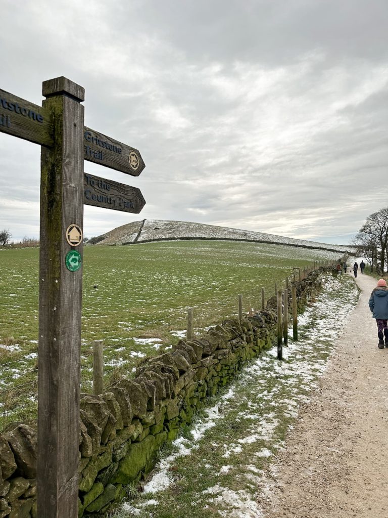
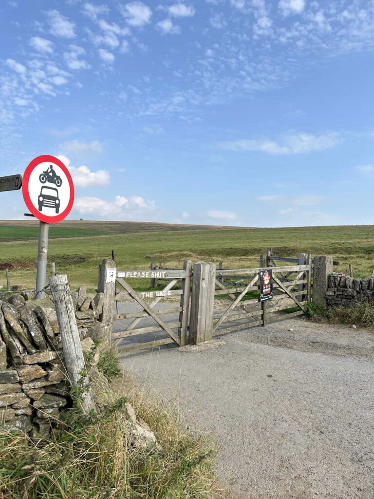
Our walk starts from a layby on Sheffield Road and heads off north-west along the Pennine Bridleway for 3 miles (5km), crossing Roych Clough before climbing steeply up, before arriving at the base of South Head. You could bag this as an extra Ethel if you fancied a quick out-and-back, but Holly vetoed that for our walk!
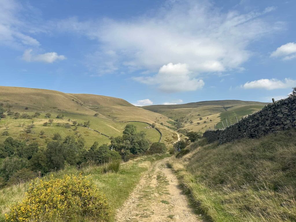

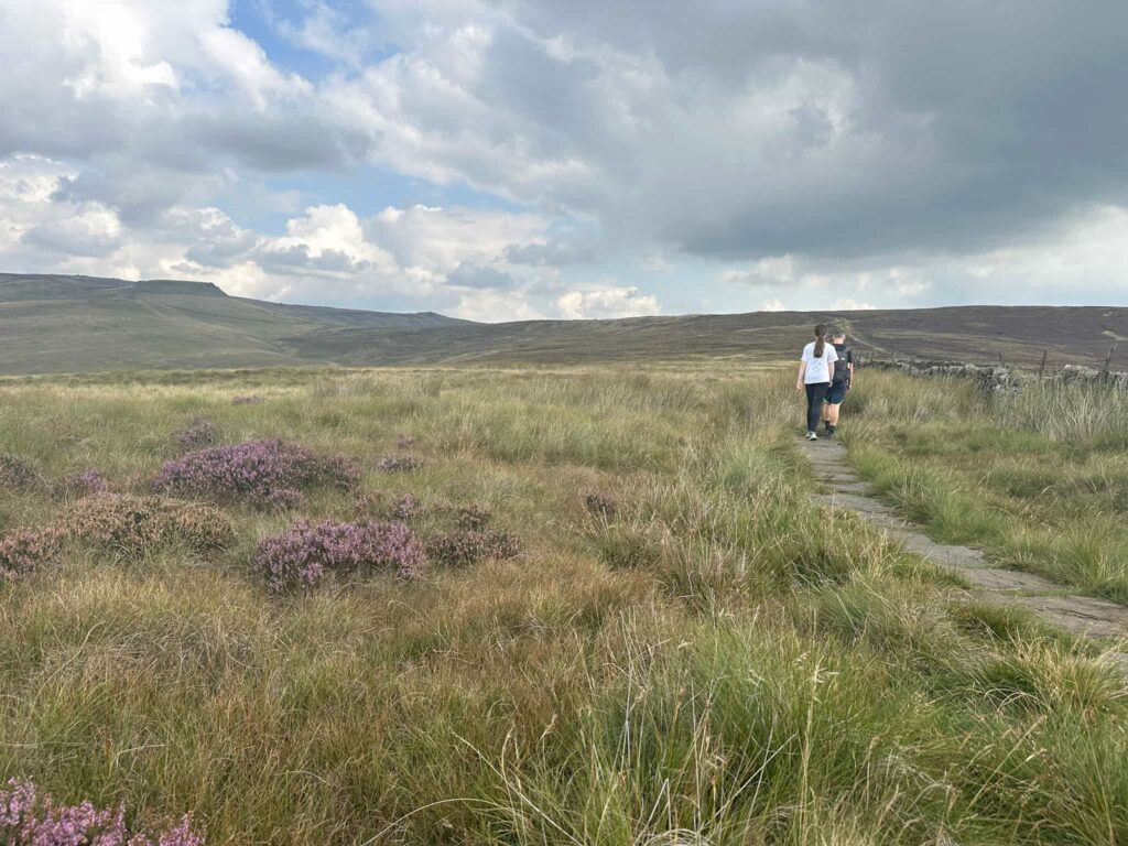
From the base of South Head we set off east over a moorland path which starts out grassy and boggy but becomes paved. After about 1.3 miles (2.1km) we reached a stile and turned right.
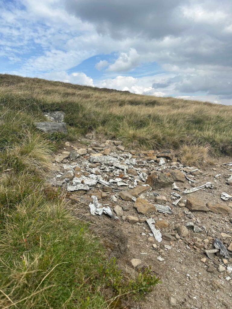
After 0.3 miles (500m) we left the path and headed south-west a short distance to find the first of the two plane crash sites near Brown Knoll, that of the Airspeed Oxford MK 1 HN594 which crashed on 28 December 1945. Everyone thankfully survived, but amazingly it was Flying Officer Edward Croker who, wrapped his fellow aircrew in a parachute then managed to raise the alarm by crawling 2 miles into Upper Booth on what he thought were broken ankles (they turned out to be only badly bruised). Amazing!
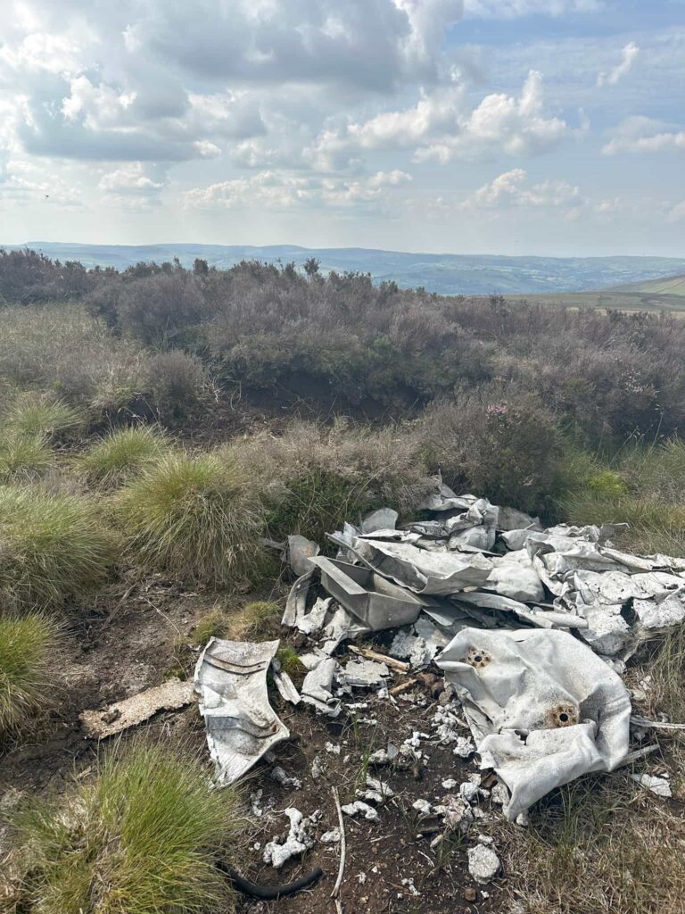
Airspeed Oxford MK 1 HN594 Grid Reference: SK 08189 85204
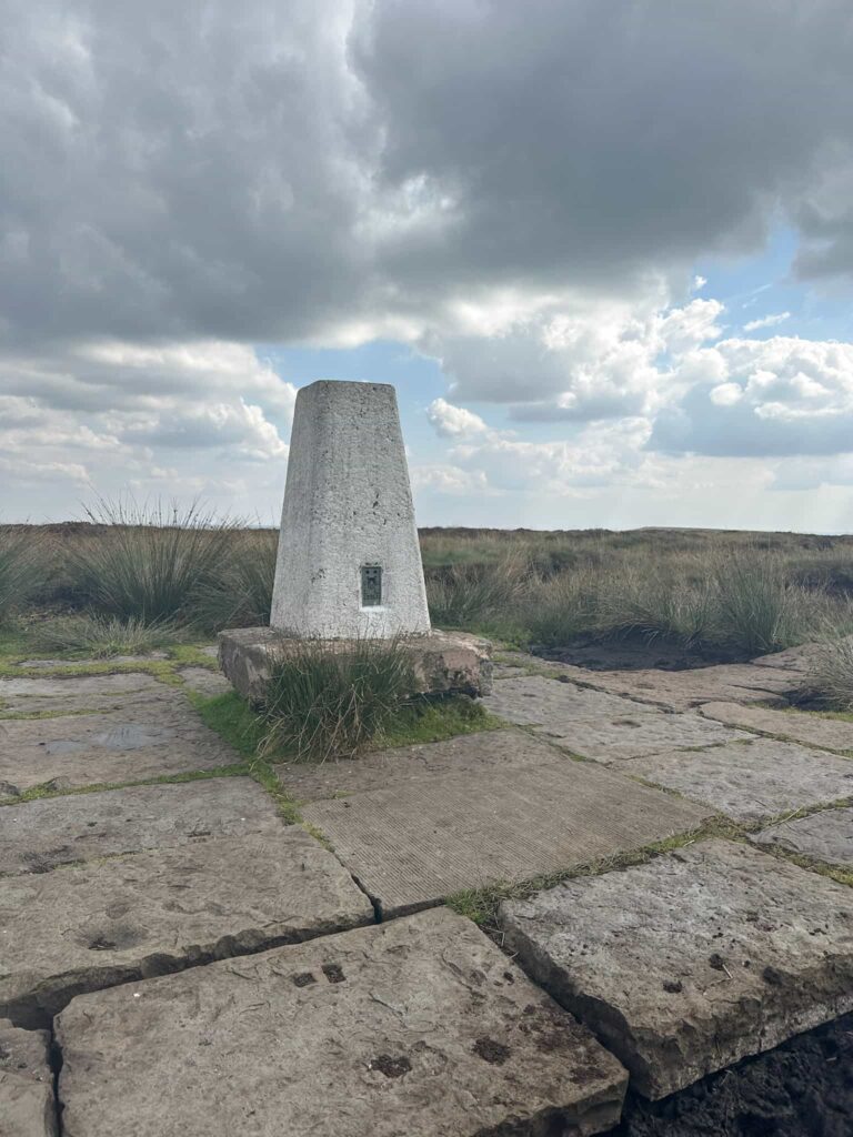
We returned to the path and followed this for about 0.1 miles (160m) to reach the Brown Knoll trig point.
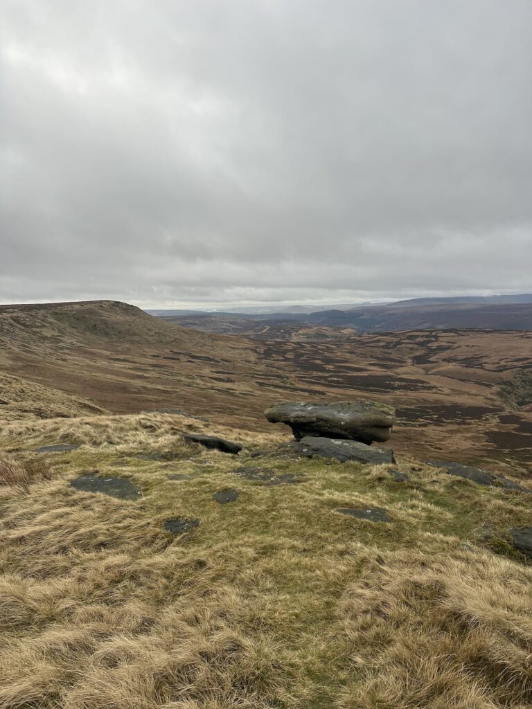
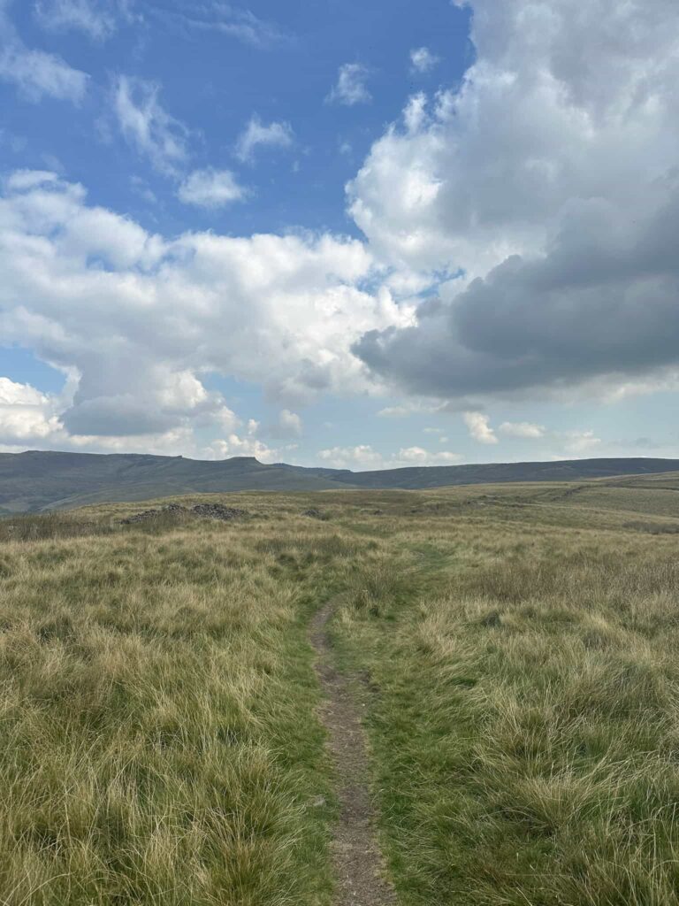
Brown Knoll might not be the most popular peak in the Peak District but it’s still worth a visit. At 569m it’s one of those big, open moorland tops that really makes you feel like you’re out in the wild. It used to be a proper boggy nightmare, but thanks to the stone-flagged paths you can actually get up there without losing a boot. The trig point sits on a flat top with amazing views over to Kinder and Mam Tor – a brilliant spot to stop and catch your breath.
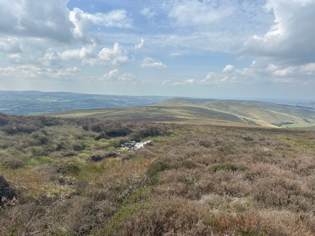
From the trig point we continued along the slabs for 0.7 miles (1.1km) before leaving the path and heading roughly north-east to find a stone memorial cairn (which has to have some of the best views in the Peak District!) and a short distance away from this cairn, the crash site of the Republic P-47C Thunderbolt 41-6227 which crashed on Horsehill Tor on 25 April 1943. The pilot bailed out after losing control and ending up in a spiral dive, but survived with spinal fractures.
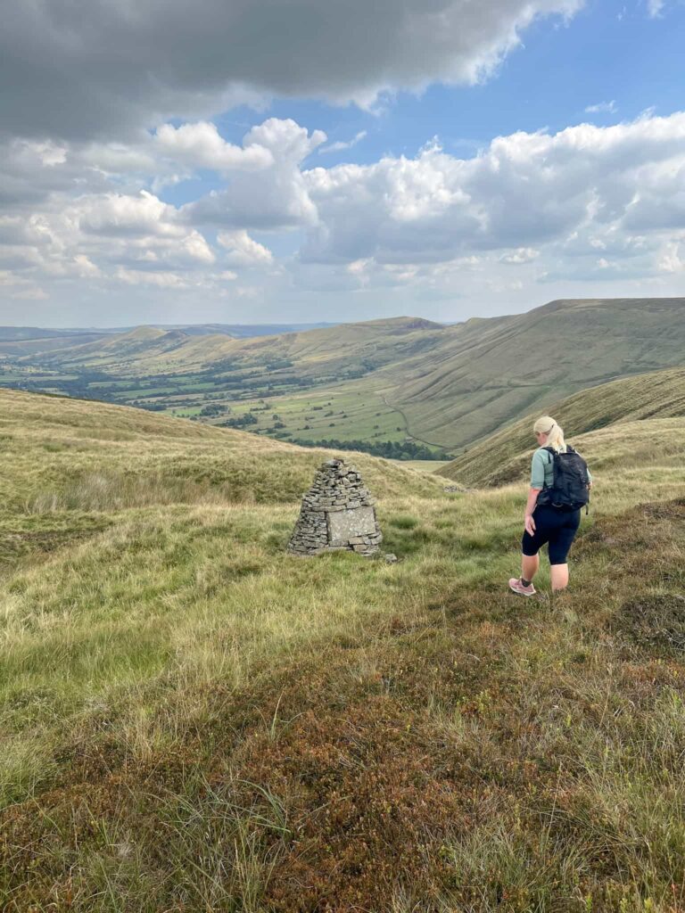
Republic P-47C Thunderbolt 41-6227 Grid Reference: SK 09344 84337
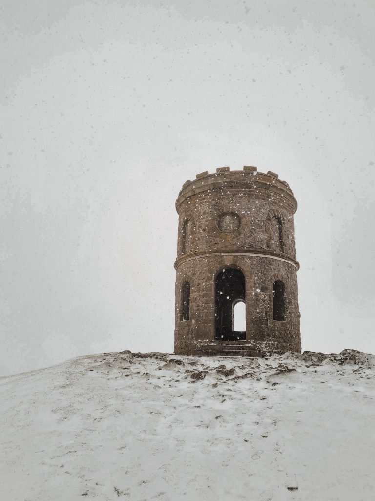
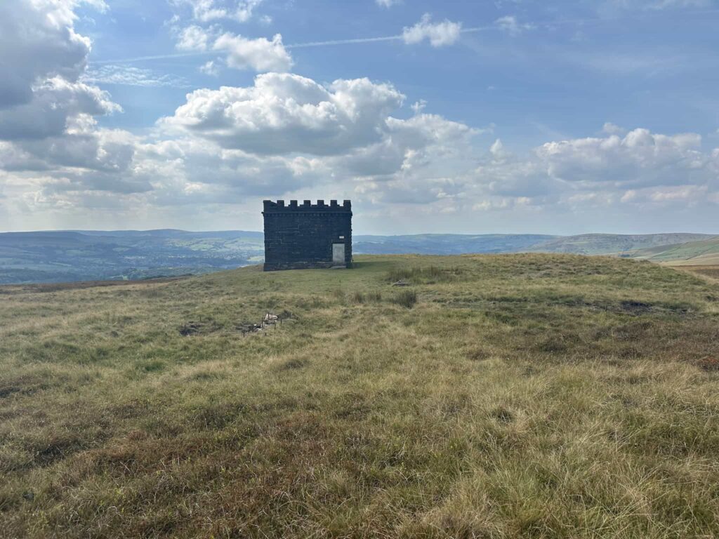
We returned to the path, following the course of a shallow grough, and then continued along the slabs for 0.06 miles (100m). We left the path on the right hand side and headed south-west to the Cowburn Tunnel shaft. Built in the 1890s, it was designed to remove smoke and fumes from the Cowburn Tunnel below. The shaft’s distinctive turreted structure is clearly visible from nearby walking routes, offering a glimpse of Victorian engineering in the Peak District.
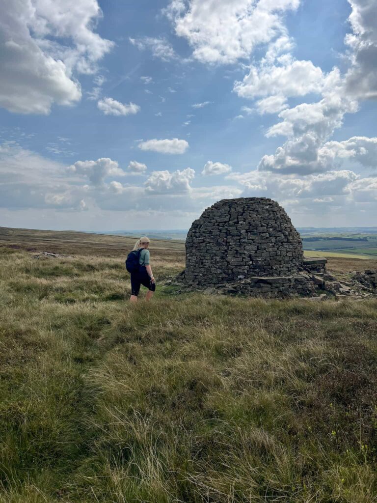
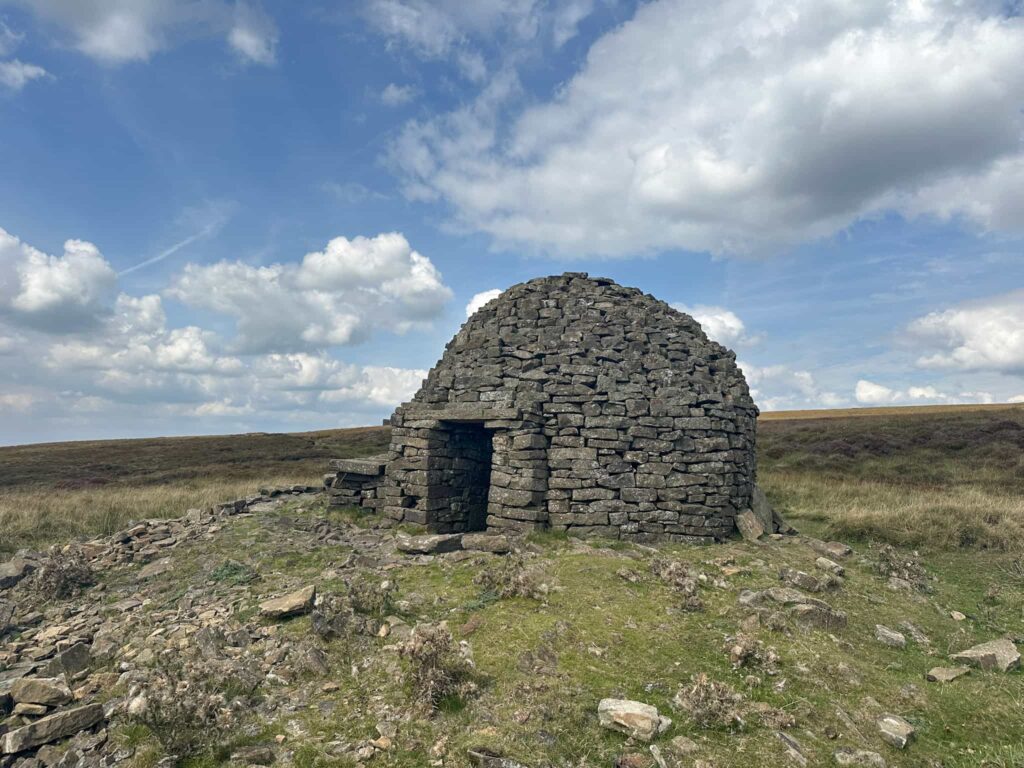
A short distance to the south-east is the quirky stone igloo, which makes a great place for a snack break. No one seems to know the origins of this cute little shelter, which makes it all the more mysterious.
We continued south-east to join Chapel Gate at the Peak and Northern Footpaths Society green sign and turned right to follow the rough track back to the start of the walk, and the car park.
This was such an interesting walk, with lots of points of interest, but does involve some off path sections and the weather can be atrocious up there. When we visited before you couldn’t see the ventilation shaft from the igloo, the mist was so thick, so good navigation skills are essential on this walk.
Brown Knoll Plane Wrecks Walk Details:
Walk Map (Opens in OS Maps): Brown Knoll Plane Wrecks Walk Map
Parking: We parked in a layby on Sheffield Road, near Rushup Edge. W3W:///logbook.arts.polka
Dogs: Allowed, but must be on a short lead during nesting season and around livestock.
Facilities: There are none – remember to Leave No Trace and take all your rubbish (including dog poo) away with you.
Walk Time: 4-5 hours
Difficulty: ▲▲▲
Distance: 7.5 miles (12km)
Elevation: 1125ft (343m)
Trig Points Bagged: Brown Knoll
Peak District Peaks Bagged: Brown Knoll
Peak District Ethels Bagged: Brown Knoll. South Head would be a very easy addition.
For more walks that visit Brown Knoll you might like:
- Kinder Scout, Brown Knoll, South Head and Mount Famine | 8 Miles
- Brown Knoll Stone Igloo Walk | 9 Miles
- Edale to Kinder Scout and Mam Tor | 12 Miles
For more Peak District plane crash site walks you might like: