• 3 Mile Walks or Less
  • 4 Mile Walks
  • 5 Mile Walks
  • 6 Mile Walks
  • 7 Mile Walks
  • 8 Mile Walks
  • 9 Mile Walks
  • 10 Mile Walks
  • 11 Mile Walks
  • 12 Mile Walks
  • 14 Mile Walks
  • 15 Mile Walks
  • 20+ Mile Walks

The Wandering Wildflower

Peak District Hikes

  • PEAK DISTRICT WALKS
    • SHORT WALKS UNDER 3 MILES
    • MEDIUM WALKS 4-9 MILES
    • LONG PEAK DISTRICT WALKS 10 MILES +
  • PEAK DISTRICT WALKS WITH PUBS
  • PEAK DISTRICT WALKS WITH KIDS
  • HOLMFIRTH WALKS

Back Tor and Lost Lad Circular Walk | 6 Miles

December 26, 2021 CIRCULAR WALKS, MEDIUM WALKS 4-9 MILES, PEAK DISTRICT WALKS, PEAK DISTRICT WALKS WITH PUBS

Here’s another trig point circular walk for you! This walk takes in Back Tor trig point and the Peak District peak of Lost Lad and is a pleasant walk over moorland of just under 10km. Exploring Derwent Edge, you’ll see fabulous millstone grit deposits and beautiful moorland views. You’ll also bag two Peak District Ethels!

Back Tor trig point

Back Tor trig point

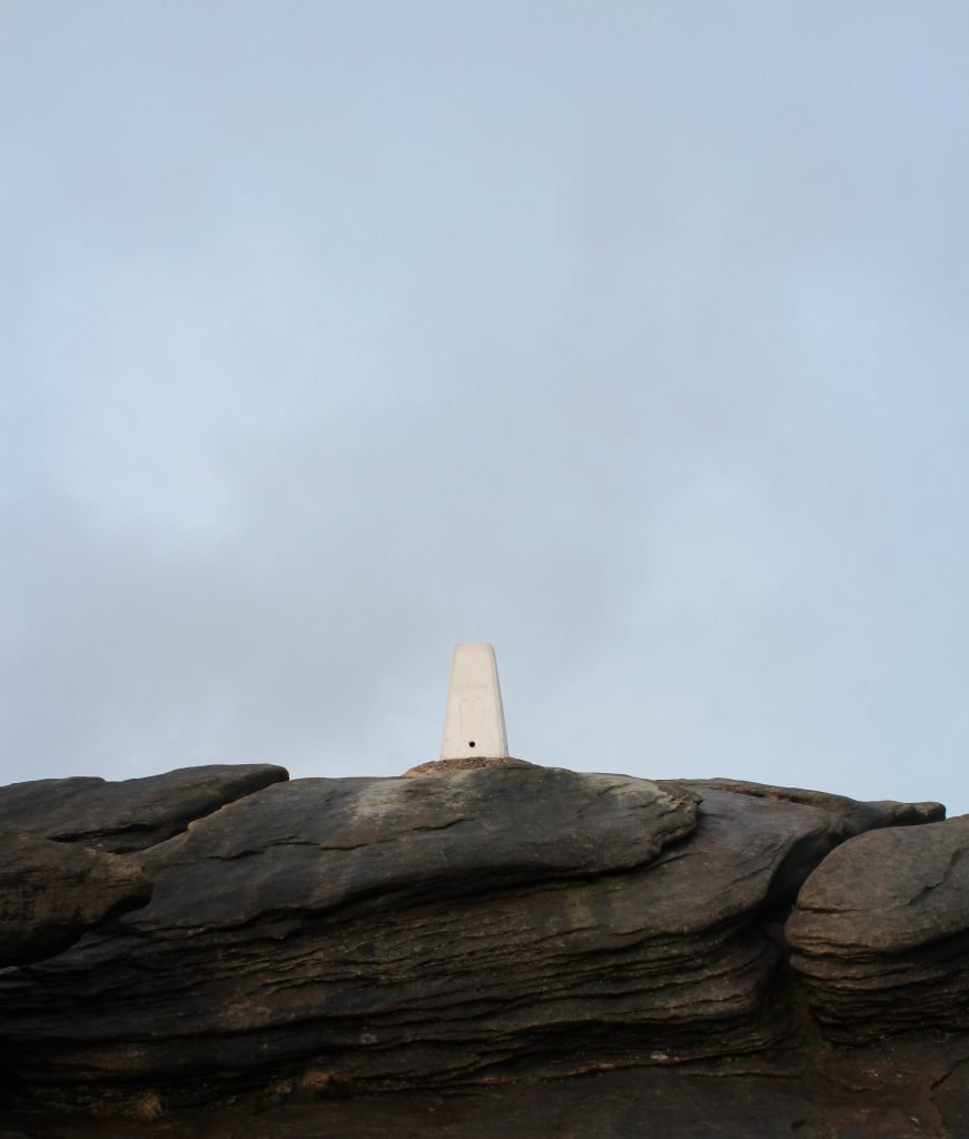
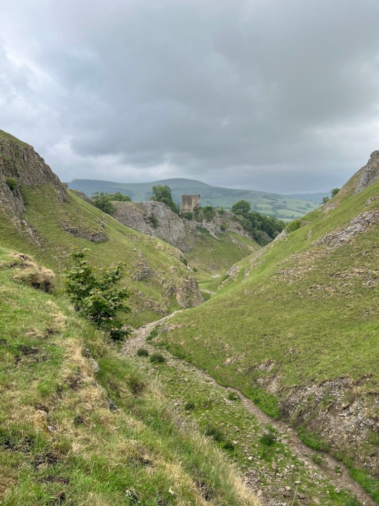
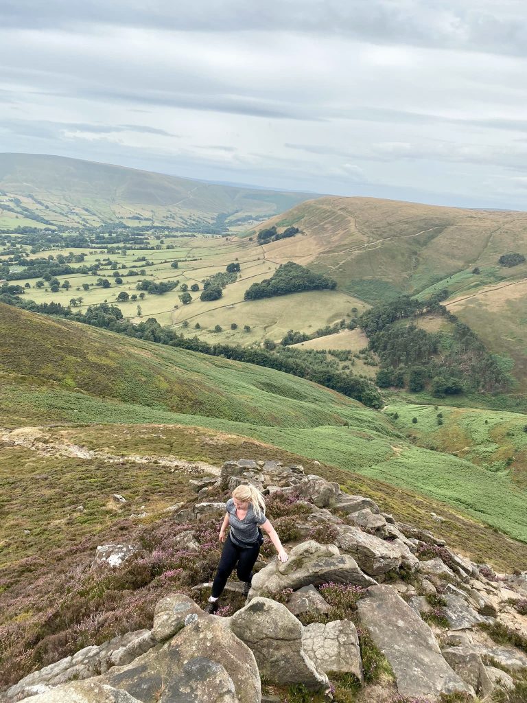
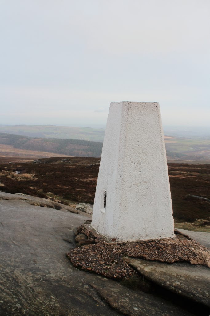
Back Tor trig point is situated approx 538m above sea level and is high on Derwent Edge, a rocky outcrop high above Ladybower Reservoir. The trig point marks the summit of Back Tor and is set in and amongst a millstone grit deposit which makes for a fun clamber about. The cairn and toposcope marking the summit of Lost Lad are a short distance away.

Rock formations at Derwent Edge, near Back Tor trig point

Rock formations at Derwent Edge, near Back Tor trig point

The name Lost Lad apparently comes from a legend about a shepherd boy who got lost in a blizzard and and died. His body was found by a passerby the following spring along with the words “Lost Lad” on a nearby stone.  Whilst we were on this walk the weather changed really quickly, and it is easy to see how you could become lost up here. There were still snow drifts on the ground as well, despite the majority having vanished elsewhere. It is a bleak place, but incredibly beautiful.

The Strines Inn, Sheffield

The Strines Inn

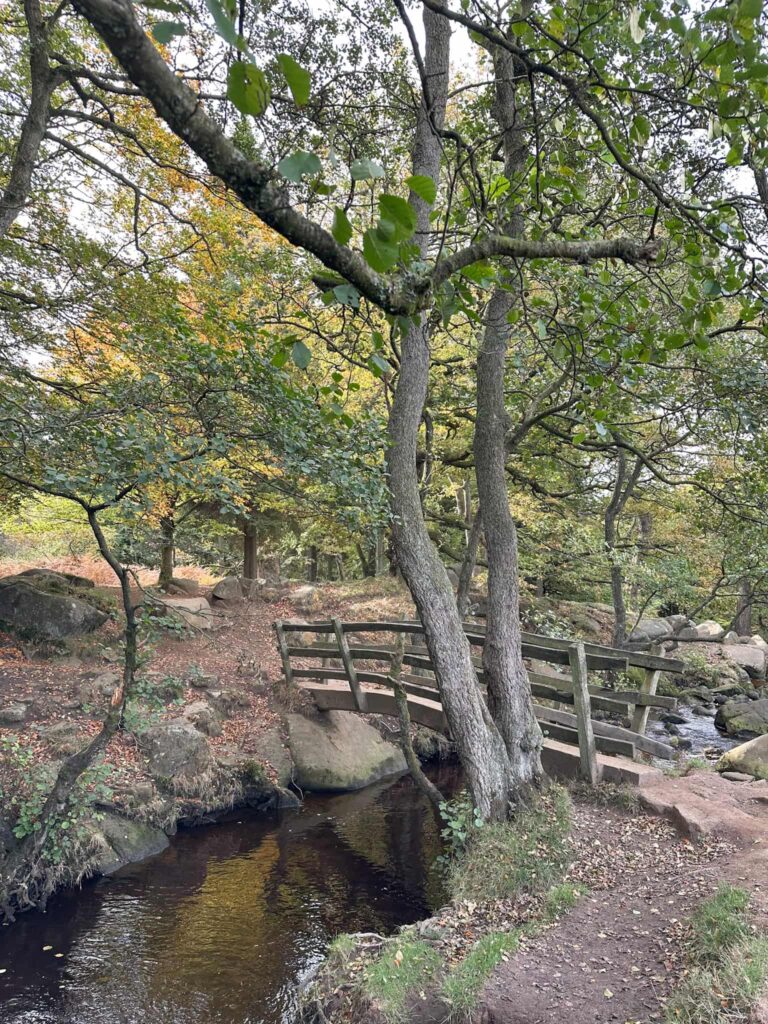
Our Back Tor trig point walk starts out from The Strines Inn and heads down the roadside through the woods. Over the bridge in the bottom of the woods, there is a gateway leading off up Foulstone Road. This track leads to a farm building but also runs to a footpath crossroads.

Foulstone Road

 Foulstone Road, turning more into a track

Foulstone Road, turning more into a track

Definitely more of a track now!

At the crossroads, turn right to head north toward Back Tor trig point. There is a paved stone path which takes you there, and the trig point will suddenly appear on top of the rocks as you get closer. It’s a bit of a clamber to get to the actual trig point, but once you’re there there are amazing views over the Dark Peak. It was a bit too windy for me to attempt to climb the trig point today!

Path to Back Tor trig point

Path to Back Tor trig point


Back Tor trig point, almost invisible against the light sky

Back Tor trig point, almost invisible against the light sky

Views from Back Tor trig point over the moorland

Views from Back Tor trig point over the moorland

Back Tor trig point and rock formations

Back Tor trig point and rock formations

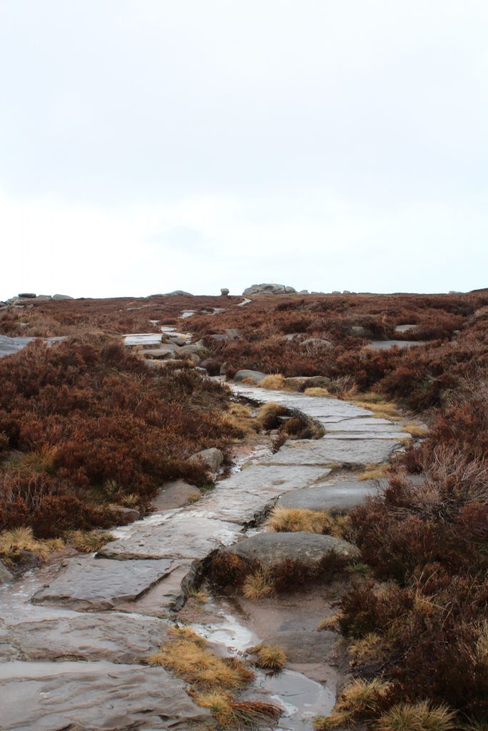
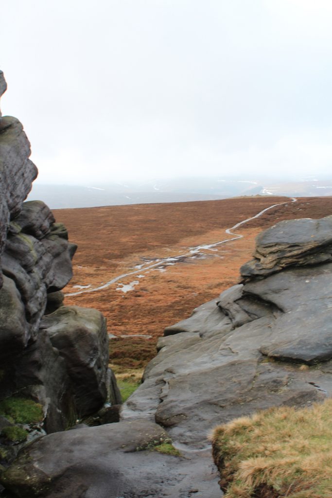
From the summit of Back Tor you can just see across to Lost Lad. The path is paved with natural stone but is still boggy in places where the stones have come unset.

View from Back Tor over to Lost Lad


Path over moorland to Lost Lad

Path over moorland to Lost Lad

Lost Lad summit toposcope

Lost Lad summit toposcope

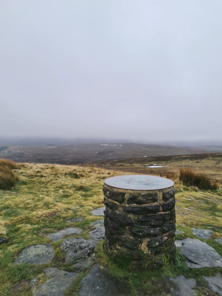
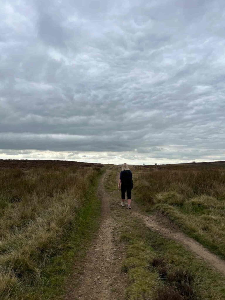
It’s a gentle climb up to the Lost Lad summit, where there is a stone cairn and a toposcope showing the names of the fells and peaks you can see. The mist was really starting to come in when we reached the summit, and looking back we couldn’t see Back Tor any more!


We then headed over the moorland of Green Sitches and looped back around to rejoin Foulstone Road before heading back to The Strines Inn for a well earned pub lunch. Luckily they had the fires roaring in the pub as it was a bitterly cold day!

Views across to Cakes of Bread from Back Tor


It was icy going in places, but this was a lovely walk to do and if we had time we would have extended it to maybe include Margery Hill trig point. As we were out during school hours we had to make sure we could get back in time (plus I wanted my walk to finish with a pub lunch!).


Here’s the route for this Peak District walk:

Route Map:


Route Map (Opens in OS Maps): Back Tor and Lost Lad Circular Walk

Parking: The Strines Inn S6 6JE. Parking is for customers only but we checked with staff before we set out for our walk that it would be OK for us to park there and have lunch after.

Facilities: The Strines Inn

Walk Time: 2 hours 30 min

Difficulty: ▲▲

Distance: 6 miles (10km) approximately

Trig Points Bagged: Back Tor

Peak District Peaks Bagged: Back Tor, Lost Lad

Peak District Ethels Bagged: Back Tor, Lost Lad


For more Peak District walking routes or Peak District Ethels walks check out the blog posts below.

You might also like Lost Lad and Back Tor with Abbey Brook or for a more challenging walk try Derwent Reservoirs Circular (Dambusters Challenge Walk).

Tap to share with your hiking friends!

  • Facebook
  • Email
  • WhatsApp
« Bakewell to Lees Moor with Calton Pastures and Noton Barn Trig Point | 9 Miles
Errwood Hall Circular Walk | 6 Miles »

RELATED POSTS

  • Hathersage Stepping StonesHathersage Stepping Stones Walk | 7 Miles
  • Ladybower ReservoirLadybower Walk | 6 Miles
  • Anvil Stone, GrindsbrookGrindsbrook Clough Scramble to Grindslow Knoll | 7 Miles
  • Trans Pennine Trail through the Longdendale Valley - easy Peak District walks from The Wandering WildflowerTorside Reservoir Circular Walk | 5 Miles

Leave a Reply Cancel reply

Your email address will not be published. Required fields are marked *

FIND YOUR NEXT WALK:

ABOUT ME

Y Garn with Kids - Y Garn via the Devil's Kitchen Walk in Ogwen Valley

Hello! I’m Jo! Welcome to The Wandering Wildflower, an outdoors lifestyle blog focusing on family walks in the Peak District, a place we love exploring. I want to share the Peak District hidden gems and show you there’s so much more than the honeypot places. When I’m not dragging my husband and now 11 year old out on Peak District walks or up mountains, I can be found on planning my next moorland walk or plotting a Geocache walk (and seeing where the nearest pub is!). I love the hills but hate the heights, so trig bagging is – er- fun!


I hope this blog will give you some ideas of places to visit in the Peak District and inspire you and your family to head into the great outdoors.  Thanks for stopping by!

CATEGORIES

  • CIRCULAR WALKS (189)
  • HOLMFIRTH WALKS (27)
  • ISLE OF SKYE WALKS (3)
  • LAKE DISTRICT WALKS (26)
  • LANCASHIRE WALKS (2)
  • LONG PEAK DISTRICT WALKS 10 MILES + (42)
  • MEDIUM WALKS 4-9 MILES (137)
  • PEAK DISTRICT SCRAMBLES (16)
  • PEAK DISTRICT WALKS (206)
  • PEAK DISTRICT WALKS WITH KIDS (76)
  • PEAK DISTRICT WALKS WITH PUBS (60)
  • SCOTLAND WALKS (6)
  • SHORT WALKS UNDER 3 MILES (40)
  • SNOWDONIA WALKS (5)
  • UK CAMPING (5)
  • YORKSHIRE WALKS (33)

Peak District Walks

List of Peak District Ethels

Peak District Peak Bagging

Peak District Trig Point Challenge

Peak District Walks with Pubs

Peak District Walks with Kids

Beautiful Walks in Holmfirth

Short Walks in the Peak District

Long Walks in the Peak District

AFFILIATE DISCLOSURE

This blog may contain affiliate links through which, at no additional cost to you, I may earn a small commission. I only recommend products I would use myself and all opinions expressed here are my own. As an Amazon Associate I earn from qualifying purchases. Read full privacy policy here.

ARCHIVES

PEAK DISTRICT WEATHER

Peak District mountain weather on Met Office

Peak District Trig Points

Promo image for a blog post about the Peak District Trig Point Challenge With Map of Peak District Trig Points and Walking Routes by The Wandering Wildflower

Peak District Ethels Challenge

Promo image for a blog post about the Peak District Trig Point Challenge With Map of Peak District Ethels and Walking Routes by The Wandering Wildflower

WALKING ROUTES STRAIGHT TO YOUR INBOX

Want new walks in your inbox? Drop your email below and I'll send you some ideas for walks you can try.

You can unsubscribe anytime. For more details, review our Privacy Policy.

Thank you!

You have successfully joined our subscriber list.

RSS LATEST POSTS

  • How to Find Three Shires Head
  • Peak District Pub Walks
  • Burnbank Fell, Blake Fell and Gavel Fell | 8 Miles
  • Bretton Park Circular Walk | 3 Miles
  • Grasmere Weekend Break

FOLLOW ON PINTEREST

Want new walks in your inbox? Drop your email below and I'll send you some ideas for walks you can try.

You can unsubscribe anytime. For more details, review our Privacy Policy.

Thank you!

You have successfully joined our subscriber list.

jo@thewanderingwildflower.co.uk

The Wandering Wildflower

  • Email
  • Facebook
  • Instagram
  • Pinterest
  • PRIVACY POLICY
  • TERMS & CONDITIONS
  • ABOUT

(c) The Wandering Wildflower. All Rights Reserved.

|| THEME BY ECLAIR DESIGNS