Sabres on Kinder Scout via Mill Hill and Upper Red Brook Scramble | 7 Miles
A true moorland adventure, involving two plane wrecks and a rocky scramble up Upper Red Brook onto Kinder Scout. This walk visits the crash sites of the B24J Liberator on Mill Hill and the Sabres on Black Ashop Moor. This walk is suited to experienced walkers who don’t mind off path hiking and can navigate in the tricky conditions that you can get on Kinder Scout.
Kinder Scout Plane Crash Walk Overview
Distance – 7.1 miles
Difficulty – Challenging with a hands-on scramble over rocky ground of Upper Red Brook
Route type – Circular
Start point – Layby on Chunal Moor
Terrain – Rocky paths, steep climbs, moorland plateau
Facilities – None
Highlights of the Walk
- Grade 1 scramble onto Kinder Scout via Upper Red Brook
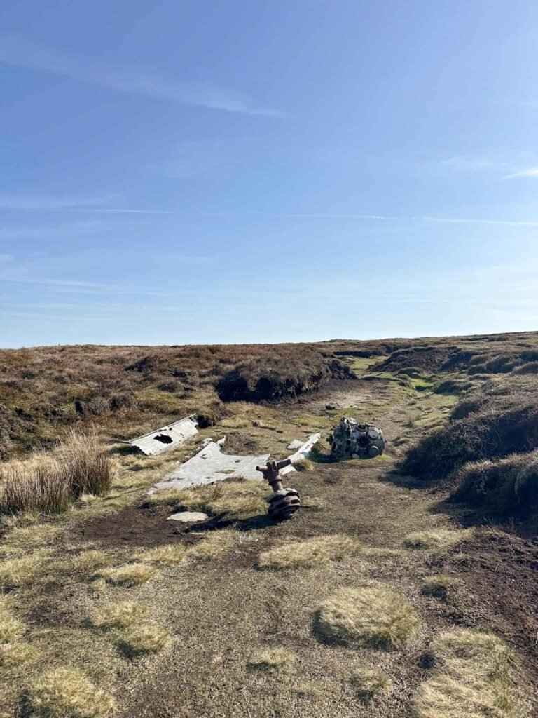
- Visiting two plane wreck sites. The B24J Liberator on Mill Hill and various debris pools of the FMk4 Sabres on Kinder Scout and Black Ashop Moor.
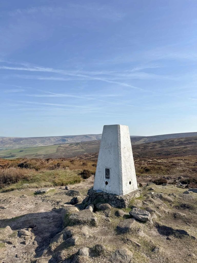
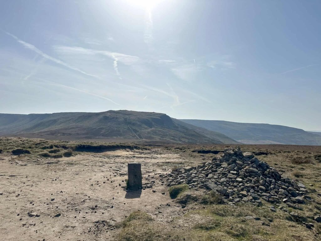
- Harry Hut trig point
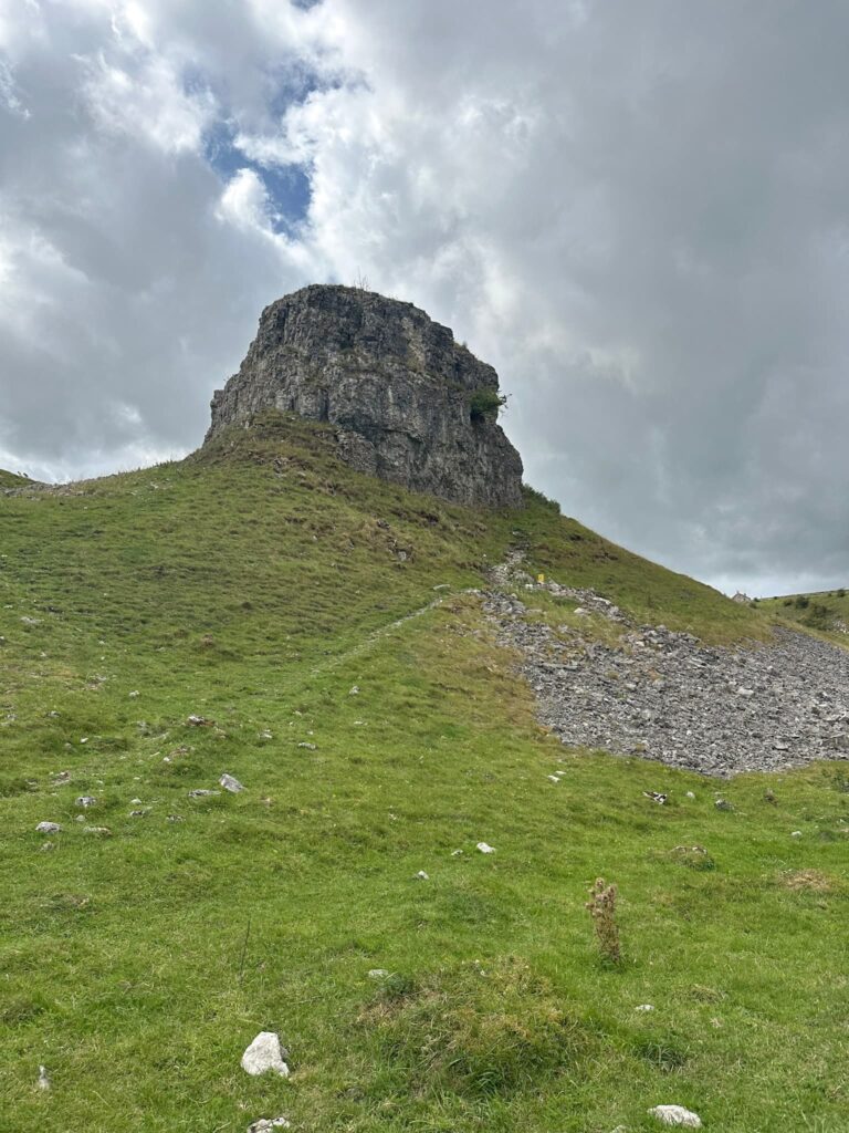
- Exploring fascinating gritstone formations such as the Boxing Glove
- Stunning views from the summit of Kinder Scout and it’s northern edge
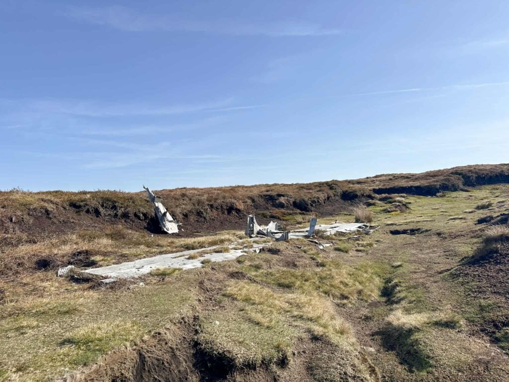
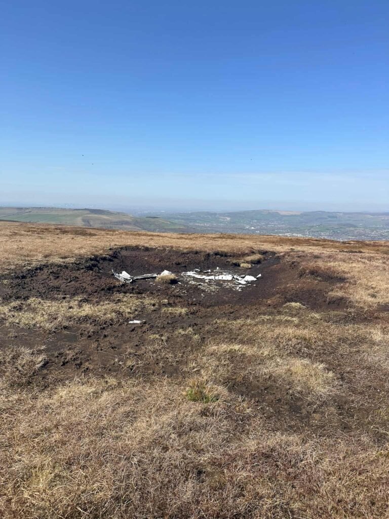
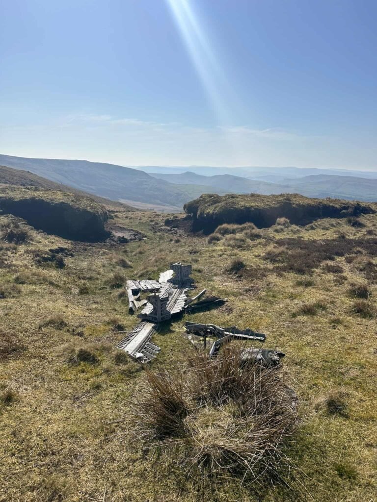
B24J Liberator on Mill Hill
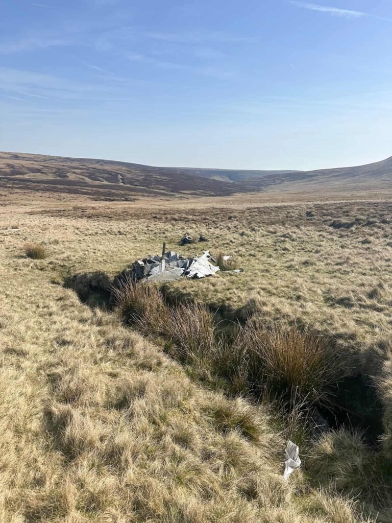
The Liberator crashed on the moors in 1944 but amazingly both crewmen escaped with only cuts and bruises, with a broken jaw being the most severe injury. There are two debris pools at grid reference SK 05844 90610 and SK 05731 90583.
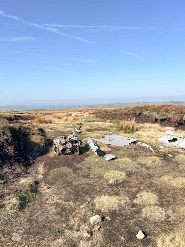
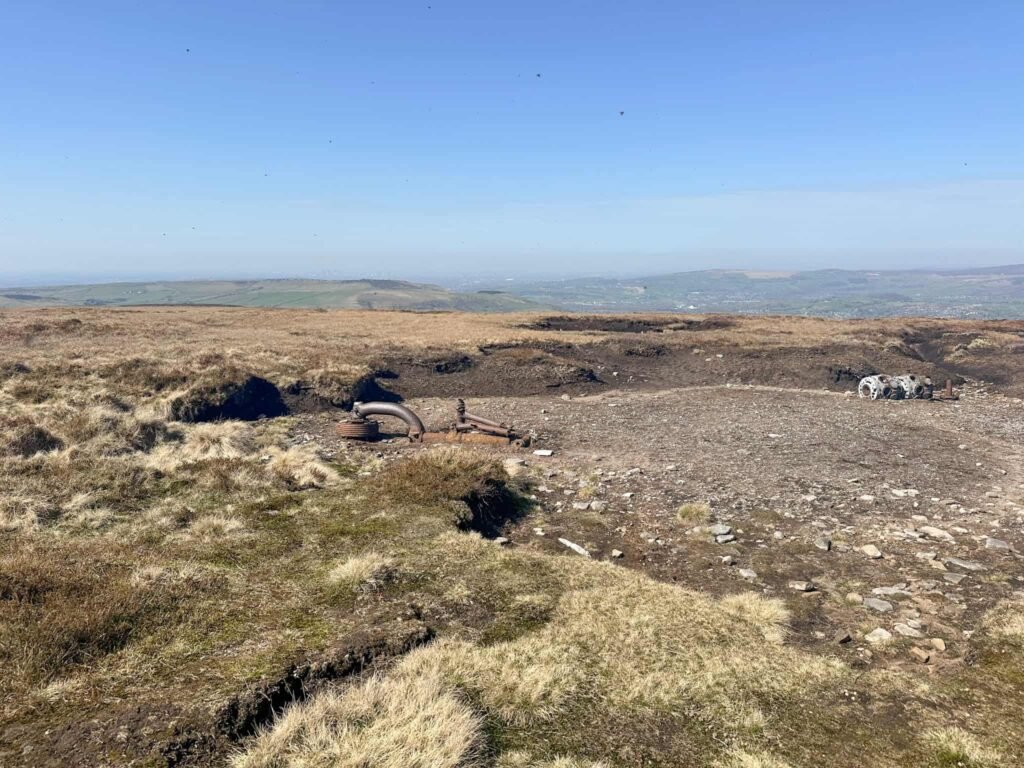
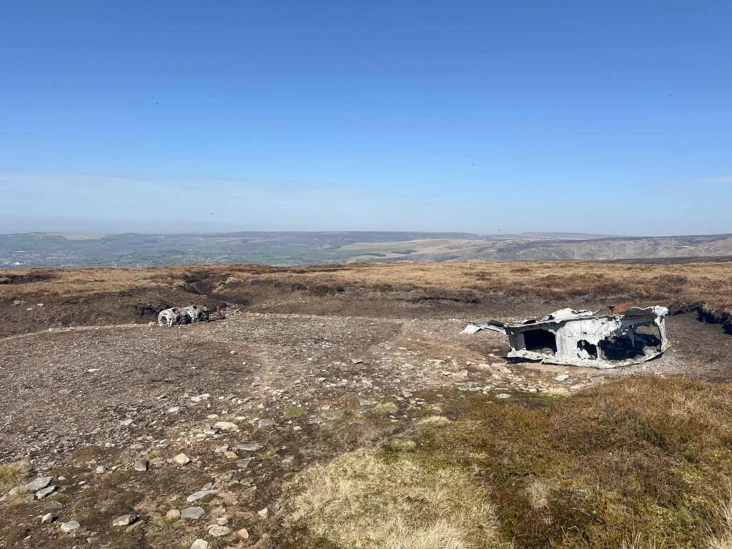
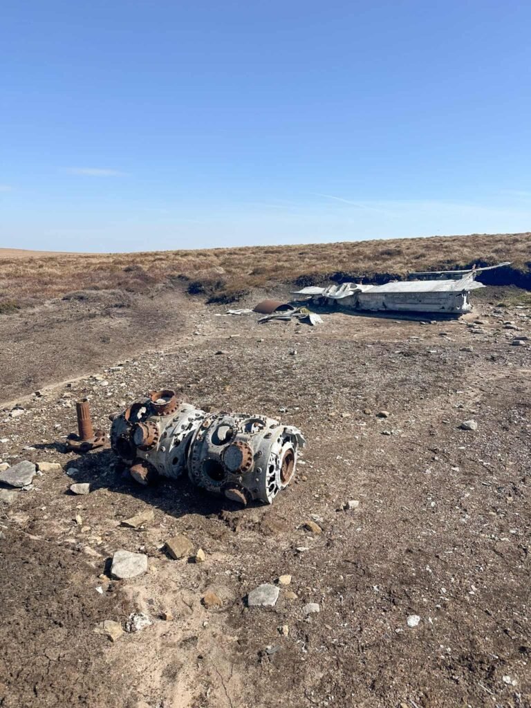
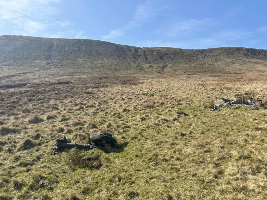
FMk4 Sabres on Kinder Scout
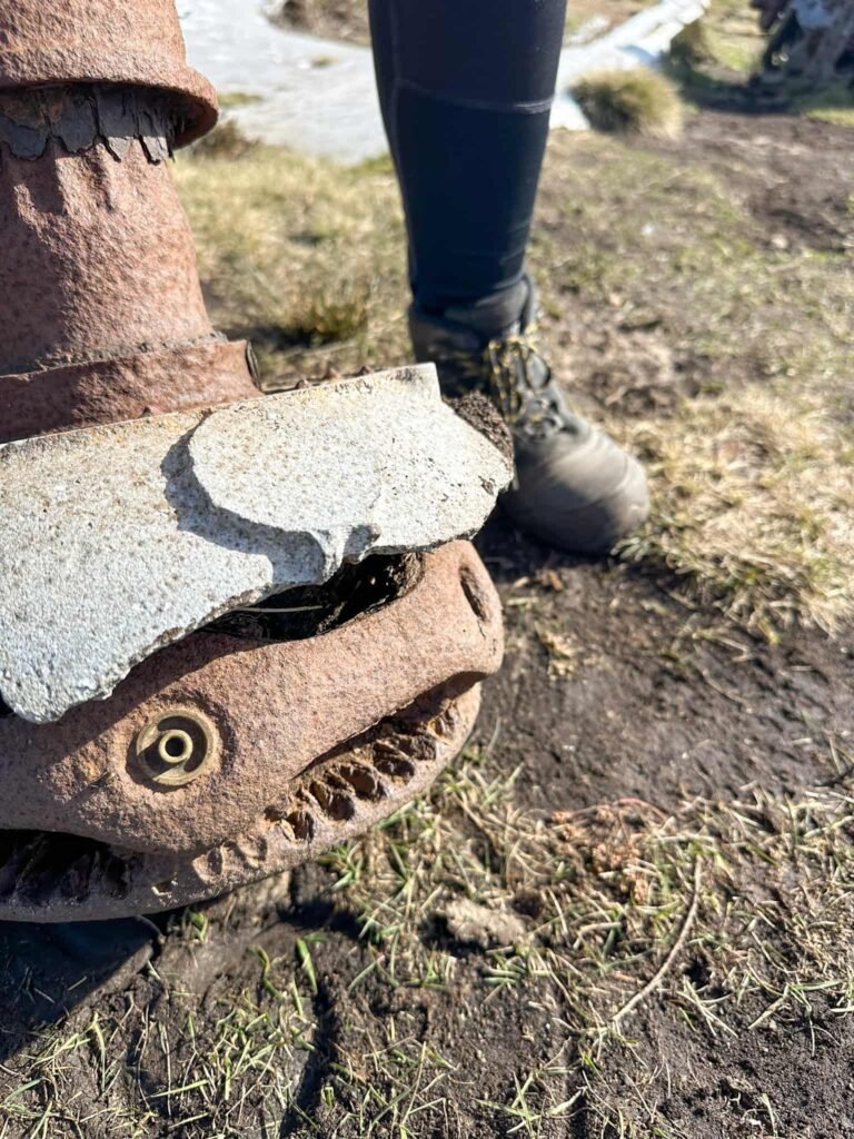
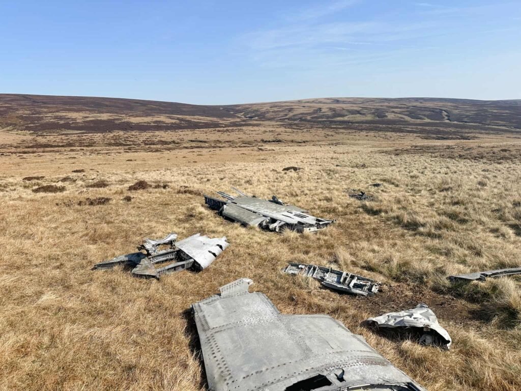
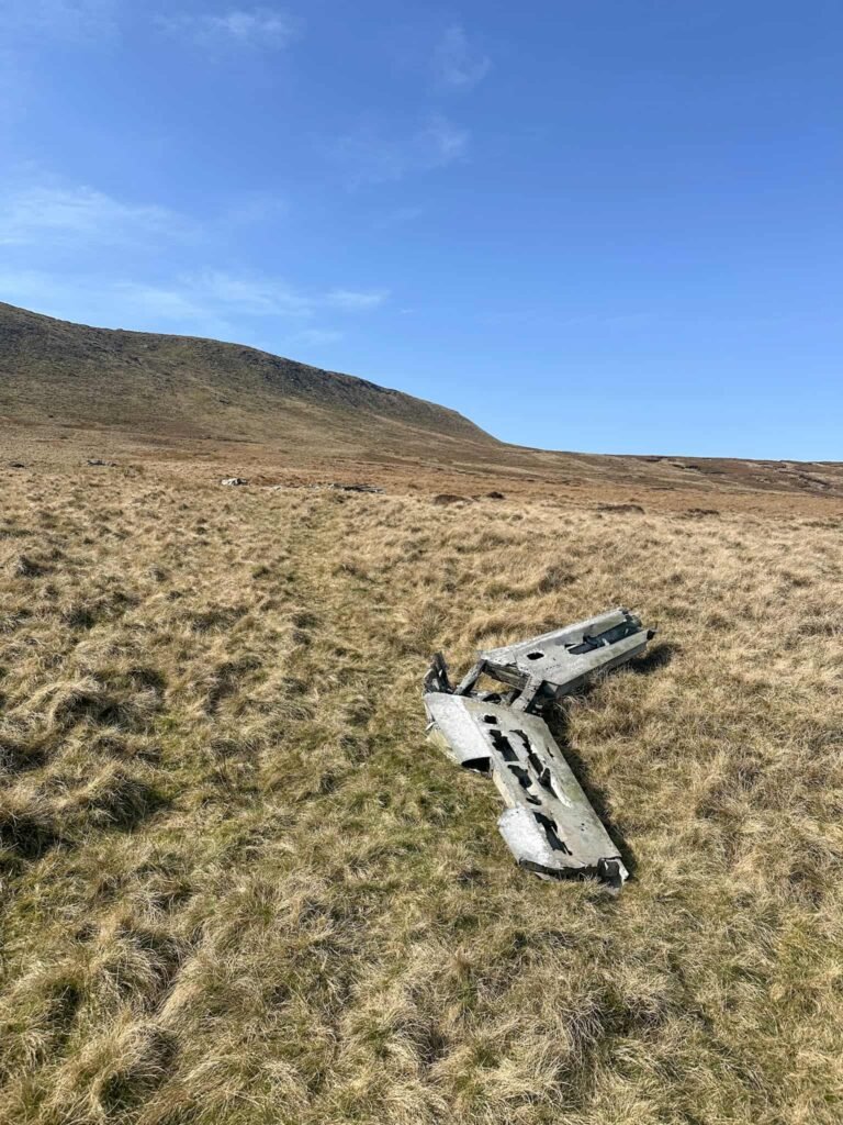
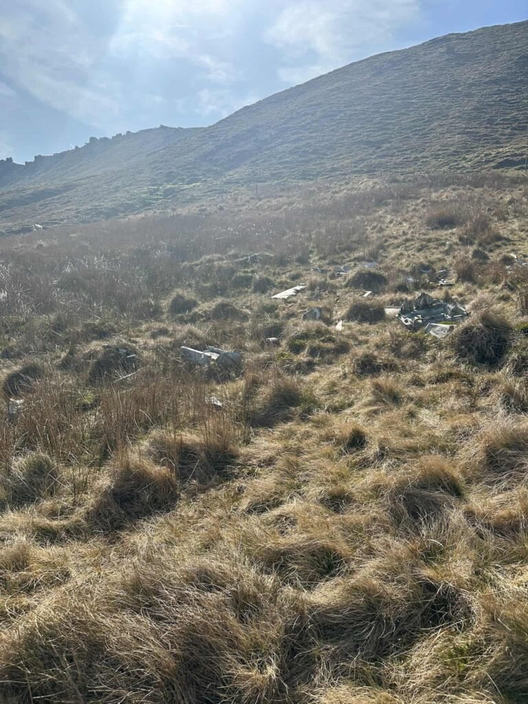
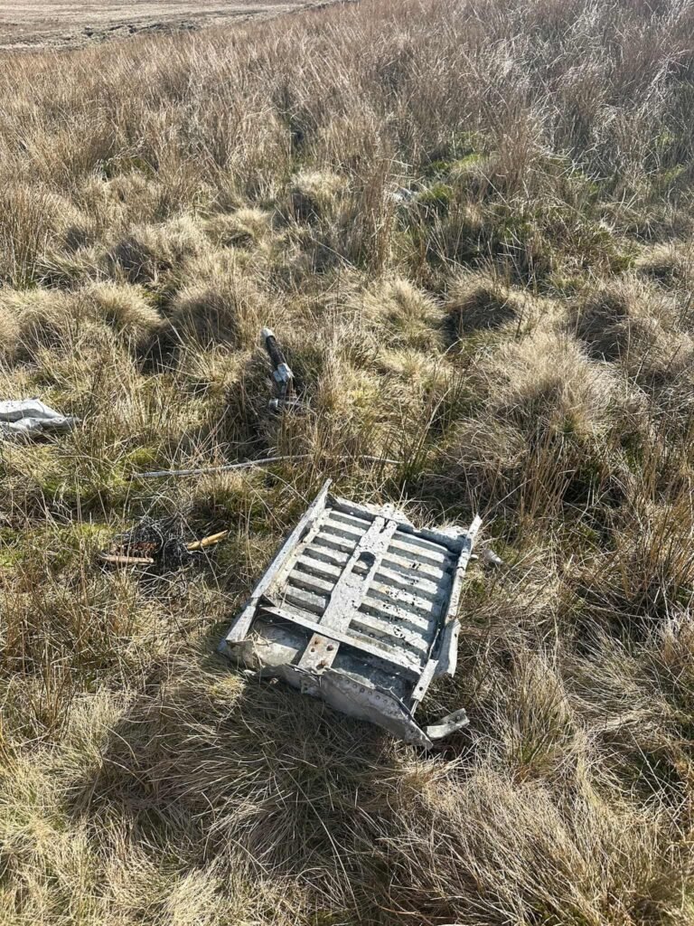
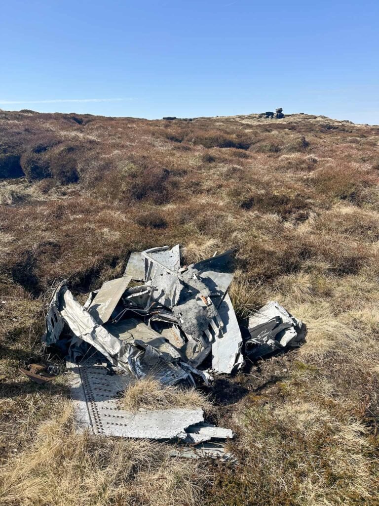
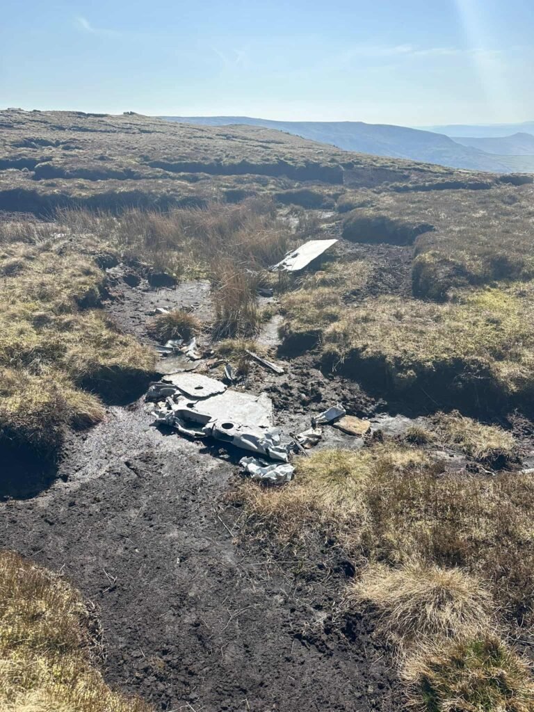
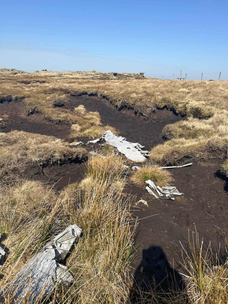
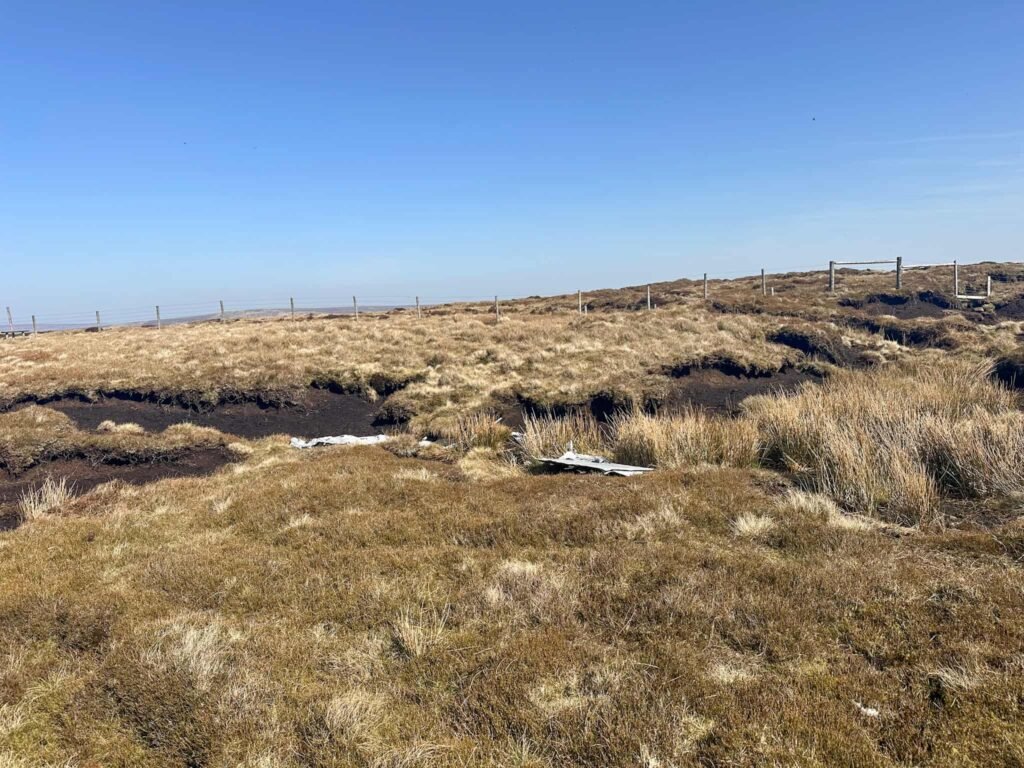
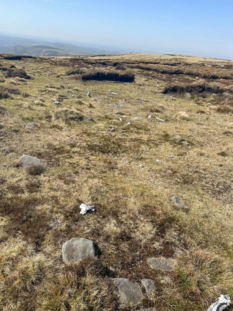
The two Sabres were flying in formation in low cloud when they crashed into the Kinder Scout plateau on 22 July 1944, killing both pilots. There was one initial impact point and both planes bounced for 900m before ending up on Black Ashop Moor. Debris was scattered along the line of the flight, with there being various debris pools across the plateau and moor. There is a surprisingly large amount of wreckage still left.
Walk Details
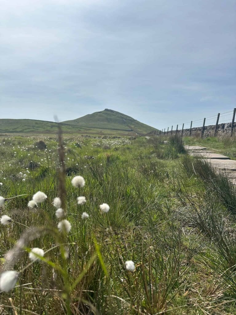
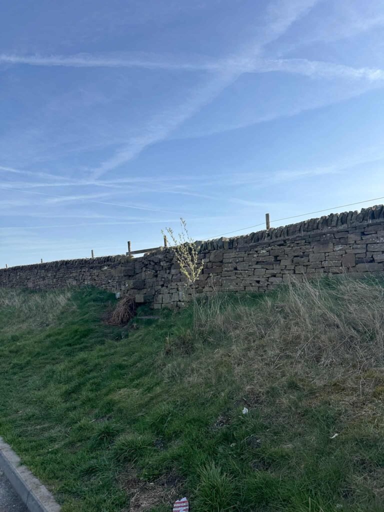
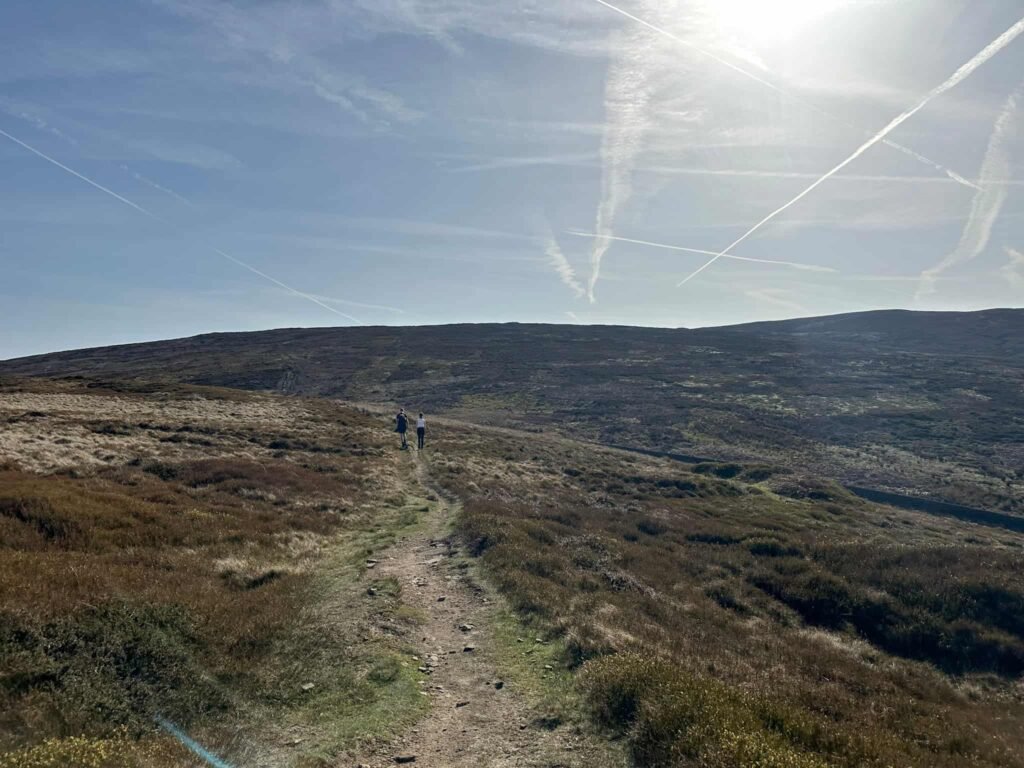
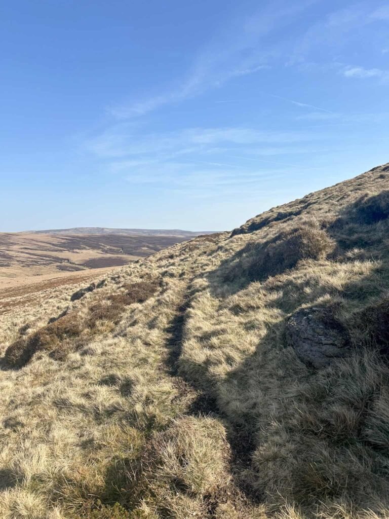
Our walk starts from a large layby on Chunal Moor and heads over a tall stone stile to open moorland. We headed east, following the path to reach Harry Hut trig point. From here we continued south-east to pick up the stone flagged path running to Mill Hill.
Just next to the path here is the remains of the B24J Liberator, with another debris pool lying off to the north-east (we visited this on the way back).
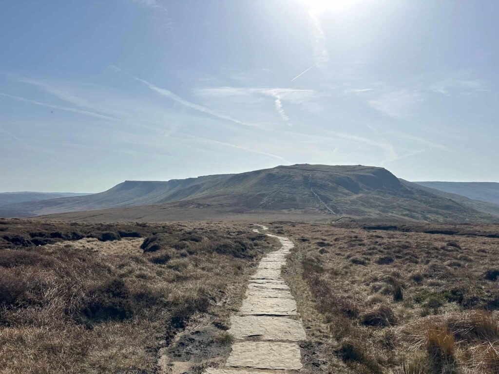
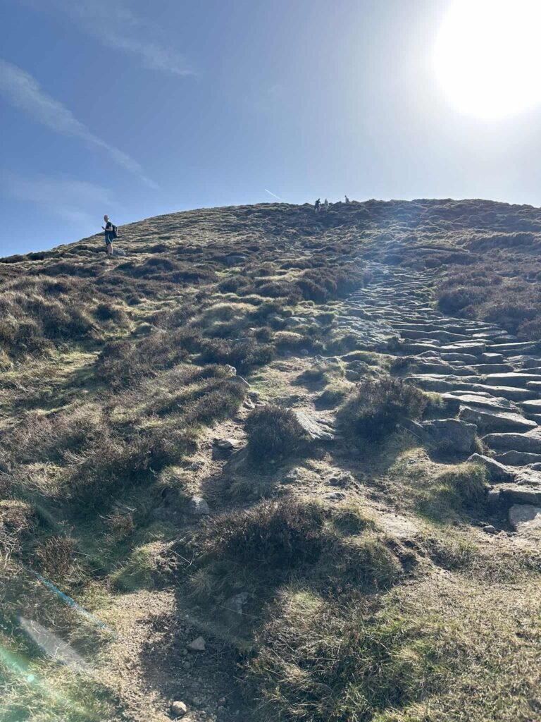
Continuing along the flags we soon reached Mill Hill, marked by a cairn and a stone Pennine Way signpost and with a stunning view of Kinder Scout. We continued forward, passing the crossroads, and started to climb up the stone steps onto Kinder Scout.
After around 50m there’s a faint path off to the left, which we took to run around the flank of Kinder Scout.
After around 350m, just before a small stream, we set off down the hillside to the debris sites of the Sabres. There are 3 debris pools down here, but we only visited 2 as it’s a long way back up!
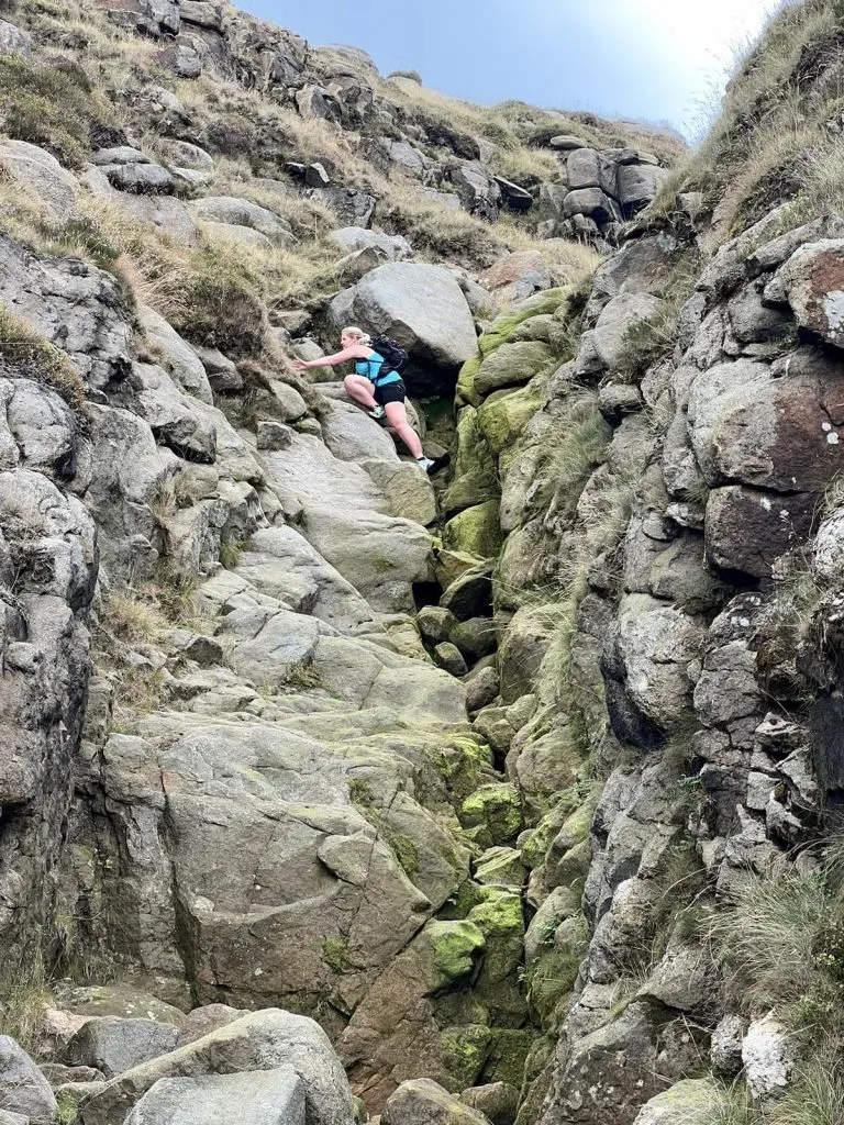
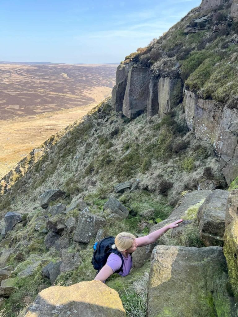
Climbing back up to the path, we passed more debris and then followed the path for another 650m to pick up the bottom of Upper Red Brook. We had to climb over the fence/stile at the bottom, and then started to climb over the rocks to the top.
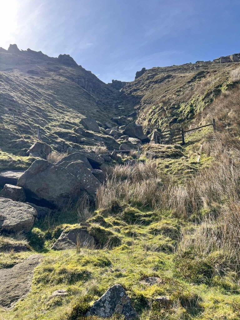
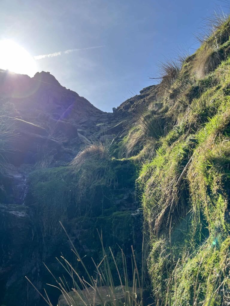
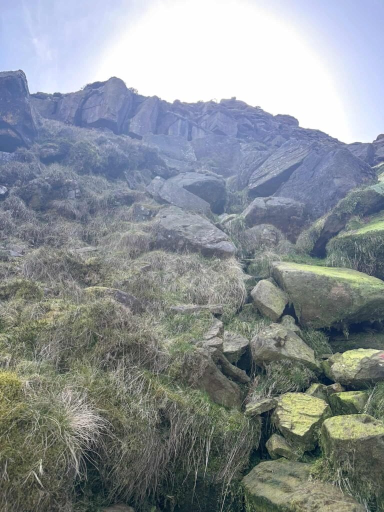
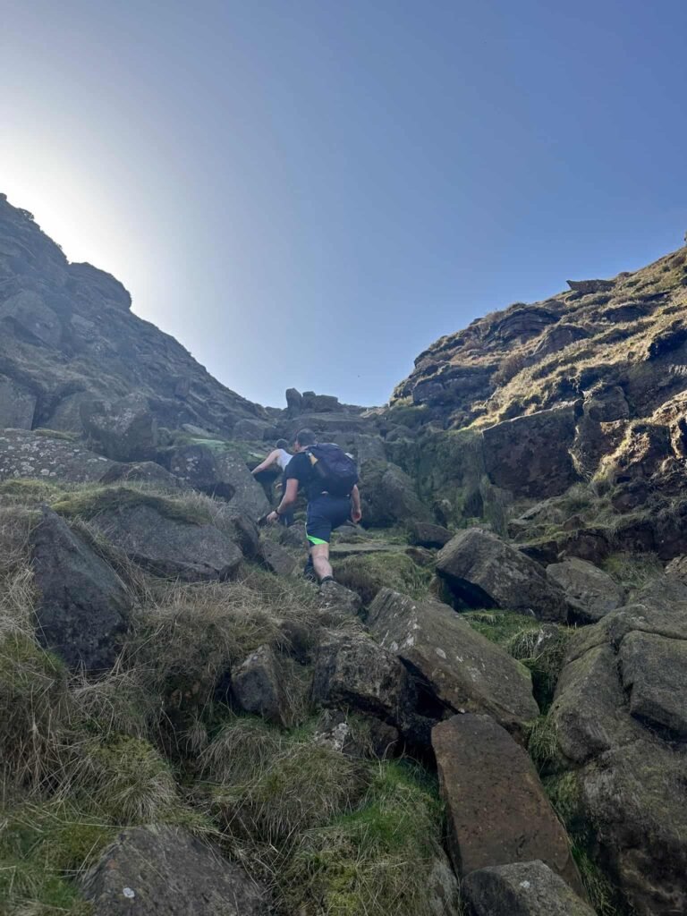
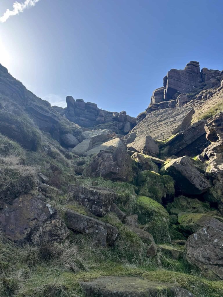
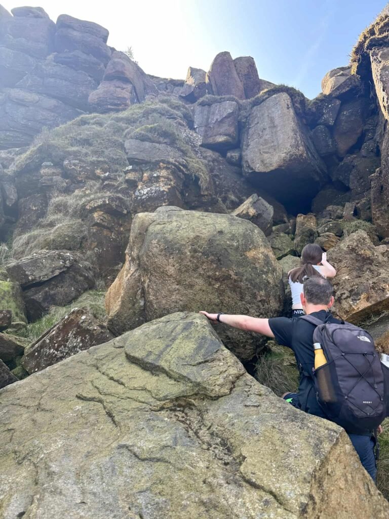
Upper Red Brook is a Grade 1 scramble, but there were a couple of areas where we had to give Hols a hand so it’s maybe a Grade 1.5, or for more experienced scramblers. It was certainly more challenging than Grindsbrook Clough. It was very green in places and in bad weather could be very slippery.
After picking our way up to the top of Upper Red Brook we followed the plateau path for around 1km (0.6 miles) and then left this, heading south to a fence line. After a short distance we discovered a debris pool, and then over the fence there was a lot more debris from the Sabres spread over a large distance, leading back to the main edge path.
We picked up the path running along the southern edge of Kinder Scout, and followed this back to the top of the steps at Sandy Heys. We then retraced our steps back down to Mill Hill, leaving the path to pick up the other debris pool for the Liberator, and then back to Harry Hut and across Chunal Moor to the car.
Kinder Scout via Mill Hill and Upper Red Brook Scramble Walk Map:

Walk Map (Opens in OS Maps): Kinder Scout via Mill Hill and Upper Red Brook – Liberator and Sabres Wrecks
Parking: Large layby on A624 near Chunal Moor, Hayfield Road, Chinley W3W:/// wants.screen.sprains.
Facilities: None
Walk Time: 4-5 hours depending on speed and fitness
Difficulty: ▲▲▲
Distance: 7.1 miles (11.4km)
Trig Points Bagged: Harry Hut
Peak District Peaks Bagged: Mill Hill
Peak District Ethels Bagged: Mill Hill
FAQs
How long does the Kinder Scout via Mill Hill and Upper Red Brook Scramble walk take?
Most walkers complete this 7 mile circular route in around 4 to 5 hours.
Where is the Liberator Mill Hill plane crash site?
The crash site of the B24J Liberator near Mill Hill, near Kinder Scout (grid reference SK 05844 90610 and SK 05731 90583). The Liberator crashed on 11 October 1944, with both crew members miraculously surviving the crash and being able to walk to Glossop for assistance.
Where are the Sabres on Kinder Scout?
There are numerous debris pools for the Sabres on Kinder Scout at grid references:
- SK 06926 89664
- SK 07268 90236
- SK 07300 90100
- SK 07548 90390
The Sabres crashed on 22 July 1954, scattering debris along the line of impact. Two planes were travelling as pair and hit the plateau in low cloud, sadly killing both pilots.
Is the Upper Red Brook route difficult?
The hands-on climb is steep and rocky but manageable for most walkers with a reasonable level of fitness. It is quite mossy and green, so can be slippery in places.
You might also like: