• 3 Mile Walks or Less
  • 4 Mile Walks
  • 5 Mile Walks
  • 6 Mile Walks
  • 7 Mile Walks
  • 8 Mile Walks
  • 9 Mile Walks
  • 10 Mile Walks
  • 11 Mile Walks
  • 12 Mile Walks
  • 14 Mile Walks
  • 15 Mile Walks
  • 20+ Mile Walks

The Wandering Wildflower

Peak District Hikes

  • PEAK DISTRICT WALKS
    • SHORT WALKS UNDER 3 MILES
    • MEDIUM WALKS 4-9 MILES
    • LONG PEAK DISTRICT WALKS 10 MILES +
  • PEAK DISTRICT WALKS WITH PUBS
  • PEAK DISTRICT WALKS WITH KIDS
  • HOLMFIRTH WALKS

Winnats Pass Scramble Walk [+ Best View Points!] | 3 Miles

June 21, 2025 CIRCULAR WALKS, PEAK DISTRICT SCRAMBLES, PEAK DISTRICT WALKS, PEAK DISTRICT WALKS WITH PUBS, SHORT WALKS UNDER 3 MILES

Looking for a Castleton walk with a bit more adventure? This Winnats Pass scramble walk is just the thing – a fun climb, views for days and all in less than 3 miles!

If you’ve ever driven or walked up Winnats Pass near Castleton, you’ll know it’s one of those places that makes you stop and stare. Towering limestone cliffs on either side, a steep winding road and views that just keep getting better the higher you go. But there’s more to this dramatic valley than just the scenery.

Winnats Pass

Walking down Winnats Pass

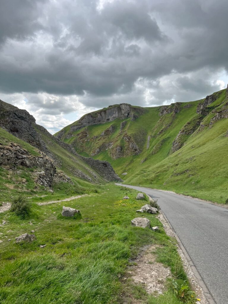
Winnats Pass – short for “Windy Gates” – is actually the collapsed remains of a massive underground cave system. Around 300 million years ago, this area was under a tropical sea, and all that time has shaped the limestone peaks and gorges you see today.

Back in the day, it wasn’t just hikers and cyclists tackling the pass. In the 18th and 19th centuries, it was a key route for packhorses carrying lead from the mines at Speedwell Cavern and beyond. Before the main Mam Tor road was built (and then eventually closed thanks to landslides), Winnats Pass was one of the only ways into Castleton from the west.

Like any good Peak District spot, it comes with a ghost story. In 1758, a young couple named Alan and Clara were travelling through the pass, eloping to get married at nearby Peak Forest – the Gretna Green of the time. Tragically, they were robbed and murdered by a group of local miners, and it’s said their ghosts still haunt the pass. A few locals have even claimed to hear screams or see strange figures when the mist rolls in…

Today, it’s a must-see for visitors, a haven for photographers, and a proper leg-burner for hikers. Whether you’re walking it or just pulling over for the view, Winnats Pass is one of those places that feels steeped in history – and maybe a little mystery too.

Here’s the route for this Winnats Pass scramble walk.

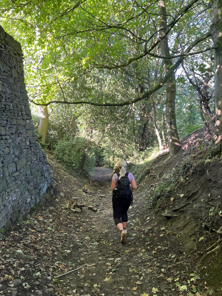
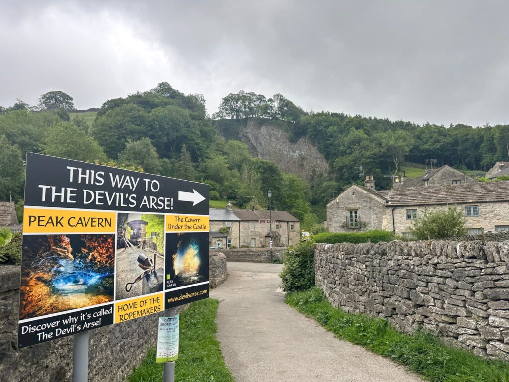
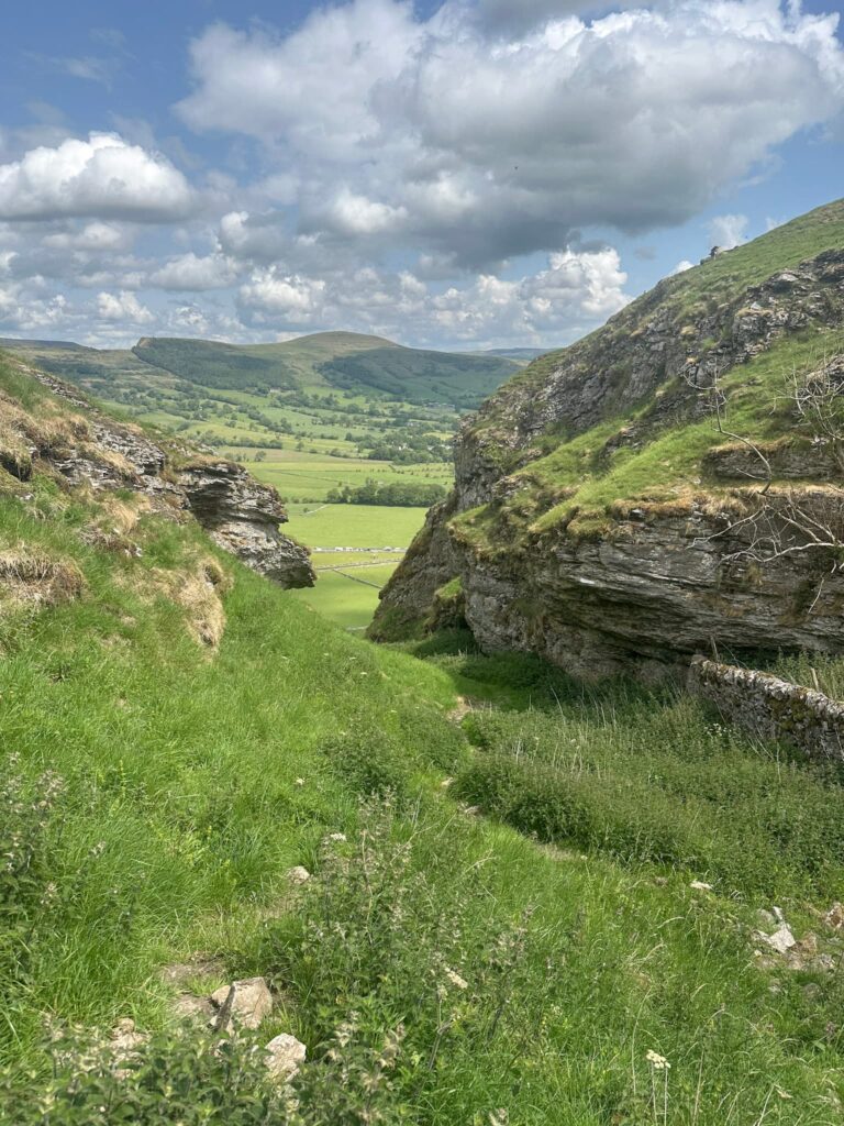
We parked in The Devil’s Arse (aka Peak Cavern) car park and set off towards the Cavern, reaching the quaint bridge over Peakshole Water.

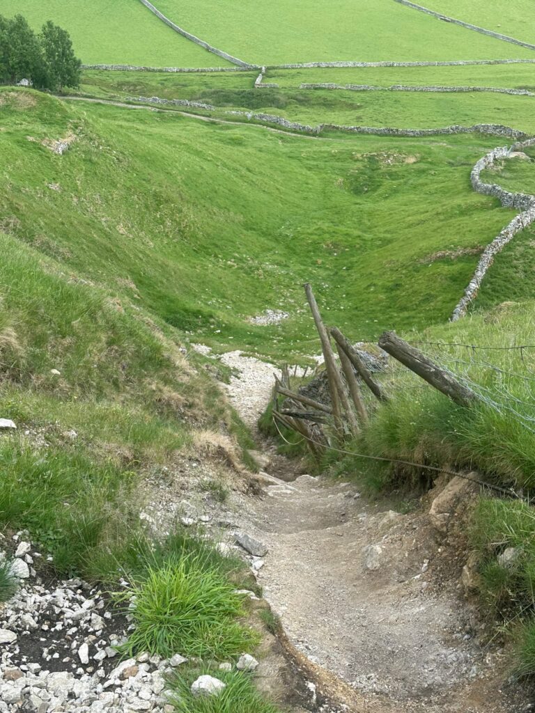
Here we turned right to climb up the hill behind Goosehill Hall – the road quickly turns to a rough, rocky track. The footpath follows the wall at the base of the hill, and just after a gate we turned left and followed the wall to the base of the climb.

Winnats Pass

The start of the climb

Winnats Pass

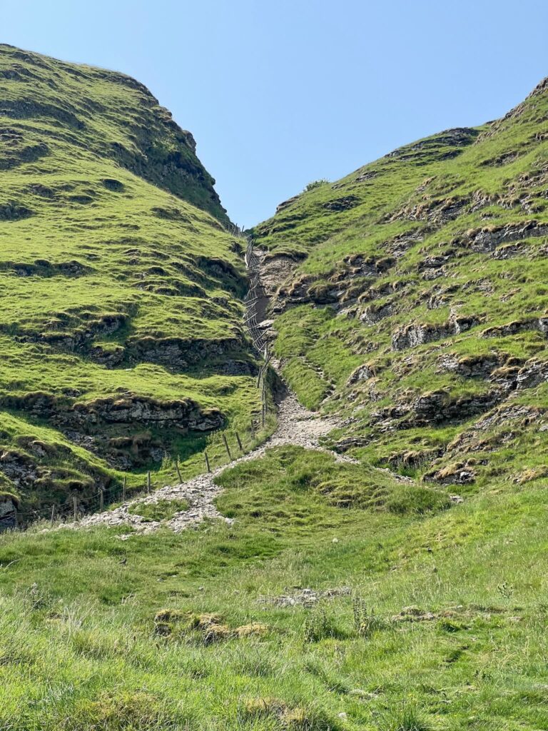
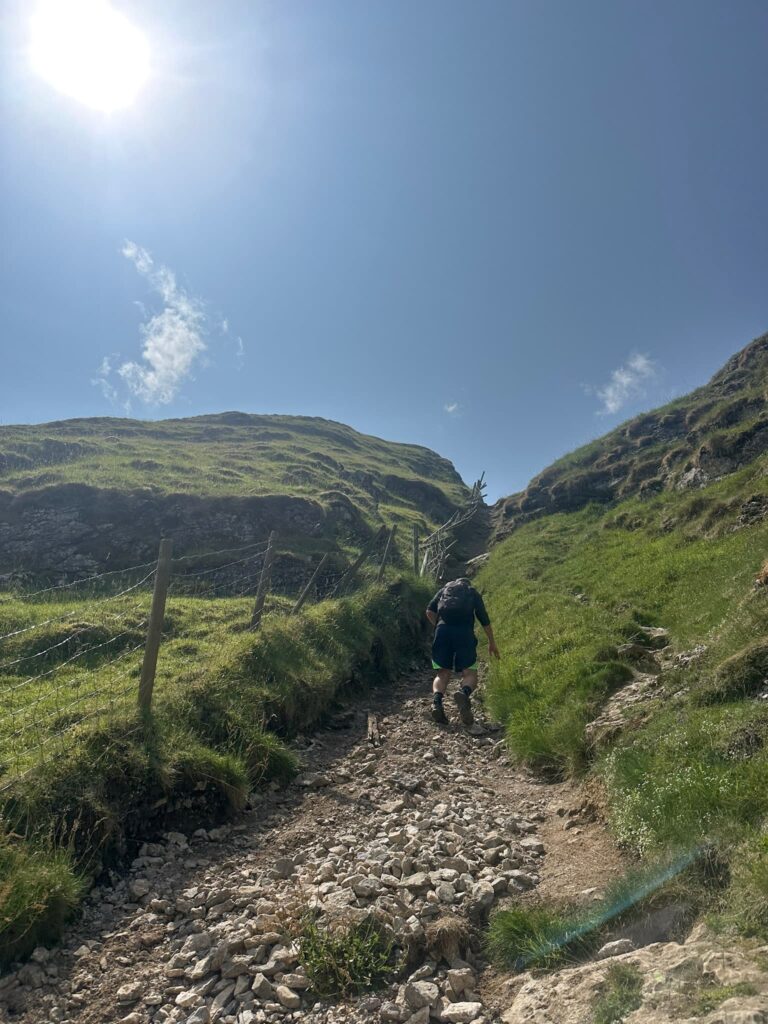
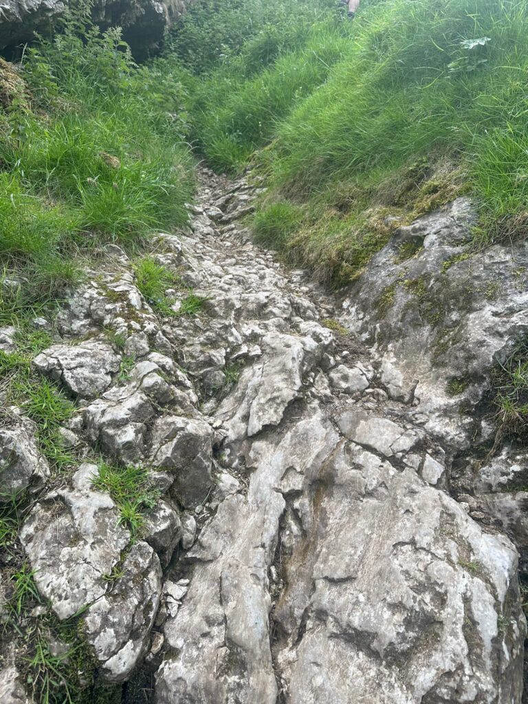
Initially this Winnats Pass scramble is just a steep climb but it soon gets REALLY steep, so steep in fact that someone has put a rope there to help you up! The rope is attached to the fence, and the fence is a bit rickety in places.

Winnats Pass

Winnats Pass

Winnats Pass

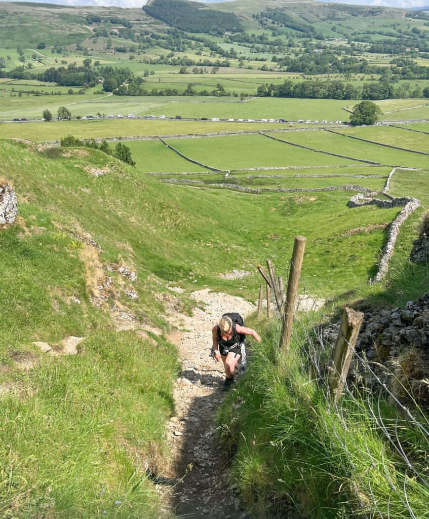
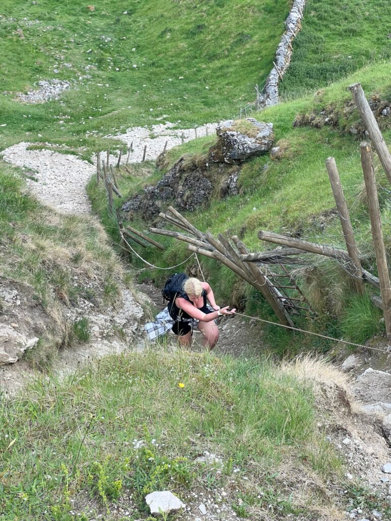
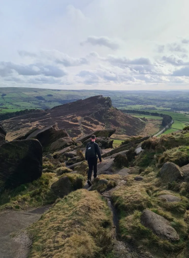
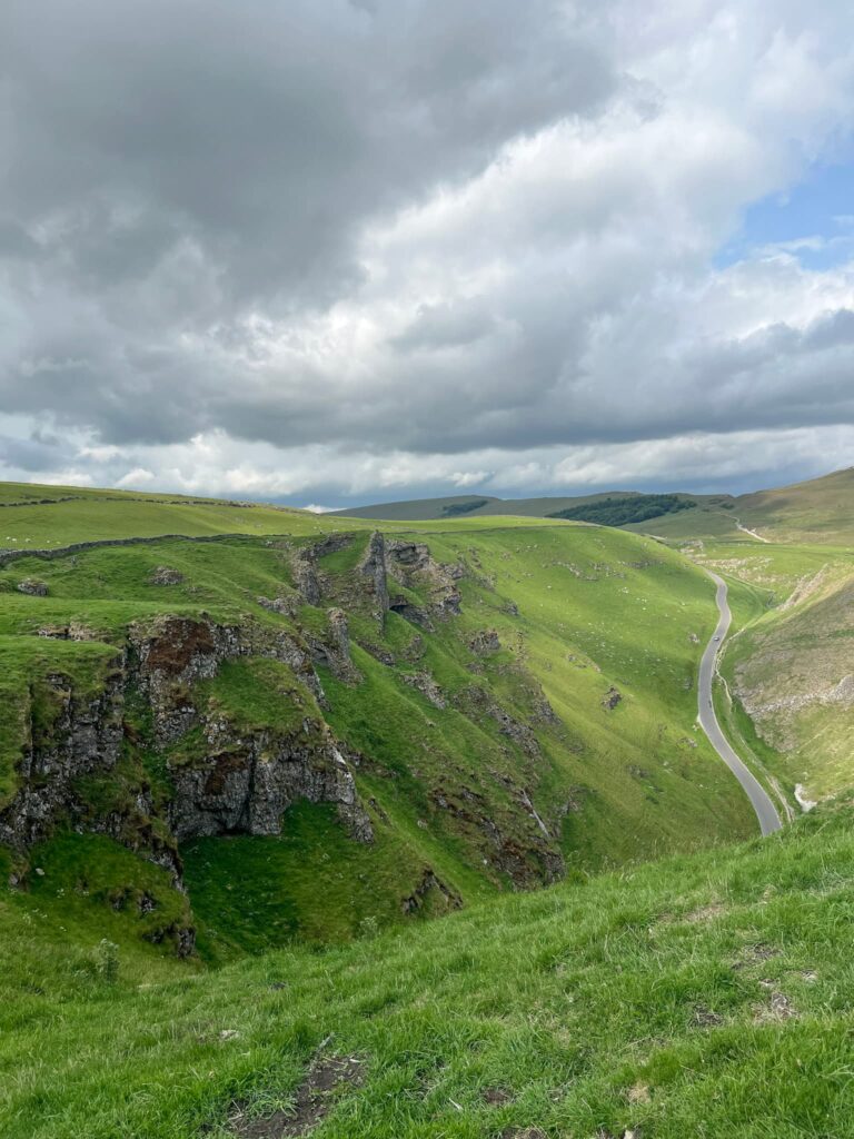
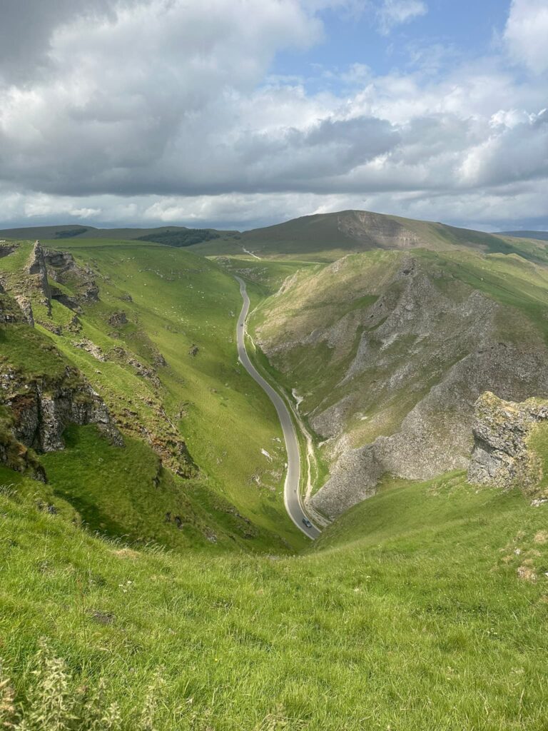
After pulling yourself up on the rope, there’s a small level part where you can catch your breath before you carry on up a small rocky scramble. The path runs up to meet a stone wall, and then we turned right onto the top of Winnats Pass.

Winnats Pass

Limestone scramble section. It’s small but could get very slippery in poor weather

Winnats Pass

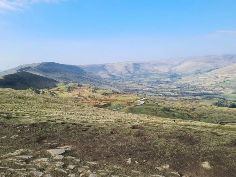
There is a path following the line of the wall, away from the cliff edges, but there are lots of viewpoints along the top. The road seems a very long way down from up here!

Winnats Pass

Winnats Pass

View down to the road, with Mam Tor in the background

We walked along the top, admiring the view, and then followed the path back down to the road level. On the other side of the road there’s a footpath just below the cattle grid.

Winnats Pass

Winnats Pass

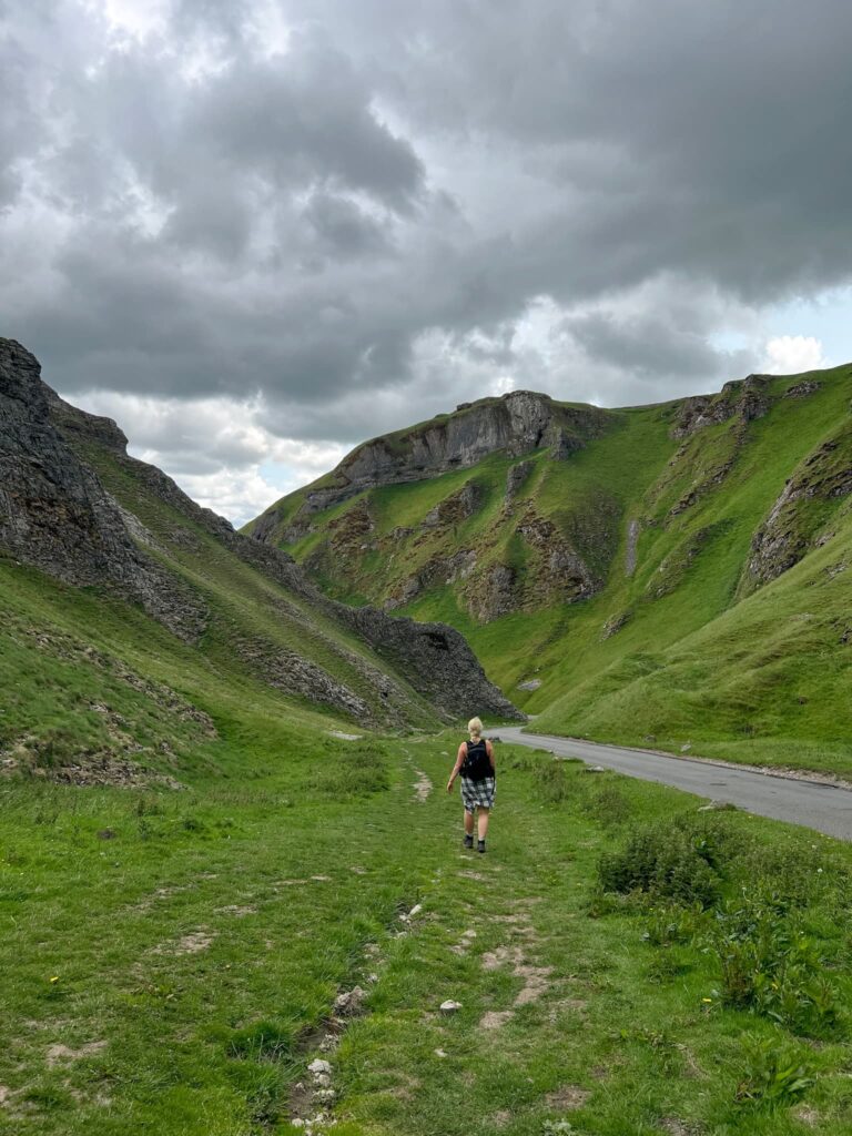
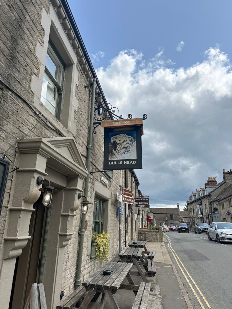
You can either follow the road back down and admire the view of the cliffs towering above, or climb up the other side (depending on how your legs are feeling!). We took the road back down into Castleton, heading to the Bulls Head for a lovely lunch.

Bulls Head, Castleton


Winnats Pass Walk Map: 


Walk Map (Opens in OS Maps): Winnats Pass Walk Map

Parking: The Devil’s Arse, Castleton, Hope Valley S33 8WN. W3W:///nest.states.watches

Facilities: There are public toilets, cafes, shops etc in Castleton. There are none on the trail, so take all your rubbish home with you.

Walk Time: 2-3 hours

Difficulty: ▲▲

Distance: 2.6 miles (4.1km)

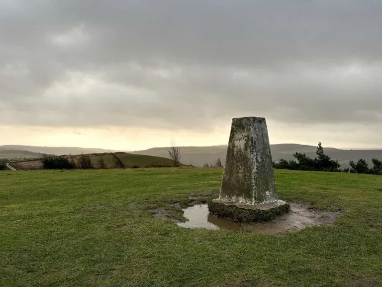
Trig Points Bagged: None

Peak District Peaks Bagged: None

Peak District Ethels Bagged: None


For more walks from Castleton why not try:

Walk from Castleton to Bradwell Moor Trig Point via Cave Dale | 5 Miles

Castleton to Mam Tor Circular Walk via Cave Dale | 6 Miles

Winnats Pass and Mam Tor Circular Walk | 6 Miles

Castleton, Mam Tor and The Great Ridge Walk | 7 Miles

Tap to share with your hiking friends!

  • Facebook
  • Email
  • WhatsApp
How to Find Three Shires Head »

RELATED POSTS

  • Three Shires HeadHow to Find Three Shires Head
  • Lathkill Dale waterfallLathkill Dale Waterfall Walk | 7 Miles
  • Sheen Hill trig pointSheen Hill Trig Point | 6 Miles
  • Honley to Meltham Circular Walk -A walk in Honley Woods - ancient woodland in HolmfirthHonley to Meltham Circular Walk | 9 Miles

Leave a Reply Cancel reply

Your email address will not be published. Required fields are marked *

FIND YOUR NEXT WALK:

ABOUT ME

Y Garn with Kids - Y Garn via the Devil's Kitchen Walk in Ogwen Valley

Hello! I’m Jo! Welcome to The Wandering Wildflower, an outdoors lifestyle blog focusing on family walks in the Peak District, a place we love exploring. I want to share the Peak District hidden gems and show you there’s so much more than the honeypot places. When I’m not dragging my husband and now 11 year old out on Peak District walks or up mountains, I can be found on planning my next moorland walk or plotting a Geocache walk (and seeing where the nearest pub is!). I love the hills but hate the heights, so trig bagging is – er- fun!


I hope this blog will give you some ideas of places to visit in the Peak District and inspire you and your family to head into the great outdoors.  Thanks for stopping by!

CATEGORIES

  • CIRCULAR WALKS (190)
  • HOLMFIRTH WALKS (27)
  • ISLE OF SKYE WALKS (3)
  • LAKE DISTRICT WALKS (26)
  • LANCASHIRE WALKS (2)
  • LONG PEAK DISTRICT WALKS 10 MILES + (42)
  • MEDIUM WALKS 4-9 MILES (137)
  • PEAK DISTRICT SCRAMBLES (17)
  • PEAK DISTRICT WALKS (207)
  • PEAK DISTRICT WALKS WITH KIDS (76)
  • PEAK DISTRICT WALKS WITH PUBS (61)
  • SCOTLAND WALKS (6)
  • SHORT WALKS UNDER 3 MILES (41)
  • SNOWDONIA WALKS (5)
  • UK CAMPING (5)
  • YORKSHIRE WALKS (33)

Peak District Walks

List of Peak District Ethels

Peak District Peak Bagging

Peak District Trig Point Challenge

Peak District Walks with Pubs

Peak District Walks with Kids

Beautiful Walks in Holmfirth

Short Walks in the Peak District

Long Walks in the Peak District

AFFILIATE DISCLOSURE

This blog may contain affiliate links through which, at no additional cost to you, I may earn a small commission. I only recommend products I would use myself and all opinions expressed here are my own. As an Amazon Associate I earn from qualifying purchases. Read full privacy policy here.

ARCHIVES

PEAK DISTRICT WEATHER

Peak District mountain weather on Met Office

Peak District Trig Points

Promo image for a blog post about the Peak District Trig Point Challenge With Map of Peak District Trig Points and Walking Routes by The Wandering Wildflower

Peak District Ethels Challenge

Promo image for a blog post about the Peak District Trig Point Challenge With Map of Peak District Ethels and Walking Routes by The Wandering Wildflower

WALKING ROUTES STRAIGHT TO YOUR INBOX

Want new walks in your inbox? Drop your email below and I'll send you some ideas for walks you can try.

You can unsubscribe anytime. For more details, review our Privacy Policy.

Thank you!

You have successfully joined our subscriber list.

RSS LATEST POSTS

  • Winnats Pass Scramble Walk [+ Best View Points!] | 3 Miles
  • How to Find Three Shires Head
  • Peak District Pub Walks
  • Burnbank Fell, Blake Fell and Gavel Fell | 8 Miles
  • Bretton Park Circular Walk | 3 Miles

FOLLOW ON PINTEREST

Want new walks in your inbox? Drop your email below and I'll send you some ideas for walks you can try.

You can unsubscribe anytime. For more details, review our Privacy Policy.

Thank you!

You have successfully joined our subscriber list.

jo@thewanderingwildflower.co.uk

The Wandering Wildflower

  • Email
  • Facebook
  • Instagram
  • Pinterest
  • PRIVACY POLICY
  • TERMS & CONDITIONS
  • ABOUT

(c) The Wandering Wildflower. All Rights Reserved.

|| THEME BY ECLAIR DESIGNS