Hayfield to Kinder Scout Circular Walk | 10 Miles
Looking to avoid the crowds on the climb up Kinder Scout? Try this Hayfield to Kinder Scout walking route, which takes you past Kinder Reservoir, up William Clough and via Mill Hill before climbing Kinder Scout from the east. It also passes Kinder Downfall and bags two trig points before heading back down Kinder Low Edge and back to Hayfield. It’s a challenging walk of approximately 10 miles but it’s definitely worth it! This is also the route of the Kinder Scout Mass Trespass of 1932.
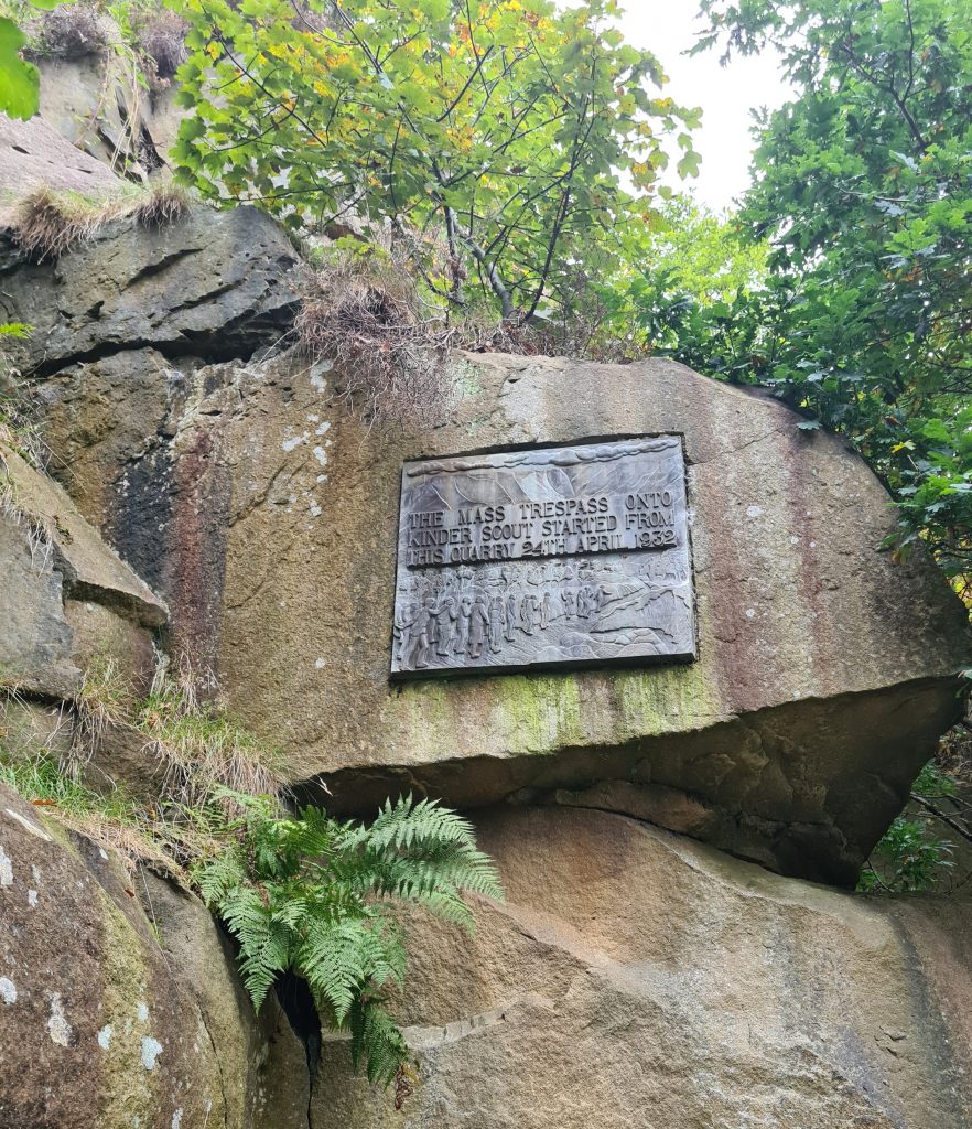
Kinder Scout is the highest peak in the Peak District at 636m above sea level. It’s made up of a huge plateau of approximately 10 square kilometres with steep sides, and towers above the surrounding area. It was the site of the Mass Trespass of 1932, which was a protest to highlight the fact that walkers in England and Wales were denied access to areas of open country. A group of plucky ramblers organised the Mass Trespass onto Kinder Scout, which eventually resulted in the creation of the Countryside and Rights of Way (CROW) Act 2000.
There is a commemorative plaque for the Mass Trespass at the Bowden Quarry, which is where we started our walk. It’s close to the campsite at Hayfield and there are some public toilets you can use here.
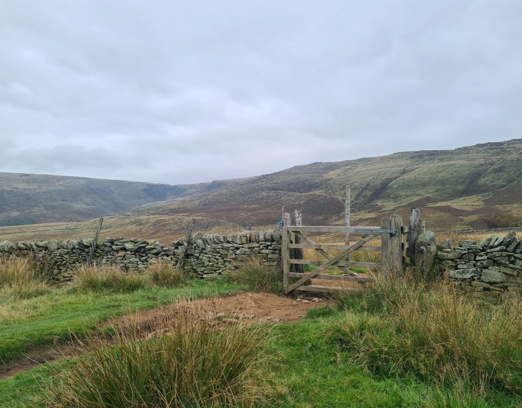
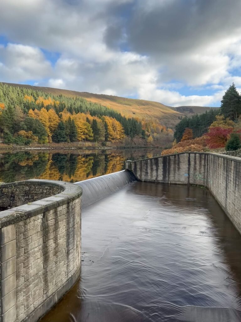
The walk starts out on the road and heads up alongside the woods and the River Kinder, following in the footsteps of the Kinder Scout Mass Trespass in 1932. At the gates to the reservoir, we took a left up onto White Brow and climbed up above the reservoir.

Following the brow of the hill it was relatively steady going to the bottom of William Clough.

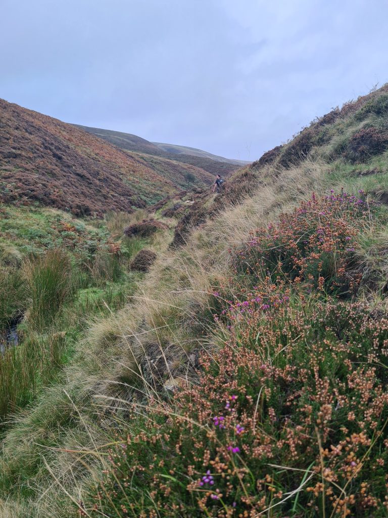
William Clough makes for a lovely walk, with the stream running down the valley and there being waterfalls and fords all the way up. It is steep and rocky in places, but there is a lovely big rock and waterfall to sit on and catch your breath.
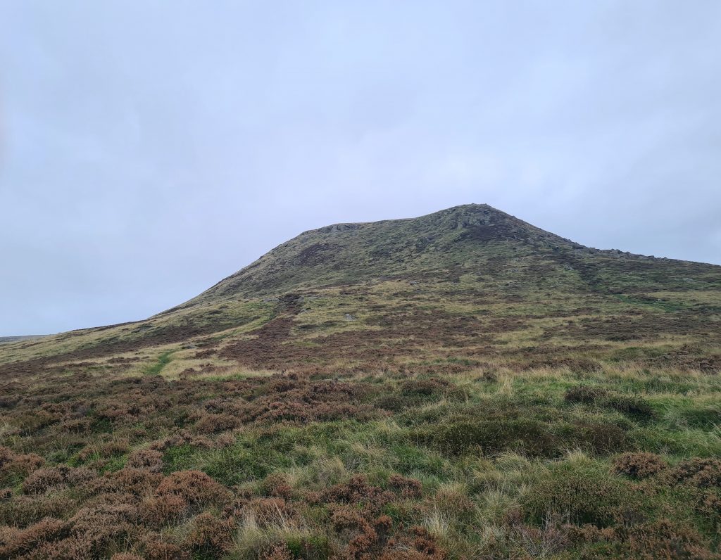
At the top of William Clough you come to a crossroads with a signpost. You can head north-west (left) to Mill Hill (and bag another peak for the Peak District Peak Bagging Challenge!), carry on forward to the Snake Inn or head south-east up Kinder Scout.

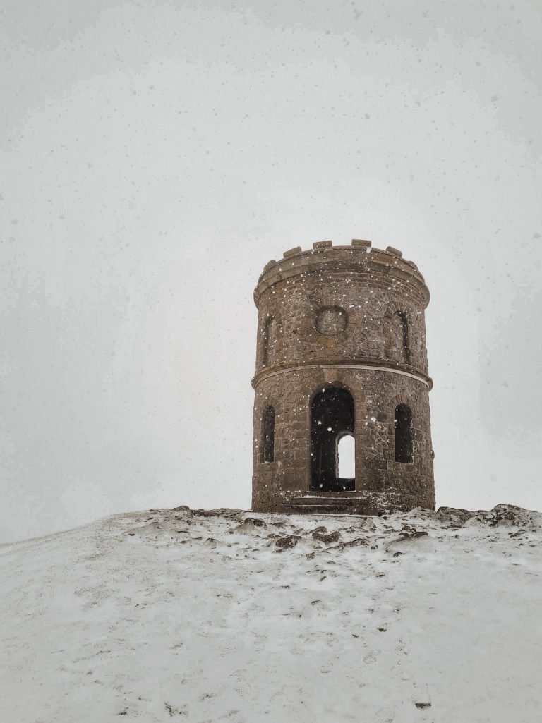
We headed off up the Pennine Way to Mill Hill, which has a (very) rough cairn for the summit and is a very gentle climb from the crossroads – so gentle in fact you might not notice! Mill Hill is 544m above sea level and there is a plane crash wreckage site nearby.

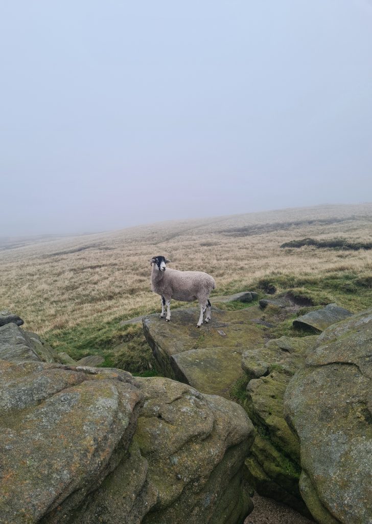
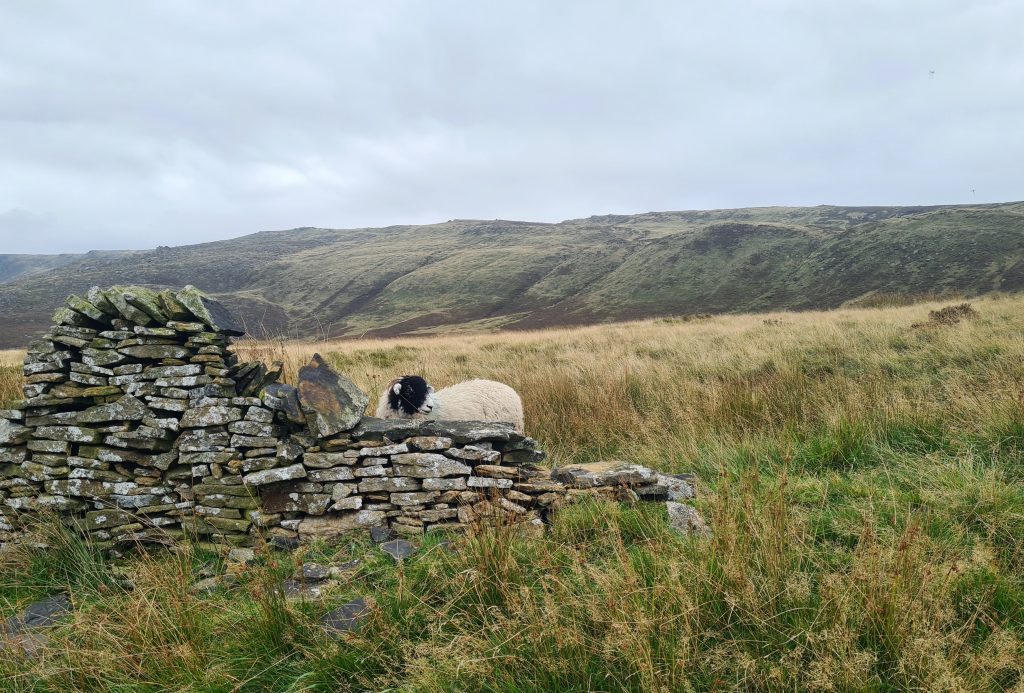
After we had a quick snack at Mill Hill we headed back past the crossroads marker and started to climb up Kinder Scout. Up until this point we had seen two, maybe three, other parties of walkers and it was lovely and quiet. We clambered up the side of Kinder Scout and then onto the plateau. Here there are loads of quirky rock formations which are great for a clamber about on, and we even made a new sheep friend Simon.


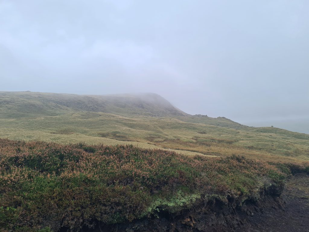
We followed the path along the edge of Kinder Scout and had stunning views over the Mermaid’s Pool down below. We didn’t see the mermaid but I was glad to have taken some photos when I did, as the inevitable mist rolled in soon after we reached the top. We did get chance to see where we had come along the route of Hayfield to Kinder Scout.


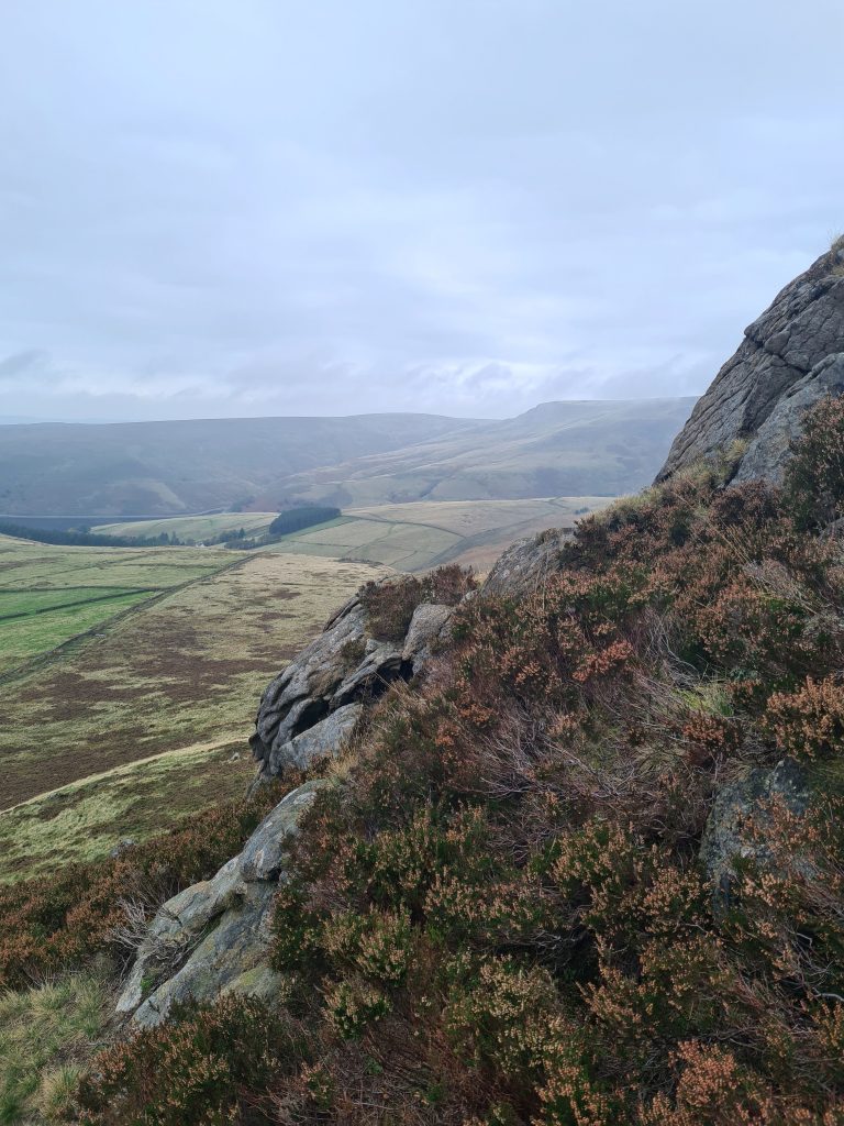
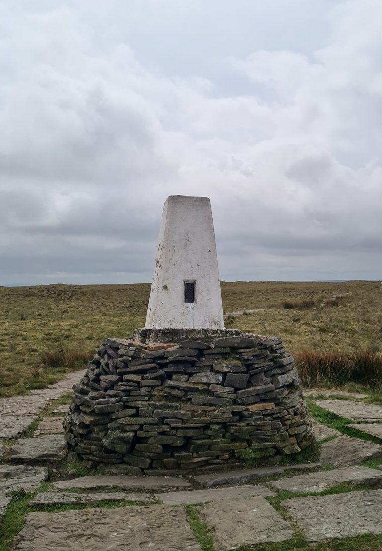
After a quick detour across the moorland to reach the trig point at The Edge (624m), the mist was really thick! We headed back across the moor, past boulders and boggy patches, to the main Pennine Way and followed this along to Kinder Downfall. This is a good walk to tick two trigs off the Peak District Trig Point list.


Prepare yourself for some of the most amazing Kinder Downfall photos…


Yes, you guessed it! It was so misty we couldn’t see a blooming thing! The only thing we could see were loads of people having lunch in the mist near the top – it was really popular, even though the views were rubbish.


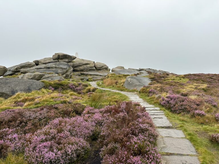
The Pennine Way continues along the edge of the plateau round to Kinder Low, where there’s another trig point. Wahoo! This isn’t actually the summit of Kinder Scout, which is some 500m to the east of the trig point, but most walkers take the trig point to be the summit so I’m happy to go with that (rather than trekking in the mist over the moors). The trig point is 633m above sea level and the summit is 636m, so there’s not much in it. One day we’ll do it properly but I’m happy until then!
The path becomes paved again and takes you on to Kinderlow End. There are loads more fabulous rock formations at Kinderlow and an early Bronze Age burial barrow, shown on the OS map as a cairn. It’s fenced off for protection.


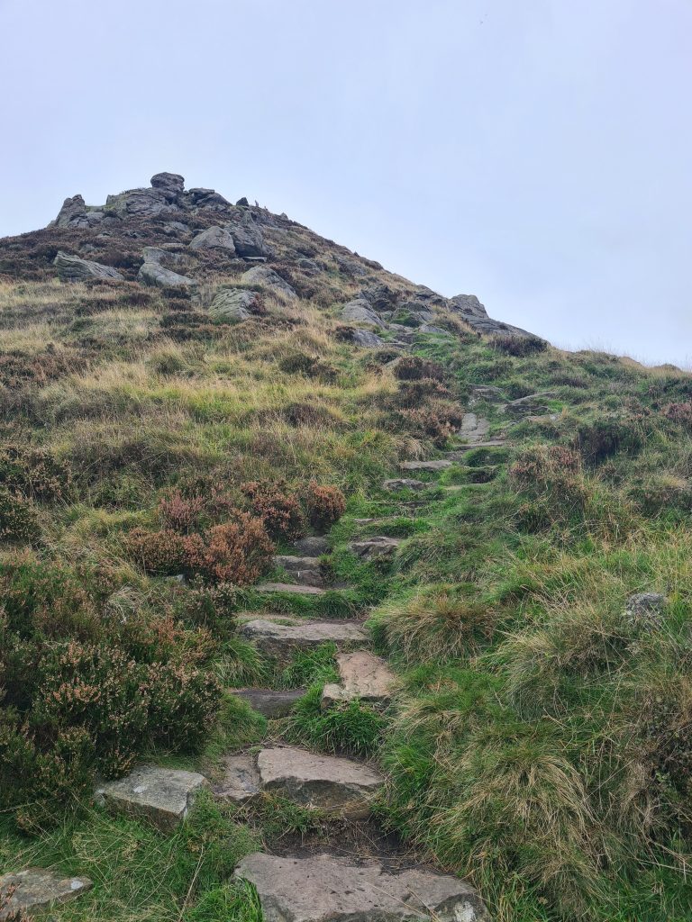
Once past the barrow it’s a steep drop down Kinderlow End. There are some stone steps but the going is pretty tough, especially as people are coming up as you’re going down.

When you get down the path takes you through farmland and back towards the bottom of Kinder Reservoir. Here you can see the former Kinder Water Treatment Works. This is a stunning building which has fallen into a bit of disrepair but the roof structure is amazing!
We headed back to the car park and then to the nearby The Sportsman for a late lunch. This walk took us 5 and a bit hours (with a 9 year old) so I’d recommend starting early if you don’t want to take a picnic up.
People also ask:
Is Kinder Scout a difficult walk?
Kinder Scout is the highest Peak in the Peak District and therefore is quite a challenging hike. The climb to the top of the plateau is tough and rocky and the paths along the top are strewn with boulders. It can be a very challenging place to navigate, especially in winter, as the weather conditions can be severe and change quickly.
How far is the walk up Kinder Scout?
This walk is just under 10 miles. You can make it longer if you wanted to by adding on a loop to Edale, but this route is shorter.
How long does it take to walk up Kinder Scout?
Obviously it depends on your fitness but you should allow around 4-5 hours to do the walk as mentioned above. It took us 5 hours 40 minutes but we kept stopping off for clambering on rocks.
What is the quietest route up Kinder Scout?
The route up William Clough is certainly quieter than the route using Jacob’s Ladder, which is the popular route from Edale to Kinder Scout. The route from Edale up Jacob’s Ladder can be very busy at times. We chose to do Hayfield to Kinder Scout as it was quieter.
Can you do this walk in trainers?
We actually saw someone walking up William Clough in white trainers! His feet were WET. I would recommend proper walking boots! William Clough is a stream which flows down the valley and the path crosses the stream in a number of places. Parts of the Kinder plateau were boggy in places as well, and there are lots of rocks and boulders strewn about which make the ground very tough going. I have these Scarpa Terra GTX walking boots and am very grateful whenever we go on a moorland walk.
This Hayfield to Kinder Scout circular hike is one I’ll definitely look to do again. Whether you want to see waterfalls, trig points, amazing rock formations, views for miles (sadly not when we went), sheep, go wild swimming in the Mermaid’s Pool – there is so much to see and do on Kinder Scout.
Hayfield to Kinder Scout Walking Route:
Route Map (Opens in OS Maps App): Kinder Scout Walk Route
Parking: Head to the Bowden Bridge car park, Kinder Road, Hayfield SK22 2ES W3W:///riverboat.coughed.steered
Facilities: Public toilets and bike rack near the car park (at the entrance to the camp site).
Kinder Scout Walk Difficulty: ▲▲▲
Walk Time: 4-5 hours
Walk Distance: 10 miles
Trig Points Bagged: Kinder Low, The Edge
Peak District Peaks Bagged: Kinder Scout, Mill Hill
Peak District Ethels Bagged: Kinder Scout, Mill Hill
For more Kinder Scout walks why not try:
- 15+ Best Kinder Scout Walks | Guides and GPX Files
- Kinder Scout 3 Trig Points Walk | 13 Miles
- Red Brook Scramble to Kinder Scout | 10 Miles
- Crowden Clough to Kinder Scout Walk | 8 Miles
- Kinder Scout via Kinder Low | 9 Miles
- Kinder Downfall Walk via Nether Red Brook Scramble | 7 Miles

Hello, is it possible to the Hayfield to kinder downfall linear as quick trip with the kids? Just want to let them see the waterfall as we’ve already done jacobs ladder and kinder scout?
Hi Gary! Thanks for your message. I don’t think you can get up to the Downfall without coming up one of the Cloughs but you could try https://explore.osmaps.com/route/15223468/hayfield-to-kinder-downfall?lat=53.390347&lon=-1.922149&zoom=12.8914&style=Standard&zoomLock=auto&type=2d&isMapDirty=false&overlays=&placesCategory= which is a 10.9k circular up Kinder Low End and onto the Downfall and round, or https://explore.osmaps.com/route/15223553/hayfield-to-kinder-downfall-2?lat=53.391304&lon=-1.919593&zoom=13.0822&style=Leisure&zoomLock=auto&type=2d&isMapDirty=false which is a slightly different way up. Hope you manage to find a way!