Cooks Study Hill and Snailsden Pike End | 4 Miles
Here’s a circular walk in the Peak District to try – Cooks Study Hill and Snailsden trig point at Snailsden Pike End. It takes in views over Snailsden Reservoir before you head out over open moorland to find the Snailsden Pike End summit, marked by a trig point. The route is 6km and there are no major climbs other than a gentle incline to the top of Snailsden Pike End. It’s a lesser known part of the Peak District so great to avoid the crowds!

Snailsden Pike End is a Peak District peak with a summit of 475m above sea level. It’s one of the less challenging climbs as you start out at around 400m! We did this walk the day after we’d done Kinder Scout, which was Holly’s first walk over 10 miles so she had really tired legs. I wanted to do something less strenuous for her!
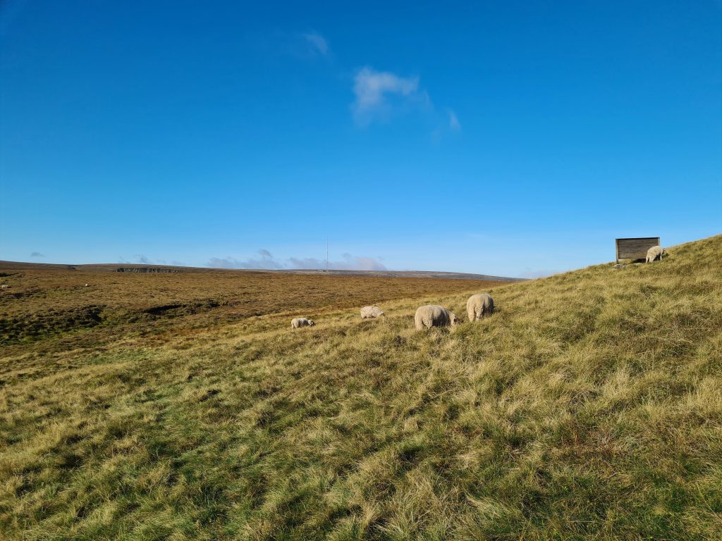
This area is grouse moorland so dogs are excluded. You can check out the Natural England Open Access Map for more details.
Parking is on the roadside in one of the lay-bys on Linshaws Road. We chose one near to the entrance of the old quarry so it wasn’t as far to walk back to the car once we’d finished on the moors. There are no other facilities nearby.
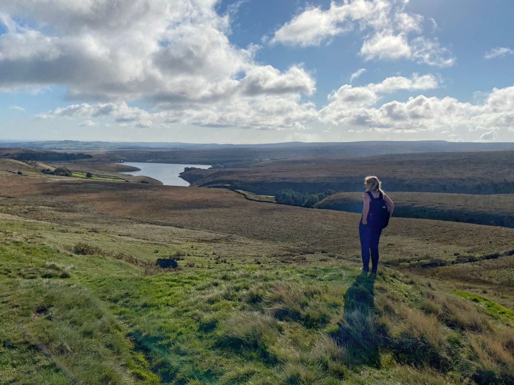
We had a beautiful sunny October day when we went on this walk. Setting out early, we parked on the roadside and walked along the road between the wood and the quarry until we reached the gate to Snailsden Reservoir. You can either bob down the lane and have a look at the reservoir or miss this step out. Our route doesn’t take us around the edge of the reservoir although as it is Open Access Land you could walk round if you wanted to. Snailsden Reservoir and the surrounding moorland is off limits to dogs and there are signs up warning you of this, so please don’t take your dog there.


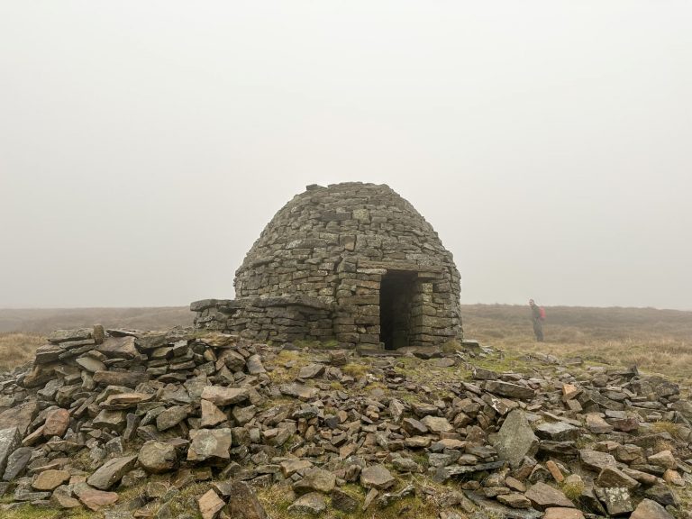
After we had visited the reservoir we headed back up the lane and out onto the road again. Following the road to the left, you soon come to another gate which gives access to Cooks Study Hill. This is a little mini peak of 450m and used to be the site of a tower. Huddersfield Exposed has a great article with photos of the tower, but all that stands there now are ruins.


Our route takes us down past the western side of Snailsden Reservoir then up the hill to Snailsden Pike End. On a clear day, once you reach the top of the hill you can see the Snailsden trig point to the south. As I mentioned before it was an October day when we tackled this walk and it had been dry for a couple of days beforehand. The ground was saturated though and was really boggy in places. Be sure to wear appropriate footwear (I wear waterproof hiking boots, as does Hols) – you don’t want to be wearing white trainers for this walk!


Trig photos duly taken, the route takes you along Snailsden Edge which gives you stunning views over the moors Grains Moss and Upper Dead Edge, as well as Winscar Reservoir. The path is quite easy to follow as it is marked with wooden pillars along the track.

The path turns towards the north and heads through an old quarry, with a lovely old ruined building, and lots of grouse butts used by grouse hunters. It then takes you down a slope and across the bridge over Harden Clough, at the top of Harden Reservoir, before you go up the incline back towards the road and the parking lay-by.

This is one of our rare walks that doesn’t end in a pub, but The Boshaw Trout is pretty nearby if you fancied a pint or some lunch after this walk.
All in all, this walk took us under two hours with plenty of time to explore Cooks Study Hill, see Snailsden Reservoir from both sides and have many, MANY snack stops for Hols. Although it is a relatively gentle walk you are still heading off open moorland so take all necessary precautions and make sure you wear appropriate clothing.
Parking: In a lay-by on Linshaws Road.
Facilities: None
Walk Time: 1.5 hours
Distance: 3,5 miles
Trig Points Bagged: Snailsden Pike End
Peak District Peaks Bagged: Snailsden Pike End
Peak District Ethels Bagged: Snailsden Pike End
Here’s the route we took for this Peak District walk:
It’s another one ticked off the Peak District Peak Bagging List, Peak District Trig Point List and the Ethels list too!
Is this one you’ll try? For more walks in Holmfirth or walks in the Peak District, why not follow the blog or check out the archives!
You might also like
Britland Edge Hill, Dead Edge End and Snailsden