• 3 Mile Walks or Less
  • 4 Mile Walks
  • 5 Mile Walks
  • 6 Mile Walks
  • 7 Mile Walks
  • 8 Mile Walks
  • 9 Mile Walks
  • 10 Mile Walks
  • 11 Mile Walks
  • 12 Mile Walks
  • 14 Mile Walks
  • 15 Mile Walks
  • 20+ Mile Walks

The Wandering Wildflower

Peak District Hikes

  • PEAK DISTRICT WALKS
    • SHORT WALKS UNDER 3 MILES
    • MEDIUM WALKS 4-9 MILES
    • LONG PEAK DISTRICT WALKS 10 MILES +
  • PEAK DISTRICT WALKS WITH PUBS
  • PEAK DISTRICT WALKS WITH KIDS
  • HOLMFIRTH WALKS

Dovedale and Thorpe Cloud Walk | 7 Miles

April 30, 2022 CIRCULAR WALKS, MEDIUM WALKS 4-9 MILES, PEAK DISTRICT WALKS, PEAK DISTRICT WALKS WITH KIDS, PEAK DISTRICT WALKS WITH PUBS

Pinterest image for Thorpe Cloud, Reynards Cave and Dovedale Stepping Stones Walk -
Pinterest image for Thorpe Cloud, Reynards Cave and Dovedale Stepping Stones Walk - The Wandering Wildflower
Pinterest image for Thorpe Cloud, Reynards Cave and Dovedale Stepping Stones Walk -

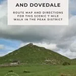
This Dovedale and Thorpe Cloud walk takes you through the beautiful Derbyshire countryside, exploring caves, the Dovedale Stepping Stones and wandering through beautiful Dovedale. At 7 miles this is one of the best walks in Dovedale and the kids will love it!

Thorpe Cloud, Dovedale

As part of the Peak District Ethels Challenge we regularly visit places we never would have gone to, and this is definitely the case with Thorpe Cloud. It’s not very local to us and my favourite types of walk are moorland walks – the bleaker the better! We planned a walk in Dovedale with the hopes of ticking off two more Ethels – Thorpe Cloud and Tissington Hill.


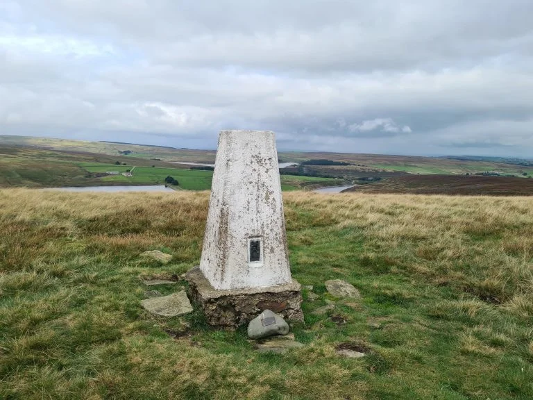
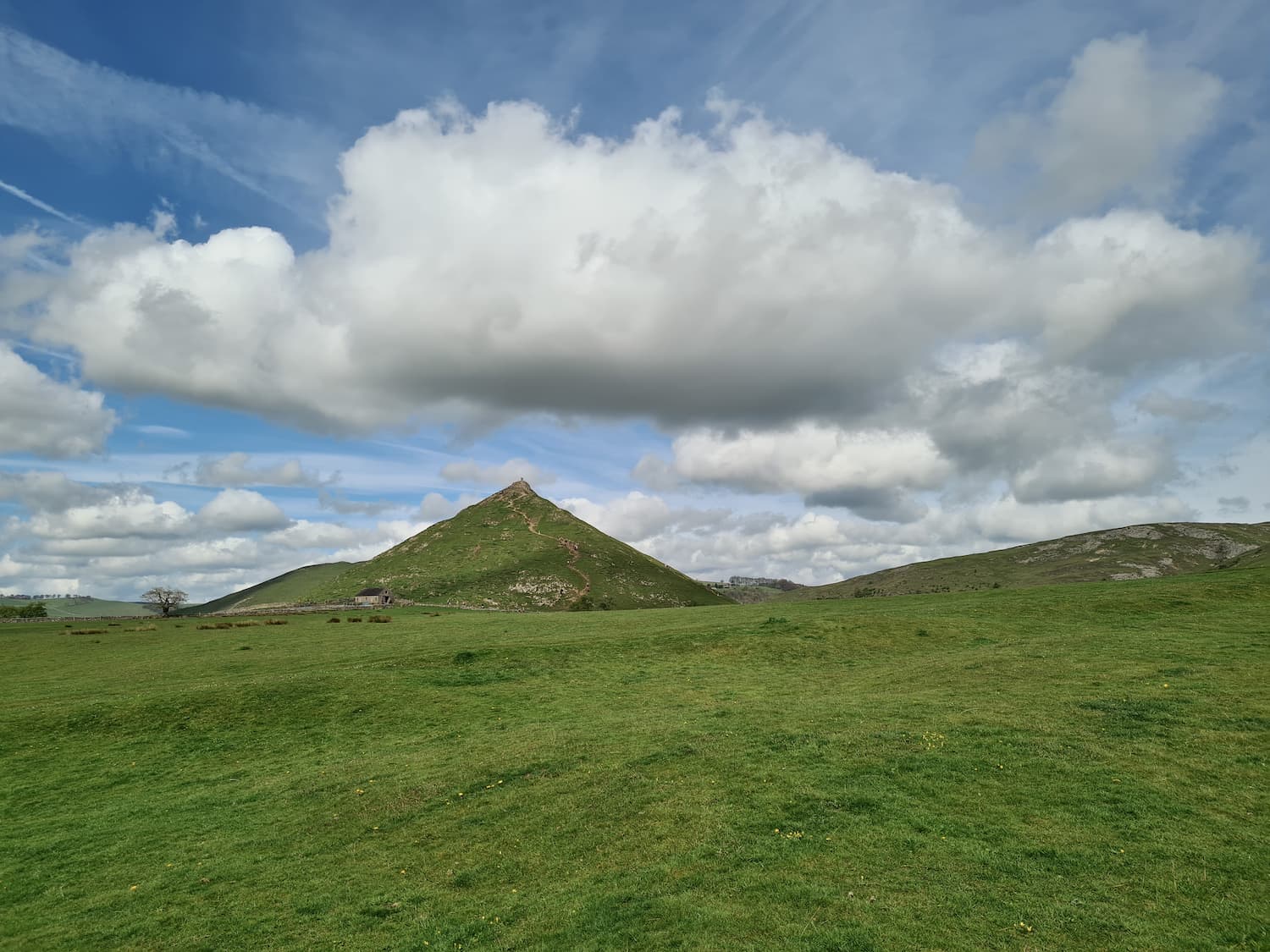
Thorpe Cloud is 287m above sea level and is an isolated limestone knoll near the villages of Thorpe and Ilam. Tissington Hill is a steep limestone hill some 369m above sea level 2 miles away from the village of Tissington. The summit of Tissington Hill is on private land unfortunately so we had to adopt the near enough is good enough approach for this. Nearby is the spectacular Reynards Cave, a natural stone arch and various caves – one of which was the site of a hoard of Iron Age and early Roman coins.


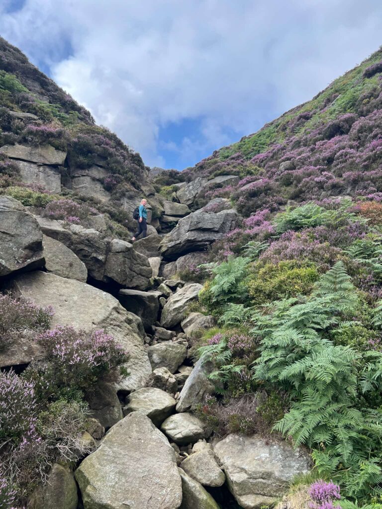
Our walk started from the National Trust Car Park in Dovedale. Heading east along the footpaths, we crossed the River Dove and then followed the blue markers round the side of Thorpe Cloud to climb to the summit. The sides are steep but the path is very obvious (not least because it’s a very popular place to visit and there is a steady stream of people climbing up!). The top part of Thorpe Cloud is very rocky, and you may have to scramble up a couple of metres to get to the actual summit ridge.

View from the top of a rocky outcrop


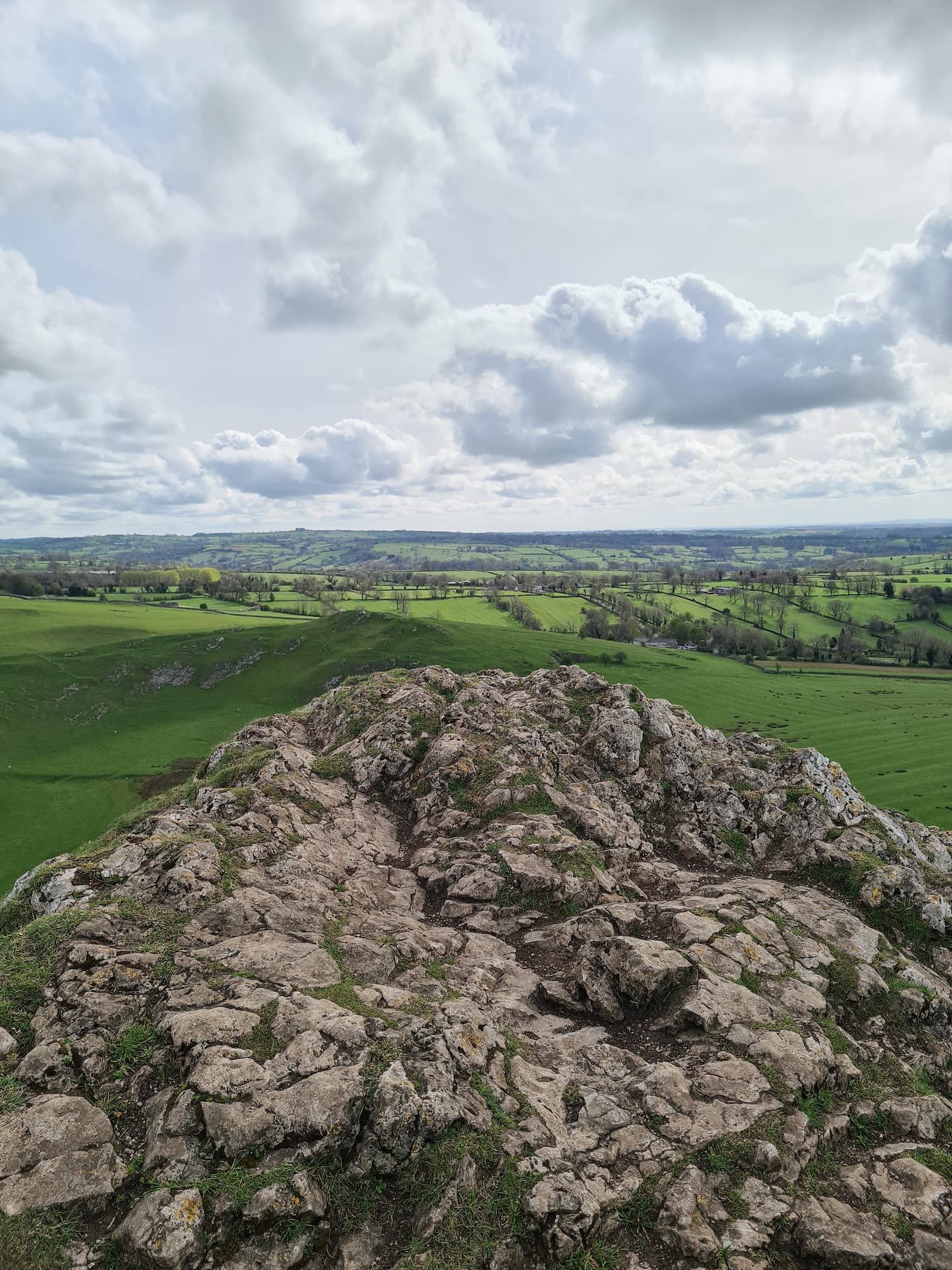
We followed the ridge along the top of Thorpe Cloud then headed down the footpath to the south-east. This took us back to where we started too climb up to the top of Thorpe Cloud.  With Thorpe Cloud behind us, we climbed over the stile and into the fields, following a footpath around the edge of the rifle range.


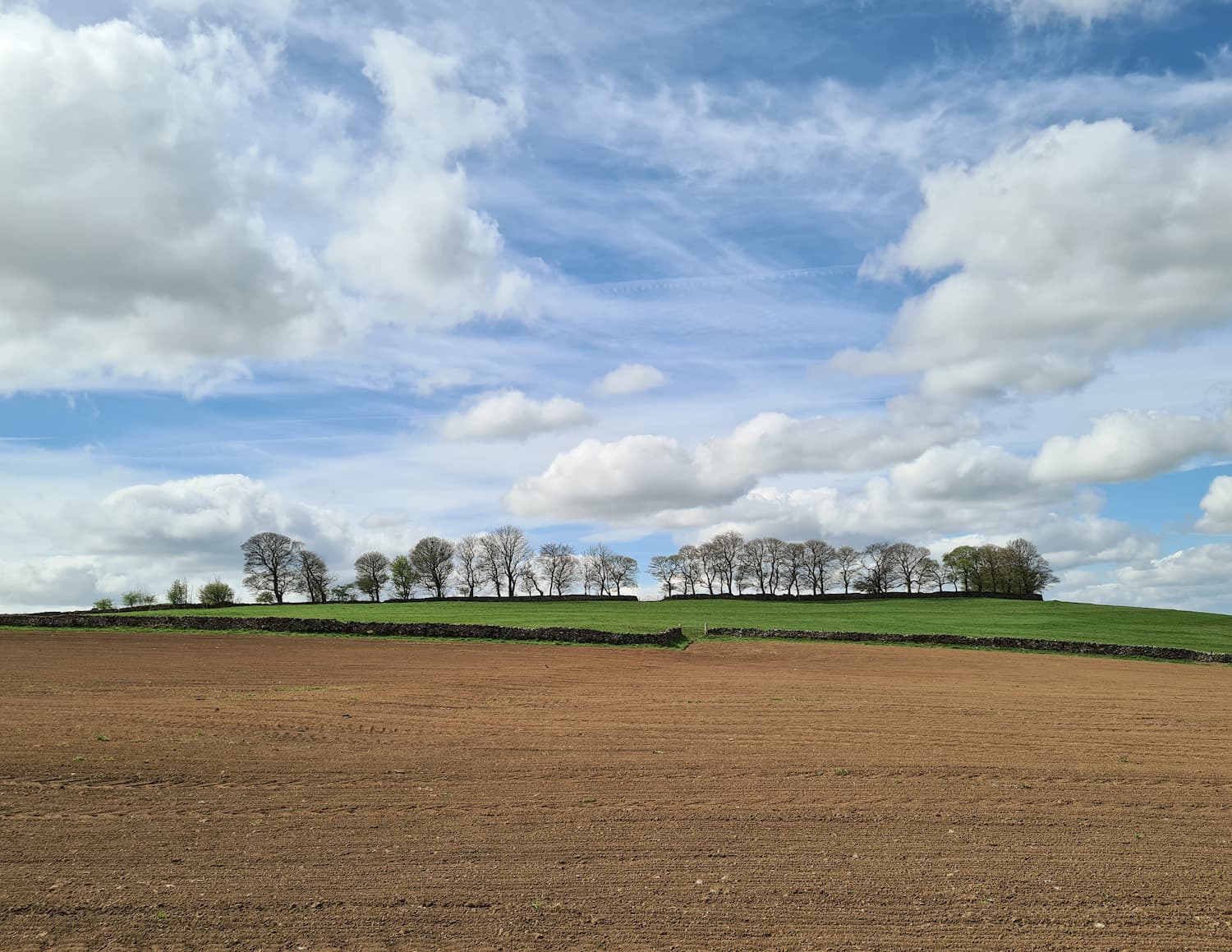
The footpath put us onto Gag Lane which we followed for a short while, before heading through the fields where there is a strange abandoned building. We didn’t investigate as it’s not Open Access Land.

Walks in Dovedale

Following the footpaths, we made our way to the footpath passing close to the summit of Tissington Hill. As this is on private land, and the field had just been ploughed and crops sewn, we walked around the edge of the field to see if we could get a view of the trig point. Unfortunately it’s in the woods on the other side of another field, so we couldn’t even see it! We headed back and passed through the farmyard, then headed down into Dovedale. From this path you could just make out the trig point on the horizon – just!

The woodland on the summit of Tissington Hill. The Tissington Hill trig point is on the right hand side of the woodland.


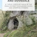
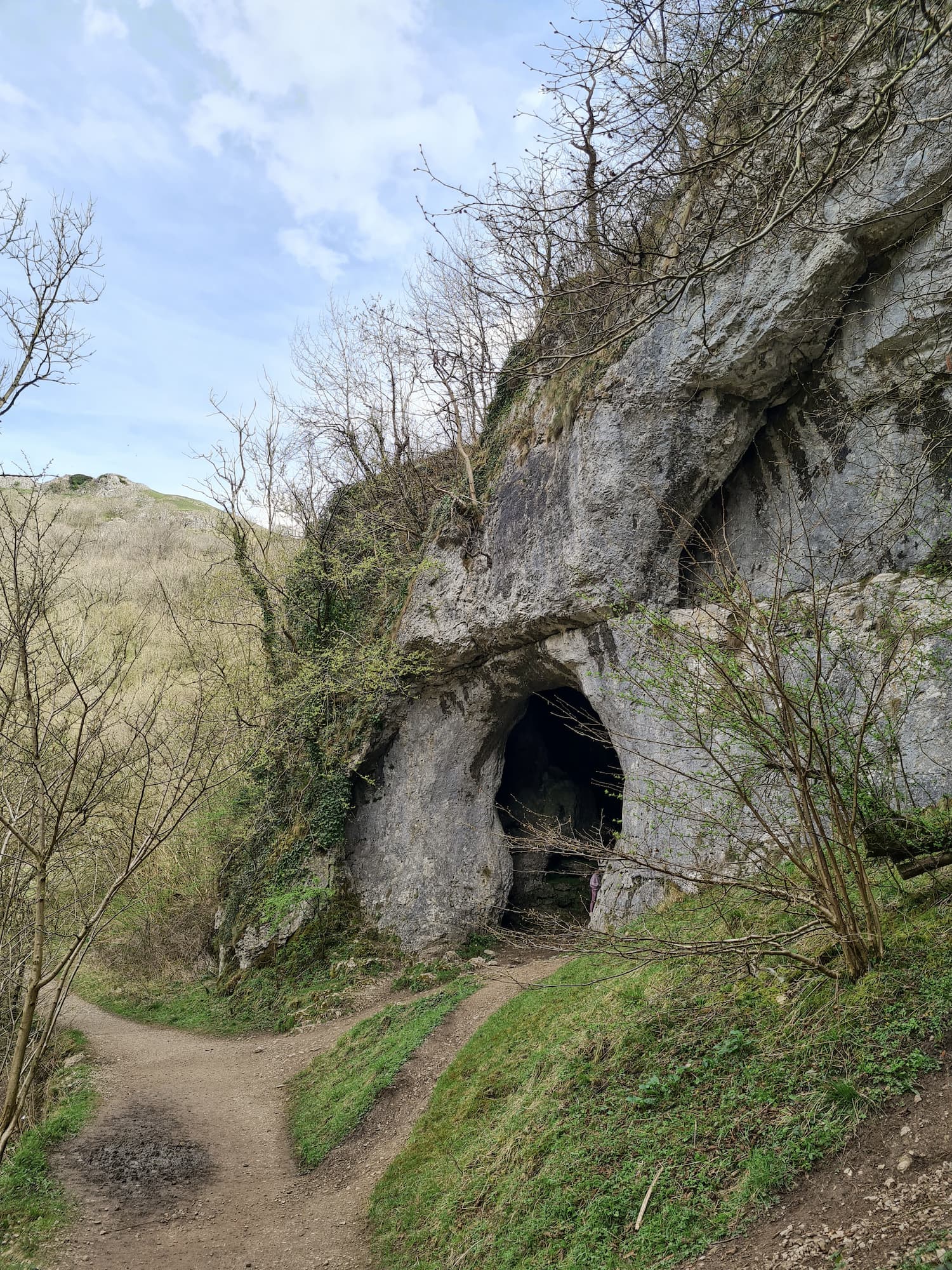
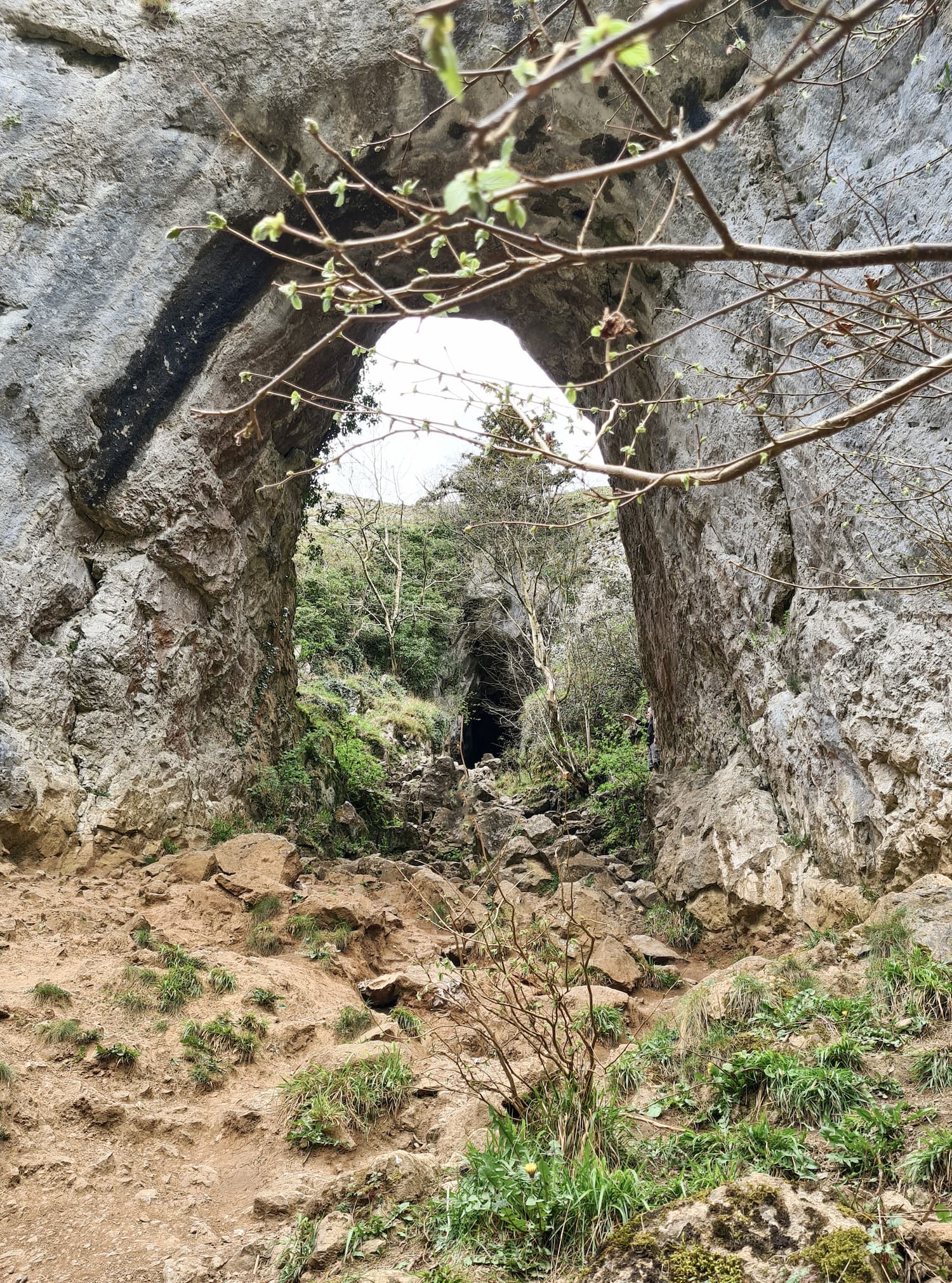
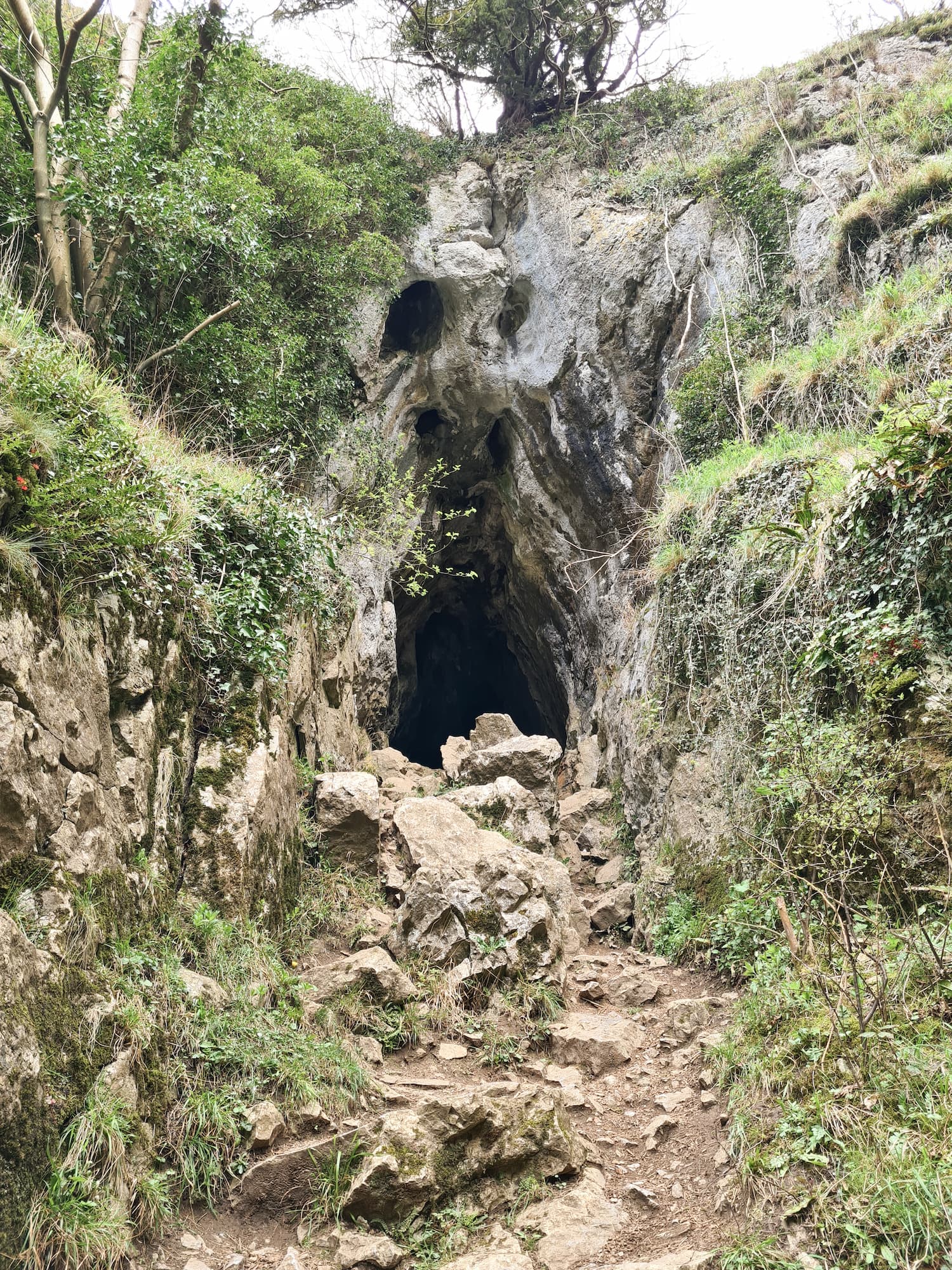
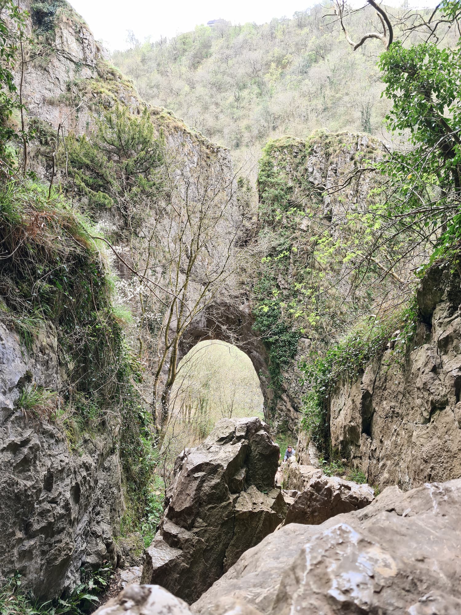
Reynards Arch and Caves in Dovedale


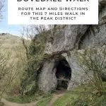
Heading down towards the River Dove, we passed by some amazing cave structures. These are huge! Dovedale is full of hidden caves. We first explored the Dove Holes, two ancient caves in the hillside. Following the river, we headed south-east and found the amazing Reynards Cave in Dovedale. This natural limestone arch leads to further caves but is a tricky scramble to access. You have to climb using your hands at some points, so it’s not for those with mobility issues unfortunately. The limestone can also become very slippery in wet conditions.


According to Wikipedia “The limestone rock that forms the geology of Dovedale is the fossilised remains of sea creatures that lived in a shallow sea over the area during the Carboniferous period, about 350 million years ago. During the two ice ages, the limestone rock (known as reef limestone) was cut into craggy shapes by glacial meltwater, and dry caves such as Dove Holes and Reynard’s Kitchen Cave were eventually formed.” Amazing to think of this being under a shallow sea!


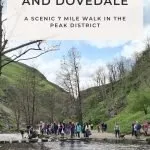
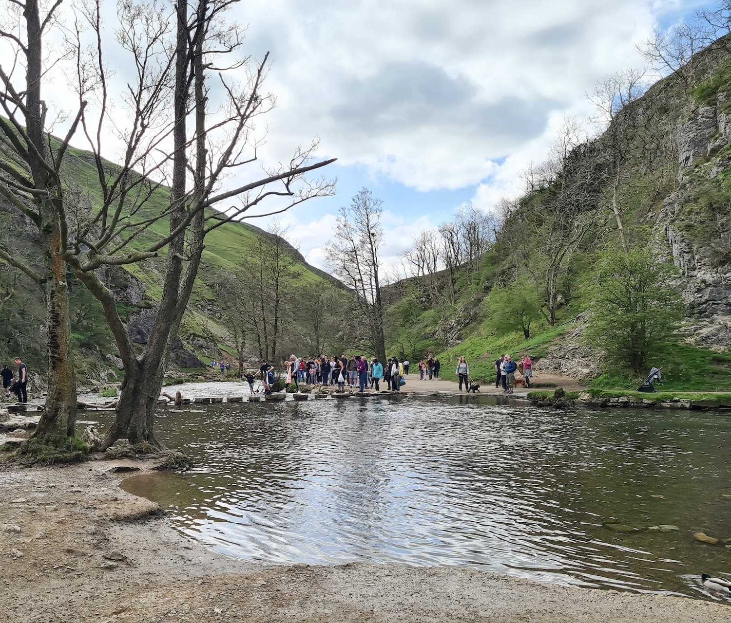
After we’d explored Reynards Arch, we followed the riverside path to the famous stepping stones at Dovedale. Because we had been silly, and visited on Easter Bank Holiday Monday, the place was packed and there were really long queues for the stepping stones.


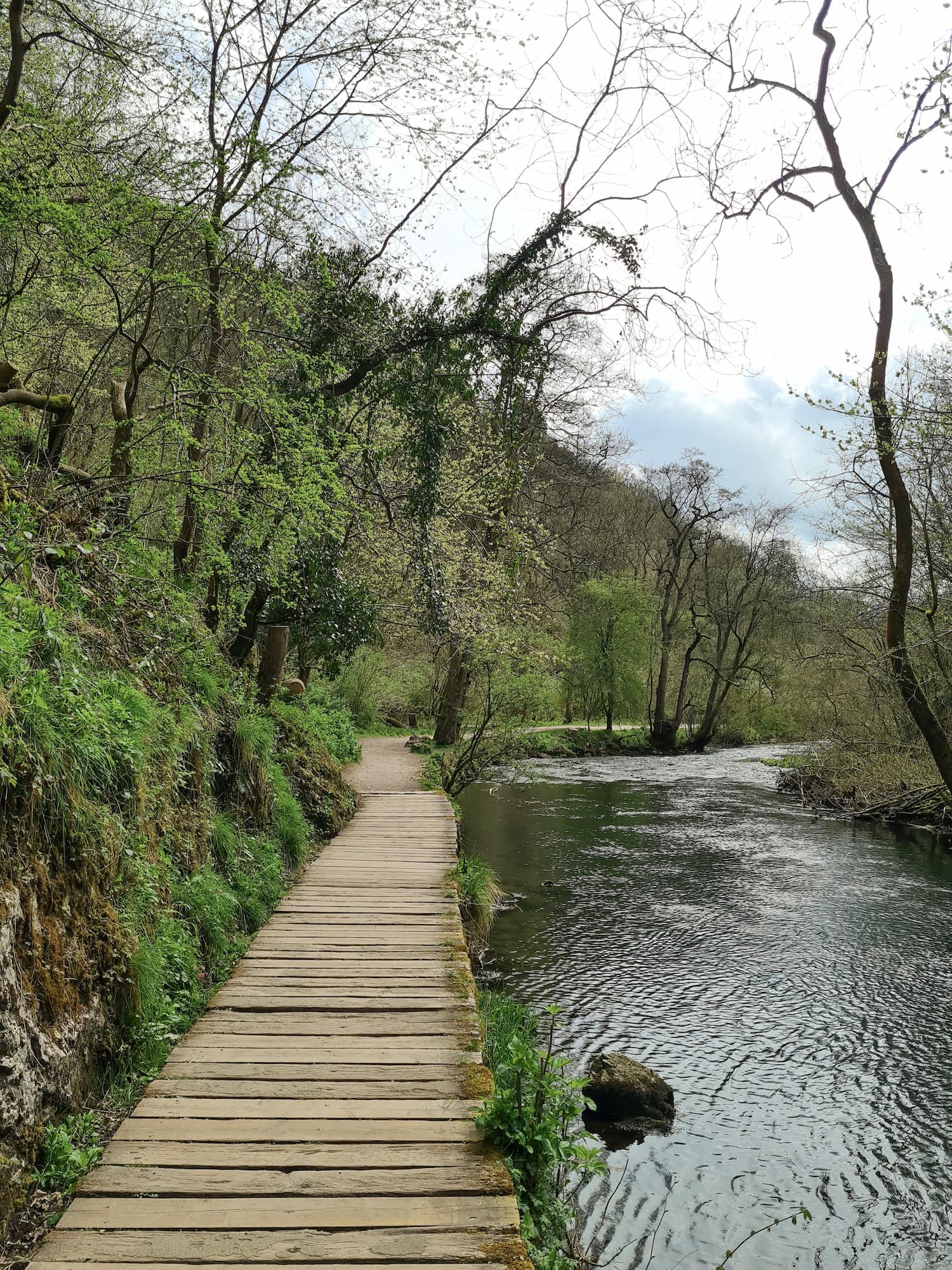
We didn’t bother with the stepping stones and instead followed the river back to the car park, before heading off to the nearby Coach & Horses pub in Fenny Bentley. We had a delicious pub meal, topped off with a delicious glass of wine.


Thorpe Cloud Walk:

Parking: Dovedale National Trust Car Park, Dovedale, Ilam, Ashbourne DE6 2AY (free for National Trust members, pay and display for everyone else)

Facilities: Pay to use toilets in the National Trust Car Park (20p), snack van

Walk Time: 2-3 hours

Difficulty: ▲▲ (Thorpe Cloud is very steep  and rocky at the top)

Distance:  7.2 miles (11.6 km) in total

Trig Points Bagged: Tissington Hill is on private land but the walk takes you nearby.

Peak District Peaks Bagged: Thorpe Cloud

Peak District Ethels Bagged: Thorpe Cloud, Tissington Hill

Thorpe Cloud Walking Route Map:


You might also like:

Chee Dale Stepping Stones Walk

A Beautiful Walk Through Wolfscote Dale & Biggin Dale

Castleton to Mam Tor Circular Walk via Cave Dale

Thorpe Cloud, Dovedale Stepping Stones, Bunster Hill and Ilam

Tap to share with your hiking friends!

  • Facebook
  • Email
  • WhatsApp
« Beinn Edra and the Fairy Glen | 7 Miles
Burbage Edge Circular Walk | 5 Miles »

RELATED POSTS

  • Three Shires HeadHow to Find Three Shires Head
  • Hathersage Stepping StonesHathersage Stepping Stones Walk | 7 Miles
  • Anvil Stone, GrindsbrookGrindsbrook Clough Scramble to Grindslow Knoll | 7 Miles
  • Waterfalls at Padley Gorge in early autumn - The Wandering WildflowerPadley Gorge, Burbage Moor and Higger Tor Walk | 8 Miles

Leave a Reply Cancel reply

Your email address will not be published. Required fields are marked *

FIND YOUR NEXT WALK:

ABOUT ME

Y Garn with Kids - Y Garn via the Devil's Kitchen Walk in Ogwen Valley

Hello! I’m Jo! Welcome to The Wandering Wildflower, an outdoors lifestyle blog focusing on family walks in the Peak District, a place we love exploring. I want to share the Peak District hidden gems and show you there’s so much more than the honeypot places. When I’m not dragging my husband and now 11 year old out on Peak District walks or up mountains, I can be found on planning my next moorland walk or plotting a Geocache walk (and seeing where the nearest pub is!). I love the hills but hate the heights, so trig bagging is – er- fun!


I hope this blog will give you some ideas of places to visit in the Peak District and inspire you and your family to head into the great outdoors.  Thanks for stopping by!

CATEGORIES

  • CIRCULAR WALKS (189)
  • HOLMFIRTH WALKS (27)
  • ISLE OF SKYE WALKS (3)
  • LAKE DISTRICT WALKS (26)
  • LANCASHIRE WALKS (2)
  • LONG PEAK DISTRICT WALKS 10 MILES + (42)
  • MEDIUM WALKS 4-9 MILES (137)
  • PEAK DISTRICT SCRAMBLES (16)
  • PEAK DISTRICT WALKS (206)
  • PEAK DISTRICT WALKS WITH KIDS (76)
  • PEAK DISTRICT WALKS WITH PUBS (60)
  • SCOTLAND WALKS (6)
  • SHORT WALKS UNDER 3 MILES (40)
  • SNOWDONIA WALKS (5)
  • UK CAMPING (5)
  • YORKSHIRE WALKS (33)

Peak District Walks

List of Peak District Ethels

Peak District Peak Bagging

Peak District Trig Point Challenge

Peak District Walks with Pubs

Peak District Walks with Kids

Beautiful Walks in Holmfirth

Short Walks in the Peak District

Long Walks in the Peak District

AFFILIATE DISCLOSURE

This blog may contain affiliate links through which, at no additional cost to you, I may earn a small commission. I only recommend products I would use myself and all opinions expressed here are my own. As an Amazon Associate I earn from qualifying purchases. Read full privacy policy here.

ARCHIVES

PEAK DISTRICT WEATHER

Peak District mountain weather on Met Office

Peak District Trig Points

Promo image for a blog post about the Peak District Trig Point Challenge With Map of Peak District Trig Points and Walking Routes by The Wandering Wildflower

Peak District Ethels Challenge

Promo image for a blog post about the Peak District Trig Point Challenge With Map of Peak District Ethels and Walking Routes by The Wandering Wildflower

WALKING ROUTES STRAIGHT TO YOUR INBOX

Want new walks in your inbox? Drop your email below and I'll send you some ideas for walks you can try.

You can unsubscribe anytime. For more details, review our Privacy Policy.

Thank you!

You have successfully joined our subscriber list.

RSS LATEST POSTS

  • How to Find Three Shires Head
  • Peak District Pub Walks
  • Burnbank Fell, Blake Fell and Gavel Fell | 8 Miles
  • Bretton Park Circular Walk | 3 Miles
  • Grasmere Weekend Break

FOLLOW ON PINTEREST

Want new walks in your inbox? Drop your email below and I'll send you some ideas for walks you can try.

You can unsubscribe anytime. For more details, review our Privacy Policy.

Thank you!

You have successfully joined our subscriber list.

jo@thewanderingwildflower.co.uk

The Wandering Wildflower

  • Email
  • Facebook
  • Instagram
  • Pinterest
  • PRIVACY POLICY
  • TERMS & CONDITIONS
  • ABOUT

(c) The Wandering Wildflower. All Rights Reserved.

|| THEME BY ECLAIR DESIGNS