• 3 Mile Walks or Less
  • 4 Mile Walks
  • 5 Mile Walks
  • 6 Mile Walks
  • 7 Mile Walks
  • 8 Mile Walks
  • 9 Mile Walks
  • 10 Mile Walks
  • 11 Mile Walks
  • 12 Mile Walks
  • 14 Mile Walks
  • 15 Mile Walks
  • 20+ Mile Walks

The Wandering Wildflower

Peak District Hikes

  • PEAK DISTRICT WALKS
    • SHORT WALKS UNDER 3 MILES
    • MEDIUM WALKS 4-9 MILES
    • LONG PEAK DISTRICT WALKS 10 MILES +
  • PEAK DISTRICT WALKS WITH PUBS
  • PEAK DISTRICT WALKS WITH KIDS
  • HOLMFIRTH WALKS

Ben Nevis Hike | 10 Miles

October 10, 2022 SCOTLAND WALKS

Pinterest Image for Ben Nevis Hike via the Pony Track Route - The Wandering Wildflower

This is our Ben Nevis route – to be fair, it’s the same as most other people’s routes who tackle the Ben Nevis pony track up!  This was the last of the National 3 Peaks for us to climb as a family – challenge completed! If you’re looking for the easiest way to walk up Ben Nevis, or want to walk Ben Nevis with kids, this is the route.

A temperature inversion on Ben Nevis summit - The Wandering Wildflower

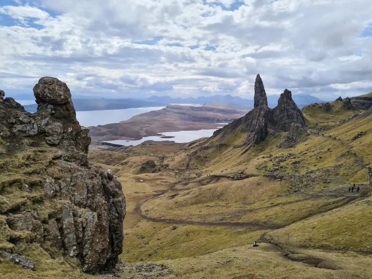
We went to the Isle of Skye earlier in the year to hide away while I turned 40 – eek – and had planned a day trip to tackle the big Ben Nevis hike while we were there. Unfortunately in April there was too much snow on the tops, and we only tackle big mountains in the right conditions – hiking Ben Nevis with kids is hard enough, let alone in treacherous conditions!


Instead we booked a week in Fort William in August, staying in a lodge at the Linnhe Lochside Holiday Park, and planned the Ben Nevis hike for the best day weather-wise. I use Mountain Forecast to check the Ben Nevis weather at the summit as it’s very different to that at ground level and conditions can change quickly up there.


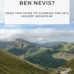
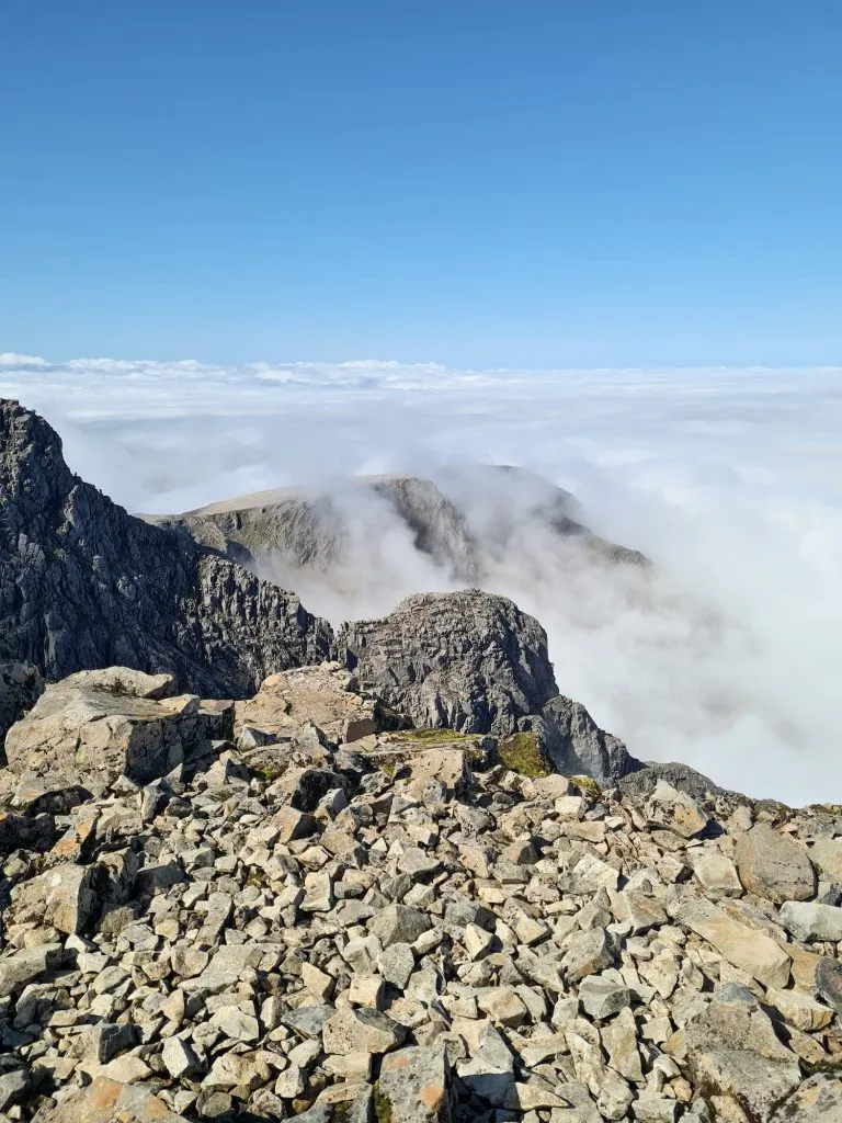
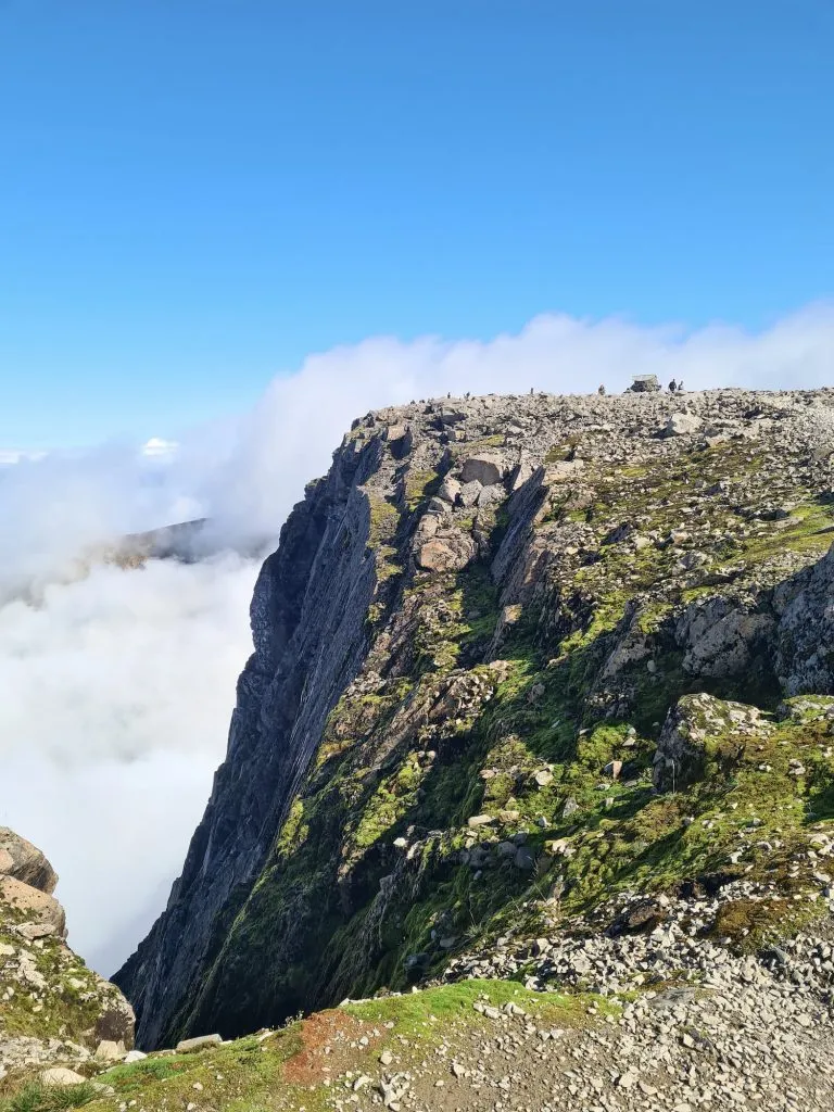
Ben Nevis is the highest mountain in the UK, being 1345m above sea level. It’s a beast! It’s also a former volcano, and used to be some 2-3km higher than it is now. It’s distinctive shape is that of a caldera, which was made when part of the side of the volcano collapsed. I do love a bit of geology!


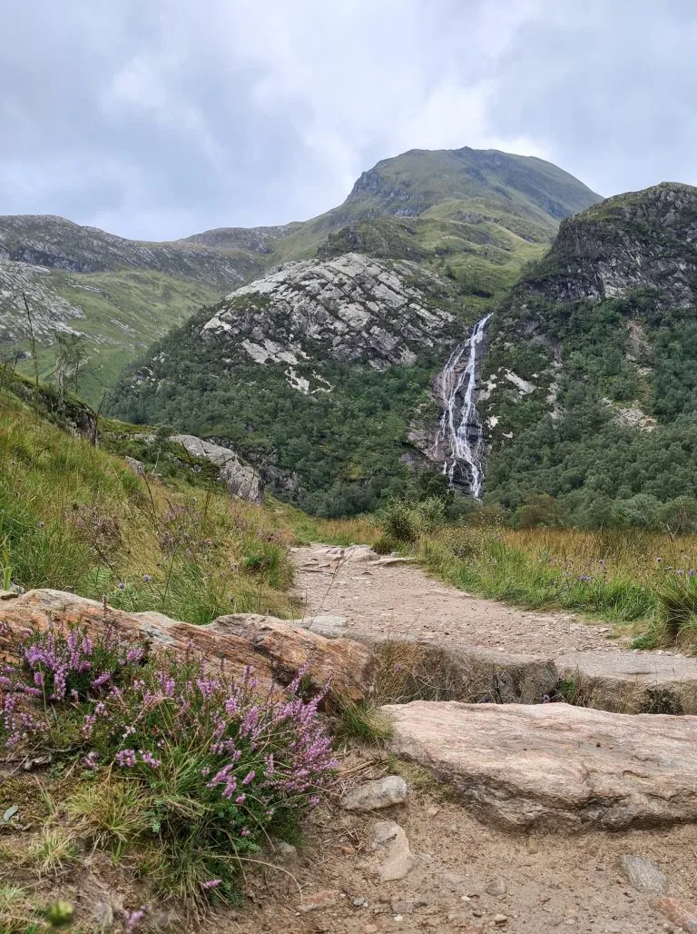
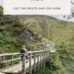
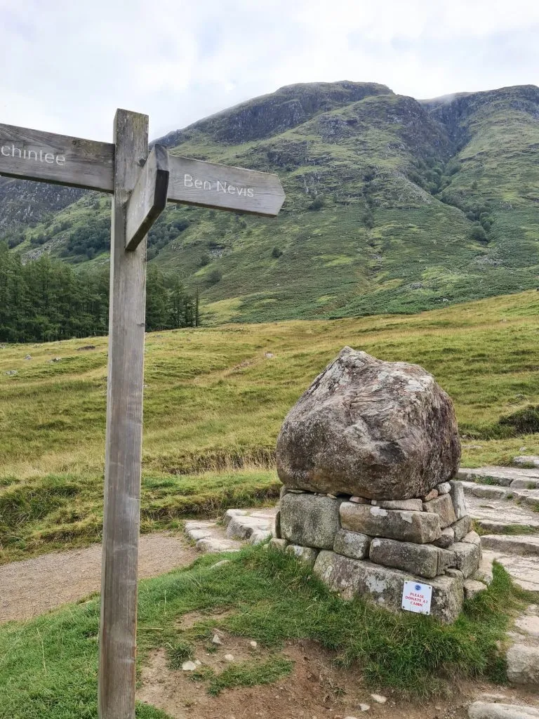
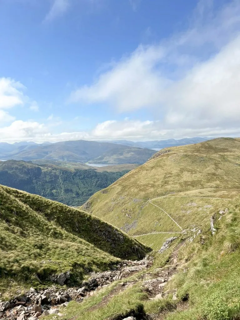
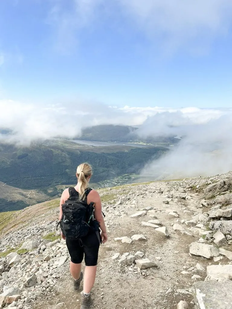
We started out at the Glen Nevis Visitor Centre car park where there is a shop and toilets. From here we crossed over the bridge over the River Nevis, then headed up (and up and up!) the Pony Track or the Mountain Track, depending on what you want to call it, to the Ben Nevis summit, crossing a stile and admiring the views up Glen Nevis (you might also like Steall Falls – A Waterfall Walk in Glen Nevis.

Signpost for Ben Nevis - Ben Nevis Route from The Wandering Wildflower

Bridge over a burn on the way up Ben Nevis - Ben Nevis Route from The Wandering Wildflower

The Ben Nevis pony track

Ben Nevis mountain path

Views back down the Ben Nevis mountain path - Ben Nevis Route from The Wandering Wildflower

We got views! We never get views – if you’ve seen our Snowdon or Scafell Pike walks, you’ll know the kind of views we usually get for mountains!

Ben Nevis Mountain Path - Ben Nevis Route from The Wandering Wildflower


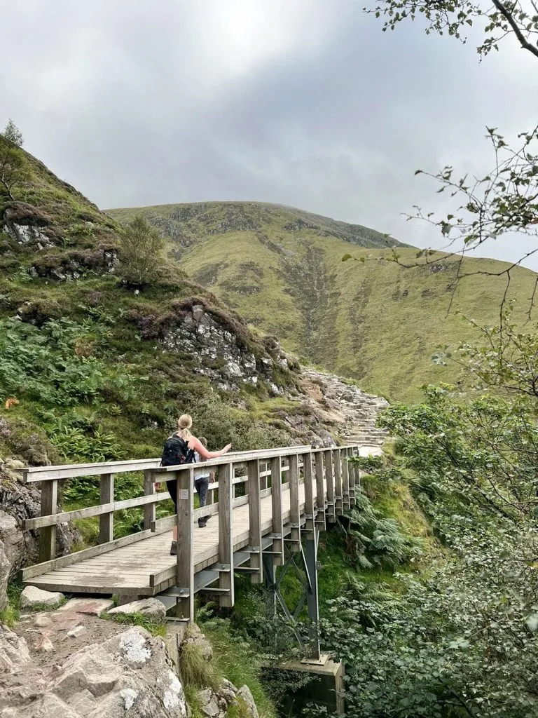
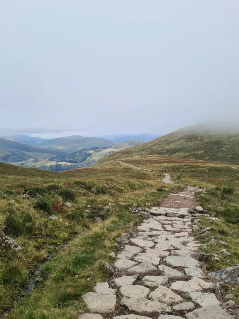
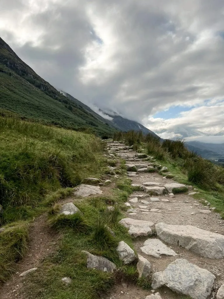
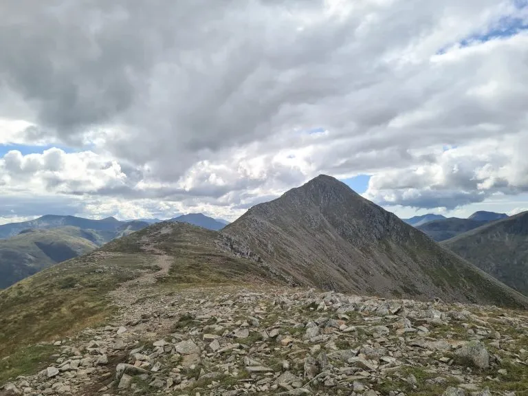
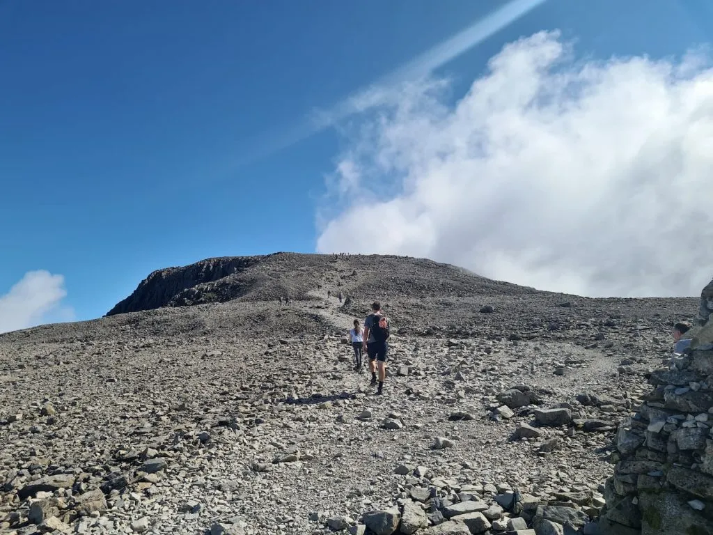
The path itself is pretty straight forward for the most part, being either steps or gravel screes. To the summit and back is around 9.8 miles and we just did this as an out and back.


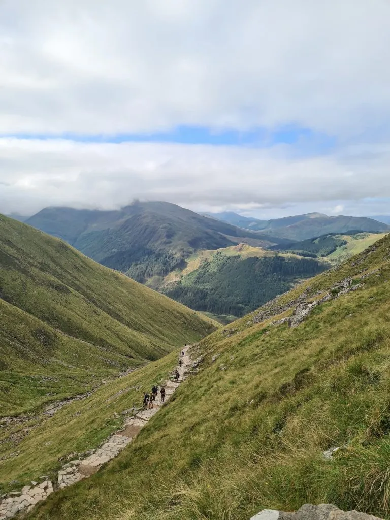
There is a loch partway up which a lot of people mistakenly refer to as the Halfway Loch – sadly it isn’t halfway up! Lochan Meall an t-Suidhe is at about 2/5 of the way up, but is a brief respite in the steep climb to the top. The path almost feels level here! The path doesn’t go all the way to the loch but it is a short detour if you fancy a nosy.


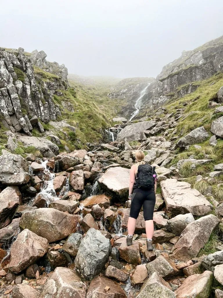
There is a waterfall at Red Burn which is around halfway up, and then the path becomes a series of switchbacks which get smaller and smaller as you near the top.

A woman looking up at Red Burn - Ben Nevis Route from The Wandering Wildflower

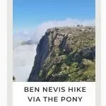
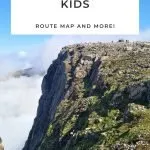
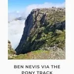
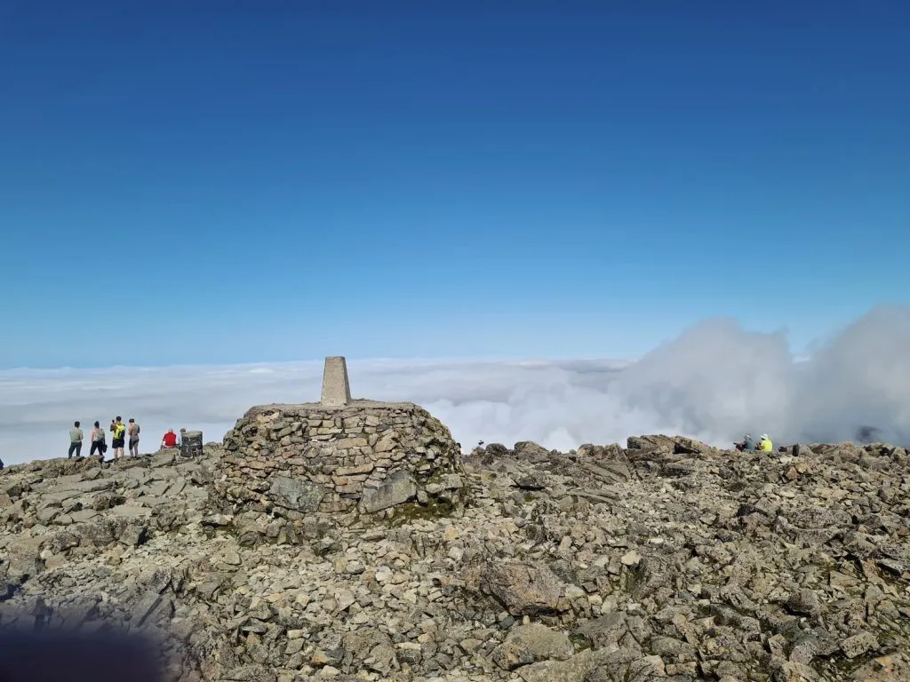
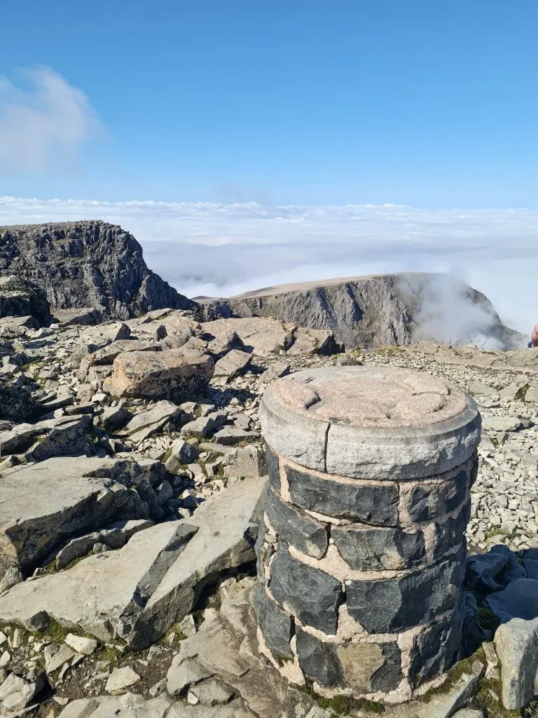
On a clear day the path is really easy to see, but in bad weather or mist it would be very easy to go near the edge and there is a very big drop down Gardyloo Gully near to the summit. There is a row of cairns to the right of the path near the southern edge of the summit plateau.

Rocky scree path up Ben Nevis - Ben Nevis Route from The Wandering Wildflower

A stone cairn on the path to Ben Nevis

The scree path to the summit of Ben Nevis

Getting near the summit – the path is clear to see on a clear day but it would be a very different story in bad weather, so care needs to be taken.

Mist and a cloud inversion on Ben Nevis near Gardyloo Gully

Views down the North Face of Ben Nevis

Gardyloo Gully at Ben Nevis summit - quite a drop!

Gardyloo Gully – it’s a massive drop and it would be really dangerous in bad weather.

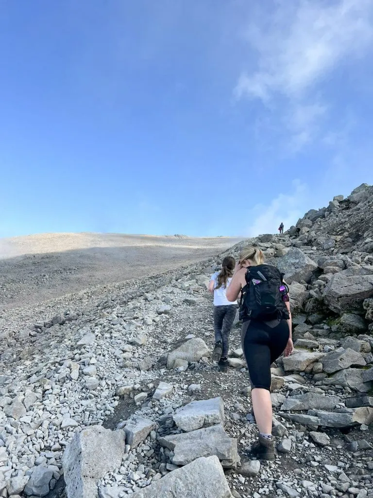
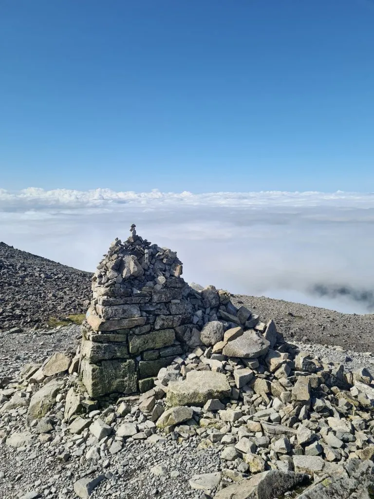
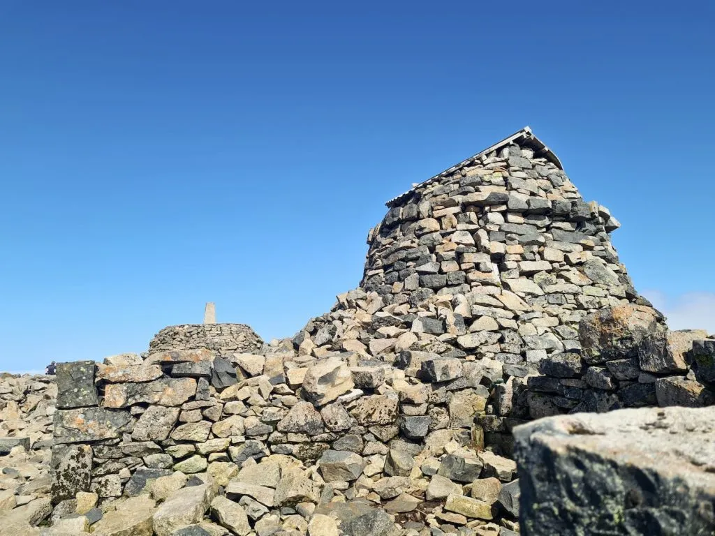
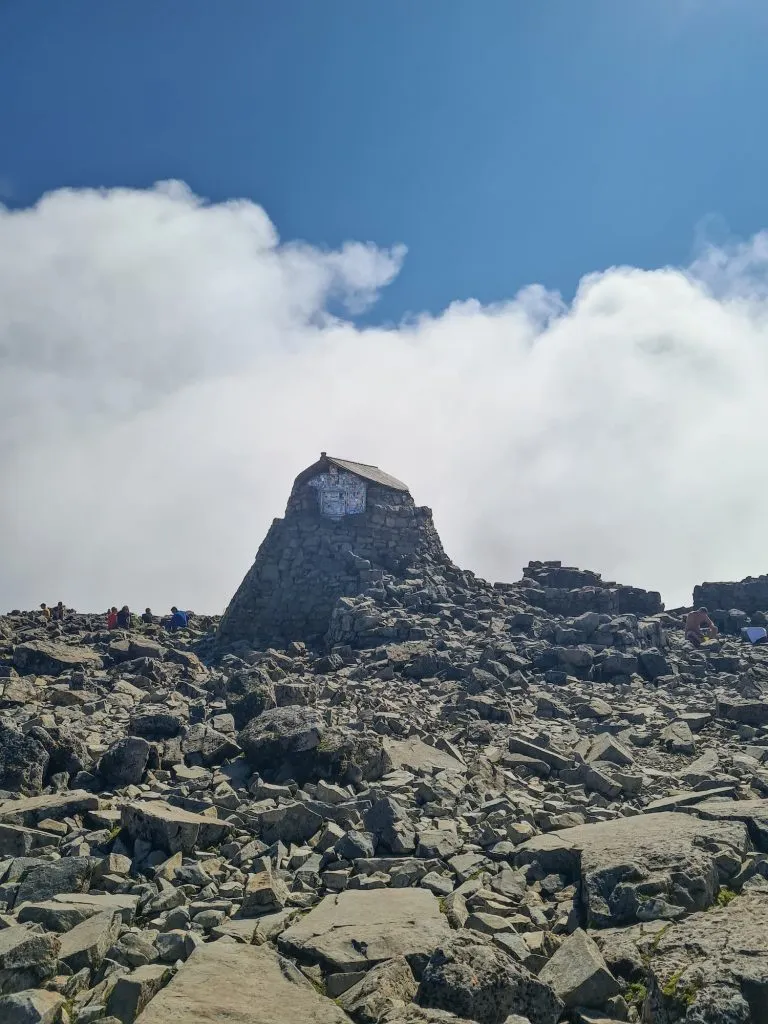
Ben Nevis used to be the site of an observatory and weather station, and even a hotel! There are just the remains of the observatory there now, and the tower has been repurposed into a survival shelter. There is a trig point and a toposcope there too. We were really lucky with the weather and had blue skies and sunshine, but this is really rare – in fact, for the remaining 6 days of our Fort William trip Ben Nevis had a constant hat of cloud on.

A family standing on top of the Ben Nevis summit with the trig point - Ben Nevis Route from The Wandering Wildflower

Ben Nevis summit and storm shelter - The Wandering Wildflower

I had to wait ages for this photo… the storm shelter and the trig point with no people!


A toposcope base on Ben Nevis summit

Ben Nevis storm shelter - The Wandering Wildflower

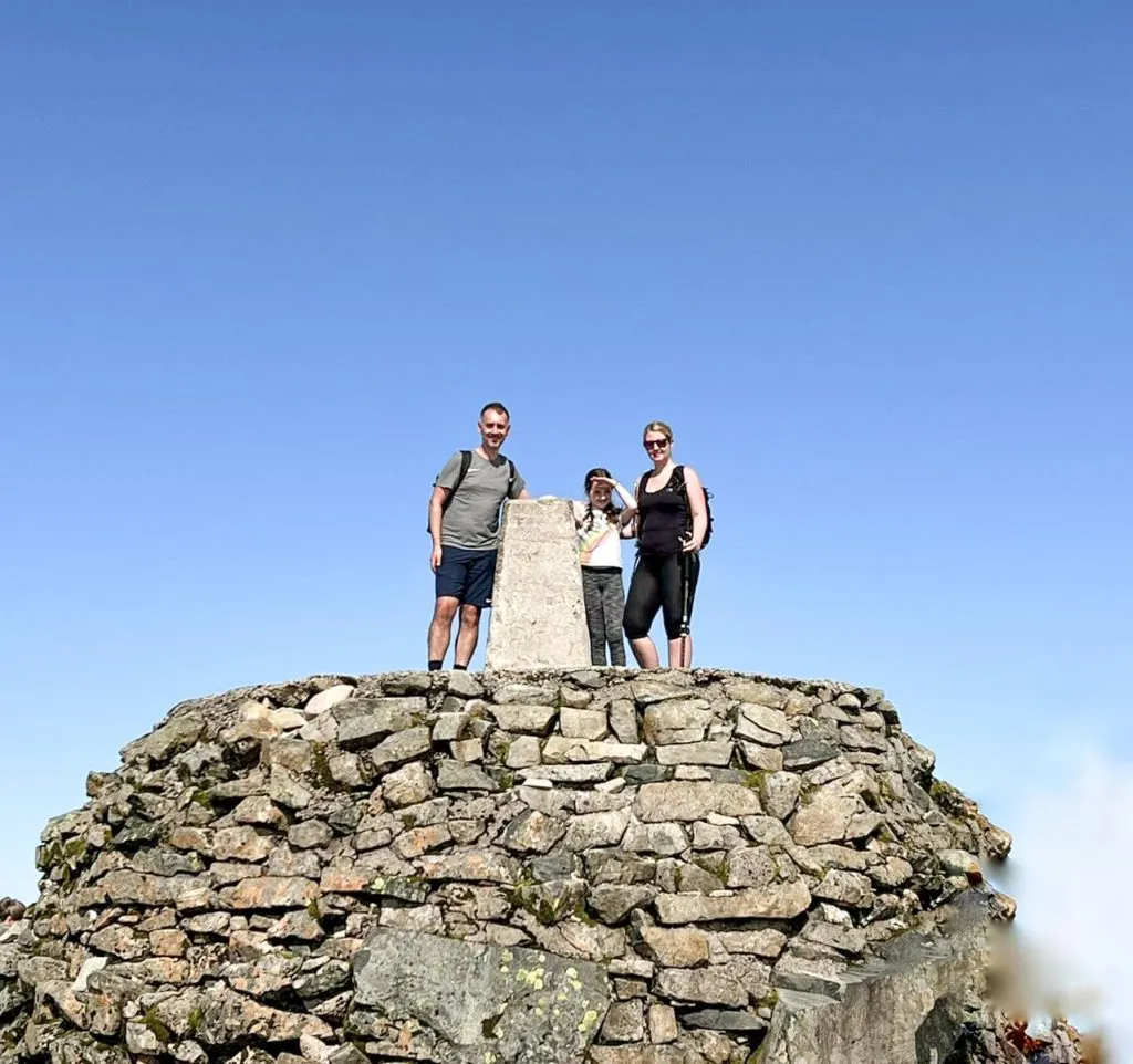
After we’d found a couple of geocaches on the summit, we headed back down. We just followed the path back down, the way we had come up! Surprisingly it didn’t take us quite as long to get down as it did to get up, but the paths are tough on the knees. I walk a lot but the next day my calves were really sore and I couldn’t even stand on tiptoe.

A woman near the summit of Ben Nevis - Ben Nevis Route from The Wandering Wildflower


There is a pub near the base, the Ben Nevis Inn, where you can get a beer and some food afterwards.


This was the last of the National 3 Peaks that Holly has done with us this year (we did Scafell Pike Route and Snowdon earlier in the summer). It was definitely the toughest of the 3, but only because of the long old slog to the top. It seems never ending, especially when you’re 10!


Ben Nevis Weather

Always check the weather before you go. I use Mountain Forecast to check the weather forecast at the summit as it can differ dramatically from that at ground level.


Can you climb Ben Nevis with a child?

Yes! As long as your child is used to walking long distances, and you go fully prepared for any weather, you should be fine. It is a very tough walk though, and you need to be patient and sympathetic when hiking mountains like this with kids. Take plenty of snacks, sing songs, play games – whatever keeps their mind off the relentless hike! We walk a lot with Holly, and we’ve gradually built up to mountains like this. I always check the weather and we won’t climb if the weather isn’t right. There’s no point making a tough situation even worse with bad weather!

Is it Easy to Navigate on Ben Nevis?

Whilst the Mountain Track or Pony Track is very easy to see in good weather, this won’t be the case in bad weather. Be sure you take a map and compass, and know how to use them, as there are deaths on Ben Nevis every year. Please don’t underestimate this mountain!
This blog may contain affiliate links through which, at no additional cost to you, I may earn a small commission. I only recommend products I would use myself and all opinions expressed here are my own. As an Amazon Associate I earn from qualifying purchases. Read full privacy policy here.

Accommodation Near Ben Nevis

We stayed in a lodge at Linnhe Lochside Holidays and I would definitely recommend it. I booked through Booking.com, and you can find more details or different accommodation on their site.


Ben Nevis Hike Route Info:

Ben Nevis Hike Routes Map:


Walk Map (Opens in OS Maps): Ben Nevis Map

Parking: Glen Nevis Visitor Centre, Glen Nevis Road, Fort William PH33 6PF

Facilities: Public toilets and cafe/shop at the car park

Walk Time: 6-7 hours depending on speed and fitness

Difficulty: ▲▲▲

Distance: 9.81 miles (15.8 km)


You might also like:

Buchaille Etive Beag Walk


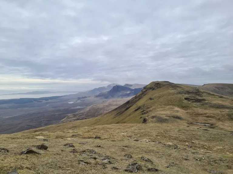
or if you’re heading to Skye and want some Isle of Skye walks, check out:

Hiking The Quiraing and Meall Na Suiramach Trig Point

Old Man of Storr Walk

Tap to share with your hiking friends!

  • Facebook
  • Email
  • WhatsApp
« Helvellyn via Striding Edge | 8 Miles
Buchaille Etive Beag Walk | 5 Miles »

RELATED POSTS

  • View of Stob Dubh from the bealach - The Wandering WildflowerBuchaille Etive Beag Walk | 5 Miles
  • Hiking The Quiraing and Meall Na Suiramach Trig Point | 5 Miles
  • Views of the Trotternish Penninsula, Isle of SkyeBeinn Edra and the Fairy Glen | 7 Miles
  • Steall Falls, the second highest waterfall in the UKSteall Falls – A Waterfall Walk in Glen Nevis | 3 Miles

Leave a Reply Cancel reply

Your email address will not be published. Required fields are marked *

FIND YOUR NEXT WALK:

ABOUT ME

Y Garn with Kids - Y Garn via the Devil's Kitchen Walk in Ogwen Valley

Hello! I’m Jo! Welcome to The Wandering Wildflower, an outdoors lifestyle blog focusing on family walks in the Peak District, a place we love exploring. I want to share the Peak District hidden gems and show you there’s so much more than the honeypot places. When I’m not dragging my husband and now 11 year old out on Peak District walks or up mountains, I can be found on planning my next moorland walk or plotting a Geocache walk (and seeing where the nearest pub is!). I love the hills but hate the heights, so trig bagging is – er- fun!


I hope this blog will give you some ideas of places to visit in the Peak District and inspire you and your family to head into the great outdoors.  Thanks for stopping by!

CATEGORIES

  • CIRCULAR WALKS (189)
  • HOLMFIRTH WALKS (27)
  • ISLE OF SKYE WALKS (3)
  • LAKE DISTRICT WALKS (26)
  • LANCASHIRE WALKS (2)
  • LONG PEAK DISTRICT WALKS 10 MILES + (42)
  • MEDIUM WALKS 4-9 MILES (137)
  • PEAK DISTRICT SCRAMBLES (16)
  • PEAK DISTRICT WALKS (206)
  • PEAK DISTRICT WALKS WITH KIDS (76)
  • PEAK DISTRICT WALKS WITH PUBS (60)
  • SCOTLAND WALKS (6)
  • SHORT WALKS UNDER 3 MILES (40)
  • SNOWDONIA WALKS (5)
  • UK CAMPING (5)
  • YORKSHIRE WALKS (33)

Peak District Walks

List of Peak District Ethels

Peak District Peak Bagging

Peak District Trig Point Challenge

Peak District Walks with Pubs

Peak District Walks with Kids

Beautiful Walks in Holmfirth

Short Walks in the Peak District

Long Walks in the Peak District

AFFILIATE DISCLOSURE

This blog may contain affiliate links through which, at no additional cost to you, I may earn a small commission. I only recommend products I would use myself and all opinions expressed here are my own. As an Amazon Associate I earn from qualifying purchases. Read full privacy policy here.

ARCHIVES

PEAK DISTRICT WEATHER

Peak District mountain weather on Met Office

Peak District Trig Points

Promo image for a blog post about the Peak District Trig Point Challenge With Map of Peak District Trig Points and Walking Routes by The Wandering Wildflower

Peak District Ethels Challenge

Promo image for a blog post about the Peak District Trig Point Challenge With Map of Peak District Ethels and Walking Routes by The Wandering Wildflower

WALKING ROUTES STRAIGHT TO YOUR INBOX

Want new walks in your inbox? Drop your email below and I'll send you some ideas for walks you can try.

You can unsubscribe anytime. For more details, review our Privacy Policy.

Thank you!

You have successfully joined our subscriber list.

RSS LATEST POSTS

  • How to Find Three Shires Head
  • Peak District Pub Walks
  • Burnbank Fell, Blake Fell and Gavel Fell | 8 Miles
  • Bretton Park Circular Walk | 3 Miles
  • Grasmere Weekend Break

FOLLOW ON PINTEREST

Want new walks in your inbox? Drop your email below and I'll send you some ideas for walks you can try.

You can unsubscribe anytime. For more details, review our Privacy Policy.

Thank you!

You have successfully joined our subscriber list.

jo@thewanderingwildflower.co.uk

The Wandering Wildflower

  • Email
  • Facebook
  • Instagram
  • Pinterest
  • PRIVACY POLICY
  • TERMS & CONDITIONS
  • ABOUT

(c) The Wandering Wildflower. All Rights Reserved.

|| THEME BY ECLAIR DESIGNS