• 3 Mile Walks or Less
  • 4 Mile Walks
  • 5 Mile Walks
  • 6 Mile Walks
  • 7 Mile Walks
  • 8 Mile Walks
  • 9 Mile Walks
  • 10 Mile Walks
  • 11 Mile Walks
  • 12 Mile Walks
  • 14 Mile Walks
  • 15 Mile Walks
  • 20+ Mile Walks

The Wandering Wildflower

Peak District Hikes

  • PEAK DISTRICT WALKS
    • SHORT WALKS UNDER 3 MILES
    • MEDIUM WALKS 4-9 MILES
    • LONG PEAK DISTRICT WALKS 10 MILES +
  • PEAK DISTRICT WALKS WITH PUBS
  • PEAK DISTRICT WALKS WITH KIDS
  • HOLMFIRTH WALKS

Bamford Edge Walk | 6 Miles

March 26, 2024 CIRCULAR WALKS, MEDIUM WALKS 4-9 MILES, PEAK DISTRICT WALKS, PEAK DISTRICT WALKS WITH KIDS, PEAK DISTRICT WALKS WITH PUBS

This 6 mile Bamford Edge walk starts from Heatherdene and heads up onto the beautiful Bamford Edge, with sweeping views across Ladybower Reservoir and Win Hill, before dropping back down past Bamford Mills and returning along the Bamford Touch Stone Trail. 

A view of Win Hill with Ladybower Reservoir Plugholes below

A view of Win Hill with Ladybower Reservoir Plugholes below, taken from Bamford Edge

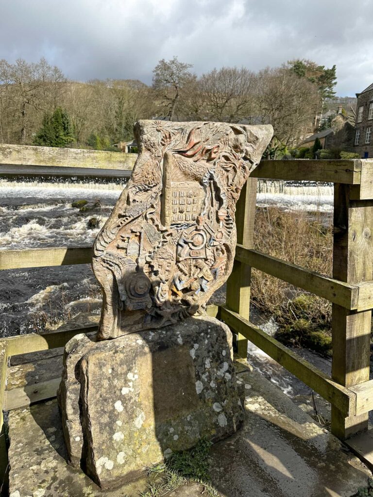
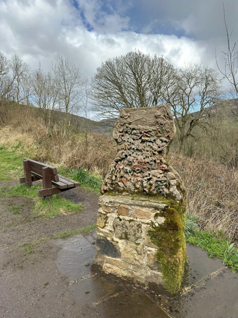
The Bamford Touch Stone Trail

This trail is a collection of sculptures which illustrate Air, Water, Earth and Fire, and a central touchstone combines all four elements. There is a Celtic symbol on each touchstone to commemorate the millennium. For more information on how the stones were created, you can visit Bamford Village website. 


Where is Bamford Edge?

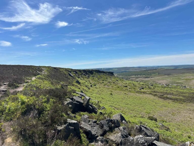
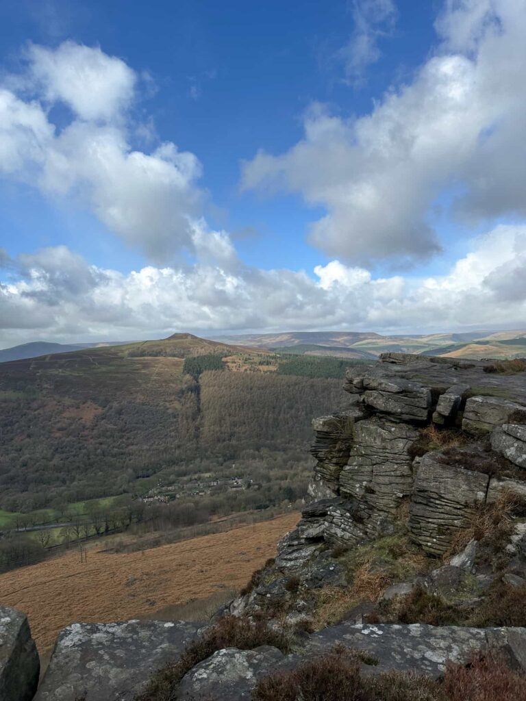
Situated on the moors to the north of the pretty village of Bamford, Bamford Edge is in Derbyshire and has spectacular views over the Hope Valley. 


Bamford Edge Walk from Heatherdene

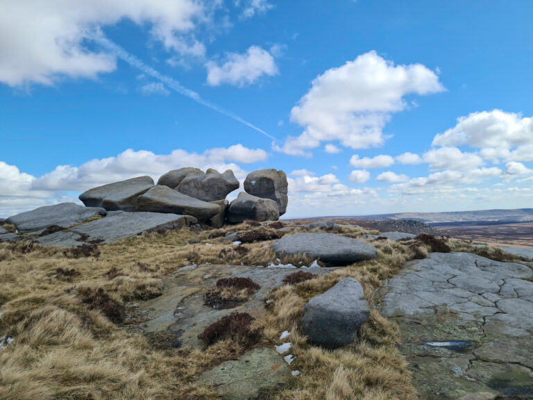
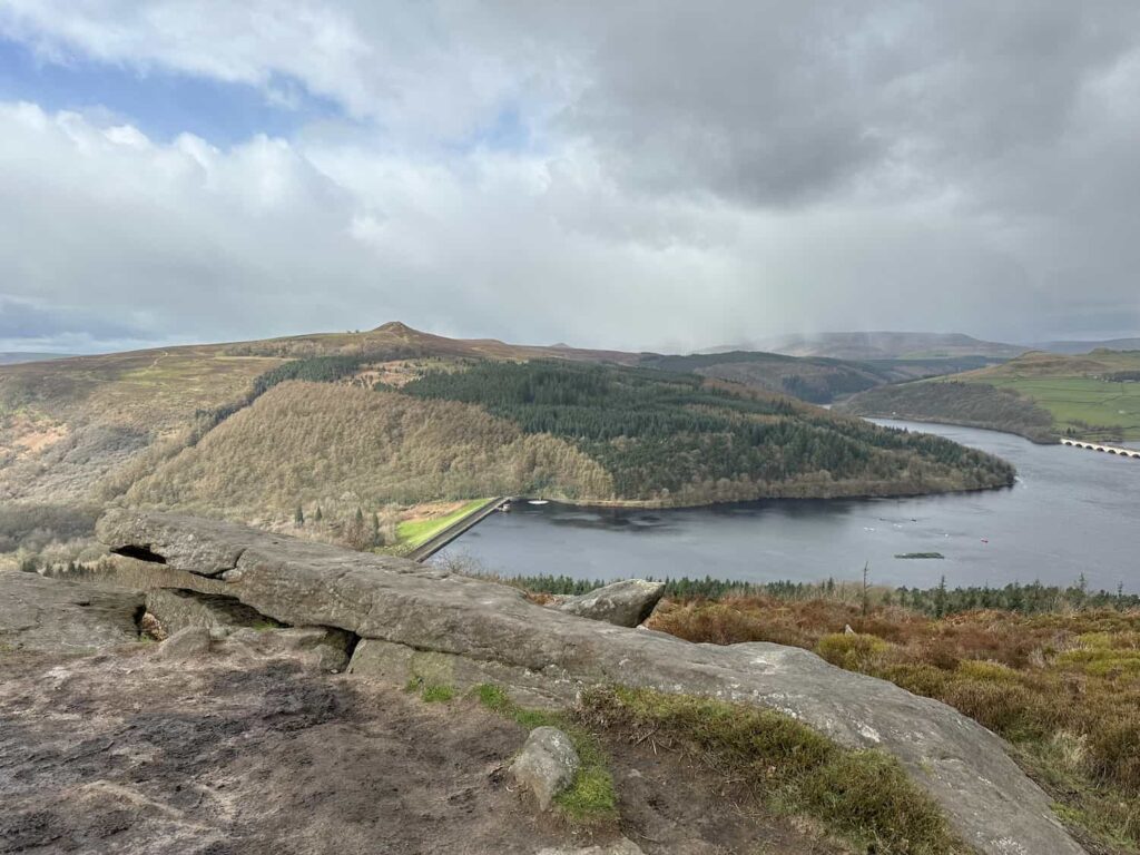
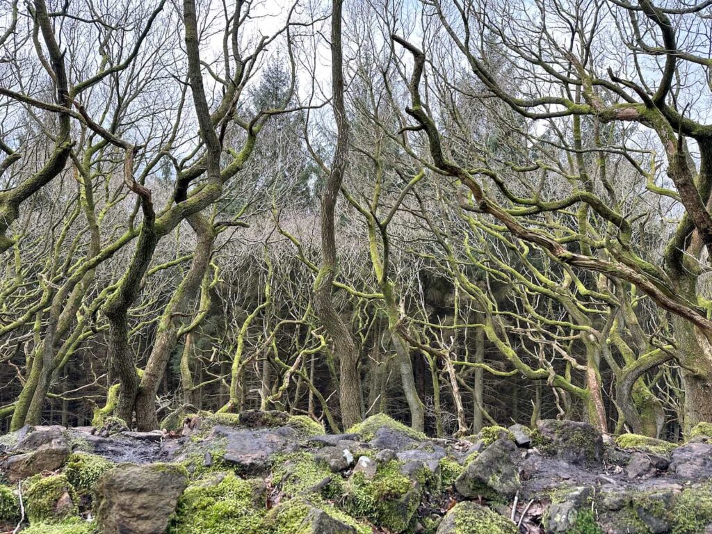
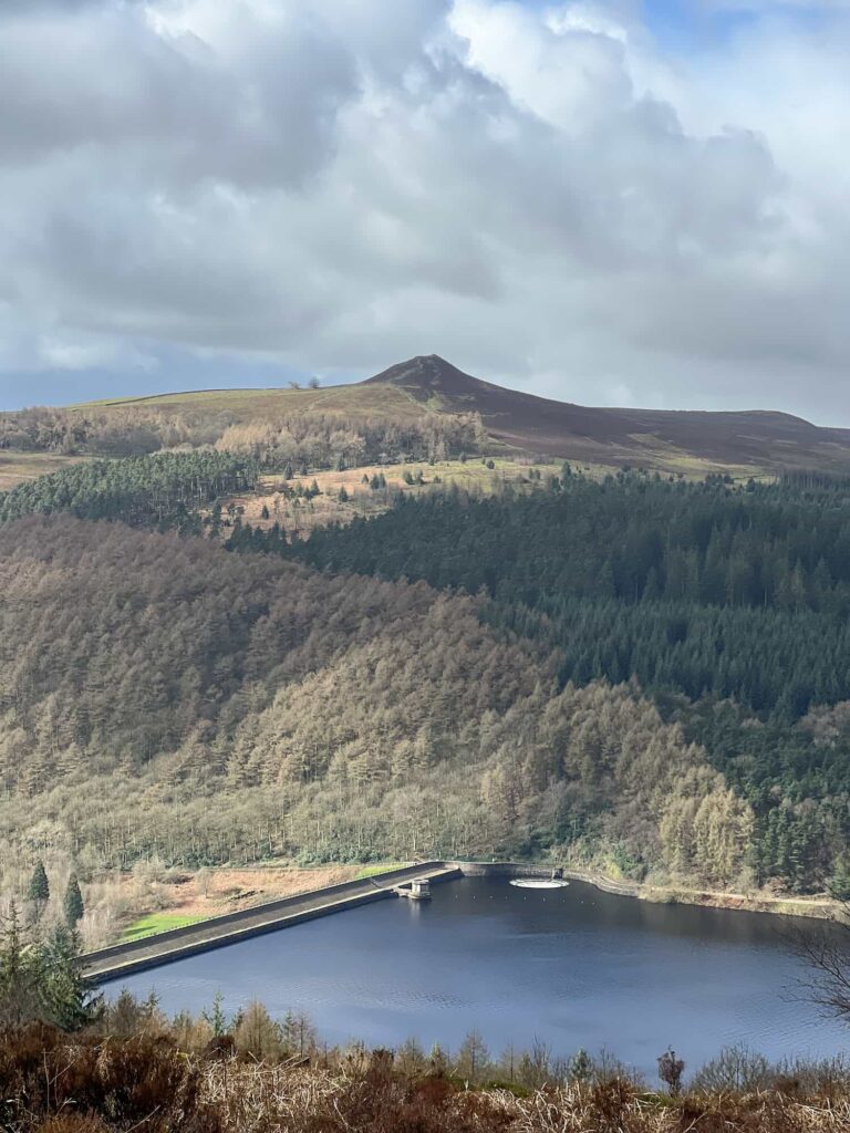
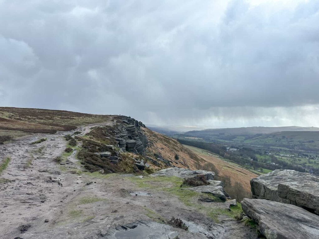
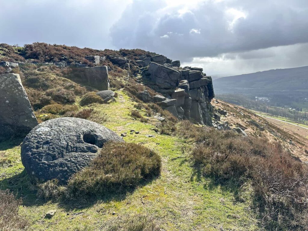
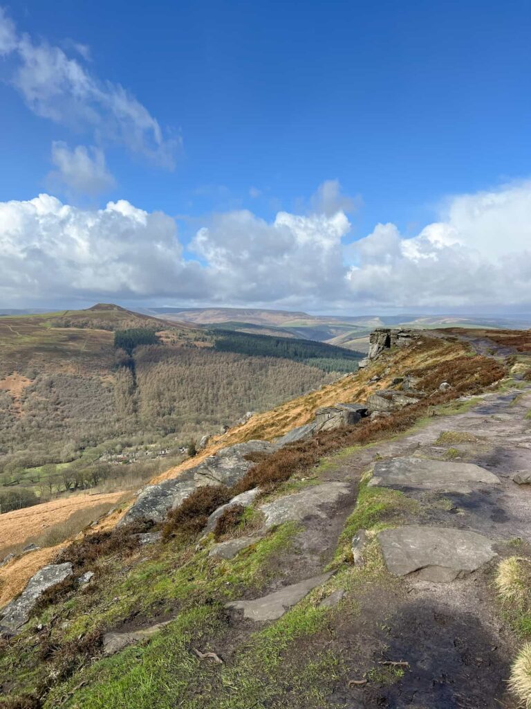
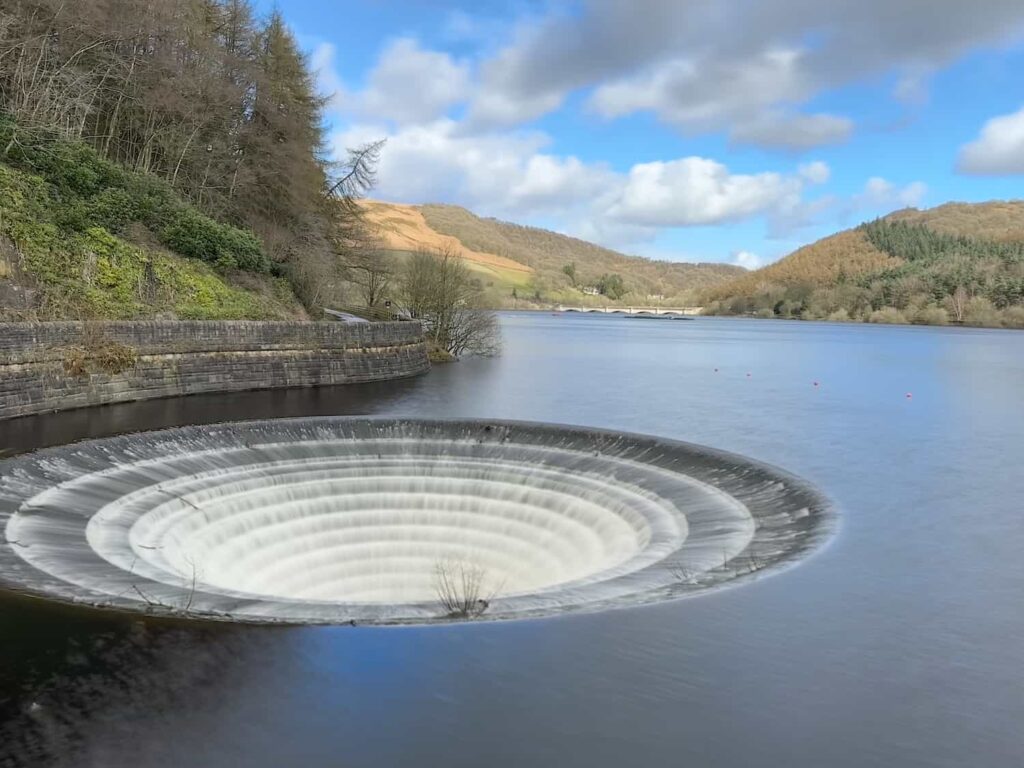
Our walk started from Heatherdene car park and headed up through Priddock Wood to the top of Bamford Edge. We turned right to walk along the Edge itself and from here you get stunning views over Ladybower and across to Win Hill – you can even see the Ladybower plugholes! We had all the weathers on this walk – lovely spring sunshine, horrible rain and super nasty hailstones which felt like needles against your face. The photos are all from the same day! 


Ancient mossy woodland at Priddock Woods

A view of Win Hill with Ladybower Reservoir Plugholes below


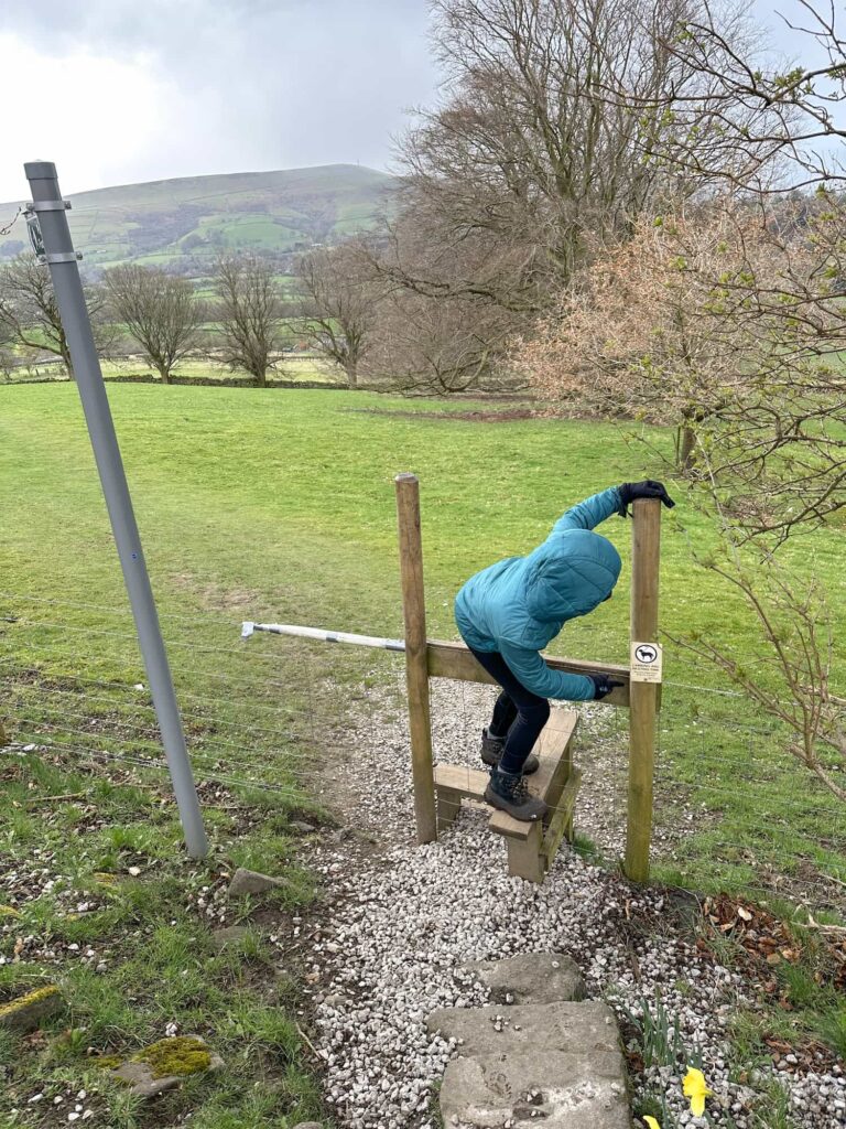
We walked for about 1.5km along the top and then started to drop down to the stile adjoining New Road. We had planned to go down Bamford Clough, possibly the steepest road in the Peak District with a 35% gradient, but it was closed so we had to detour along New Road for about 1km before picking up a footpath over a stile, next to the driveway for a house called The Veg! 


A view of Win Hill from Bamford Edge

A view along Bamford Edge

Millstones on Bamford Edge

Win Hill from Bamford Edge

A young girl of about 12 climbing over a stile


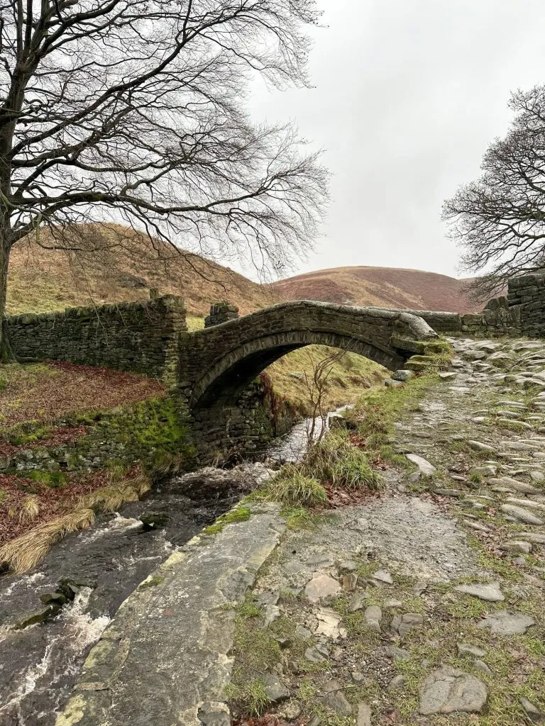
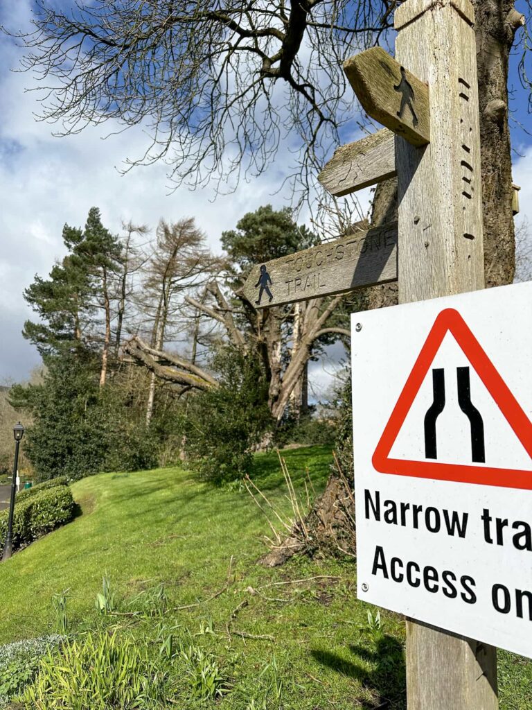
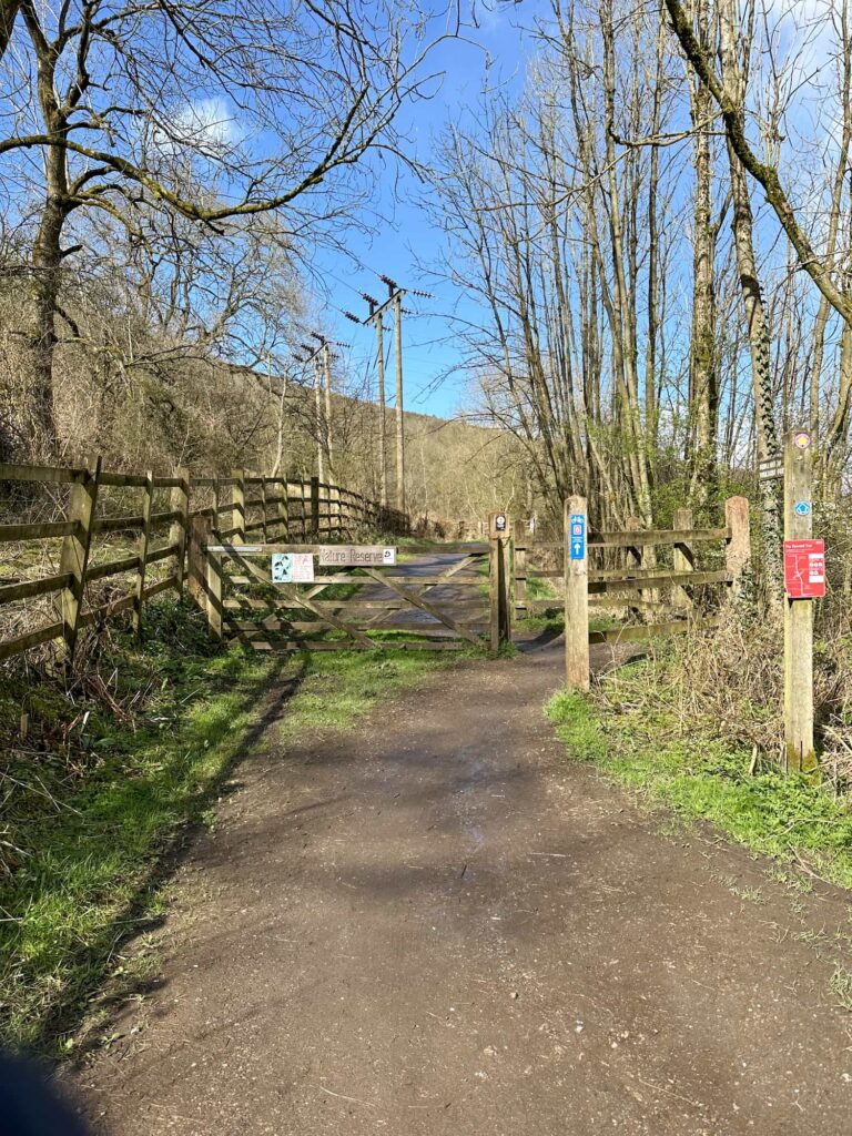
The footpath heads south over the fields and behind the houses on Ashopton Road, then along Greenhead Park to meet the main road in Bamford. We walked along the pavement a short distance and then walked down a track called The Hollows towards Bamford Mill. There are a few sign posts for the Touch Stone Trail. 


A wooden signpost with Touchstone Trail written on it


Bamford Mill

Bamford Mill was a water-powered cotton spinning mill built in the 1780s. The mill was destroyed by fire in October 1791 and rebuilt as a 13-bay mill. The mill complex expanded as the cotton industry boomed, becoming industrialised with the addition of a 60 horse power steam engine by 1857 and modern steam engine machinery installed in 1907. The mill remained in use as a textile mill until 1965 when it was used for the manufacture of electric furnaces. The site closed at the end of the 20th Century and the mill was converted into residential use but still retains the engine house, horizontal engine, rope race and drives. The boiler house and chimney were demolished and the engine can no longer be operated under steam. 


Bamford Mill and stepping stones

Bamford Mill stepping stones

A Touch Stone on the Touch Stone Trail


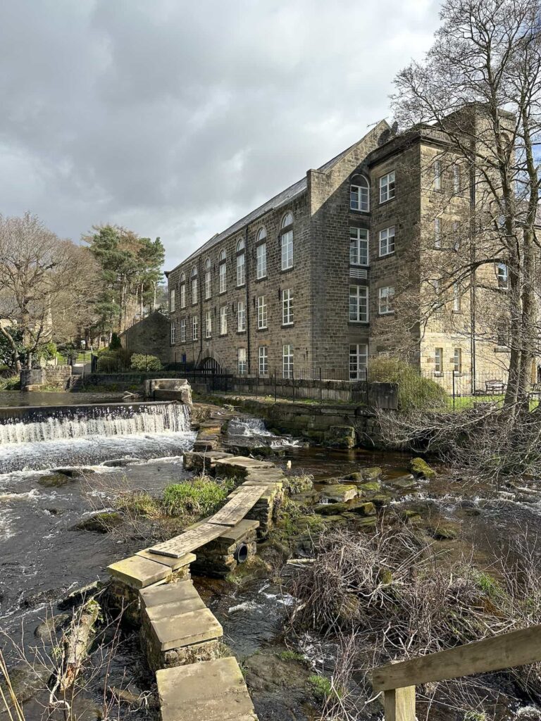
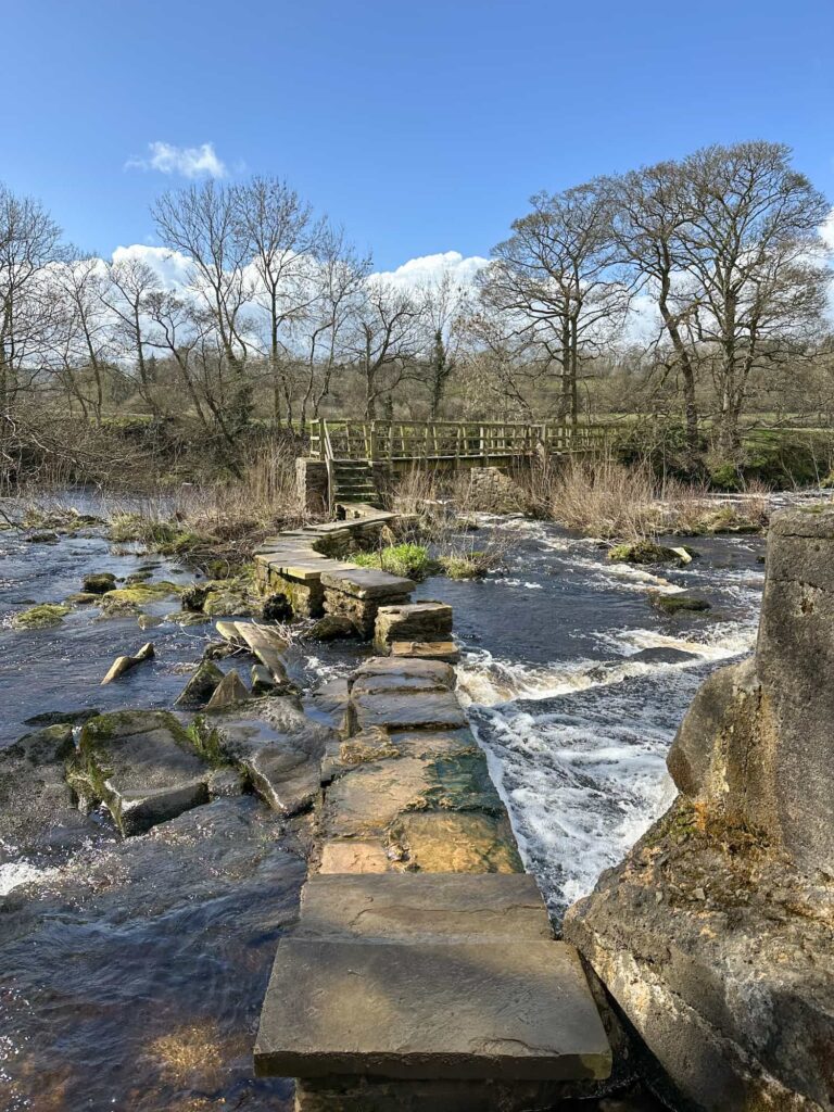
We crossed the weir over the River Derwent, built to provide water power to the mill, using the stepping stones (which are a bit dodgy in one spot so extra care is needed!) and headed over the fields to Thornhill Carr. The footpath leads onto the Thornhill Trail which is a traffic-free trail running along a disused railway line between Ladybower Dam and Bamford station. This railway line was used to bring in stone for the construction of the Derwent Dams from Bolehill Quarry. 

A Touch Stone on the Touch Stone Trail

A wooden gate leading to the Thornhill Carrs Trail

Thornhill Carrs Sculpture Trail


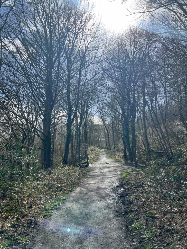
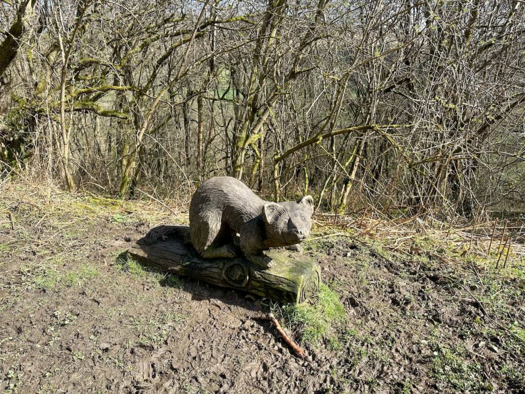
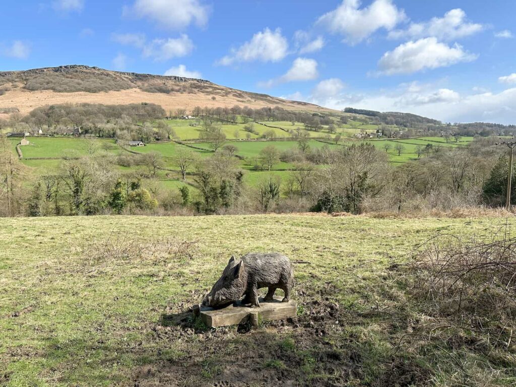
We followed this trail for about 1.5 miles, passing the sculptures of the Touch Stone Trail and the Thornhill Carrs Sculpture Trail, which is another sculpture trail highlighting some creatures which are “missing” from the area due to habitat loss or persecution including pine marten, red squirrel, wild boar and osprey. 


A wooden sculpture of a pine marten

A wooden sculpture of a wild boar with Bamford Edge in the background


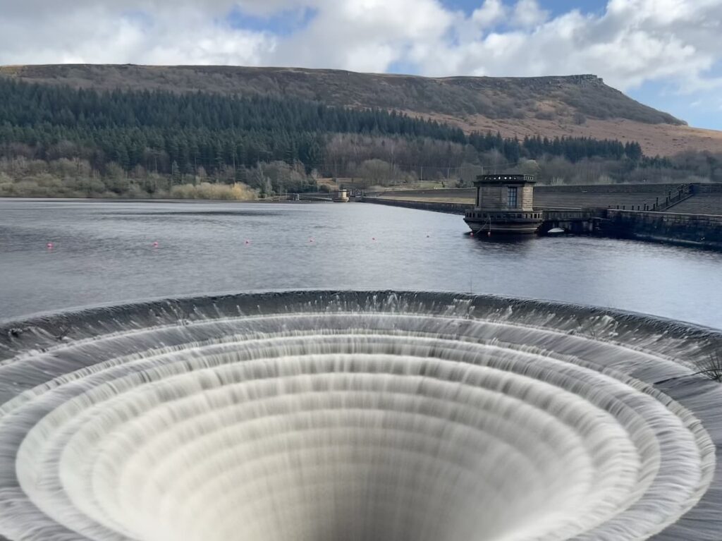
The trail leads to the dam at Ladybower Reservoir where the two giant “plugholes” are, and we were lucky that they were overflowing. It’s quite mesmerising to watch! We then followed the path over the dam wall and crossed the road, heading back up to Heatherdene via the monument to those who built the reservoirs and dams. 


Ladybower Reservoir plugholes in full flow

Ladybower Reservoir plugholes in full flow

Ladybower Reservoir plugholes in full flow, with Bamford Edge in the background


This is a great Bamford Edge walk for older kids who can manage a steep climb, and for younger kids you could reverse the route and just head along the Thornhill Carrs Sculpture Trail. There is the Yorkshire Bridge Inn nearby for some pub grub too, and a short drive away is the Fairholmes Visitor Centre with cafe kiosk for a snack or quick lunch. 


Bamford Edge Walk Details:


Walk Route in OS Maps: Bamford Edge, Bamford Mill and Sculpture Trail Walk

Parking: Heatherdene Car Park, off A6013, Hope Valley S33 0BY. W3W:// rhino.napped.shack

Facilities: Public toilets at Heatherdene Car Park

Walk Time: 3-4 hours

Difficulty: ▲▲

Distance: 6.3 miles (10.2km)

Elevation: 1,350ft (350m)

Trig Points Bagged: None

Peak District Peaks Bagged: None

Peak District Ethels Bagged: None


For more walks nearby you might like:

Scenic Bamford Edge and Stanage Edge

Crook Hill and Win Hill Walk via Ladybower Reservoir

Ladybower Reservoir Walk With Win Hill

Tap to share with your hiking friends!

  • Facebook
  • Email
  • WhatsApp
« Edale to Kinder Scout and Mam Tor | 12 Miles
Edale to the Dragon Rapide on Kinder Scout | 7.5 Miles »

RELATED POSTS

  • Hathersage Stepping StonesHathersage Stepping Stones Walk | 7 Miles
  • Ladybower ReservoirLadybower Walk | 6 Miles
  • Anvil Stone, GrindsbrookGrindsbrook Clough Scramble to Grindslow Knoll | 7 Miles
  • Peak District Waterfalls at Torside Clough - The Wandering WildflowerTorside Clough Scramble | 6 Miles

Leave a Reply Cancel reply

Your email address will not be published. Required fields are marked *

FIND YOUR NEXT WALK:

ABOUT ME

Y Garn with Kids - Y Garn via the Devil's Kitchen Walk in Ogwen Valley

Hello! I’m Jo! Welcome to The Wandering Wildflower, an outdoors lifestyle blog focusing on family walks in the Peak District, a place we love exploring. I want to share the Peak District hidden gems and show you there’s so much more than the honeypot places. When I’m not dragging my husband and now 11 year old out on Peak District walks or up mountains, I can be found on planning my next moorland walk or plotting a Geocache walk (and seeing where the nearest pub is!). I love the hills but hate the heights, so trig bagging is – er- fun!


I hope this blog will give you some ideas of places to visit in the Peak District and inspire you and your family to head into the great outdoors.  Thanks for stopping by!

CATEGORIES

  • CIRCULAR WALKS (189)
  • HOLMFIRTH WALKS (27)
  • ISLE OF SKYE WALKS (3)
  • LAKE DISTRICT WALKS (26)
  • LANCASHIRE WALKS (2)
  • LONG PEAK DISTRICT WALKS 10 MILES + (42)
  • MEDIUM WALKS 4-9 MILES (137)
  • PEAK DISTRICT SCRAMBLES (16)
  • PEAK DISTRICT WALKS (206)
  • PEAK DISTRICT WALKS WITH KIDS (76)
  • PEAK DISTRICT WALKS WITH PUBS (60)
  • SCOTLAND WALKS (6)
  • SHORT WALKS UNDER 3 MILES (40)
  • SNOWDONIA WALKS (5)
  • UK CAMPING (5)
  • YORKSHIRE WALKS (33)

Peak District Walks

List of Peak District Ethels

Peak District Peak Bagging

Peak District Trig Point Challenge

Peak District Walks with Pubs

Peak District Walks with Kids

Beautiful Walks in Holmfirth

Short Walks in the Peak District

Long Walks in the Peak District

AFFILIATE DISCLOSURE

This blog may contain affiliate links through which, at no additional cost to you, I may earn a small commission. I only recommend products I would use myself and all opinions expressed here are my own. As an Amazon Associate I earn from qualifying purchases. Read full privacy policy here.

ARCHIVES

PEAK DISTRICT WEATHER

Peak District mountain weather on Met Office

Peak District Trig Points

Promo image for a blog post about the Peak District Trig Point Challenge With Map of Peak District Trig Points and Walking Routes by The Wandering Wildflower

Peak District Ethels Challenge

Promo image for a blog post about the Peak District Trig Point Challenge With Map of Peak District Ethels and Walking Routes by The Wandering Wildflower

WALKING ROUTES STRAIGHT TO YOUR INBOX

Want new walks in your inbox? Drop your email below and I'll send you some ideas for walks you can try.

You can unsubscribe anytime. For more details, review our Privacy Policy.

Thank you!

You have successfully joined our subscriber list.

RSS LATEST POSTS

  • How to Find Three Shires Head
  • Peak District Pub Walks
  • Burnbank Fell, Blake Fell and Gavel Fell | 8 Miles
  • Bretton Park Circular Walk | 3 Miles
  • Grasmere Weekend Break

FOLLOW ON PINTEREST

Want new walks in your inbox? Drop your email below and I'll send you some ideas for walks you can try.

You can unsubscribe anytime. For more details, review our Privacy Policy.

Thank you!

You have successfully joined our subscriber list.

jo@thewanderingwildflower.co.uk

The Wandering Wildflower

  • Email
  • Facebook
  • Instagram
  • Pinterest
  • PRIVACY POLICY
  • TERMS & CONDITIONS
  • ABOUT

(c) The Wandering Wildflower. All Rights Reserved.

|| THEME BY ECLAIR DESIGNS