Alport Moor and Bleaklow Walking Route | 9 Miles
This Alport Moor and Bleaklow walk starts from Snake Pass and takes you through some of the bleakest Peak District moorland. You’ll pass the Bleaklow Stones, Hern Stones and can add in a quick detour to the Higher Shelf Stones and the B29 Over Exposed plane crash site if you want to.

This is a challenging walk to navigate and should only be attempted if you are confident navigating. The weather can change quickly, and it’s not called Bleaklow for nothing! There have been numerous call outs to Mountain Rescue teams to help people who have gone out ill prepared onto the moors, so please don’t put yourself at risk. This is not a walk to try in flip flops or trainers – have waterproof boots, layers and some means of navigation.
As part of the Peak District Ethels Challenge we had planned to walk to Alport Moor when we walked to Alport Castles from Fairholmes. On the way we walked as far as the Westend Moor trig point and mistakenly thought that was the summit of the Ethel too, and only realised it wasn’t when we were on our way back from the trig point. We decided to go another day, and that day was a school day (giving us a limited time) and the day we set off driving up to Glasgow for our Isle of Skye trip. The timing probably wasn’t the best but the weather was dry and clear so Joel and I packed our bags and headed out onto the moors!

We parked in the lay-by at Snake Pass and followed the Pennine Way for 1.6 miles. We came to Hern Clough and followed the faint path along the hillside to where it joins the River Alport, a place (rather alarmingly) called The Swamp. It turns out The Swamp wasn’t as swampy when we visited, thankfully!

We crossed the river and followed the faint path, rising gradually up the hillside but following the path of the river for around 0.45 miles. Here we left the path just near some larger rocks and yomped across the moors up to the summit of Alport Moor.

Alport Moor is an especially bleak, featureless summit in the Peak District! It’s 535m above sea level and there are some fabulous views up to Bleaklow Stones, but there is nothing to mark the summit and even on a dry day it was very wet and boggy. You’ll have to use your GPS device to find the actual summit if you want to bag this Ethel, or you could look for a single stone approximately 30cm x 20cm. Not much to go on, I know!
We headed back along The Ridge towards the fence, climbed the stile then set off up the hill to Bleaklow Stones. These are a fabulous place to explore and have a picnic! Look out for the Anvil Stone. Near Bleaklow Stones there is the site where a Defiant N3378 crashed in 1941. We visited on our Middle Black Clough Waterfall and Bleaklow Stones hike.

From Bleaklow Stones we followed a line of stakes through the peat groughs to Bleaklow Hill, then in turn Bleaklow Head. I attempted a handstand at the pole but I’m not as athletic as I used to be so this was a massive fail.
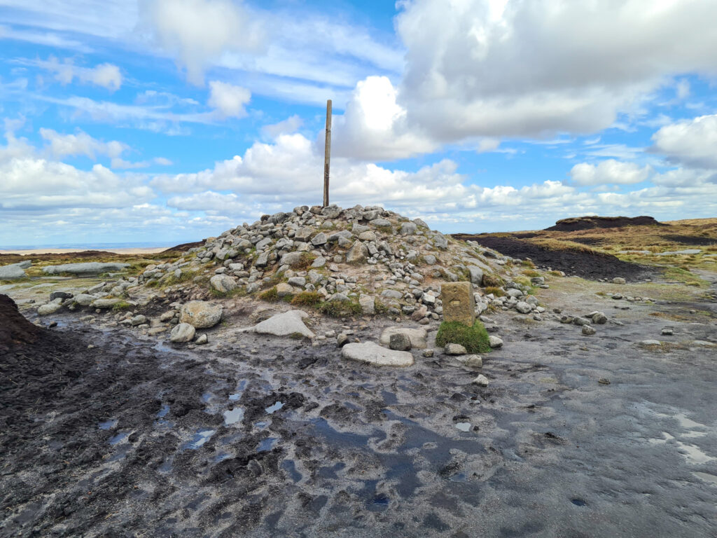
From Bleaklow Head we went to the Hern Stones, where there were some locals spying on us, and then followed the Pennine Way back to the car parked at Snake Pass.

When you get to the point where we set off to the east following Hern Clough you could head west to Higher Shelf Stones and the B29 Over Exposed plane crash site as per this Bleaklow and Higher Shelf Stones circular walk we did. It’s about 1km away as the crow flies, but again it’s only one to attempt if you are confident navigating over bleak, featureless, boggy wet moorland as the paths are very faint (if at all in places) and the weather can change rapidly on the moors.
On our walk we saw a family who were on their way to the plane crash site and were lost, having set out with no map and no idea of where they were going. Please don’t be like them! We helped them get back onto the Pennine Way and find their way back to the car parking spot.
This is my favourite kind of walk, as we barely saw any other people. We saw more hares than people, as we saw 4 of them running about on Alport Moor with their white winter coats on.
Alport Moor and Bleaklow Head Walk:
Alport Moor and Bleaklow Walk Route Map:

Route Map (Opens in OS Maps): Alport Moor and Bleaklow Head Walk Route
Parking: in the lay-by on Snake Pass A57 W3W: starters.spilling.pythons
Facilities: None
Walk Time: 3-4 hours
Difficulty: ▲▲▲
Distance: 9 miles (14.5 km)
Trig Points Bagged: None (short detour to Higher Shelf Stones possible)
Peak District Peaks Bagged: Alport Moor, Bleaklow Head
Peak District Ethels Bagged: Alport Moor, Bleaklow Head (short detour to Higher Shelf Stones possible)


Hello Jo
Thank you for putting together this wonderful walking resource, it is always a delight to learn how you go about planning and doing a walk. I am a keen Ethel-bagger (69 out of 95 done so far), so a good friend, Roz and I planned a walk taking in Featherbed Top, and Alport Moor from the Pennine Way / Snake Rd lay-by last Friday. We had prepared things as best we could by planning the route on an OS map, and also being reasonably familiar with that section of the Pennine Way already. We walked to Featherbed Top first as the weather conditions were poor. All good so far. Next was Alport Moor which I wasn’t confident in achieving, but if nothing else the walk would teach me about the terrain and conditions in that area. Following Hern Clough eastwards, across the Swamp, and the narrow footpath from Grains in the Water to around about SK 113 944, we just couldn’t see a natural way to traverse the dense heather and thick covering of ferns. With afternoon setting in, and both of us tired we called it a day. I had recorded the walk on All Trails, and I was keen to compare our experience with the walk you had recorded, so I could see where you left the narrow path. I downloaded your GPX file of the walk for https://thewanderingwildflower.co.uk/alport-moor-and-bleaklow-walking-route/ only to find it is the Fairholmes version of the walk…
Could you amend the link to point to the right GPX file, or attach it if you respond by email please?
Many thanks Jo, and keep up the great work
Hi Mark, thank you for your email 🙂 and congratulations on 69/95!
I’ve double checked the OS link in my post and it opens as the correct route.
Yes, the route does involve some off path yomping through the heather and it can be quite tough going at times! We left the path by a small rocky outcrop at roughly SK 11087 94553 which seemed the only landmark in an otherwise featureless section. Alport Moor has to be one of the hardest to visit as it’s so far from anywhere and the terrain is awful, especially in winter.
I hope you manage to tick this one off soon 🙂
Best wishes
Jo