• 3 Mile Walks or Less
  • 4 Mile Walks
  • 5 Mile Walks
  • 6 Mile Walks
  • 7 Mile Walks
  • 8 Mile Walks
  • 9 Mile Walks
  • 10 Mile Walks
  • 11 Mile Walks
  • 12 Mile Walks
  • 14 Mile Walks
  • 15 Mile Walks
  • 20+ Mile Walks

The Wandering Wildflower

Peak District Hikes

  • PEAK DISTRICT WALKS
    • SHORT WALKS UNDER 3 MILES
    • MEDIUM WALKS 4-9 MILES
    • LONG PEAK DISTRICT WALKS 10 MILES +
  • PEAK DISTRICT WALKS WITH PUBS
  • PEAK DISTRICT WALKS WITH KIDS
  • HOLMFIRTH WALKS

Grindslow Knoll and True Kinder Scout Summit | 7.5 Miles

May 8, 2022 CIRCULAR WALKS, MEDIUM WALKS 4-9 MILES, PEAK DISTRICT WALKS, PEAK DISTRICT WALKS WITH KIDS

Pinterest pin for Grindslow Knoll and Kinder Scout True Summit - The Wandering Wildflower

This 7.5 mile walk starts in Barber Booth and heads up Grindslow Knoll before exploring the Peak District’s highest mountain and the true Kinder Scout summit. With amazing rock formations and spectacular views, this is a classic Peak District walk.

Kinder Scout in the Autumn sunshine


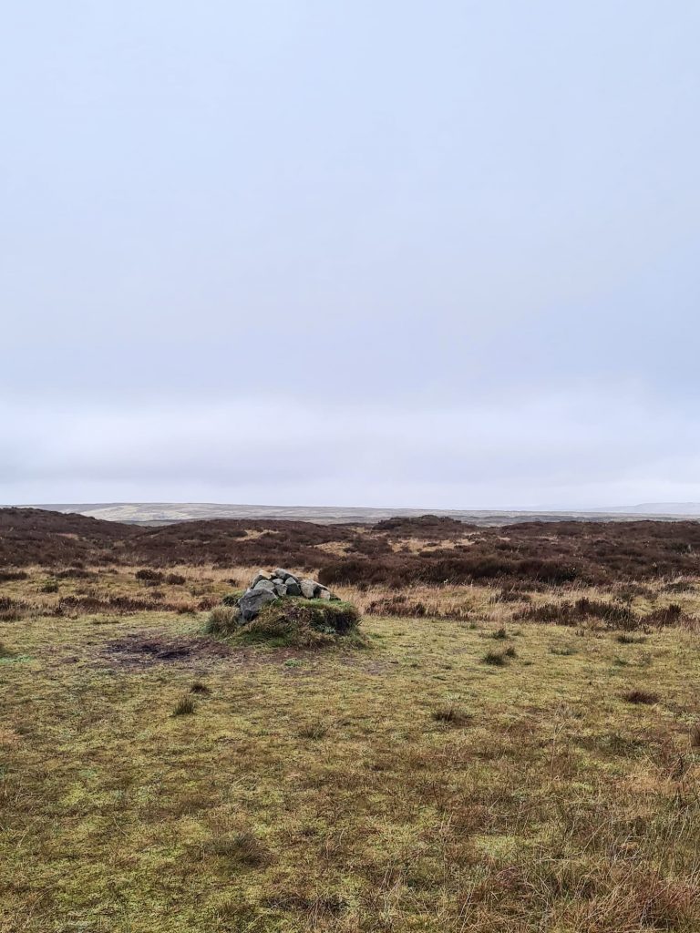
Kinder Scout is the highest mountain in the Peak District, with it’s recorded summit being at 636m above sea level. A lot of walkers use the Kinder Low trig point as the summit, as it’s only 3m below the summit level and the summit itself is located off the beaten path in the peat bogs.  In 2009 or 2010 a survey by The National Trust revealed there was a slightly higher point at 636.3m, making this the true Kinder Scout summit. It’s around 45m north-west from the previous summit and not marked on the OS map, however is marked on the ground by an underwhelming cairn on a tussock of grass. I can see why most people don’t bother heading here!


Our walk started in the free car park at Barber Booth and headed along the road towards Upper Booth. At the phone box we followed the Pennine Way through the campsite and to the base of Broadlee-Bank Tor. From here we headed off onto the Open Access Land to climb the very steep hillside to the summit of Grindslow Knoll.

A woman walking in a muddy puddle

A woman and her daughter walking up a very steep hill


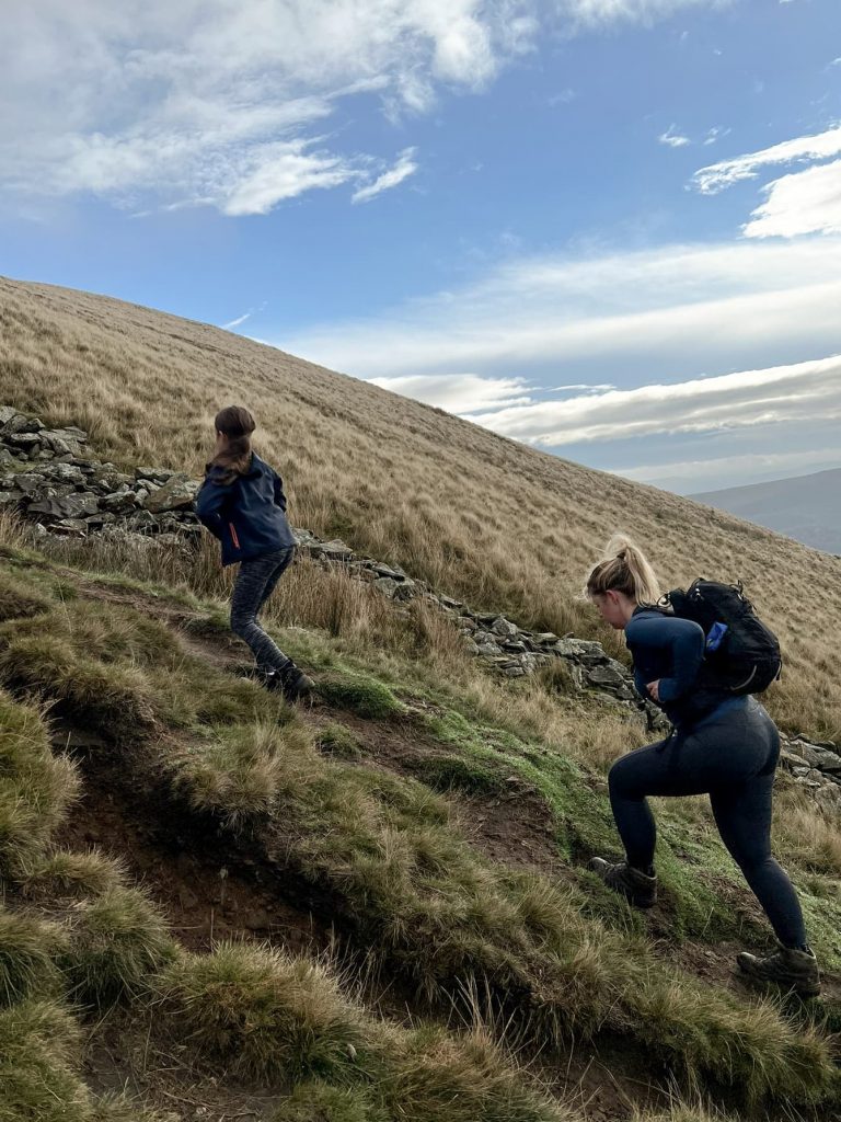
Though it’s very steep, it doesn’t take long and then that’s most of the climbing out of the way for this walk!

Grindslow Knoll in the mist

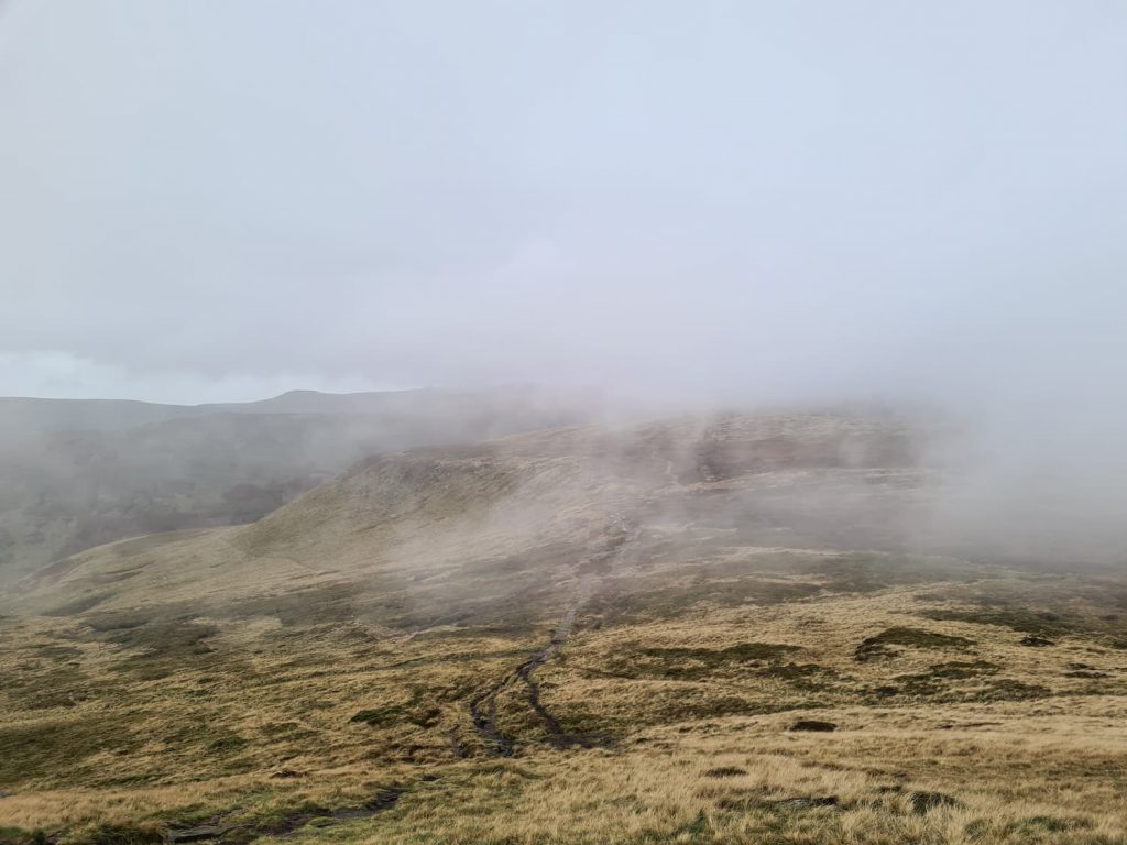
The summit of Grindslow Knoll at 601m above sea level is marked by a large cairn and there are spectacular views over the vale of Edale and towards The Great Ridge, Mam Tor and Lose Hill to the south-west. To the west, on a clear day, there are views over the Kinder Scout plateau towards Crowden Brook and the Woolpacks. We didn’t get a clear day – our views got worse and the walk got wetter as we got higher!

View from Grindslow Knoll over Edale

Mist on Kinder Scout


From Grindslow Knoll we followed the footpath heading north-east towards Crowden Tower. On a clear day the path is easy to follow and has  mixture of paved surface and rocky areas.


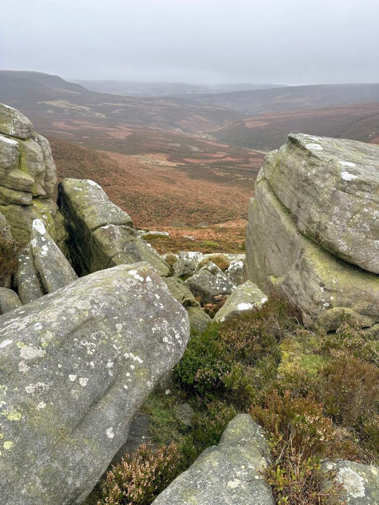
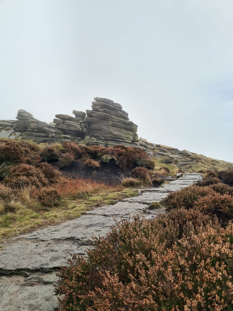
We passed the top of Crowden Clough, which is a fabulous way to scramble up onto Kinder Scout, then headed on towards Crowden Tower, a huge gritstone formation looming over Edale. The rock formations on Kinder Scout are some of my favourites!

Rock formations near Crowden Tower

Rock formations at Crowden Tower

Crowden Clough


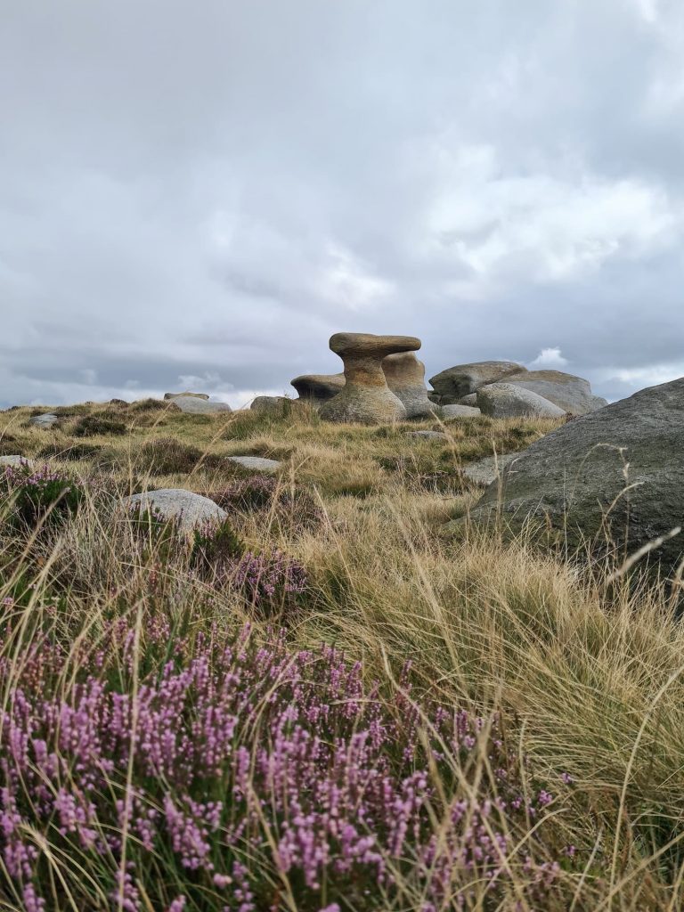
From Crowden Tower we continued along the path heading west to The Wool Packs, an other worldly collection of gritstone tors and boulders which are so-called because they’re said to resemble packs of wool on the horizon. They’re brilliant for adventurous kids to climb about and explore but it’s a VERY boggy and peaty area. When Joel and I did our Mini Edale Skyline walk we came this way and I dropped my phone in the peat! Yuck!

The Wool Packs on Kinder Scout

The Wool Packs rock formations on Kinder Scout

The Wool Packs rock formations on Kinder Scout

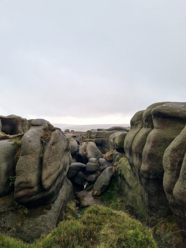
Once out the other side of The Wool Packs we headed along the northernmost path to Pym Chair. Again, this is a humongous gritstone tor which towers over the Kinder Plateau. From Pym Chair we headed off the path to look for the true Kinder Scout summit.

Pym Chair on Kinder Scout, a huge gritstone tor

There is a very faint path leading through the peat bogs and groughs but on a misty day it would be hard to find. This path winds it’s way to the summit in a generally north-west direction from Pym Chair, towards the point on the OS Maps marked with a 636 and a dot. The true summit of Kinder Scout lies some 45m to the north-west from this point and is marked by a small cairn on a grassy tussock. We couldn’t find anything at the 636 point apart from a single stone!

Screenshot from the OS App showing the summit of Kinder Scout

Screenshot from the OS App showing the summit of Kinder Scout

Boggy path leading to the summit of Kinder Scout

Kinder Scout true summit cairn

Once we’d been to the (frankly) underwhelming summit, we headed off south back to rejoin the path and follow it round by Noe Stool.

Noe Stool, a rock formation on Kinder Scout

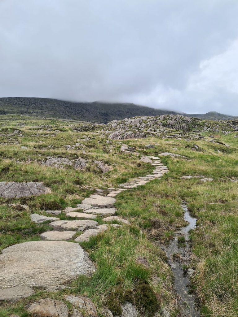
We picked up the Pennine Way near Swine’s Back then headed back down Jacob’s Ladder, the most popular way to walk up Kinder Scout. It did feel lovely coming DOWN it, rather than climbing UP, as it’s really tough going!

Jacob's Ladder, a steep path from Edale to Kinder Scout

A woman walking over an old packhorse bridge on Jacob's Ladder

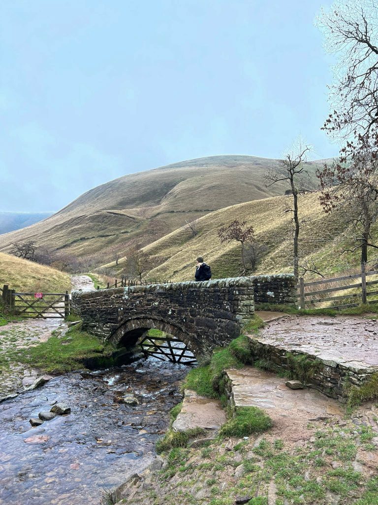
At the cairn we took the left hand path to continue down Jacob’s Ladder. This takes you down through farmland and following the road takes us back to the phone box at the campsite, where we retraced our steps back to the car.


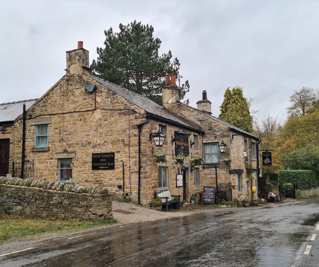
We jumped in the car and drove a short distance for some Sunday lunch at The Cheshire Cheese Inn in Edale.

The Cheshire Cheese pub in Edale

This blog may contain affiliate links through which, at no additional cost to you, I may earn a small commission. I only recommend products I would use myself and all opinions expressed here are my own. As an Amazon Associate I earn from qualifying purchases. Read full privacy policy here.


This was a great walk, but as always on Kinder Scout the weather can change quickly. Our walk started out with clear blue skies, with no rain forecast, and ended up with me having two coats on and being very glad of my Sealskinz waterproof socks! If you try this walk please make sure you’re prepared – it’ll be a long time before Mountain Rescue can reach you if you need help.

Peat bogs on Kinder Scout

Is Kinder Scout a difficult walk?

This would be regarded as a strenuous walk, being moderately challenging. The navigation makes it extra difficult as there are a few off path sections which can make it easy to get lost if you’re not sure where you’re going. The Kinder plateau is quite featureless in places and the terrain undulates, making visibility difficult at times.


Grindslow Knoll to Kinder Scout summit walk

Parking: Barber Booth, Edale Rd High Peak S33 7ZL. W3W:// version.plod.secures Pay and Display: £4.75 for the day

Facilities: None

Walk Time: 3-4 hours

Difficulty: ▲▲▲

Distance: 7.5 miles (12.1km)

Trig Points Bagged: None

Peak District Peaks Bagged: Kinder Scout

Peak District Ethels Bagged: Grindslow Knoll, Kinder Scout

True Kinder Scout Summit Walk Map:

Click on the map to download the GPX file.


For more Kinder Scout walks, why not try:

Best Kinder Scout Walks

Hayfield to Kinder Scout Circular Walk

Red Brook Scramble to Kinder Scout

Crowden Clough to Kinder Scout Walk


Or some other Grindslow Knoll walks to try:

Edale to Grindslow Knoll Circular Walk

Edale to Ringing Roger Scramble


If you’re taking part in the Peak District Ethels Challenge, this is a great walk to tick off a couple of Ethels. You can find more Peak District Ethels Walks here.

Tap to share with your hiking friends!

  • Facebook
  • Email
  • WhatsApp
« Hiking The Quiraing and Meall Na Suiramach Trig Point | 5 Miles
Alport Moor and Bleaklow Walking Route | 9 Miles »

RELATED POSTS

  • Hathersage Stepping StonesHathersage Stepping Stones Walk | 7 Miles
  • Ladybower ReservoirLadybower Walk | 6 Miles
  • Anvil Stone, GrindsbrookGrindsbrook Clough Scramble to Grindslow Knoll | 7 Miles
  • A small cabin on the moors above BuxtonCorbar Hill, Black Edge and Combs Head Circular Walk | 7 Miles

Leave a Reply Cancel reply

Your email address will not be published. Required fields are marked *

FIND YOUR NEXT WALK:

ABOUT ME

Y Garn with Kids - Y Garn via the Devil's Kitchen Walk in Ogwen Valley

Hello! I’m Jo! Welcome to The Wandering Wildflower, an outdoors lifestyle blog focusing on family walks in the Peak District, a place we love exploring. I want to share the Peak District hidden gems and show you there’s so much more than the honeypot places. When I’m not dragging my husband and now 11 year old out on Peak District walks or up mountains, I can be found on planning my next moorland walk or plotting a Geocache walk (and seeing where the nearest pub is!). I love the hills but hate the heights, so trig bagging is – er- fun!


I hope this blog will give you some ideas of places to visit in the Peak District and inspire you and your family to head into the great outdoors.  Thanks for stopping by!

CATEGORIES

  • CIRCULAR WALKS (188)
  • HOLMFIRTH WALKS (27)
  • ISLE OF SKYE WALKS (3)
  • LAKE DISTRICT WALKS (24)
  • LANCASHIRE WALKS (2)
  • LONG PEAK DISTRICT WALKS 10 MILES + (42)
  • MEDIUM WALKS 4-9 MILES (136)
  • PEAK DISTRICT SCRAMBLES (16)
  • PEAK DISTRICT WALKS (202)
  • PEAK DISTRICT WALKS WITH KIDS (75)
  • PEAK DISTRICT WALKS WITH PUBS (60)
  • SCOTLAND WALKS (6)
  • SHORT WALKS UNDER 3 MILES (40)
  • SNOWDONIA WALKS (5)
  • UK CAMPING (5)
  • YORKSHIRE WALKS (33)

Peak District Walks

List of Peak District Ethels

Peak District Peak Bagging

Peak District Trig Point Challenge

Peak District Walks with Pubs

Peak District Walks with Kids

Beautiful Walks in Holmfirth

Short Walks in the Peak District

Long Walks in the Peak District

AFFILIATE DISCLOSURE

This blog may contain affiliate links through which, at no additional cost to you, I may earn a small commission. I only recommend products I would use myself and all opinions expressed here are my own. As an Amazon Associate I earn from qualifying purchases. Read full privacy policy here.

ARCHIVES

PEAK DISTRICT WEATHER

Peak District mountain weather on Met Office

Peak District Trig Points

Promo image for a blog post about the Peak District Trig Point Challenge With Map of Peak District Trig Points and Walking Routes by The Wandering Wildflower

Peak District Ethels Challenge

Promo image for a blog post about the Peak District Trig Point Challenge With Map of Peak District Ethels and Walking Routes by The Wandering Wildflower

WALKING ROUTES STRAIGHT TO YOUR INBOX

Want new walks in your inbox? Drop your email below and I'll send you some ideas for walks you can try.

You can unsubscribe anytime. For more details, review our Privacy Policy.

Thank you!

You have successfully joined our subscriber list.

RSS LATEST POSTS

  • Burnbank Fell, Blake Fell and Gavel Fell | 8 Miles
  • Bretton Park Circular Walk | 3 Miles
  • Hathersage Stepping Stones Walk | 7 Miles
  • Ladybower Walk | 6 Miles
  • Derbyshire Peak District Walks

FOLLOW ON PINTEREST

Want new walks in your inbox? Drop your email below and I'll send you some ideas for walks you can try.

You can unsubscribe anytime. For more details, review our Privacy Policy.

Thank you!

You have successfully joined our subscriber list.

jo@thewanderingwildflower.co.uk

The Wandering Wildflower

  • Email
  • Facebook
  • Instagram
  • Pinterest
  • PRIVACY POLICY
  • TERMS & CONDITIONS
  • ABOUT

(c) The Wandering Wildflower. All Rights Reserved.

|| THEME BY ECLAIR DESIGNS