• 3 Mile Walks or Less
  • 4 Mile Walks
  • 5 Mile Walks
  • 6 Mile Walks
  • 7 Mile Walks
  • 8 Mile Walks
  • 9 Mile Walks
  • 10 Mile Walks
  • 11 Mile Walks
  • 12 Mile Walks
  • 14 Mile Walks
  • 15 Mile Walks
  • 20+ Mile Walks

The Wandering Wildflower

Peak District Hikes

  • PEAK DISTRICT WALKS
    • SHORT WALKS UNDER 3 MILES
    • MEDIUM WALKS 4-9 MILES
    • LONG PEAK DISTRICT WALKS 10 MILES +
  • PEAK DISTRICT WALKS WITH PUBS
  • PEAK DISTRICT WALKS WITH KIDS
  • HOLMFIRTH WALKS

Crowden to Woodhead Tunnel Walk | 6 Miles

February 10, 2022 PEAK DISTRICT WALKS, SHORT WALKS UNDER 3 MILES

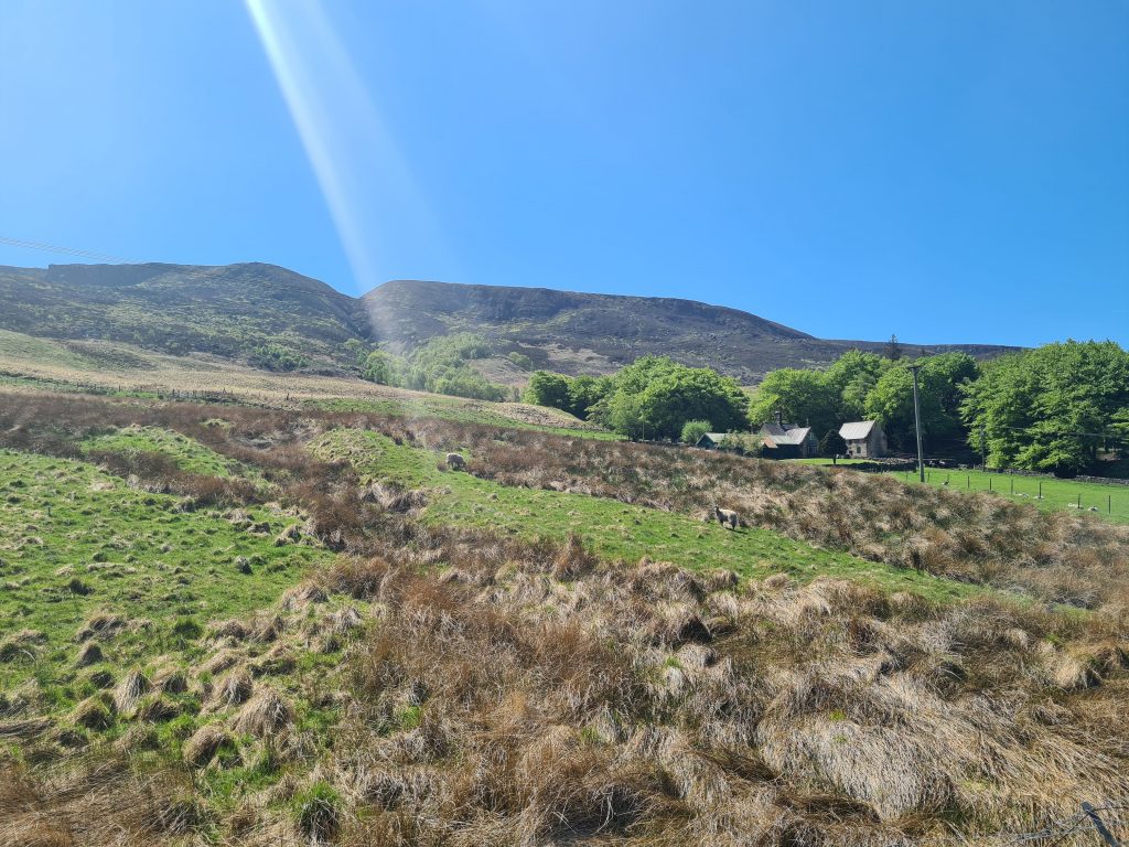
This easy 6 mile route from Crowden follows the Trans Pennine Trail through the Longdendale Valley to the former Woodhead tunnel and the abandoned Woodhead Station. This is a great walk with kids, as the route alongside the Woodhead Reservoir is pretty level all the way, and is great for railway enthusiasts too.

Railway cottages near the site of the former Crowden railway station, Torside Reservoir near Crowden

Railway cottages near the site of the former Crowden railway station

Woodhead Station was adjacent to the western side of the Woodhead Tunnel and was on the route from Sheffield to Manchester, originally opened in 1844 and closed in 1964. Little remains of the original station, which was originally had the appearance of a miniature castle, however part of the platform is still in place. You can see how the building would have looked on Disused Stations.


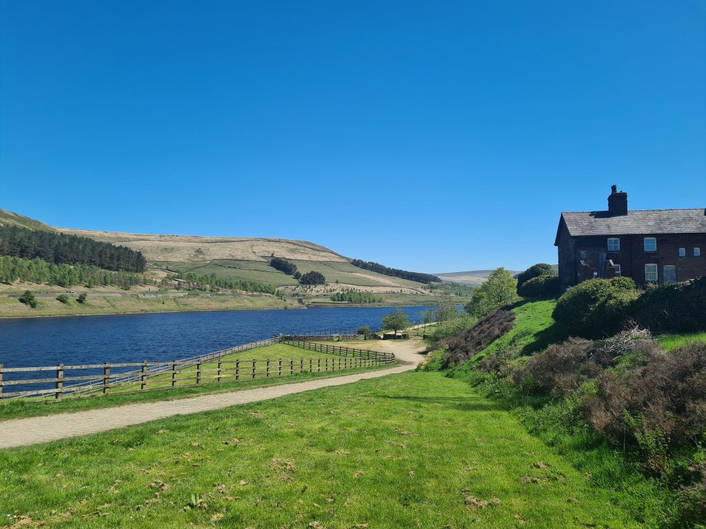
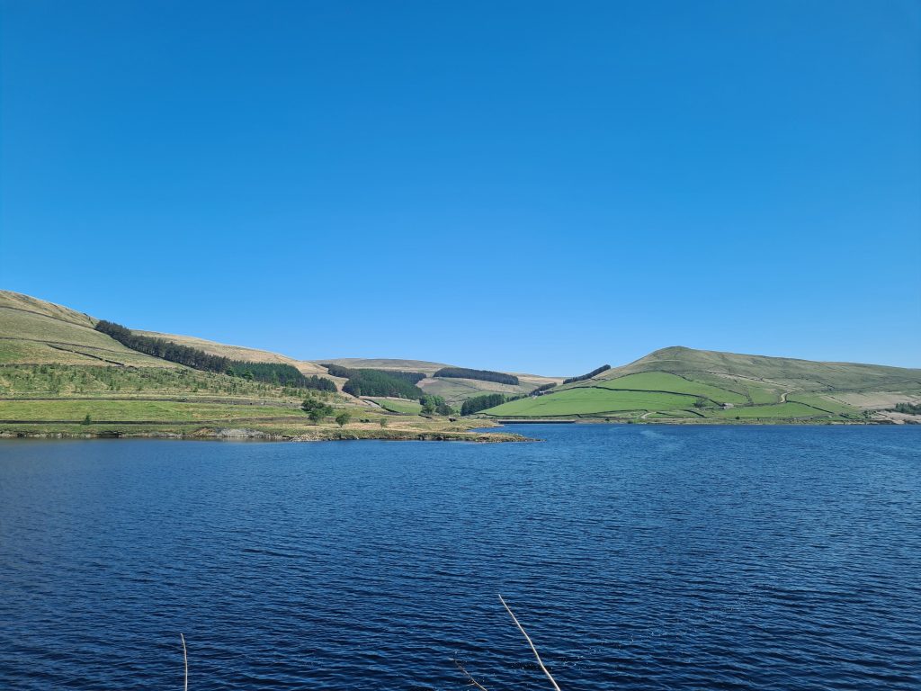
This easy walk takes you alongside Woodhead Reservoir in the Longdendale Valley. The paths are well marked and relatively level, following the route of the old railway line. This route is popular with walkers, horse riders and cyclists and makes for a lovely there-and-back walk from Crowden.

Trans Pennine Trail from Crowden to Woodhead Tunnels - a walk with kids on The Wandering Wildflower

Views of Woodhead Reservoir from the Trans Pennine Trail

Views of Woodhead Reservoir from the Trans Pennine Trail

Parking is in a lay-by just off Woodhead Road near the reservoir embankment. I couldn’t find a postcode for it but you can find it here. It’s near the red brick railway cottages, which are in turn near what was the former Crowden railway station. Hardly anything other than a wall remains of this station however, having closed in 1957.

Views of Woodhead Reservoir and Pikenaze Hill from the Trans Pennine Trail

The Trans Pennine Trail from Crowden to Woodhead Tunnels

Shining Clough Moss as seen from Woodhead Reservoir

Views of Shining Clough Moss from the Trans Pennine Trail


All that remains of the Woodhead station now is a platform and the tunnels are gated up with no access.

Former Woodhead Station and Woodhead Tunnels on the Trans Pennine Trail

Former Woodhead Station and Woodhead Tunnels on the Trans Pennine Trail

Former Woodhead Station and Woodhead Tunnels on the Trans Pennine Trail

There’s not really much to say about this part of the walk, as the paths are easy to follow and well laid out. The route only goes as far as the old Woodhead Tunnels, which are gated up and there is no access through them any more. To continue along the Trans Pennine Trail you need to head up onto the road.


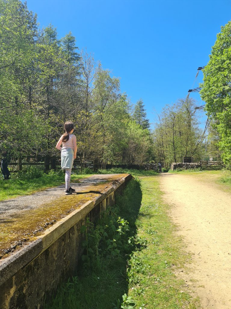
Despite this being an out-and-back walk, it’s still a lovely walk to do on a summers day. It’s a great place for kids to ride their bikes as it’s level and traffic free, and a lovely, easy walk with kids in the Peak District.


Route Map for Crowden to Woodhead Tunnel walk: Click the map to download the gpx file for your device.

Parking: Near the former Crowden Railway Station

Facilities: None.

Walk Time: 1-2 hours

Difficulty: ▲

Distance: 6 miles approximately


Click here for more walks from Crowden Camp Site and the surrounding area.

Tap to share with your hiking friends!

  • Facebook
  • Email
  • WhatsApp
« Shutlingsloe Circular Walk via Whetstone Ridge | 8 Miles
Waterfalls at Wessenden | 5 Miles »

RELATED POSTS

  • Hathersage Stepping StonesHathersage Stepping Stones Walk | 7 Miles
  • Ladybower ReservoirLadybower Walk | 6 Miles
  • Anvil Stone, GrindsbrookGrindsbrook Clough Scramble to Grindslow Knoll | 7 Miles
  • Sunset at High Tor in the Peak DistrictMatlock to Oker Hill and High Tor | 8 Miles

Leave a Reply Cancel reply

Your email address will not be published. Required fields are marked *

FIND YOUR NEXT WALK:

ABOUT ME

Y Garn with Kids - Y Garn via the Devil's Kitchen Walk in Ogwen Valley

Hello! I’m Jo! Welcome to The Wandering Wildflower, an outdoors lifestyle blog focusing on family walks in the Peak District, a place we love exploring. I want to share the Peak District hidden gems and show you there’s so much more than the honeypot places. When I’m not dragging my husband and now 11 year old out on Peak District walks or up mountains, I can be found on planning my next moorland walk or plotting a Geocache walk (and seeing where the nearest pub is!). I love the hills but hate the heights, so trig bagging is – er- fun!


I hope this blog will give you some ideas of places to visit in the Peak District and inspire you and your family to head into the great outdoors.  Thanks for stopping by!

CATEGORIES

  • CIRCULAR WALKS (189)
  • HOLMFIRTH WALKS (27)
  • ISLE OF SKYE WALKS (3)
  • LAKE DISTRICT WALKS (24)
  • LANCASHIRE WALKS (2)
  • LONG PEAK DISTRICT WALKS 10 MILES + (42)
  • MEDIUM WALKS 4-9 MILES (137)
  • PEAK DISTRICT SCRAMBLES (16)
  • PEAK DISTRICT WALKS (205)
  • PEAK DISTRICT WALKS WITH KIDS (76)
  • PEAK DISTRICT WALKS WITH PUBS (60)
  • SCOTLAND WALKS (6)
  • SHORT WALKS UNDER 3 MILES (40)
  • SNOWDONIA WALKS (5)
  • UK CAMPING (5)
  • YORKSHIRE WALKS (33)

Peak District Walks

List of Peak District Ethels

Peak District Peak Bagging

Peak District Trig Point Challenge

Peak District Walks with Pubs

Peak District Walks with Kids

Beautiful Walks in Holmfirth

Short Walks in the Peak District

Long Walks in the Peak District

AFFILIATE DISCLOSURE

This blog may contain affiliate links through which, at no additional cost to you, I may earn a small commission. I only recommend products I would use myself and all opinions expressed here are my own. As an Amazon Associate I earn from qualifying purchases. Read full privacy policy here.

ARCHIVES

PEAK DISTRICT WEATHER

Peak District mountain weather on Met Office

Peak District Trig Points

Promo image for a blog post about the Peak District Trig Point Challenge With Map of Peak District Trig Points and Walking Routes by The Wandering Wildflower

Peak District Ethels Challenge

Promo image for a blog post about the Peak District Trig Point Challenge With Map of Peak District Ethels and Walking Routes by The Wandering Wildflower

WALKING ROUTES STRAIGHT TO YOUR INBOX

Want new walks in your inbox? Drop your email below and I'll send you some ideas for walks you can try.

You can unsubscribe anytime. For more details, review our Privacy Policy.

Thank you!

You have successfully joined our subscriber list.

RSS LATEST POSTS

  • How to Find Three Shires Head
  • Burnbank Fell, Blake Fell and Gavel Fell | 8 Miles
  • Bretton Park Circular Walk | 3 Miles
  • Hathersage Stepping Stones Walk | 7 Miles
  • Peak District Caves

FOLLOW ON PINTEREST

Want new walks in your inbox? Drop your email below and I'll send you some ideas for walks you can try.

You can unsubscribe anytime. For more details, review our Privacy Policy.

Thank you!

You have successfully joined our subscriber list.

jo@thewanderingwildflower.co.uk

The Wandering Wildflower

  • Email
  • Facebook
  • Instagram
  • Pinterest
  • PRIVACY POLICY
  • TERMS & CONDITIONS
  • ABOUT

(c) The Wandering Wildflower. All Rights Reserved.

|| THEME BY ECLAIR DESIGNS