• 3 Mile Walks or Less
  • 4 Mile Walks
  • 5 Mile Walks
  • 6 Mile Walks
  • 7 Mile Walks
  • 8 Mile Walks
  • 9 Mile Walks
  • 10 Mile Walks
  • 11 Mile Walks
  • 12 Mile Walks
  • 14 Mile Walks
  • 15 Mile Walks
  • 20+ Mile Walks

The Wandering Wildflower

Peak District Hikes

  • PEAK DISTRICT WALKS
    • SHORT WALKS UNDER 3 MILES
    • MEDIUM WALKS 4-9 MILES
    • LONG PEAK DISTRICT WALKS 10 MILES +
  • PEAK DISTRICT WALKS WITH PUBS
  • PEAK DISTRICT WALKS WITH KIDS
  • HOLMFIRTH WALKS

Grindsbrook Clough Scramble to Grindslow Knoll | 7 Miles

March 18, 2025 CIRCULAR WALKS, MEDIUM WALKS 4-9 MILES, PEAK DISTRICT SCRAMBLES, PEAK DISTRICT WALKS, PEAK DISTRICT WALKS WITH PUBS

A classic Peak District scramble, with a twist! This Grindsbrook Clough scramble walk avoids the crowds before visiting Grindslow Knoll, then hiking along the tops to descend via Ringing Roger, and is 7 miles, perfect for a morning or afternoon out on the hills.

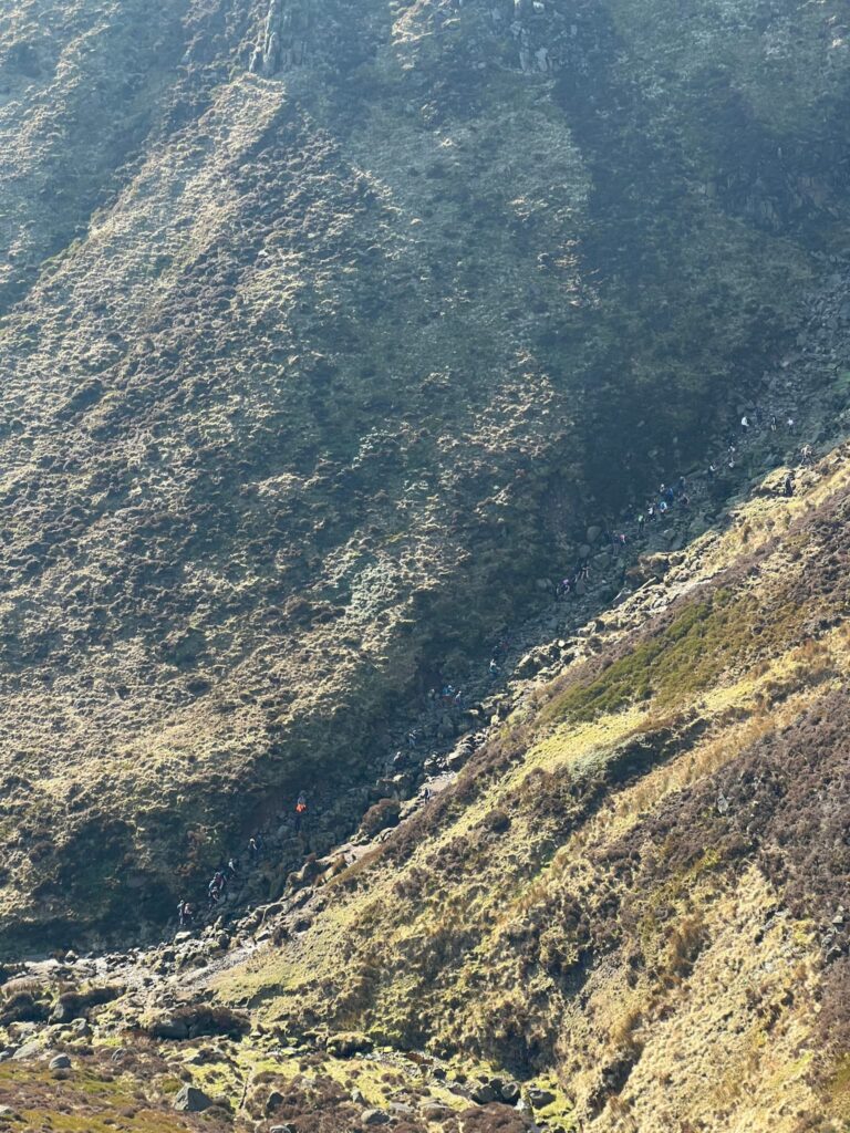
The Grindsbrook Clough scramble is a popular Grade 1 scramble. When I say popular, I mean it gets busy! It’s no wonder though – it’s a great way to get up onto the Kinder Scout plateau without having the long, arduous climb up Jacob’s Ladder, and is a beautiful route with waterfalls along the way.

Grindsbrook Clough Scramble

People climbing the more popular way up Grindsbrook.

Our walk starts from Edale. We had planned to park in the Edale car park but this was full, so we managed to get one of the last parking spaces in the overflow car park next to the railway station. If you want to park in Edale on a sunny dry day, you need to get there early!


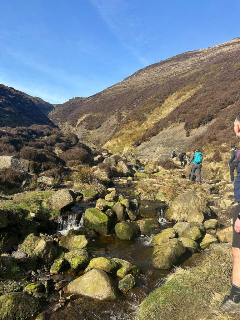
We walked along Station Approach, passing the Penny Pot Cafe on our left, and turned left to walk up into the village of Edale. Passing the Old Nags Head Inn (the official start of the Pennine Way) we continued up the track a short distance before forking to the right down to the bridge over Grindsbrook. Once over the bridge, we followed the stone slabs through the fields and woodland before reaching the Open Access Land beyond, crossing a pretty wooden bridge.

Wooden signpost with "Grindsbrook Kinder Scout" on

Stone flagged path through field

Path alongside Grindsbrook

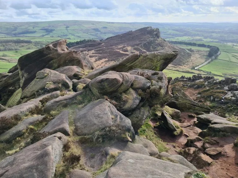
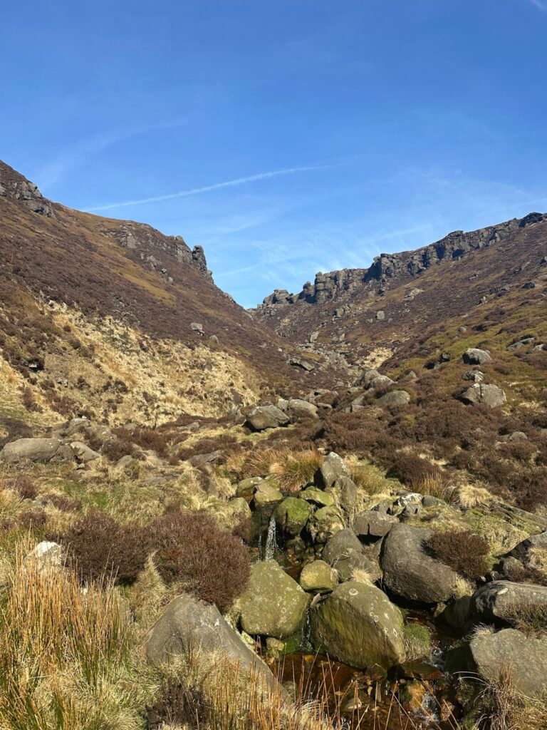
The path then winds it’s way up the valley, passing small waterfalls. It is very rocky in places, and gets rockier and steeper as it gets higher. There is a section with a shale banking – it’s best to cross the stream here and head up the left hand bank.

Grindsbrook

Grindsbrook Scramble

See the shale bank there where the blue rucksack lady is? It’s easier to get past if you cross using the stones in the foreground of this pic.

About one mile from the wooden bridge, there is an obvious fork in Grindsbrook Clough. Most people continue straight on to climb the left hand fork, but here we crossed Grindsbrook and headed for the right hand fork. The right hand fork is slightly more challenging than the left hand fork, but both are still hands on scrambles.

View up Grindsbrook

The view of the right hand fork from the split point.

Grindsbrook Scramble

Grindsbrook Scramble

Grindsbrook Scramble

View down Grindsbrook Scramble

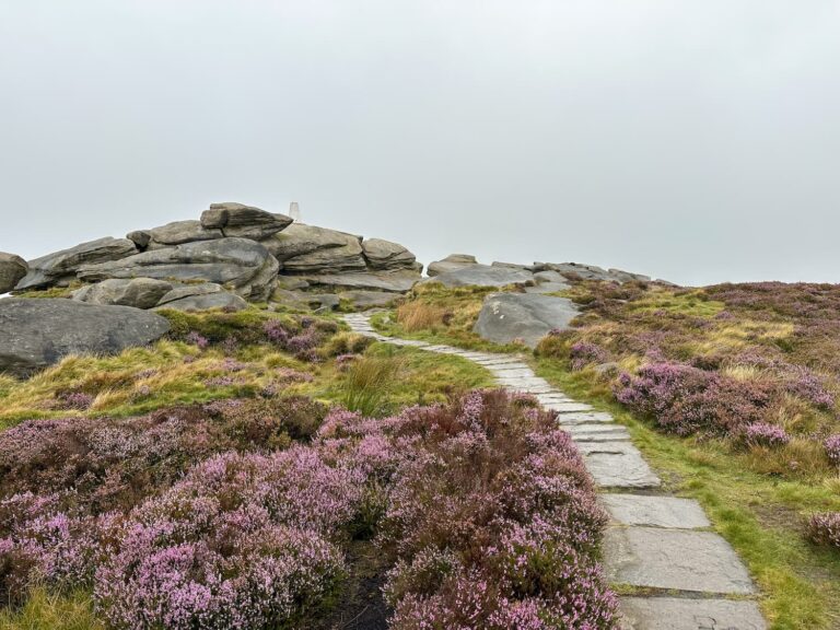
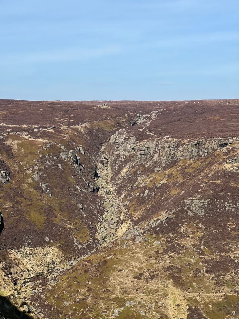
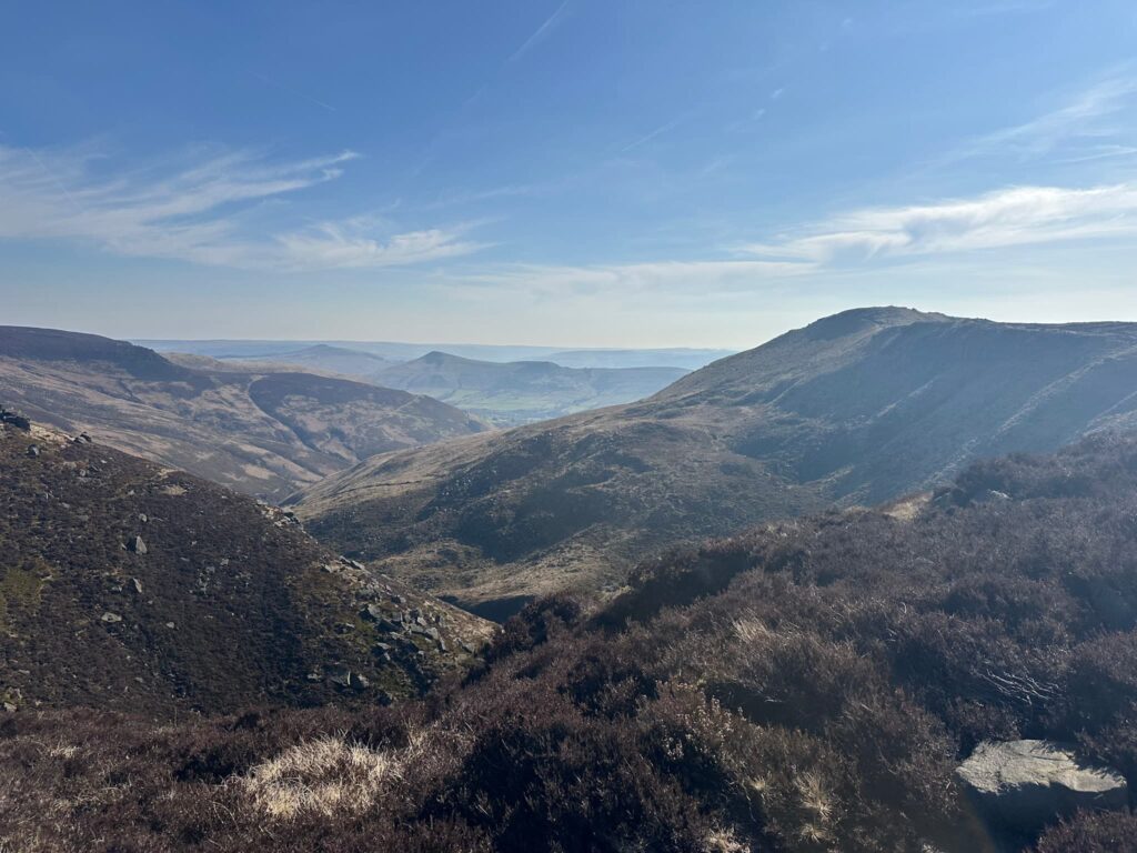
Once at the top of the Grindsbrook scramble we turned left and followed the path round to the top of Grindsbrook – it can get very busy here. We followed the stone slabs until they formed a junction, and we took the left hand path over to Grindslow Knoll. There is a short sharp climb up to the summit cairn, but the views from the top make it worthwhile.

Stone flagged path over Kinder Scout

Grindslow Knoll summit

View to Grindsbrook Scramble

The view of the scramble we climbed up, as seen from Grindslow Knoll

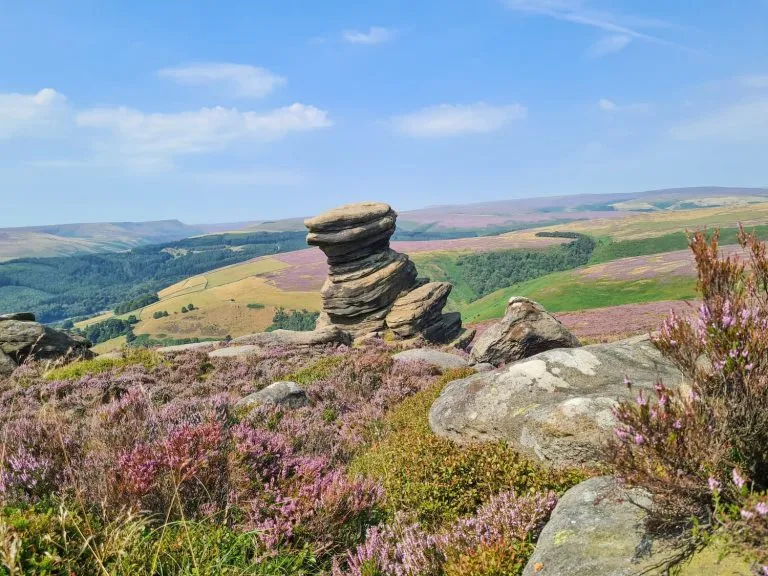
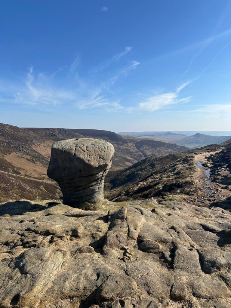
We bagged the summit and then picked up the path that runs back towards the top of Grindsbrook, following this path past the Anvil Stone, marked with the names of gamekeepers from days gone by. We skirted the top of the Grindsbrook scramble we’d just climbed up, and then followed the path round to Upper Tor and Nether Tor before descending down Ringing Roger, down the switchbacks, back into the fields we started the walk in. We then retraced our steps over the bridge and back into Edale, where we had a lovely lunch in the Old Nags Head Inn beer garden.

Anvil Stone, Grindsbrook

The Anvil Rock – graffiti carved by gamekeepers

View down Grindsbrook

Stunning views!

Rock formation at Upper Tor

View of Grindslow Knoll from Ringing Roger

Looking back up to Grindslow Knoll as we descend RInging Roger

This was a lovely hike, and it was lovely to get away from the crowds on Grindsbrook (even if for a short while).


Grindsbrook Scramble to Grindslow Knoll Details:


Walk Map (Opens in OS Maps): Grindsbrook Scramble to Grindslow Knoll

Parking: We parked in the overflow car park near Edale train station, Station Approach, Edale, Hope Valley S33 7ZA W3W:///scarecrow.careful.sushi – £5 for the day, car park locked at 6pm.

Dogs: Allowed on leads – the route passes farmland and enters the Kinder Scout Nature Reserve.

Facilities: Once you leave Edale there are none – remember to Leave No Trace and take all your rubbish (including dog poo) away with you.

Walk Time: 4-5 hours

Difficulty: ▲▲▲

Distance: 7 miles (11km)

Elevation: 1800ft (548m)

Trig Points Bagged: None

Peak District Peaks Bagged: Grindslow Knoll

Peak District Ethels Bagged: Grindslow Knoll


For more Kinder Scout scramble walks you might like:

Blackden Brook Scramble to Edale Moor Trig Point | 8 Miles

Fair Brook Scramble to Kinder Scout Northern Edges | 9 Miles

Red Brook Scramble to Kinder Scout | 10 Miles

Grindslow Knoll and True Kinder Scout Summit | 7.5 Miles

Edale to Grindslow Knoll Circular Walk | 4 Miles

Tap to share with your hiking friends!

  • Facebook
  • Email
  • WhatsApp
« Souther Fell, Mungrisdale Common, Bannerdale Crags and Bowscale Pike | 11 Miles
Three Monuments Circular Walk From Chatsworth | 7.5 Miles »

RELATED POSTS

  • Three Shires HeadHow to Find Three Shires Head
  • Hathersage Stepping StonesHathersage Stepping Stones Walk | 7 Miles
  • Ladybower ReservoirLadybower Walk | 6 Miles
  • Views from Back Tor over The Great Ridge to Mam Tor from a mini Edale Skyline circular walk from The Wandering WildflowerMini Edale Skyline Circular Walk | 17 Miles

Leave a Reply Cancel reply

Your email address will not be published. Required fields are marked *

FIND YOUR NEXT WALK:

ABOUT ME

Y Garn with Kids - Y Garn via the Devil's Kitchen Walk in Ogwen Valley

Hello! I’m Jo! Welcome to The Wandering Wildflower, an outdoors lifestyle blog focusing on family walks in the Peak District, a place we love exploring. I want to share the Peak District hidden gems and show you there’s so much more than the honeypot places. When I’m not dragging my husband and now 11 year old out on Peak District walks or up mountains, I can be found on planning my next moorland walk or plotting a Geocache walk (and seeing where the nearest pub is!). I love the hills but hate the heights, so trig bagging is – er- fun!


I hope this blog will give you some ideas of places to visit in the Peak District and inspire you and your family to head into the great outdoors.  Thanks for stopping by!

CATEGORIES

  • CIRCULAR WALKS (189)
  • HOLMFIRTH WALKS (27)
  • ISLE OF SKYE WALKS (3)
  • LAKE DISTRICT WALKS (26)
  • LANCASHIRE WALKS (2)
  • LONG PEAK DISTRICT WALKS 10 MILES + (42)
  • MEDIUM WALKS 4-9 MILES (137)
  • PEAK DISTRICT SCRAMBLES (16)
  • PEAK DISTRICT WALKS (206)
  • PEAK DISTRICT WALKS WITH KIDS (76)
  • PEAK DISTRICT WALKS WITH PUBS (60)
  • SCOTLAND WALKS (6)
  • SHORT WALKS UNDER 3 MILES (40)
  • SNOWDONIA WALKS (5)
  • UK CAMPING (5)
  • YORKSHIRE WALKS (33)

Peak District Walks

List of Peak District Ethels

Peak District Peak Bagging

Peak District Trig Point Challenge

Peak District Walks with Pubs

Peak District Walks with Kids

Beautiful Walks in Holmfirth

Short Walks in the Peak District

Long Walks in the Peak District

AFFILIATE DISCLOSURE

This blog may contain affiliate links through which, at no additional cost to you, I may earn a small commission. I only recommend products I would use myself and all opinions expressed here are my own. As an Amazon Associate I earn from qualifying purchases. Read full privacy policy here.

ARCHIVES

PEAK DISTRICT WEATHER

Peak District mountain weather on Met Office

Peak District Trig Points

Promo image for a blog post about the Peak District Trig Point Challenge With Map of Peak District Trig Points and Walking Routes by The Wandering Wildflower

Peak District Ethels Challenge

Promo image for a blog post about the Peak District Trig Point Challenge With Map of Peak District Ethels and Walking Routes by The Wandering Wildflower

WALKING ROUTES STRAIGHT TO YOUR INBOX

Want new walks in your inbox? Drop your email below and I'll send you some ideas for walks you can try.

You can unsubscribe anytime. For more details, review our Privacy Policy.

Thank you!

You have successfully joined our subscriber list.

RSS LATEST POSTS

  • How to Find Three Shires Head
  • Peak District Pub Walks
  • Burnbank Fell, Blake Fell and Gavel Fell | 8 Miles
  • Bretton Park Circular Walk | 3 Miles
  • Grasmere Weekend Break

FOLLOW ON PINTEREST

Want new walks in your inbox? Drop your email below and I'll send you some ideas for walks you can try.

You can unsubscribe anytime. For more details, review our Privacy Policy.

Thank you!

You have successfully joined our subscriber list.

jo@thewanderingwildflower.co.uk

The Wandering Wildflower

  • Email
  • Facebook
  • Instagram
  • Pinterest
  • PRIVACY POLICY
  • TERMS & CONDITIONS
  • ABOUT

(c) The Wandering Wildflower. All Rights Reserved.

|| THEME BY ECLAIR DESIGNS