• 3 Mile Walks or Less
  • 4 Mile Walks
  • 5 Mile Walks
  • 6 Mile Walks
  • 7 Mile Walks
  • 8 Mile Walks
  • 9 Mile Walks
  • 10 Mile Walks
  • 11 Mile Walks
  • 12 Mile Walks
  • 14 Mile Walks
  • 15 Mile Walks
  • 20+ Mile Walks

The Wandering Wildflower

Peak District Hikes

  • PEAK DISTRICT WALKS
    • SHORT WALKS UNDER 3 MILES
    • MEDIUM WALKS 4-9 MILES
    • LONG PEAK DISTRICT WALKS 10 MILES +
  • PEAK DISTRICT WALKS WITH PUBS
  • PEAK DISTRICT WALKS WITH KIDS
  • HOLMFIRTH WALKS

Ladybower Reservoir Walk With Win Hill | 8 Miles

January 1, 2023 CIRCULAR WALKS, MEDIUM WALKS 4-9 MILES, PEAK DISTRICT WALKS, PEAK DISTRICT WALKS WITH KIDS

Pinterest Image for Ladybower Reservoir Walk with Win Hill from The Wandering Wildflower - Peak District Walks

This Ladybower Reservoir walk is 7.8 miles long and explores the woodland surrounding the reservoir as well as Win Hill with it’s stunning far reaching views. Starting from Haggwater Bridge, this walk only has two steep climbs and is the gentle way to climb Win Hill.

A view over Ladybower Reservoir

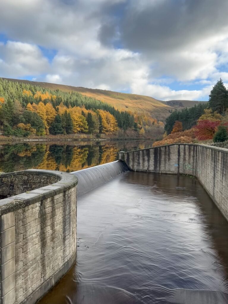
Ladybower Reservoir is a large reservoir in the Upper Derwent Valley surrounded by beautiful countryside with views of woodland and moorland. Ladybower Reservoir (together with Howden and Derwent Reservoirs) were built by flooding the villages of Derwent and Ashopton, known as the Lost Villages, with residents relocated to nearby Yorkshire Bridge. Completed in 1943, the reservoir was opened by King George VI on 24 September 1945.  There are many walks around Ladybower and the surrounding area. This Ladybower Reservoir walk takes in varied terrain, including woodland tracks, trails and moorland which can be muddy in winter.


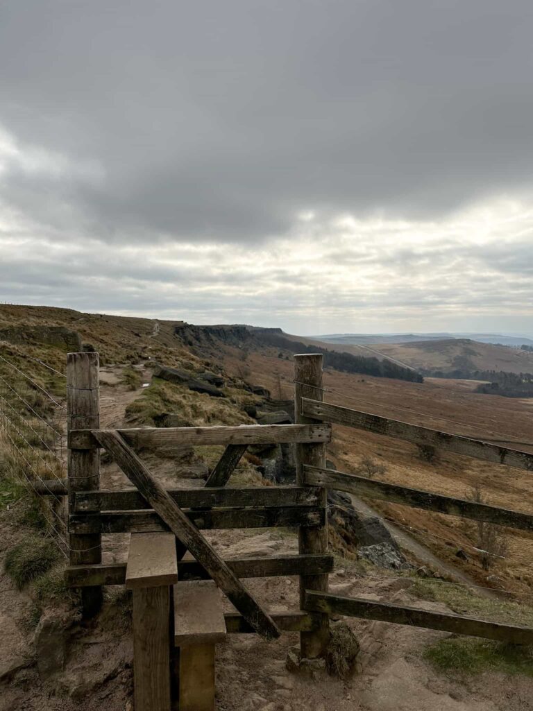
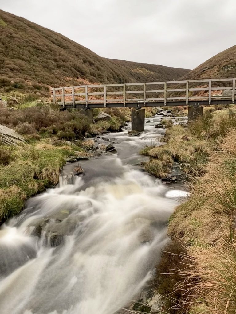
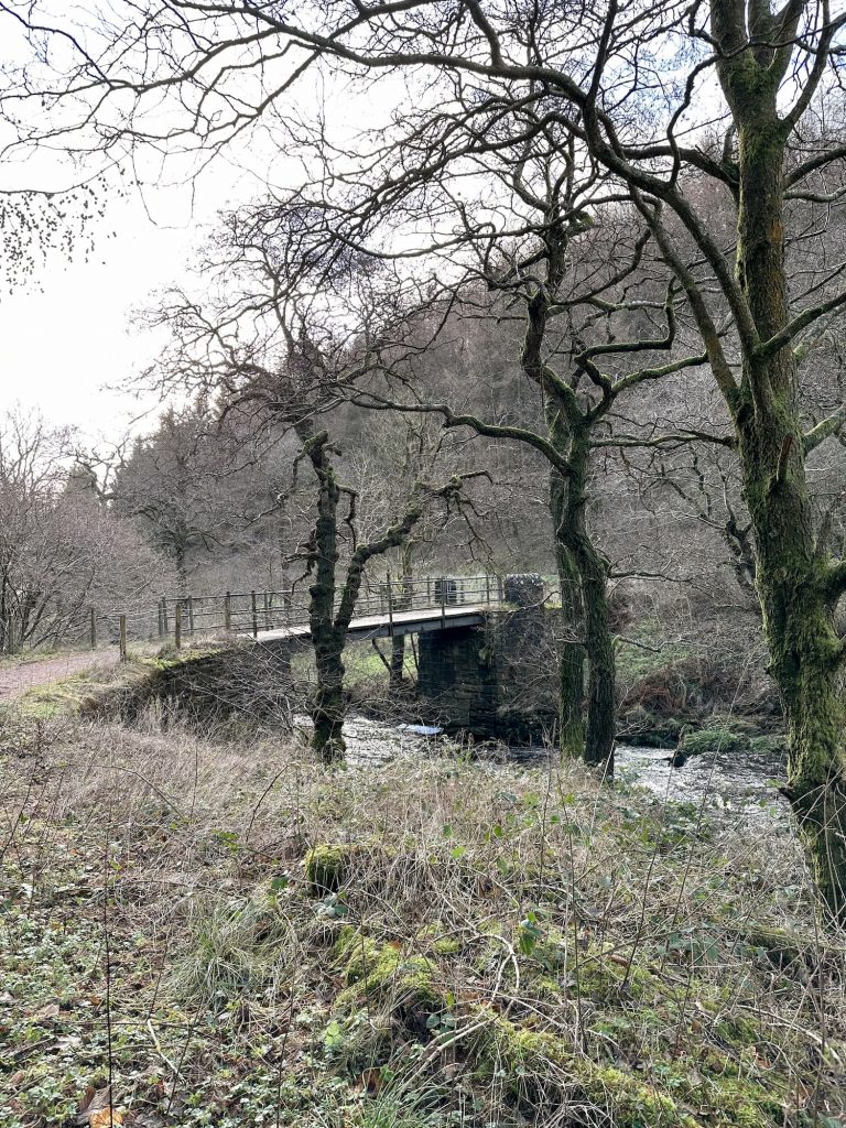
Our walk starts from a parking lay-by behind the bus stop on Snake Pass. This lay-by is free but is small, with space for about 10-12 cars. Walking a short distance on the road north-east, we took the track down the hill towards Haggwater Bridge. Crossing the bridge we followed the path adjacent to the River Ashop and then followed a track which zig zagged up the hill. At the stile, which has amazing views over to Mam Tor and The Great Ridge as well as Crookstone Knoll on Kinder Scout, we joined the course of the Roman Road to Hope Cross, a former waypost.

A woman and her daughter walking through the woods

Haggwater Bridge over the River Ashop

A small woodland waterfall

A rough stone track leading up through the woods

A view over to Mam Tor and The Great Ridge, Peak District

Hope Cross, a stone column

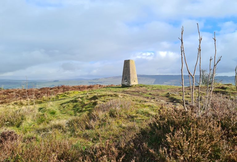
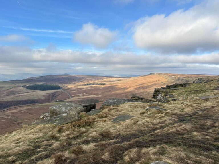
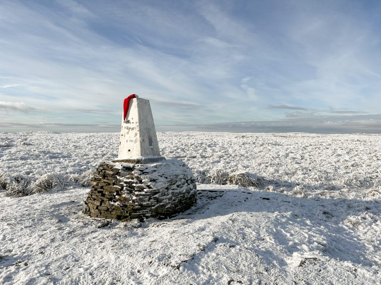
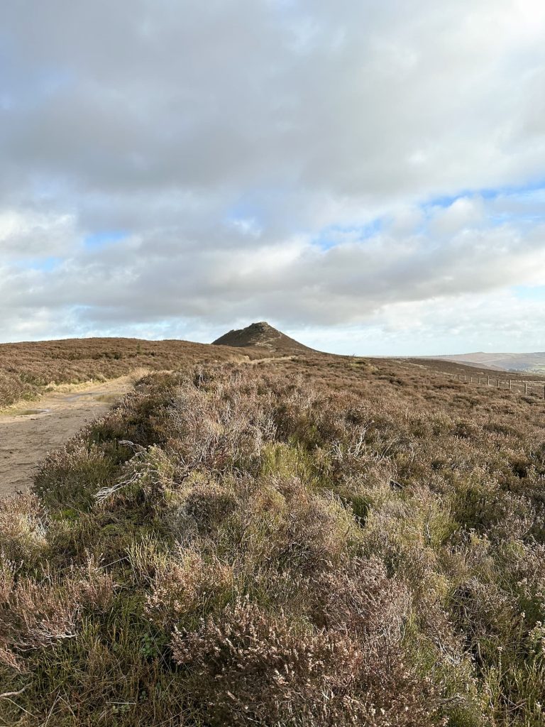
Following the course of the Roman Road, we then headed up Hope Brink and Thornhill Brink towards Win Hill and Win Hill Pike. The climb is very gentle and you hardly notice it in places! Win Hill stands at 462m above sea level and has spectacular views down over Ladybower Reservoir, Howden and Derwent Reservoirs and across to Crook Hill and Bamford Edge. This has to be one of the best views in the Peak District! Win Hill Pike is the nobbly, rocky ridge on the top of Win Hill, where the trig point has a gold heart painted on.

A view of Crookstone Knoll

The path leading up to Win Hill

Win Hill trig point

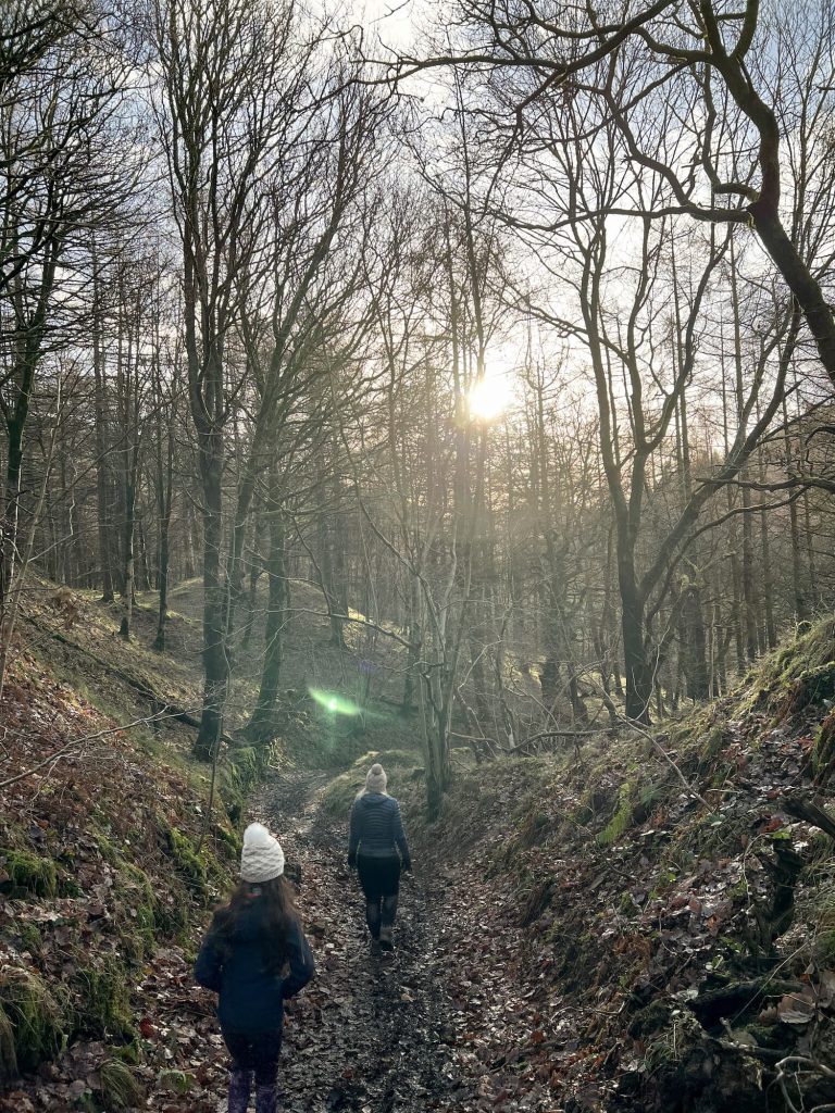
We carried on over the top of Win Hill and then headed down the steps at the other side. We followed the line of the wall down the hill north-east, then took the footpath north-west which headed down into the woods of Wiseman Hay Clough Plantation. There are lots of different paths which wind through the forest, all of which are muddy in winter!

A muddy woodland trail

We wandered through the woods, heading downhill to pick up the track which leads alongside Ladybower Reservoir. From here you have amazing views of Crook Hill and the reservoir itself, which looks like something from the Lake District.

A view over Ladybower Reservoir with Crook Hill in the distance

We followed the track alongside Ladybower Reservoir back to Haggwater Bridge, then retraced our steps back up to the car park.


This is a great walk for the kids, as there is lots to see, and who doesn’t love a woodland walk? It’s also the easiest way to climb Win Hill (although it takes longer than the short, sharp Parkin Clough route).


This walk doesn’t take you near the Ladybower Reservoir plugholes unfortunately as they are down at the southern end of Ladybower Reservoir. You can find out in this blog post how to find the Ladybower Reservoir plugholes.


Ladybower Reservoir Walk Map: 


Walk Map (Opens in OS Maps): Ladybower Reservoir and Win Hill Walk

Ladybower Reservoir Walk parking:

We parked in a lay-by on the A57 Snake Pass, near Haggwater Bridge and Hagg Farm, Bamford, Hope Valley, Derbyshire S33 0BJ. W3W:///compliant.shifting.young

Facilities: Toilets in the car park at nearby Heatherdene

Walk Time: 3-4 hours

Difficulty: ▲

Distance: 7.8 miles (12.5km)

Trig Points Bagged: Win Hill

Peak District Peaks Bagged: Win Hill

Peak District Ethels Bagged: Win Hill


Tap to share with your hiking friends!

  • Facebook
  • Email
  • WhatsApp
« Brown Knoll Stone Igloo Walk | 9 Miles
Teggs Nose Country Park Short Walk | 2 Miles »

RELATED POSTS

  • Hathersage Stepping StonesHathersage Stepping Stones Walk | 7 Miles
  • Ladybower ReservoirLadybower Walk | 6 Miles
  • Anvil Stone, GrindsbrookGrindsbrook Clough Scramble to Grindslow Knoll | 7 Miles
  • West Nab trig point in the snowWest Nab and Deer Hill Circular Walk | 8.5 Miles

Leave a Reply Cancel reply

Your email address will not be published. Required fields are marked *

FIND YOUR NEXT WALK:

ABOUT ME

Y Garn with Kids - Y Garn via the Devil's Kitchen Walk in Ogwen Valley

Hello! I’m Jo! Welcome to The Wandering Wildflower, an outdoors lifestyle blog focusing on family walks in the Peak District, a place we love exploring. I want to share the Peak District hidden gems and show you there’s so much more than the honeypot places. When I’m not dragging my husband and now 11 year old out on Peak District walks or up mountains, I can be found on planning my next moorland walk or plotting a Geocache walk (and seeing where the nearest pub is!). I love the hills but hate the heights, so trig bagging is – er- fun!


I hope this blog will give you some ideas of places to visit in the Peak District and inspire you and your family to head into the great outdoors.  Thanks for stopping by!

CATEGORIES

  • CIRCULAR WALKS (189)
  • HOLMFIRTH WALKS (27)
  • ISLE OF SKYE WALKS (3)
  • LAKE DISTRICT WALKS (26)
  • LANCASHIRE WALKS (2)
  • LONG PEAK DISTRICT WALKS 10 MILES + (42)
  • MEDIUM WALKS 4-9 MILES (137)
  • PEAK DISTRICT SCRAMBLES (16)
  • PEAK DISTRICT WALKS (206)
  • PEAK DISTRICT WALKS WITH KIDS (76)
  • PEAK DISTRICT WALKS WITH PUBS (60)
  • SCOTLAND WALKS (6)
  • SHORT WALKS UNDER 3 MILES (40)
  • SNOWDONIA WALKS (5)
  • UK CAMPING (5)
  • YORKSHIRE WALKS (33)

Peak District Walks

List of Peak District Ethels

Peak District Peak Bagging

Peak District Trig Point Challenge

Peak District Walks with Pubs

Peak District Walks with Kids

Beautiful Walks in Holmfirth

Short Walks in the Peak District

Long Walks in the Peak District

AFFILIATE DISCLOSURE

This blog may contain affiliate links through which, at no additional cost to you, I may earn a small commission. I only recommend products I would use myself and all opinions expressed here are my own. As an Amazon Associate I earn from qualifying purchases. Read full privacy policy here.

ARCHIVES

PEAK DISTRICT WEATHER

Peak District mountain weather on Met Office

Peak District Trig Points

Promo image for a blog post about the Peak District Trig Point Challenge With Map of Peak District Trig Points and Walking Routes by The Wandering Wildflower

Peak District Ethels Challenge

Promo image for a blog post about the Peak District Trig Point Challenge With Map of Peak District Ethels and Walking Routes by The Wandering Wildflower

WALKING ROUTES STRAIGHT TO YOUR INBOX

Want new walks in your inbox? Drop your email below and I'll send you some ideas for walks you can try.

You can unsubscribe anytime. For more details, review our Privacy Policy.

Thank you!

You have successfully joined our subscriber list.

RSS LATEST POSTS

  • How to Find Three Shires Head
  • Peak District Pub Walks
  • Burnbank Fell, Blake Fell and Gavel Fell | 8 Miles
  • Bretton Park Circular Walk | 3 Miles
  • Grasmere Weekend Break

FOLLOW ON PINTEREST

Want new walks in your inbox? Drop your email below and I'll send you some ideas for walks you can try.

You can unsubscribe anytime. For more details, review our Privacy Policy.

Thank you!

You have successfully joined our subscriber list.

jo@thewanderingwildflower.co.uk

The Wandering Wildflower

  • Email
  • Facebook
  • Instagram
  • Pinterest
  • PRIVACY POLICY
  • TERMS & CONDITIONS
  • ABOUT

(c) The Wandering Wildflower. All Rights Reserved.

|| THEME BY ECLAIR DESIGNS