• 3 Mile Walks or Less
  • 4 Mile Walks
  • 5 Mile Walks
  • 6 Mile Walks
  • 7 Mile Walks
  • 8 Mile Walks
  • 9 Mile Walks
  • 10 Mile Walks
  • 11 Mile Walks
  • 12 Mile Walks
  • 14 Mile Walks
  • 15 Mile Walks
  • 20+ Mile Walks

The Wandering Wildflower

Peak District Hikes

  • PEAK DISTRICT WALKS
    • SHORT WALKS UNDER 3 MILES
    • MEDIUM WALKS 4-9 MILES
    • LONG PEAK DISTRICT WALKS 10 MILES +
  • PEAK DISTRICT WALKS WITH PUBS
  • PEAK DISTRICT WALKS WITH KIDS
  • HOLMFIRTH WALKS

Mount Famine, South Head and Chinley Churn Walk | 6 Miles

November 12, 2021 CIRCULAR WALKS, LONG PEAK DISTRICT WALKS 10 MILES +, MEDIUM WALKS 4-9 MILES, PEAK DISTRICT WALKS, PEAK DISTRICT WALKS WITH PUBS

Pin Image for Mount Famine, South Head and Chinley Churn Walk aka Mini 3 Peaks - 10km Peak District Walk - The Wandering Wildflower

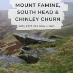
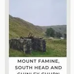
This circular walk takes in Mount Famine, South Head and Chinley Churn. It takes you through beautiful countryside with stunning views from each of the summits, and the old Cracken Edge quarry at Chinley Churn is great for exploring. At just under 6 miles, this walk is lovely if you’re hiking with kids in the Peak District – you can finish the walk after the first two peaks if little legs are getting tired. This walk takes in three Peak District Ethels. 


Chinley Churn Quarry Old Quarry Machinery - The Wandering Wildflower

The winding drum of Cracken Edge quarry

Mount Famine is a peak in the Peak District which stands at 473m above sea level, while South Head is 494m high. The two peaks are about 500m apart so it makes sense to hike up both in the same day! Chinley Churn, standing at 457m high, is also close by on the other side of the valley, so we added it into the walk to create a Mini 3 Peaks Challenge.


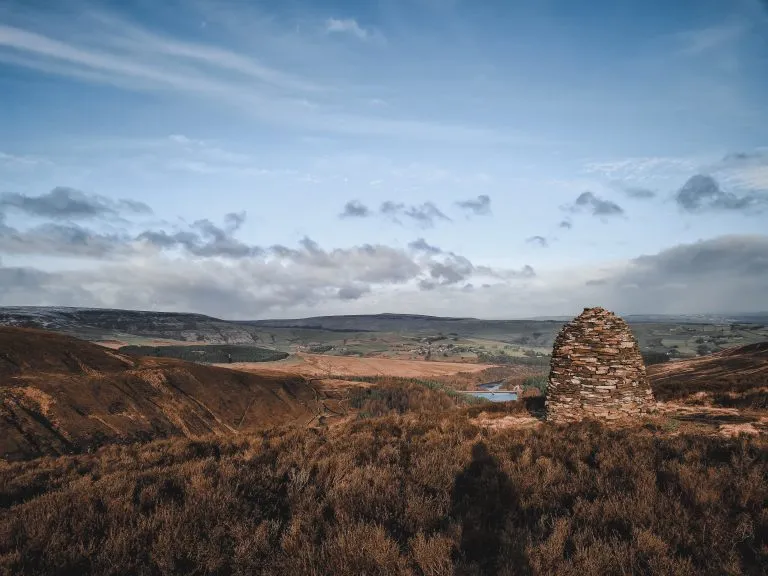
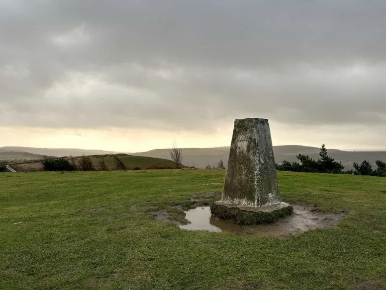
As of June 2024 the Chinley Churn trig point seems to have been removed by the landowner.


This walk starts in a layby just up from The Lamb Inn on Hayfield Road. After walking a short distance up the road, head off along the public bridleway towards Mount Famine. You’ll come to a bit of a confusing junction – head through the gate and along the footpath signed with a green footpath sign for Edale via Kinder Valley. You’ll see Mount Famine on your right hand side as you walk along the footpath.

View back down the bridleway on the route to Mount Famine - The Wandering Wildflower

View back down the bridleway

Views of Mount Famine - The Wandering Wildflower

Views of Mount Famine from the path

Go through the wooden gate and turn right to head up Mount Famine. Over the stile, you’ll start to climb up the steep side of Mount Famine. The path is rocky in places and as it was raining when we went it was a bit slippery.

Rain soaked wooden gate in farmland

Wooden stile with Mount Famine in the background - The Wandering Wildflower Peak District Walks


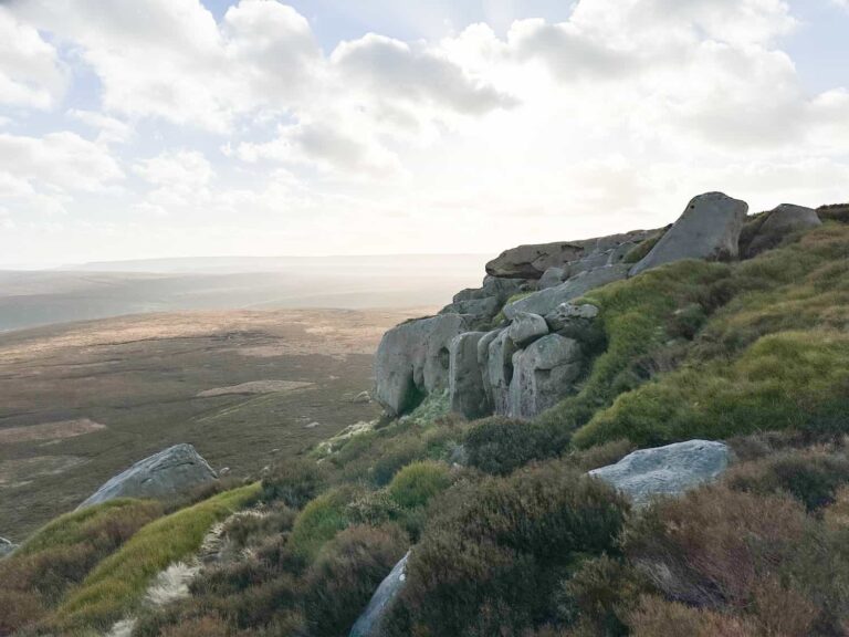
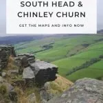
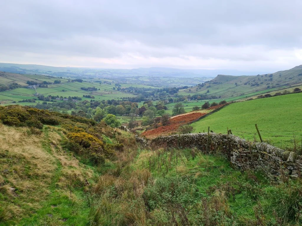
About 3/4 of the way up to the summit there are some fabulous rock formations – perfect spot for a breather after the climb! They also give you amazing views over towards Kinderlow End and Kinder Scout. We had another misty day so didn’t get many photos of the view but in the brief spells between clouds it looked amazing. There isn’t anything marking the summit of Mount Famine.


Views from Mount Famine across to Kinderlow End

Views across to Kinderlow End


Views from Mount Famine down to the River Sett - The Wandering Wildflower

Rock formations on Mount Famine - The Wandering Wildflower

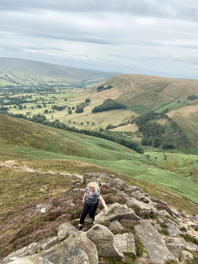
Walk along the ridge of Mount Famine and down the other side. Cross the bridleway and head into the field where South Head stands. There’s a quick scramble up to the summit, which is marked by a cairn, and then we headed back down the same way we came up. All over in a flash!


South Head summit cairn - The Wandering Wildflower

South Head summit cairn

View of Mount Famine from South Head summit - The Wandering Wildflower

Views back to Mount Famine and the other ridges whose names I don’t know!


The walk takes you along the Pennine Bridleway for a short distance before heading over the public footpaths through farmland. We saw pretty much every farm animal on this walk, including pigs and alpacas later on, but there were plenty of sheep, ducks and chickens on this footpath. Hols loved it.


Wooden stile in a wall in the English countryside - The Wandering Wildflower

Country lane - The Wandering Wildflower

Views of South Head from the lane - The Wandering Wildflower

Views of South Head from the lane, with two horses in a field - The Wandering Wildflower


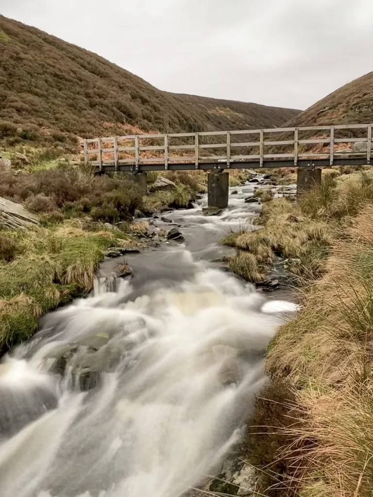
The footpath takes you back down to Hayfield Road which you need to cross. Take care when crossing as it is a busy road with fast moving traffic. Climb the stile and follow the footpath down to Otter Brook – it was really muddy here! There’s an old abandoned barn and Otter Brook itself is really pretty.


Views of Chinley Churn from the fields near Otter Brook - The Wandering Wildflower

Views of Chinley Churn from the fields near Otter Brook


Old abandoned barn near Otter Brook - The Wandering Wildflower

Old abandoned barn near Otter Brook


Head up the other side of the valley and pop out onto Maynestone Road. Cross this and go through a gate which is quite well hidden in the undergrowth – apologies for the really blurry photograph!

Maynestone Road - Autumnal road scene - The Wandering Wildflower

Footpath to climb Chinley Churn - The Wandering Wildflower

Chinley Churn

Gateway to the right to climb Chinley Churn

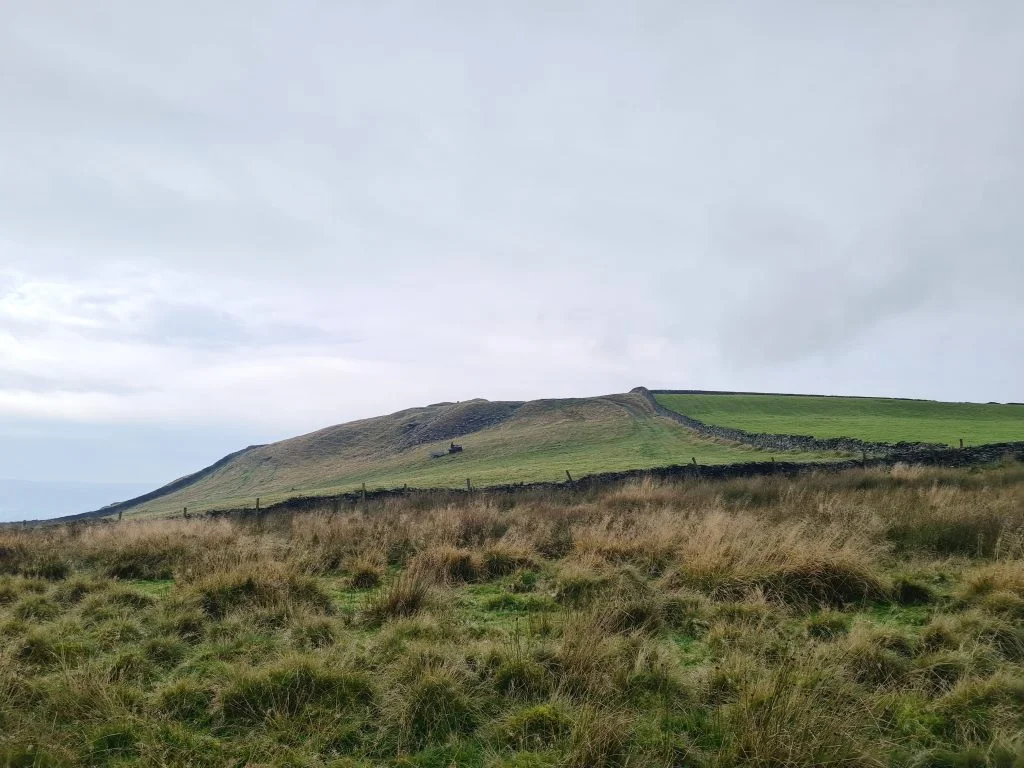
It’s a steep climb up to the quarry at Chinley Churn. There’s a stile about halfway up which is useful for a rest stop if you need it.


Public footpath sign under an autumnal tree - The Wandering Wildflower

We were going to head to the Chinley Churn trig point, and you can see on our map that we were heading in that direction looking for a way to get to it. Unfortunately the trig point is on private land and the farmer, busy loading sheep into a trailer, wasn’t keen for us to go to the trig. Please don’t go climbing over walls to get to the trig – respect the landowners wishes!


As of June 2024 it looks as though the landowner has removed the trig point altogether. 

Views to Chinley Churn Trig Point - The Wandering Wildflower

If you squint you can just see the trig point on the top of the hill, just above the farmer on his quad bike in the centre of the field. The wall marks the boundary of private land


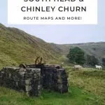
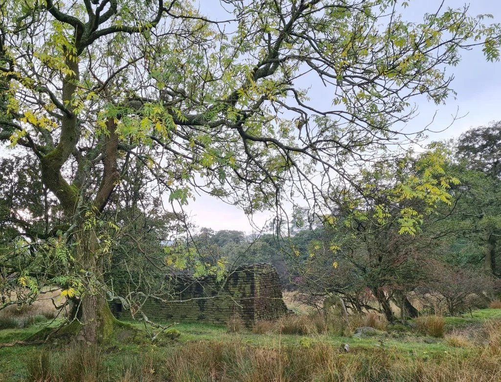
We set off back to explore the old Cracken Edge quarry at Chinley Churn, which has some fabulous old machinery still in place (this forum has a photo of them in their prime!). There are some rock faces which I imagine climbers would love, and some old ruined buildings which I presume are from the old quarry. Apparently the quarry used to produce flagstones and roofing slates until it’s closure in the 1900s. I don’t envy the people who had to work there!


Old quarry machinery at Chinley Churn quarry - The Wandering Wildflower

Sheep on a quarry spoil heap at Chinley Churn - The Wandering Wildflower

Chinley Churn Quarry - The Wandering Wildflower

Old Quarry buildings at Chinley Churn

Was this an outside toilet?

Toadstools growing in moss - The Wandering Wildflower


After having a mooch about the quarry for a little while we headed back down the slopes towards the road, meeting the footpath near the Peep O’Day. This house (as well as being beautiful) has a story attached to it with an information plaque explaining the reason for the name of the house.

Peep O'Day Farm

Information plaque about Peep O'Day Farm


Once out on the road, we turned right and head back along the road towards the layby where the car was parked. We drove 30 seconds down the road to The Lamb Inn, (we thought it was a lot further away than it was!) in the hopes of getting some late lunch, but they were fully booked so we headed to The Sportsman in Hayfield again (we went there when we walked up Kinder Scout).

Rock formations at Chinley Churn - The Wandering Wildflower

Autumnal English countryside views - The Wandering Wildflower


Distance: just under 10km (6 miles)

Parking: Layby on Hayfield Road

Facilities: None nearby, although The Lamb Inn is just down the road.

Difficulty: ▲▲▲

Trig Points Bagged: None – Chinley Churn is on private land and we couldn’t get permission to access

Peak District Peaks Bagged: Mount Famine, South Head and Chinley Churn

Peak District Ethels Bagged: Mount Famine, South Head and Chinley Churn

Route: Click the map to get the Mount Famine, South Head and Chinley Churn hiking route


Whilst this is one trig point we might not be able to get to, we had a lovely walk out and can check these peaks off our Peak District Peak Bagging Checklist. It’s still a nice route to do if you are planning to go hiking with kids in the Peak District – check out some of our other family friendly Peak District walks.


Tap to share with your hiking friends!

  • Facebook
  • Email
  • WhatsApp
« How to Find Middle Black Clough Waterfall | 2 Miles
Lantern Pike Circular Walk | 11 Miles »

RELATED POSTS

  • Hathersage Stepping StonesHathersage Stepping Stones Walk | 7 Miles
  • Ladybower ReservoirLadybower Walk | 6 Miles
  • Anvil Stone, GrindsbrookGrindsbrook Clough Scramble to Grindslow Knoll | 7 Miles
  • Bleaklow to Higher Shelf Stones Circular Hike | 6 Miles

Leave a Reply Cancel reply

Your email address will not be published. Required fields are marked *

FIND YOUR NEXT WALK:

ABOUT ME

Y Garn with Kids - Y Garn via the Devil's Kitchen Walk in Ogwen Valley

Hello! I’m Jo! Welcome to The Wandering Wildflower, an outdoors lifestyle blog focusing on family walks in the Peak District, a place we love exploring. I want to share the Peak District hidden gems and show you there’s so much more than the honeypot places. When I’m not dragging my husband and now 11 year old out on Peak District walks or up mountains, I can be found on planning my next moorland walk or plotting a Geocache walk (and seeing where the nearest pub is!). I love the hills but hate the heights, so trig bagging is – er- fun!


I hope this blog will give you some ideas of places to visit in the Peak District and inspire you and your family to head into the great outdoors.  Thanks for stopping by!

CATEGORIES

  • CIRCULAR WALKS (189)
  • HOLMFIRTH WALKS (27)
  • ISLE OF SKYE WALKS (3)
  • LAKE DISTRICT WALKS (26)
  • LANCASHIRE WALKS (2)
  • LONG PEAK DISTRICT WALKS 10 MILES + (42)
  • MEDIUM WALKS 4-9 MILES (137)
  • PEAK DISTRICT SCRAMBLES (16)
  • PEAK DISTRICT WALKS (206)
  • PEAK DISTRICT WALKS WITH KIDS (76)
  • PEAK DISTRICT WALKS WITH PUBS (60)
  • SCOTLAND WALKS (6)
  • SHORT WALKS UNDER 3 MILES (40)
  • SNOWDONIA WALKS (5)
  • UK CAMPING (5)
  • YORKSHIRE WALKS (33)

Peak District Walks

List of Peak District Ethels

Peak District Peak Bagging

Peak District Trig Point Challenge

Peak District Walks with Pubs

Peak District Walks with Kids

Beautiful Walks in Holmfirth

Short Walks in the Peak District

Long Walks in the Peak District

AFFILIATE DISCLOSURE

This blog may contain affiliate links through which, at no additional cost to you, I may earn a small commission. I only recommend products I would use myself and all opinions expressed here are my own. As an Amazon Associate I earn from qualifying purchases. Read full privacy policy here.

ARCHIVES

PEAK DISTRICT WEATHER

Peak District mountain weather on Met Office

Peak District Trig Points

Promo image for a blog post about the Peak District Trig Point Challenge With Map of Peak District Trig Points and Walking Routes by The Wandering Wildflower

Peak District Ethels Challenge

Promo image for a blog post about the Peak District Trig Point Challenge With Map of Peak District Ethels and Walking Routes by The Wandering Wildflower

WALKING ROUTES STRAIGHT TO YOUR INBOX

Want new walks in your inbox? Drop your email below and I'll send you some ideas for walks you can try.

You can unsubscribe anytime. For more details, review our Privacy Policy.

Thank you!

You have successfully joined our subscriber list.

RSS LATEST POSTS

  • How to Find Three Shires Head
  • Peak District Pub Walks
  • Burnbank Fell, Blake Fell and Gavel Fell | 8 Miles
  • Bretton Park Circular Walk | 3 Miles
  • Grasmere Weekend Break

FOLLOW ON PINTEREST

Want new walks in your inbox? Drop your email below and I'll send you some ideas for walks you can try.

You can unsubscribe anytime. For more details, review our Privacy Policy.

Thank you!

You have successfully joined our subscriber list.

jo@thewanderingwildflower.co.uk

The Wandering Wildflower

  • Email
  • Facebook
  • Instagram
  • Pinterest
  • PRIVACY POLICY
  • TERMS & CONDITIONS
  • ABOUT

(c) The Wandering Wildflower. All Rights Reserved.

|| THEME BY ECLAIR DESIGNS