The Trinnacle Trail and Alphin Pike | 14 Miles
This circular walk on the very northern edge of the Peak District takes in the rugged moorlands around Dovestone Reservoir, including a waterfall scramble up to The Trinnacle and a moorland walk with spectacular views. This is a great adventure walk of 13.5 miles, popularly known as The Trinnacle Trail.

Some other websites have christened this The Trinnacle Trail – I think this route is a bit longer than the usual route up to The Trinnacle as it winds around the top of the valley to Alphin Pike as well.
Please don’t underestimate how challenging this Trinnacle Trail walk is – more than one fifth of all Oldham Mountain Rescue Team‘s callouts in 2022 were to help walkers who needed help in and around the Birchen Clough area. This is a steep, rocky scramble, which can be very slippery and muddy. You’ll need decent footwear – it’s not one for the Crocs unfortunately. There are places where you need to use your hands to climb and you’re climbing up the waterfall in places. Please also don’t leave loads of rubbish – if you take a water bottle, take it home with you. Don’t stuff it behind the rocks.
Hidden away on the moors above Dovestone Reservoir stands Raven Stone Brow and the enigmatic Trinnacle. This unique rocky outcrop has become super popular, thanks to social media and the images of people standing on with the amazing view in the background.
The walk starts from Binn Green Car Park and heads down towards the reservoirs through the woods, turning left onto the road leading down to Yeoman Hey Reservoir. I then headed along the footpath next to Yeoman Hey Reservoir until I reached the reservoir end, crossed the bridge and then climbed up the dam embankment for Greenfield Reservoir. There is a track that runs alongside both of these reservoirs but it was closed for grouse shooting, which is why I had to off road a bit.

Just a point to note – when I did this walk, there was a load of engineering works taking place on the embankment of Yeoman Hey Reservoir meaning that the path across the dam was closed. If you do this walk and the path is still closed, when you get back to Dove Stone Reservoir follow the road round to the boathouse and go clockwise around the reservoir, otherwise you’ll have to add on another 1.5 miles to do a loop of Yeoman Hey Reservoir (as I did!).
At the top of the dam wall, I walked around Greenfield Reservoir and then headed over the stepping stones to the track leading alongside Greenfield Brook. There are some lovely little waterfalls here. The track ends at a weir bridge, and here I went through the gate and headed to the right/south-east up Birchen Clough.

Birchen Clough is a scramble up a waterfall/stream bed. It’s steep in places and very rocky, and you have to cross the stream in places. It can be very difficult to get up in bad weather or when the Clough is full as there is a lot of water flowing down. There is a faint path up the left side of the Clough but you’re mostly finding your own way up over the rocks. It starts out steep but the gradient eases as you get closer to the top.

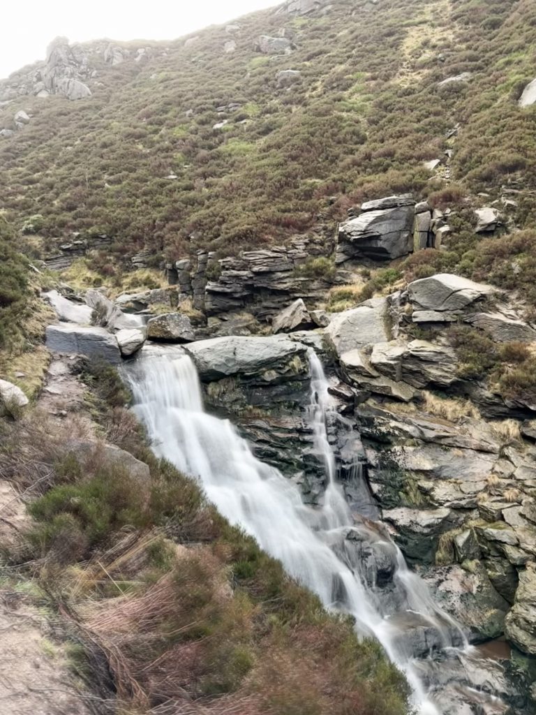
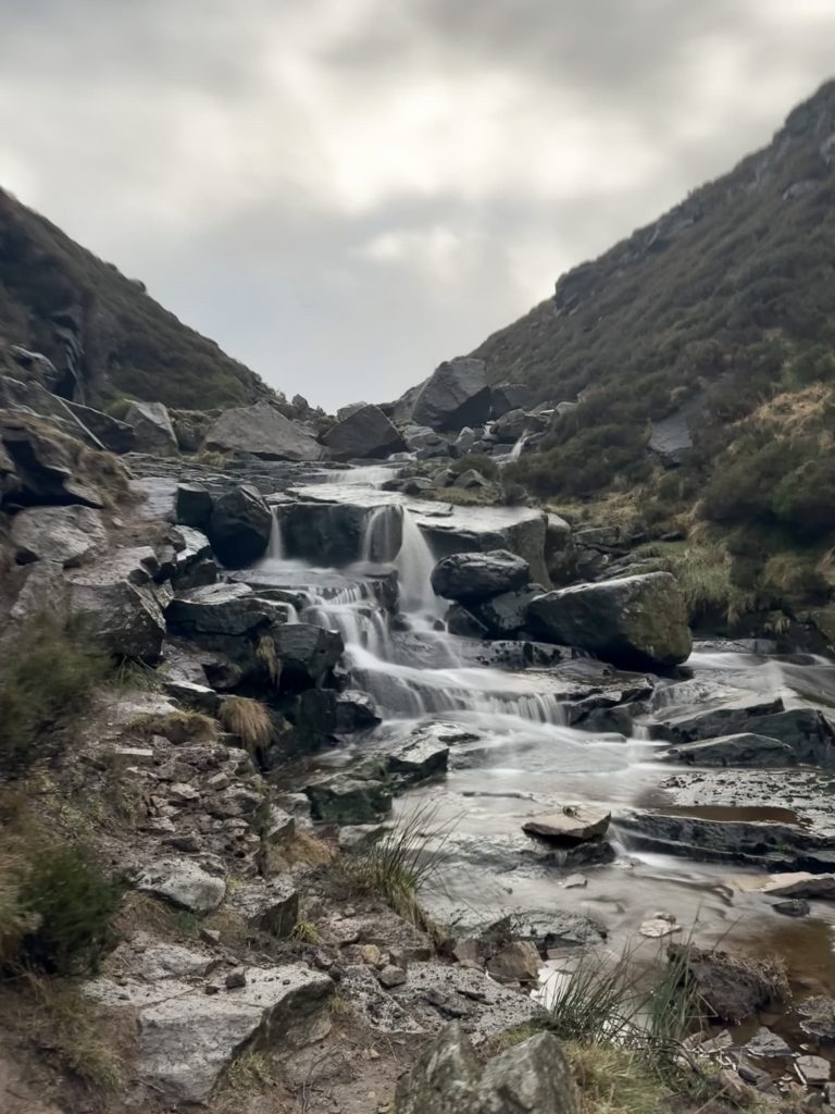
The path on the left of the picture is the kind of path to expect – it’s not an easy path!
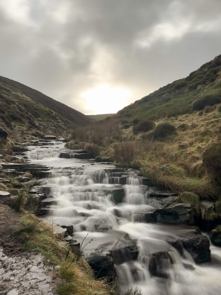
When the Clough starts to level, there are some stepping stones leading to a VERY boggy and steep section which leads up the hillside to Raven Stones Brow. You’ll soon come to The Trinnacle – if you’re lucky you’ll have the place to yourself but we’ve been before when there have been 20-30 people having lunch there. The views from here are amazing, down over the reservoirs below and across to Aldermans Brow.
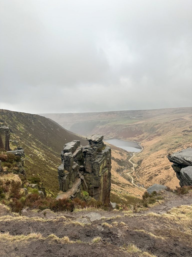

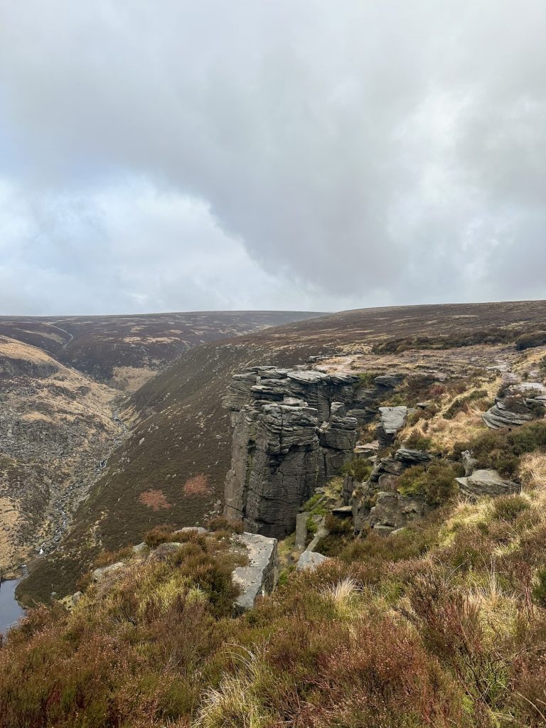
Another, less popular view of the Trinnacle showing how sheer a drop it is.
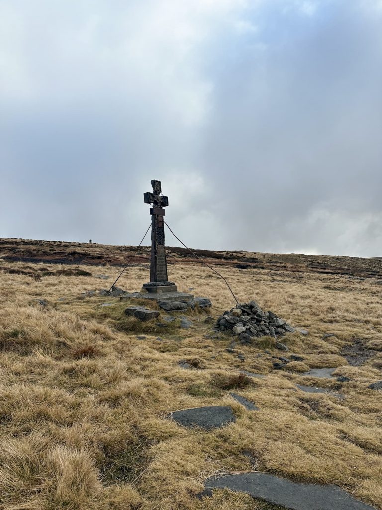
From here I headed along the path, dodging the bogs as I went, following the route as it wound around the top of the hillside. I passed the Ashway Cross, a memorial to James Platt MP who died from injuries sustained in a shooting accident in the 1850s, then carried on around to Bramleys Cot, a ruined building set into the rocks. The path winds around the top of this or you can climb up the rocks to the right of the building, which is what I did.
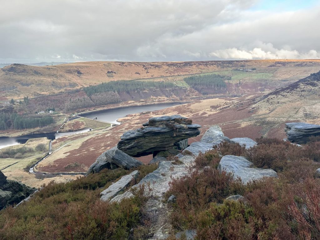


I then followed the route round until the path met Chew Road, leading up to Chew Reservoir. The road is a gentle but long climb until you reach Blindstones Moss. I then headed east towards Chew Hurdles, Chew Green and round to Wimberry Rocks aka Indians Head, so called because they apparently resemble a head looking up to the sky.


The path continues until you reach a stile, then over the stile it’s a short climb to Alphin Pike trig point and it’s cairn.

I had to use a pic from another time as I didn’t take a trig point picture!
The route down from Alphin Pike is very steep and can be quite tough on your knees! The stony path winds down the hillside to White Lee, then I turned east along the road towards Intake. The path goes through a small collection of cottages and splits – I took the right hand path that lead along a rough track on the top edge of the woodland, before coming out into some (very wet) fields. The path then winds through Chew Piece Plantation and then runs alongside Chew Brook on a former railway track, built when Chew Reservoir was built. The railway was used to bring in the substantial amount of clay needed to built the dam wall of Chew Reservoir.

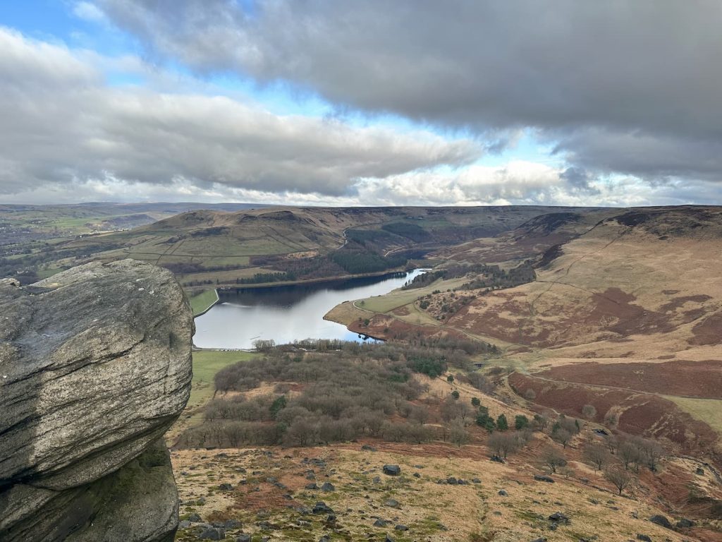
Views over Dove Stone Reservoir towards Aldermans Hill
Over the bridge and up the hillside, and then I turned to head down the road to head back towards Dove Stone Reservoir. The road comes to a junction, and turns left to head round the reservoir but I took the path to the road to head anticlockwise around the reservoir. As mentioned earlier, if the engineering works are still ongoing on the dam wall you’d be better heading round Dove Stone Reservoir clockwise from here to get back to Binn Green. I didn’t realise this, and thought I could get across, and had to walk another 1.5 miles around Yeoman Hey Reservoir.
It’s then a case of heading back up the road and into the woods, up the steps back into the car park.
As mentioned, this is longer than some of the other Trinnacle Trail walks out there. Please don’t underestimate how tricky the scramble up Birchen Clough is!
The Trinnacle Walk Map:
Walk Map (Opens in OS Maps): Dove Stone Reservoir and the Trinnacle Trail
Trinnacle Trail parking:
Binn Green Car Park, just off the A635 W3W:///fillers.spouse.short
Facilities: Toilets in the car park at Dove Stone Reservoir
Walk Time: 5-6 hours (ignore the time I did this in, I ran some of it!)
Difficulty: ▲▲▲
Distance: 13.5 miles (21km) – the map shows the extra loop I had to do of Yeoman Hey Reservoir.
Trig Points Bagged: Alphin Pike
Peak District Peaks Bagged: Alphin Pike
Peak District Ethels Bagged: Alphin Pike (a short detour off the path near Ashway Cross could get you Ashway Moss as well)
For a slightly shorter walk you may like Ashway Moss and The Trinnacle Circular Walk and other nearby walks include Dove Stone Reservoir Circular Walk, Dovestone Reservoir to Alphin Pike Circular Walk and Dove Stone Reservoir Skyline Walk.


Leave a Reply