• 3 Mile Walks or Less
  • 4 Mile Walks
  • 5 Mile Walks
  • 6 Mile Walks
  • 7 Mile Walks
  • 8 Mile Walks
  • 9 Mile Walks
  • 10 Mile Walks
  • 11 Mile Walks
  • 12 Mile Walks
  • 14 Mile Walks
  • 15 Mile Walks
  • 20+ Mile Walks

The Wandering Wildflower

Peak District Hikes

  • PEAK DISTRICT WALKS
    • SHORT WALKS UNDER 3 MILES
    • MEDIUM WALKS 4-9 MILES
    • LONG PEAK DISTRICT WALKS 10 MILES +
  • PEAK DISTRICT WALKS WITH PUBS
  • PEAK DISTRICT WALKS WITH KIDS
  • HOLMFIRTH WALKS

The Roaches and Hen Cloud Circular Walk | 17 Miles

February 15, 2022 CIRCULAR WALKS, LONG PEAK DISTRICT WALKS 10 MILES +, PEAK DISTRICT WALKS, PEAK DISTRICT WALKS WITH PUBS

As part of my training for the Yorkshire 3 Peaks Challenge we’ve been putting together some long walks in the Peak District. This circular Peak District walk takes in Gun Moor Trig Point, The Roaches Trig Point, Hen Cloud, Ramshaw Rocks and Merryton Low (Blake Mere Trig Point). At 17 miles it’s definitely a challenge distance-wise (for me!), with some steep climbs.

Gritstone rock formations at The Roaches - 17 Mile Circular Walk in the Peak District by The Wandering Wildflower

Gritstone rock formations at The Roaches

Starting at Tittesworth Reservoir car park, this walk lets you tick off the Gun, The Roaches, Hen Cloud, Ramshaw Rocks and Merryton Low Peak District Ethels as well! We stopped off for a very well deserved drink at The Lazy Trout in Meerbrook after the walk.

Tittesworth Reservoir with views of The Roaches and Hen Cloud - The Wandering Wildflower

Tittesworth Reservoir with views of The Roaches and Hen Cloud


Annoyingly we set out late and got to the car park later than we intended, meaning we had to cut our route short. We were also going to include the Peak District Ethel at Revidge which would have made our walk 19 miles+. Next time!!


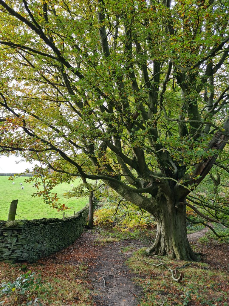
Our walk started at Tittesworth Reservoir and heads through the village of Meerbrook, past The Lazy Trout pub. Follow the road up the hill to the gate leading onto Gun Moor. A short walk across the moor to the north, over well worn but muddy paths, will take you to the Gun trig point. This is the first of 3 trig points on this walk, making it into a Hat Trig walk – Hols loves that phrase.

Snowdrops in Spring - Peak District Walks by The Wandering Wildflower

Spring is in the air!

Access to Gun Moor

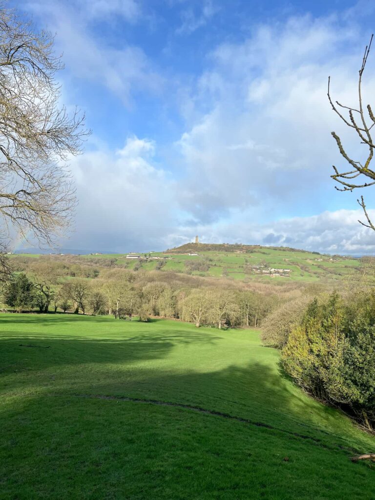
Gun Moor is a a Peak District Marylin, with a prominence of 168m, which has amazing views over to Hen Cloud and The Roaches as well as Shutlingsloe, Croker Hill and Shining Tor.

Gun Moor trig point - The Wandering Wildflower trig point walks

Gun Moor trig point - trig point walks by The Wandering Wildflower

After the photos at Gun Moor trig point, we headed off north across the moorland plateau. We came to a farm track and followed this for about 300m before setting off over the fields to the north-east. The path across the field is quite hard to see but there are stiles in the walls to guide you across.

Farm track - 17 Mile Peak District walk by The Wandering Wildflower

Farm track leading to the field crossing

Sheep in the Peak District near a cattle grid


We passed through Meadows Farm yard (with a sheep guarding the access!) and out onto the road, which we then followed up the hill towards The Roaches. At the T junction with the well and signpost, take the left road and keep climbing up Clough Head Lane. This was a long hard slog of a hill to get up and I was very glad to reach the top!

Peak District sign post near The Roaches - The Wandering Wildflower blog


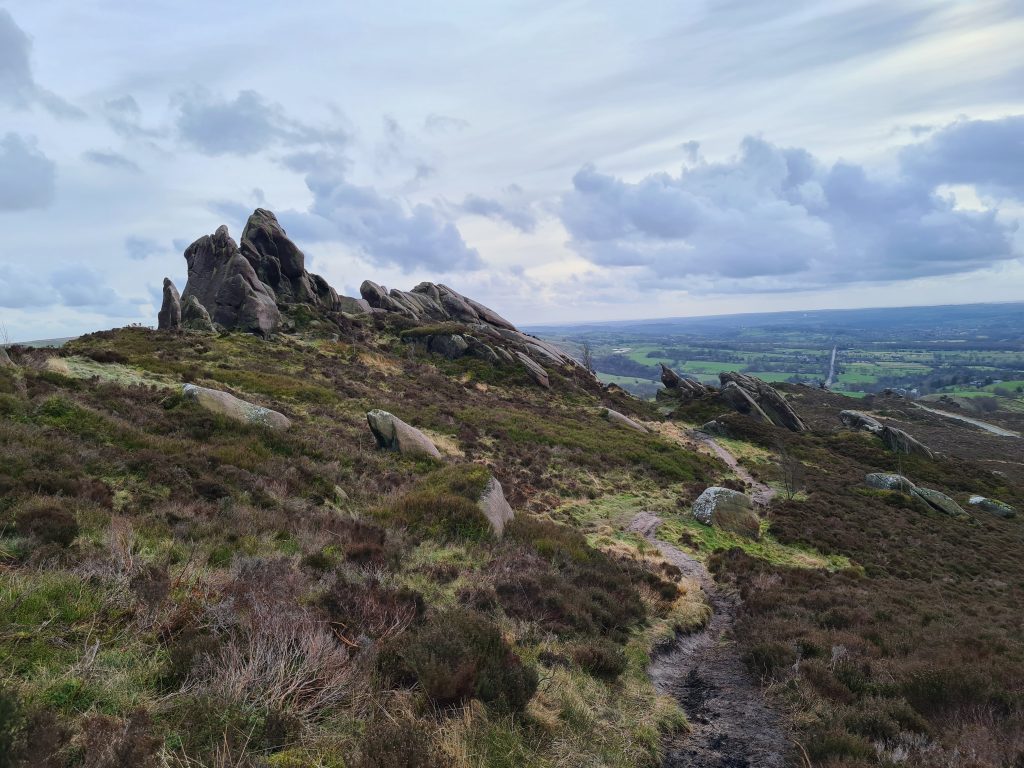
You’ll see a sign on your left mentioning Roach End. We took the stone path up the hill which lead us onto The Roaches, a 395 hectare Site of Special Scientific Interest. The Roaches is an amazing place for wildlife, where you can see curlew, red grouse and tree pipit as well as the resident peregrines. As this is a SSSI dogs must be kept on a lead so they don’t disturb the wildlife. 


Path to The Roaches circular walk - The Wandering Wildflower

Path leading to The Roaches circular walk - The Wandering Wildflower

Gritstone rock formations The Roaches circular walk - The Wandering Wildflower

Gritstone rock formations on The Roaches circular walk - The Wandering Wildflower

Old graffiti on The Roaches circular walk - The Wandering Wildflower

Views from The Roaches circular walk - The Wandering Wildflower

Views from The Roaches circular walk - The Wandering Wildflower

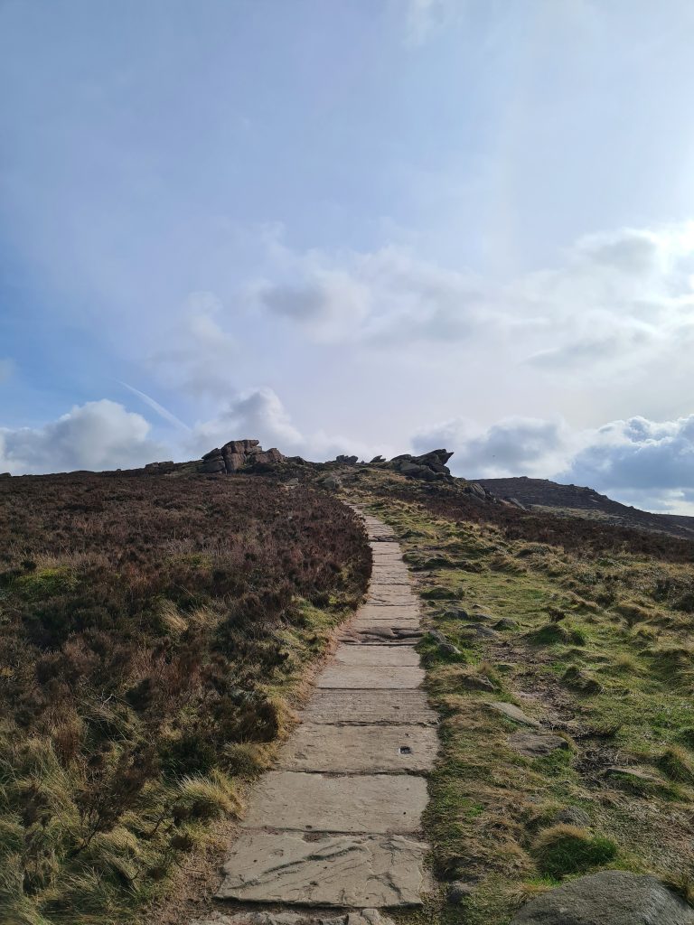
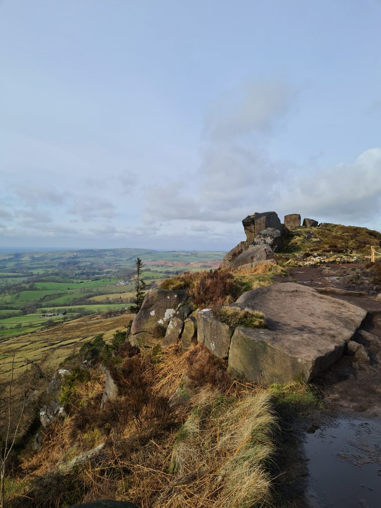
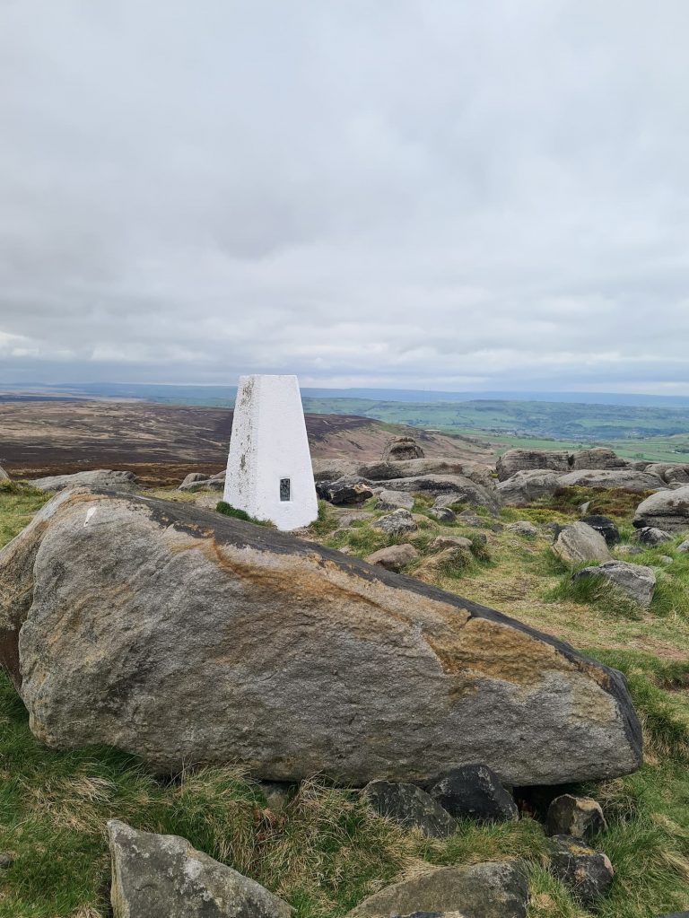
We followed the ridge of The Roaches along to The Roaches trig point, which is nestled in and amongst the magnificent gritstone rock formations. There are so many to explore on here! This was the busiest trig point of the day, with there being a bit of a queue for people to take a photo of it.

The Roaches trig point - Long Peak District walks from The Wandering Wildflower

The Roaches trig point - Long Peak District walks from The Wandering Wildflower


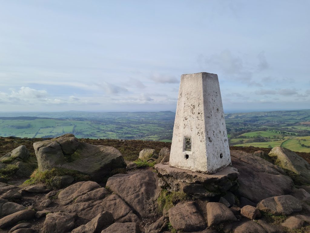
A quick rant about ‘trig point etiquette’ – if you get to a trig point, and see a queue of people behind you, please don’t lounge about all over the trig. Take your photos, and then move away so the next people can get theirs. Sort your bags out and eat your banana somewhere else!!


After the wait for a young guy and an older lady to move out of our photos, we headed off towards the Doxey Pool where a mermaid apparently lies in wait, ready to lure you to your death. She didn’t catch us, thankfully, and we climbed down the steep scrambly south-east side of The Roaches without incident.

Doxey Pool on The Roaches - Long Peak District walks from The Wandering Wildflower

Doxey Pool

View of Hen Cloud from The Roaches

Hen Cloud as seen from The Roaches - Long Peak District walks from The Wandering Wildflower

Hen Cloud as seen from The Roaches


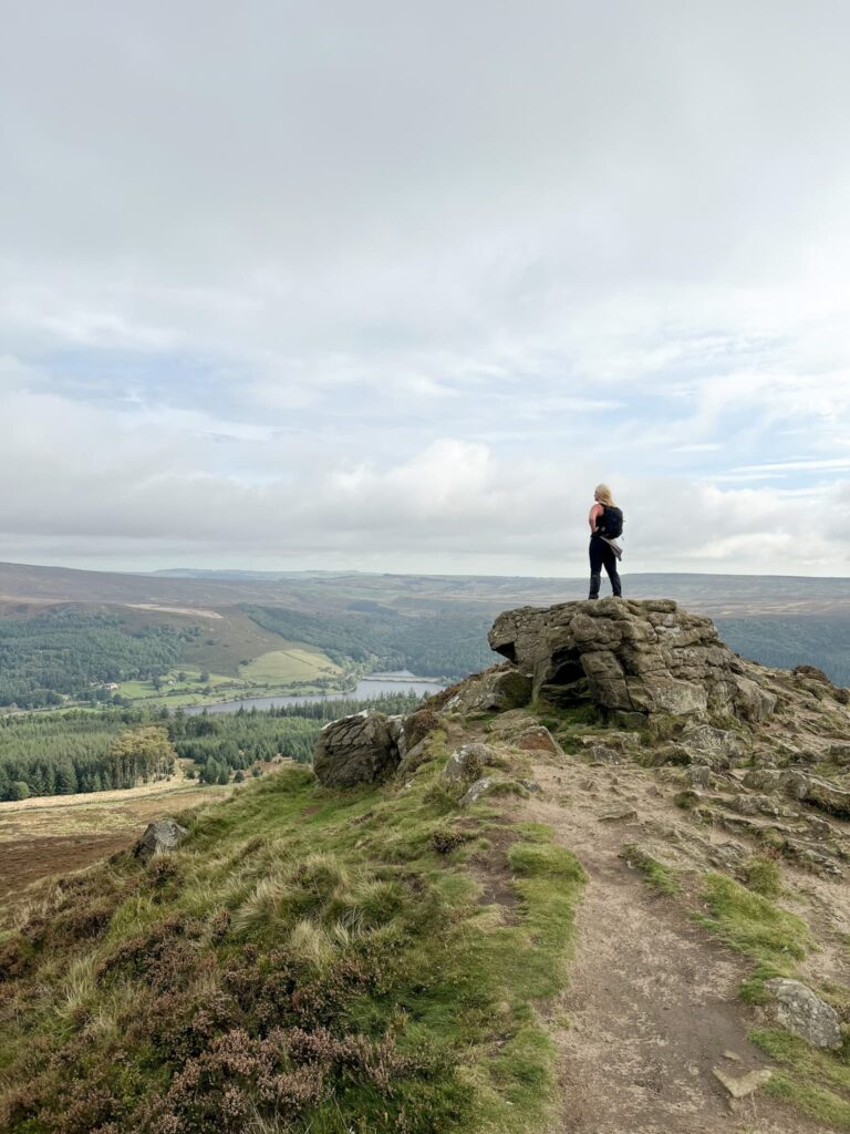
Crossing the fields, we then headed up the steep side of Hen Cloud. This is a smaller version of The Roaches at 410m above sea level, and was much quieter than it’s big sister. After a quick stop to look at the amazing views from the top of Hen Cloud, we clambered down the east side and headed into the woods for a picnic lunch on a rock.

The approach to Hen Cloud

Views from the summit of Hen Cloud

Views from the summit of Hen Cloud

Gritstone rock formations on Hen Cloud

Gritstone rock formations on Hen Cloud

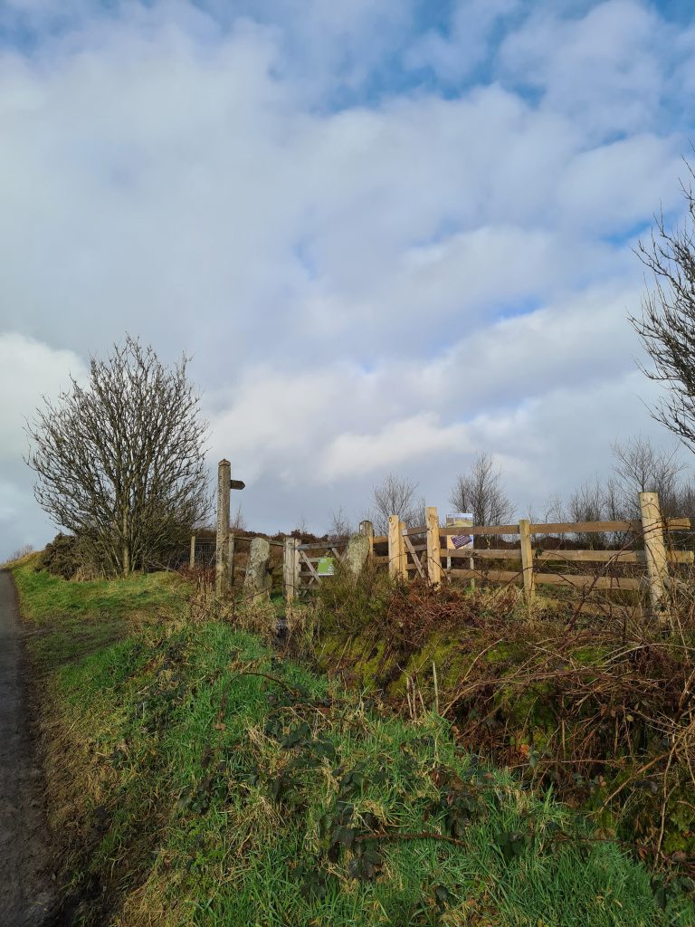
The path wound through the woods then back out onto the moorland, before heading up through some fields into a farm yard. We followed the stony track out to the start of a driveway to Roaches Hall, however this is private and the footpath takes you through a small gate and through farmland, past a ruined old barn.

Gate and stile in The Peak District

Don’t go through the metal gate – go through the wooden gate and follow the fence line.

Ruined barn in the Peak District

Signpost to Naychurch Farm

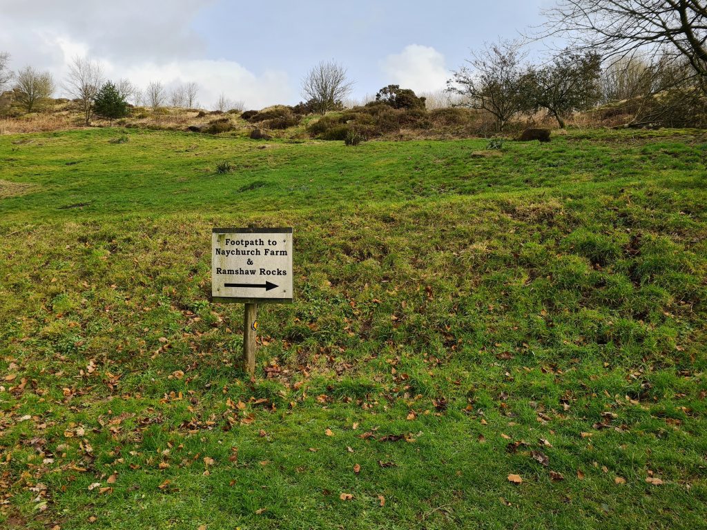
We followed the path up the hill (handily sign posted to Naychurch Farm) and met possibly the cutest dog in the world, Vi, and her owner. Here the OS map will tell you to go through the farmyard but there is a concessionary path marked with red topped sign posts to follow which skirts around Naychurch Farm. There are signs up advising of this.

A cute mixed breed dog

Concessionary footpath sign at Naychurch Farm


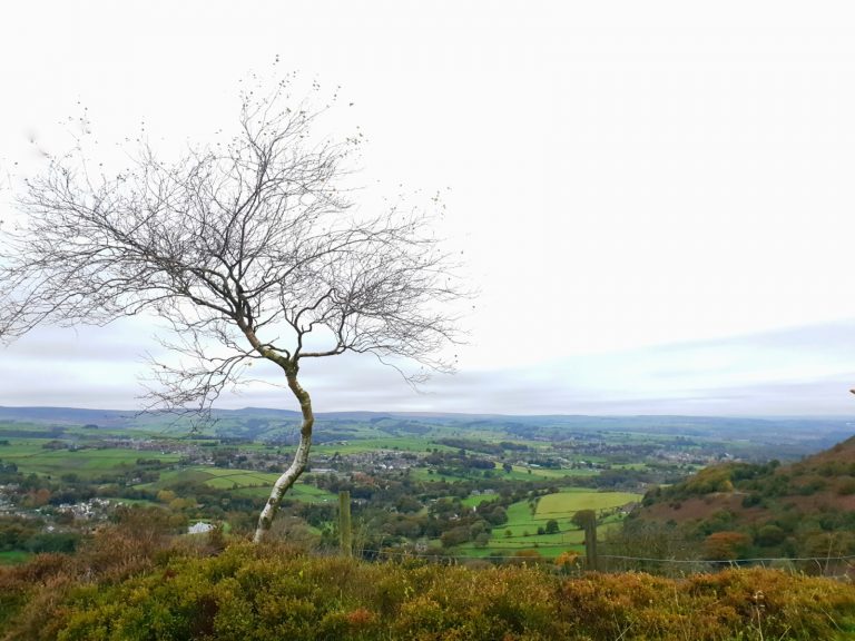
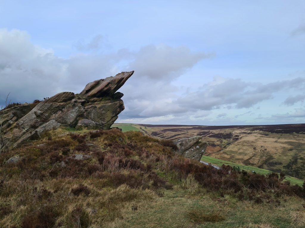
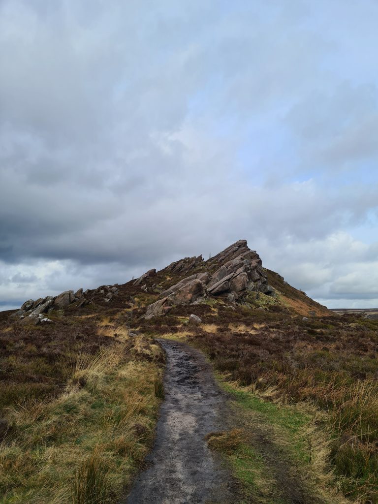
The path will lead you out onto a road, and after about 30m there is a footpath heading up onto the moorland towards Ramshaw Rocks. We climbed up the hill, exploring the amazing rock formations along the way, before reaching the summit of Ramshaw Rocks which has amazing views over the moors towards Merryton Low and back over to The Roaches. This is a much quieter version of The Roaches – we didn’t see anyone else while we were here.


Ramshaw Rocks, Ramshaw Ridge - The Peak District (The Wandering Wildflower walks)

Ramshaw Rocks, Ramshaw Ridge - The Peak District (The Wandering Wildflower walks)

Ramshaw Rocks, Ramshaw Ridge - The Peak District (The Wandering Wildflower walks)

Ramshaw Rocks, Ramshaw Ridge - The Peak District (The Wandering Wildflower walks)

Ramshaw Rocks, Ramshaw Ridge - The Peak District (The Wandering Wildflower walks)

After we had a clamber about on Ramshaw Rocks, we followed the path down across the fields to the road near Stake Gutter Farm. Crossing the busy Leek Road, we then set off along Blackmere Road towards Merryton Low trig point. The rest of our walk was on the roads now, so we were able to make up good time.


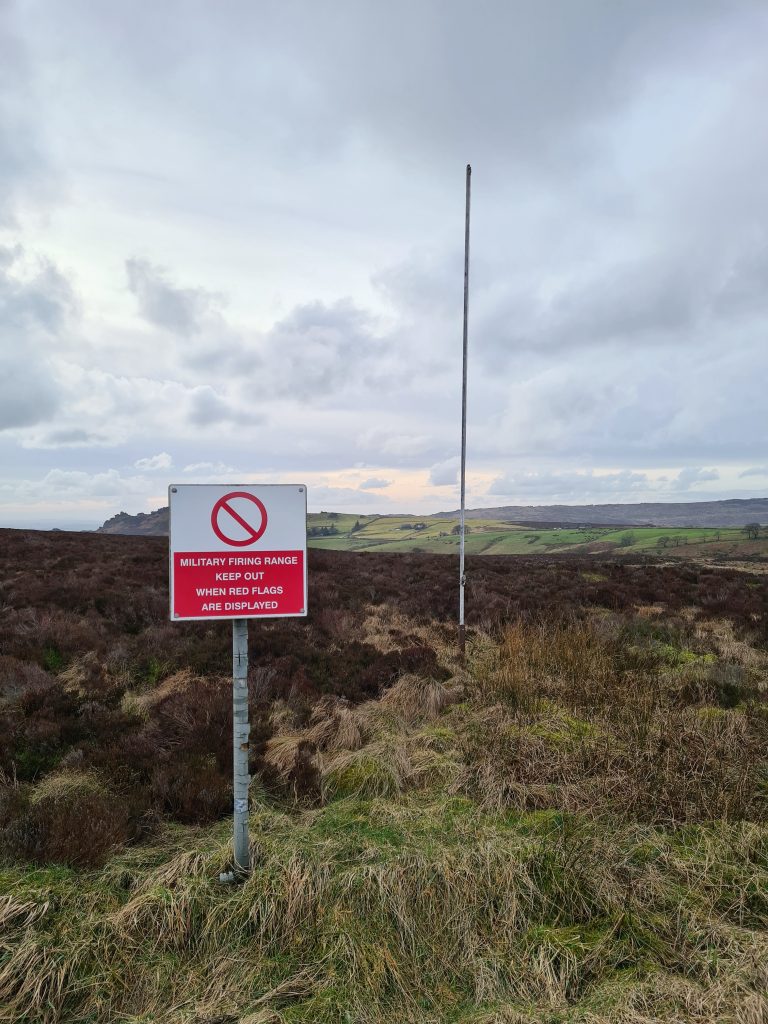
Interestingly this walk skirts around the land owned by the Ministry of Defence which is used as a firing range. You can access the land, but not when the red flags are flying. We didn’t have time to explore unfortunately as the car park closed at 6pm and we needed to make sure we were back to the car! We’ll see the abandoned tank next time.

Ministry of Defence Firing Range Signpost


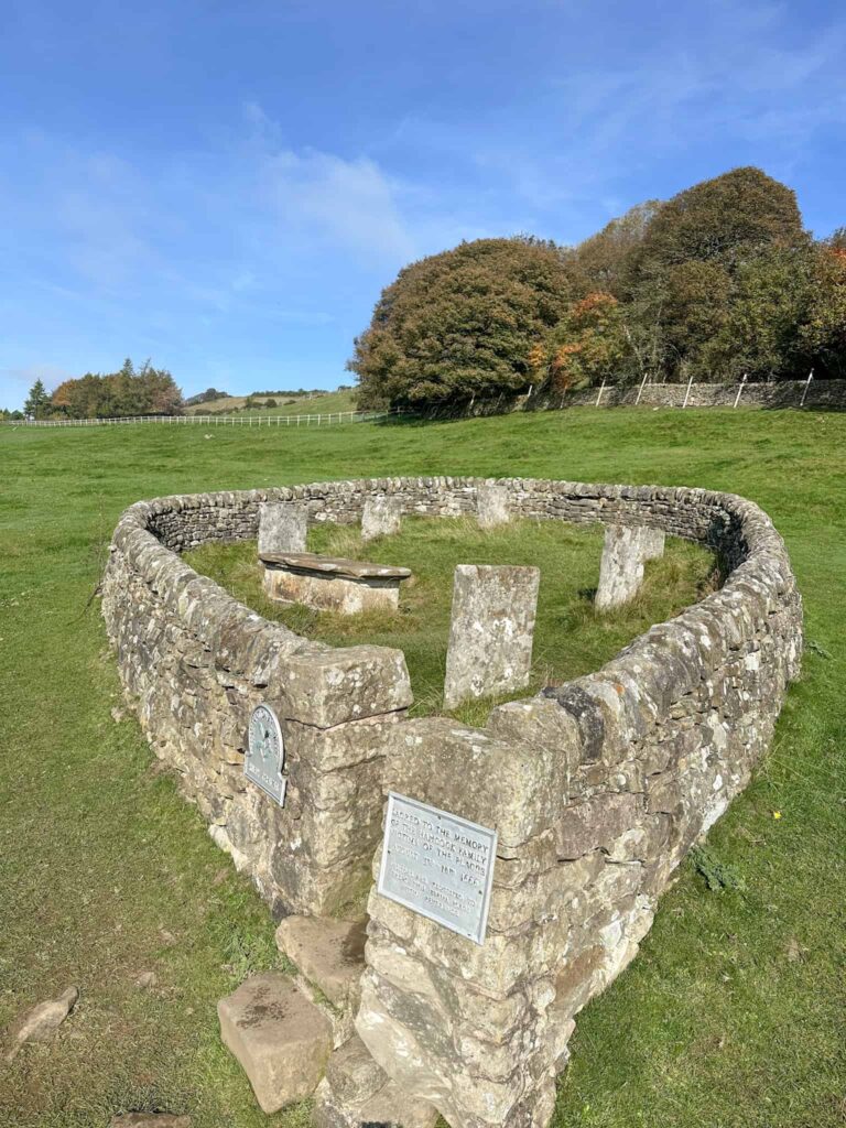
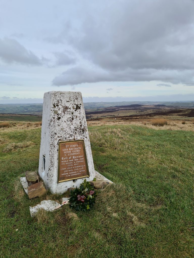
Merryton Low is the name of the Ethel but Blake Mere is the name of a pool of water nearby, so confusing the trig point is known by both names. The Blake Mere trig point is situated a short walk from the roadside and has a memorial plaque, dedicated to the Home Guard in the Second World War. After we had take photos of the trig point, we set off back along Blackmere Road towards the village of Thorncliffe.

Merryton Low (Blake Mere) trig point

Merryton Low (Blake Mere) trig point - trig point walks from The Wandering Wildflower

Merryton Low (Blake Mere) trig point - trig point walks from The Wandering Wildflower

Merryton Low (Blake Mere) trig point - trig point walks from The Wandering Wildflower


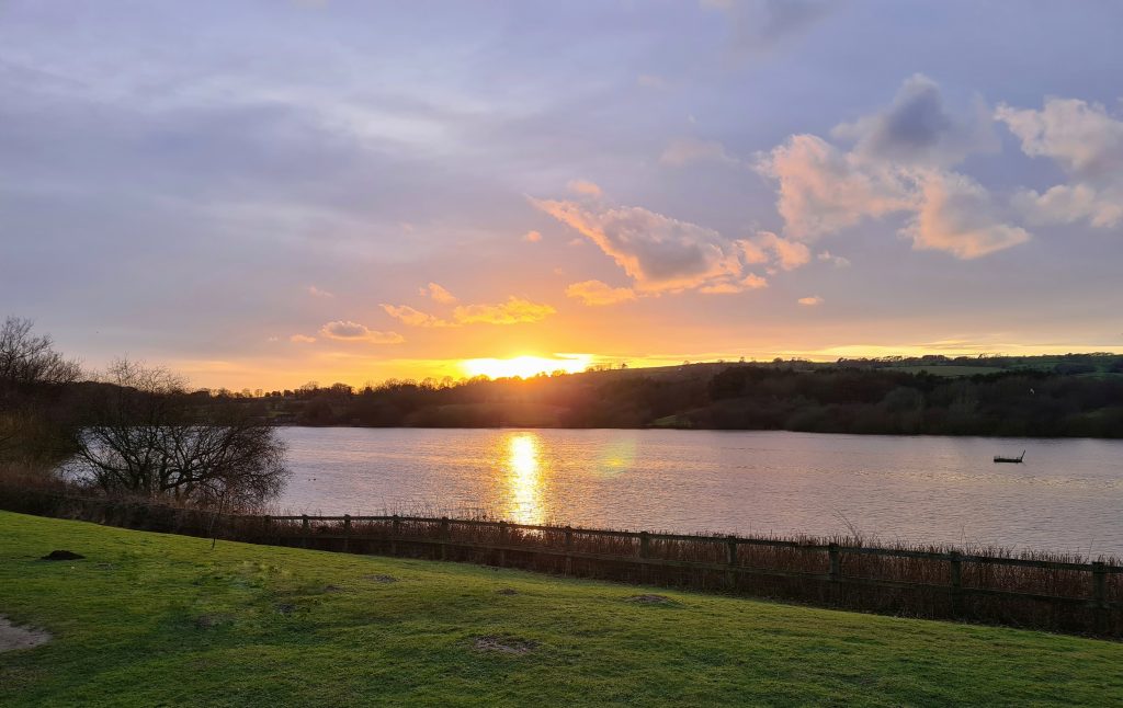
At the phone box, we turned down Thorncliffe Road and walked past the Anzio Camp before reaching Leek Road again. We crossed the road and set off down Blackshaw Lane, back to the Tittesworth Reservoir car park. It turned out we had made such good time marching on the roads that we had enough time to have a well earned drink in The Lazy Trout, and we got to see a beautiful Peak District sunset.

Peak District sunset over Tittesworth Water


This walk was a great training walk for the Yorkshire 3 Peaks challenge, with a couple of steep (albeit small) climbs. You can also check out some of the longer Peak District walks we’ve done too.


Gun Moor, The Roaches, Hen Cloud, Ramshaw Rocks, Merryton Low (Blake Mere) Walking Route:

The Roaches Walk Route Map: (click the image to download the gpx file for your device)


Parking: Tittesworth Reservoir Pay and Display car park ST13 6AT – £5 all day parking. Closes at 6pm.

Facilities: Tittesworth Reservoir has toilet facilities and a visitors centre.

Walk Time: This took us 6 hours, with a stop off for a picnic lunch. The time will obviously depend on your speed and fitness but allow 6-7 hours.

Difficulty: ▲▲▲

Distance: 27.5km (17 miles)

Trig Points Bagged: Gun Moor, The Roaches, Blake Mere (Merryton Low)

Peak District Peaks Bagged: Gun Moor, The Roaches, Hen Cloud, Ramshaw Rocks, Merryton Low (Blake Mere)

Peak District Ethels Bagged: Gun Moor, The Roaches, Hen Cloud, Ramshaw Rocks, Merryton Low (Blake Mere)


Tap to share with your hiking friends!

  • Facebook
  • Email
  • WhatsApp
« 21 Short Walks in the Peak District
Ramsden Reservoir to Hade Edge Circular | 3 Miles »

RELATED POSTS

  • Three Shires HeadHow to Find Three Shires Head
  • A wooden stile on Stanage EdgeBamford Edge, Stanage Edge, Higger Tor, Surprise View | 15 Miles
  • Lathkill Dale waterfallLathkill Dale Waterfall Walk | 7 Miles
  • Black Hill, Peak District trig point (Soldiers Lump)Holme to Black Hill to Crowden Circular Walk | 17 Miles

Leave a Reply Cancel reply

Your email address will not be published. Required fields are marked *

FIND YOUR NEXT WALK:

ABOUT ME

Y Garn with Kids - Y Garn via the Devil's Kitchen Walk in Ogwen Valley

Hello! I’m Jo! Welcome to The Wandering Wildflower, an outdoors lifestyle blog focusing on family walks in the Peak District, a place we love exploring. I want to share the Peak District hidden gems and show you there’s so much more than the honeypot places. When I’m not dragging my husband and now 11 year old out on Peak District walks or up mountains, I can be found on planning my next moorland walk or plotting a Geocache walk (and seeing where the nearest pub is!). I love the hills but hate the heights, so trig bagging is – er- fun!


I hope this blog will give you some ideas of places to visit in the Peak District and inspire you and your family to head into the great outdoors.  Thanks for stopping by!

CATEGORIES

  • CIRCULAR WALKS (189)
  • HOLMFIRTH WALKS (27)
  • ISLE OF SKYE WALKS (3)
  • LAKE DISTRICT WALKS (26)
  • LANCASHIRE WALKS (2)
  • LONG PEAK DISTRICT WALKS 10 MILES + (42)
  • MEDIUM WALKS 4-9 MILES (137)
  • PEAK DISTRICT SCRAMBLES (16)
  • PEAK DISTRICT WALKS (206)
  • PEAK DISTRICT WALKS WITH KIDS (76)
  • PEAK DISTRICT WALKS WITH PUBS (60)
  • SCOTLAND WALKS (6)
  • SHORT WALKS UNDER 3 MILES (40)
  • SNOWDONIA WALKS (5)
  • UK CAMPING (5)
  • YORKSHIRE WALKS (33)

Peak District Walks

List of Peak District Ethels

Peak District Peak Bagging

Peak District Trig Point Challenge

Peak District Walks with Pubs

Peak District Walks with Kids

Beautiful Walks in Holmfirth

Short Walks in the Peak District

Long Walks in the Peak District

AFFILIATE DISCLOSURE

This blog may contain affiliate links through which, at no additional cost to you, I may earn a small commission. I only recommend products I would use myself and all opinions expressed here are my own. As an Amazon Associate I earn from qualifying purchases. Read full privacy policy here.

ARCHIVES

PEAK DISTRICT WEATHER

Peak District mountain weather on Met Office

Peak District Trig Points

Promo image for a blog post about the Peak District Trig Point Challenge With Map of Peak District Trig Points and Walking Routes by The Wandering Wildflower

Peak District Ethels Challenge

Promo image for a blog post about the Peak District Trig Point Challenge With Map of Peak District Ethels and Walking Routes by The Wandering Wildflower

WALKING ROUTES STRAIGHT TO YOUR INBOX

Want new walks in your inbox? Drop your email below and I'll send you some ideas for walks you can try.

You can unsubscribe anytime. For more details, review our Privacy Policy.

Thank you!

You have successfully joined our subscriber list.

RSS LATEST POSTS

  • How to Find Three Shires Head
  • Peak District Pub Walks
  • Burnbank Fell, Blake Fell and Gavel Fell | 8 Miles
  • Bretton Park Circular Walk | 3 Miles
  • Grasmere Weekend Break

FOLLOW ON PINTEREST

Want new walks in your inbox? Drop your email below and I'll send you some ideas for walks you can try.

You can unsubscribe anytime. For more details, review our Privacy Policy.

Thank you!

You have successfully joined our subscriber list.

jo@thewanderingwildflower.co.uk

The Wandering Wildflower

  • Email
  • Facebook
  • Instagram
  • Pinterest
  • PRIVACY POLICY
  • TERMS & CONDITIONS
  • ABOUT

(c) The Wandering Wildflower. All Rights Reserved.

|| THEME BY ECLAIR DESIGNS