• 3 Mile Walks or Less
  • 4 Mile Walks
  • 5 Mile Walks
  • 6 Mile Walks
  • 7 Mile Walks
  • 8 Mile Walks
  • 9 Mile Walks
  • 10 Mile Walks
  • 11 Mile Walks
  • 12 Mile Walks
  • 14 Mile Walks
  • 15 Mile Walks
  • 20+ Mile Walks

The Wandering Wildflower

Peak District Hikes

  • PEAK DISTRICT WALKS
    • SHORT WALKS UNDER 3 MILES
    • MEDIUM WALKS 4-9 MILES
    • LONG PEAK DISTRICT WALKS 10 MILES +
  • PEAK DISTRICT WALKS WITH PUBS
  • PEAK DISTRICT WALKS WITH KIDS
  • HOLMFIRTH WALKS

Crook Hill and Win Hill Walk via Ladybower Reservoir | 9 Miles

May 19, 2022 CIRCULAR WALKS, MEDIUM WALKS 4-9 MILES, PEAK DISTRICT WALKS, PEAK DISTRICT WALKS WITH KIDS, PEAK DISTRICT WALKS WITH PUBS

This Win Hill walk also takes in Crook Hill and Ladybower Reservoir and is a 8.5 mile Peak District walk. Bagging the Peak District Ethels of Win Hill and Crook Hill, as well as the Win Hill trig point, this is a great long Peak District walk with a pub stop.


Crook Hill & Win Hill & Ladybower Reservoir Walk in the Peak District - The Wandering Wildflower


This Win Hill walk starts from the Heatherdene Car Park at Ladybower Reservoir where there are public toilets. We set off over the Ladybower Reservoir dam wall, past the famous Ladybower plugholes, and up into the woods, where we followed Parkin Clough up to the Win Hill summit. Parkin Clough is very steep, and there are sections which are rocky, have tree roots sticking out and you may need to scramble using your hands in places.


At the top of Parkin Clough we headed through the gate and into the woods, then followed the path up the hill to the summit of Win Hill. There are some stone steps forming the path.


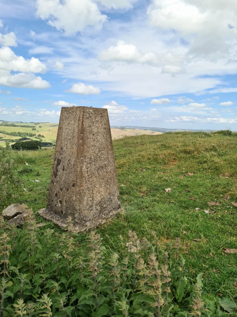
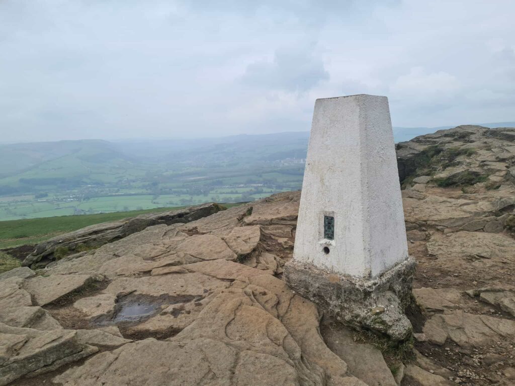
Win Hill is 462m above sea level and has amazing views of the surrounding area, including over to Mam Tor and The Great Ridge and over Ladybower Reservoir. The top of Win Hill also has Win Hill Pike, known locally as The Pimple, and a trig point. Unfortunately when we went someone had poured some juice or something all over the trig point and it was covered in insects. Some people are just idiots.


Win Hill trig point

Win Hill trig point


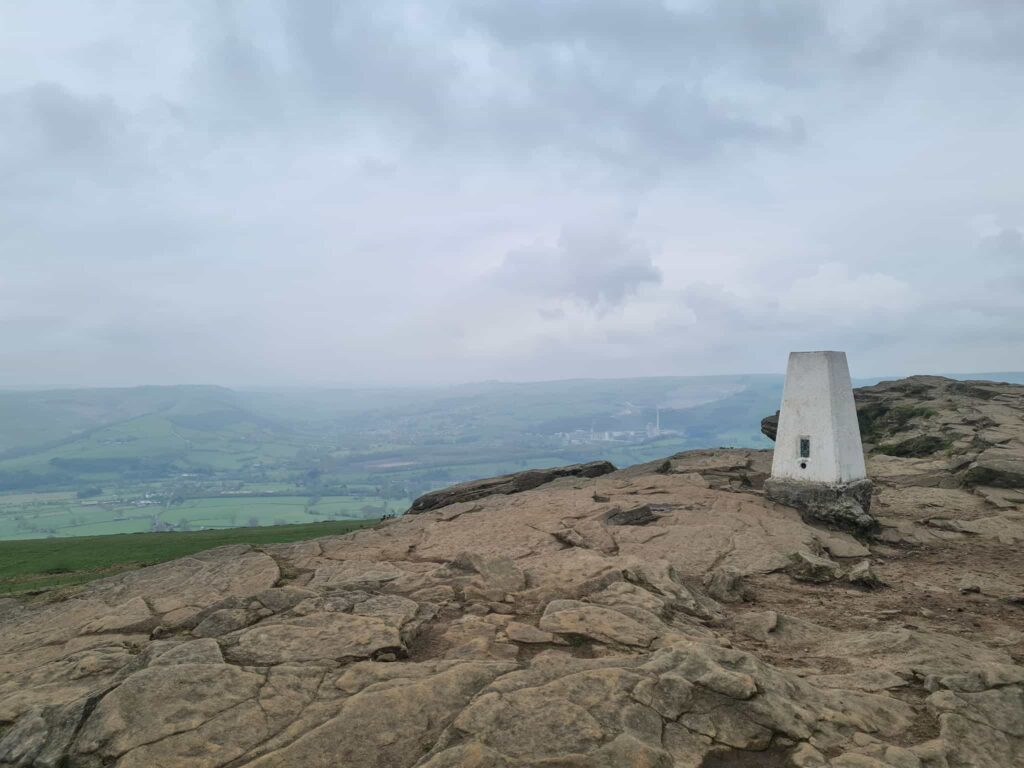
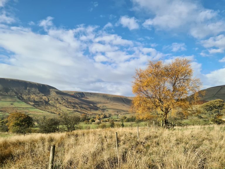
After we’d taken some photos of Win Hill trig point (from a safe distance, avoiding all bugs) we headed down the other side of Win Hill to the west. We followed the path until it forked round to the right to enter some woodland, and then headed along the woodland track. This leads to the River Ashop and Ladybower Reservoir, and we walked around the head of the reservoir.


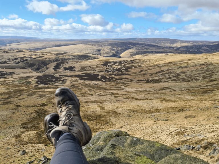
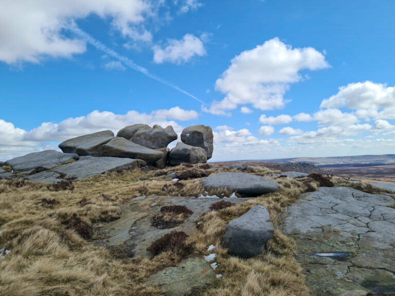
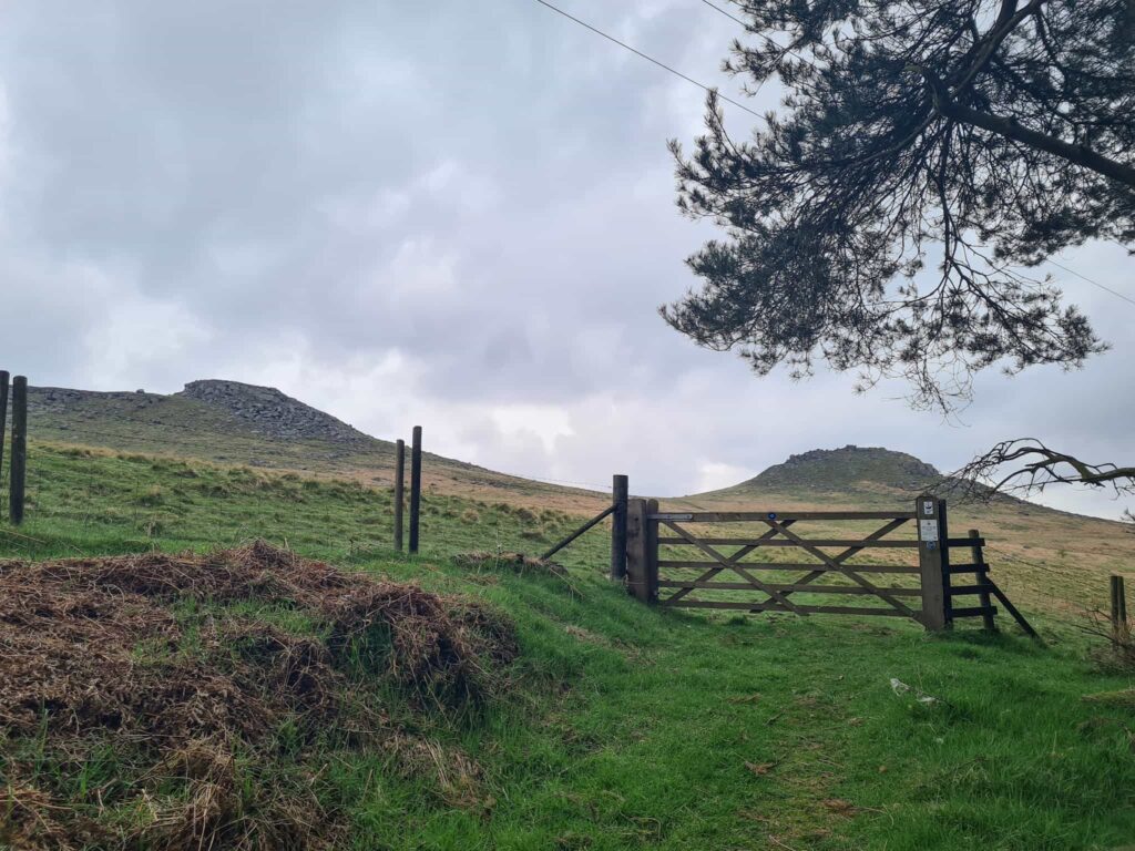
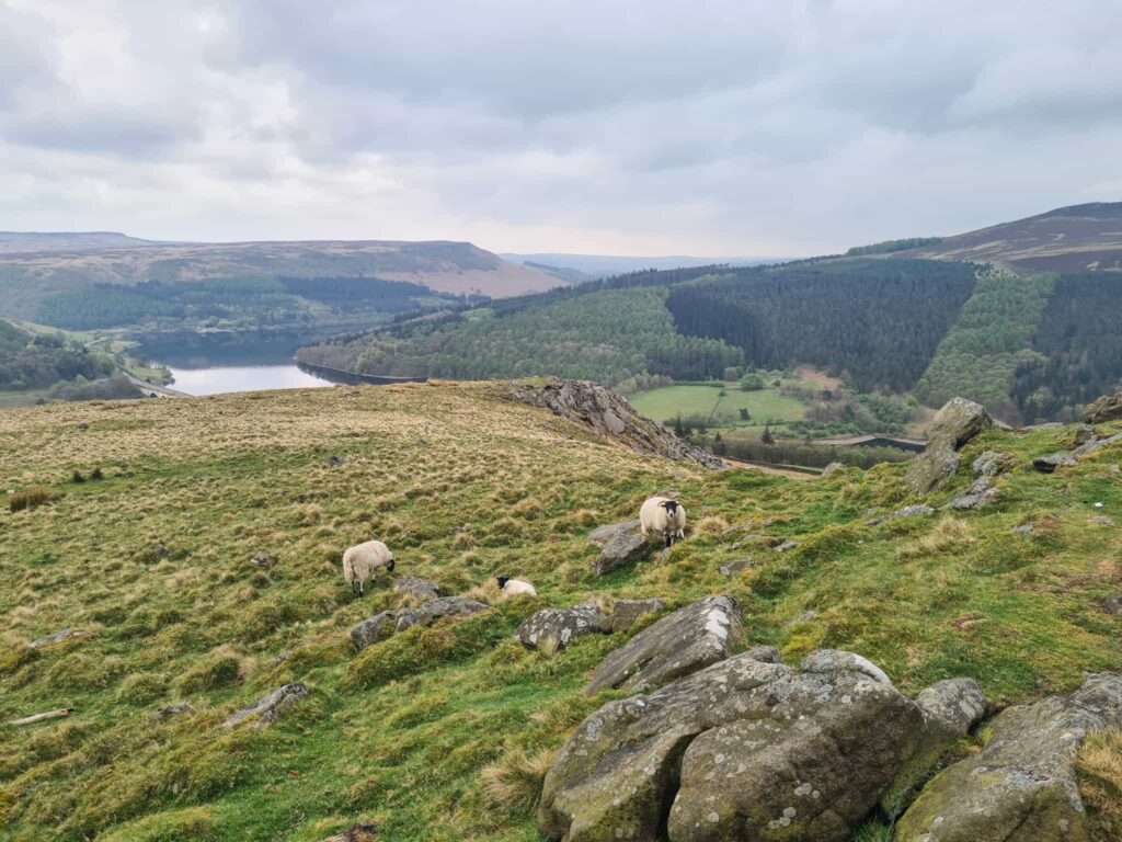
We had to walk along the A57 Snake Road for a short distance until we reached a footpath running up through the woods on the other side of the road. This path leads to a gate where you can see the two peaks of Crook Hill (382m above sea level). The higher summit is sometimes known as Ladycrook Hill, and there is the remains of a Bronze Age stone circle between the two summits. We headed across the Open Access Land and up the higher summit first, then followed the path along to the lower summit which has spectacular far reaching views over Ladybower Reservoir.


Views to the twin peaks of Crook Hill (right) and Ladycrook Hill (left)

Views to the twin peaks of Crook Hill (right) and Ladycrook Hill (left)

Views from Crook Hill down to Ladybower Reservoir

Views from Crook Hill down to Ladybower Reservoir

Views from Crook Hill down to Ladybower Reservoir


We then headed down the hillside towards Crookhill Farm, and followed the footpath through the farmyard. The footpath is quite hard to see but we followed the farm track out of the farm yard until we came to a barn, and the footpath gate runs alongside the barn.

Crookhill Farm. The footpath follows the farm track through the farm yard.


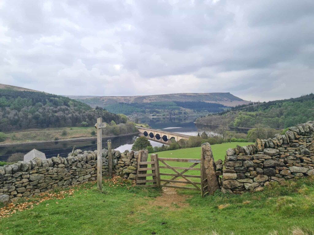
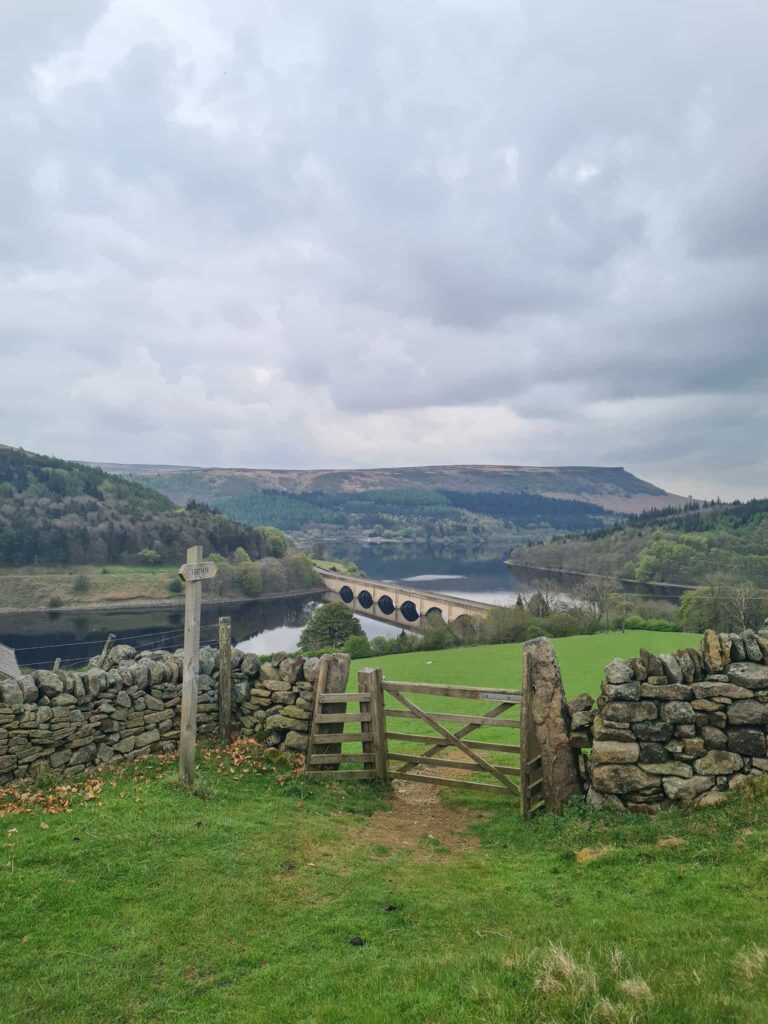
The path then leads down the hill and pops out near the junction with Snake Road. From here, we walked over the Ashopton Viaduct and to The Ladybower Inn for a pub lunch, before heading back to the car park at Heatherdene.


Looking over Ladybower Reservoir towards Derwent Edge

This walk features some short, steep climbs but the views from Win Hill and Crook Hill are definitely worth it! You could miss out Crook Hill if you just wanted to do a Win Hill walk – we wanted to tick off those two Ethels though.


Crook Hill and Win Hill Walk via Ladybower Reservoir:

Win Hill and Crook Hill Route Map:

Walk Route in OS Maps: Win Hill and Crook Hill via Ladybower Reservoir

Parking for Ladybower Reservoir: Heatherdene Car Park S33 0BY

Facilities: Public loos in the Heatherdene car park, and we went for a lunch in the Ladybower Inn

Walk Time: 3-4 hours

Difficulty: ▲▲

Distance: 8.1 miles (13 km)

Trig Points Bagged: Win Hill

Peak District Peaks Bagged: Win Hill, Crook Hill

Peak District Ethels Bagged: Win Hill, Crook Hill


You might also like:

Lose Hill and Win Hill

Ladybower Reservoir Walk With Win Hill


Tap to share with your hiking friends!

  • Facebook
  • Email
  • WhatsApp
« Birchen Edge Walk | 2 Miles
Kinder Downfall Walk via Nether Red Brook Scramble | 7 Miles »

RELATED POSTS

  • Hathersage Stepping StonesHathersage Stepping Stones Walk | 7 Miles
  • Ladybower ReservoirLadybower Walk | 6 Miles
  • Anvil Stone, GrindsbrookGrindsbrook Clough Scramble to Grindslow Knoll | 7 Miles
  • A woman dressed in black, wearing a pink bobble hat looking up at a waterfall - Wessenden waterfalls walk in the Peak District - The Wandering WildflowerWaterfalls at Wessenden | 5 Miles

Leave a Reply Cancel reply

Your email address will not be published. Required fields are marked *

FIND YOUR NEXT WALK:

ABOUT ME

Y Garn with Kids - Y Garn via the Devil's Kitchen Walk in Ogwen Valley

Hello! I’m Jo! Welcome to The Wandering Wildflower, an outdoors lifestyle blog focusing on family walks in the Peak District, a place we love exploring. I want to share the Peak District hidden gems and show you there’s so much more than the honeypot places. When I’m not dragging my husband and now 11 year old out on Peak District walks or up mountains, I can be found on planning my next moorland walk or plotting a Geocache walk (and seeing where the nearest pub is!). I love the hills but hate the heights, so trig bagging is – er- fun!


I hope this blog will give you some ideas of places to visit in the Peak District and inspire you and your family to head into the great outdoors.  Thanks for stopping by!

CATEGORIES

  • CIRCULAR WALKS (189)
  • HOLMFIRTH WALKS (27)
  • ISLE OF SKYE WALKS (3)
  • LAKE DISTRICT WALKS (26)
  • LANCASHIRE WALKS (2)
  • LONG PEAK DISTRICT WALKS 10 MILES + (42)
  • MEDIUM WALKS 4-9 MILES (137)
  • PEAK DISTRICT SCRAMBLES (16)
  • PEAK DISTRICT WALKS (206)
  • PEAK DISTRICT WALKS WITH KIDS (76)
  • PEAK DISTRICT WALKS WITH PUBS (60)
  • SCOTLAND WALKS (6)
  • SHORT WALKS UNDER 3 MILES (40)
  • SNOWDONIA WALKS (5)
  • UK CAMPING (5)
  • YORKSHIRE WALKS (33)

Peak District Walks

List of Peak District Ethels

Peak District Peak Bagging

Peak District Trig Point Challenge

Peak District Walks with Pubs

Peak District Walks with Kids

Beautiful Walks in Holmfirth

Short Walks in the Peak District

Long Walks in the Peak District

AFFILIATE DISCLOSURE

This blog may contain affiliate links through which, at no additional cost to you, I may earn a small commission. I only recommend products I would use myself and all opinions expressed here are my own. As an Amazon Associate I earn from qualifying purchases. Read full privacy policy here.

ARCHIVES

PEAK DISTRICT WEATHER

Peak District mountain weather on Met Office

Peak District Trig Points

Promo image for a blog post about the Peak District Trig Point Challenge With Map of Peak District Trig Points and Walking Routes by The Wandering Wildflower

Peak District Ethels Challenge

Promo image for a blog post about the Peak District Trig Point Challenge With Map of Peak District Ethels and Walking Routes by The Wandering Wildflower

WALKING ROUTES STRAIGHT TO YOUR INBOX

Want new walks in your inbox? Drop your email below and I'll send you some ideas for walks you can try.

You can unsubscribe anytime. For more details, review our Privacy Policy.

Thank you!

You have successfully joined our subscriber list.

RSS LATEST POSTS

  • How to Find Three Shires Head
  • Peak District Pub Walks
  • Burnbank Fell, Blake Fell and Gavel Fell | 8 Miles
  • Bretton Park Circular Walk | 3 Miles
  • Grasmere Weekend Break

FOLLOW ON PINTEREST

Want new walks in your inbox? Drop your email below and I'll send you some ideas for walks you can try.

You can unsubscribe anytime. For more details, review our Privacy Policy.

Thank you!

You have successfully joined our subscriber list.

jo@thewanderingwildflower.co.uk

The Wandering Wildflower

  • Email
  • Facebook
  • Instagram
  • Pinterest
  • PRIVACY POLICY
  • TERMS & CONDITIONS
  • ABOUT

(c) The Wandering Wildflower. All Rights Reserved.

|| THEME BY ECLAIR DESIGNS