• 3 Mile Walks or Less
  • 4 Mile Walks
  • 5 Mile Walks
  • 6 Mile Walks
  • 7 Mile Walks
  • 8 Mile Walks
  • 9 Mile Walks
  • 10 Mile Walks
  • 11 Mile Walks
  • 12 Mile Walks
  • 14 Mile Walks
  • 15 Mile Walks
  • 20+ Mile Walks

The Wandering Wildflower

Peak District Hikes

  • PEAK DISTRICT WALKS
    • SHORT WALKS UNDER 3 MILES
    • MEDIUM WALKS 4-9 MILES
    • LONG PEAK DISTRICT WALKS 10 MILES +
  • PEAK DISTRICT WALKS WITH PUBS
  • PEAK DISTRICT WALKS WITH KIDS
  • HOLMFIRTH WALKS

Edale to the Dragon Rapide on Kinder Scout | 7.5 Miles

March 21, 2024 CIRCULAR WALKS, MEDIUM WALKS 4-9 MILES, PEAK DISTRICT WALKS

Leaving the beautiful village of Edale, this Peak District walk climbs Grindslow Knoll before heading off over the Kinder Scout plateau to discover the wreck of the Dragon Rapide on Edale Moor, the Seal Stones on the northern edge of the plateau and returning via the ‘Seven Minute Crossing’ across the plateau. This is a challenging 7.5 mile walk and good navigational skills are essential.


A view over moorland with blue skies

Views from the top of Grinds Brook with Grindslow Knoll to the right of the image


This blog may contain affiliate links through which, at no additional cost to you, I may earn a small commission. I only recommend products I would use myself and all opinions expressed here are my own. Read full privacy policy here.


I was gifted a copy of Mountain Walks: Kinder Scout by Sarah Lister. This is one of the walks from the book, which is packed with 15 brilliant walks on or around Kinder Scout, including some lower level walks for when the weather isn’t great or time is short.


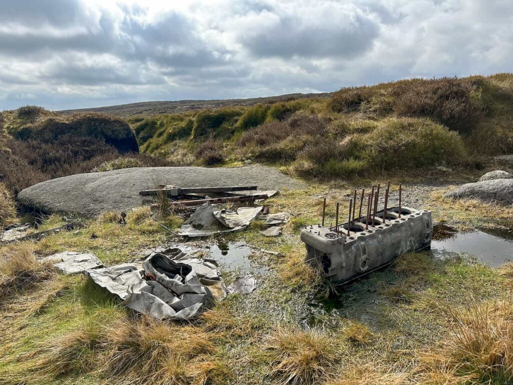
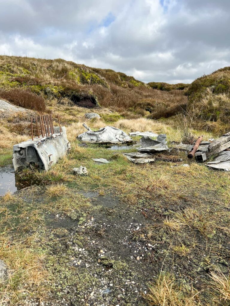
Dragon Rapide Crash Site, Edale Moor

The De Havilland Dragon DH89 Rapide G-ALBC crashed on Edale Moor in 1963 after carrying out a photographic survey. Both crew members were recovered alive by rescue teams, as were their films and cameras! The grid reference for the crash site is SK 10160 88241 – it’s hidden in a grough though so you might need to search about as it’s not immediately obvious.


We had planned to head out on this walk a few weeks back but a combination of poor weather (not what you want for searching for plane wreck sites on Kinder Scout) and then a cold/flu bug meant that we had to wait. Luckily for us, we picked a day with lovely weather!


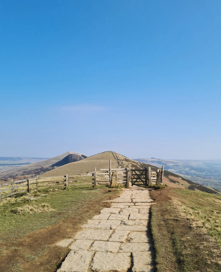
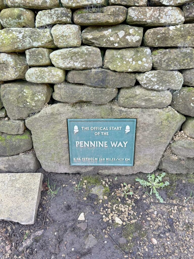
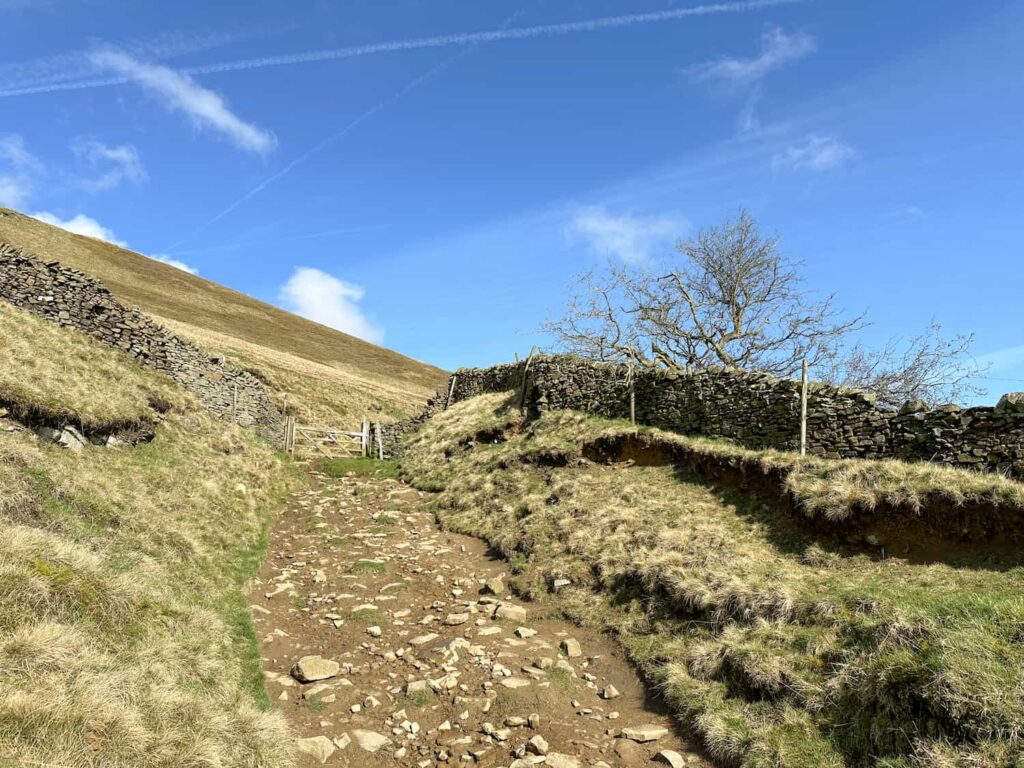
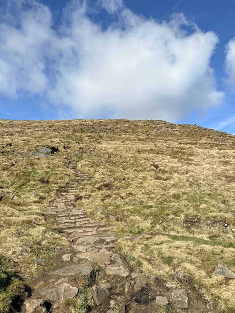
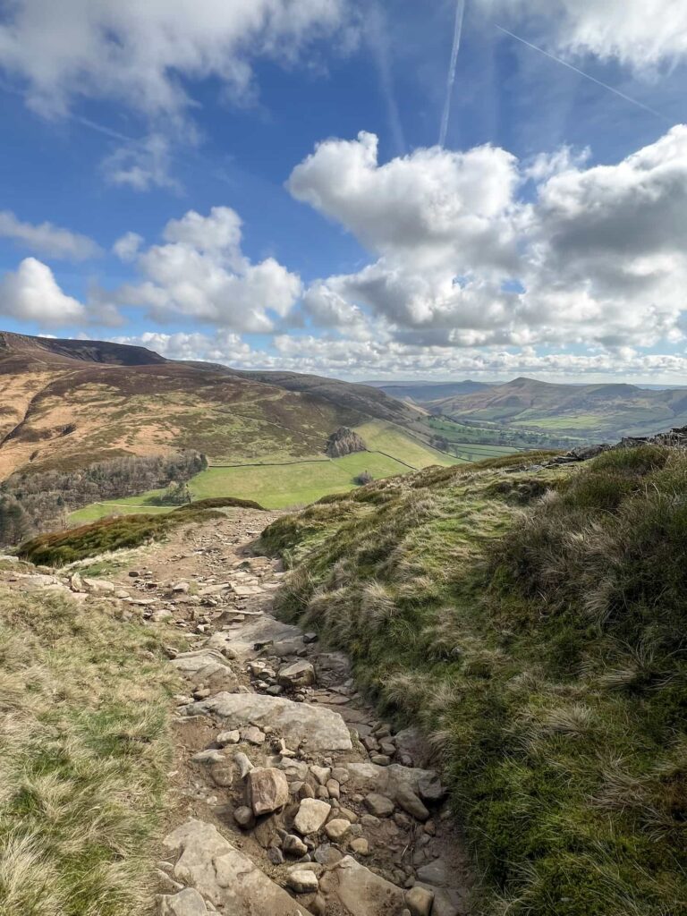
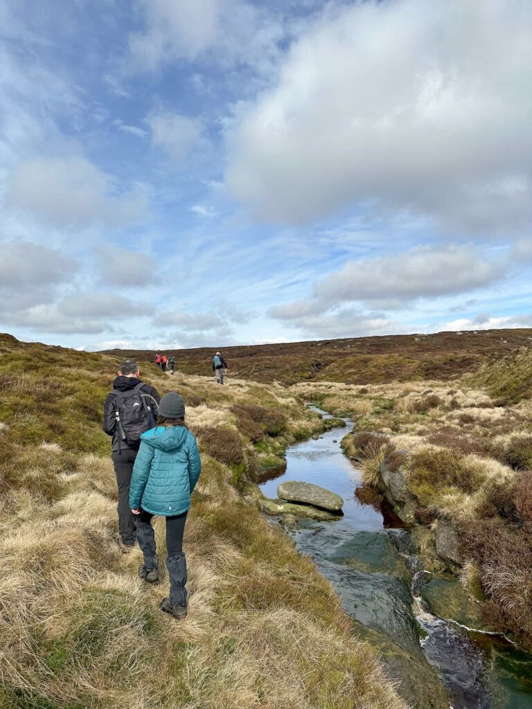
The walk starts from Edale car park and heads up through the village of Edale to the start of the Pennine Way, at The Old  Nags Head inn. We followed the Pennine Way a short distance past the campsite and then forked right at the wooden sign post to start the climb up Grindslow Knoll, up the fields then the steep, rocky path.

A green plaque set into a wall marking the start of the Pennine Way

A rocky path leading to a wooden gate

Stone steps leading to the summit of Grindslow Knoll


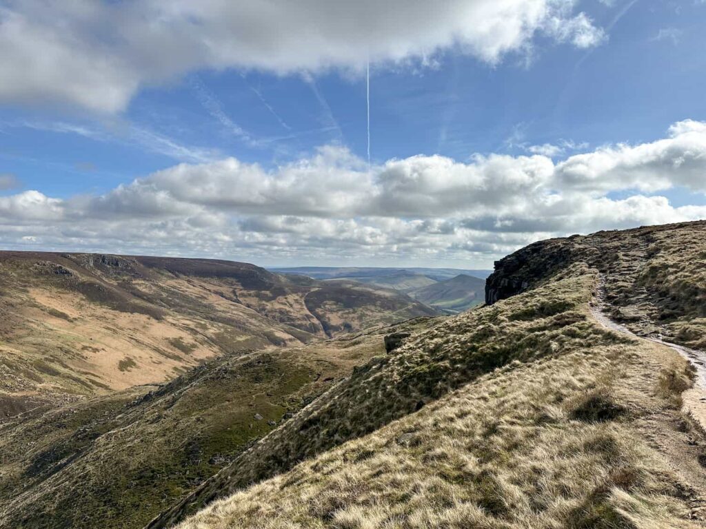
At the summit of Grindslow Knoll we were met by stunning views over to the Kinder Scout plateau and back over the Great Ridge of Mam Tor and Lose Hill.


A view back down the climb up Grindslow Knoll

The view from the top of Grindslow Knoll, with Kinder Scout in the background

The view from the top of Grindslow Knoll, with Kinder Scout in the background

A view of Grindslow Knoll summit

A mushroom shaped rock formation


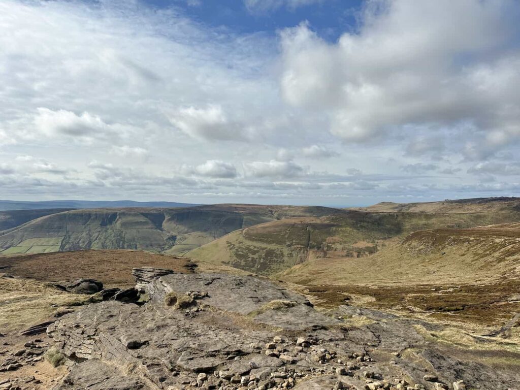
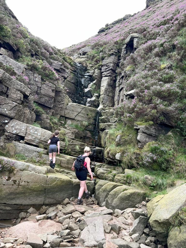
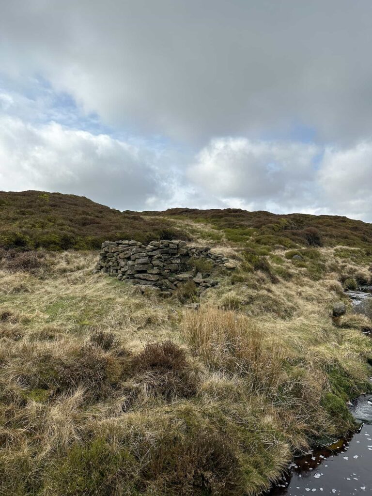
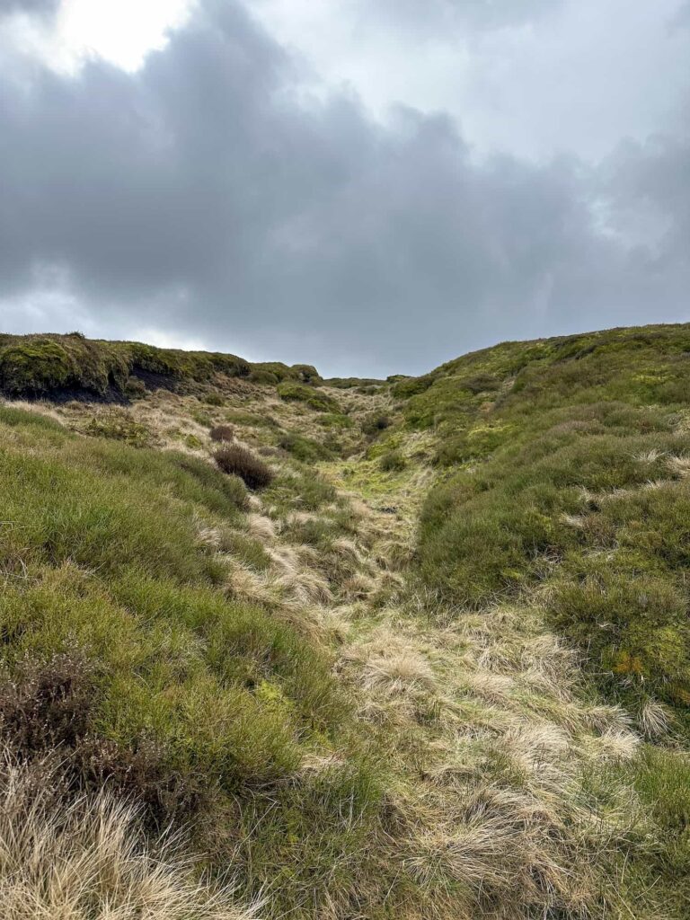
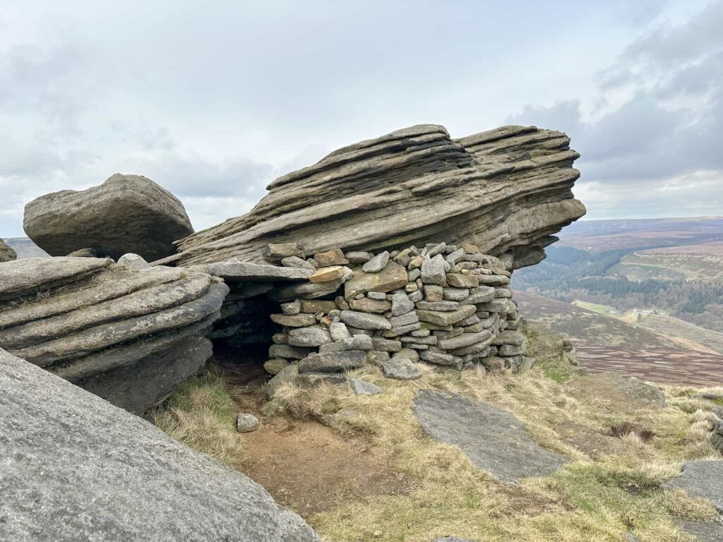
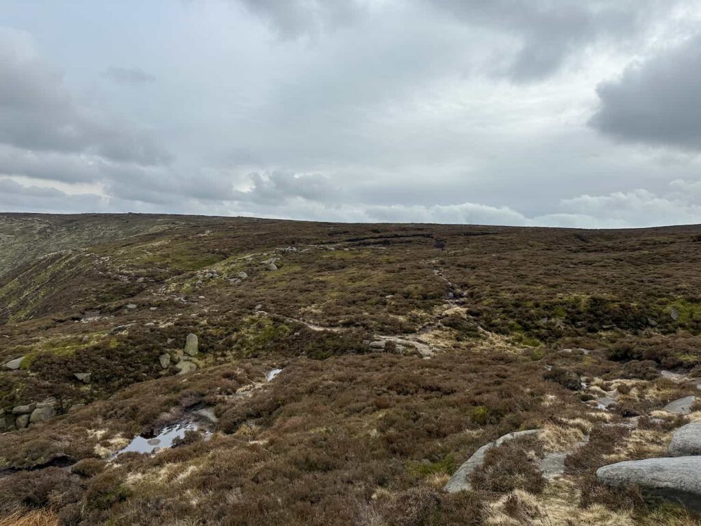
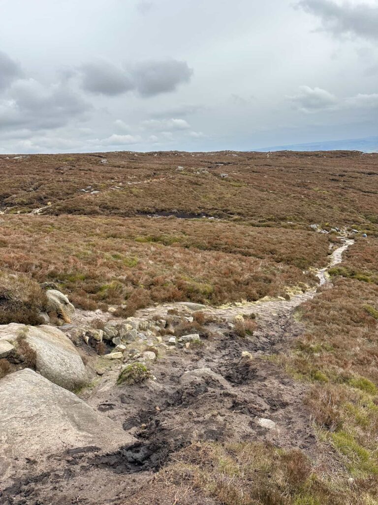
We followed the path down to the top of Grinds Brook, where there was a steady stream of people coming up the Grindsbrook Clough scramble. The path heads round the edge a short distance to a rocky gorge. We followed the stream to the north over the Kinder plateau, and this is where your navigation skills will come in – the stream winds it’s way past the remains of Four Jacks Cabin, at one time the highest shooting cabin in Derbyshire, but then it gets harder to see where the path goes as it winds in and amongst the peat groughs.


A father and daughter hiking on the moors next to a stream

There were some other plane wreck hunters looking for the Rapide, but they were heading to the Anson wreckage first

The remains of Four Jacks Cabin, little more than a low stone wall now

The remains of Four Jacks Cabin

A moorland view of some peat groughs

The “path”! The groughs are high and it’s hard to see where you need to head. Good navigational skills are a must!


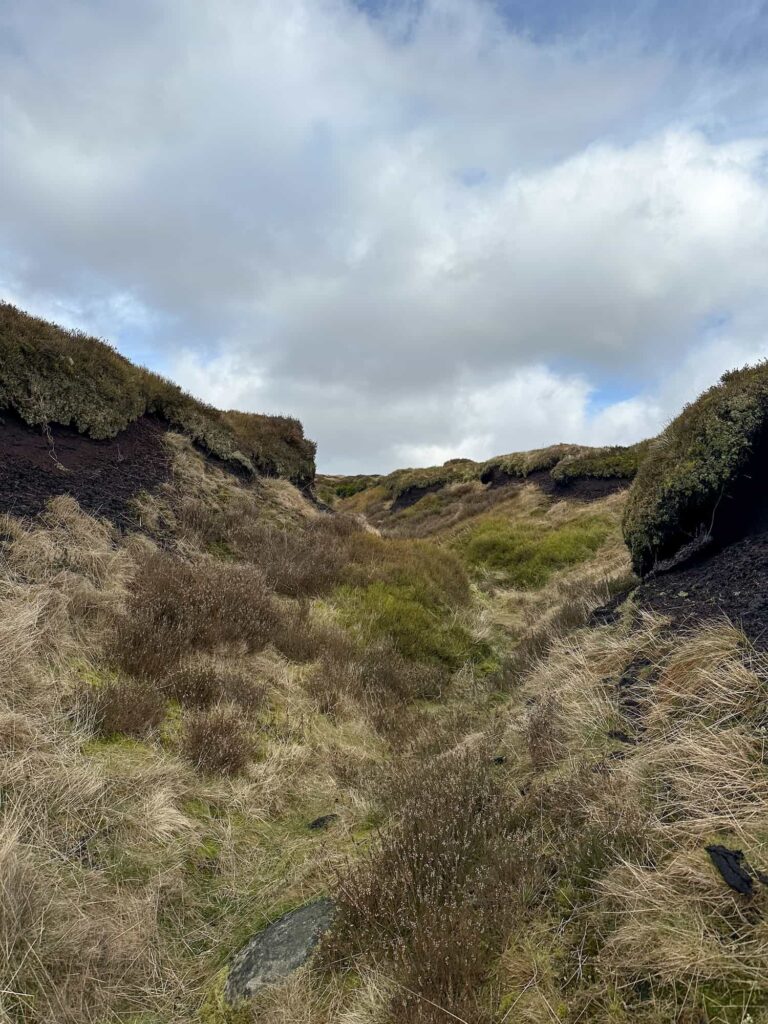
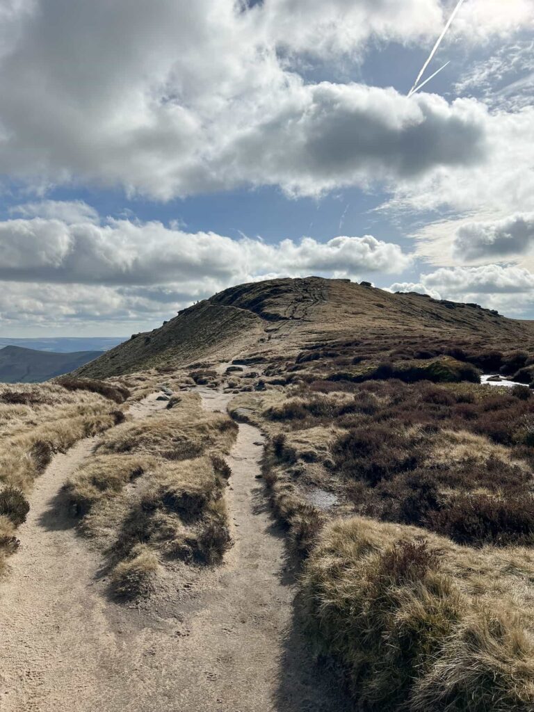
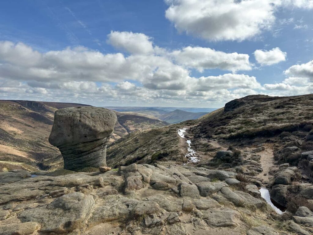
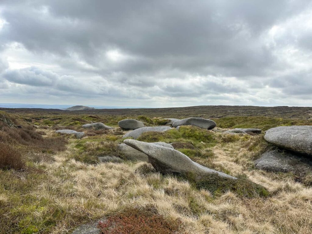
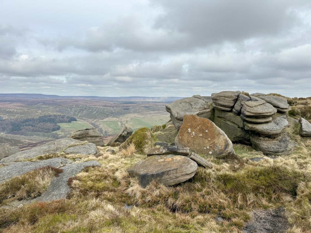
We found the site of the Dragon Rapide and then headed to group of rocks at the 623 spot height, before winding our way up and over the peat groughs in a north-easterly direction to pick up the path around the northern edge of Kinder Scout near the Seal Stones.

The remains of the Dragon Rapide on Edale Moor/Kinder Scout

The crash site of the Dragon Rapide on Kinder Scout

A stream bed on the moor, making navigation difficult

The terrain…!

A collection of rocks on Kinder Scout

The stones at the spot height

Some hikers on the northern edge of Kinder Scout

Safely on the northern edge path of Kinder Scout

A gritstone rock formation at the top of Blackden Brook

Nearing the top of Blackden Brook

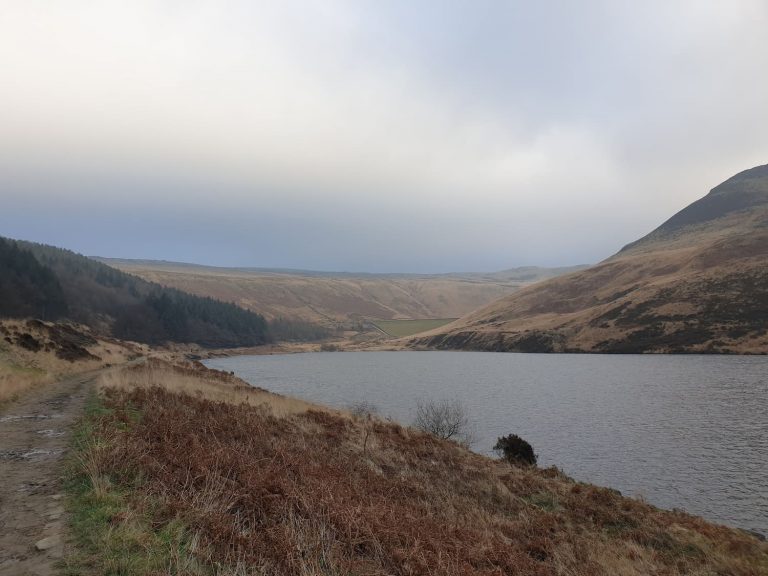
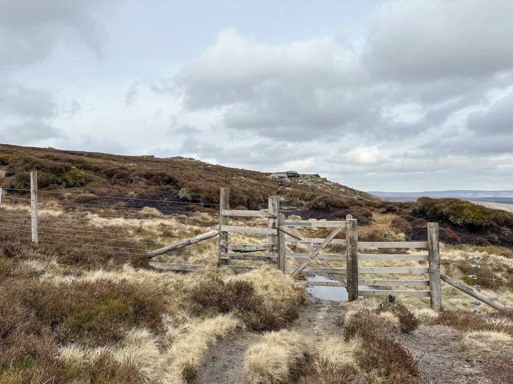
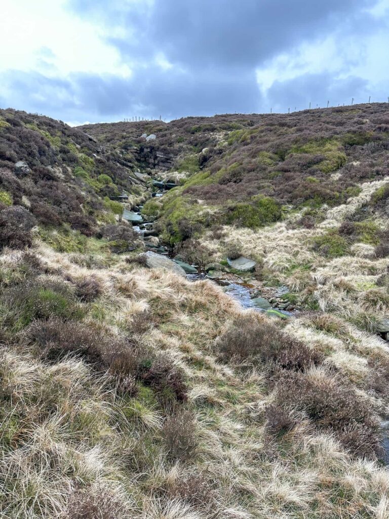
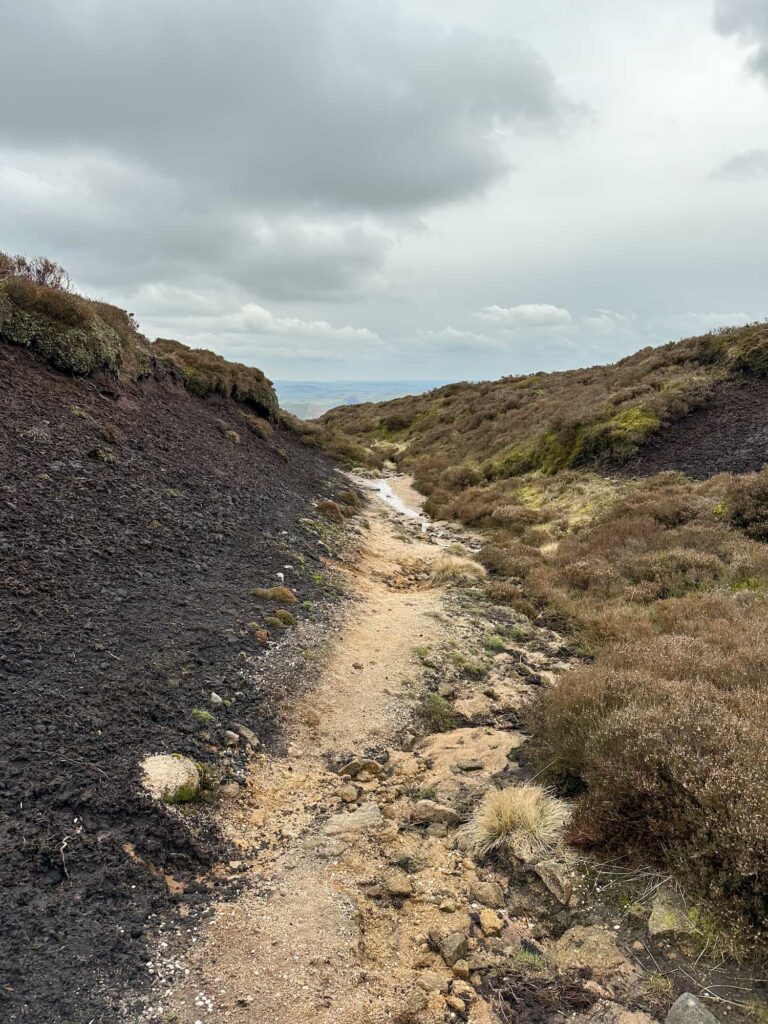
The path follows the edge until you reach Blackden Brook. After passing through the wooden gate and crossing the second stream of Blackden Brook, there is a path off over the plateau known as the Seven Minute Crossing. It took us 17 minutes to cross though as we had to pick our way through the peat bogs!

A small shelter at the top of Blackden Brook

A small shelter near the top of Blackden Brook

A wooden gate at the top of Blackden Brook

A stream at the top of Blackden Brook

After crossing the stream the path forks and we went right over the plateau

A moorland view with the Seven Minute Crossing faintly marked

You can *just* see where the Seven Minute Crossing path forks off, in the centre of the image

A peat grough

When you hit the beach (!) the southern edge path isn’t far away

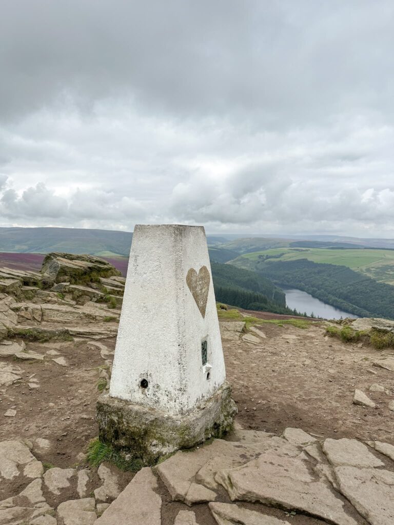
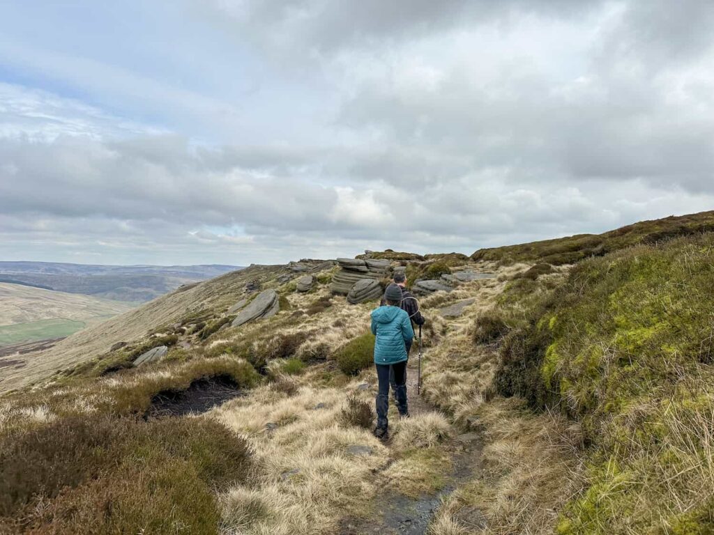
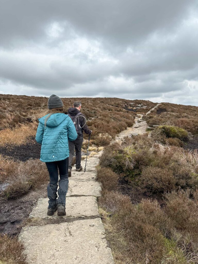
We picked up the paved path that runs along the southern edge to Nether Tor, and then descended back down via a rocky path below Ringing Roger to Edale and a well-earned pint and pub lunch in The Old Nags Head.


A father and daughter hiking on a stone slab path

A view of the Kinder Scout plateau

We took the right hand path which heads back down the hillside to Edale


Walk Details:


Walk Map (Opens in OS Maps): Edale to Kinder Scout, Dragon Rapide and the Seal Stones

Parking: Edale Car Park, Water Meadows, Hope Rd, Edale, Hope Valley S33 7ZQ W3W:///prices.heartburn.adjust

Facilities: There are public toilets in the car park, and plenty of cafes and pubs nearby including the Penny Pot cafe and The Old Nags Head pub in Edale itself.

Walk Time: 4-5 hours

Difficulty: ▲▲▲

Distance: 7.5 miles (12km)

Elevation: 1,750ft (534m)

Trig Points Bagged: None

Peak District Peaks Bagged: Grindslow Knoll

Peak District Ethels Bagged: Grindslow Knoll


For more Peak District plane crash site walks, you might like:

Peak District Plane Crashes

Tintwistle Seven Falls and Plane Crash Sites

Bleaklow Plane Crash Walk

USAAF B24-H Liberator Crash Site on Twizle Head Moss, Holmfirth

B29 Overexposed Crash Site on Bleaklow – A Guide


Tap to share with your hiking friends!

  • Facebook
  • Email
  • WhatsApp
« Bamford Edge Walk | 6 Miles
Accessible Peak District Trig Points »

RELATED POSTS

  • Hathersage Stepping StonesHathersage Stepping Stones Walk | 7 Miles
  • Ladybower ReservoirLadybower Walk | 6 Miles
  • Anvil Stone, GrindsbrookGrindsbrook Clough Scramble to Grindslow Knoll | 7 Miles
  • Dove Stone Reservoir Circular Walk | 4 Miles

Leave a Reply Cancel reply

Your email address will not be published. Required fields are marked *

FIND YOUR NEXT WALK:

ABOUT ME

Y Garn with Kids - Y Garn via the Devil's Kitchen Walk in Ogwen Valley

Hello! I’m Jo! Welcome to The Wandering Wildflower, an outdoors lifestyle blog focusing on family walks in the Peak District, a place we love exploring. I want to share the Peak District hidden gems and show you there’s so much more than the honeypot places. When I’m not dragging my husband and now 11 year old out on Peak District walks or up mountains, I can be found on planning my next moorland walk or plotting a Geocache walk (and seeing where the nearest pub is!). I love the hills but hate the heights, so trig bagging is – er- fun!


I hope this blog will give you some ideas of places to visit in the Peak District and inspire you and your family to head into the great outdoors.  Thanks for stopping by!

CATEGORIES

  • CIRCULAR WALKS (189)
  • HOLMFIRTH WALKS (27)
  • ISLE OF SKYE WALKS (3)
  • LAKE DISTRICT WALKS (26)
  • LANCASHIRE WALKS (2)
  • LONG PEAK DISTRICT WALKS 10 MILES + (42)
  • MEDIUM WALKS 4-9 MILES (137)
  • PEAK DISTRICT SCRAMBLES (16)
  • PEAK DISTRICT WALKS (206)
  • PEAK DISTRICT WALKS WITH KIDS (76)
  • PEAK DISTRICT WALKS WITH PUBS (60)
  • SCOTLAND WALKS (6)
  • SHORT WALKS UNDER 3 MILES (40)
  • SNOWDONIA WALKS (5)
  • UK CAMPING (5)
  • YORKSHIRE WALKS (33)

Peak District Walks

List of Peak District Ethels

Peak District Peak Bagging

Peak District Trig Point Challenge

Peak District Walks with Pubs

Peak District Walks with Kids

Beautiful Walks in Holmfirth

Short Walks in the Peak District

Long Walks in the Peak District

AFFILIATE DISCLOSURE

This blog may contain affiliate links through which, at no additional cost to you, I may earn a small commission. I only recommend products I would use myself and all opinions expressed here are my own. As an Amazon Associate I earn from qualifying purchases. Read full privacy policy here.

ARCHIVES

PEAK DISTRICT WEATHER

Peak District mountain weather on Met Office

Peak District Trig Points

Promo image for a blog post about the Peak District Trig Point Challenge With Map of Peak District Trig Points and Walking Routes by The Wandering Wildflower

Peak District Ethels Challenge

Promo image for a blog post about the Peak District Trig Point Challenge With Map of Peak District Ethels and Walking Routes by The Wandering Wildflower

WALKING ROUTES STRAIGHT TO YOUR INBOX

Want new walks in your inbox? Drop your email below and I'll send you some ideas for walks you can try.

You can unsubscribe anytime. For more details, review our Privacy Policy.

Thank you!

You have successfully joined our subscriber list.

RSS LATEST POSTS

  • How to Find Three Shires Head
  • Peak District Pub Walks
  • Burnbank Fell, Blake Fell and Gavel Fell | 8 Miles
  • Bretton Park Circular Walk | 3 Miles
  • Grasmere Weekend Break

FOLLOW ON PINTEREST

Want new walks in your inbox? Drop your email below and I'll send you some ideas for walks you can try.

You can unsubscribe anytime. For more details, review our Privacy Policy.

Thank you!

You have successfully joined our subscriber list.

jo@thewanderingwildflower.co.uk

The Wandering Wildflower

  • Email
  • Facebook
  • Instagram
  • Pinterest
  • PRIVACY POLICY
  • TERMS & CONDITIONS
  • ABOUT

(c) The Wandering Wildflower. All Rights Reserved.

|| THEME BY ECLAIR DESIGNS