• 3 Mile Walks or Less
  • 4 Mile Walks
  • 5 Mile Walks
  • 6 Mile Walks
  • 7 Mile Walks
  • 8 Mile Walks
  • 9 Mile Walks
  • 10 Mile Walks
  • 11 Mile Walks
  • 12 Mile Walks
  • 14 Mile Walks
  • 15 Mile Walks
  • 20+ Mile Walks

The Wandering Wildflower

Peak District Hikes

  • PEAK DISTRICT WALKS
    • SHORT WALKS UNDER 3 MILES
    • MEDIUM WALKS 4-9 MILES
    • LONG PEAK DISTRICT WALKS 10 MILES +
  • PEAK DISTRICT WALKS WITH PUBS
  • PEAK DISTRICT WALKS WITH KIDS
  • HOLMFIRTH WALKS

Sough Top and Chelmorton Low | 3 Miles

July 13, 2022 CIRCULAR WALKS, PEAK DISTRICT WALKS, PEAK DISTRICT WALKS WITH KIDS, PEAK DISTRICT WALKS WITH PUBS, SHORT WALKS UNDER 3 MILES

Sough Top and Chelmorton Low are two of the Peak District Ethels on our challenge which are relatively near to each other. Located just near the village of Chelmorton, near Buxton, this walk is a gentle 3 miles in the beautiful Peak District countryside.

Chelmorton Low, a Derbyshire hill

Chelmorton Low

Chelmorton Low is a hill of 446m above sea level just outside the village of Chelmorton. At first glance it’s pretty unremarkable but there are actually two Bronze round barrows at the summit which are a scheduled monument. The summit of the hill is on private land but the route takes you very close and the wall between the private land and open access land is in a very poor condition. There is more information on Bronze Age burial sites on Megalithic.


Sough Top is a hill of 438m above sea level. There is no access to Sough Top trig point unfortunately as it’s on private land but you can get pretty close to it from the public footpath. To the west of Sough Top is Five Wells, a Neolithic chambered tomb which lines up with the Bronze Age burial mounds on Chelmorton Low.


It’s amazing how many Bronze Age burial sites there are dotted around the White Peak. It seems like almost every hill has a burial site! My favourite so far is Minninglow – it’s a very atmospheric place to visit.


Our walk starts from just outside the Church Inn on Main Street. We followed the road up to the entrance to the public footpath and headed north-east through the gate onto Open Access Land. There are no real paths up so we made our own way up to the summit of Chelmorton Low, admired the view and headed back the way we came back to the gate. It was very windy so we didn’t stay long!

Views towards Sough Top

The summit of Chelmorton Low, just over the wall.

From the gate we headed back onto the road and then followed the road past a small woodland area where there is the Bank Pit Spring. Once known as Illy-Willy Water, this spring was the water supply for Chelmorton at one time!


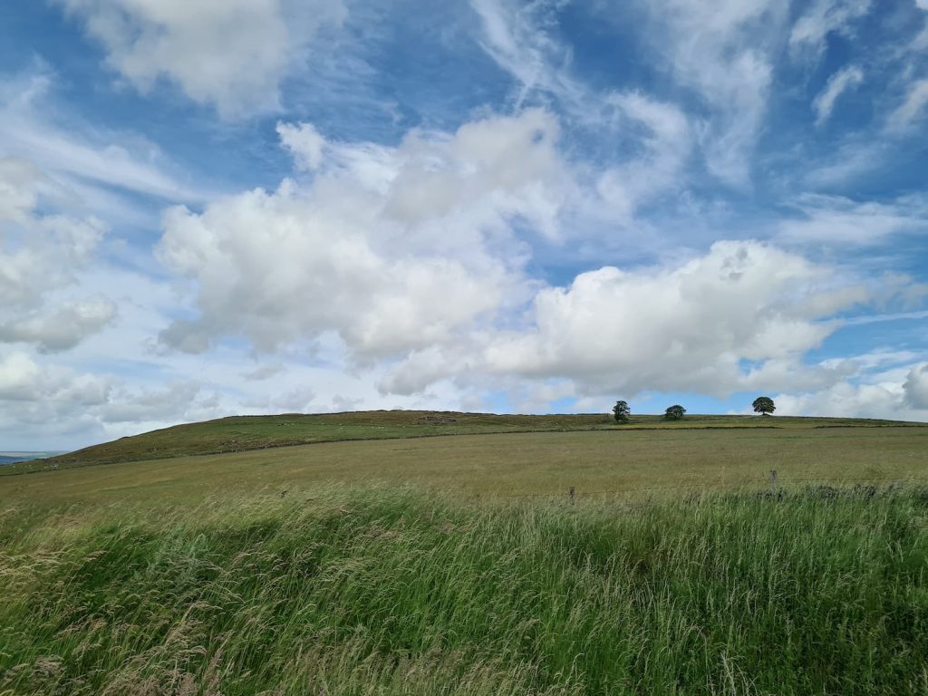
The lane eventually meets a bridleway, which we crossed then headed through the fields, over about a million stiles, to reach the summit of Sough Top.

Sough Top trig point

We could just see the top of Sough Top trig point peeping out of the wheat/corn/barley/whatever it is that was growing there!


We the headed back the way we had come, past the million stiles, and back down the lane to the car.


This was a quick and easy Ethels walk, bagging 2 Ethels without much effort. For more quick and easy Ethels walks, you might like 21 Short Walks in the Peak District.


Walk Route Map: 


Walk Map (Opens in OS Maps): Sough Top and Chelmorton Low

Parking: Main Street, Chelmorton SK17 9SL

Facilities: None apart from the pub

Walk Time: 1-2 hours

Difficulty: ▲ (Chelmorton Low is steep but the rest is pretty gentle)

Distance:  3.1 miles (5 km) in total

Trig Points Bagged: Sough Top

Peak District Peaks Bagged: Sough Top, Chelmorton Low

Peak District Ethels Bagged: Sough Top, Chelmorton Low


Tap to share with your hiking friends!

  • Facebook
  • Email
  • WhatsApp
« The Cloud, Bosley | 2 Miles
Snowdon Route via Rhyd Ddu Path | 10 Miles »

RELATED POSTS

  • Three Shires HeadHow to Find Three Shires Head
  • Lathkill Dale waterfallLathkill Dale Waterfall Walk | 7 Miles
  • Sheen Hill trig pointSheen Hill Trig Point | 6 Miles
  • Lantern Pike summit marker - Lantern Pike circular walk via Cown Edge and Harry Hut - Peak District walks with pubs - The Wandering WildflowerLantern Pike Circular Walk | 11 Miles

Leave a Reply Cancel reply

Your email address will not be published. Required fields are marked *

FIND YOUR NEXT WALK:

ABOUT ME

Y Garn with Kids - Y Garn via the Devil's Kitchen Walk in Ogwen Valley

Hello! I’m Jo! Welcome to The Wandering Wildflower, an outdoors lifestyle blog focusing on family walks in the Peak District, a place we love exploring. I want to share the Peak District hidden gems and show you there’s so much more than the honeypot places. When I’m not dragging my husband and now 11 year old out on Peak District walks or up mountains, I can be found on planning my next moorland walk or plotting a Geocache walk (and seeing where the nearest pub is!). I love the hills but hate the heights, so trig bagging is – er- fun!


I hope this blog will give you some ideas of places to visit in the Peak District and inspire you and your family to head into the great outdoors.  Thanks for stopping by!

CATEGORIES

  • CIRCULAR WALKS (189)
  • HOLMFIRTH WALKS (27)
  • ISLE OF SKYE WALKS (3)
  • LAKE DISTRICT WALKS (26)
  • LANCASHIRE WALKS (2)
  • LONG PEAK DISTRICT WALKS 10 MILES + (42)
  • MEDIUM WALKS 4-9 MILES (137)
  • PEAK DISTRICT SCRAMBLES (16)
  • PEAK DISTRICT WALKS (206)
  • PEAK DISTRICT WALKS WITH KIDS (76)
  • PEAK DISTRICT WALKS WITH PUBS (60)
  • SCOTLAND WALKS (6)
  • SHORT WALKS UNDER 3 MILES (40)
  • SNOWDONIA WALKS (5)
  • UK CAMPING (5)
  • YORKSHIRE WALKS (33)

Peak District Walks

List of Peak District Ethels

Peak District Peak Bagging

Peak District Trig Point Challenge

Peak District Walks with Pubs

Peak District Walks with Kids

Beautiful Walks in Holmfirth

Short Walks in the Peak District

Long Walks in the Peak District

AFFILIATE DISCLOSURE

This blog may contain affiliate links through which, at no additional cost to you, I may earn a small commission. I only recommend products I would use myself and all opinions expressed here are my own. As an Amazon Associate I earn from qualifying purchases. Read full privacy policy here.

ARCHIVES

PEAK DISTRICT WEATHER

Peak District mountain weather on Met Office

Peak District Trig Points

Promo image for a blog post about the Peak District Trig Point Challenge With Map of Peak District Trig Points and Walking Routes by The Wandering Wildflower

Peak District Ethels Challenge

Promo image for a blog post about the Peak District Trig Point Challenge With Map of Peak District Ethels and Walking Routes by The Wandering Wildflower

WALKING ROUTES STRAIGHT TO YOUR INBOX

Want new walks in your inbox? Drop your email below and I'll send you some ideas for walks you can try.

You can unsubscribe anytime. For more details, review our Privacy Policy.

Thank you!

You have successfully joined our subscriber list.

RSS LATEST POSTS

  • How to Find Three Shires Head
  • Peak District Pub Walks
  • Burnbank Fell, Blake Fell and Gavel Fell | 8 Miles
  • Bretton Park Circular Walk | 3 Miles
  • Grasmere Weekend Break

FOLLOW ON PINTEREST

Want new walks in your inbox? Drop your email below and I'll send you some ideas for walks you can try.

You can unsubscribe anytime. For more details, review our Privacy Policy.

Thank you!

You have successfully joined our subscriber list.

jo@thewanderingwildflower.co.uk

The Wandering Wildflower

  • Email
  • Facebook
  • Instagram
  • Pinterest
  • PRIVACY POLICY
  • TERMS & CONDITIONS
  • ABOUT

(c) The Wandering Wildflower. All Rights Reserved.

|| THEME BY ECLAIR DESIGNS