• 3 Mile Walks or Less
  • 4 Mile Walks
  • 5 Mile Walks
  • 6 Mile Walks
  • 7 Mile Walks
  • 8 Mile Walks
  • 9 Mile Walks
  • 10 Mile Walks
  • 11 Mile Walks
  • 12 Mile Walks
  • 14 Mile Walks
  • 15 Mile Walks
  • 20+ Mile Walks

The Wandering Wildflower

Peak District Hikes

  • PEAK DISTRICT WALKS
    • SHORT WALKS UNDER 3 MILES
    • MEDIUM WALKS 4-9 MILES
    • LONG PEAK DISTRICT WALKS 10 MILES +
  • PEAK DISTRICT WALKS WITH PUBS
  • PEAK DISTRICT WALKS WITH KIDS
  • HOLMFIRTH WALKS

The Roaches Walk | 4 Miles

February 22, 2022 CIRCULAR WALKS, MEDIUM WALKS 4-9 MILES, PEAK DISTRICT WALKS, PEAK DISTRICT WALKS WITH KIDS

If you are looking for somewhere to take the kids for a day out in the Peak District, what about The Roaches nature reserve in Staffordshire? It’s a great place to explore with rock formations to climb, wildlife to see, places to picnic and more. If you need a walk map for The Roaches, read on!

The Roaches is an amazing 395 acre protected landscape near Leek. This is a Site of Special Scientific Interest and is a great place to spot curlew, red grouse and tree pipit as well as the resident peregrines. As this is a SSSI dogs must be kept on a lead so they don’t disturb the wildlife. 


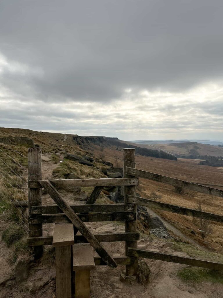
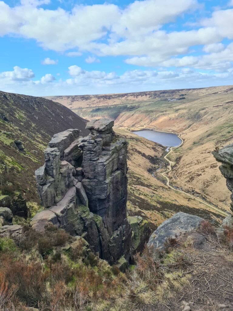
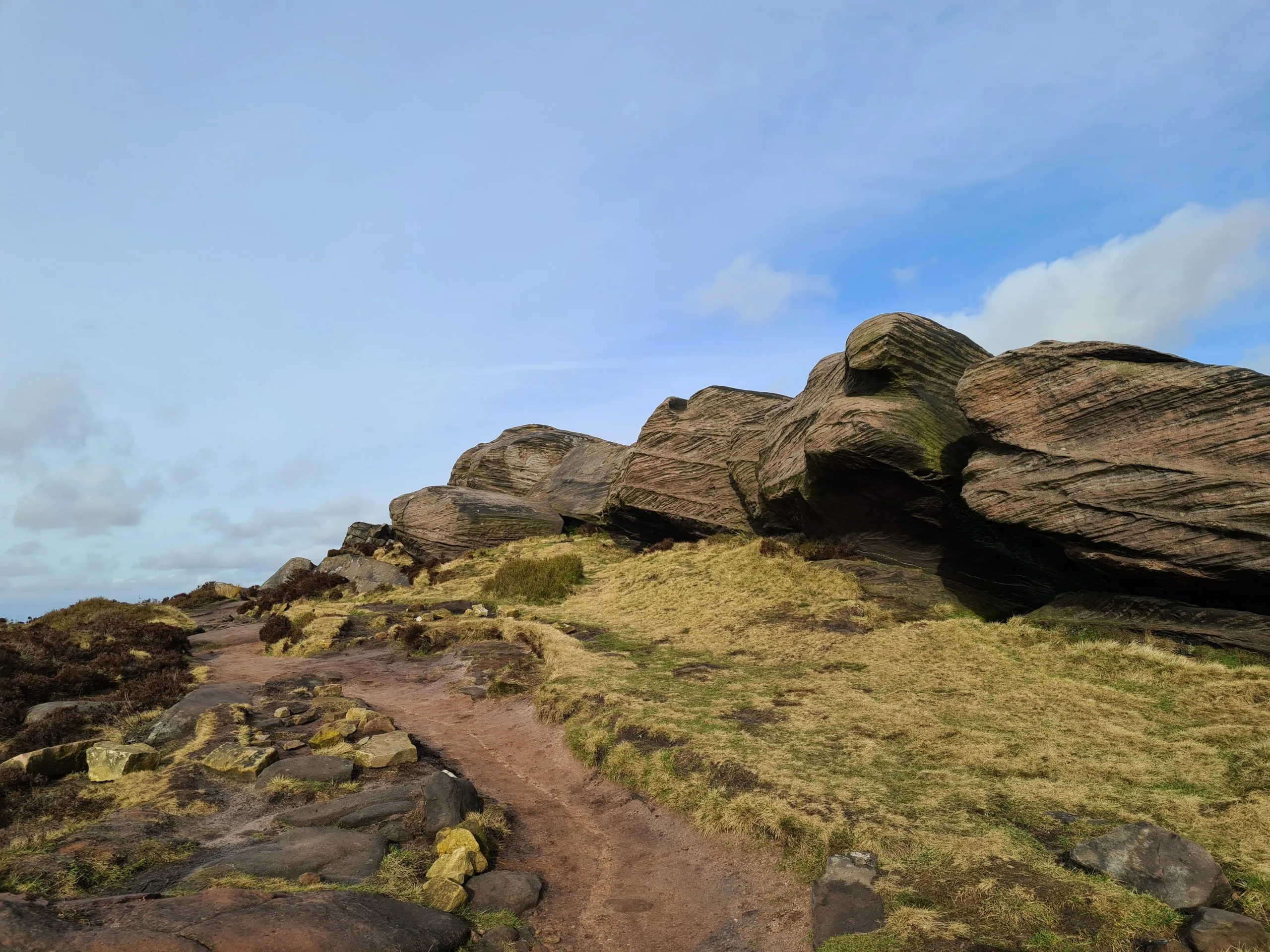
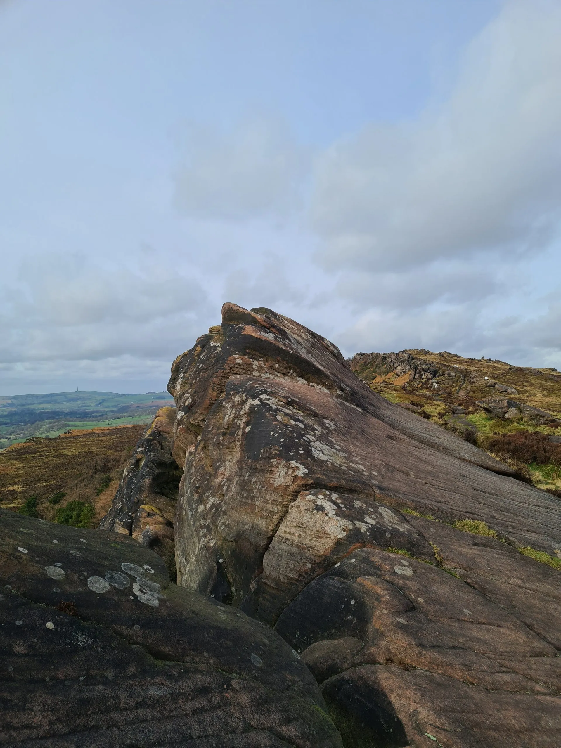
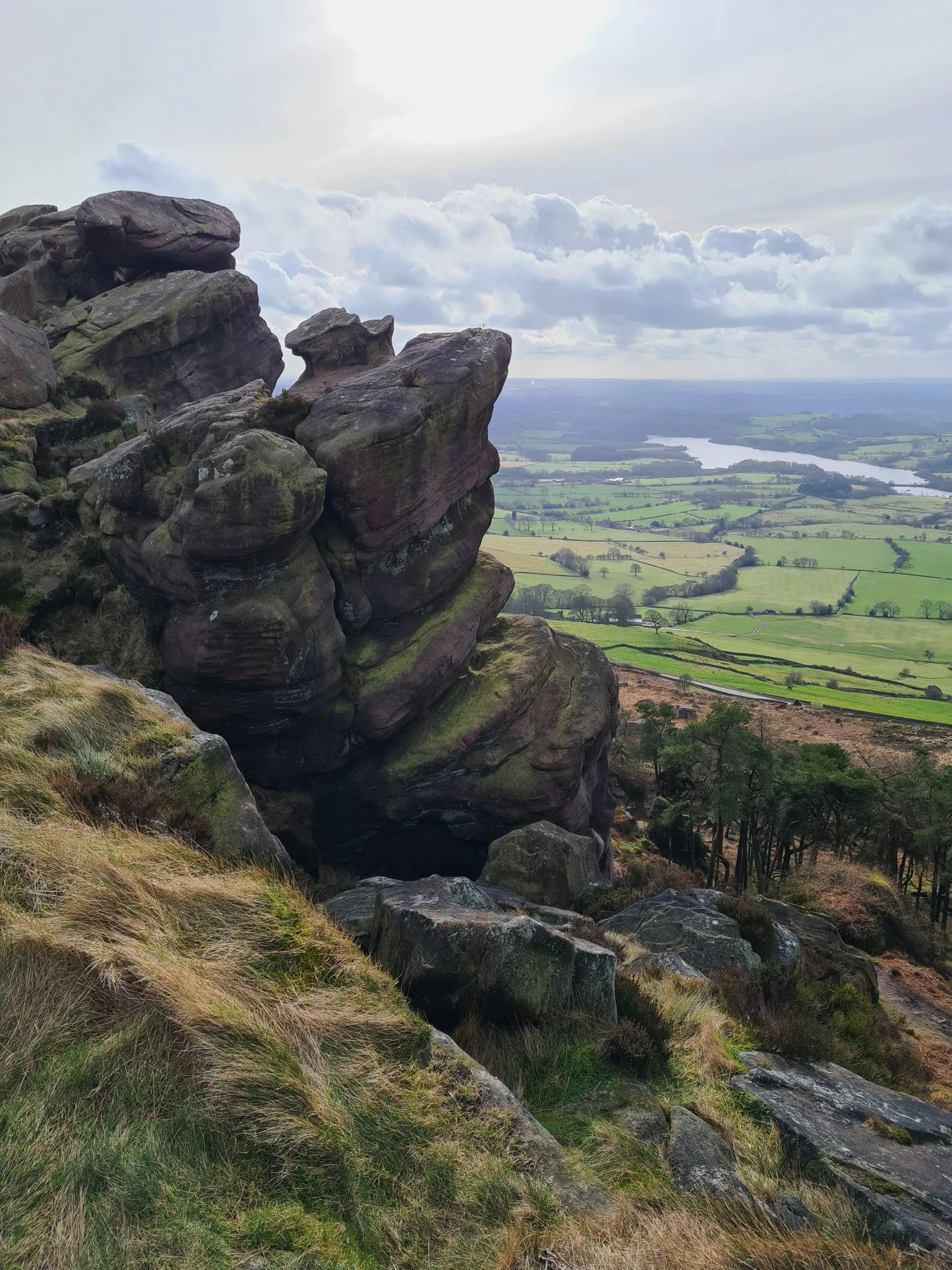
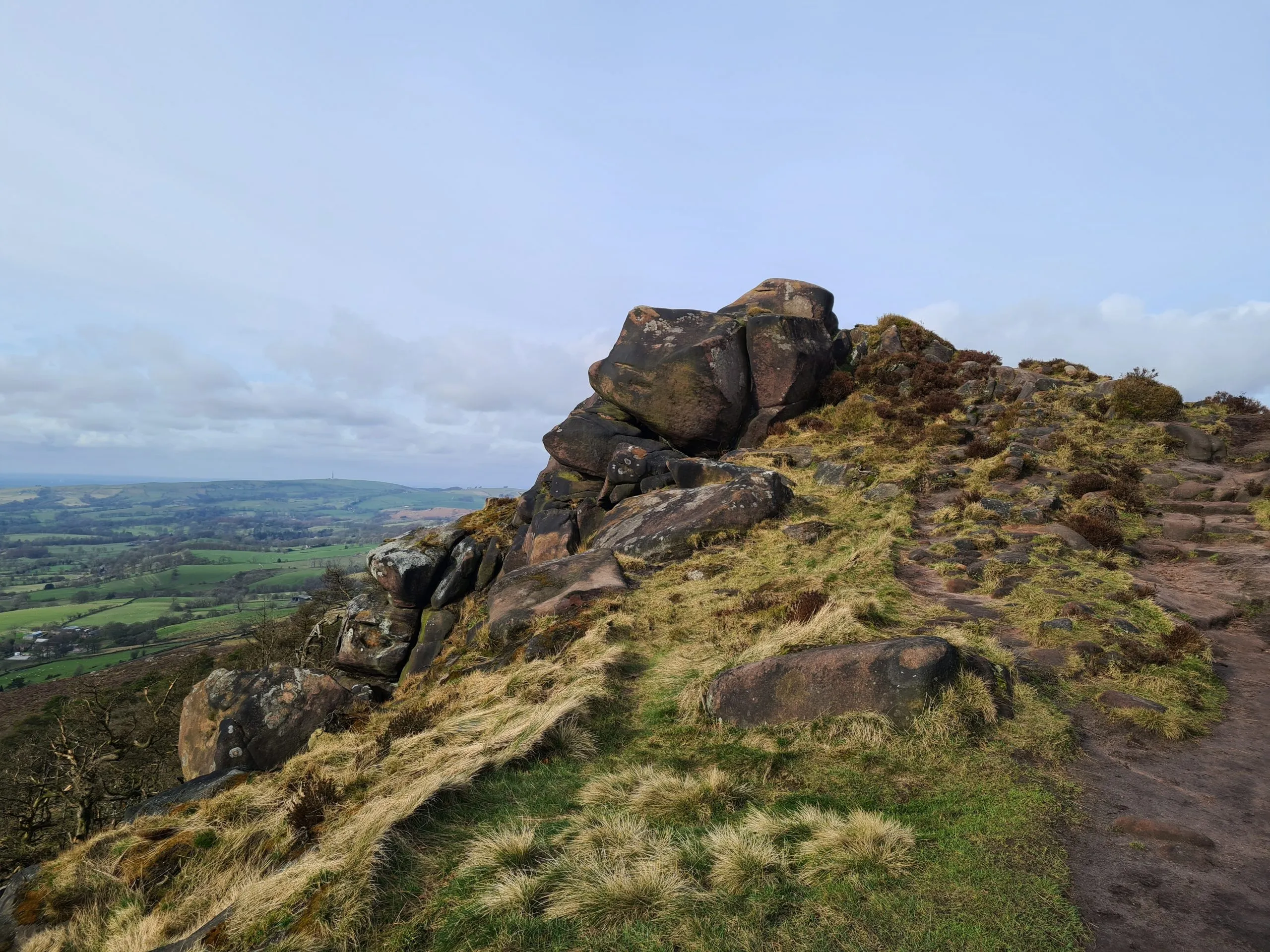
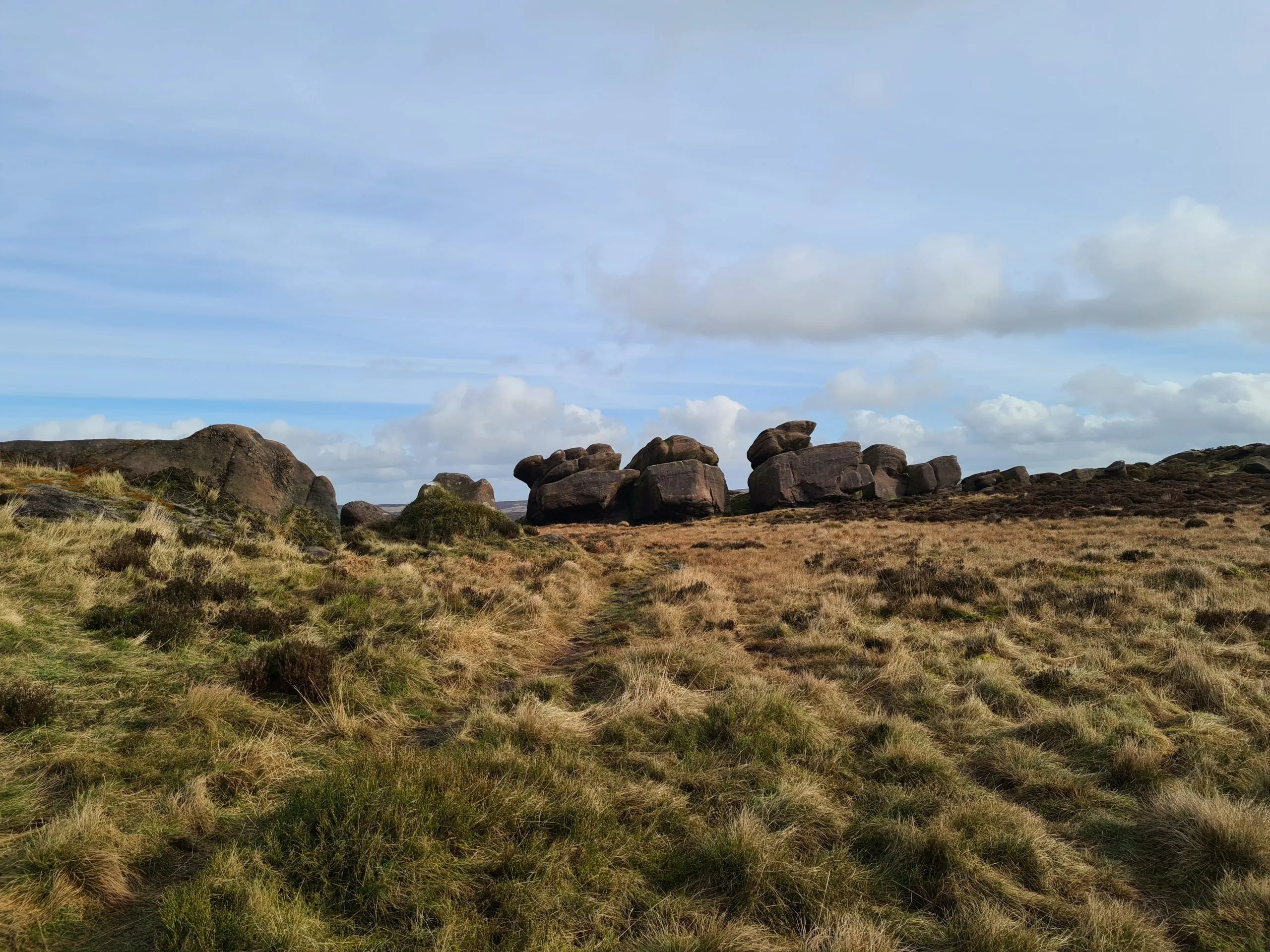
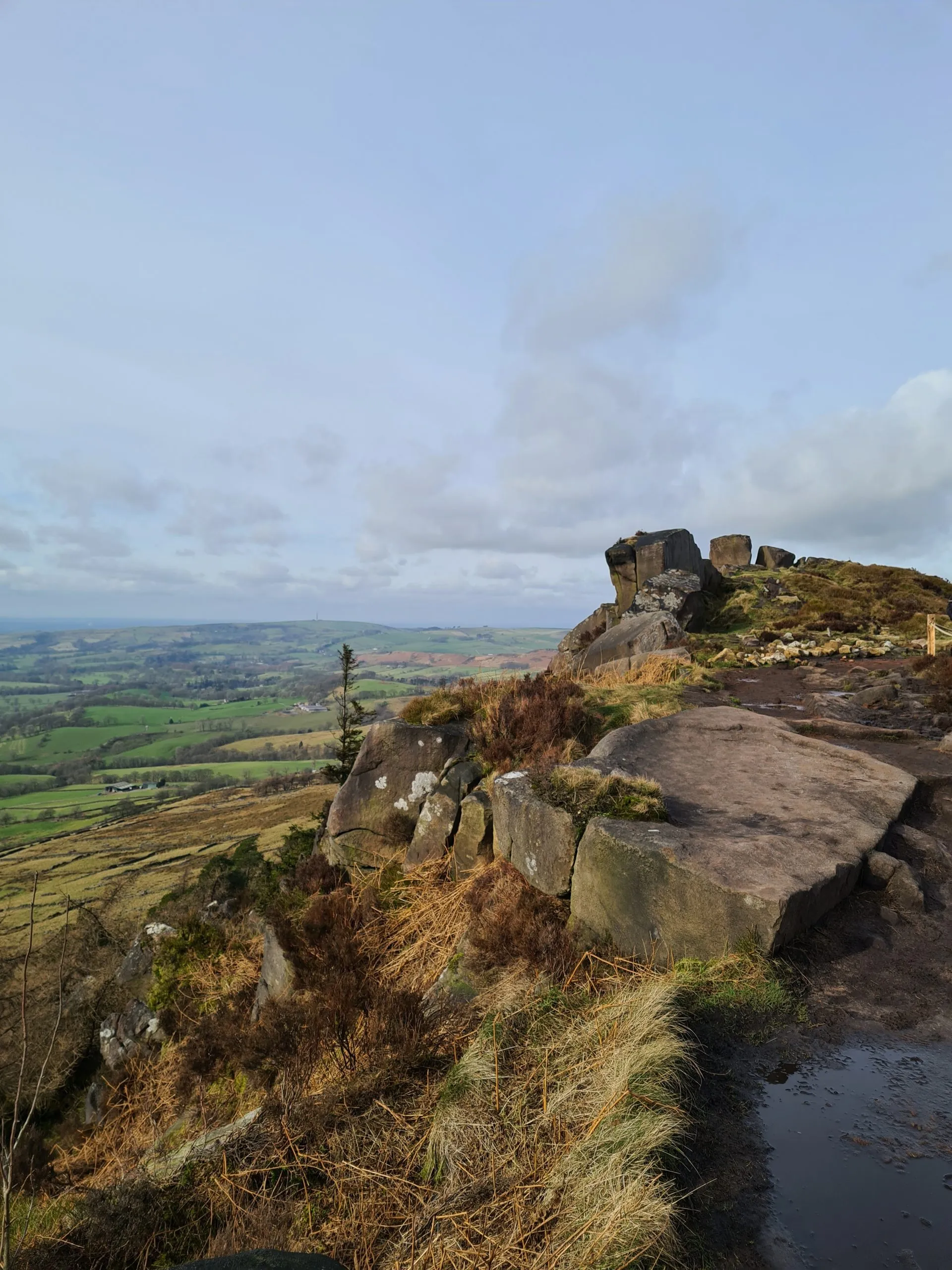
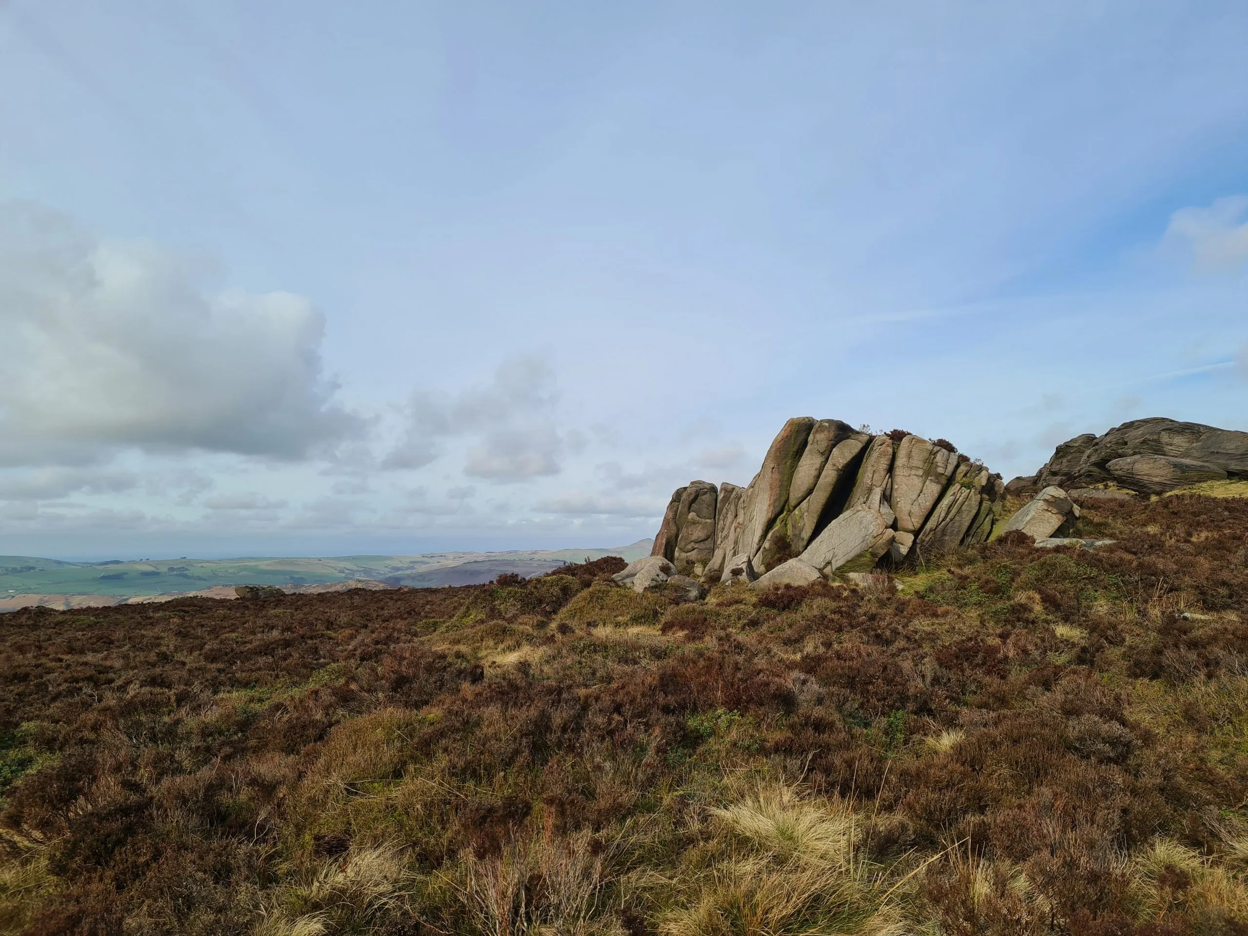
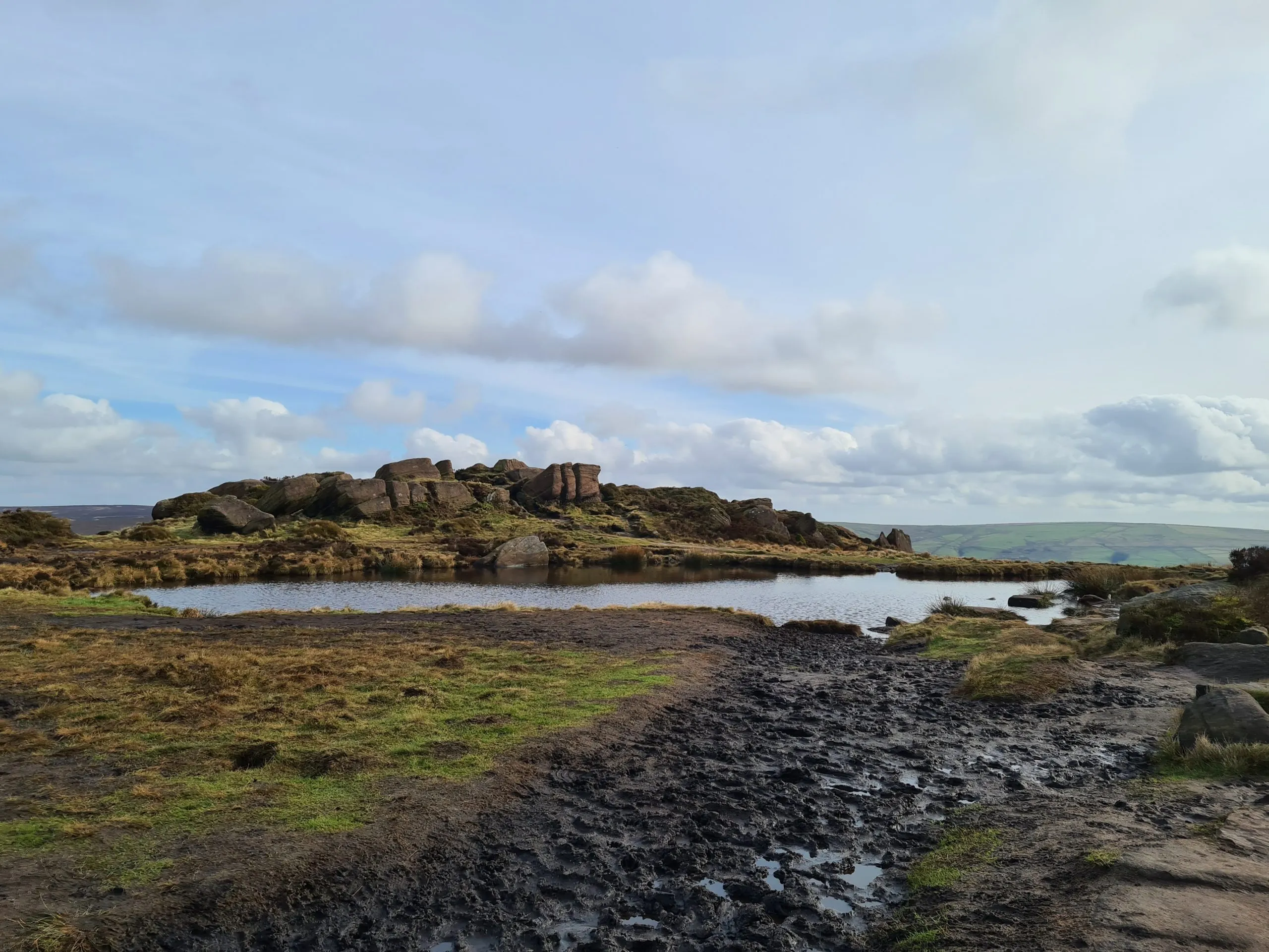
The Roaches is famous for it’s huge gritstone escarpment which has a prominence of 120m. The name comes from the French “les roches” which means the rocks, and it’s easy to see why. This area is really popular with rock climbers.

Parking for The Roaches is either in the car park in Gradbach, by the Youth Hostel or park in the lay-bys on the road at ST13 8UB. Be sure to park in the designated parking areas only – traffic wardens do visit to hand out tickets occasionally. If you park in the lay-by indicated by the A on the map, the route up to The Roaches is really easy to find.

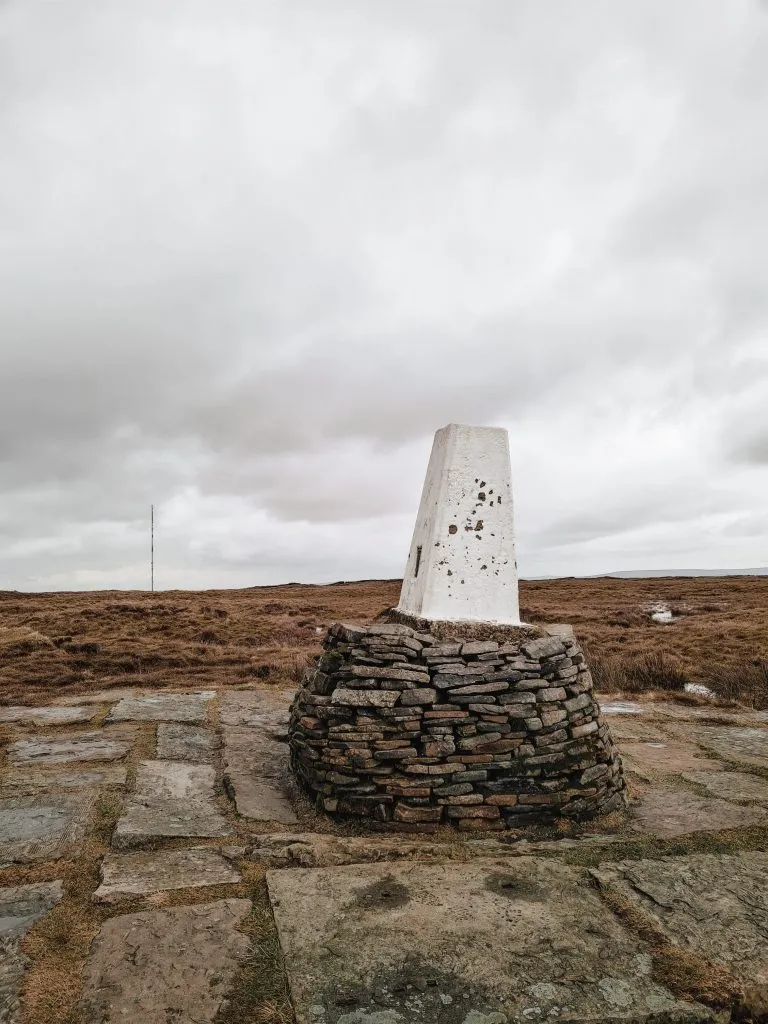
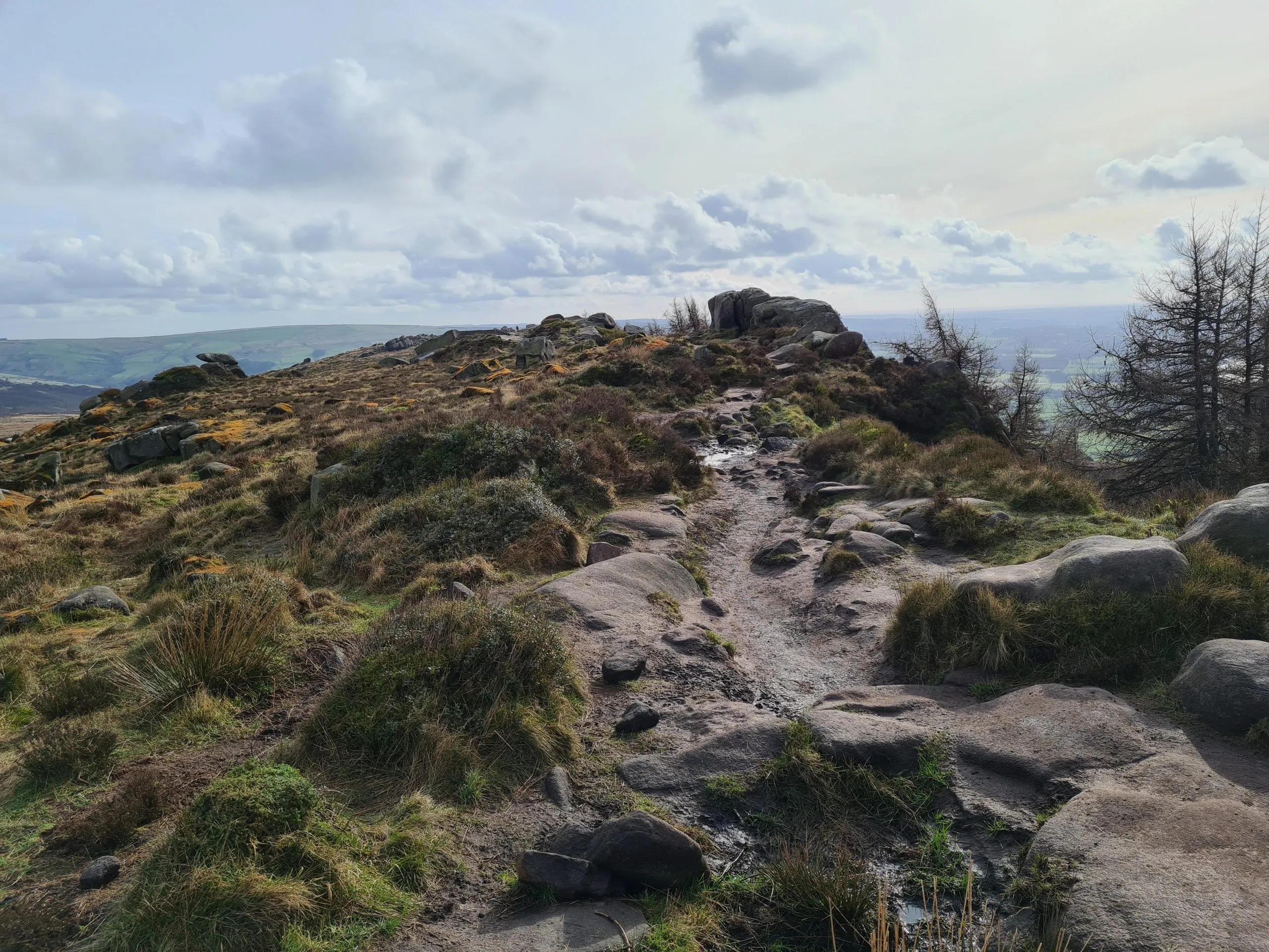
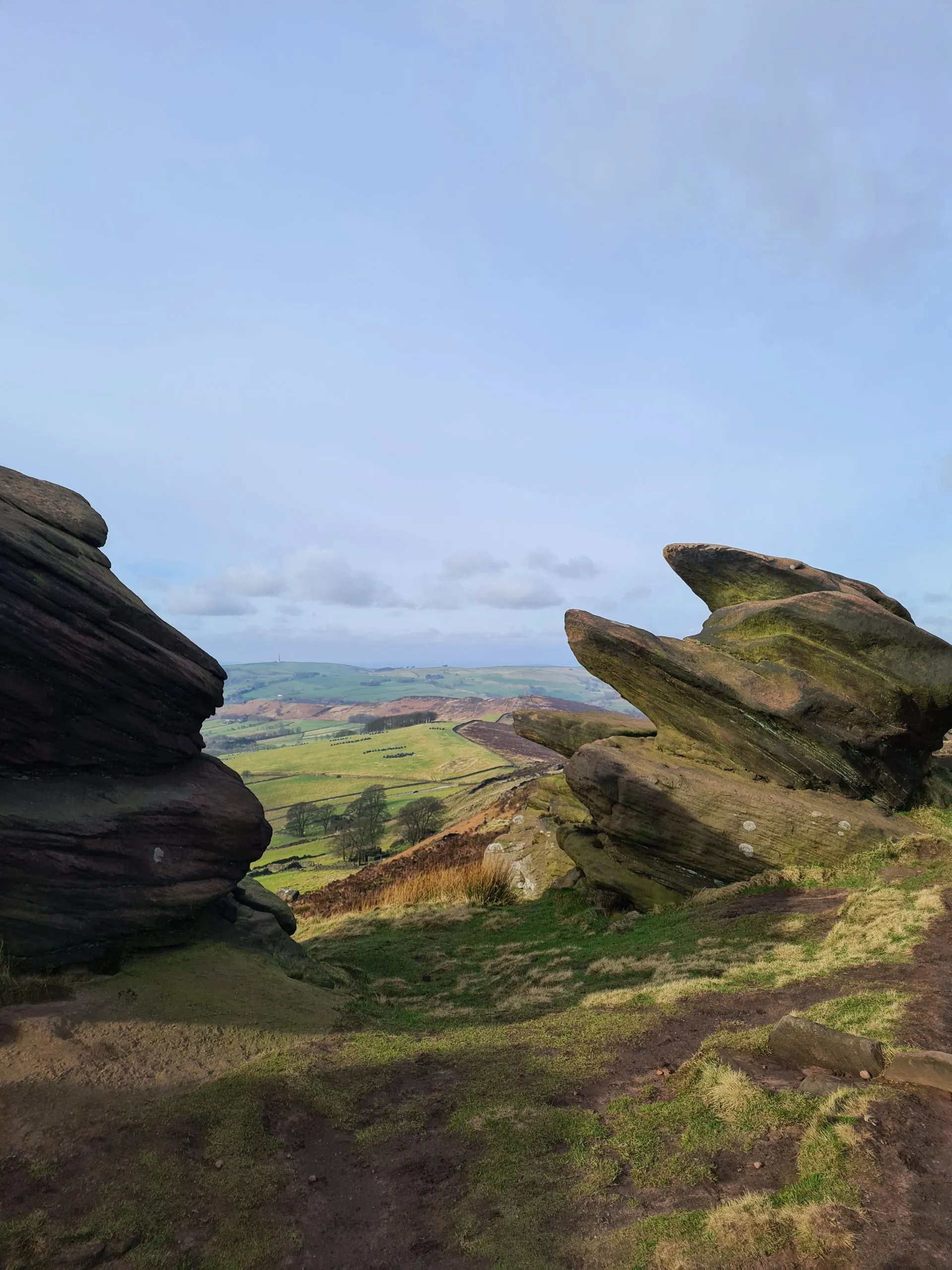
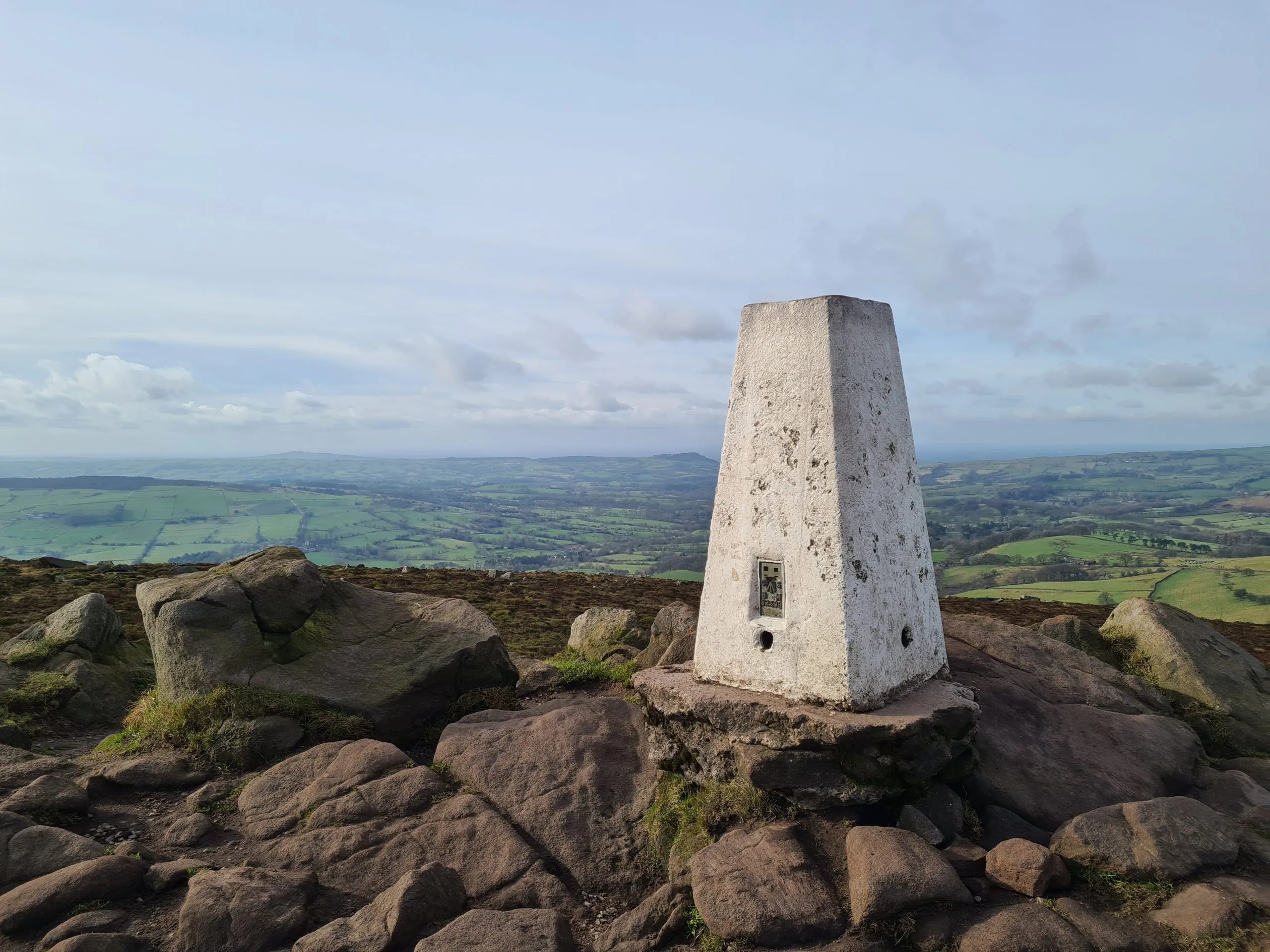
There are a few walks you can do on The Roaches. If you want a short walk on the Roaches, you can walk up from the parking area, walk along as far as you like and then retrace your steps back to the car. Alternatively, for a longer walk along The Roaches you could head past The Roaches trig point and the Doxey Pool (the alleged home of a mermaid!) before climbing down through the gritstone rocks and walking back to the parking area along the lower paths.

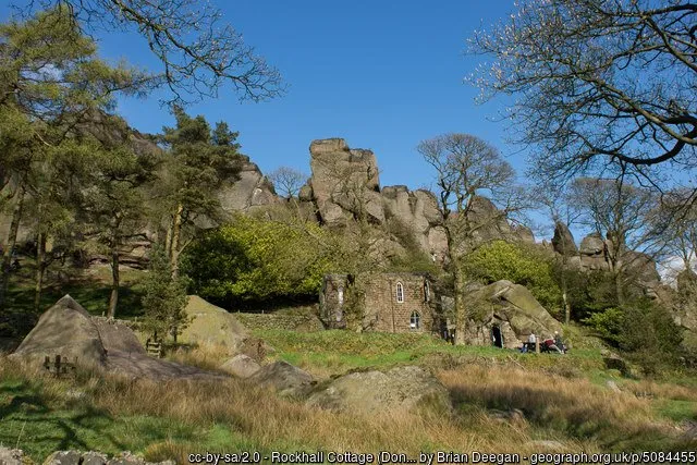
Don’t forget to visit Don Whillan’s Memorial Hut. This is a small building which is carved into the rock itself!


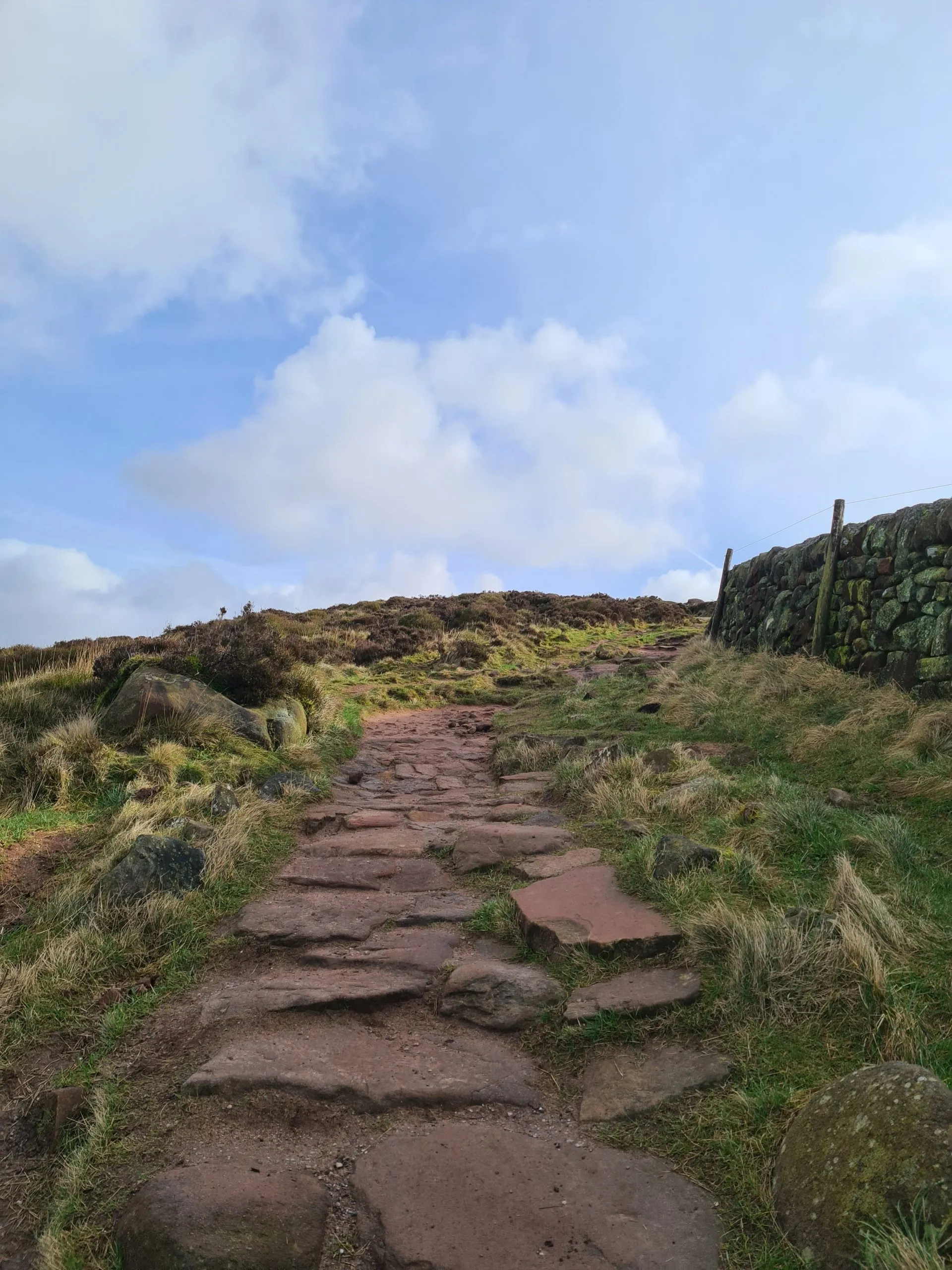
This The Roaches walk route is just under 4 miles and will be long enough for little legs. It has some steep climbs in and amongst rocks, so care should be taken. Kids will love exploring The Roaches though, so this will be a lovely walk for the school holidays. For more Peak District walks for kids, check out these Short Peak District walks.


Parking: Small on road lay-bys or in Gradbach.

Facilities: None.

Walk Time: 2-3 hours depending on how long you spend exploring The Roaches

Difficulty: ▲▲

Distance: 6.4km (4 miles)

Trig Points Bagged: The Roaches

Peak District Peaks Bagged: The Roaches

Peak District Ethels Bagged: The Roaches

The Roaches Walk Map:

Can dogs go on The Roaches?

The Roaches is a Site of Special Scientific Interest. Dogs are allowed but they need to be kept on a lead.

Where to park for The Roaches?

You can park in the car park in Gradbach, by the Youth Hostel or park in the lay-bys on the road at ST13 8UB. Be sure to park in the designated parking areas only – traffic wardens do visit to hand out tickets occasionally.

Is The Roaches a difficult walk?

The Roaches walk isn’t too difficult but there are some steep climbs, and it is very rocky on the top of the plateau. Getting down the south end of The Roaches is a bit scrambly and difficult. There are also some steps and stiles.


We included The Roaches on our 17 mile Peak District walk from Tittesworth Reservoir to Gun Moor, The Roaches, Hen Cloud, Ramshaw Rocks and Merryton Low. You could also just add on an extra walk to include Hen Cloud as well.

Tap to share with your hiking friends!

  • Facebook
  • Email
  • WhatsApp
« The Best Bluebell Woods in Holmfirth
Holmbridge Circular Walk | 3 Miles »

RELATED POSTS

  • Lathkill Dale waterfallLathkill Dale Waterfall Walk | 7 Miles
  • Black Hill trig point also known as Soldier's LumpBlack Hill Plane Wrecks Walk | 4 Miles
  • Sheen Hill trig pointSheen Hill Trig Point | 6 Miles
  • A woman and her daughter walking on the moors. It's a sunny day with blue skies.USAAF B24-H Liberator Crash Site on Twizle Head Moss, Holmfirth

Leave a Reply Cancel reply

Your email address will not be published. Required fields are marked *

FIND YOUR NEXT WALK:

ABOUT ME

Y Garn with Kids - Y Garn via the Devil's Kitchen Walk in Ogwen Valley

Hello! I’m Jo! Welcome to The Wandering Wildflower, an outdoors lifestyle blog focusing on family walks in the Peak District, a place we love exploring. I want to share the Peak District hidden gems and show you there’s so much more than the honeypot places. When I’m not dragging my husband and now 11 year old out on Peak District walks or up mountains, I can be found on planning my next moorland walk or plotting a Geocache walk (and seeing where the nearest pub is!). I love the hills but hate the heights, so trig bagging is – er- fun!


I hope this blog will give you some ideas of places to visit in the Peak District and inspire you and your family to head into the great outdoors.  Thanks for stopping by!

CATEGORIES

  • CIRCULAR WALKS (188)
  • HOLMFIRTH WALKS (27)
  • ISLE OF SKYE WALKS (3)
  • LAKE DISTRICT WALKS (24)
  • LANCASHIRE WALKS (2)
  • LONG PEAK DISTRICT WALKS 10 MILES + (42)
  • MEDIUM WALKS 4-9 MILES (136)
  • PEAK DISTRICT SCRAMBLES (16)
  • PEAK DISTRICT WALKS (202)
  • PEAK DISTRICT WALKS WITH KIDS (75)
  • PEAK DISTRICT WALKS WITH PUBS (60)
  • SCOTLAND WALKS (6)
  • SHORT WALKS UNDER 3 MILES (40)
  • SNOWDONIA WALKS (5)
  • UK CAMPING (5)
  • YORKSHIRE WALKS (33)

Peak District Walks

List of Peak District Ethels

Peak District Peak Bagging

Peak District Trig Point Challenge

Peak District Walks with Pubs

Peak District Walks with Kids

Beautiful Walks in Holmfirth

Short Walks in the Peak District

Long Walks in the Peak District

AFFILIATE DISCLOSURE

This blog may contain affiliate links through which, at no additional cost to you, I may earn a small commission. I only recommend products I would use myself and all opinions expressed here are my own. As an Amazon Associate I earn from qualifying purchases. Read full privacy policy here.

ARCHIVES

PEAK DISTRICT WEATHER

Peak District mountain weather on Met Office

Peak District Trig Points

Promo image for a blog post about the Peak District Trig Point Challenge With Map of Peak District Trig Points and Walking Routes by The Wandering Wildflower

Peak District Ethels Challenge

Promo image for a blog post about the Peak District Trig Point Challenge With Map of Peak District Ethels and Walking Routes by The Wandering Wildflower

WALKING ROUTES STRAIGHT TO YOUR INBOX

Want new walks in your inbox? Drop your email below and I'll send you some ideas for walks you can try.

You can unsubscribe anytime. For more details, review our Privacy Policy.

Thank you!

You have successfully joined our subscriber list.

RSS LATEST POSTS

  • Burnbank Fell, Blake Fell and Gavel Fell | 8 Miles
  • Bretton Park Circular Walk | 3 Miles
  • Hathersage Stepping Stones Walk | 7 Miles
  • Ladybower Walk | 6 Miles
  • Derbyshire Peak District Walks

FOLLOW ON PINTEREST

Want new walks in your inbox? Drop your email below and I'll send you some ideas for walks you can try.

You can unsubscribe anytime. For more details, review our Privacy Policy.

Thank you!

You have successfully joined our subscriber list.

jo@thewanderingwildflower.co.uk

The Wandering Wildflower

  • Email
  • Facebook
  • Instagram
  • Pinterest
  • PRIVACY POLICY
  • TERMS & CONDITIONS
  • ABOUT

(c) The Wandering Wildflower. All Rights Reserved.

|| THEME BY ECLAIR DESIGNS