• 3 Mile Walks or Less
  • 4 Mile Walks
  • 5 Mile Walks
  • 6 Mile Walks
  • 7 Mile Walks
  • 8 Mile Walks
  • 9 Mile Walks
  • 10 Mile Walks
  • 11 Mile Walks
  • 12 Mile Walks
  • 14 Mile Walks
  • 15 Mile Walks
  • 20+ Mile Walks

The Wandering Wildflower

Peak District Hikes

  • PEAK DISTRICT WALKS
    • SHORT WALKS UNDER 3 MILES
    • MEDIUM WALKS 4-9 MILES
    • LONG PEAK DISTRICT WALKS 10 MILES +
  • PEAK DISTRICT WALKS WITH PUBS
  • PEAK DISTRICT WALKS WITH KIDS
  • HOLMFIRTH WALKS

Win Hill and Ladybower Reservoir Loop | 8 Miles

January 24, 2025 CIRCULAR WALKS, PEAK DISTRICT WALKS, PEAK DISTRICT WALKS WITH KIDS, PEAK DISTRICT WALKS WITH PUBS

This Win Hill and Ladybower Reservoir loop is 8 miles. Passing the famous Ladybower plugholes, the walk heads up to Win Hill, passing the ruins of Win Hill Barn, and then along Wooler Knoll to the Hope Cross before passing through Hope Woodlands next to Ladybower Reservoir. There’s only one major climb, and then it’s flattish or downhillish all the way!

Win Hill Trig Point

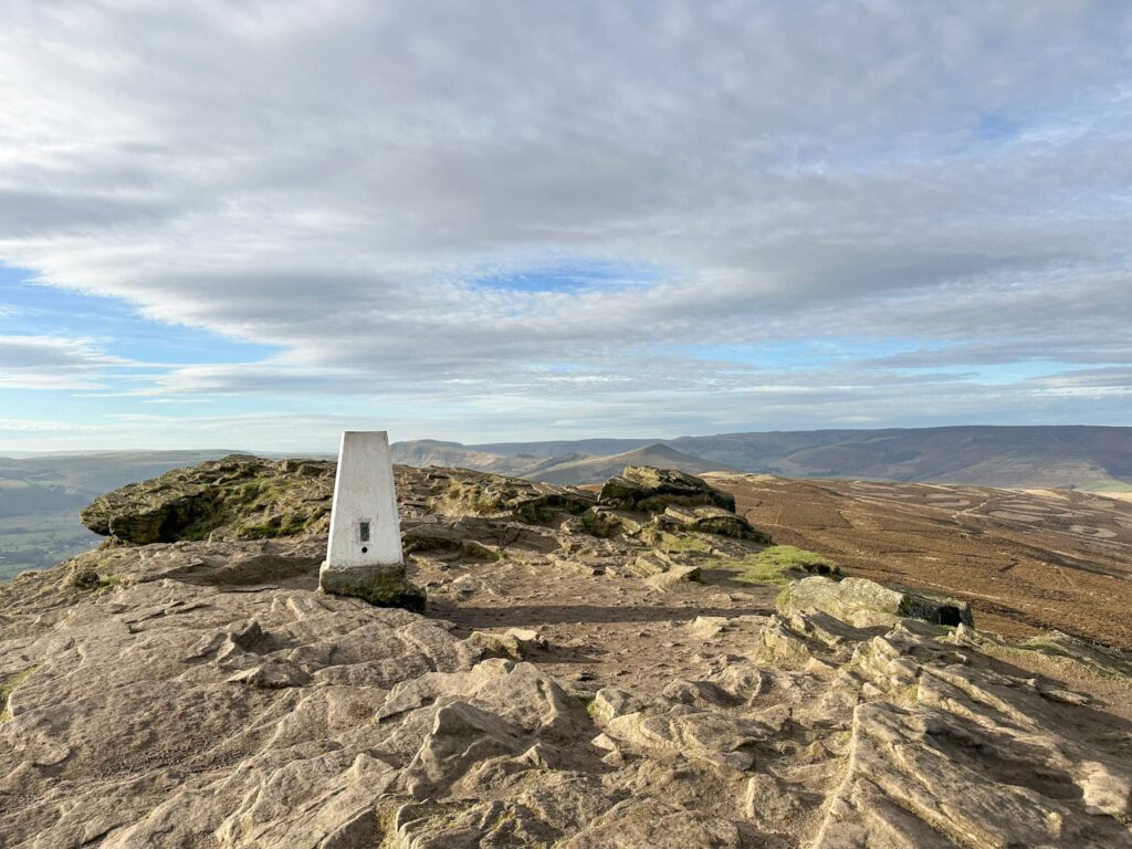
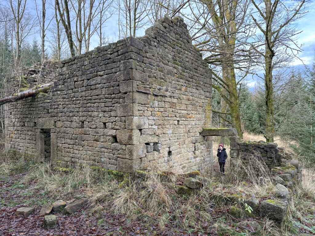
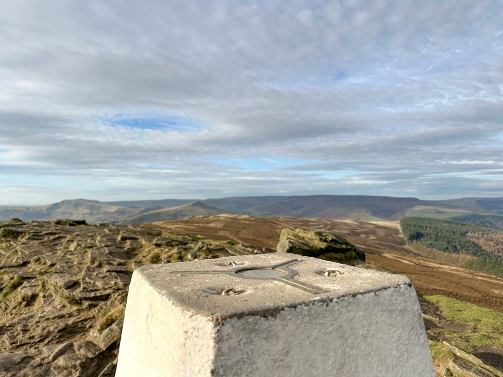
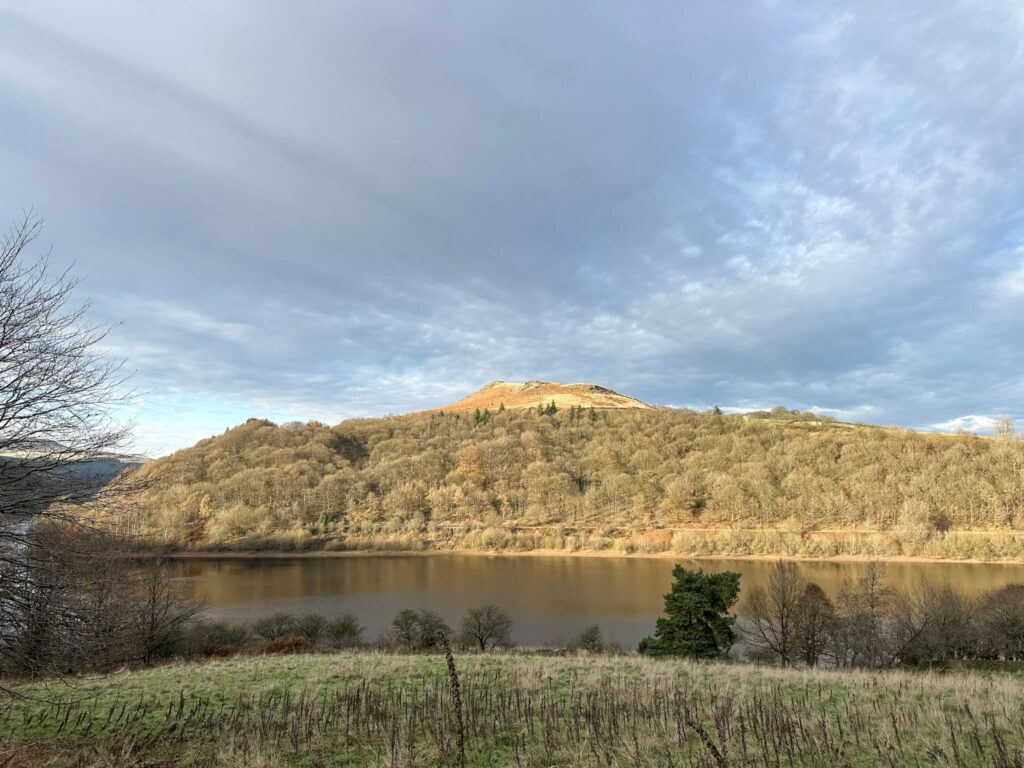
Win Hill has some of the best views in the Peak District. At 463m high this iconic peak towers over Ladybower Reservoir and can be seen from miles around. It’s a brilliant place to head for a sunrise (it doesn’t get anywhere near as busy as Mam Tor does) and looks spectacular in late summer when the heather is out.  There are a few ways to hike Win Hill, but I love an old ruined building and this Win Hill and Ladybower Reservoir loop walk took us past Win Hill Barn and the remains of Elmin Pits Farm in Hope Woodlands which was abandoned when the Ladybower Reservoir was flooded.


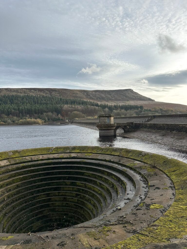
Our walk starts from the parking lay-by next to the Yorkshire Bridge Inn – we got there really early to get a space. There is more (paid) parking at the Heatherdene car park a short distance away. We crossed the dam wall and turned right, having a nosy at the Ladybower plugholes on the way. They weren’t overflowing (this was on 29 November 2024).

Ladybower Plugholes

A woman walking in Hope Woodlands

It was a bit muddy in places!

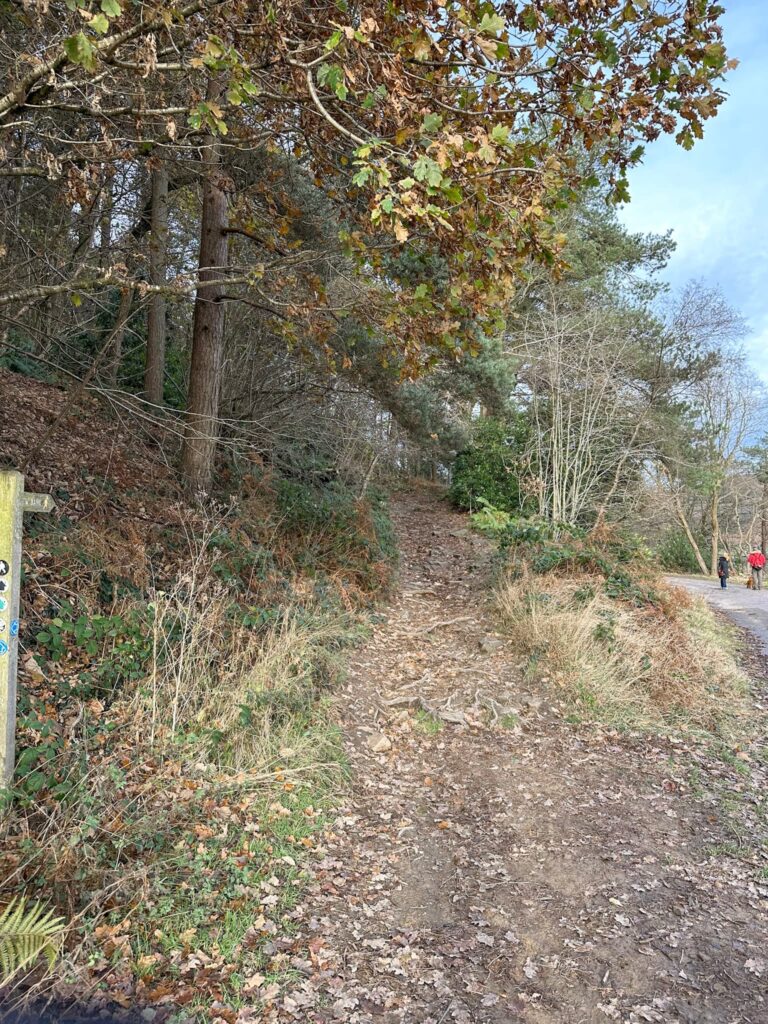
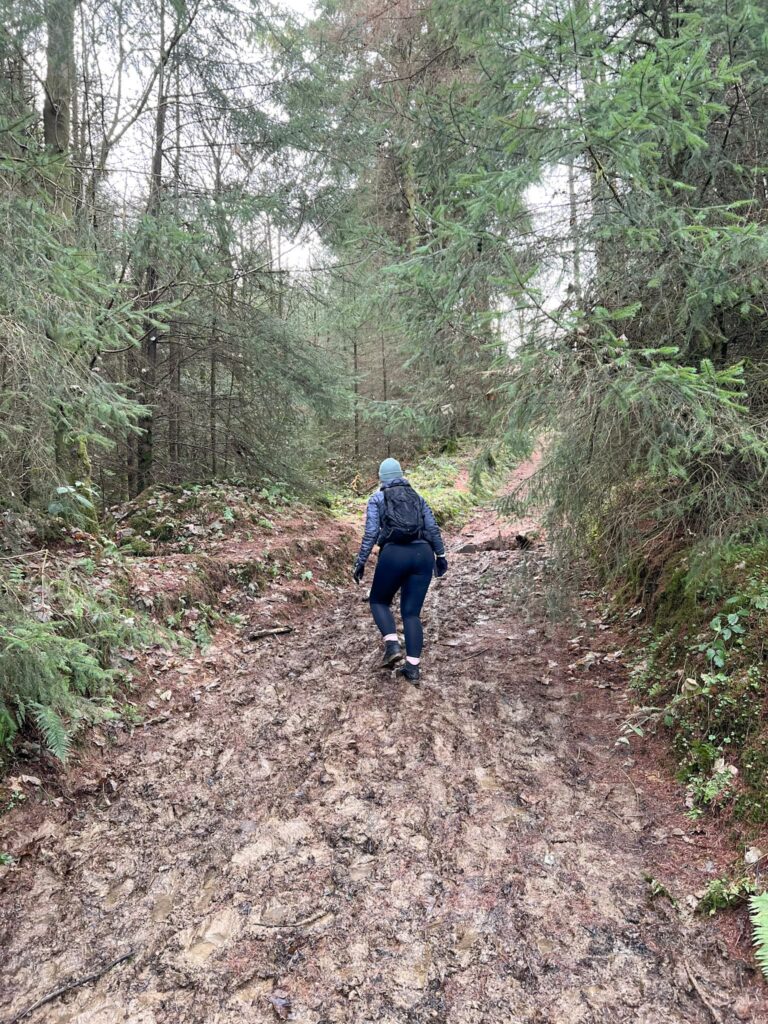
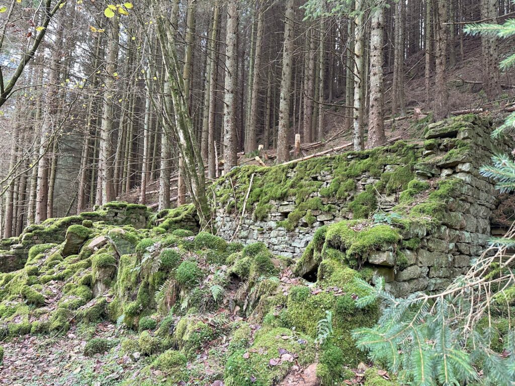
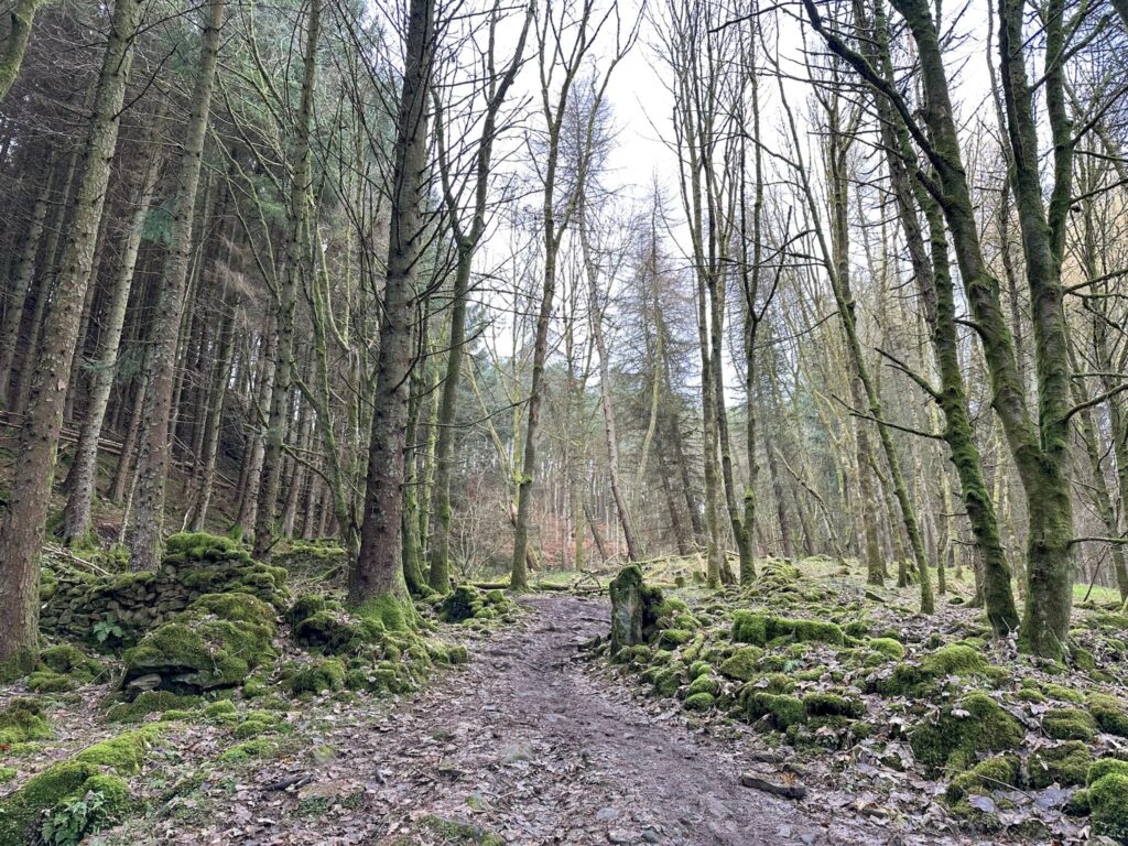
Passing the plugholes we wandered along the path until it forked, then we took the steep, rough track up to the left. After about 0.4 miles the path forks again and we turned left up through the trees along a very muddy track. This track passes the remains of Win Hill Barn, which used to be a barn and loose courtyard.

Win Hill Barn

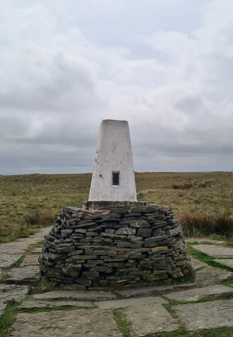
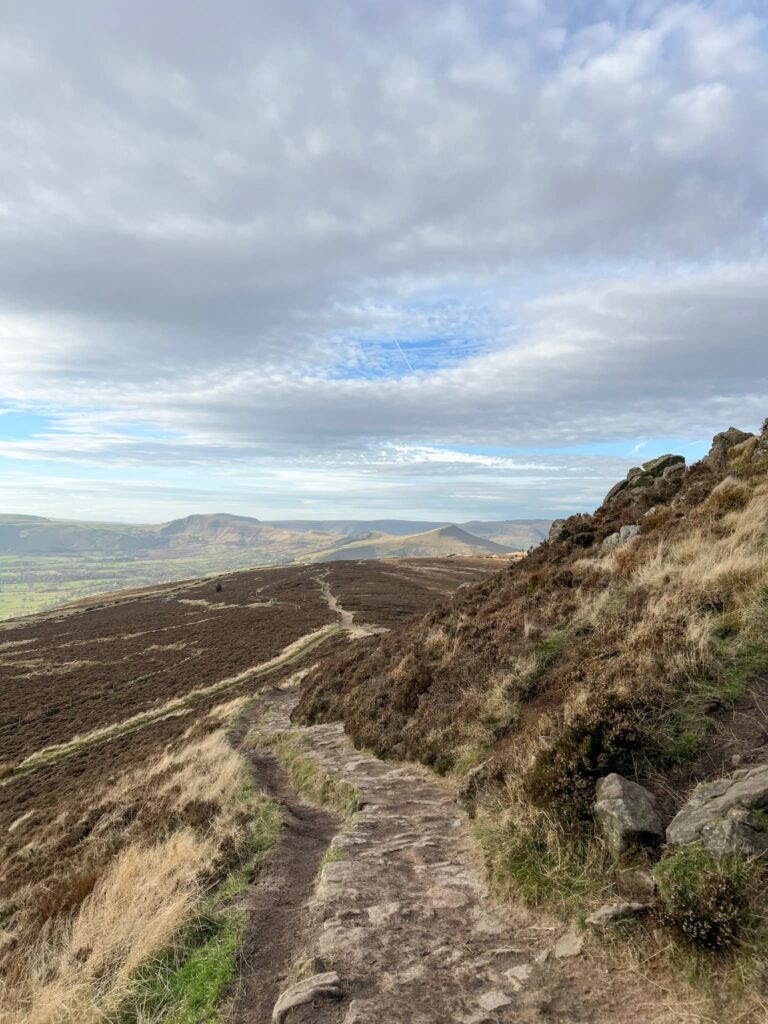
From the barn we continued up the hillside, along the fence line, with the trees giving way to open moorland. We crossed the stile and then started the steeper climb up Win Hill, following the well worn path. It wasn’t long before we reached the trig point and stopped to admire the view/have a snack.

Win Hill

Win Hill Trig Point

Views from Win Hill trig point. You can see Lose Hill and the Great Ridge with Mam Tor over to the left of the picture, as well as Kinder Scout.

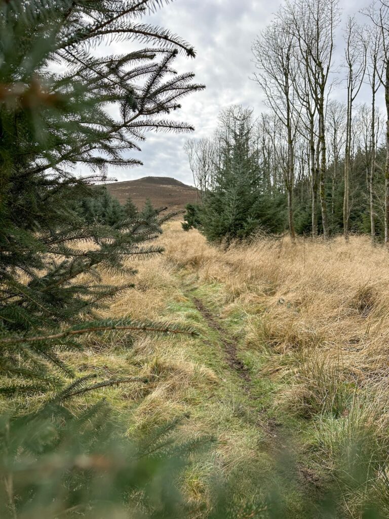
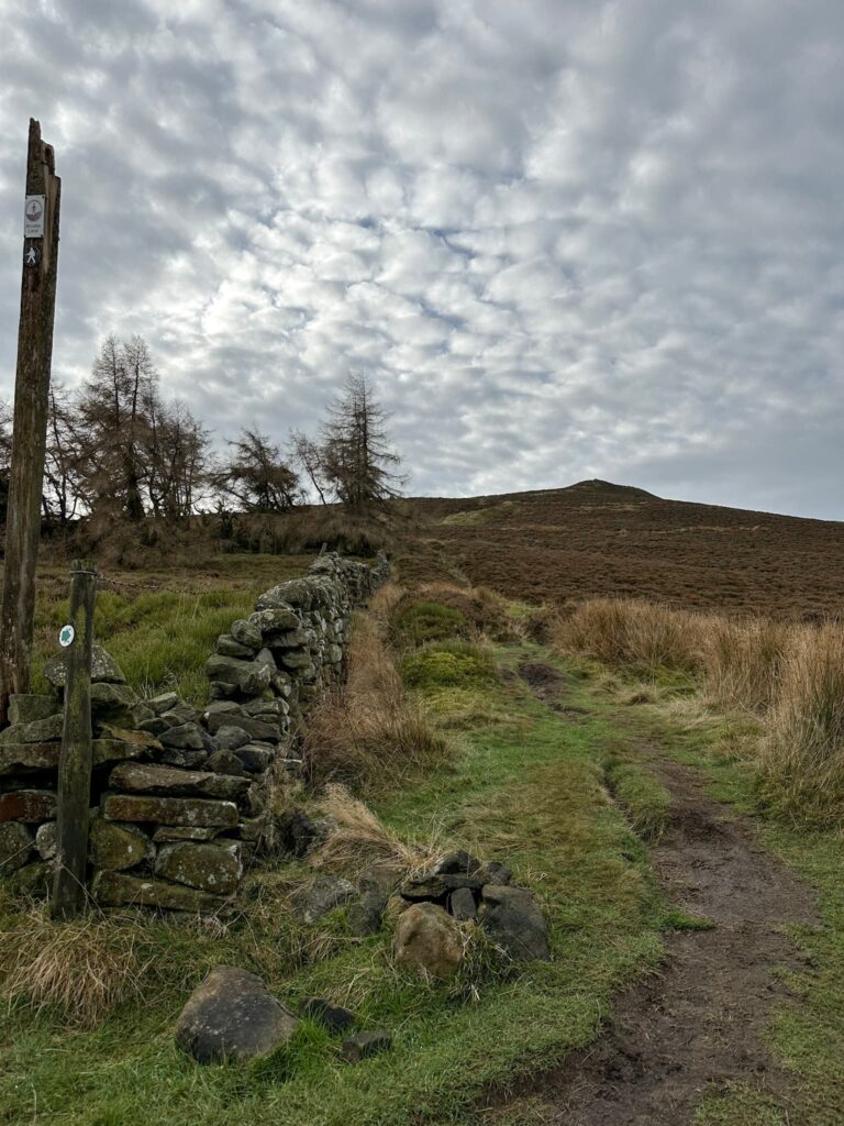
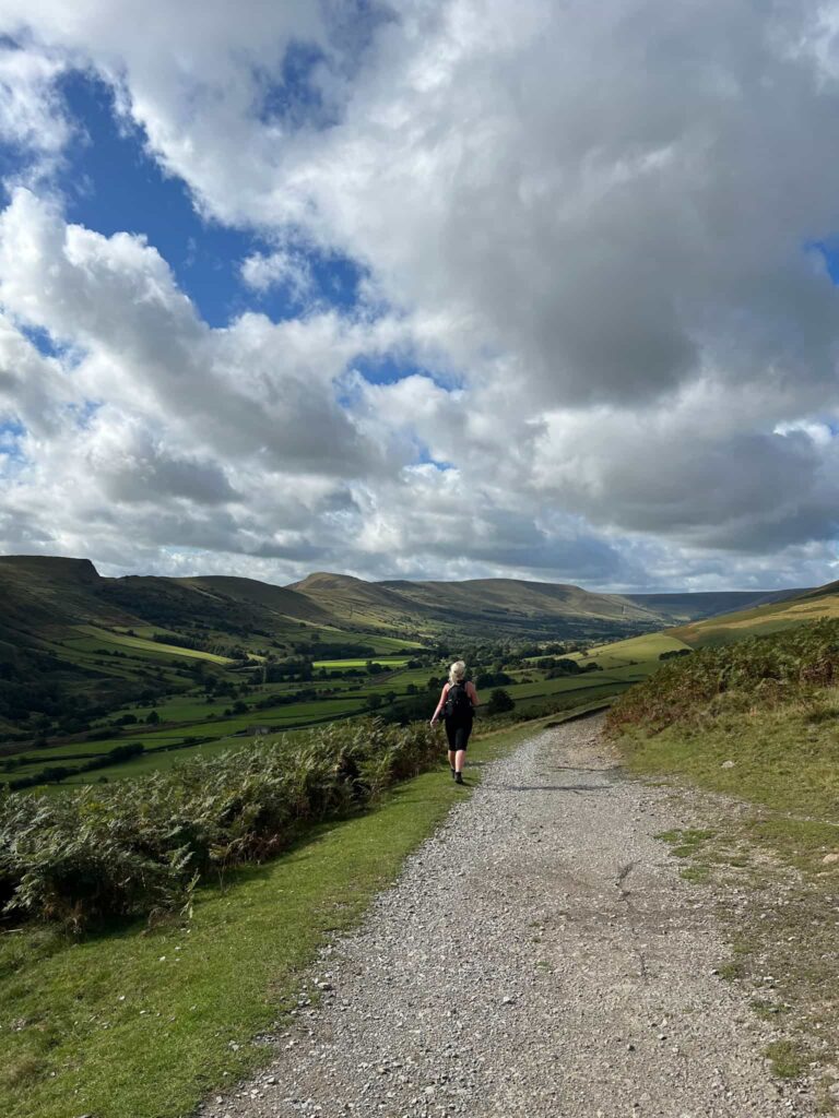
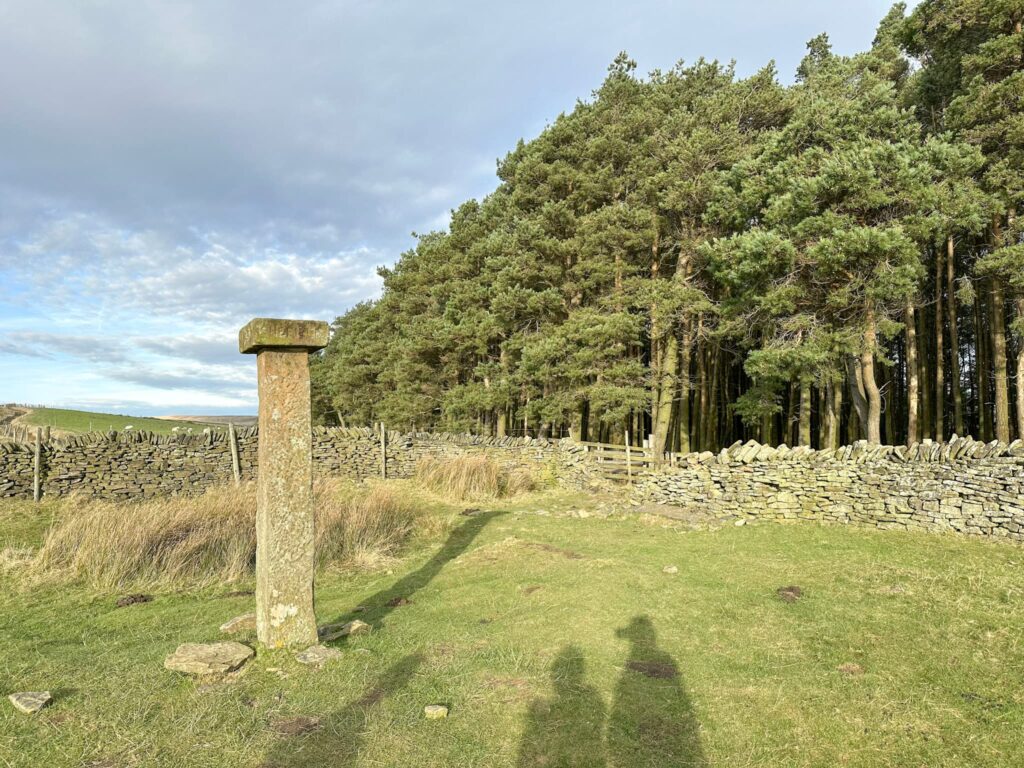
We continued over the top of Winhill Pike (aka the top of Win Hill) and followed the lovely wide track down over Wooler Knoll to the Hope Cross, a Grade II listed waymarker with a date of 1737 on. Just after the cross we entered the woodlands and followed the track down the hill. The track turns sharply back on itself near the site of Elmin Pits Farm, a collection of farm buildings which was abandoned when Ladybower Reservoir was built.

Looking from Win Hill to Lose Hill

Hope Cross

Hope Cross – we went through the wall and into the woods just above where the shadows are.

Hope Woodlands

Elmin Pits Farm

Elmin Pits Farm

Elmin Pits Farm

Elmin Pits Farm


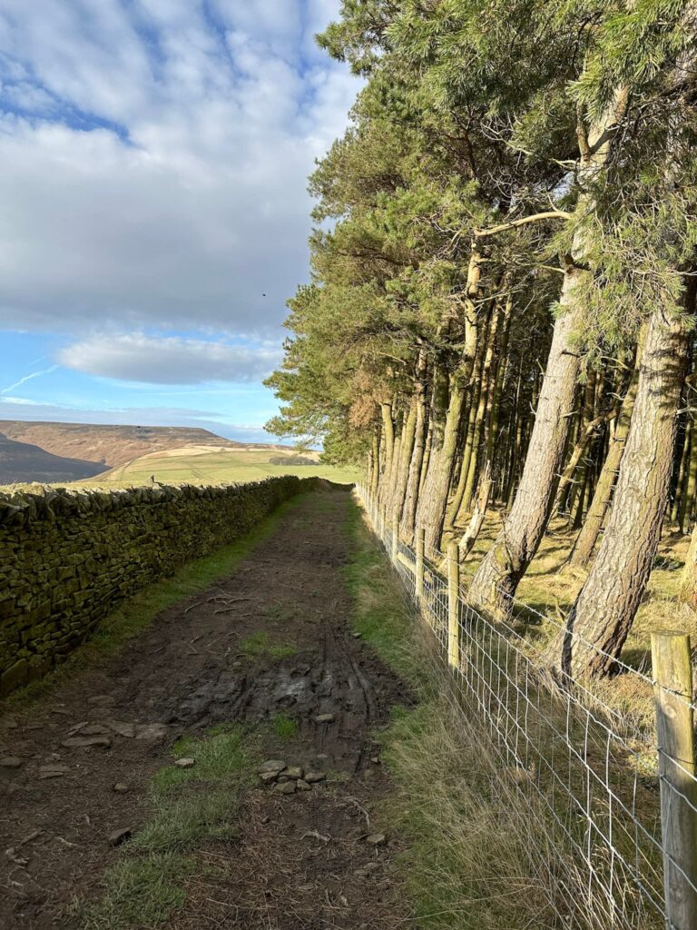
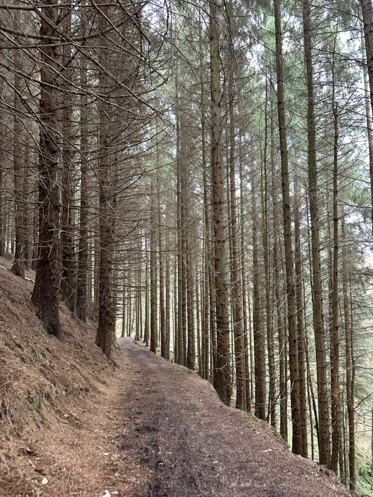
The track continues down the hillside to run alongside Ladybower Reservoir and has some fabulous views up to Crook Hill and over the reservoir to Bamford Edge. It eventually brings you back to the plugholes, and then it’s just back across the dam and back to the car (or the Yorkshire Bridge Inn for a lovely pub lunch and well deserved drink!).


Crook Hill and ladybower Reservoir

Crook Hill and Ladybower Reservoir


Win Hill and Ladybower Reservoir Loop Walk Details:


Walk Map (Opens in OS Maps): Win Hill and Ladybower Loop

Parking: We parked in one of the free lay-bys on Ashopton Rd, Bamford, Hope Valley S33 0AZ W3W:///cookbooks.uncouth.dime

Facilities: None, but there are toilets in the Heatherdene car park a short distance away. Take all your rubbish home with you – remember to LEAVE NO TRACE.

Walk Time: 3-4 hours

Difficulty: ▲▲ – there’s one climb up

Distance: 7.8 miles (12.55km)

Elevation: 1100ft (335m)

Trig Points Bagged: Win Hill

Peak District Peaks Bagged: Win Hill

Peak District Ethels Bagged: Win Hill


For more Win Hill walks you might like:

Ladybower Reservoir Walk With Win Hill | 8 Miles (a different route!)

Lose Hill and Win Hill | 8 Miles

Crook Hill and Win Hill Walk via Ladybower Reservoir

Edale Skyline [With GPX File]

Tap to share with your hiking friends!

  • Facebook
  • Email
  • WhatsApp
« Jane Eyre Trail – Hathersage | 5 Miles
Woodhead to Shepherds Meeting Stones | 7 Miles »

RELATED POSTS

  • Hathersage Stepping StonesHathersage Stepping Stones Walk | 7 Miles
  • Ladybower ReservoirLadybower Walk | 6 Miles
  • Anvil Stone, GrindsbrookGrindsbrook Clough Scramble to Grindslow Knoll | 7 Miles
  • Old Abandoned Millstones on the Hillside - igh Neb - Stanage Pole - White Path Moss - Stanage Edge Circular Walk - The Wandering WildflowerStanage Edge Circular Walk | 7 Miles

Leave a Reply Cancel reply

Your email address will not be published. Required fields are marked *

FIND YOUR NEXT WALK:

ABOUT ME

Y Garn with Kids - Y Garn via the Devil's Kitchen Walk in Ogwen Valley

Hello! I’m Jo! Welcome to The Wandering Wildflower, an outdoors lifestyle blog focusing on family walks in the Peak District, a place we love exploring. I want to share the Peak District hidden gems and show you there’s so much more than the honeypot places. When I’m not dragging my husband and now 11 year old out on Peak District walks or up mountains, I can be found on planning my next moorland walk or plotting a Geocache walk (and seeing where the nearest pub is!). I love the hills but hate the heights, so trig bagging is – er- fun!


I hope this blog will give you some ideas of places to visit in the Peak District and inspire you and your family to head into the great outdoors.  Thanks for stopping by!

CATEGORIES

  • CIRCULAR WALKS (189)
  • HOLMFIRTH WALKS (27)
  • ISLE OF SKYE WALKS (3)
  • LAKE DISTRICT WALKS (24)
  • LANCASHIRE WALKS (2)
  • LONG PEAK DISTRICT WALKS 10 MILES + (42)
  • MEDIUM WALKS 4-9 MILES (137)
  • PEAK DISTRICT SCRAMBLES (16)
  • PEAK DISTRICT WALKS (205)
  • PEAK DISTRICT WALKS WITH KIDS (76)
  • PEAK DISTRICT WALKS WITH PUBS (60)
  • SCOTLAND WALKS (6)
  • SHORT WALKS UNDER 3 MILES (40)
  • SNOWDONIA WALKS (5)
  • UK CAMPING (5)
  • YORKSHIRE WALKS (33)

Peak District Walks

List of Peak District Ethels

Peak District Peak Bagging

Peak District Trig Point Challenge

Peak District Walks with Pubs

Peak District Walks with Kids

Beautiful Walks in Holmfirth

Short Walks in the Peak District

Long Walks in the Peak District

AFFILIATE DISCLOSURE

This blog may contain affiliate links through which, at no additional cost to you, I may earn a small commission. I only recommend products I would use myself and all opinions expressed here are my own. As an Amazon Associate I earn from qualifying purchases. Read full privacy policy here.

ARCHIVES

PEAK DISTRICT WEATHER

Peak District mountain weather on Met Office

Peak District Trig Points

Promo image for a blog post about the Peak District Trig Point Challenge With Map of Peak District Trig Points and Walking Routes by The Wandering Wildflower

Peak District Ethels Challenge

Promo image for a blog post about the Peak District Trig Point Challenge With Map of Peak District Ethels and Walking Routes by The Wandering Wildflower

WALKING ROUTES STRAIGHT TO YOUR INBOX

Want new walks in your inbox? Drop your email below and I'll send you some ideas for walks you can try.

You can unsubscribe anytime. For more details, review our Privacy Policy.

Thank you!

You have successfully joined our subscriber list.

RSS LATEST POSTS

  • How to Find Three Shires Head
  • Burnbank Fell, Blake Fell and Gavel Fell | 8 Miles
  • Bretton Park Circular Walk | 3 Miles
  • Hathersage Stepping Stones Walk | 7 Miles
  • Peak District Caves

FOLLOW ON PINTEREST

Want new walks in your inbox? Drop your email below and I'll send you some ideas for walks you can try.

You can unsubscribe anytime. For more details, review our Privacy Policy.

Thank you!

You have successfully joined our subscriber list.

jo@thewanderingwildflower.co.uk

The Wandering Wildflower

  • Email
  • Facebook
  • Instagram
  • Pinterest
  • PRIVACY POLICY
  • TERMS & CONDITIONS
  • ABOUT

(c) The Wandering Wildflower. All Rights Reserved.

|| THEME BY ECLAIR DESIGNS