Derwent Edge, Back Tor and Lost Lad | 8 Miles
Derwent Edge has to be up there with one of the best places to walk in the Peak District, with far reaching views over the Ladybower, Derwent and Howden Reservoirs, stunning rock formations and proper big skies. This 8 mile walk starts from Fairholmes and heads past the Lost Village of Derwent before climbing up onto Derwent Edge, passing Back Tor and Lost Lad before returning via Green Sitches.
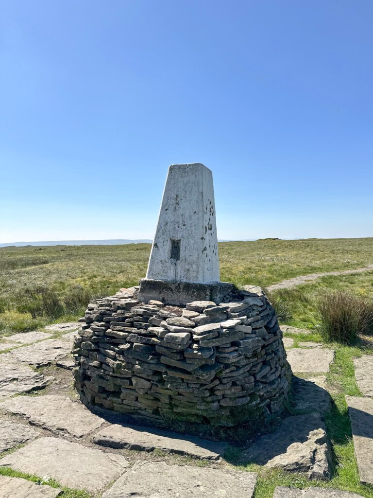
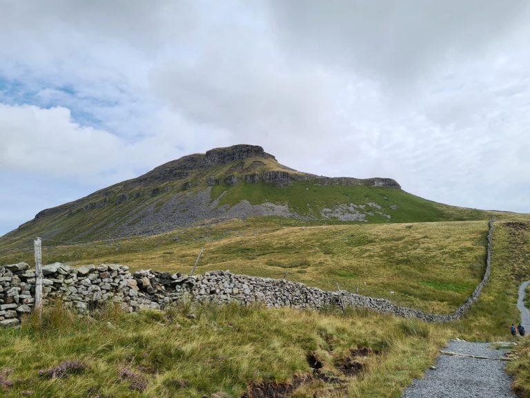
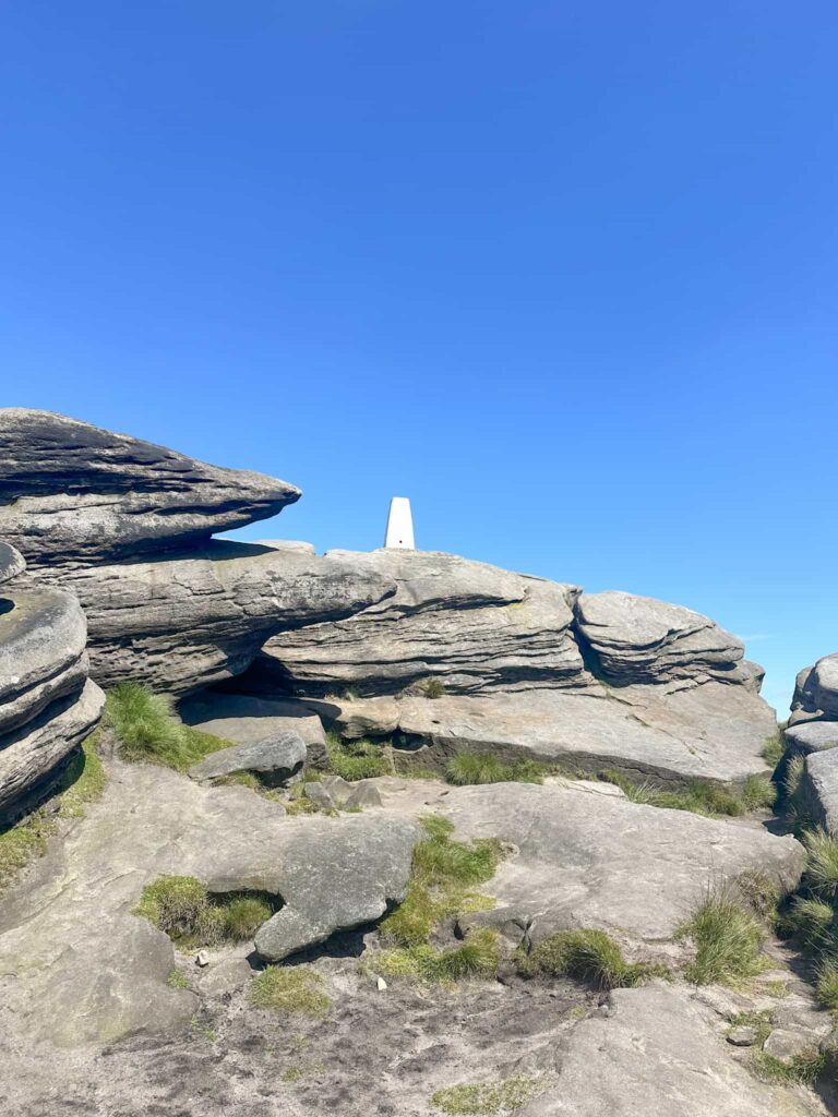
Back Tor is the highest point of the walk, and has a trig point sat at 538m above sea level. It’s a bit of a climb up to touch this one!
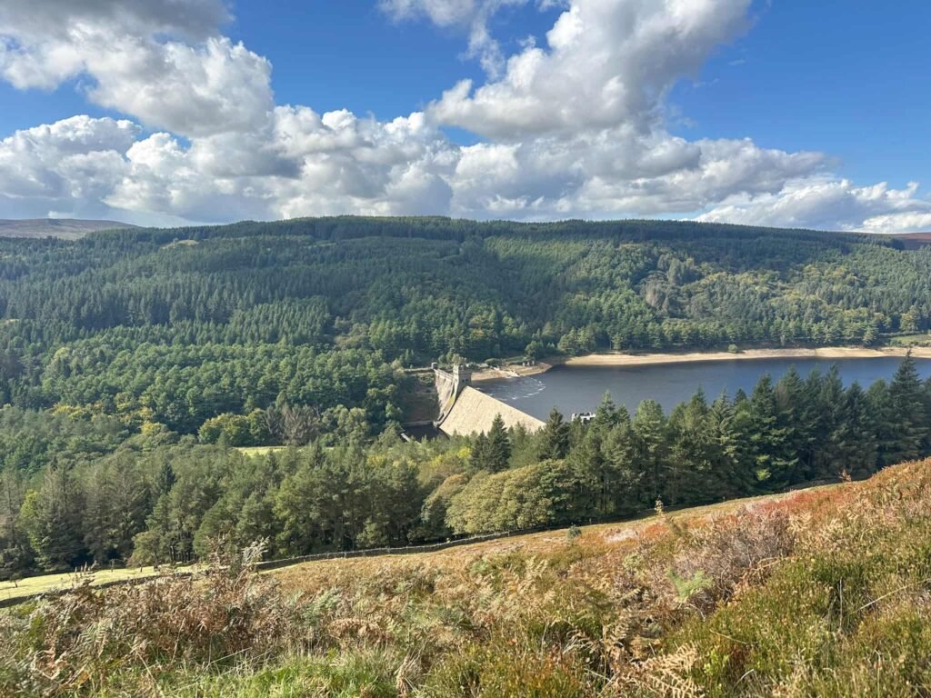
We started our walk from Fairholmes and headed out onto the road, passing the impressive Derwent Dam. It wasn’t overflowing – this usually starts to happen in November/December time after a period of heavy rain. We followed the road around, passing the red phone box and the last few buildings which remain of the drowned village of Derwent, the ruins of which now lie beneath Ladybower Reservoir. After a particularly dry summer the ruins become visible.


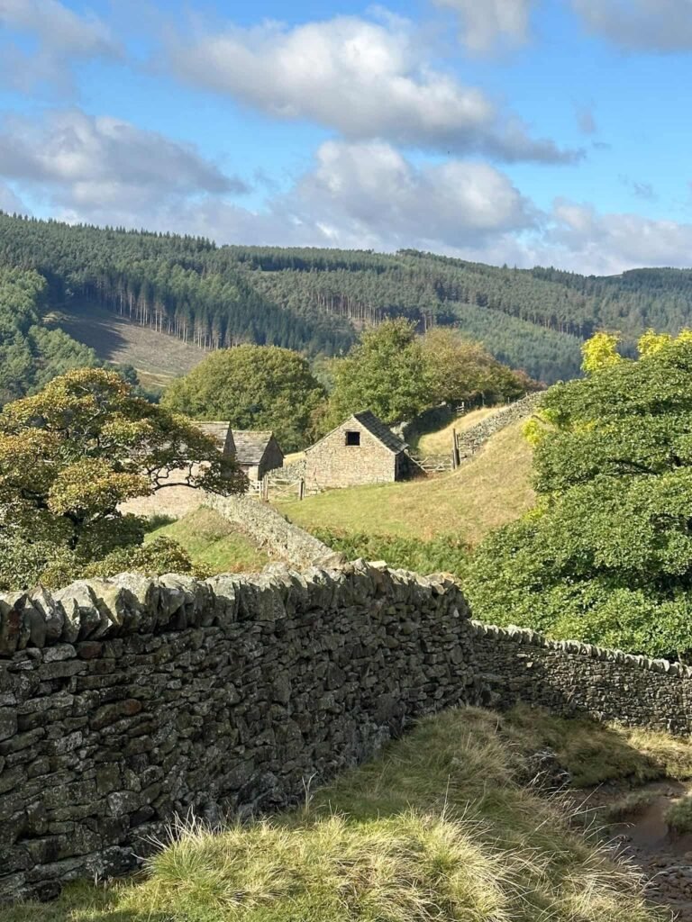
We followed the road until we saw a Peak and Northern Footpaths Society ‘green sign’ with ‘Public Footpath via Derwent Edge to Moscar’, and went through the gate, following the stone slabbed path up the hill to reach a small cluster of barns. Here there’s a handy shelter if you fancy a cuppa stop.
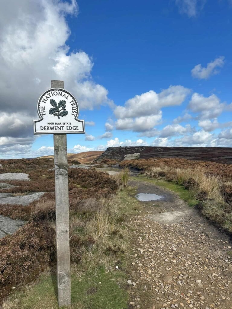
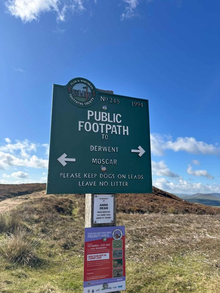
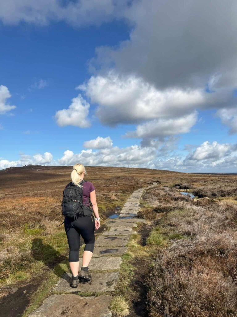
Carrying on past the barns, crossing Grindle Clough, the route continues up the hill with some woodland on the right. Through another gate, and onto the moors, the path then continues up to reach Derwent Edge at a crossroads of paths. There’s another PNFS sign here (number 248), with arrows pointing to Derwent and Moscar.
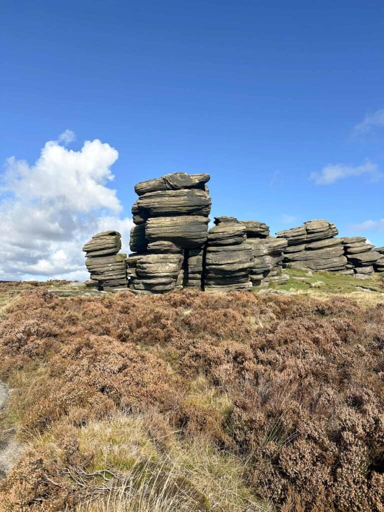
Turning left, the route winds its way along Derwent Edge, passing some iconic rock formations such as the Coach and Horses (Wheelstones), White Tor, the Salt Cellar, Dovestone Tor and the Cakes of Bread before reaching another junction of paths. We carried straight on to reach Back Tor, with it’s trig point perched high on the rocks.
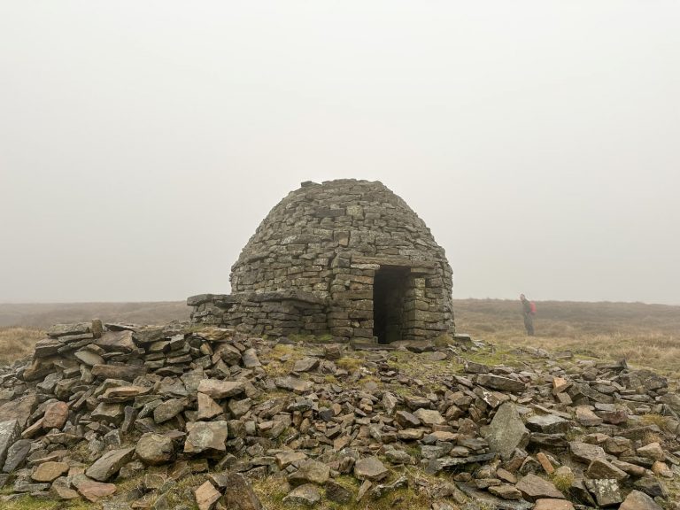
After we’d patted the trig point we continued on to Lost Lad, following the paved path over the moors to reach the cairn and toposcope marking the summit. Lost Lad gets its name from a boy who was lost on the moors and died, but before he died he scratched ‘Lost Lad’ into a rock. The cairn is said to have grown as shepherds placed rocks in remembrance of him.

We followed the well defined path over the moors, and then descended down the hillside (which has stunning views over the reservoirs below) to reach a small woodland. Passing through this, we turned left along the road, and then a sharp right at the road junction, and we were back at the Derwent Dam. It was back to Fairholmes for a jacket potato for Hols, and a cheese and onion pasty for us!
Derwent Edge, Back Tor and Lost Lad Walk Map:
Walk Map (Opens in OS Maps): Derwent Edge, Back Tor and Lost Lad Walk
Parking: Fairholmes car park, Bamford, Hope Valley S33 0AQ W3W//: coasting.promotion.hype – £6 for the day
Facilities: There is a cafe and toilets at Fairholmes.
Walk Time: 4-5 hours
Difficulty: ▲▲
Distance: 8.2 miles (13.2km)
Elevation: 1350ft (411m)
Trig Points Bagged: Back Tor
Peak District Peaks Bagged: Back Tor, Lost Lad
Peak District Ethels Bagged: Back Tor, Lost Lad
You might also like:
- Derwent Edge, Derwent Moors and Boots Folly | 8.5 Miles
- Back Tor and Ughill Moors Walk From Bradfield | 14 Miles
- Ladybower Reservoir and Derwent Edge | 8 Miles
- Back Tor and Lost Lad Circular Walk | 6 Miles
- Lost Lad and Back Tor with Abbey Brook | 10 Miles
- Derwent Reservoirs Circular (Dambusters Challenge Walk)
- Derwent Valley Skyline Walk | 24.5 Miles