• 3 Mile Walks or Less
  • 4 Mile Walks
  • 5 Mile Walks
  • 6 Mile Walks
  • 7 Mile Walks
  • 8 Mile Walks
  • 9 Mile Walks
  • 10 Mile Walks
  • 11 Mile Walks
  • 12 Mile Walks
  • 14 Mile Walks
  • 15 Mile Walks
  • 20+ Mile Walks

The Wandering Wildflower

Peak District Hikes

  • PEAK DISTRICT WALKS
    • SHORT WALKS UNDER 3 MILES
    • MEDIUM WALKS 4-9 MILES
    • LONG PEAK DISTRICT WALKS 10 MILES +
  • PEAK DISTRICT WALKS WITH PUBS
  • PEAK DISTRICT WALKS WITH KIDS
  • HOLMFIRTH WALKS

Aldermans Hill to Broadstone Hill Trig Point Walk | 5 Miles

January 10, 2022 CIRCULAR WALKS, MEDIUM WALKS 4-9 MILES, PEAK DISTRICT WALKS

Looking for walks on Saddleworth Moor? This 5 mile walk from Binn Green car park climbs up on the moors above Saddleworth, giving amazing views across Dove Stone Reservoir and the Peak District moors. Taking in various amazing rock formations over Aldermans Hill, Dick Hill and Broadstone Hill, as well as the war memorial, this walk also takes you to Broadstone Hill trig point. This is a great alternative walk to a Dovestone Reservoir circular if you are looking for a walk near Dove Stone.


Views from Aldermans Brow over to Ashway Rocks near Dove Stone Reservoir - The Wandering Wildflower

Views from Aldermans Brow over to Ashway Rocks

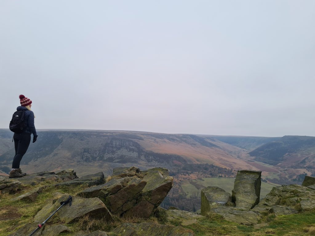
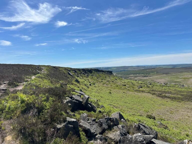
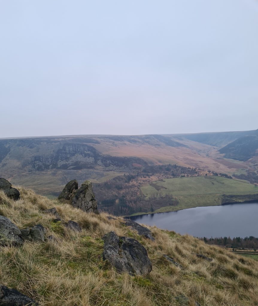
This walk to Broadstone Hill trig point starts from Binn Green car park. Crossing the main A635, the path climbs up the steep side of Aldermans Hill. The views from Aldermans Brow are amazing over towards Indians Head, the Chew Valley, Yeoman Hey Reservoir and Dove Stone Reservoir so the climb is definitely worth it.

Pheasant in Binn Green Car Park

Pheasant in Binn Green Car Park


Views over Yeoman Hey Reservoir from Binn Green Car Park

Views over Yeoman Hey Reservoir from Binn Green Car Park


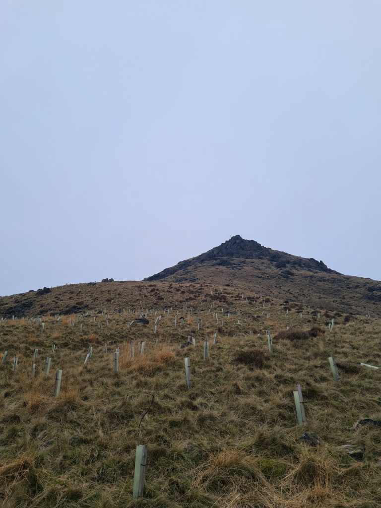
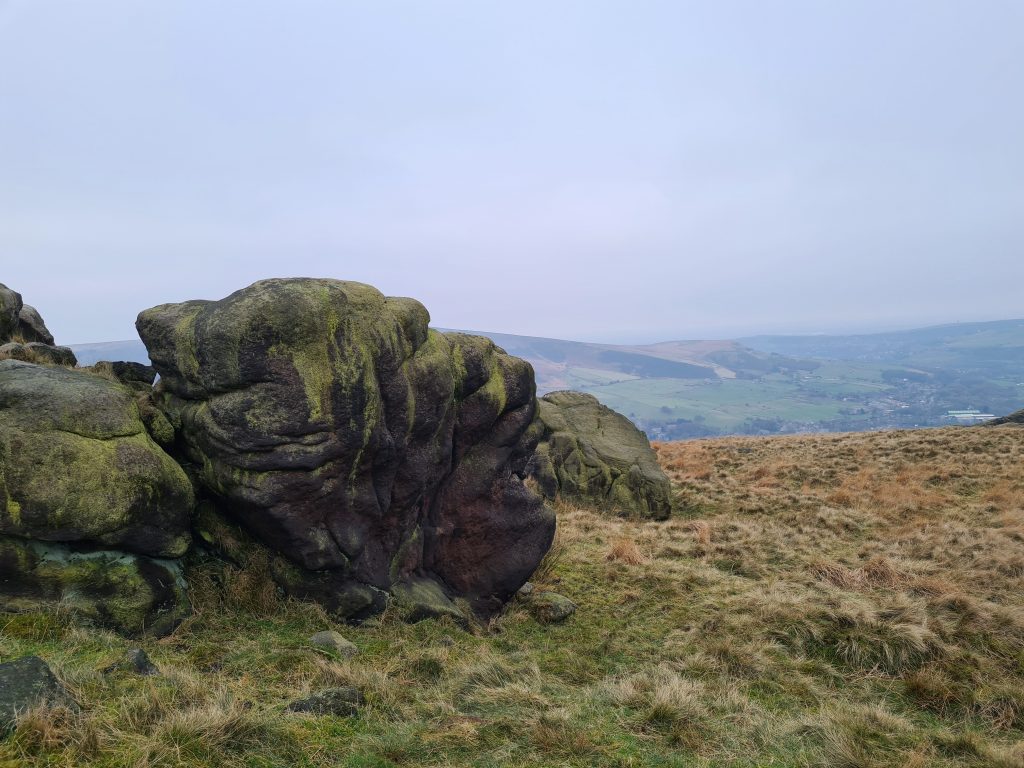
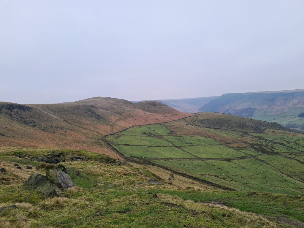
At the top of the hill you can spot the war memorial in the distance and the Pots and Pans Stone. Our path turns off across the moors over Dick Hill, which has a summit of 453m above sea level and Sugar Loaf at 450m high.

Aldermans Hill, near Dove Stone Reservoir

Aldermans Hill, near Dove Stone Reservoir


Views over Dove Stone Reservoir from Aldermans Hill

Views over Dove Stone Reservoir from Aldermans Hill


Views over Dove Stone Reservoir from Aldermans Hill

Views over Dove Stone Reservoir from Aldermans Hill

Views towards the War Memorial and the Pots and Pans Stone

Views towards the War Memorial and the Pots and Pans Stone


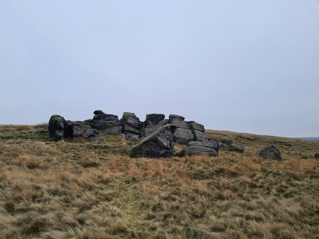
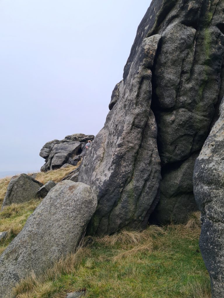
Following the path over Shaw Rocks, you’ll head to the ridge above Rocher Brow. There are fabulous views down to Uppermill and Dobcross. This part of the walk undulates gently, with no steep climbs, as it follows the plateau of the hill.


Mini Christmas Tree on Dick Hill

Mini Christmas Tree on Dick Hill

A stone formation called the Broken Wine Glass

A stone formation called the Broken Wine Glass – the top boulder used to be in place on top of the bottom one until erosion made it topple.


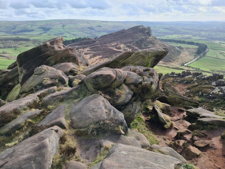
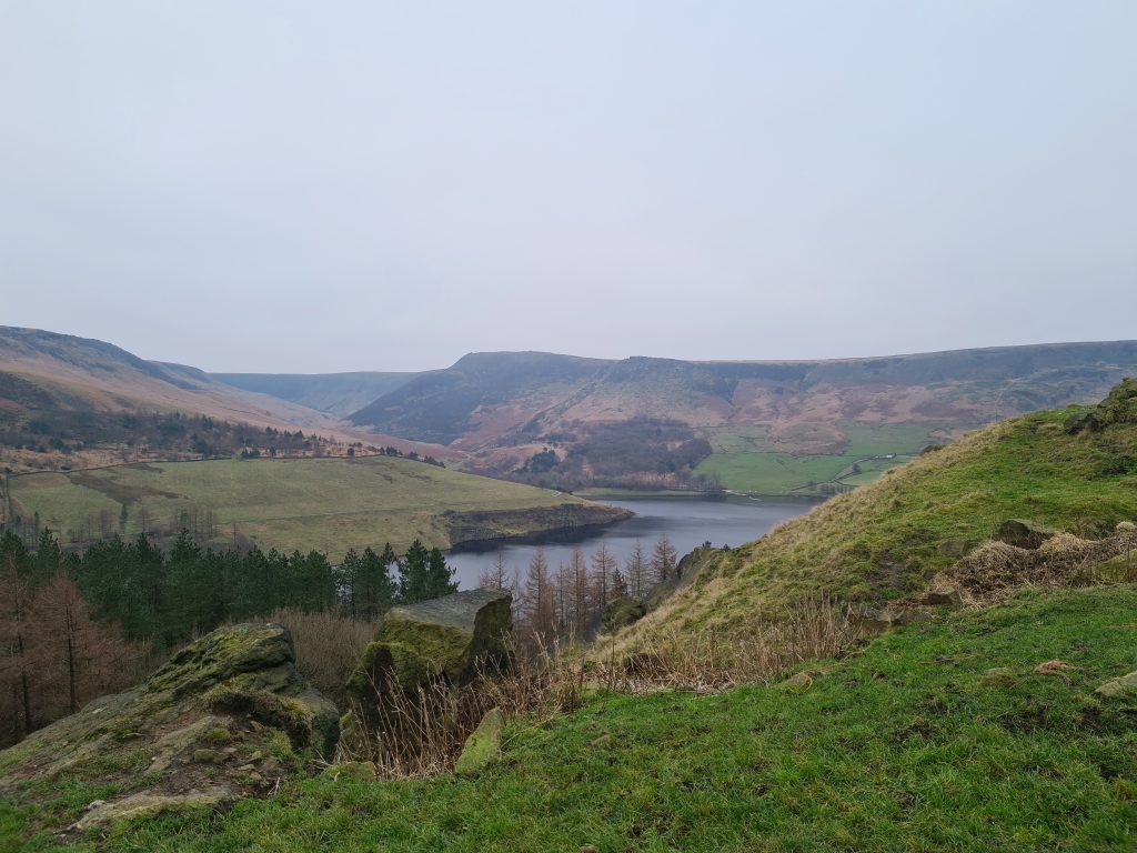
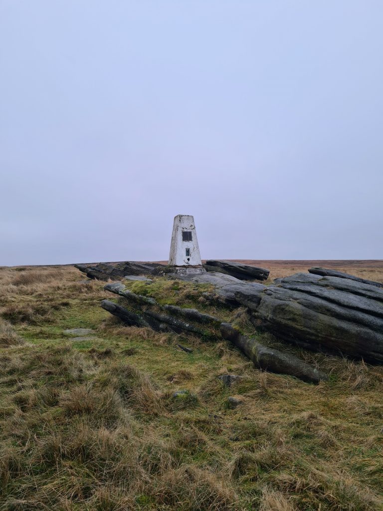
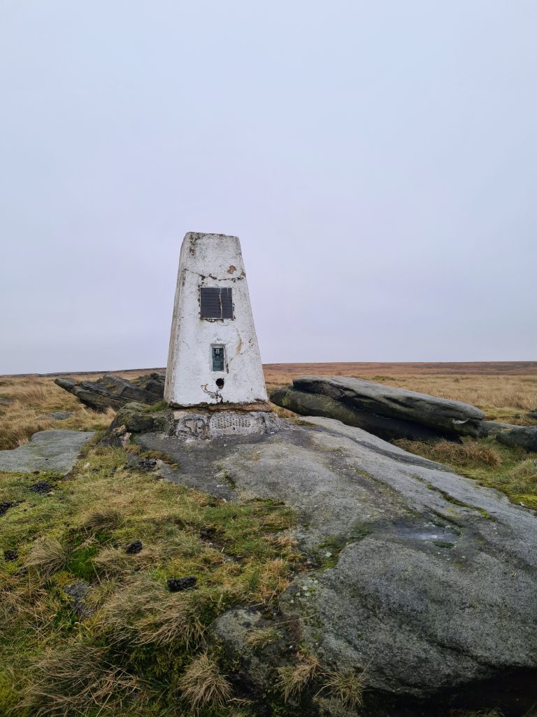
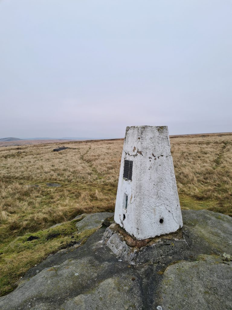
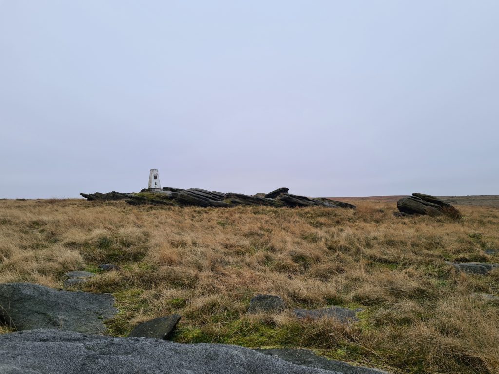
Heading north, the path will lead you to Broadstone Hill trig point. It’s set on a rocky outcrop and has amazing views over to Pule Hill, Swellands Reservoir and Black Moss Reservoir.

Broadstone Hill Trig Point, Saddleworth Moor

Broadstone Hill Trig Point, Saddleworth Moor looking towards Pule Hill

Broadstone Hill Trig Point, Saddleworth Moor

Broadstone Hill Trig Point, Saddleworth Moor

Broadstone Hill Trig Point, Saddleworth Moor

Broadstone Hill Trig Point, Saddleworth Moor


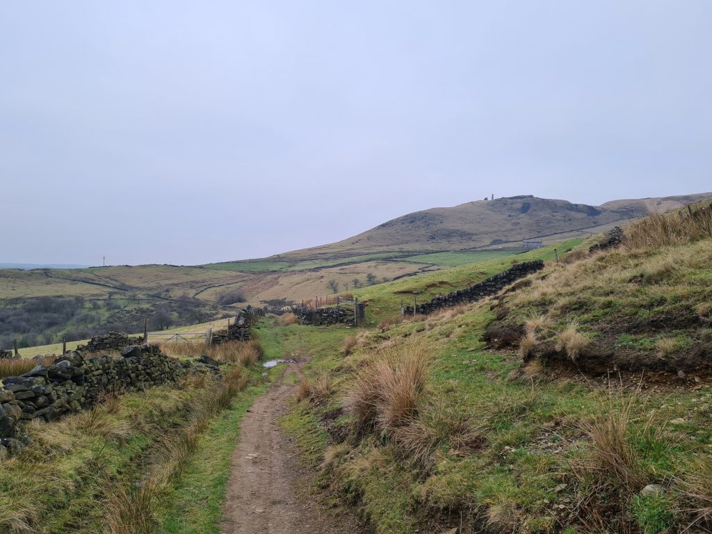
Once we’d explored Broadstone Hill trig point and taken all our photos, we headed off back towards Dick Hill. At Sugar Loaf, we took the path towards the war memorial and the Pots and Pans Memorial.

Oven Stone on Saddleworth Moor

Oven Stone on Saddleworth Moor

View of the war memorial from Oven Stone on Saddleworth Moor

Oven Stone on Saddleworth Moor

Spot Holly!

Oven Stone on Saddleworth Moor


After a quick stop off at the Oven Stone (perfect for a clamber about on, by the way!) we took the path to the huge war memorial – it’s way bigger than it looks in this photo! The views from here over the surrounding towns are incredible on a clear day.


Pots and Pans Stone and the war memorial on the hill top

Pots and Pans Stone and the war memorial on the hill top

Pots and Pans Stone on Saddleworth Moor


We then took the Oldham Way back down the hill. This turns into a farm track which leads back out onto the A635 and back to the car park.


Oldham Way skirting around Aldermans Hill

Views back to the Pots and Pans Stone

Sheep peering over a dry stone wall with Dove Stone Reservoir and Indians Head rocks in the background


Sadly there is no nearby pub so we headed to The Huntsman Inn in Holmfirth for some delicious pub grub.


Here’s the route for this Peak District walk:


Route Map:


Walk Map (Opens in OS Maps): Aldermans Hill and Broadstone Hill Trig Point Walk

Parking: Binn Green car park on the A635 Holmfirth Road OL3 7NN – W3W:///lateral.buns.munch

Facilities: There are composting toilets in the car park but these were closed when we went. There are toilets in the nearby Dove Stone Reservoir car park.

Terrain: Moorland – appropriate footwear advised.

Walk Time: 2 hours

Difficulty: ▲▲▲

Distance: 5.3 miles approximately

Trig Points Bagged: Saddleworth (Broadstone Hill)

Peak District Peaks Bagged: None

Peak District Ethels Bagged: None


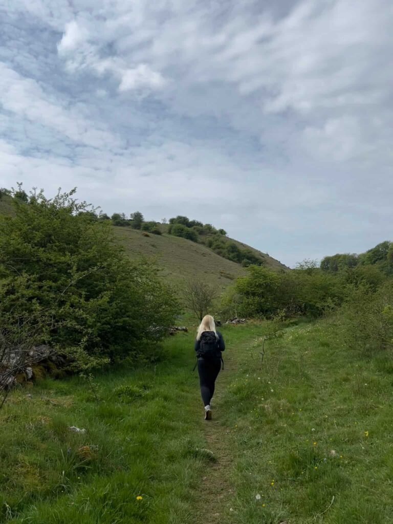
This walk around Saddleworth moor has amazing views and is a great place for kids to explore. Holly loved exploring and climbing on all the different rock formations, which are apparently the remains of an almighty fight between two giants, Alder and Alphin (of Alphin’s Pike fame). They fell out over a water nymph who lived in a nearby stream – it’s always the way, isn’t it?


For more walks around Saddleworth, or walks from Dove Stone Reservoir, you might like Dovestone Reservoir to Alphin Pike Circular or Dovestone Circular Walk.

Tap to share with your hiking friends!

  • Facebook
  • Email
  • WhatsApp
« Edale to Grindslow Knoll Circular Walk | 4 Miles
Torside Reservoir Circular Walk | 5 Miles »

RELATED POSTS

  • Hathersage Stepping StonesHathersage Stepping Stones Walk | 7 Miles
  • Ladybower ReservoirLadybower Walk | 6 Miles
  • Anvil Stone, GrindsbrookGrindsbrook Clough Scramble to Grindslow Knoll | 7 Miles
  • Signpost pointing to Teggs Nose Country ParkTeggs Nose Country Park Short Walk | 2 Miles

Leave a Reply Cancel reply

Your email address will not be published. Required fields are marked *

FIND YOUR NEXT WALK:

ABOUT ME

Y Garn with Kids - Y Garn via the Devil's Kitchen Walk in Ogwen Valley

Hello! I’m Jo! Welcome to The Wandering Wildflower, an outdoors lifestyle blog focusing on family walks in the Peak District, a place we love exploring. I want to share the Peak District hidden gems and show you there’s so much more than the honeypot places. When I’m not dragging my husband and now 11 year old out on Peak District walks or up mountains, I can be found on planning my next moorland walk or plotting a Geocache walk (and seeing where the nearest pub is!). I love the hills but hate the heights, so trig bagging is – er- fun!


I hope this blog will give you some ideas of places to visit in the Peak District and inspire you and your family to head into the great outdoors.  Thanks for stopping by!

CATEGORIES

  • CIRCULAR WALKS (188)
  • HOLMFIRTH WALKS (27)
  • ISLE OF SKYE WALKS (3)
  • LAKE DISTRICT WALKS (24)
  • LANCASHIRE WALKS (2)
  • LONG PEAK DISTRICT WALKS 10 MILES + (42)
  • MEDIUM WALKS 4-9 MILES (136)
  • PEAK DISTRICT SCRAMBLES (16)
  • PEAK DISTRICT WALKS (202)
  • PEAK DISTRICT WALKS WITH KIDS (75)
  • PEAK DISTRICT WALKS WITH PUBS (60)
  • SCOTLAND WALKS (6)
  • SHORT WALKS UNDER 3 MILES (40)
  • SNOWDONIA WALKS (5)
  • UK CAMPING (5)
  • YORKSHIRE WALKS (33)

Peak District Walks

List of Peak District Ethels

Peak District Peak Bagging

Peak District Trig Point Challenge

Peak District Walks with Pubs

Peak District Walks with Kids

Beautiful Walks in Holmfirth

Short Walks in the Peak District

Long Walks in the Peak District

AFFILIATE DISCLOSURE

This blog may contain affiliate links through which, at no additional cost to you, I may earn a small commission. I only recommend products I would use myself and all opinions expressed here are my own. As an Amazon Associate I earn from qualifying purchases. Read full privacy policy here.

ARCHIVES

PEAK DISTRICT WEATHER

Peak District mountain weather on Met Office

Peak District Trig Points

Promo image for a blog post about the Peak District Trig Point Challenge With Map of Peak District Trig Points and Walking Routes by The Wandering Wildflower

Peak District Ethels Challenge

Promo image for a blog post about the Peak District Trig Point Challenge With Map of Peak District Ethels and Walking Routes by The Wandering Wildflower

WALKING ROUTES STRAIGHT TO YOUR INBOX

Want new walks in your inbox? Drop your email below and I'll send you some ideas for walks you can try.

You can unsubscribe anytime. For more details, review our Privacy Policy.

Thank you!

You have successfully joined our subscriber list.

RSS LATEST POSTS

  • Burnbank Fell, Blake Fell and Gavel Fell | 8 Miles
  • Bretton Park Circular Walk | 3 Miles
  • Hathersage Stepping Stones Walk | 7 Miles
  • Ladybower Walk | 6 Miles
  • Derbyshire Peak District Walks

FOLLOW ON PINTEREST

Want new walks in your inbox? Drop your email below and I'll send you some ideas for walks you can try.

You can unsubscribe anytime. For more details, review our Privacy Policy.

Thank you!

You have successfully joined our subscriber list.

jo@thewanderingwildflower.co.uk

The Wandering Wildflower

  • Email
  • Facebook
  • Instagram
  • Pinterest
  • PRIVACY POLICY
  • TERMS & CONDITIONS
  • ABOUT

(c) The Wandering Wildflower. All Rights Reserved.

|| THEME BY ECLAIR DESIGNS