• 3 Mile Walks or Less
  • 4 Mile Walks
  • 5 Mile Walks
  • 6 Mile Walks
  • 7 Mile Walks
  • 8 Mile Walks
  • 9 Mile Walks
  • 10 Mile Walks
  • 11 Mile Walks
  • 12 Mile Walks
  • 14 Mile Walks
  • 15 Mile Walks
  • 20+ Mile Walks

The Wandering Wildflower

Peak District Hikes

  • PEAK DISTRICT WALKS
    • SHORT WALKS UNDER 3 MILES
    • MEDIUM WALKS 4-9 MILES
    • LONG PEAK DISTRICT WALKS 10 MILES +
  • PEAK DISTRICT WALKS WITH PUBS
  • PEAK DISTRICT WALKS WITH KIDS
  • HOLMFIRTH WALKS

Bradnop, Moor Top and Hill House Trig Point Walk | 8 Miles

March 10, 2023 CIRCULAR WALKS, MEDIUM WALKS 4-9 MILES, PEAK DISTRICT WALKS, PEAK DISTRICT WALKS WITH PUBS

This is a triple trig bagging walk starting in the pretty village of Onecote before heading out to find Bradnop trig point, Moor Top trig point and Hill House trig point. The walk is 8 miles long and explores the beautiful Staffordshire Peak District countryside (whilst ticking a few off the Peak District trig point list).


Hill House trig point

We parked outside the village hall in Onecote, where there is an honesty box (suggested donation £2). We then headed north-west through the village to find the public footpath (it runs through the farmyard next to the church). The footpath leads across the fields, and isn’t the most obvious, but soon comes to a stile crossing a stream. Over the stile, the path heads through the field (head to the water trough at the top of the field) and then up alongside a line of trees.


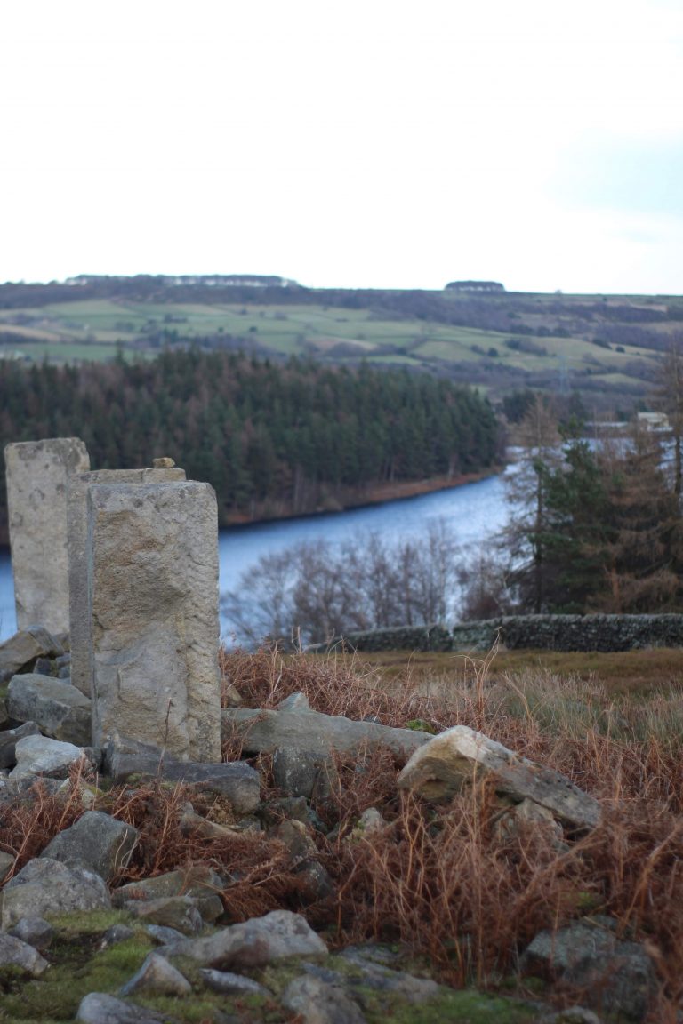
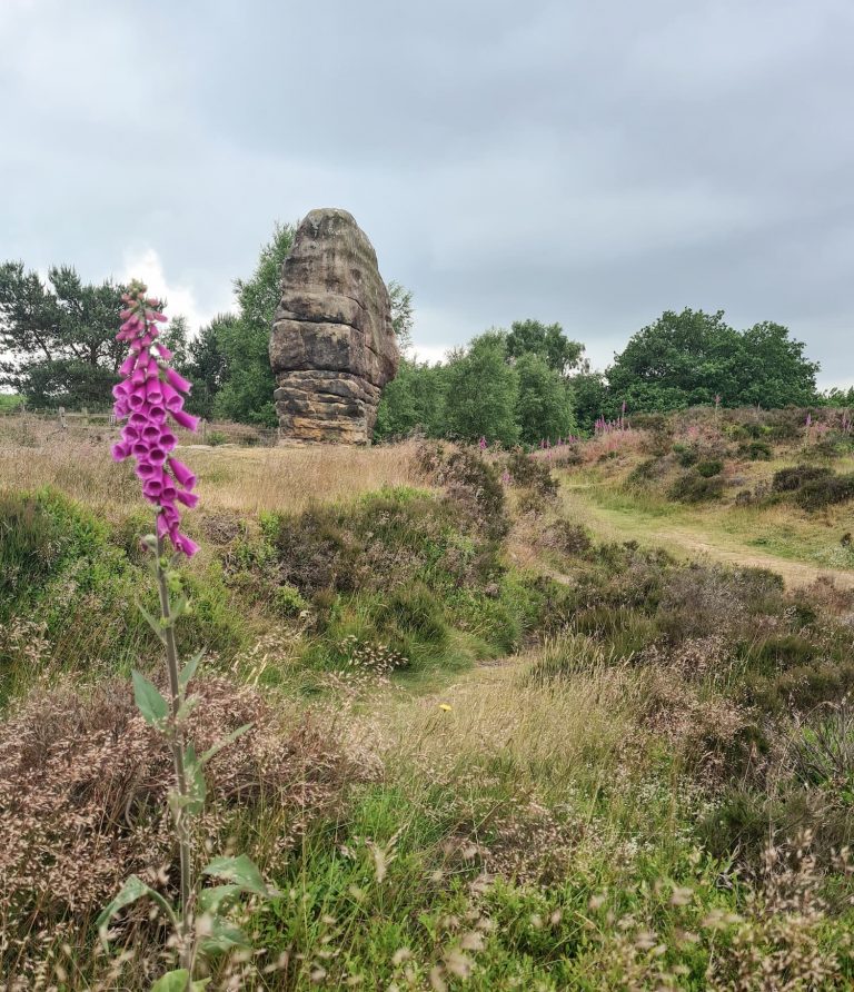
We found the stile in the fence – it’s quite well hidden – and then carried on up to Morridge Top Road. A quick detour to the south-west and we found our first trig point, Bradnop. It’s tucked over the wall (topped with barbed wire) and is just reachable if you have really long arms or a stick!

Bradnop trig point on the other side of a stone wall

Bradnop trig point

We turned back and walked along Morridge Top Road for almost a mile to find the next trig point, Moor Top. Again, this is stuck on the other side of a wall topped with barbed wire but is slightly nearer the wall so easier to reach!

Moor Top trig point

Moor Top trig point

Trig photos taken, we set off along the road for around another mile until we came to some stone gateposts leading to a farm track and the footpath. The footpath runs down the track a short distance and then off over the fields, and took us through a field of the friendliest sheep ever! They ran over to us and made Holly’s day.

A girl stroking a sheep

After fussing with the sheep, we followed the footpaths down the fields into Mixon and we came into a farmyard near a beautiful run down barn. I love a bit of “faded grandeur” and this barn fits it (a bit). The footpath dog legs round the barn and down into a dell with a pond, which we passed and walked through more sheep fields.

An old barn in the Peak District

The path runs alongside what I think is a former mill pond, leading to a farm track where the farmer has put in new fencing to mark out the footpath. With the fence on our right and the stone wall on our left we walked up the field before joining the farm track.

A former mill pond

A footpath in the Peak District

A stile and signpost heading into a field of white sheep

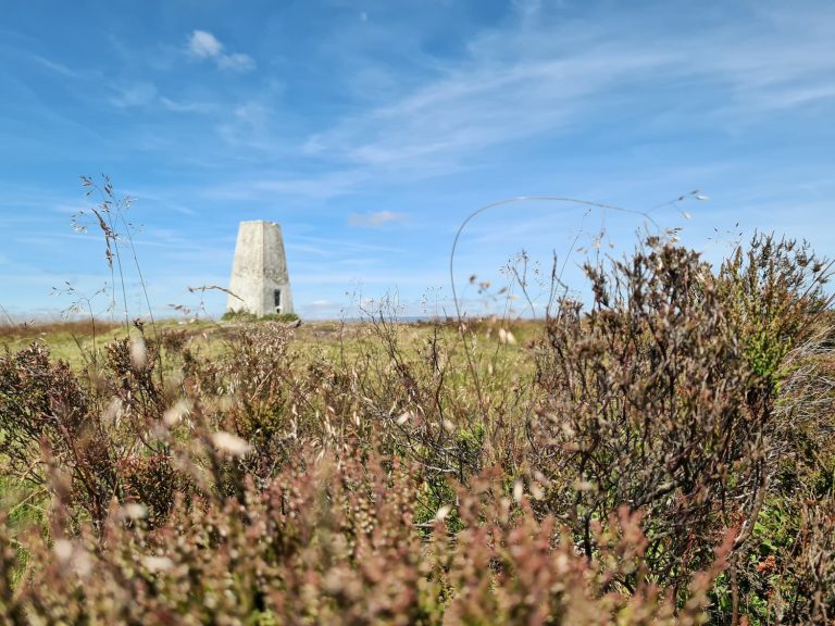
The path leads out onto Breech Road and you can see the gate leading to the trig point straight ahead. It’s a very short walk from the gate to Hill House trig point (and it’s sheep guardians).

Hill House trig point

Hill House trig point


After we’d admired the views at Hill House trig point, we followed Breech Road for about half a mile before picking up the footpath across the fields, passing through Butterton Moor Top Farm.


A wooden stile in a hedgerow in the Peak District

A shed of cows grazing on hay, all looking at the camera


The footpath eventually joins Onecote Road and passes The Jervis Arms pub, where we had a lovely Sunday lunch. It’s not a muddy boots style pub and we didn’t see any dogs there either, but the food was delicious.


This was a great walk for ticking off a few more of those Peak District trig points, and exploring the beautiful Staffordshire Peak District countryside.


Walk Map: 

You can click on the map to download the GPX file from Komoot.


Walk Map (Opens in OS Maps): Bradnop, Hill House and Moor Top Trig Point Walk

Parking: There is a parking area in front of Onecote Village Hall, Douse Lane, Onecote, Leek ST13 7RU

Facilities: None

Walk Time: 3-4 hours

Difficulty: ▲▲

Distance: 8 miles (12.5km)

Trig Points Bagged: Bradnop, Moor Top, Hill House

Peak District Peaks Bagged: None

Peak District Ethels Bagged: None


For more walks to bag trig points, you might like

Peak District Trig Point Walks

Peak District Trig Point List

Tap to share with your hiking friends!

  • Facebook
  • Email
  • WhatsApp
« Coledale Horseshoe – A Lake District Classic Walk | 9 Miles
Walla Crag, Bleaberry Fell and High Seat | 6 Miles »

RELATED POSTS

  • Nelson's Monument on Baslow EdgeThree Monuments Circular Walk From Chatsworth | 7.5 Miles
  • Lathkill Dale waterfallLathkill Dale Waterfall Walk | 7 Miles
  • South Head and a stone path through the heather - Peak District Walks by The Wandering WildflowerKinder Scout, Brown Knoll, South Head and Mount Famine | 8 Miles
  • A cloud inversion near Holme MossBritland Edge Hill, Dead Edge End and Snailsden | 8 Miles

Leave a Reply Cancel reply

Your email address will not be published. Required fields are marked *

FIND YOUR NEXT WALK:

ABOUT ME

Y Garn with Kids - Y Garn via the Devil's Kitchen Walk in Ogwen Valley

Hello! I’m Jo! Welcome to The Wandering Wildflower, an outdoors lifestyle blog focusing on family walks in the Peak District, a place we love exploring. I want to share the Peak District hidden gems and show you there’s so much more than the honeypot places. When I’m not dragging my husband and now 11 year old out on Peak District walks or up mountains, I can be found on planning my next moorland walk or plotting a Geocache walk (and seeing where the nearest pub is!). I love the hills but hate the heights, so trig bagging is – er- fun!


I hope this blog will give you some ideas of places to visit in the Peak District and inspire you and your family to head into the great outdoors.  Thanks for stopping by!

CATEGORIES

  • CIRCULAR WALKS (188)
  • HOLMFIRTH WALKS (27)
  • ISLE OF SKYE WALKS (3)
  • LAKE DISTRICT WALKS (24)
  • LANCASHIRE WALKS (2)
  • LONG PEAK DISTRICT WALKS 10 MILES + (42)
  • MEDIUM WALKS 4-9 MILES (136)
  • PEAK DISTRICT SCRAMBLES (16)
  • PEAK DISTRICT WALKS (202)
  • PEAK DISTRICT WALKS WITH KIDS (75)
  • PEAK DISTRICT WALKS WITH PUBS (60)
  • SCOTLAND WALKS (6)
  • SHORT WALKS UNDER 3 MILES (40)
  • SNOWDONIA WALKS (5)
  • UK CAMPING (5)
  • YORKSHIRE WALKS (33)

Peak District Walks

List of Peak District Ethels

Peak District Peak Bagging

Peak District Trig Point Challenge

Peak District Walks with Pubs

Peak District Walks with Kids

Beautiful Walks in Holmfirth

Short Walks in the Peak District

Long Walks in the Peak District

AFFILIATE DISCLOSURE

This blog may contain affiliate links through which, at no additional cost to you, I may earn a small commission. I only recommend products I would use myself and all opinions expressed here are my own. As an Amazon Associate I earn from qualifying purchases. Read full privacy policy here.

ARCHIVES

PEAK DISTRICT WEATHER

Peak District mountain weather on Met Office

Peak District Trig Points

Promo image for a blog post about the Peak District Trig Point Challenge With Map of Peak District Trig Points and Walking Routes by The Wandering Wildflower

Peak District Ethels Challenge

Promo image for a blog post about the Peak District Trig Point Challenge With Map of Peak District Ethels and Walking Routes by The Wandering Wildflower

WALKING ROUTES STRAIGHT TO YOUR INBOX

Want new walks in your inbox? Drop your email below and I'll send you some ideas for walks you can try.

You can unsubscribe anytime. For more details, review our Privacy Policy.

Thank you!

You have successfully joined our subscriber list.

RSS LATEST POSTS

  • Burnbank Fell, Blake Fell and Gavel Fell | 8 Miles
  • Bretton Park Circular Walk | 3 Miles
  • Hathersage Stepping Stones Walk | 7 Miles
  • Ladybower Walk | 6 Miles
  • Derbyshire Peak District Walks

FOLLOW ON PINTEREST

Want new walks in your inbox? Drop your email below and I'll send you some ideas for walks you can try.

You can unsubscribe anytime. For more details, review our Privacy Policy.

Thank you!

You have successfully joined our subscriber list.

jo@thewanderingwildflower.co.uk

The Wandering Wildflower

  • Email
  • Facebook
  • Instagram
  • Pinterest
  • PRIVACY POLICY
  • TERMS & CONDITIONS
  • ABOUT

(c) The Wandering Wildflower. All Rights Reserved.

|| THEME BY ECLAIR DESIGNS