• 3 Mile Walks or Less
  • 4 Mile Walks
  • 5 Mile Walks
  • 6 Mile Walks
  • 7 Mile Walks
  • 8 Mile Walks
  • 9 Mile Walks
  • 10 Mile Walks
  • 11 Mile Walks
  • 12 Mile Walks
  • 14 Mile Walks
  • 15 Mile Walks
  • 20+ Mile Walks

The Wandering Wildflower

Peak District Hikes

  • PEAK DISTRICT WALKS
    • SHORT WALKS UNDER 3 MILES
    • MEDIUM WALKS 4-9 MILES
    • LONG PEAK DISTRICT WALKS 10 MILES +
  • PEAK DISTRICT WALKS WITH PUBS
  • PEAK DISTRICT WALKS WITH KIDS
  • HOLMFIRTH WALKS

Britland Edge Hill and Dead Edge End Walk | 5.5 Miles

November 2, 2021 HOLMFIRTH WALKS, PEAK DISTRICT WALKS, YORKSHIRE WALKS

Fancy a walk on the moors to Britland Edge Hill and Dead Edge End? This is a there-and-back moorland walk near Holmfirth starting at Holme Moss Car Park. These are two Peak District Ethels and take you to a lesser known part of the Peak District.

View from Dead Edge End trig point

This route is part of a walk we planned to do but had to cut short when we found ourselves in the middle of a grouse shoot! We had planned to visit the nearby Ramsden Clough but had to turn back and head back to Holme Moss so as not to get shot at by men in tweed. We did however manage to bag two more for the Peak District Peak Bagging Challenge and another trig point for the Peak District Trig Point Checklist, so it was still worth doing.


View from Holme Moss car park towards Brownhill Reservoir

View from Holme Moss car park towards Yateholme Reservoir


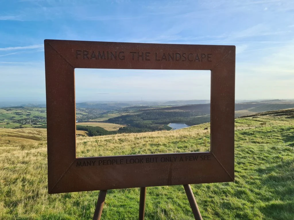
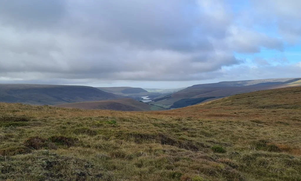
In terms of scenery, other than the moorland views there isn’t a lot to see up here once you leave the car park. The moorland is pretty bleak and featureless, although the views over towards Bleaklow and down towards Longdendale are beautiful.

Holme Moss Transmitter

View back to Holme Moss.


This blog may contain affiliate links through which, at no additional cost to you, I may earn a small commission. I only recommend products I would use myself and all opinions expressed here are my own. Read full privacy policy here.


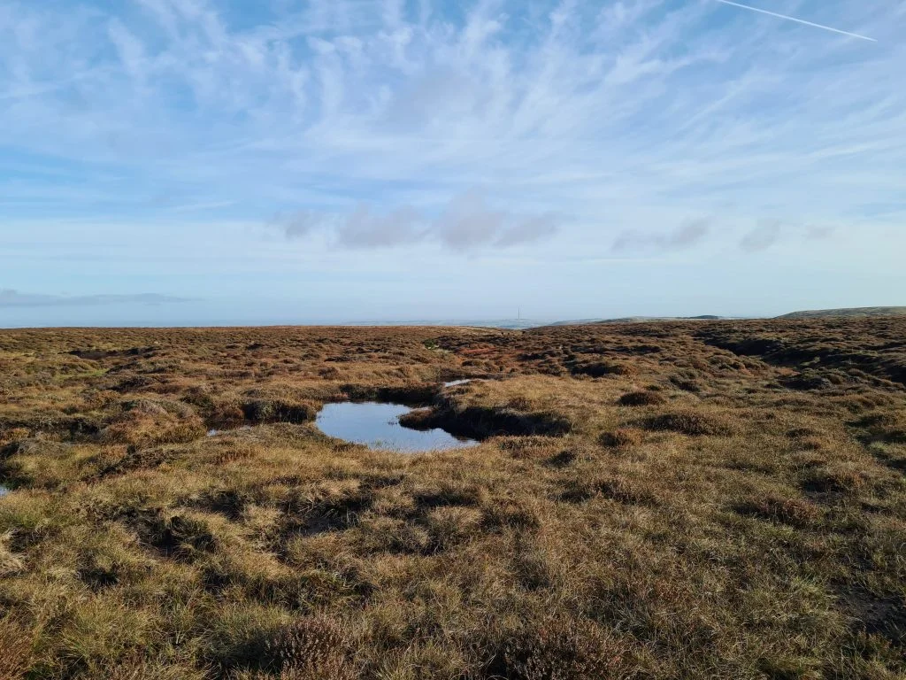
It’s a pretty gentle walk, with there being no steep climbs, but it is over peat moorland which can be really wet and boggy, and it definitely was when we went. As with all moorland walks I would only attempt this with the proper equipment and navigational aids. Proper footwear is a must for this walk – don’t attempt this in trainers! I love my Scarpa Terra GTX walking boots, which are really comfortable for long hikes, waterproof and give me lots of support and grip when walking on rough ground.


Boggy peat moorland near Britland Edge Hill with blue skies

Boggy peat moorland near Dead Edge End with blue skies

Footprint in the peat bog at Dead Edge End


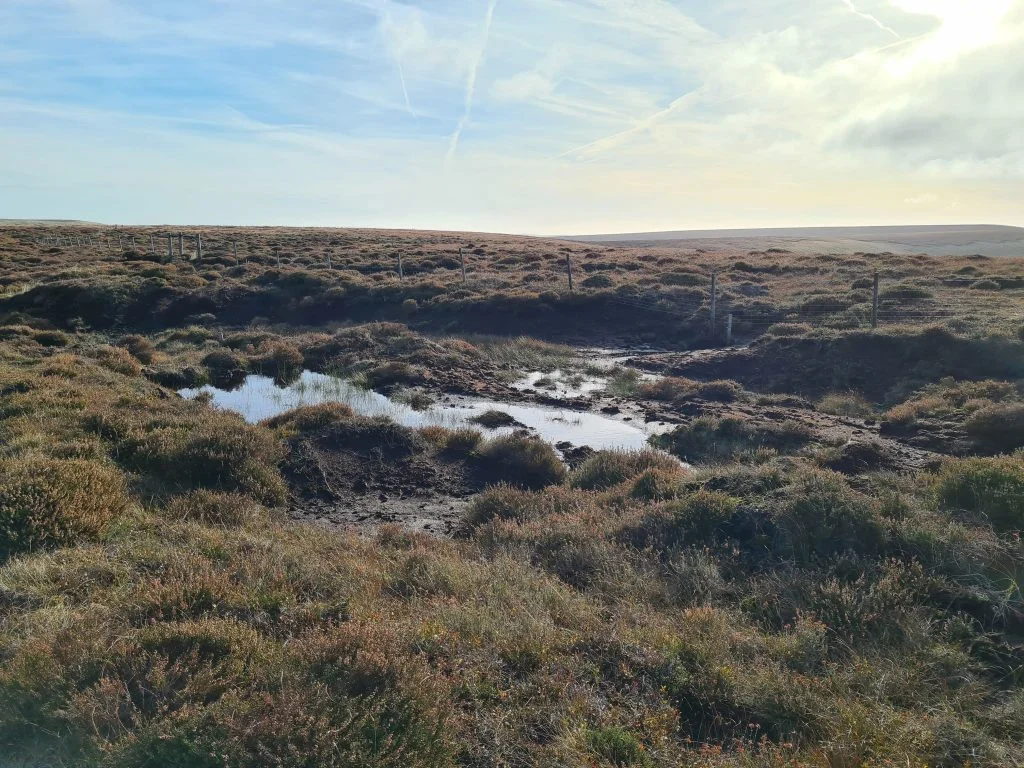
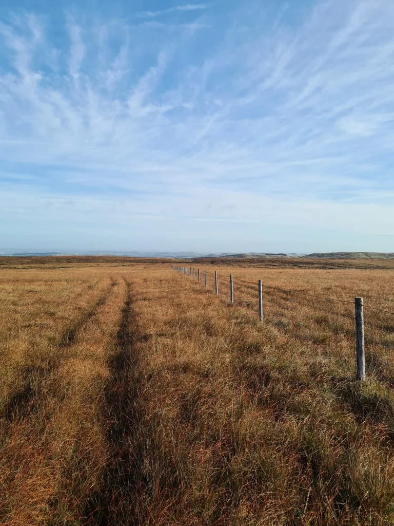
This is a walk from Holme Moss car park which takes you along the fence line towards Britland Edge Hill. This is a Peak District Peak at 523m above sea level, however the summit is a corner fence post and a puddle. Not even a cairn! After a quick search around to make sure we weren’t missing something, we headed off towards Dead Edge End.

Britland Edge Hill summit - Peak District Peak Bagging

The summit of Britland Edge Hill

Britland Edge Hill summit - Peak District Peak Bagging


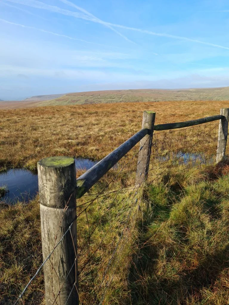
The route takes you along the line of the fences for most of the walk, which makes it quite easy to navigate.


Boundary fence near Britland Edge Hill


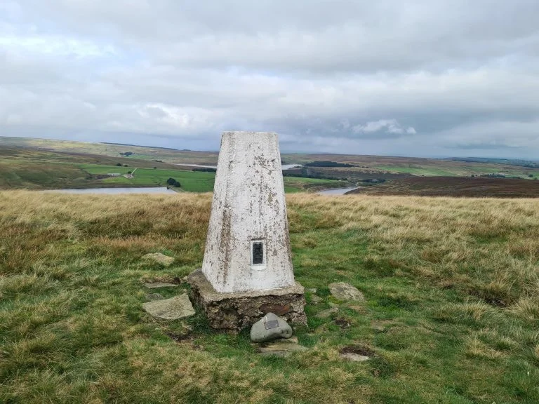
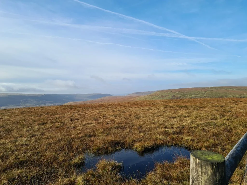
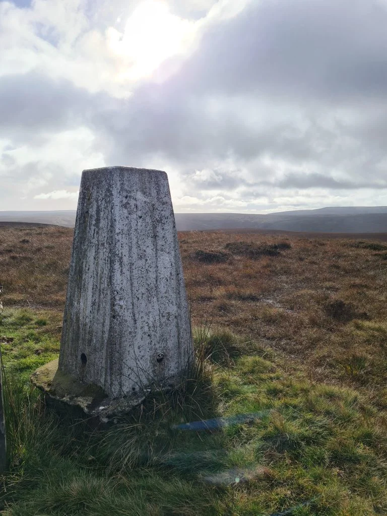
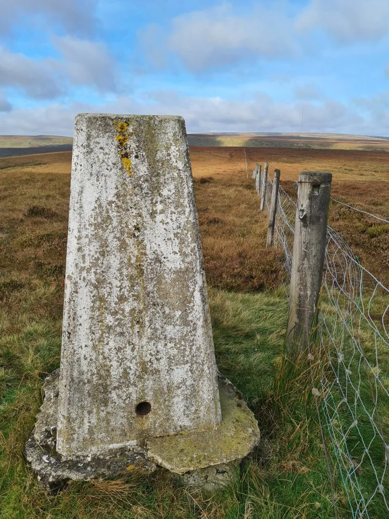
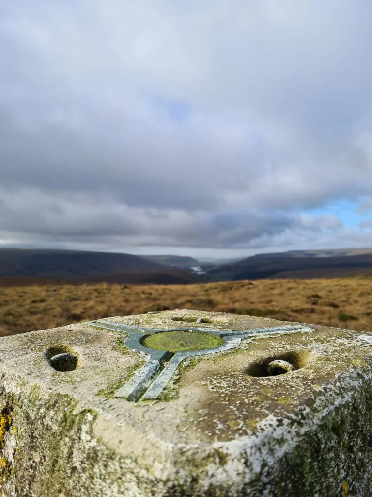
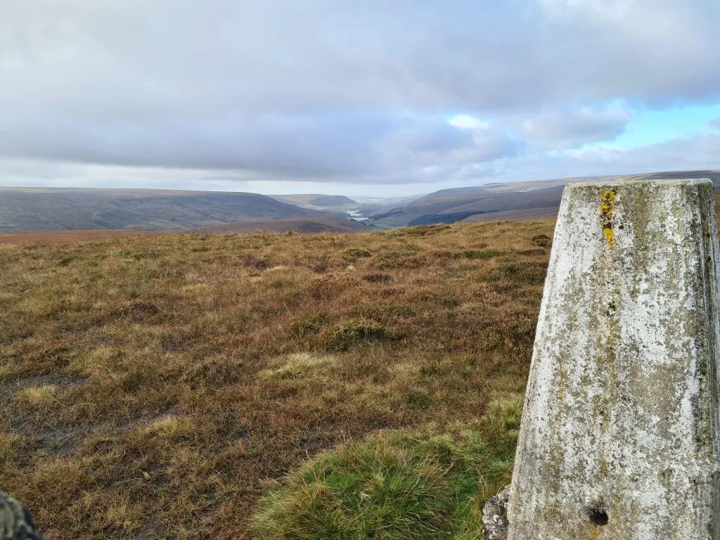
There is a gentle climb up to Dead Edge End, which is 499m above sea level and lies on the boundary between Yorkshire and Derbyshire. The fence follows the boundary and we approached the trig from Yorkshire – wahoo! The views from the trig are stunning as it looks down over Longdendale Valley and the reservoirs there.


Dead Edge End Trig Point - Peak District Trig Point Checklist

Dead Edge End Trig Point - Peak District Trig Point Checklist

Dead Edge End Trig Point - Peak District Trig Point Checklist

Dead Edge End Trig Point - Peak District Trig Point Checklist


We turned and were going to head back towards Ramsden Clough but ran into a gamekeeper who told us about the grouse shoot. We had to head back via Britland Edge Hill towards Holme Moss to avoid being caught up in the crossfire so will have to save Ramsden Clough for another day. We might actually approach it from Snailsden and Cooks Study Hill as there is a cliff face known as Ramsden Rocks, and I don’t want to be approaching that from above!


Parking: the free Holme Moss car park at HD9 2QF.

Facilities: None, although there is sometimes an ice cream van in the car park.

Distance: 5.5 miles over moorland.

Trig Points Bagged: Dead Edge End

Peak District Peaks Bagged: Dead Edge End, Britland Edge Hill

Peak District Ethels Bagged: Dead Edge End, Britland Edge Hill

Our route taking in Britland Edge Hill and Dead Edge End was just under 9km (5.5 miles). You can download the route map gpx file for the walk by clicking on the map image.

You could tie these two Peaks in with some other nearby ones including Snailsden Pike End or Black Hill, if you’re feeling energetic! You could also head down into the Crowden Valley (so this would be a good walk from Crowden campsite). There are lots of walks from Holme Moss car park to go on as well.


Peaks bagged, Ethels bagged and trig point checked off – onto the next Peak District walk!


Tap to share with your hiking friends!

  • Facebook
  • Email
  • WhatsApp
« Crowden to White Low and Hey Edge | 5.5 Miles
Wessenden Moor Circular Hike | 4 Miles »

RELATED POSTS

  • Hathersage Stepping StonesHathersage Stepping Stones Walk | 7 Miles
  • Ladybower ReservoirLadybower Walk | 6 Miles
  • Anvil Stone, GrindsbrookGrindsbrook Clough Scramble to Grindslow Knoll | 7 Miles
  • Circular Walk from Marsden to Wessenden Head | 6 Miles

Leave a Reply Cancel reply

Your email address will not be published. Required fields are marked *

FIND YOUR NEXT WALK:

ABOUT ME

Y Garn with Kids - Y Garn via the Devil's Kitchen Walk in Ogwen Valley

Hello! I’m Jo! Welcome to The Wandering Wildflower, an outdoors lifestyle blog focusing on family walks in the Peak District, a place we love exploring. I want to share the Peak District hidden gems and show you there’s so much more than the honeypot places. When I’m not dragging my husband and now 11 year old out on Peak District walks or up mountains, I can be found on planning my next moorland walk or plotting a Geocache walk (and seeing where the nearest pub is!). I love the hills but hate the heights, so trig bagging is – er- fun!


I hope this blog will give you some ideas of places to visit in the Peak District and inspire you and your family to head into the great outdoors.  Thanks for stopping by!

CATEGORIES

  • CIRCULAR WALKS (189)
  • HOLMFIRTH WALKS (27)
  • ISLE OF SKYE WALKS (3)
  • LAKE DISTRICT WALKS (24)
  • LANCASHIRE WALKS (2)
  • LONG PEAK DISTRICT WALKS 10 MILES + (42)
  • MEDIUM WALKS 4-9 MILES (137)
  • PEAK DISTRICT SCRAMBLES (16)
  • PEAK DISTRICT WALKS (205)
  • PEAK DISTRICT WALKS WITH KIDS (76)
  • PEAK DISTRICT WALKS WITH PUBS (60)
  • SCOTLAND WALKS (6)
  • SHORT WALKS UNDER 3 MILES (40)
  • SNOWDONIA WALKS (5)
  • UK CAMPING (5)
  • YORKSHIRE WALKS (33)

Peak District Walks

List of Peak District Ethels

Peak District Peak Bagging

Peak District Trig Point Challenge

Peak District Walks with Pubs

Peak District Walks with Kids

Beautiful Walks in Holmfirth

Short Walks in the Peak District

Long Walks in the Peak District

AFFILIATE DISCLOSURE

This blog may contain affiliate links through which, at no additional cost to you, I may earn a small commission. I only recommend products I would use myself and all opinions expressed here are my own. As an Amazon Associate I earn from qualifying purchases. Read full privacy policy here.

ARCHIVES

PEAK DISTRICT WEATHER

Peak District mountain weather on Met Office

Peak District Trig Points

Promo image for a blog post about the Peak District Trig Point Challenge With Map of Peak District Trig Points and Walking Routes by The Wandering Wildflower

Peak District Ethels Challenge

Promo image for a blog post about the Peak District Trig Point Challenge With Map of Peak District Ethels and Walking Routes by The Wandering Wildflower

WALKING ROUTES STRAIGHT TO YOUR INBOX

Want new walks in your inbox? Drop your email below and I'll send you some ideas for walks you can try.

You can unsubscribe anytime. For more details, review our Privacy Policy.

Thank you!

You have successfully joined our subscriber list.

RSS LATEST POSTS

  • How to Find Three Shires Head
  • Burnbank Fell, Blake Fell and Gavel Fell | 8 Miles
  • Bretton Park Circular Walk | 3 Miles
  • Hathersage Stepping Stones Walk | 7 Miles
  • Peak District Caves

FOLLOW ON PINTEREST

Want new walks in your inbox? Drop your email below and I'll send you some ideas for walks you can try.

You can unsubscribe anytime. For more details, review our Privacy Policy.

Thank you!

You have successfully joined our subscriber list.

jo@thewanderingwildflower.co.uk

The Wandering Wildflower

  • Email
  • Facebook
  • Instagram
  • Pinterest
  • PRIVACY POLICY
  • TERMS & CONDITIONS
  • ABOUT

(c) The Wandering Wildflower. All Rights Reserved.

|| THEME BY ECLAIR DESIGNS