• 3 Mile Walks or Less
  • 4 Mile Walks
  • 5 Mile Walks
  • 6 Mile Walks
  • 7 Mile Walks
  • 8 Mile Walks
  • 9 Mile Walks
  • 10 Mile Walks
  • 11 Mile Walks
  • 12 Mile Walks
  • 14 Mile Walks
  • 15 Mile Walks
  • 20+ Mile Walks

The Wandering Wildflower

Peak District Hikes

  • PEAK DISTRICT WALKS
    • SHORT WALKS UNDER 3 MILES
    • MEDIUM WALKS 4-9 MILES
    • LONG PEAK DISTRICT WALKS 10 MILES +
  • PEAK DISTRICT WALKS WITH PUBS
  • PEAK DISTRICT WALKS WITH KIDS
  • HOLMFIRTH WALKS

Langsett Reservoir and Langsett Moors Circular Walk | 5 Miles

November 24, 2023 CIRCULAR WALKS, MEDIUM WALKS 4-9 MILES, PEAK DISTRICT WALKS

If you’re looking for a Peak District walk to escape the crowds, this is the one for you. Starting from the car park near Langsett Reservoir, the walk heads through the woods before reaching the Langsett Moors, then following the Little Don River back to the start. This is a lovely 5 mile walk exploring some of the quieter parts of the Peak District, as well as the quirky Hordron Sheep Fort.

A view of the Little Don river

This walk uses Open Access Land where dogs are not allowed – check with Natural England for up to date restrictions before you go as the landowners sometimes close the moors. Dogs are only allowed on public footpaths which are shown green on OS maps, and there are none on the Langsett Moors unfortunately.


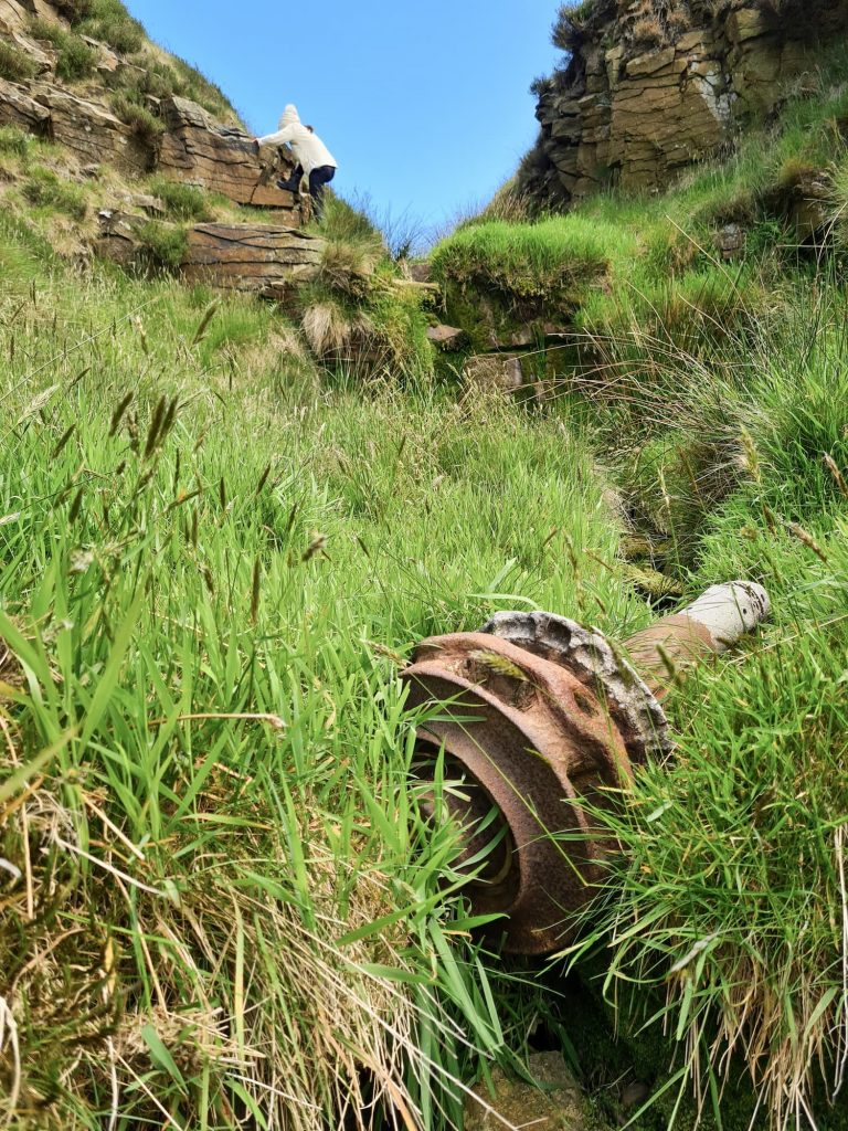
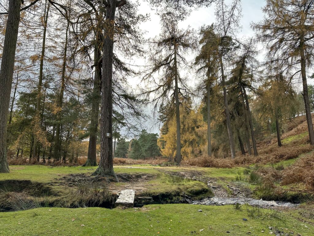
Our walk started from the free Yorkshire Water car park near to the Flouch roundabout, and we headed across the road into the woods. The paths are a bit confusing, but we followed the main track and turned right, then came to a stream and turned right, and then immediately took the left hand path (the muddy one, sorry!) which leads up through the woods. The path runs alongside a stream through the woods, which opens onto farmland.

A woman and her daughter walking in some woods

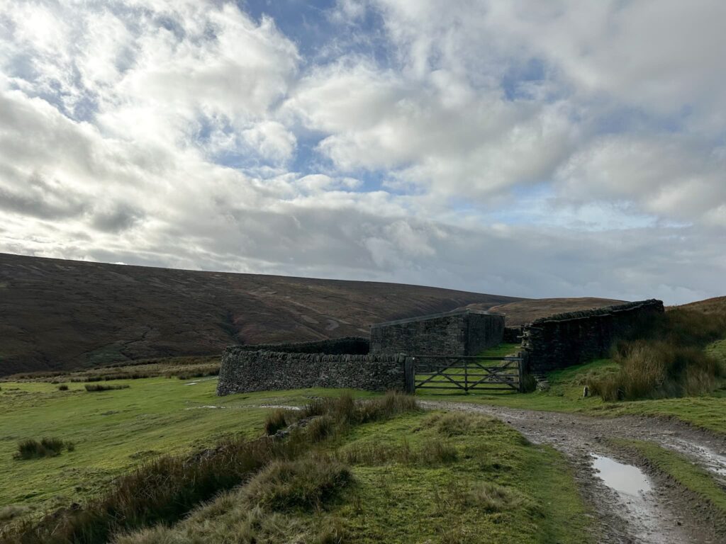
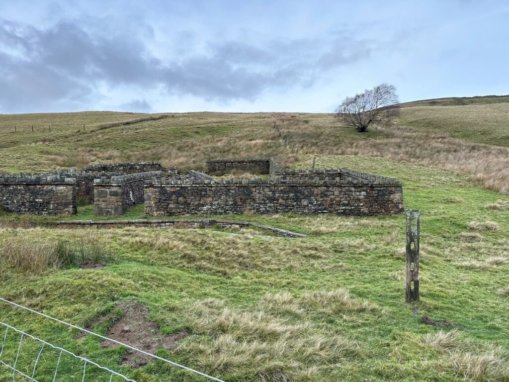
We followed the track as it became Swinden Lane, and this is where the public footpath stops and the Open Access Land begins. We walked down the hill, following Hordron Road as it winds it’s way over Little Moor (negoatiating a couple of overflowing river fords along the way!) to the first of the fortified sheep “forts”. This barn within a huge wall is a great place to shelter from the rough weather we get up here.

A rough country track with a ford to cross

Hordron Road, a rough country track

A barn with a huge stone wall shelter surrounding it


From the barn we headed down the steep hillside to the river. There is a path that leads to the south-east to meet Hordron Clough but we went Route 1 – it was really steep in places so if you’re unsure, follow the path to the bridge with Cat Clough, and then follow the river downstream. There are lovely views over the Langsett Moors here and it makes a great place to stop for a picnic.


A view of the Little Don River


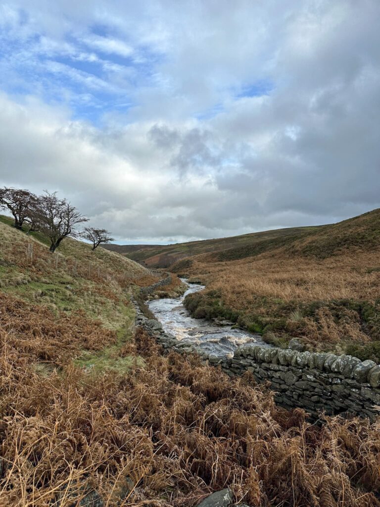
There is a boggy path that runs alongside the river, passing the Hordron sheep fort, a fortified sheepfold with sheepdip.


Hordron Sheep Fort, a fortified sheepfold

Hordron Sheep Fort, a fortified sheepfold


The path winds it’s way through the valley bottom, and we followed it until it split. Here we should have taken the left hand fork which climbs up the hill but we took the right hand path, staying nearer to the river, and then we had to clamber up a muddy bank to get to the right level – lesson learned for next time! If you get into a small patch of woodland next to the river, you’ve gone too far. The GPX file shows the right way, whereas the Komoot shows the actual way we went.

Some fungi on a tree


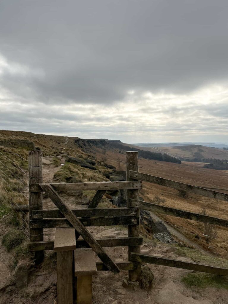
We walked through the woodland, following some very muddy, skinny paths in places, and eventually reached Swinden Plantation. The path climbs up the hillside and runs alongside a wall next to the woods, and then turns into Crooklands Wood and leads back to the main track through the woods. This track leads back to the road and the car park.


A view of the Little Don river

Crookland Wood, near Langsett

A view of the Little Don river


There are a couple of places nearby to get some refreshments – the Spotty Cafe aka Bank View Cafe, and the Waggon and Horses pub. Both of these are great.


Walk Details:


Walk Map (Opens in OS Maps): Langsett to Hordron Bank Walk

Parking: There is a free car park near the Flouch roundabout (S36 4GY) but there is a height restriction here. There is also layby parking nearby. W3W:///cadet.geese.talent

Facilities: There are none in the car park but there is a cafe and pub nearby.

Walk Time: 3-4 hours

Difficulty: ▲▲

Distance: 5.2 miles (8.36km)

Elevation: 254ft (77.4m)

Trig Points Bagged: None

Peak District Peaks Bagged: None

Peak District Ethels Bagged: None


For more walks nearby you might like:

Langsett Reservoir Walk

Langsett to Margery Hill, High Stones and Outer Edge

Margery Hill, Outer Edge and Crow Stones

Underbank Reservoir Walk

Tap to share with your hiking friends!

  • Facebook
  • Email
  • WhatsApp
« Kinder Scout via Kinder Low | 9 Miles
Riding Wood and Ramsden Reservoir Circular Walk | 3 Miles »

RELATED POSTS

  • Hathersage Stepping StonesHathersage Stepping Stones Walk | 7 Miles
  • Ladybower ReservoirLadybower Walk | 6 Miles
  • Anvil Stone, GrindsbrookGrindsbrook Clough Scramble to Grindslow Knoll | 7 Miles
  • High Wheeldon, Pilsbury Hill and Carder Low Walk | 8.5 Miles

Leave a Reply Cancel reply

Your email address will not be published. Required fields are marked *

FIND YOUR NEXT WALK:

ABOUT ME

Y Garn with Kids - Y Garn via the Devil's Kitchen Walk in Ogwen Valley

Hello! I’m Jo! Welcome to The Wandering Wildflower, an outdoors lifestyle blog focusing on family walks in the Peak District, a place we love exploring. I want to share the Peak District hidden gems and show you there’s so much more than the honeypot places. When I’m not dragging my husband and now 11 year old out on Peak District walks or up mountains, I can be found on planning my next moorland walk or plotting a Geocache walk (and seeing where the nearest pub is!). I love the hills but hate the heights, so trig bagging is – er- fun!


I hope this blog will give you some ideas of places to visit in the Peak District and inspire you and your family to head into the great outdoors.  Thanks for stopping by!

CATEGORIES

  • CIRCULAR WALKS (189)
  • HOLMFIRTH WALKS (27)
  • ISLE OF SKYE WALKS (3)
  • LAKE DISTRICT WALKS (24)
  • LANCASHIRE WALKS (2)
  • LONG PEAK DISTRICT WALKS 10 MILES + (42)
  • MEDIUM WALKS 4-9 MILES (137)
  • PEAK DISTRICT SCRAMBLES (16)
  • PEAK DISTRICT WALKS (205)
  • PEAK DISTRICT WALKS WITH KIDS (76)
  • PEAK DISTRICT WALKS WITH PUBS (60)
  • SCOTLAND WALKS (6)
  • SHORT WALKS UNDER 3 MILES (40)
  • SNOWDONIA WALKS (5)
  • UK CAMPING (5)
  • YORKSHIRE WALKS (33)

Peak District Walks

List of Peak District Ethels

Peak District Peak Bagging

Peak District Trig Point Challenge

Peak District Walks with Pubs

Peak District Walks with Kids

Beautiful Walks in Holmfirth

Short Walks in the Peak District

Long Walks in the Peak District

AFFILIATE DISCLOSURE

This blog may contain affiliate links through which, at no additional cost to you, I may earn a small commission. I only recommend products I would use myself and all opinions expressed here are my own. As an Amazon Associate I earn from qualifying purchases. Read full privacy policy here.

ARCHIVES

PEAK DISTRICT WEATHER

Peak District mountain weather on Met Office

Peak District Trig Points

Promo image for a blog post about the Peak District Trig Point Challenge With Map of Peak District Trig Points and Walking Routes by The Wandering Wildflower

Peak District Ethels Challenge

Promo image for a blog post about the Peak District Trig Point Challenge With Map of Peak District Ethels and Walking Routes by The Wandering Wildflower

WALKING ROUTES STRAIGHT TO YOUR INBOX

Want new walks in your inbox? Drop your email below and I'll send you some ideas for walks you can try.

You can unsubscribe anytime. For more details, review our Privacy Policy.

Thank you!

You have successfully joined our subscriber list.

RSS LATEST POSTS

  • How to Find Three Shires Head
  • Burnbank Fell, Blake Fell and Gavel Fell | 8 Miles
  • Bretton Park Circular Walk | 3 Miles
  • Hathersage Stepping Stones Walk | 7 Miles
  • Peak District Caves

FOLLOW ON PINTEREST

Want new walks in your inbox? Drop your email below and I'll send you some ideas for walks you can try.

You can unsubscribe anytime. For more details, review our Privacy Policy.

Thank you!

You have successfully joined our subscriber list.

jo@thewanderingwildflower.co.uk

The Wandering Wildflower

  • Email
  • Facebook
  • Instagram
  • Pinterest
  • PRIVACY POLICY
  • TERMS & CONDITIONS
  • ABOUT

(c) The Wandering Wildflower. All Rights Reserved.

|| THEME BY ECLAIR DESIGNS