• 3 Mile Walks or Less
  • 4 Mile Walks
  • 5 Mile Walks
  • 6 Mile Walks
  • 7 Mile Walks
  • 8 Mile Walks
  • 9 Mile Walks
  • 10 Mile Walks
  • 11 Mile Walks
  • 12 Mile Walks
  • 14 Mile Walks
  • 15 Mile Walks
  • 20+ Mile Walks

The Wandering Wildflower

Peak District Hikes

  • PEAK DISTRICT WALKS
    • SHORT WALKS UNDER 3 MILES
    • MEDIUM WALKS 4-9 MILES
    • LONG PEAK DISTRICT WALKS 10 MILES +
  • PEAK DISTRICT WALKS WITH PUBS
  • PEAK DISTRICT WALKS WITH KIDS
  • HOLMFIRTH WALKS

Minninglow Walk and Stanton Moor via High Peak Trail | 18 Miles

July 20, 2022 CIRCULAR WALKS, LONG PEAK DISTRICT WALKS 10 MILES +, PEAK DISTRICT WALKS

This Peak District walk takes in Minninglow, Bonsall Moor, Stanton Moor and Harthill Moor and is a challenging 17.7 miles. This is a great walk if you are taking part in the Peak District Ethels challenge, and also bags the Stanton Moor trig point and takes you as near as you can get to the Harthill Moor, Slipper Low, Blake Low and Bonsall Moor trig points. 

Minninglow in the mist as seen over a small tumbledown stone wall

Minninglow in the mist

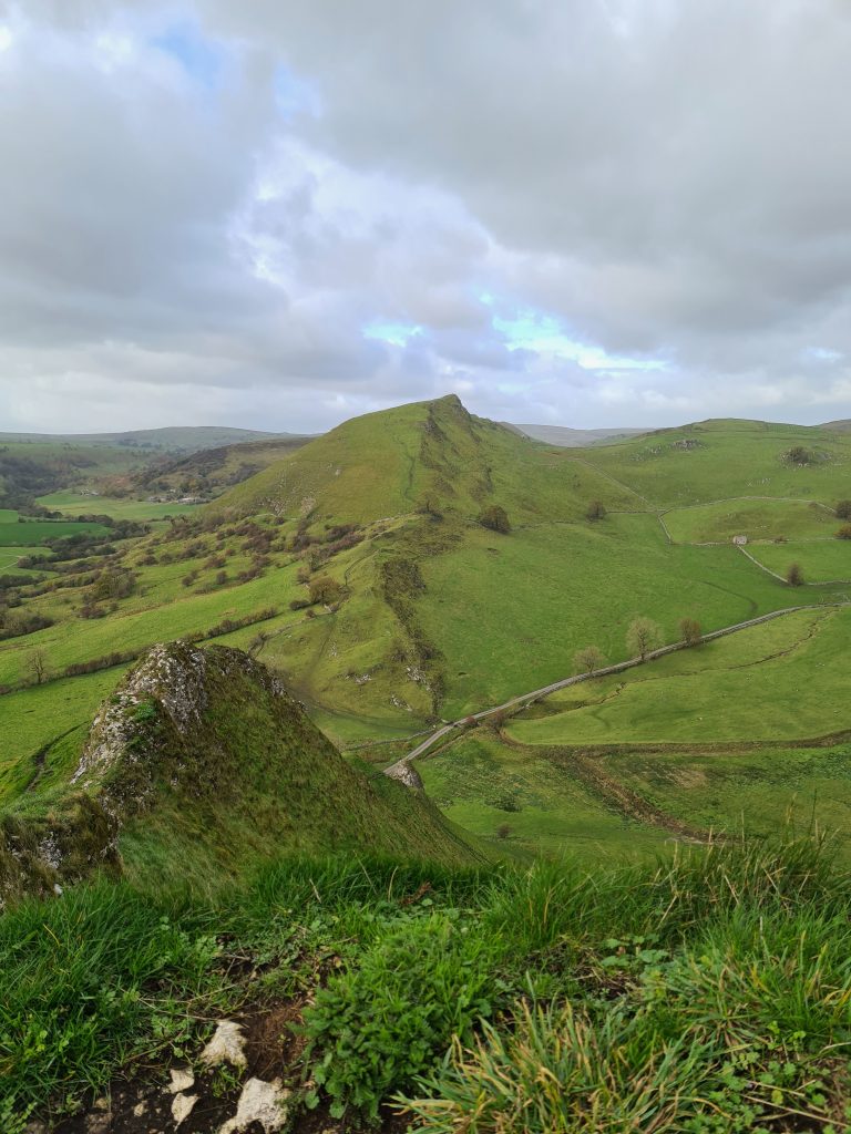
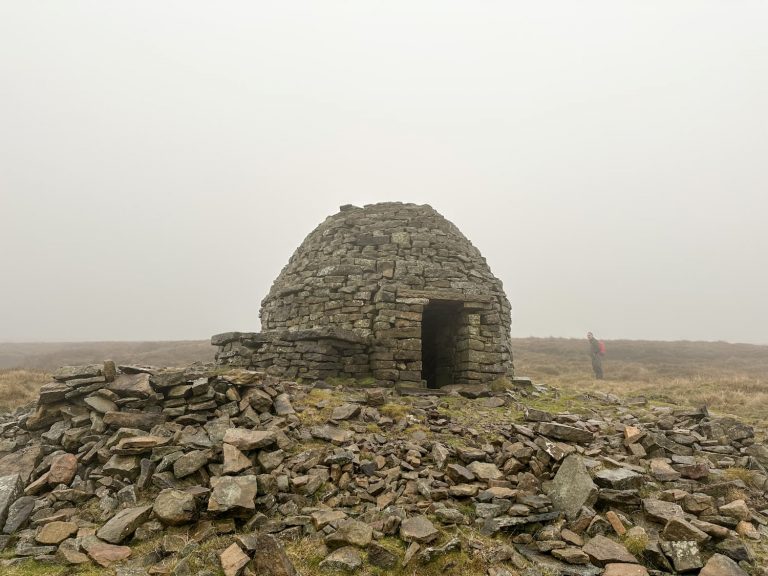
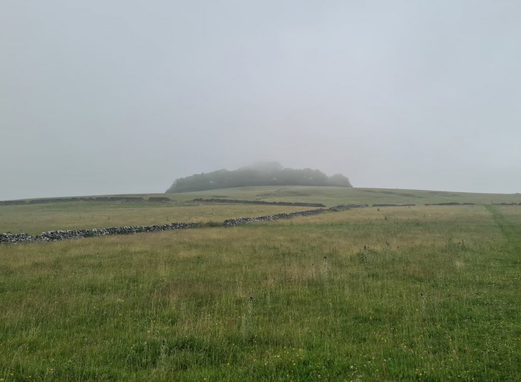
Our walk took us along part of the High Peak Trail (we covered a bit more of this in our Harboro Rocks walk) to Minninglow, which is a limestone hill near Parwich. It’s 372m above sea level and has a ring of trees crowning the summit, which features a Neolithic chambered tomb and two Bronze Age bowl barrows. The hill itself can be seen from miles away and is a really prominent feature on the landscape. It’s also a really atmospheric place – although it might have been because we went on a really misty day!


You could make this Minninglow walk a bit shorter and not add on the other peaks we went to.


We started at the High Peak Trail car park in Parwich and followed the Trail for approximately 1.25 miles before following a concessionary path up to the summit of Minninglow. There is a wooden gate to pass through which makes you feel like you’re entering a magical place!

Minninglow in the mist

From here we passed over the summit and down through the field to the track. We followed the track for a short distance, past the site of the Slipper Low trig point (which is in a privately owned field).

Slipper Low trig point is up near those trees – this was as close as we went.


We walked along New Lane, which becomes Brassington Lane and then turned right onto Mill Lane. Passing through Grangemill, we followed Grange Dale to the north-east. This soon becomes Tophill Lane. At the crossroads with Whitelow Lane and Green Lane, we took a left onto a rough track. We passed a mere, where we stopped and had some lunch, then headed back onto the lane to find the footpath to lead into the fields.


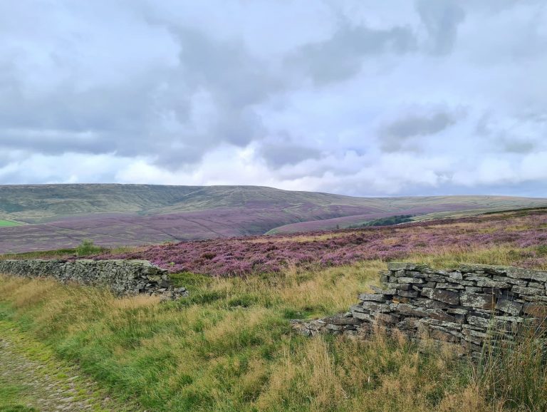
You’ll see on the map below our route gets a bit windy now. The paths are impossible to see, and we got as close as we could to the Bonsall Moor trig point. Bonsall Moor is a farmland hilltop of 367m above sea level. The trig point here is on private land so we couldn’t access it.

Bonsall Moor trig point

Bonsall Moor trig point

Once we had found the stile in the hedgerow, we headed over the fields towards Bonsallmoor Lane.

A wooden stile in an overgrown hedgerow with dog roses and hawthorn

A wooden stile in an overgrown hedgerow with dog roses and hawthorn

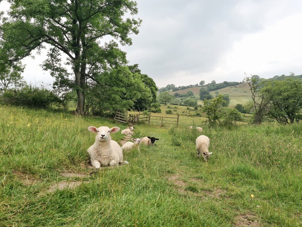
Our walk took us through the pretty village of Winster, which has a beautiful old market hall and lots of pretty cottages. There was also a field of hand reared lambs who were super friendly!

5 or 6 cute lambs laying down in a field

The hand reared lambinos! They were so friendly. Their field is on the map – just outside Winster, where the camera icon is.

From here we walked over the fields to Barn Farm Campsite and Bunk Barn. Passing through the camp site, there is a footpath which leads onto Lees Road. Just across Lees Road is a footpath which takes you onto Stanton Moor itself.


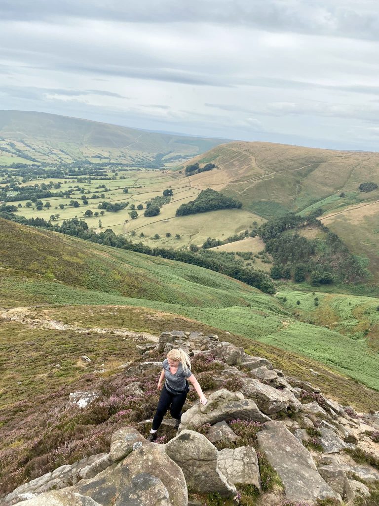
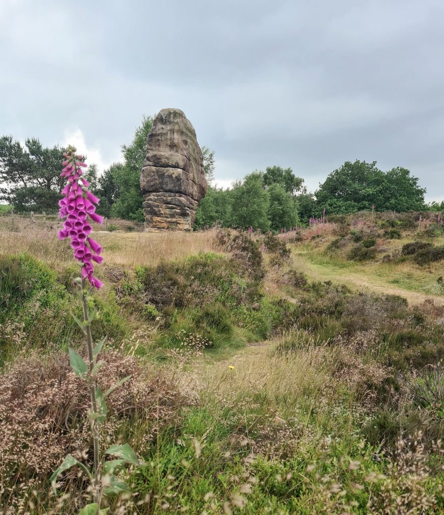
Stanton Moor is a popular destination for walkers and is easily accessible from the surrounding lanes. At 323m above sea level it’s one of the smaller peaks in the Peak District but is a very beautiful place to explore. We passed the Stanton Moor trig point and the Cork Stone, which is a gritstone lump. Some clever folk in the 19th Century added in some metal handles to help people climb to the top. We had a go – it was fine climbing up but getting back down felt a whole other matter!

The Cork Stone, Stanton Moor

The Cork Stone

The Cork Stone, a huge lump of gritstone with hand holes for climbing

The Cork Stone

Stanton Moor trig point

Stanton Moor trig point

From Stanton Moor we headed back onto Birchover Road and through the village of Birchover. We walked along a lane with views of the Hermits Cave and then followed the footpaths past Robin Hood’s Stride and Rowtor Rocks. We didn’t have a lot of time to explore Rowtor Rocks but it is an amazing place with lots of things to see in the caves – it’s a great place to take the kids.

Robin Hood's Stride and Rowtor Rocks, The Peak District

Robin Hood’s Stride and Rowtor Rocks

We then headed to our last Ethel peak of the day, Harthill Moor. This is a bit of a disappointing one as you can’t get near the summit, as it’s private, and can’t even see the trig point from the footpath. There’s a wall with barbed wire blocking your way.


From Harthill Moor we set off back towards Elton, had a detour past the Blake Low trig point (with a clear sign on the gate saying no unauthorised access) then followed the country lanes back to the car park.

An old stone barn in a wildflower meadow

An old stone barn in a wildflower meadow

This was a great walk to bag some Ethels and Peak District trig points, even if we couldn’t get close to most of them! With 4 Ethels and 4 trig points (only one you can access) it would have been a bumper haul.


Here’s the route map for this Stanton Moor walk.

Minninglow Walk Map:


Walk Map (Opens in OS Maps): Minninglow, Stanton Moor and Blakelow Hill Walk

Parking: Minninglow Car Park DE4 2PN (W3W:///sake.clipboard.bound)

Facilities: None

Walk Time: 6-7 hours depending on speed and fitness

Difficulty: ▲▲▲

Distance: 17.7 miles (28.5km)

Trig Points Bagged: Stanton Moor (accessible), Blakelow Hill, Harthill Moor (Hopping Top), Elton Common (Blake Low), Slipper Low (private)

Peak District Peaks Bagged: Stanton Moor, Minninglow, Bonsall Moor, Harthill Moor, Slipper Low, Blake Low

Peak District Ethels Bagged: Stanton Moor, Bonsall Moor, Harthill Moor, Minninglow


A quick note about the trig points and summits – we only go to the ones which are publicly accessible. If they are on private land, we get as near as we can without trespassing. You can always find out who the landowner is and ask permission but please don’t just go trespassing – farmers work hard enough without having to deal with all this. Some landowners are reluctant to allow access because of people letting dogs off the lead, or climbing over walls, so please be respectful.

Tap to share with your hiking friends!

  • Facebook
  • Email
  • WhatsApp
« Monyash to Magpie Mine and Bole Hill | 6 Miles
Family Adventure Quotes »

RELATED POSTS

  • Three Shires HeadHow to Find Three Shires Head
  • A wooden stile on Stanage EdgeBamford Edge, Stanage Edge, Higger Tor, Surprise View | 15 Miles
  • Lathkill Dale waterfallLathkill Dale Waterfall Walk | 7 Miles
  • Derwent Dam - Derwent Reservoir Walk by The Wandering WildflowerDerwent Reservoir and Slippery Stones Walk | 10 Miles

Leave a Reply Cancel reply

Your email address will not be published. Required fields are marked *

FIND YOUR NEXT WALK:

ABOUT ME

Y Garn with Kids - Y Garn via the Devil's Kitchen Walk in Ogwen Valley

Hello! I’m Jo! Welcome to The Wandering Wildflower, an outdoors lifestyle blog focusing on family walks in the Peak District, a place we love exploring. I want to share the Peak District hidden gems and show you there’s so much more than the honeypot places. When I’m not dragging my husband and now 11 year old out on Peak District walks or up mountains, I can be found on planning my next moorland walk or plotting a Geocache walk (and seeing where the nearest pub is!). I love the hills but hate the heights, so trig bagging is – er- fun!


I hope this blog will give you some ideas of places to visit in the Peak District and inspire you and your family to head into the great outdoors.  Thanks for stopping by!

CATEGORIES

  • CIRCULAR WALKS (189)
  • HOLMFIRTH WALKS (27)
  • ISLE OF SKYE WALKS (3)
  • LAKE DISTRICT WALKS (24)
  • LANCASHIRE WALKS (2)
  • LONG PEAK DISTRICT WALKS 10 MILES + (42)
  • MEDIUM WALKS 4-9 MILES (137)
  • PEAK DISTRICT SCRAMBLES (16)
  • PEAK DISTRICT WALKS (205)
  • PEAK DISTRICT WALKS WITH KIDS (76)
  • PEAK DISTRICT WALKS WITH PUBS (60)
  • SCOTLAND WALKS (6)
  • SHORT WALKS UNDER 3 MILES (40)
  • SNOWDONIA WALKS (5)
  • UK CAMPING (5)
  • YORKSHIRE WALKS (33)

Peak District Walks

List of Peak District Ethels

Peak District Peak Bagging

Peak District Trig Point Challenge

Peak District Walks with Pubs

Peak District Walks with Kids

Beautiful Walks in Holmfirth

Short Walks in the Peak District

Long Walks in the Peak District

AFFILIATE DISCLOSURE

This blog may contain affiliate links through which, at no additional cost to you, I may earn a small commission. I only recommend products I would use myself and all opinions expressed here are my own. As an Amazon Associate I earn from qualifying purchases. Read full privacy policy here.

ARCHIVES

PEAK DISTRICT WEATHER

Peak District mountain weather on Met Office

Peak District Trig Points

Promo image for a blog post about the Peak District Trig Point Challenge With Map of Peak District Trig Points and Walking Routes by The Wandering Wildflower

Peak District Ethels Challenge

Promo image for a blog post about the Peak District Trig Point Challenge With Map of Peak District Ethels and Walking Routes by The Wandering Wildflower

WALKING ROUTES STRAIGHT TO YOUR INBOX

Want new walks in your inbox? Drop your email below and I'll send you some ideas for walks you can try.

You can unsubscribe anytime. For more details, review our Privacy Policy.

Thank you!

You have successfully joined our subscriber list.

RSS LATEST POSTS

  • How to Find Three Shires Head
  • Burnbank Fell, Blake Fell and Gavel Fell | 8 Miles
  • Bretton Park Circular Walk | 3 Miles
  • Hathersage Stepping Stones Walk | 7 Miles
  • Peak District Caves

FOLLOW ON PINTEREST

Want new walks in your inbox? Drop your email below and I'll send you some ideas for walks you can try.

You can unsubscribe anytime. For more details, review our Privacy Policy.

Thank you!

You have successfully joined our subscriber list.

jo@thewanderingwildflower.co.uk

The Wandering Wildflower

  • Email
  • Facebook
  • Instagram
  • Pinterest
  • PRIVACY POLICY
  • TERMS & CONDITIONS
  • ABOUT

(c) The Wandering Wildflower. All Rights Reserved.

|| THEME BY ECLAIR DESIGNS