• 3 Mile Walks or Less
  • 4 Mile Walks
  • 5 Mile Walks
  • 6 Mile Walks
  • 7 Mile Walks
  • 8 Mile Walks
  • 9 Mile Walks
  • 10 Mile Walks
  • 11 Mile Walks
  • 12 Mile Walks
  • 14 Mile Walks
  • 15 Mile Walks
  • 20+ Mile Walks

The Wandering Wildflower

Peak District Hikes

  • PEAK DISTRICT WALKS
    • SHORT WALKS UNDER 3 MILES
    • MEDIUM WALKS 4-9 MILES
    • LONG PEAK DISTRICT WALKS 10 MILES +
  • PEAK DISTRICT WALKS WITH PUBS
  • PEAK DISTRICT WALKS WITH KIDS
  • HOLMFIRTH WALKS

Shutlingsloe Circular Walk via Whetstone Ridge | 8 Miles

February 14, 2022 CIRCULAR WALKS, MEDIUM WALKS 4-9 MILES, PEAK DISTRICT WALKS, PEAK DISTRICT WALKS WITH KIDS

Pin image for Shutlingsloe and Whetstone Ridge Walk by The Wandering Wildflower

This Peak District walk takes you to Shutlingsloe and then onto Whetstone Ridge via The Cat and Fiddle. This is a lovely 7.5 mile walk to do, exploring the Peak District countryside and bagging two more Peak District Ethels and the Shutlingsloe trig point. This was definitely a Peak District walk of two halves! The route for this Shutlingsloe circular walk takes you through stunning Cheshire countryside, including woodlands and waterfalls.

Shutlingsloe circular walk via Whetstone Ridge - Peak District walks by The Wandering Wildflower


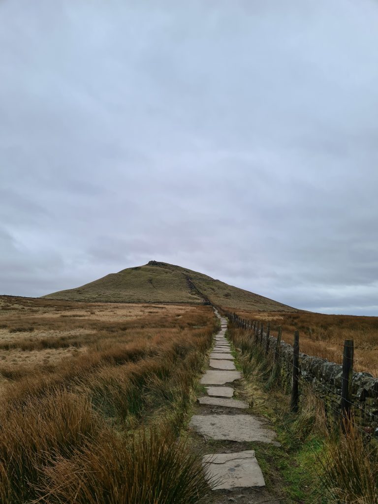
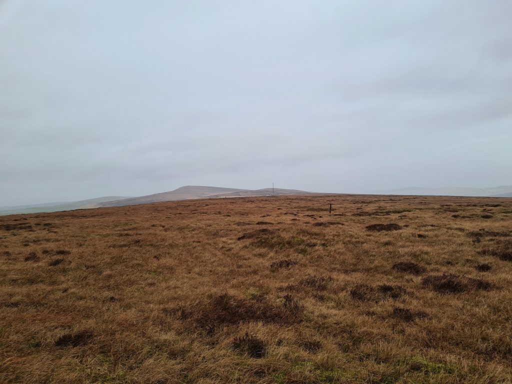
Shutlingsloe, also known as the Matterhorn of Cheshire, is a stunning steep-sided hill in the Peak District. At 506m above sea level Shutlingsloe has amazing views (on a clear day) over to Shining Tor, Macclesfield Forest and Whetstone Ridge and has a trig point at the summit. Whetstone Ridge is a moorland hilltop near to The Cat and Fiddle distillery and is 547m above sea level. It couldn’t be more different from Shutlingsloe though – Whetstone Ridge has a flat, moorland top and there is nothing to mark the summit at all. It was also very wet when we went on this walk – we suffered driving rain and hail!


Our Shutlingsloe circular walk starts from the Clough House car park in Wildboarclough (SK11 0BD). This free car park also has picnic benches, and is an ideal place to start the climb up Shutlingsloe. Heading north out of the car park, you’ll follow the road to the left and head south-west along Clough Road until you come to a stile and gate on the right hand side, heading up the hill.

Gateway through some trees - Shutlingsloe circular walk via Whetstone Ridge by The Wandering Wildflower

Track across farmland -0 Shutlingsloe circular walk via Whetstone Ridge by The Wandering Wildflower

Follow the edge of the woodland until you come to Shutlingsloe Farm. Here you’ll start to climb up the steep hill towards Shutlingsloe itself.

Shutlingsloe - Shutlingsloe circular walk via Whetstone Ridge by The Wandering Wildflower

The path up Shutlingsloe - Shutlingsloe circular walk via Whetstone Ridge by The Wandering Wildflower

The rocky, scrambly path up to Shutlingsloe summit

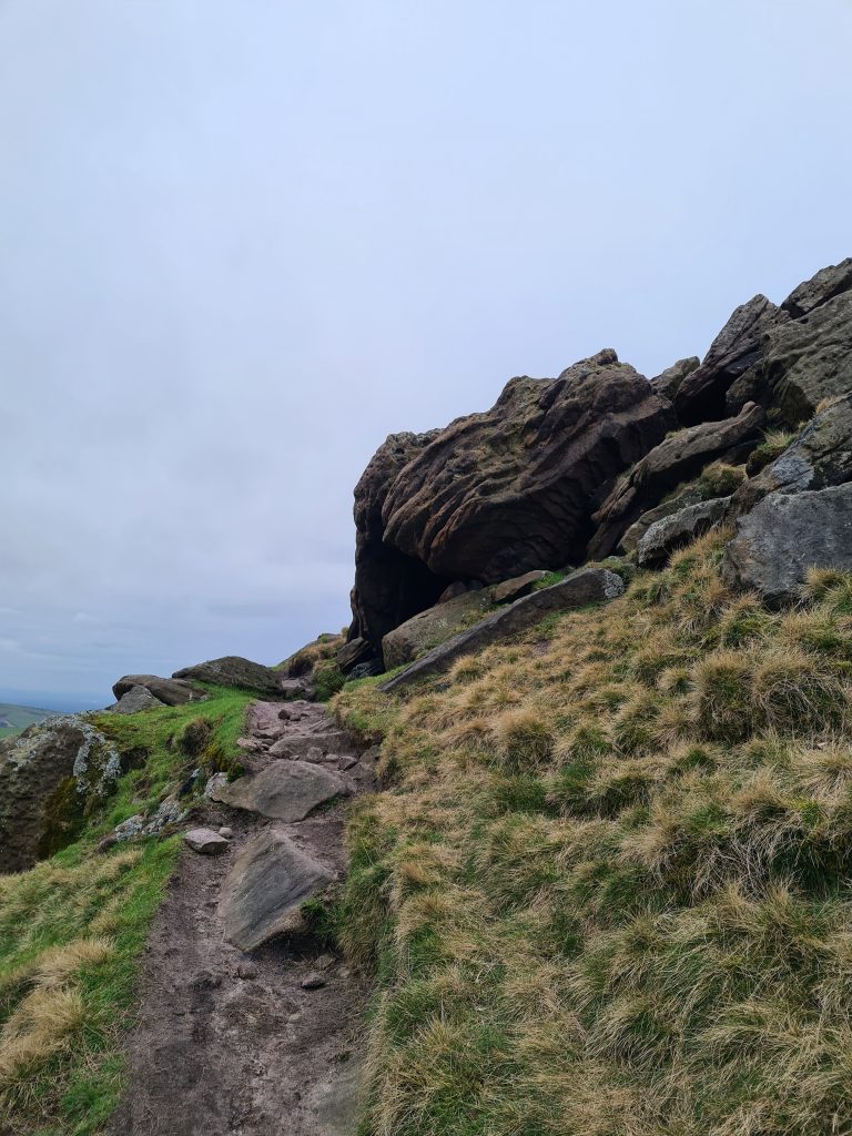
This eastern side of the hill is very steep and there are a few sections near the top which are more of a scramble than a walk. At the summit there is a trig point with spectacular views, and the handy toposcope shows which hills you can see.

Shutlingsloe trig point - Shutlingsloe circular walk via Whetstone Ridge by The Wandering Wildflower


Shutlingsloe trig point - Shutlingsloe circular walk via Whetstone Ridge by The Wandering Wildflower

Toposcope on Shutlingsloe - Shutlingsloe circular walk via Whetstone Ridge by The Wandering Wildflower

The walk then heads down the steep northern side of Shutlingsloe, towards the Macclesfield Forest. This part of the route is paved although it is very steep, with some larger than average steps down in places.

Path towards Macclesfield Forest from Shutlingsloe

Path towards Macclesfield Forest


Follow the path until you come to the Forest and then turn right along the path.

Path to Macclesfield Forest

Pathway leading into some trees

Winding pathway through pine woodland - Shutlingsloe circular walk via Whetstone Ridge by The Wandering Wildflower

The path winds through the thick pine forest, and then splits. You can either follow the right hand fork which is a rough track or the left hand fork which is a continuation of the path from before. Both paths lead to the same place so it doesn’t matter!


An English countryside lane - Shutlingsloe circular walk via Whetstone Ridge by The Wandering Wildflower

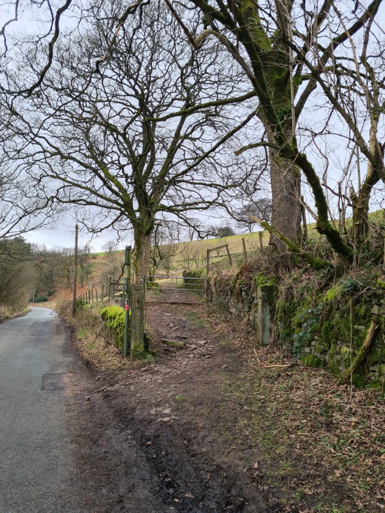
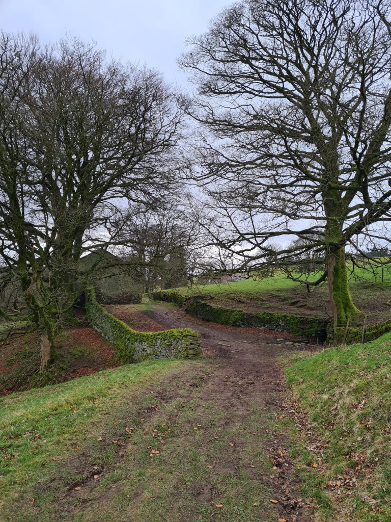
At the car park gates, take Standing Stone Road down the hill. You’ll come to a junction at the bottom of the hill – take the path to the left, then to the right, then left again. You’ll be on a track which looks like a private driveway and leads to a farm building. Pass through the yard, past the house, and there is a small gate into the woods.

A man walking up a farm track - Shutlingsloe circular walk via Whetstone Ridge by The Wandering Wildflower

A lone tree and a stream in the Peak District National Park

Follow the path over the bridge and through the fields, past the ruins of an old barn or sheep pen. We were surrounded by sheep here!

A field of sheep in the Peak District National Park

Views towards Shutlingsloe - Shutlingsloe circular walk via Whetstone Ridge by The Wandering Wildflower

The iconic shape of Shutlingsloe

The path continues along through the fields and past the camp site. Look out for the devil as you pass by!

A garden ornament in the shape of a devil - Shutlingsloe circular walk via Whetstone Ridge by The Wandering Wildflower

The route will bring you out on Ankers Lane, which is quite a busy road with cars going pretty fast. This road will take you up to the Buxton New Road (or Cat and Fiddle Road, as it’s better known). At the junction you’ll be able to see Peak Tea Rooms in front of you. This is a handy spot for a warm drink.

A winding lane up to the Cat & Fiddle Distillery

Pass the tea rooms, and head along the public footpath onto the moor (to avoid walking on the busy road). You’ll see the Cat and Fiddle Distillery ahead, which was formerly the highest pub in England. On the side of the Cat and Fiddle is a trig point flush bracket set into the wall of the former pub itself.

Cat & Fiddle Distillery - Shutlingsloe circular walk via Whetstone Ridge by The Wandering Wildflower

Flush Bracket on the Cat & Fiddle - Shutlingsloe circular walk via Whetstone Ridge by The Wandering Wildflower


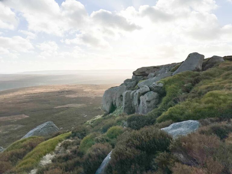
Across from the Cat and Fiddle is a car parking area and a path leading to Whetstone Ridge known as Danebower Hollow. The rough stone path is pretty easy to follow, and when you come to a stile and the start of a fence on the left hand side you’ll need to head onto the moors to find the summit of Whetstone Ridge, using your GPS as navigation. There are no structures or markers for the summit unfortunately, and it can be disorientating on the open moorland so please take care in poor weather conditions and visibility.


Track to Whetstone Ridge

The summit of Whetstone Ridge

Views from the summit of Whetstone Ridge.

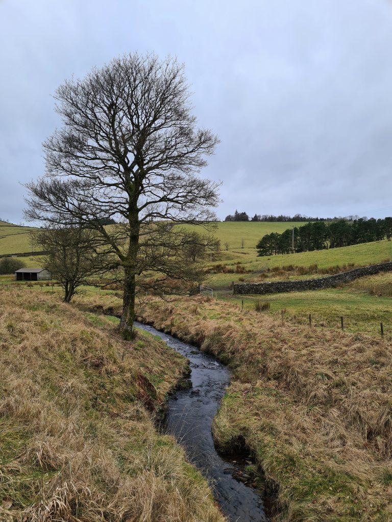
Once you’ve reached the summit, head back to the path and carry on down through the valley alongside Cumberland Brook. This is a lovely scenic valley, with woodland and waterfalls. Once you’ve passed through the woodland, you’ll head over a stile. Be sure to look behind you as there is a lovely waterfall flowing from Cumberland Brook. This path, known as Cumberland Clough, will lead you back onto the road and from here you can head north again to the car parking area.

Waterfalls in Cumberland Clough - Shutlingsloe circular walk via Whetstone Ridge by The Wandering Wildflower

Waterfalls at Cumberland Clough

Waterfalls at Cumberland Clough - Peak District waterfalls

Gate with a view to Shutlingsloe

Gate with a view to Shutlingsloe


Peak District scenery with Shutlingsloe in the background

Waterfalls at Cumberland Clough

This Peak District walk is a lovely walk to do, bagging two Peak District Ethels, one trig point and taking in lots of beautiful scenery. Shutlingsloe is an iconic Peak District hill, one which can be really popular with walkers, so I would advise setting off early if you want to have a quieter time. Let me know if you head out on this Shutlingsloe circular walk – come and say hi on Instagram.


Walk Route Map: (click the image to download the gpx file for your device)

Parking for Shutlingsloe circular walk: Clough House car park in Wildboarclough SK11 0BD. This is a small car park which could get busy so get there early.

Facilities: None, although if you are a customer of the Peak Tea Rooms or Cat and Fiddle Distillery you will be able to use theirs.

Walk Time: 3-4 hours depending on your speed and fitness

Distance: 12km (7.5 miles)

Difficulty: ▲▲▲

Trig Points Bagged: Shutlingsloe

Peak District Peaks Bagged: Shutlingsloe, Whetstone Ridge

Peak District Ethels Bagged: Shutlingsloe, Whetstone Ridge


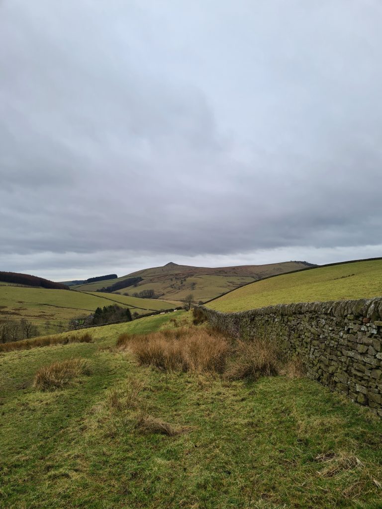
Shutlingsloe and Whetstone Ridge are quite close to Shining Tor so you could extend the walk to include that too.  The car park for Shutlingsloe is also a great place to start a walk to Three Shires Head.

Tap to share with your hiking friends!

  • Facebook
  • Email
  • WhatsApp
« Ramsden Reservoir to Hade Edge Circular | 3 Miles
Crowden to Woodhead Tunnel Walk | 6 Miles »

RELATED POSTS

  • Three Shires HeadHow to Find Three Shires Head
  • Nelson's Monument on Baslow EdgeThree Monuments Circular Walk From Chatsworth | 7.5 Miles
  • Lathkill Dale waterfallLathkill Dale Waterfall Walk | 7 Miles
  • A view of Win Hill from Bamford EdgeBamford Edge Walk | 6 Miles

Leave a Reply Cancel reply

Your email address will not be published. Required fields are marked *

FIND YOUR NEXT WALK:

ABOUT ME

Y Garn with Kids - Y Garn via the Devil's Kitchen Walk in Ogwen Valley

Hello! I’m Jo! Welcome to The Wandering Wildflower, an outdoors lifestyle blog focusing on family walks in the Peak District, a place we love exploring. I want to share the Peak District hidden gems and show you there’s so much more than the honeypot places. When I’m not dragging my husband and now 11 year old out on Peak District walks or up mountains, I can be found on planning my next moorland walk or plotting a Geocache walk (and seeing where the nearest pub is!). I love the hills but hate the heights, so trig bagging is – er- fun!


I hope this blog will give you some ideas of places to visit in the Peak District and inspire you and your family to head into the great outdoors.  Thanks for stopping by!

CATEGORIES

  • CIRCULAR WALKS (189)
  • HOLMFIRTH WALKS (27)
  • ISLE OF SKYE WALKS (3)
  • LAKE DISTRICT WALKS (24)
  • LANCASHIRE WALKS (2)
  • LONG PEAK DISTRICT WALKS 10 MILES + (42)
  • MEDIUM WALKS 4-9 MILES (137)
  • PEAK DISTRICT SCRAMBLES (16)
  • PEAK DISTRICT WALKS (205)
  • PEAK DISTRICT WALKS WITH KIDS (76)
  • PEAK DISTRICT WALKS WITH PUBS (60)
  • SCOTLAND WALKS (6)
  • SHORT WALKS UNDER 3 MILES (40)
  • SNOWDONIA WALKS (5)
  • UK CAMPING (5)
  • YORKSHIRE WALKS (33)

Peak District Walks

List of Peak District Ethels

Peak District Peak Bagging

Peak District Trig Point Challenge

Peak District Walks with Pubs

Peak District Walks with Kids

Beautiful Walks in Holmfirth

Short Walks in the Peak District

Long Walks in the Peak District

AFFILIATE DISCLOSURE

This blog may contain affiliate links through which, at no additional cost to you, I may earn a small commission. I only recommend products I would use myself and all opinions expressed here are my own. As an Amazon Associate I earn from qualifying purchases. Read full privacy policy here.

ARCHIVES

PEAK DISTRICT WEATHER

Peak District mountain weather on Met Office

Peak District Trig Points

Promo image for a blog post about the Peak District Trig Point Challenge With Map of Peak District Trig Points and Walking Routes by The Wandering Wildflower

Peak District Ethels Challenge

Promo image for a blog post about the Peak District Trig Point Challenge With Map of Peak District Ethels and Walking Routes by The Wandering Wildflower

WALKING ROUTES STRAIGHT TO YOUR INBOX

Want new walks in your inbox? Drop your email below and I'll send you some ideas for walks you can try.

You can unsubscribe anytime. For more details, review our Privacy Policy.

Thank you!

You have successfully joined our subscriber list.

RSS LATEST POSTS

  • How to Find Three Shires Head
  • Burnbank Fell, Blake Fell and Gavel Fell | 8 Miles
  • Bretton Park Circular Walk | 3 Miles
  • Hathersage Stepping Stones Walk | 7 Miles
  • Peak District Caves

FOLLOW ON PINTEREST

Want new walks in your inbox? Drop your email below and I'll send you some ideas for walks you can try.

You can unsubscribe anytime. For more details, review our Privacy Policy.

Thank you!

You have successfully joined our subscriber list.

jo@thewanderingwildflower.co.uk

The Wandering Wildflower

  • Email
  • Facebook
  • Instagram
  • Pinterest
  • PRIVACY POLICY
  • TERMS & CONDITIONS
  • ABOUT

(c) The Wandering Wildflower. All Rights Reserved.

|| THEME BY ECLAIR DESIGNS