Thor’s Cave Walk | 6.5 Miles


This Thor’s Cave walk starts in the pretty village of Wetton and explores the stunning Thor’s Cave before heading along the Manifold Way to Ecton Hill via the Sugar Loaf and Nan Tor cave. This 6.5 mile walk also has a pub stop.

Thor’s Cave is one of the must-see places in the Peak District – kids will love exploring it!
This natural cave is high on the hillside above the River Manifold and is a limestone cave formed millions of years ago when the area was a reef in a warm, shallow sea. The cave is thought to have been used by humans and animals for shelter, and is the site of a Bronze Age burial. It’s a very impressive structure, and really interesting to explore inside but it does get very busy! It’s long been a tourist attraction, with there having been a railway station at the foot of the hillside which closed in the 1930s, but since the rise of Instagram and TikTok it’s become even more well known.
The name Thor’s Cave is thought either to come from the Norse god of Thunder or a corruption of Tor’s Cave. Even though we’re big Marvel fans, I think it’s probably the latter!
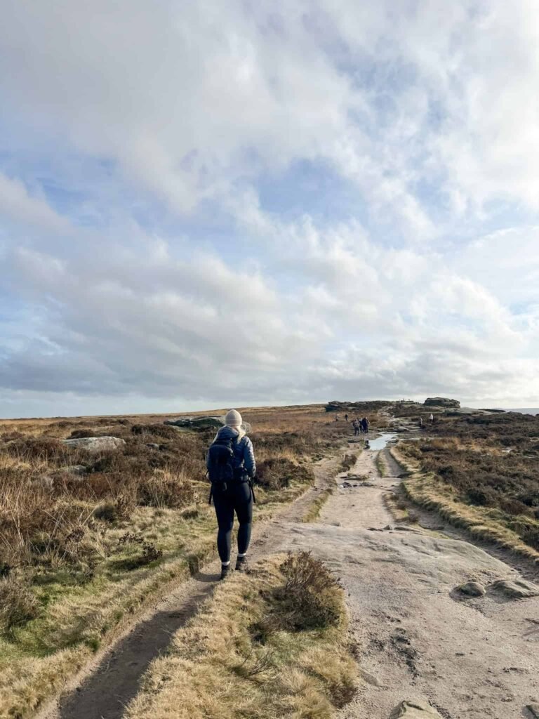
Our walk started in Wetton, where we parked in a field owned by Manifold Farm. We set off along Carr Lane then turned left onto School Lane, and walked to the junction with Leek Road. Here there’s a track which leads off to the west known as Thor’s Lane, and we followed the signs down to a gate.

Over the stile you’ll see the hillside which makes up Thor’s Cave. The path is relatively easy to follow. Through the gate you have the choice of heading up onto the top of Thor’s Cave to admire the views across the valley, or heading down the steps to the entrance of Thor’s Cave.
There are some steps leading to the entrance of the cave, but these don’t go all the way and there is a slippery limestone scramble to access the cave itself. The floor of the cave is very slippery in places and can be wet so please take care if you go in. It will almost certainly be very busy as well! I’ve photoshopped out all the people (quite badly in places).


There are a few chambers to the cave itself, and the view from inside the cave is stunning.
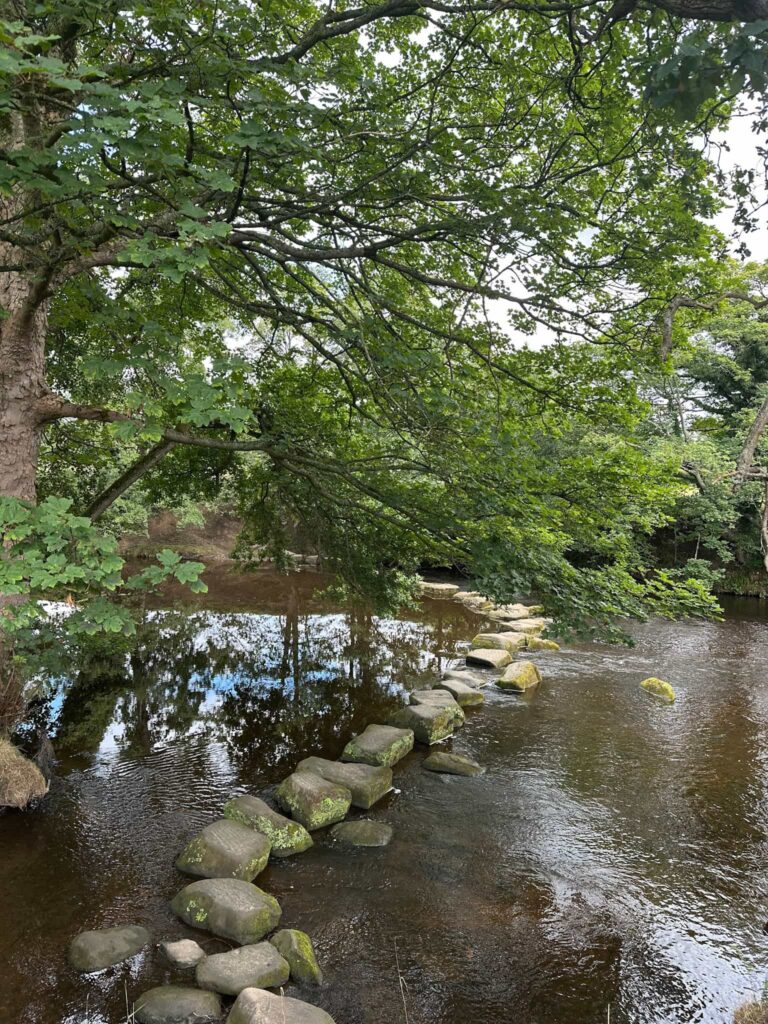
We explored the cave quickly and then headed down the hillside, following the trail that winds through the woods down to the Manifold Way, crossing the bridge over the River Manifold. The Leek and Manifold narrow gauge railway ran on this route from 1904 to 1934 but the rails have all gone, leaving a lovely traffic free trail.

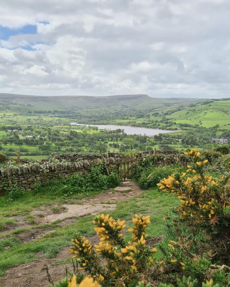
We walked along the Manifold Way to where it crosses Leek Road, and then continued north to wander through the beautiful Staffordshire Dales. At this time of year they’re full of wildflowers and look stunning.
We stumbled upon a path to Nan Tor cave, which we christened Loki’s Cave because it’s like Thor’s Cave’s little brother. Loki’s Cave is high on the hillside above Wetton Mill tea rooms and is a lovely place to explore. There are also amazing views across the valley to Thor’s Cave.


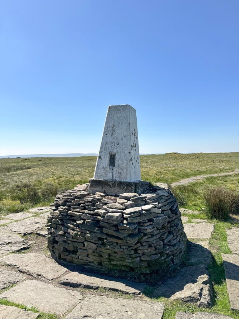
The path heads down the hill and passes the tearooms (which have a loo and cafe) and we followed the river a short way before reaching Dale Farm. The trail heads up through the farmyard and out over the fields, passing the Sugarloaf, a huge limestone outcrop, and then heading over the fields to Ecton Hill. We had to walk through a field of cows (and a bull) before we reached the field where the Ecton Hill trig point is located.


Ecton Hill trig point bagged (again), we set off south-east over the fields until we reached a lane running south. This leads past some pretty cottages to a footpath over more fields near Wetton Hill. We followed the wall round, over the stiles and through some very narrow openings in the wall, back onto a lane with no name that leads to School Lane. We followed this back to the car, and while we were deciding where to eat we drove the very short distance to The Royal Oak on Ashbourne Lane, just round the corner from the Wetton Village Hall and Tea Rooms.


This was a lovely walk, and once we’d got past Thor’s Cave and the Manifold Way we barely saw any other walkers.
How long does it take to hike Thors Cave?
Thor’s Cave is less than a mile from Wetton village so I would allow 1-1.5 hours to walk there and back. This longer Thor’s Cave walk took 3-4 hours but we explored more of the Staffordshire countryside.
Is Thor’s Cave an easy walk?
Thor’s Cave is a gentle walk of about a mile from Wetton, although there is a short scramble to the cave itself. The floor of the cave is very slippery as the limestone has been polished smooth. It can also be muddy in wet weather.
Is Thor’s Cave hard to climb?
Thor’s Cave is set high on the hillside so if you are coming up from the Manifold Trail near the river there are a lot of steps to climb up to the cave entrance. From Wetton it is about a mile’s walk along mostly good trails before you reach Thor’s Cave. This would be the easiest way to get to the cave with less climbing.
What’s the best time to visit Thor’s Cave?
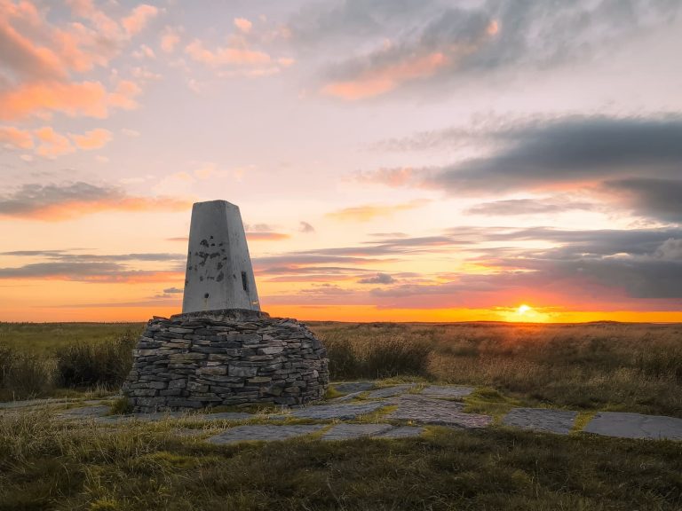
Definitely not a Sunday afternoon! The popularity of Thor’s Cave means it gets very busy and it can be crowded inside. The best time to visit Thor’s Cave would be early evening in the summer when the days are longer. There are also lovely sunrises from Thor’s Cave so getting there early in the morning before the crowds arrive would be best!
Parking for Thor’s Cave, Peak District
There is no car parking at Thor’s Cave. The nearest parking would be in Wetton on Carr Lane. There is a parking area but this is small and fills up very quickly, especially on weekends. Manifold Farm have a field you can park in for £3 all day (W3w// obstruct.ideas.decays).
Walk Details:

Walk Route (Opens in OS Maps): Thor’s Cave Walk Map
Parking for Thor’s Cave: Carr Lane, Wetton Village – we parked in a field owned by Manifold Farm which was an honesty box car park of £3 for the day. W3w// obstruct.ideas.decays
Facilities: The route passes Wetton Mill Tea Rooms with a cafe and toilets, and there are lots of facilities in Wetton village.
Walk Time: 3-4 hours
Difficulty: ▲▲
Distance: 6.5 miles (6.02km)
Elevation: 1000ft (304m)
Trig Points Bagged: Ecton Hill
Peak District Peaks Bagged: Ecton Hill
Peak District Ethels Bagged: Ecton Hill
For more walks with caves, you might like:
A Beautiful Walk Through Wolfscote Dale & Biggin Dale
Stanton Moor Walk [Cork Stone and Nine Ladies Stone Circle]
You might also like: