• 3 Mile Walks or Less
  • 4 Mile Walks
  • 5 Mile Walks
  • 6 Mile Walks
  • 7 Mile Walks
  • 8 Mile Walks
  • 9 Mile Walks
  • 10 Mile Walks
  • 11 Mile Walks
  • 12 Mile Walks
  • 14 Mile Walks
  • 15 Mile Walks
  • 20+ Mile Walks

The Wandering Wildflower

Peak District Hikes

  • PEAK DISTRICT WALKS
    • SHORT WALKS UNDER 3 MILES
    • MEDIUM WALKS 4-9 MILES
    • LONG PEAK DISTRICT WALKS 10 MILES +
  • PEAK DISTRICT WALKS WITH PUBS
  • PEAK DISTRICT WALKS WITH KIDS
  • HOLMFIRTH WALKS

Thorpe Cloud, Dovedale Stepping Stones, Bunster Hill and Ilam

April 19, 2023 MEDIUM WALKS 4-9 MILES, PEAK DISTRICT WALKS, PEAK DISTRICT WALKS WITH KIDS

Pinterest image for Thorpe Cloud, Dovedale Stepping Stones and Bunster Hill With Ilam Walking Route - The Wandering Wildflower

Dovedale is an area of natural beauty, with limestone cliffs and scenic views. At just over 5.5 miles, this walk includes Thorpe Cloud, the famous Dovedale stepping stones and a scramble up Bunster Hill before a wander around Ilam Country Park. This is a great walk with lots to see in the beautiful White Peak area of the Peak District National Park.

A woman standing looking at Thorpe Cloud, a classic mountain shaped hill


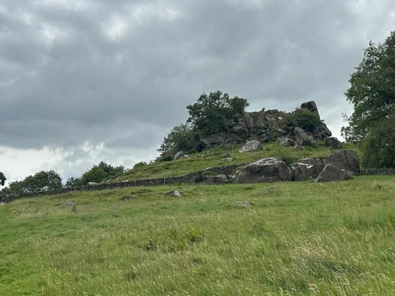
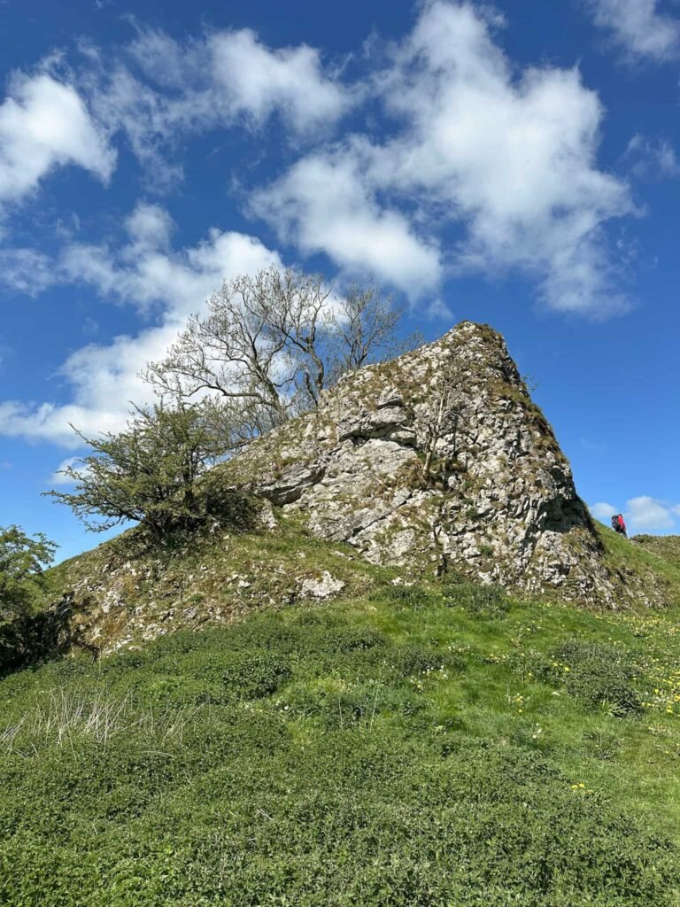
Thorpe Cloud is an iconic hill in the White Peak, with a summit of 287m instantly recognisable because of it’s unique mini-mountain shape. It’s a popular walk with families as you can park quite close by and it’s a short, steep walk to the rocky summit, and you can head down the hillside to the famous Dovedale Stepping Stones across the River Dove. Bunster Hill is higher than Thorpe Cloud at 329m but is much quieter, and it’s summit is hidden in a wooded copse. It’s one of the Peak District 75s, which is a great list of accessible hills taking you all over the Peak District, exploring places you might not visit necessarily (but you’ll be glad you did).


Ilam Country Park is 84 acres of parkland looked after by the National Trust and features beautiful Italianate gardens, views to Thorpe Cloud and walks through a wooded valley which is bursting with wild garlic in Spring. Ilam Hall is managed as a youth hostel by the YHA.


Our walk starts in the National Trust car park at Dovedale and we set off east towards the River Dove. Crossing at the wooden bridge, we started to head up the side of Thorpe Cloud. Due to the amount of people who visit, there are erosion control measures in place and the paths have been diverted. We followed the blue post markers to wind around Thorpe Cloud to the south-east before the final steep climb up to the summit. You might have to use your hands to get to the summit as it’s a bit scrambly, but not too bad.

The summit of Thorpe Cloud

The summit of Thorpe Cloud


It is busy though! This walk is very popular with families and it can be very busy on sunny weekends and school holidays. The best time to visit the Dovedale stepping stones would be midweek or very early in the morning before the crowds arrive.


A view down Dovedale from Thorpe Cloud

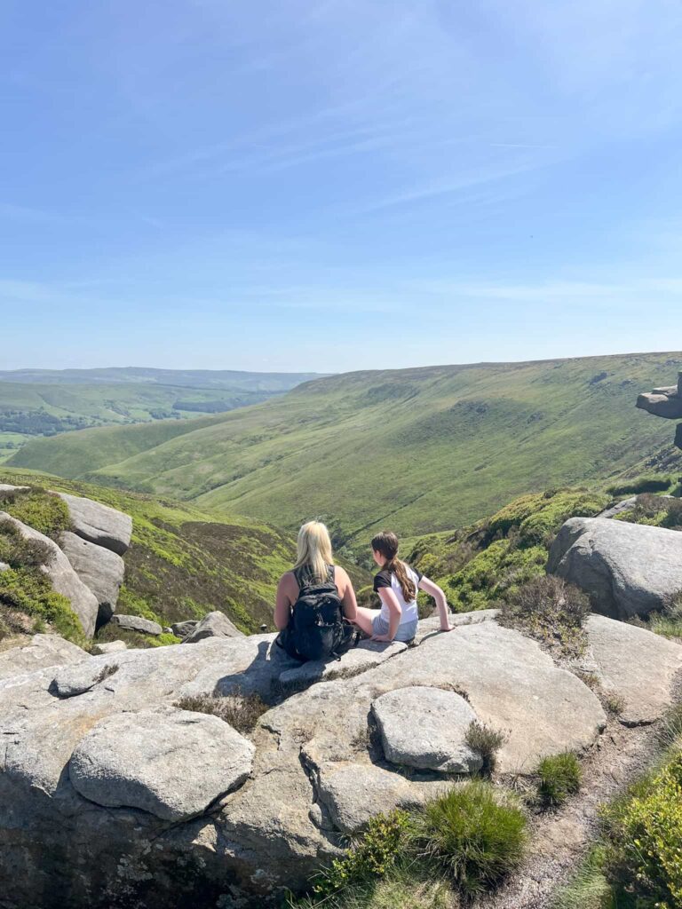
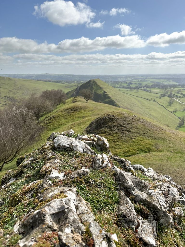
From the summit of Thorpe Cloud we could see across to Bunster Hill, and a view down to the River Dove.


We set off back down Thorpe Cloud, following a path down to the south-east, then turned left and headed towards the River Dove. The path here was very wet in places!


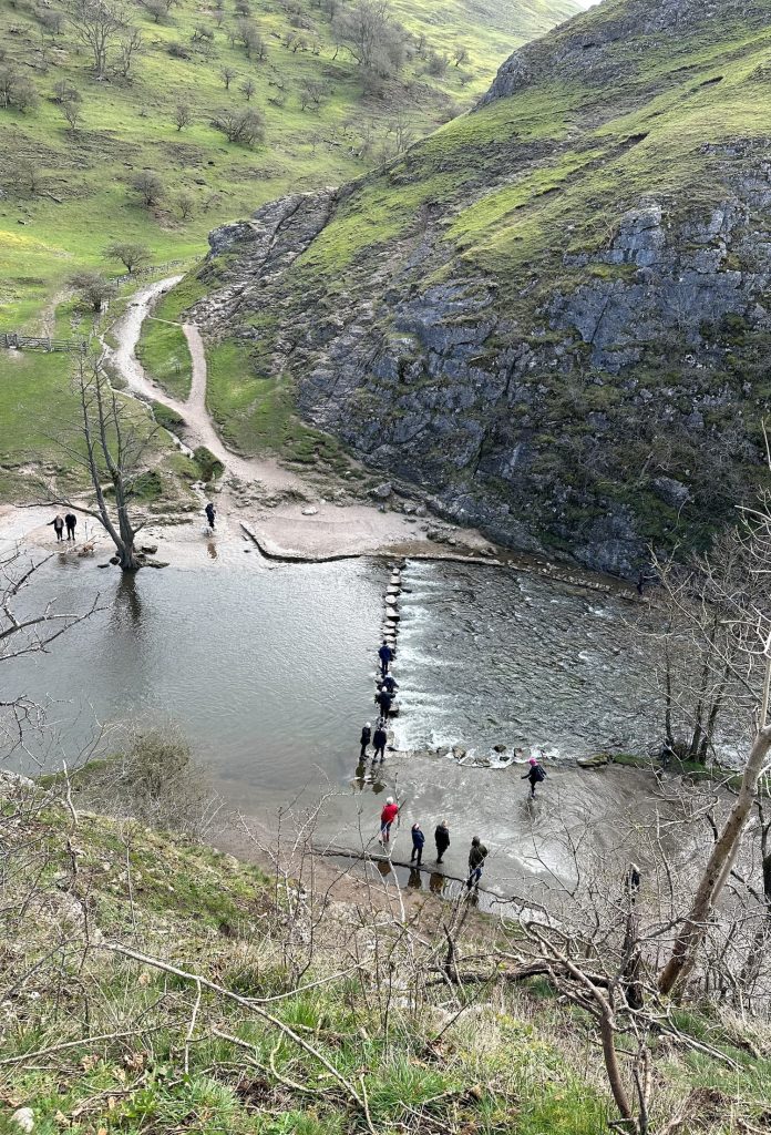
Once at the River Dove we found the Dovedale stepping stones. These are 16 limestone capped stepping stones making a fun way to cross the river. It had been raining and the River Dove was running high, so the stepping stones were only just poking out. We had waterproof boots on so we headed across, but most people were going around to cross the river higher up.

Dovedale stepping stones over the River Dove

A woman and her daughter crossing a river using stepping stones at Dovedale


Straight across from the stepping stones is a limestone rock face and we scrambled up this as part of our climb up Bunster Hill. There are handholds and footholds to help you up. If you didn’t want to attempt the scramble you could either miss out Bunster Hill altogether or head back to the car park along the River Dove to pick up a footpath running along the wall near the green sign. Bunster Hill is Open Access Land and there are footpaths running all over it.


A woman and her daughter climbing up a limestone rock face

The Dovedale stepping stones in Staffordshire

Once we had climbed up Bunster Hill, we headed along the ridge (which has a look of the Dragons Back about it) to the summit, which is hidden in a small secluded woodland area. The summit of Bunster Hill couldn’t be more different to that of Thorpe Cloud!

Thorpe Cloud, a classic mountain shaped hill in the Peak District


A view of Thorpe Cloud from Bunster Hill with a limestone outcrop


The summit of Bunster Hill, a wooded copse


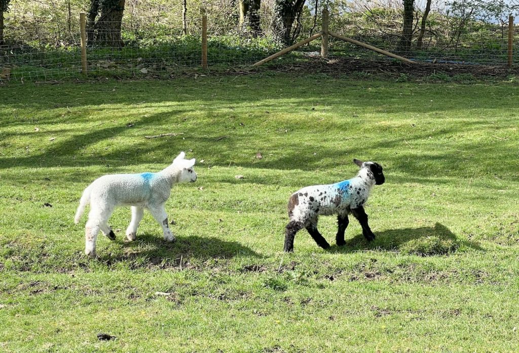
We retraced our steps and headed over the stile to begin the steep descent of Bunster Hill, following the line of the wall as we headed down hill. We were lucky that there were lots of sheep and lambs in the fields. After jumping over another stile, we continued south until we reached Thorpe Road and then we set off into the pretty village of Ilam.


Some spring lambs in the sunshine


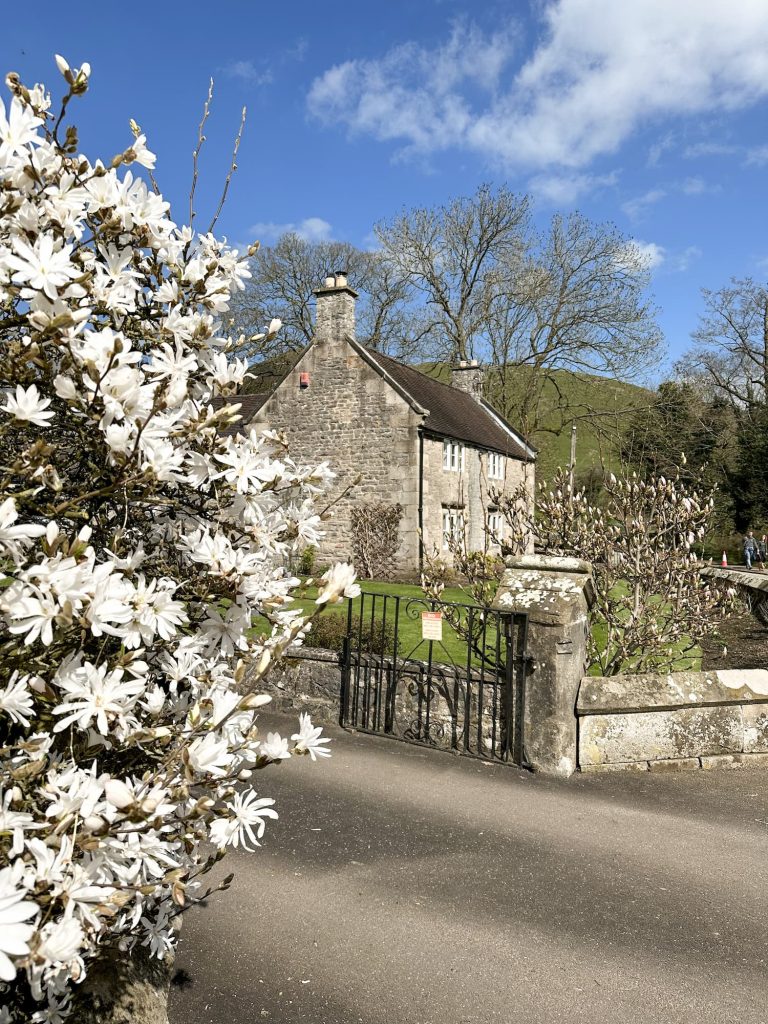
At the roundabout in Ilam is a beautiful ornate structure known as the Ilam Cross (or the Mary Watts-Russell Memorial) built by J W Russell of Ilam Hall as a memorial for his late wife in 1841. We headed past Ilam Church and up towards Ilam Hall, stopping for a bite to eat at the Manifold Tea Rooms.


A pretty cottage with a magnolia tree in full bloom.

An ornate stone sculpture also known as Ilam Cross


From here we went downhill, heading west, towards the woodland and the walk along the banks of the River Manifold. We then turned back up the hillside and headed through the country park back to the village centre, before picking up the footpath leading over the fields back to the car park. These fields were exceptionally muddy!


A grand house with formal gardens, with a view of Thorpe Cloud and Bunster Hill in the background

A village church in Ilam


How Long is the Dovedale Stepping Stones Walk?

You can do a short walk to the Dovedale stepping stones along the River Dove, and this will take 20 minutes each way. Adding in Thorpe Cloud is a great way to make more of a day of your adventures, and this walk including Bunster Hill and Ilam Park also extends a day out.


How Do You Get to The Dovedale Stepping Stones?

The best way to get to the stepping stones is to park at the National Trust car park and head along the River Dove for about half a mile.


How Far is The Walk From The Car Park to the Dovedale Stepping Stones?

The shortest walk to the Dovedale stepping stones is about half a mile each way.


Dovedale Stepping Stones Walk

Dovedale Stepping Stones Walk Map:


Walk Map (Opens in OS Maps): Dovedale Stepping Stones, Thorpe Cloud and Bunster Hill Walk

Dovedale Stepping Stones Car Park:

Dovedale National Trust Car Park, Dovedale, Ilam, Ashbourne DE6 2AY (free for National Trust members, pay and display for everyone else)

Facilities: Pay to use toilets in the National Trust Car Park (20p), snack van

Walk Time: 2-3 hours

Difficulty: ▲▲ (Thorpe Cloud is very steep  and rocky at the top, and we scrambled up Bunster Hill)

Distance: 5.59 miles in total

Trig Points Bagged: None.

Peak District Peaks Bagged: Thorpe Cloud, Bunster Hill

Peak District Ethels Bagged: Thorpe Cloud


You might also like this Dovedale and Thorpe Cloud Walk


For a more secluded stepping stones walk which doesn’t get as busy, you could check out this Chee Dale Stepping Stones Walk.

Tap to share with your hiking friends!

  • Facebook
  • Email
  • WhatsApp
« Fair Brook Scramble to Kinder Scout Northern Edges | 9 Miles
Langdale Pikes Circular via Jack’s Rake | 8 Miles »

RELATED POSTS

  • Three Shires HeadHow to Find Three Shires Head
  • Ladybower ReservoirLadybower Walk | 6 Miles
  • Lathkill Dale waterfallLathkill Dale Waterfall Walk | 7 Miles
  • A wooden stile on Stanage EdgeBamford Edge, Stanage Edge, Higger Tor, Surprise View | 15 Miles

Leave a Reply Cancel reply

Your email address will not be published. Required fields are marked *

FIND YOUR NEXT WALK:

ABOUT ME

Y Garn with Kids - Y Garn via the Devil's Kitchen Walk in Ogwen Valley

Hello! I’m Jo! Welcome to The Wandering Wildflower, an outdoors lifestyle blog focusing on family walks in the Peak District, a place we love exploring. I want to share the Peak District hidden gems and show you there’s so much more than the honeypot places. When I’m not dragging my husband and now 11 year old out on Peak District walks or up mountains, I can be found on planning my next moorland walk or plotting a Geocache walk (and seeing where the nearest pub is!). I love the hills but hate the heights, so trig bagging is – er- fun!


I hope this blog will give you some ideas of places to visit in the Peak District and inspire you and your family to head into the great outdoors.  Thanks for stopping by!

CATEGORIES

  • CIRCULAR WALKS (189)
  • HOLMFIRTH WALKS (27)
  • ISLE OF SKYE WALKS (3)
  • LAKE DISTRICT WALKS (26)
  • LANCASHIRE WALKS (2)
  • LONG PEAK DISTRICT WALKS 10 MILES + (42)
  • MEDIUM WALKS 4-9 MILES (137)
  • PEAK DISTRICT SCRAMBLES (16)
  • PEAK DISTRICT WALKS (206)
  • PEAK DISTRICT WALKS WITH KIDS (76)
  • PEAK DISTRICT WALKS WITH PUBS (60)
  • SCOTLAND WALKS (6)
  • SHORT WALKS UNDER 3 MILES (40)
  • SNOWDONIA WALKS (5)
  • UK CAMPING (5)
  • YORKSHIRE WALKS (33)

Peak District Walks

List of Peak District Ethels

Peak District Peak Bagging

Peak District Trig Point Challenge

Peak District Walks with Pubs

Peak District Walks with Kids

Beautiful Walks in Holmfirth

Short Walks in the Peak District

Long Walks in the Peak District

AFFILIATE DISCLOSURE

This blog may contain affiliate links through which, at no additional cost to you, I may earn a small commission. I only recommend products I would use myself and all opinions expressed here are my own. As an Amazon Associate I earn from qualifying purchases. Read full privacy policy here.

ARCHIVES

PEAK DISTRICT WEATHER

Peak District mountain weather on Met Office

Peak District Trig Points

Promo image for a blog post about the Peak District Trig Point Challenge With Map of Peak District Trig Points and Walking Routes by The Wandering Wildflower

Peak District Ethels Challenge

Promo image for a blog post about the Peak District Trig Point Challenge With Map of Peak District Ethels and Walking Routes by The Wandering Wildflower

WALKING ROUTES STRAIGHT TO YOUR INBOX

Want new walks in your inbox? Drop your email below and I'll send you some ideas for walks you can try.

You can unsubscribe anytime. For more details, review our Privacy Policy.

Thank you!

You have successfully joined our subscriber list.

RSS LATEST POSTS

  • How to Find Three Shires Head
  • Peak District Pub Walks
  • Burnbank Fell, Blake Fell and Gavel Fell | 8 Miles
  • Bretton Park Circular Walk | 3 Miles
  • Grasmere Weekend Break

FOLLOW ON PINTEREST

Want new walks in your inbox? Drop your email below and I'll send you some ideas for walks you can try.

You can unsubscribe anytime. For more details, review our Privacy Policy.

Thank you!

You have successfully joined our subscriber list.

jo@thewanderingwildflower.co.uk

The Wandering Wildflower

  • Email
  • Facebook
  • Instagram
  • Pinterest
  • PRIVACY POLICY
  • TERMS & CONDITIONS
  • ABOUT

(c) The Wandering Wildflower. All Rights Reserved.

|| THEME BY ECLAIR DESIGNS