• 3 Mile Walks or Less
  • 4 Mile Walks
  • 5 Mile Walks
  • 6 Mile Walks
  • 7 Mile Walks
  • 8 Mile Walks
  • 9 Mile Walks
  • 10 Mile Walks
  • 11 Mile Walks
  • 12 Mile Walks
  • 14 Mile Walks
  • 15 Mile Walks
  • 20+ Mile Walks

The Wandering Wildflower

Peak District Hikes

  • PEAK DISTRICT WALKS
    • SHORT WALKS UNDER 3 MILES
    • MEDIUM WALKS 4-9 MILES
    • LONG PEAK DISTRICT WALKS 10 MILES +
  • PEAK DISTRICT WALKS WITH PUBS
  • PEAK DISTRICT WALKS WITH KIDS
  • HOLMFIRTH WALKS

Scenic Bamford Edge and Stanage Edge | 9 Miles

April 4, 2023 CIRCULAR WALKS, MEDIUM WALKS 4-9 MILES, PEAK DISTRICT WALKS

Pinterest Image for Bamford and Stanage Edge Circular Walk - The Wandering Wildflower

This scenic Bamford Edge walk also visits Stanage Edge and is a 9 mile circular, taking in some of the best views in the Peak District.

A view of Ladybower Reservoir from Bamford Edge

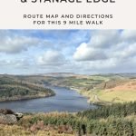
The Bamford Edge walk has spectacular views down over Ladybower Reservoir (including the Ladybower plugholes) and Stanage Edge is a place full of history, again with stunning views.

The walk starts from Cutthroat Bridge car parking layby. I walked a short distance down the main road to get to the gate into the woods, then crossed the stile. The path is a track which leads up to a pine plantation. On the OS map the path is shown as going through this plantation but in real life the path heads down the side of the plantation. I went the wrong way around and ended up in some very wet, boggy places but was rewarded with a scramble along the river bank.

A view of a stream and waterfall with walking boots in the bottom of the frame


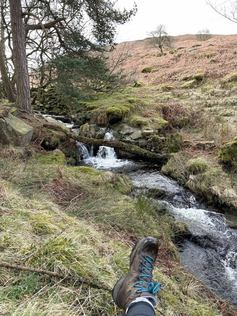
Crossing the river using stepping stones the path runs alongside the wall. I followed the path as shown on the OS map, which runs around the edge of the field, but there is a more direct path cutting diagonally. The climb up is steep but relatively short, and you’re soon on Bamford Edge.


Bamford Edge Walk

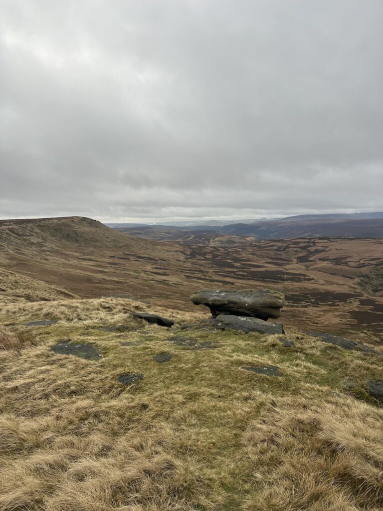
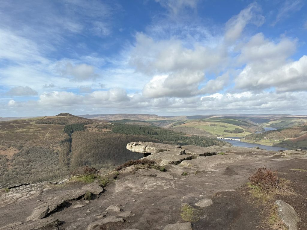
A wander along Bamford Edge is one of the most popular walks in the Peak District and it’s easy to see why. The views are amazing! You can see Win Hill and Parkin Clough, Lose Hill and The Great Ridge, Crook Hill, Ladybower Reservoir and the plugholes – so many iconic Peak District spots! There are also signs of the history of the area, including the sighting towers for the construction of the Rivelin Tunnel which runs from Ladybower to Lower Rivelin Reservoir 4.5 miles away.

A sighting tower, a stone pillar, with views of Ladybower Reservoir in the background

A view of Win Hill and Ladybower Reservoir from Bamford Edge

After I’d taken about 11 million photos of the view from the sighting tower I followed the path along Bamford Edge, passing the Instagram famous stone and a former quarry complete with abandoned millstone. It was far too windy for me to go too near the edge though! I then turned east and took the top path skirting round the top of the larger former quarry, which brought me via a quarry track to the roadside.

A protruding rock on Bamford Edge with a view of Ladybower Reservoir

A well worn track along Bamford Edge

An abandoned millstone on Bamford Edge

I climbed the stile and turned left on New Road, heading along the road for around 1.8 miles, passing through Dennis Knoll car park and past the Plantation car park.

A single track road with Stanage Edge in the background

Stanage Edge Walk

Just after the Plantation car park is a footpath leading up through a small woodland onto a section of Long Causeway on Stanage Edge. Long Causeway is a medieval packhorse route running between Hathersage and Sheffield and there are still some paved sections remaining.

A stone path leading up to Stanage Edge

A stone path with wheel ruts. The remains of a medieval packhorse track

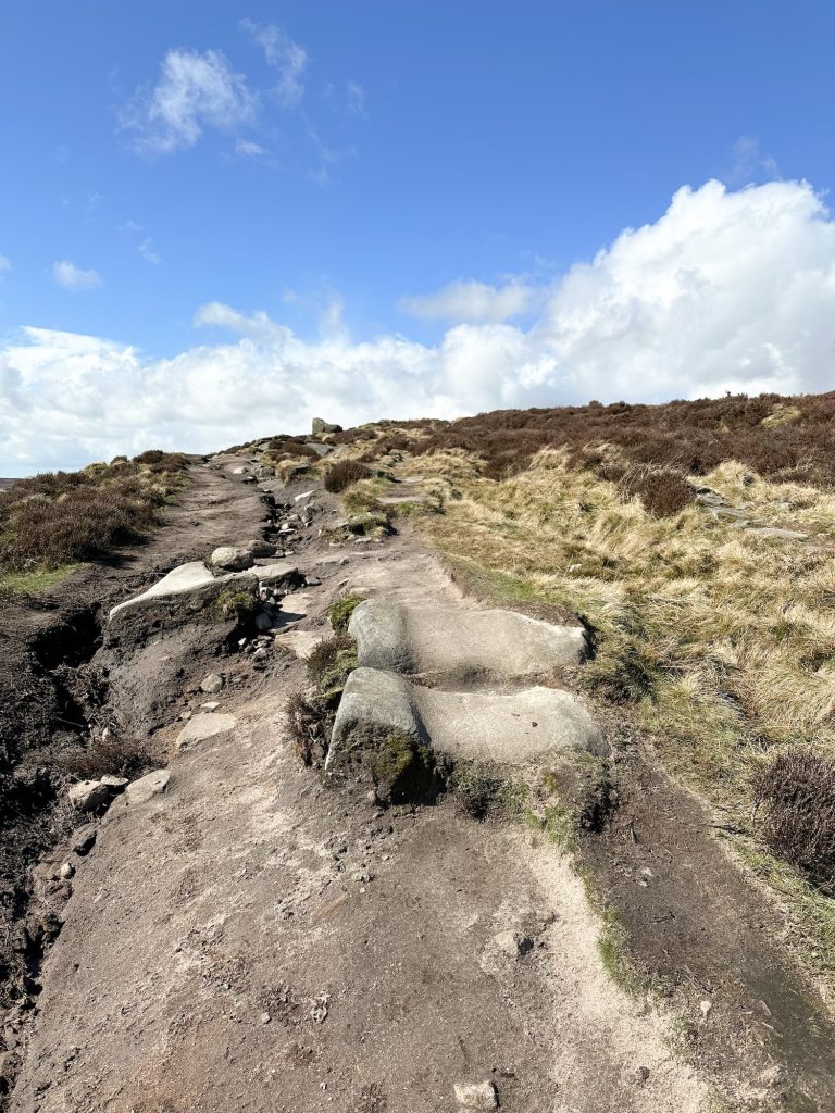
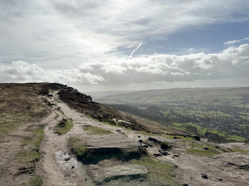
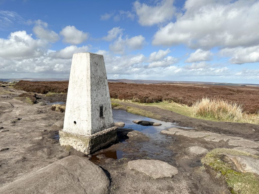
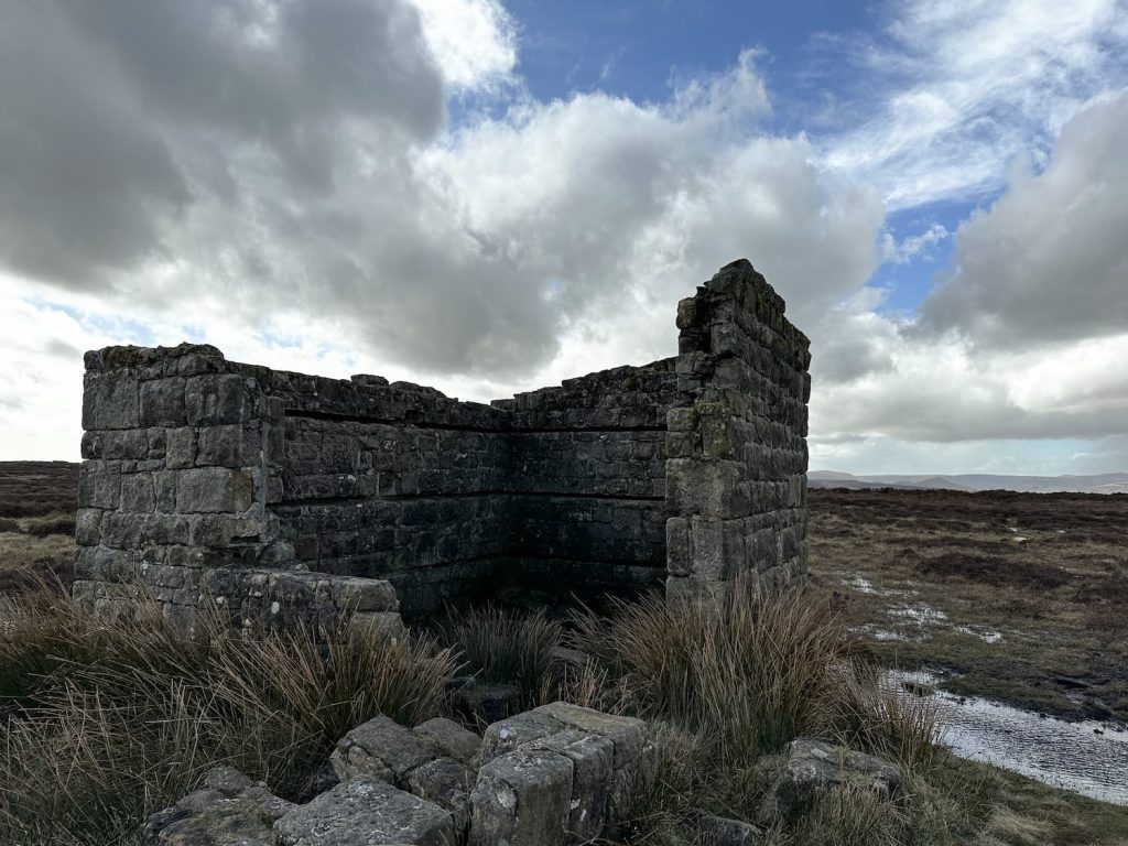
Following the path along the top of Stanage Edge is relatively simple – again, it was really windy so I didn’t spend too much time exploring the rocks (I didn’t even channel my inner Keira Knightley in Pride and Prejudice and stand on that famous rock!). I headed for a cuppa in the stone shelter on Stanage Moor, then off towards High Neb and its trig point. As you venture north along Stanage Edge it becomes much less busy.

View from Crow Chin on Stanage Edge

A small stone shelter on Stanage Moor

High Neb trig point


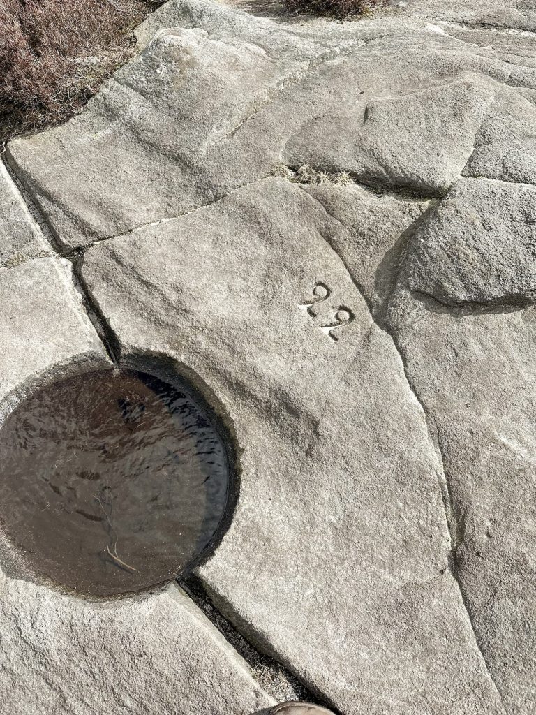
From High Neb I passed Crow Chin, a gritstone outcrop with fabulous views down over Bamford Moor and Moscar Moor. The path starts to descend through a former quarry, passing some boundary stones on the way, then heads out onto the A57 again where it’s a walk of just under a mile to get back to the car parking layby. There is a faint footpath on the verge but traffic is very fast!


A stone drinking trough for grouse, on the moors on Stanage Edge

A dilapidated building on Stanage Edge

A rock formation on Stanage Edge

Stone boundary stone on Moscar Moor

This was a great walk exploring some of the Peak District’s best known spots, enjoying the spectacular views. I’d love to know if you do this walk – find me on Instagram @wanderingwildflowerblog.


Bamford Edge and Stanage Edge Walk Map: 


Walk Map (Opens in OS Maps): Bamford Edge and Stanage Edge Walk

Parking: Cutthroat Bridge, A57 – S33 0AX

Facilities: None

Walk Time: 4-5 hours

Difficulty: ▲▲

Distance: 9.3 miles (14.29km)

Trig Points Bagged: High Neb (you could also nip to White Path Moss, on Stanage Edge)

Peak District Peaks Bagged: High Neb

Peak District Ethels Bagged: None


You might also like:

Redmires to Stanage Edge Walk (With Spooky House)

Stanage Edge Circular Walk

Bamford Edge – A Short Walk with Stunning Views

Bamford Edge Walk

Bamford Edge, Stanage Edge, Higger Tor, Surprise View | 15 Miles

Tap to share with your hiking friends!

  • Facebook
  • Email
  • WhatsApp
« Black Hill via Crowden Little Brook | 9 Miles
Peak District 75s »

RELATED POSTS

  • Hathersage Stepping StonesHathersage Stepping Stones Walk | 7 Miles
  • Ladybower ReservoirLadybower Walk | 6 Miles
  • Anvil Stone, GrindsbrookGrindsbrook Clough Scramble to Grindslow Knoll | 7 Miles
  • Scammonden Reservoir Circular WalkScammonden Reservoir Walk Map | 4 Miles

Leave a Reply Cancel reply

Your email address will not be published. Required fields are marked *

FIND YOUR NEXT WALK:

ABOUT ME

Y Garn with Kids - Y Garn via the Devil's Kitchen Walk in Ogwen Valley

Hello! I’m Jo! Welcome to The Wandering Wildflower, an outdoors lifestyle blog focusing on family walks in the Peak District, a place we love exploring. I want to share the Peak District hidden gems and show you there’s so much more than the honeypot places. When I’m not dragging my husband and now 11 year old out on Peak District walks or up mountains, I can be found on planning my next moorland walk or plotting a Geocache walk (and seeing where the nearest pub is!). I love the hills but hate the heights, so trig bagging is – er- fun!


I hope this blog will give you some ideas of places to visit in the Peak District and inspire you and your family to head into the great outdoors.  Thanks for stopping by!

CATEGORIES

  • CIRCULAR WALKS (189)
  • HOLMFIRTH WALKS (27)
  • ISLE OF SKYE WALKS (3)
  • LAKE DISTRICT WALKS (26)
  • LANCASHIRE WALKS (2)
  • LONG PEAK DISTRICT WALKS 10 MILES + (42)
  • MEDIUM WALKS 4-9 MILES (137)
  • PEAK DISTRICT SCRAMBLES (16)
  • PEAK DISTRICT WALKS (206)
  • PEAK DISTRICT WALKS WITH KIDS (76)
  • PEAK DISTRICT WALKS WITH PUBS (60)
  • SCOTLAND WALKS (6)
  • SHORT WALKS UNDER 3 MILES (40)
  • SNOWDONIA WALKS (5)
  • UK CAMPING (5)
  • YORKSHIRE WALKS (33)

Peak District Walks

List of Peak District Ethels

Peak District Peak Bagging

Peak District Trig Point Challenge

Peak District Walks with Pubs

Peak District Walks with Kids

Beautiful Walks in Holmfirth

Short Walks in the Peak District

Long Walks in the Peak District

AFFILIATE DISCLOSURE

This blog may contain affiliate links through which, at no additional cost to you, I may earn a small commission. I only recommend products I would use myself and all opinions expressed here are my own. As an Amazon Associate I earn from qualifying purchases. Read full privacy policy here.

ARCHIVES

PEAK DISTRICT WEATHER

Peak District mountain weather on Met Office

Peak District Trig Points

Promo image for a blog post about the Peak District Trig Point Challenge With Map of Peak District Trig Points and Walking Routes by The Wandering Wildflower

Peak District Ethels Challenge

Promo image for a blog post about the Peak District Trig Point Challenge With Map of Peak District Ethels and Walking Routes by The Wandering Wildflower

WALKING ROUTES STRAIGHT TO YOUR INBOX

Want new walks in your inbox? Drop your email below and I'll send you some ideas for walks you can try.

You can unsubscribe anytime. For more details, review our Privacy Policy.

Thank you!

You have successfully joined our subscriber list.

RSS LATEST POSTS

  • How to Find Three Shires Head
  • Peak District Pub Walks
  • Burnbank Fell, Blake Fell and Gavel Fell | 8 Miles
  • Bretton Park Circular Walk | 3 Miles
  • Grasmere Weekend Break

FOLLOW ON PINTEREST

Want new walks in your inbox? Drop your email below and I'll send you some ideas for walks you can try.

You can unsubscribe anytime. For more details, review our Privacy Policy.

Thank you!

You have successfully joined our subscriber list.

jo@thewanderingwildflower.co.uk

The Wandering Wildflower

  • Email
  • Facebook
  • Instagram
  • Pinterest
  • PRIVACY POLICY
  • TERMS & CONDITIONS
  • ABOUT

(c) The Wandering Wildflower. All Rights Reserved.

|| THEME BY ECLAIR DESIGNS