• 3 Mile Walks or Less
  • 4 Mile Walks
  • 5 Mile Walks
  • 6 Mile Walks
  • 7 Mile Walks
  • 8 Mile Walks
  • 9 Mile Walks
  • 10 Mile Walks
  • 11 Mile Walks
  • 12 Mile Walks
  • 14 Mile Walks
  • 15 Mile Walks
  • 20+ Mile Walks

The Wandering Wildflower

Peak District Hikes

  • PEAK DISTRICT WALKS
    • SHORT WALKS UNDER 3 MILES
    • MEDIUM WALKS 4-9 MILES
    • LONG PEAK DISTRICT WALKS 10 MILES +
  • PEAK DISTRICT WALKS WITH PUBS
  • PEAK DISTRICT WALKS WITH KIDS
  • HOLMFIRTH WALKS

Black Hill Peak District Walk | 23 Miles

June 3, 2022 CIRCULAR WALKS, LONG PEAK DISTRICT WALKS 10 MILES +, PEAK DISTRICT WALKS

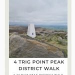
This challenging Black Hill Peak District walk is 23 miles and takes in 4 Peak District trig points, including Featherbed Moss, Black Hill, West Nab and Hey Edge. It also takes in the County Top of Black Chew Head and the amazing Laddow Rocks. This is a challenging long distance walk in the Peak District but showcases the absolute best of the Dark Peak.

Black Hill trig point

Black Hill trig point

I’ve signed up to walk the Yorkshire 3 Peaks route again with Joel and some friends, so have been getting in some long walks as part of my training. I love Black Hill – it’s my favourite peak in the Peak District and it’s also a trig point near me so we go quite a bit. I put together a challenging walk in the Dark Peak which included this and 3 other trig points.

View from Laddow Rocks over Crowden Valley

View from Laddow Rocks over Crowden Valley

Our walk starts at Crowden, at the car park near Crowden Camp Site, and follows the Pennine Way for a short distance before heading off up to Highstone Rocks and Lads Leap, following the moorland paths round to Tintwistle Knarr. This was an area of the outlying Peak District we’d not explored yet, and it’s just as beautiful. There are stunning views down over the reservoirs at Torside. We followed the moorland path around to Robinson Moss and Millstone Rocks. From Tintwistle Knarr it’s a trek over Arnfield Moor to Ogden Brook, which we followed over the bleak moors to Wilderness, then following the path along the ridge above Dovestone Reservoir to Chew Reservoir.

Lads Leap, a steeply sided gully in the Peak District

Lads Leap – whoever the lad was, he must have had long legs as it’s quite a leap over there!

The Devils Bridge at Ogden Brook

The Devils Bridge at Ogden Brook

Views down the valley over Dove Stone Reservoir

Views down the valley over Dove Stone Reservoir

We headed off across the moors to bag our first trig point Featherbed Moss, which involved an energy sapping yomp over the heather. From Featherbed Moss we headed north-east to Black Chew Head, the County Top summit of Manchester marked by a tiny cairn of stones.

Featherbed Moss trig point in the winter heather

Featherbed Moss trig point

A stone cairn marking the summit of Black Chew Head, the County Top of Greater Manchester

The summit of Black Chew Head in all it’s glory!

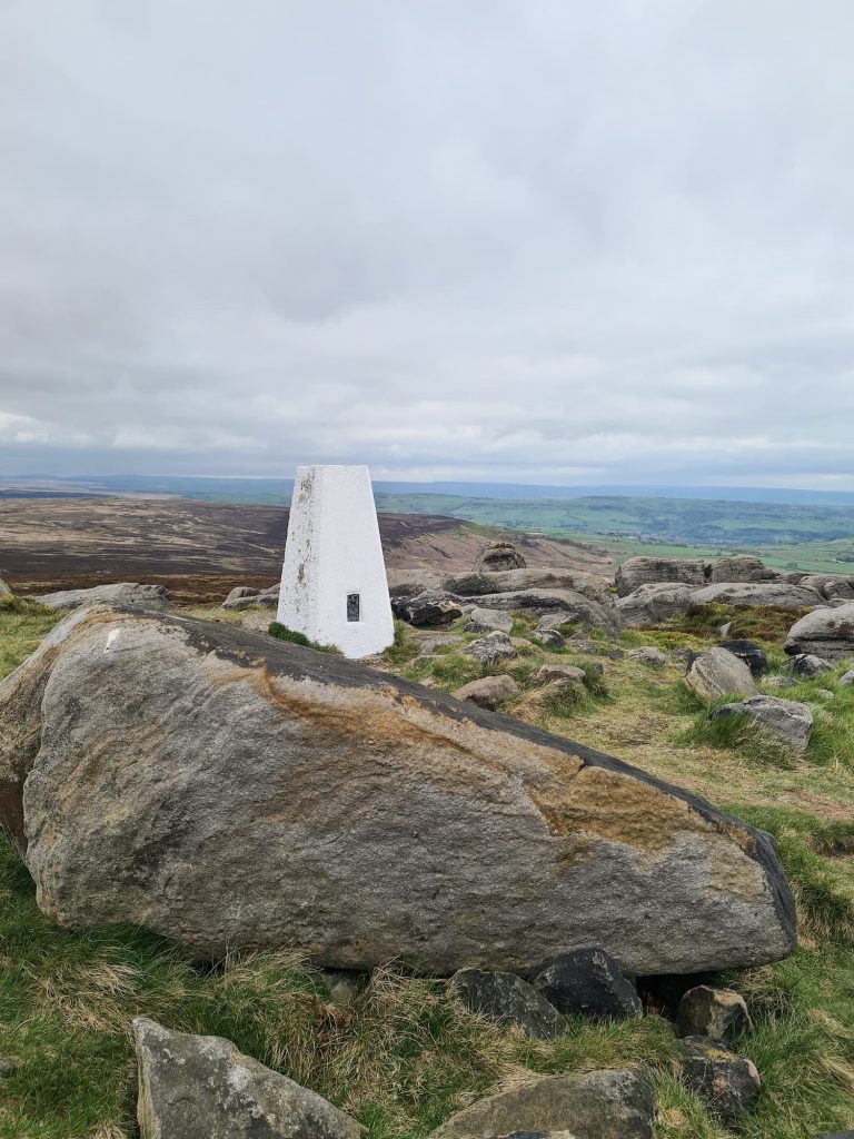
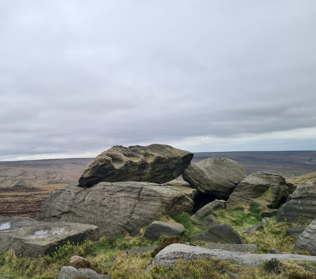
After Black Chew Head, we went over the moor to the stunning Laddow Rocks which has spectacular views over Crowden Valley, then followed Crowden Great Brook up to Black Hill (for the first time). From Black Hill we followed the Pennine Way north-east over to West Nab, following Wessenden Head Road, then from West Nab we walked via the Raven Stones and Leyzing Clough down to Wessenden Head Reservoir.

West Nab trig point surrounded by rocky outcrops

West Nab trig point

The Druid's Stone at West Nab, a large gritstone boulder with three hollows

The Druid’s Stone at West Nab

West Nab as seen from the Raven Stones near Wessenden Head

West Nab as seen from the Raven Stones

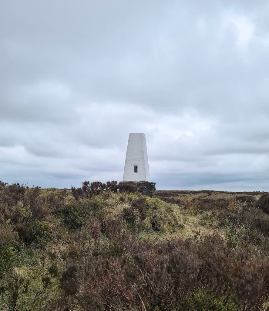
Crossing the main road again, we headed back up the Pennine Way to Black Hill for the second time then over Tooleyshaw Moss, Westend Moss and White Low to Hey Edge trig point. It was surprisingly dry underfoot here, and the trig point didn’t have it’s usual moat (although it was raining heavily during our walk and we were drenched!). From here we went to the Crowden Quarry and took the steep path back to Crowden car park.

Hey Edge trig point, looking very bleak in the wet mist

Hey Edge trig point

View from the passenger side of a car of rain and mist

Holme Moss is out there. Apparently!

This was great preparation for the Yorkshire 3 Peaks, with so much climbing as well as the distance. For more Black Hill walks (I have a few on the blog) you could try

Holme Moss to Black Hill Trig Point

Black Hill, West Nab and Blackpool Bridge

Holme to Black Hill to Crowden Circular Walk

Holme to Black Hill Circular Walk

Black Hill Circular Walk, Holmfirth – Yorkshire Walks

10 Reservoirs Walk

Black Hill via Crowden Little Brook


This walk will bag 4 Peak District trig points and 5 Peak District Ethels, as well as two Peak District County Tops, so it’s a great one to do if you have any walking challenges going on.


Black Hill Walk with 4 Trig Points Map:


Walk Route in OS Maps: Dark Peak 4 Trig Point Walk Map

Black Hill 4 Trig Points Walk:

Parking: Crowden Car Park near Crowden Campsite (SK13 1HZ)

Facilities: Public toilets at the car park

Walk Time: 8-9 hours depending on speed and fitness – it’s an all day walk

Difficulty: ▲▲▲

Distance: 23 miles (37 km)

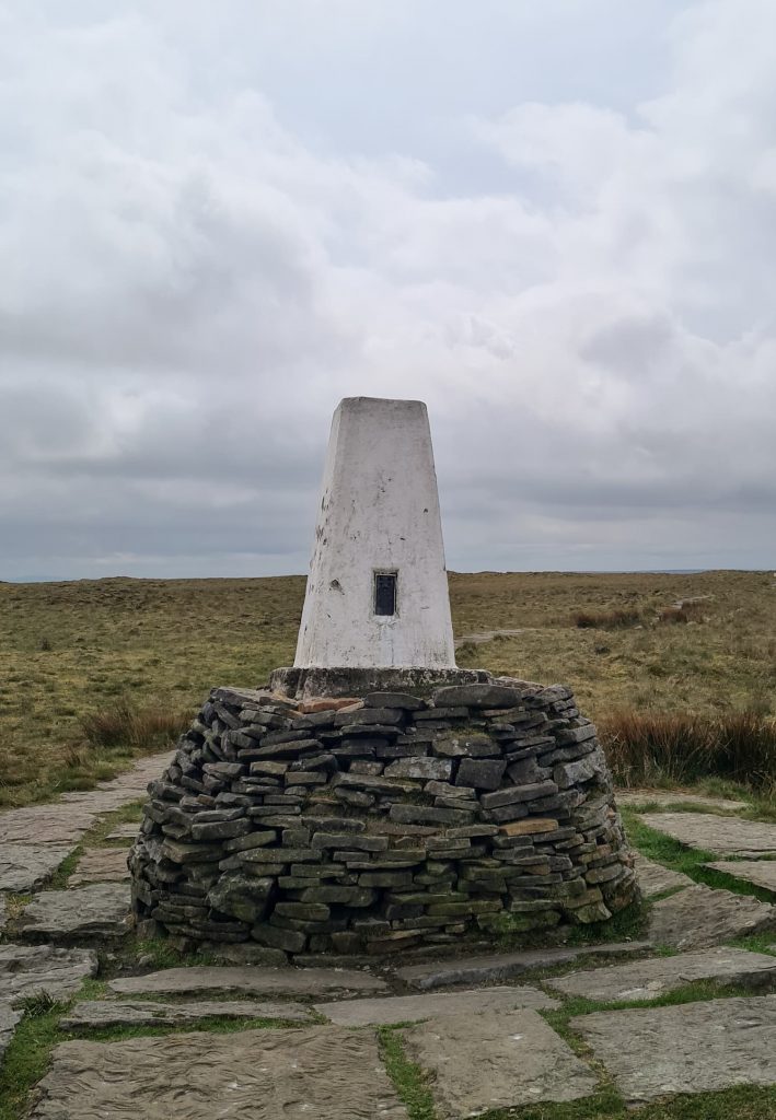
Trig Points Bagged: Featherbed Moss, Black Hill, West Nab, Hey Edge

Peak District Peaks Bagged: Black Hill, Black Chew Head, Featherbed Moss, White Low, West Nab

Peak District Ethels Bagged: Black Hill, Black Chew Head, Featherbed Moss, White Low, West Nab


For more Peak District trig point walks, check out the Peak District Trig Point Challenge page where there are loads of walks to help you complete the challenge. You might also like Holme Valley Circular Walk for a challenging walk of 23.5 miles with similar ascent. There are also a lot more challenging day hikes in the Peak District here: https://thewanderingwildflower.co.uk/tag/20-mile-walks/

Tap to share with your hiking friends!

  • Facebook
  • Email
  • WhatsApp
« Fairfield Horseshoe Hiking Route | 11 Miles
Beeley Moor and Harland Edge Trig Point | 9 Miles »

RELATED POSTS

  • Hathersage Stepping StonesHathersage Stepping Stones Walk | 7 Miles
  • Ladybower ReservoirLadybower Walk | 6 Miles
  • Anvil Stone, GrindsbrookGrindsbrook Clough Scramble to Grindslow Knoll | 7 Miles
  • The Cloud, Bosley | 2 Miles

Leave a Reply Cancel reply

Your email address will not be published. Required fields are marked *

FIND YOUR NEXT WALK:

ABOUT ME

Y Garn with Kids - Y Garn via the Devil's Kitchen Walk in Ogwen Valley

Hello! I’m Jo! Welcome to The Wandering Wildflower, an outdoors lifestyle blog focusing on family walks in the Peak District, a place we love exploring. I want to share the Peak District hidden gems and show you there’s so much more than the honeypot places. When I’m not dragging my husband and now 11 year old out on Peak District walks or up mountains, I can be found on planning my next moorland walk or plotting a Geocache walk (and seeing where the nearest pub is!). I love the hills but hate the heights, so trig bagging is – er- fun!


I hope this blog will give you some ideas of places to visit in the Peak District and inspire you and your family to head into the great outdoors.  Thanks for stopping by!

CATEGORIES

  • CIRCULAR WALKS (189)
  • HOLMFIRTH WALKS (27)
  • ISLE OF SKYE WALKS (3)
  • LAKE DISTRICT WALKS (26)
  • LANCASHIRE WALKS (2)
  • LONG PEAK DISTRICT WALKS 10 MILES + (42)
  • MEDIUM WALKS 4-9 MILES (137)
  • PEAK DISTRICT SCRAMBLES (16)
  • PEAK DISTRICT WALKS (206)
  • PEAK DISTRICT WALKS WITH KIDS (76)
  • PEAK DISTRICT WALKS WITH PUBS (60)
  • SCOTLAND WALKS (6)
  • SHORT WALKS UNDER 3 MILES (40)
  • SNOWDONIA WALKS (5)
  • UK CAMPING (5)
  • YORKSHIRE WALKS (33)

Peak District Walks

List of Peak District Ethels

Peak District Peak Bagging

Peak District Trig Point Challenge

Peak District Walks with Pubs

Peak District Walks with Kids

Beautiful Walks in Holmfirth

Short Walks in the Peak District

Long Walks in the Peak District

AFFILIATE DISCLOSURE

This blog may contain affiliate links through which, at no additional cost to you, I may earn a small commission. I only recommend products I would use myself and all opinions expressed here are my own. As an Amazon Associate I earn from qualifying purchases. Read full privacy policy here.

ARCHIVES

PEAK DISTRICT WEATHER

Peak District mountain weather on Met Office

Peak District Trig Points

Promo image for a blog post about the Peak District Trig Point Challenge With Map of Peak District Trig Points and Walking Routes by The Wandering Wildflower

Peak District Ethels Challenge

Promo image for a blog post about the Peak District Trig Point Challenge With Map of Peak District Ethels and Walking Routes by The Wandering Wildflower

WALKING ROUTES STRAIGHT TO YOUR INBOX

Want new walks in your inbox? Drop your email below and I'll send you some ideas for walks you can try.

You can unsubscribe anytime. For more details, review our Privacy Policy.

Thank you!

You have successfully joined our subscriber list.

RSS LATEST POSTS

  • How to Find Three Shires Head
  • Peak District Pub Walks
  • Burnbank Fell, Blake Fell and Gavel Fell | 8 Miles
  • Bretton Park Circular Walk | 3 Miles
  • Grasmere Weekend Break

FOLLOW ON PINTEREST

Want new walks in your inbox? Drop your email below and I'll send you some ideas for walks you can try.

You can unsubscribe anytime. For more details, review our Privacy Policy.

Thank you!

You have successfully joined our subscriber list.

jo@thewanderingwildflower.co.uk

The Wandering Wildflower

  • Email
  • Facebook
  • Instagram
  • Pinterest
  • PRIVACY POLICY
  • TERMS & CONDITIONS
  • ABOUT

(c) The Wandering Wildflower. All Rights Reserved.

|| THEME BY ECLAIR DESIGNS