• 3 Mile Walks or Less
  • 4 Mile Walks
  • 5 Mile Walks
  • 6 Mile Walks
  • 7 Mile Walks
  • 8 Mile Walks
  • 9 Mile Walks
  • 10 Mile Walks
  • 11 Mile Walks
  • 12 Mile Walks
  • 14 Mile Walks
  • 15 Mile Walks
  • 20+ Mile Walks

The Wandering Wildflower

Peak District Hikes

  • PEAK DISTRICT WALKS
    • SHORT WALKS UNDER 3 MILES
    • MEDIUM WALKS 4-9 MILES
    • LONG PEAK DISTRICT WALKS 10 MILES +
  • PEAK DISTRICT WALKS WITH PUBS
  • PEAK DISTRICT WALKS WITH KIDS
  • HOLMFIRTH WALKS

Britland Edge Hill, Dead Edge End and Snailsden | 8 Miles

November 27, 2022 CIRCULAR WALKS, HOLMFIRTH WALKS, MEDIUM WALKS 4-9 MILES, PEAK DISTRICT WALKS

Pinterest image for a walk from Britland Edge Hill, Dead Edge End and Snailsden by The Wandering Wildflower

This Peak District Ethels walk bags 3 of the Dark Peak Ethels – Britland Edge Hill, Dead Edge End and Snailsden, and 2 trig points. This 8.4 mile walk explores some of the bleaker, more remote parts of the Peak District and the terrain is wet and boggy, to say the least!

A metal picture frame surrounding a countryside view


We have already bagged these 3 Peak District Ethels, but on 2 separate walks. We had planned to walk this route originally but had to turn back after bagging Britland Edge Hill and Dead Edge End because of a grouse shoot. We have been to Snailsden a few times before as well but it was nice to link them all up in one walk.

This blog may contain affiliate links through which, at no additional cost to you, I may earn a small commission. I only recommend products I would use myself and all opinions expressed here are my own. As an Amazon Associate I earn from qualifying purchases. Read full privacy policy here.


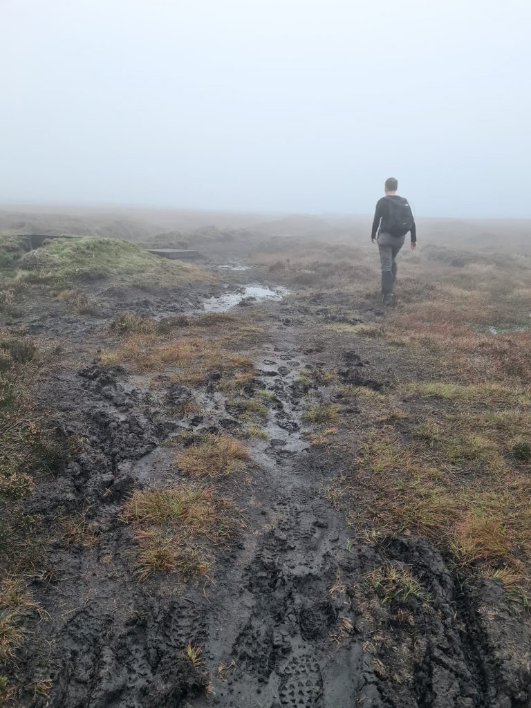
The terrain up on these moors is very wet. The landowners are undertaking works to make the plateau even wetter, by damming up the streams and mini cloughs and planting lots of heather. I was very glad I had my Sealskinz waterproof socks on, because my boots were soaked but my feet were dry!

A man walking on boggy moorland above Holmfirth


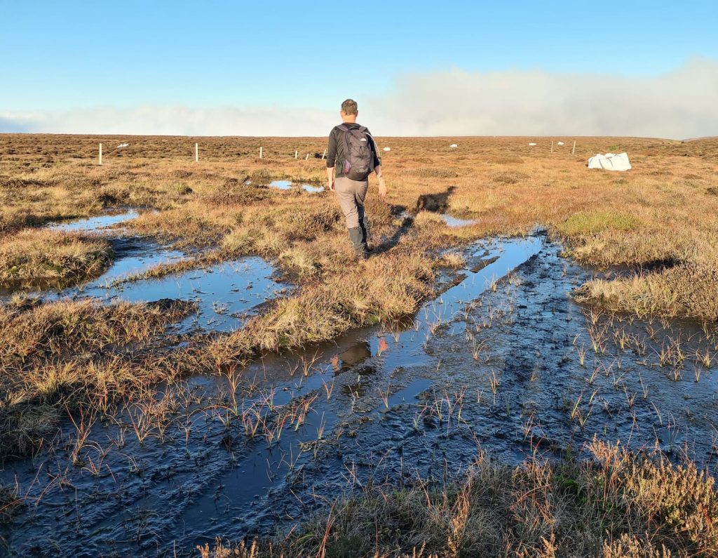
We started our walk from the Holme Moss car park, and headed south-east onto the moors, following the fence line. In fact, we spent a lot of time following the seemingly never-ending fence! We followed the fence to Britland Edge Hill, dodging the peat bogs and puddles as best we could.


Moorland views

Britland Edge Hill summit - a fence post and a puddle

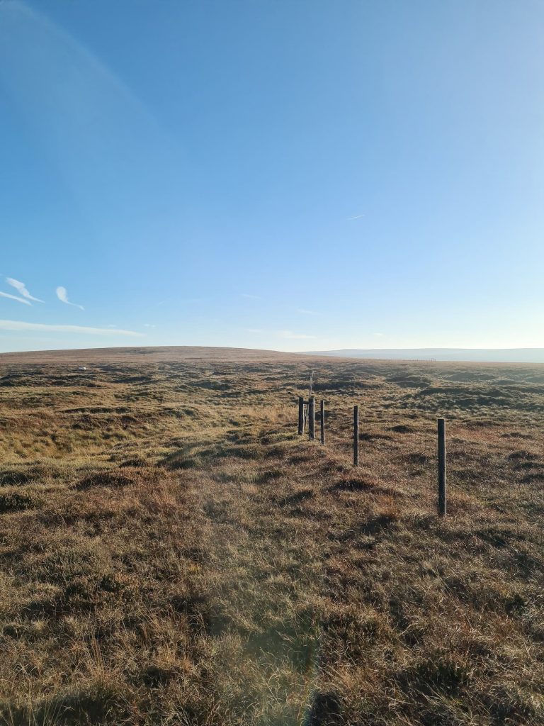
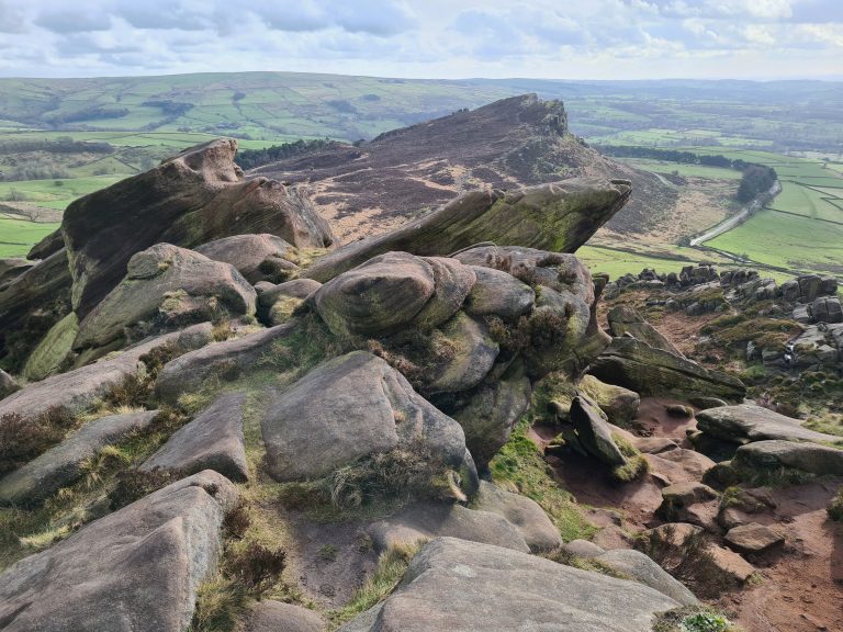
Britland Edge Hill, at 523m above sea level, is an Ethel but it’s an especially unremarkable summit. On a clear day there are lovely moorland views, but on a wet misty day it’s rather bleak. The summit isn’t marked by anything other than a fence post and a puddle.


From here we followed the fence line for 1.75 miles, again dodging the bogs and crossing the stile (the stile becomes an event because it’s quite a featureless walk!) until we reached the trig point at Dead Edge End. We were on the wrong side of the fence but it’s easy enough to pop over the fence – it’s all Open Access Land.

A boggy moorland with a wooden stile

Dead Edge End trig point with blue skies behind

A woman looking off into the distance next to Dead Edge End trig point


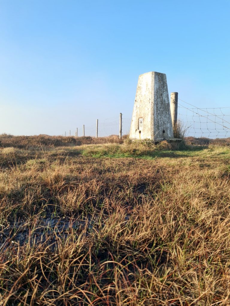
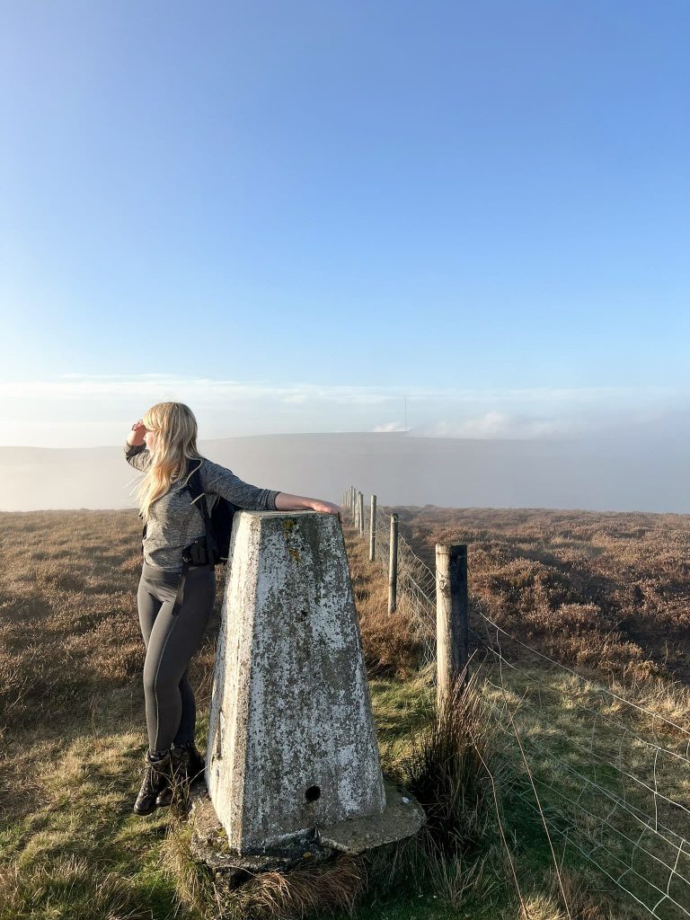
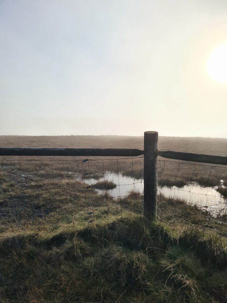
Dead Edge End trig point has some lovely views on a clear day down over Torside Reservoir and Crowden. On this visit the Peak District was having one of those amazing cloud inversion days. We were above the clouds temporarily, so we couldn’t see the views down over Torside, and within 30 seconds of us leaving the trig point the mist rolled in. We spent most of the rest of the walk in the mist!


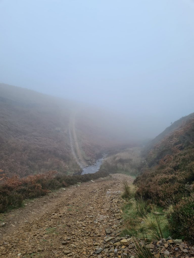
From the Dead Edge End trig point we picked up a faint path heading roughly north-east. This path peters out in places and goes over rough terrain where it would be easy to become disorientated. Eventually it leads to a row of grouse butts and a gamekeepers track, which we followed, crossing the River Don and climbing up the steepest track I’ve ever seen. When the track levelled out a bit, we followed a faint track to meet Snailsden Edge.


A grouse butt appearing in the mist on Snailsden

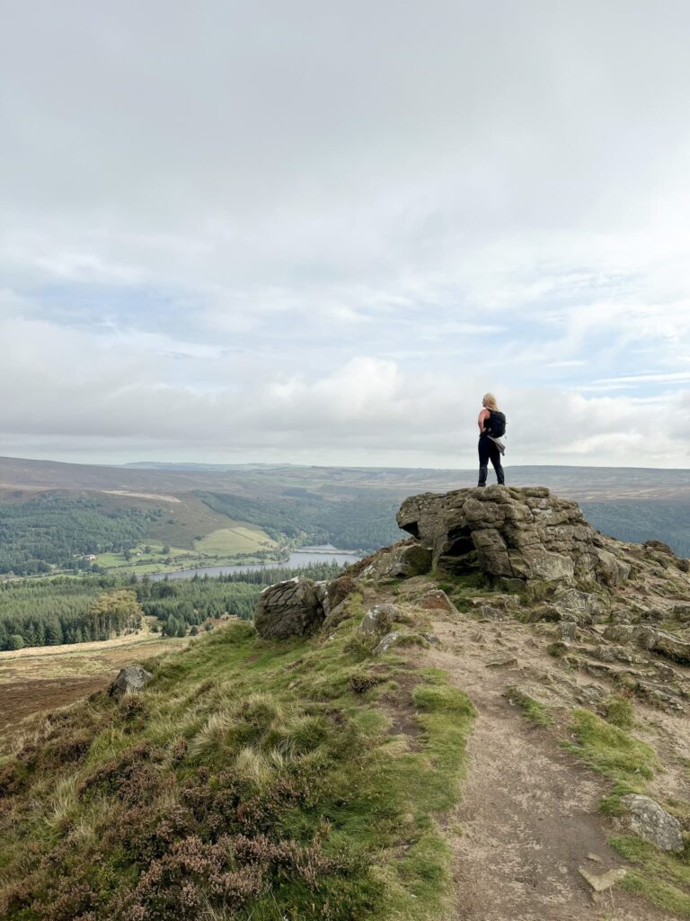
Snailsden Edge usually has some amazing views down over Winscar Reservoir – not when we went though! You can see them on our Snailsden Pike End walk to get an idea of what they should be like!


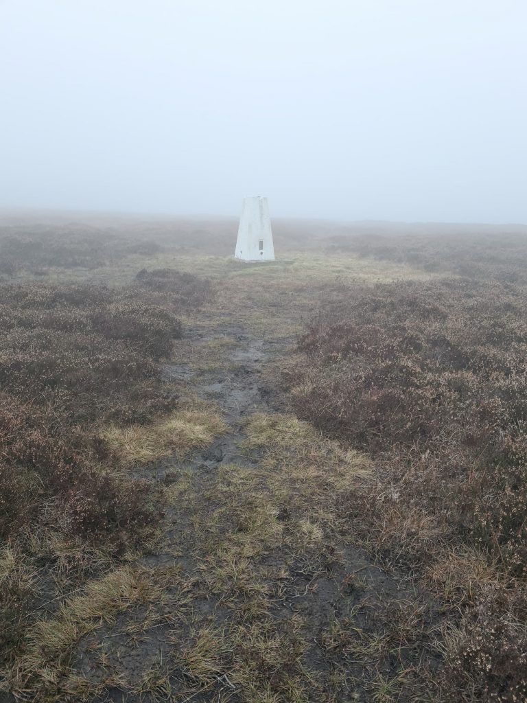
We wandered along Snailsden Edge for around 0.6 miles before heading north off into the murk to bag the Snailsden Pike End trig point. It’s worth noting that the Snailsden Pike End Ethel is slightly further along the track, so we walked back to the track to continue around to Reaps Moss.

A gamekeepers track in the mist

Snailsden Pike End trig point

Snailsden Pike End trig point

Heading down the hillside (which can be slippery when it’s muddy) we crossed the boardwalk bridge and then turned left, heading past West Drive grouse butt and dodging the bogs to get to the fence and stile.

A grouse butt in the mist on the moors above Holmfirth

A man walking on very boggy moors

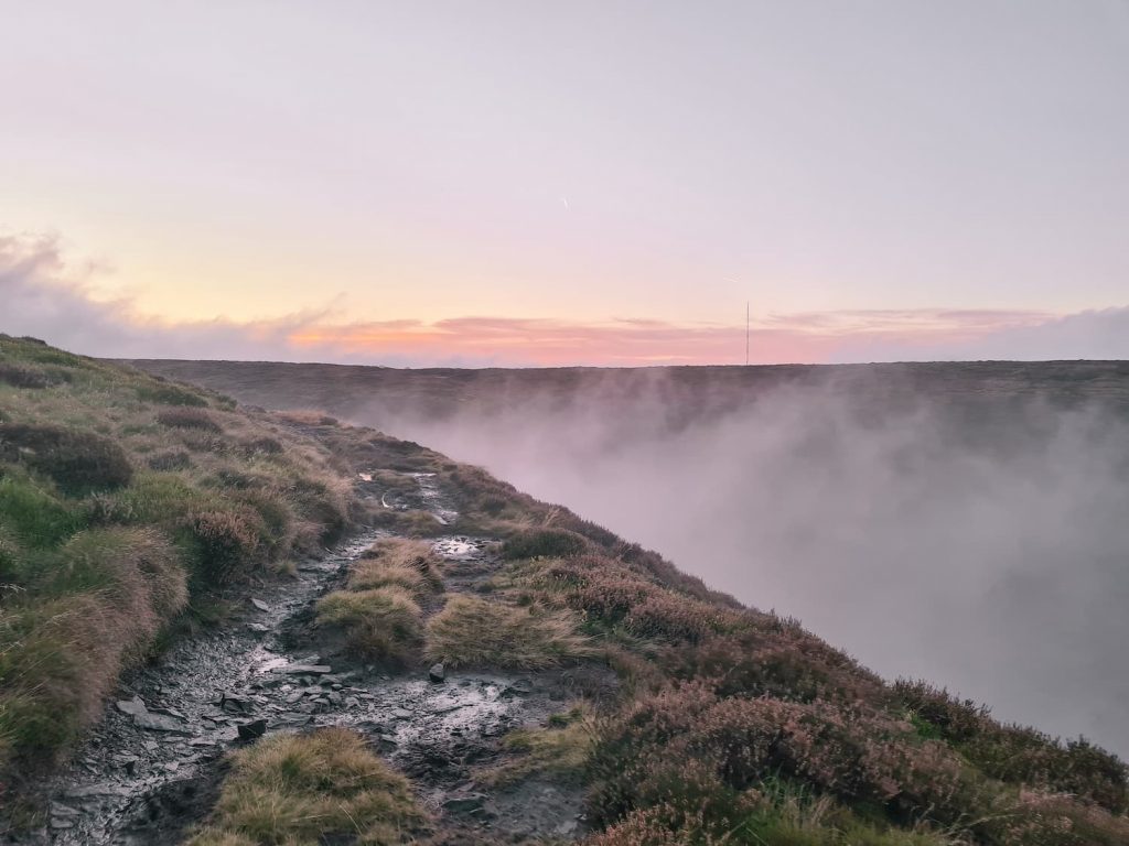
We jumped over the stile, and then turned left, following the track as it winds its way round the contours of Bailie Causeway Moss, Twizle Head Moss, Lightens Edge and Wilmer Hill, back to the car park. Again, there are usually amazing views down over the Holme Valley and Yateholme Reservoir but not today. We did however manage to walk above the clouds, and the sun setting over Holme Moss was rather pretty.

A cloud inversion near Holme Moss

A cloud inversion near Holme Moss

This was a lovely (if rather wet and boggy) walk. I’d recommend The Fleece Inn in Holme for a post walk pint and a meal.


If you’re feeling energetic you could also add on a visit to the Black Hill trig point on this walk as well to bag that trig point and Ethel.


For more Peak District Ethels walks, don’t forget to check out List of Peak District Ethels and Walking Routes or Walking The Peak District Ethels in 41 Walks


Walk Map: 


Walk Map (Opens in OS Maps): Snailsden, Dead Edge End and Britland Edge Hill Walk

Parking: Holme Moss Car Park, opposite the transmitter station HD9 2QF W3W:///salads.cleansed.micro

Facilities: None

Walk Time: 3-4 hours

Difficulty: ▲▲▲ (just for the bogs! It’s very wet)

Distance: 8.4 miles (13.6km)

Trig Points Bagged: Dead Edge End, Snailsden Pike End

Peak District Peaks Bagged: Dead Edge End, Britland Edge Hill, Snailsden Pike End

Peak District Ethels Bagged: Dead Edge End, Britland Edge Hill, Snailsden Pike End


Tap to share with your hiking friends!

  • Facebook
  • Email
  • WhatsApp
« Best Peak District Walks for Boxing Day
Wyming Brook Waterfalls Walk | 6 Miles »

RELATED POSTS

  • Hathersage Stepping StonesHathersage Stepping Stones Walk | 7 Miles
  • Ladybower ReservoirLadybower Walk | 6 Miles
  • Anvil Stone, GrindsbrookGrindsbrook Clough Scramble to Grindslow Knoll | 7 Miles
  • Dead Edge End Trig Point - Peak District Trig Point Checklist - The Wandering Wildflower - Moorland Walks in the Peak DistrictBritland Edge Hill and Dead Edge End Walk | 5.5 Miles

Leave a Reply Cancel reply

Your email address will not be published. Required fields are marked *

FIND YOUR NEXT WALK:

ABOUT ME

Y Garn with Kids - Y Garn via the Devil's Kitchen Walk in Ogwen Valley

Hello! I’m Jo! Welcome to The Wandering Wildflower, an outdoors lifestyle blog focusing on family walks in the Peak District, a place we love exploring. I want to share the Peak District hidden gems and show you there’s so much more than the honeypot places. When I’m not dragging my husband and now 11 year old out on Peak District walks or up mountains, I can be found on planning my next moorland walk or plotting a Geocache walk (and seeing where the nearest pub is!). I love the hills but hate the heights, so trig bagging is – er- fun!


I hope this blog will give you some ideas of places to visit in the Peak District and inspire you and your family to head into the great outdoors.  Thanks for stopping by!

CATEGORIES

  • CIRCULAR WALKS (192)
  • HOLMFIRTH WALKS (27)
  • ISLE OF SKYE WALKS (3)
  • LAKE DISTRICT WALKS (28)
  • LANCASHIRE WALKS (2)
  • LONG PEAK DISTRICT WALKS 10 MILES + (43)
  • MEDIUM WALKS 4-9 MILES (138)
  • PEAK DISTRICT SCRAMBLES (17)
  • PEAK DISTRICT WALKS (209)
  • PEAK DISTRICT WALKS WITH KIDS (76)
  • PEAK DISTRICT WALKS WITH PUBS (62)
  • SCOTLAND WALKS (6)
  • SHORT WALKS UNDER 3 MILES (41)
  • SNOWDONIA WALKS (5)
  • UK CAMPING (5)
  • YORKSHIRE WALKS (33)

Peak District Walks

List of Peak District Ethels

Peak District Peak Bagging

Peak District Trig Point Challenge

Peak District Walks with Pubs

Peak District Walks with Kids

Beautiful Walks in Holmfirth

Short Walks in the Peak District

Long Walks in the Peak District

AFFILIATE DISCLOSURE

This blog may contain affiliate links through which, at no additional cost to you, I may earn a small commission. I only recommend products I would use myself and all opinions expressed here are my own. As an Amazon Associate I earn from qualifying purchases. Read full privacy policy here.

ARCHIVES

PEAK DISTRICT WEATHER

Peak District mountain weather on Met Office

Peak District Trig Points

Promo image for a blog post about the Peak District Trig Point Challenge With Map of Peak District Trig Points and Walking Routes by The Wandering Wildflower

Peak District Ethels Challenge

Promo image for a blog post about the Peak District Trig Point Challenge With Map of Peak District Ethels and Walking Routes by The Wandering Wildflower

WALKING ROUTES STRAIGHT TO YOUR INBOX

Want new walks in your inbox? Drop your email below and I'll send you some ideas for walks you can try.

You can unsubscribe anytime. For more details, review our Privacy Policy.

Thank you!

You have successfully joined our subscriber list.

RSS LATEST POSTS

  • Castleton Circular Walk via Cave Dale and Pin Dale | 5 Miles
  • How to Find Slater Bridge
  • Derbyshire 3 Peaks | 18 Miles
  • Holme Fell, Black Fell and Tarn Hows Waterfalls | 7 Miles
  • Winnats Pass Scramble Walk [+ Best View Points!] | 3 Miles

FOLLOW ON PINTEREST

Want new walks in your inbox? Drop your email below and I'll send you some ideas for walks you can try.

You can unsubscribe anytime. For more details, review our Privacy Policy.

Thank you!

You have successfully joined our subscriber list.

jo@thewanderingwildflower.co.uk

The Wandering Wildflower

  • Email
  • Facebook
  • Instagram
  • Pinterest
  • PRIVACY POLICY
  • TERMS & CONDITIONS
  • ABOUT

(c) The Wandering Wildflower. All Rights Reserved.

|| THEME BY ECLAIR DESIGNS