• 3 Mile Walks or Less
  • 4 Mile Walks
  • 5 Mile Walks
  • 6 Mile Walks
  • 7 Mile Walks
  • 8 Mile Walks
  • 9 Mile Walks
  • 10 Mile Walks
  • 11 Mile Walks
  • 12 Mile Walks
  • 14 Mile Walks
  • 15 Mile Walks
  • 20+ Mile Walks

The Wandering Wildflower

Peak District Hikes

  • PEAK DISTRICT WALKS
    • SHORT WALKS UNDER 3 MILES
    • MEDIUM WALKS 4-9 MILES
    • LONG PEAK DISTRICT WALKS 10 MILES +
  • PEAK DISTRICT WALKS WITH PUBS
  • PEAK DISTRICT WALKS WITH KIDS
  • HOLMFIRTH WALKS

Cadair Idris | 6.5 Miles

September 6, 2022 SNOWDONIA WALKS

Pinterest Image for Cadair Idris Walk Route from The Wandering Wildflower - Family Walks in Snowdonia

The Cadair Idris horseshoe is one of the best walks in Snowdonia and I can certainly see why! Amazing views, stunning mountains, beautiful lakes – what more do you need? Here’s the Cadair Idris route information.

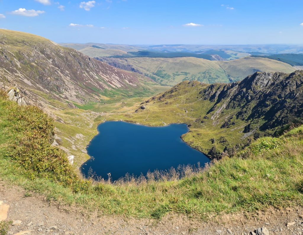
Looking for a Cadair Idris walk? This 6.5 mile horseshoe walk takes in Craig Lwyd, Craig Cwm Amarch, Cadair Idris and Mynydd Moel and has a stop off at the beautiful Llyn Cau, where you can have a paddle or wild swim if it’s warm enough.

We recently had a trip to North Wales after I’d been easily influenced on Instagram. I saw a post about Dolgamedd camp site and loved the idea of camping next to a river bank (it was almost as good as I expected but the feral kids on the campsite spoiled it a bit – I’ll do another post about the campsite). We packed up our Vango Spectre 600xl and headed to Dolgellau for a midweek break.


The first thing we do is see what walks are available nearby and we soon realised we were really near Cadair Idris. Route planned, we set off on what turned out to be a scorching day.


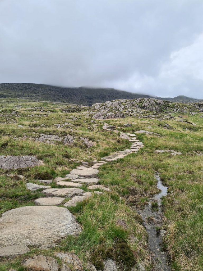
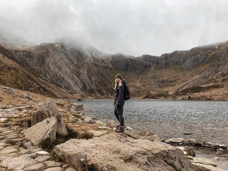
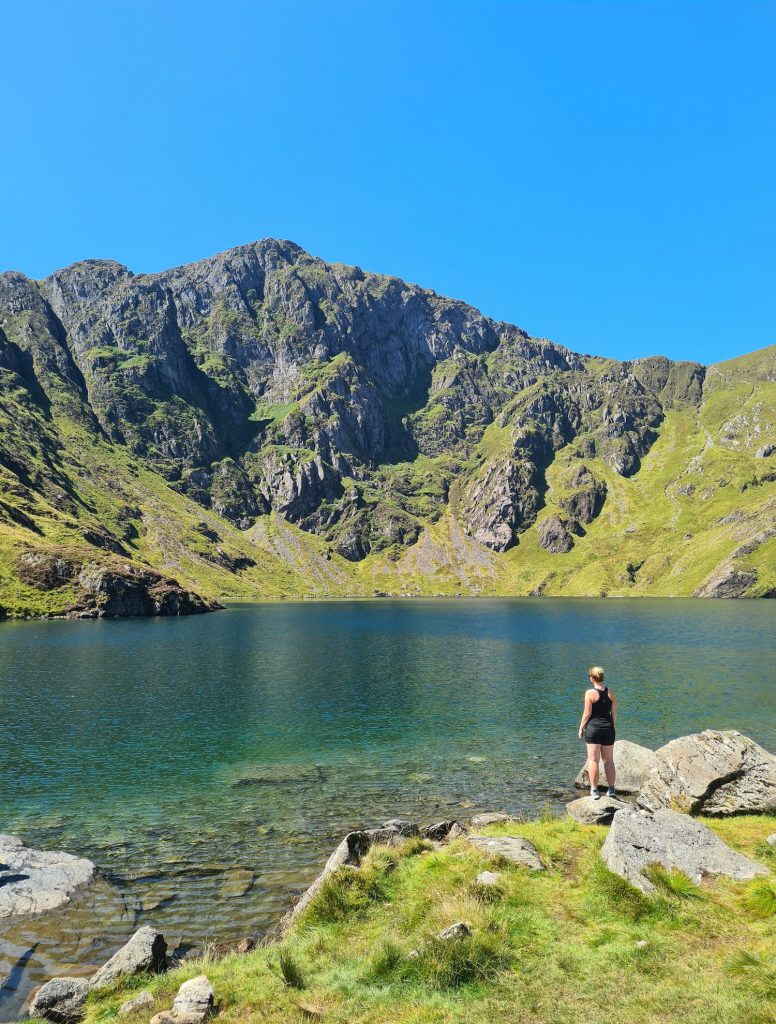
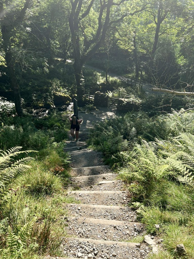
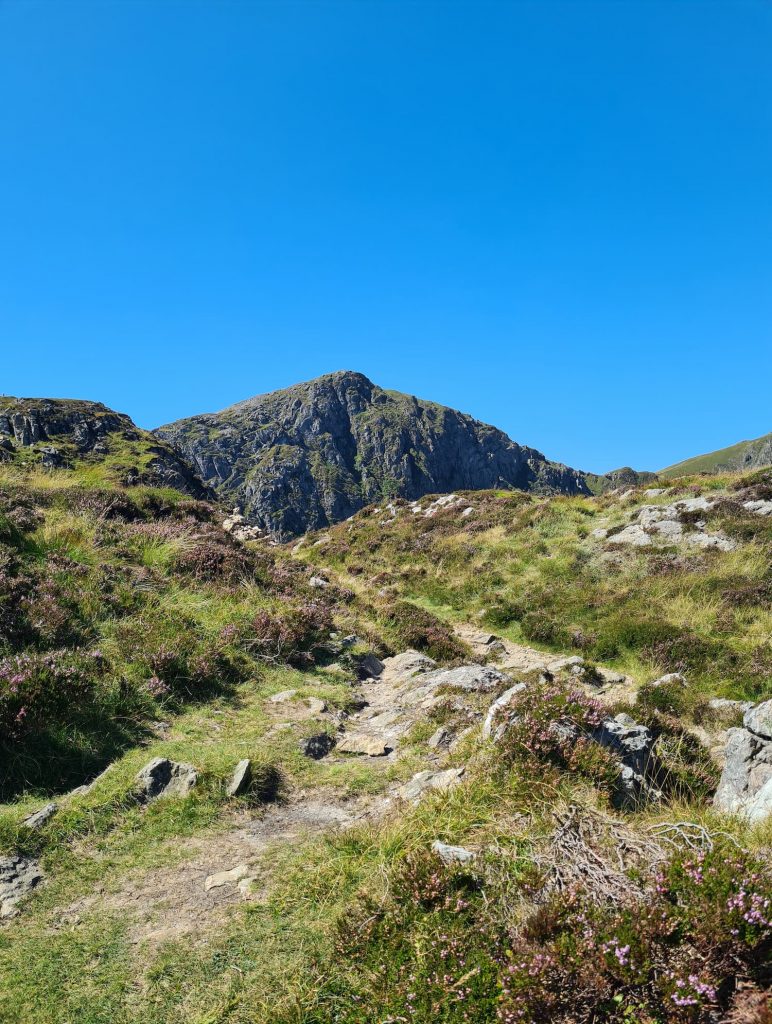
We started in the Dol Idris car park, which is very handy, and headed up the Minffordd Path to Llyn Cau. This is a steep path through the woods, running alongside the waterfalls, which then leads to the beautiful lake past a huge roche moutonee, left over from when the glaciers were forming this amazing place.

We were so hot by this point we went straight in the water (Hols just paddled!) for a swim and a cool down.

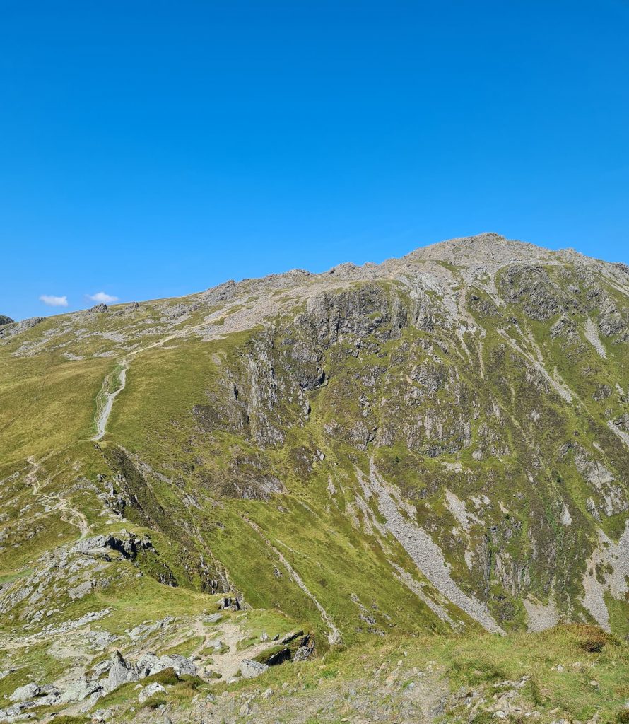
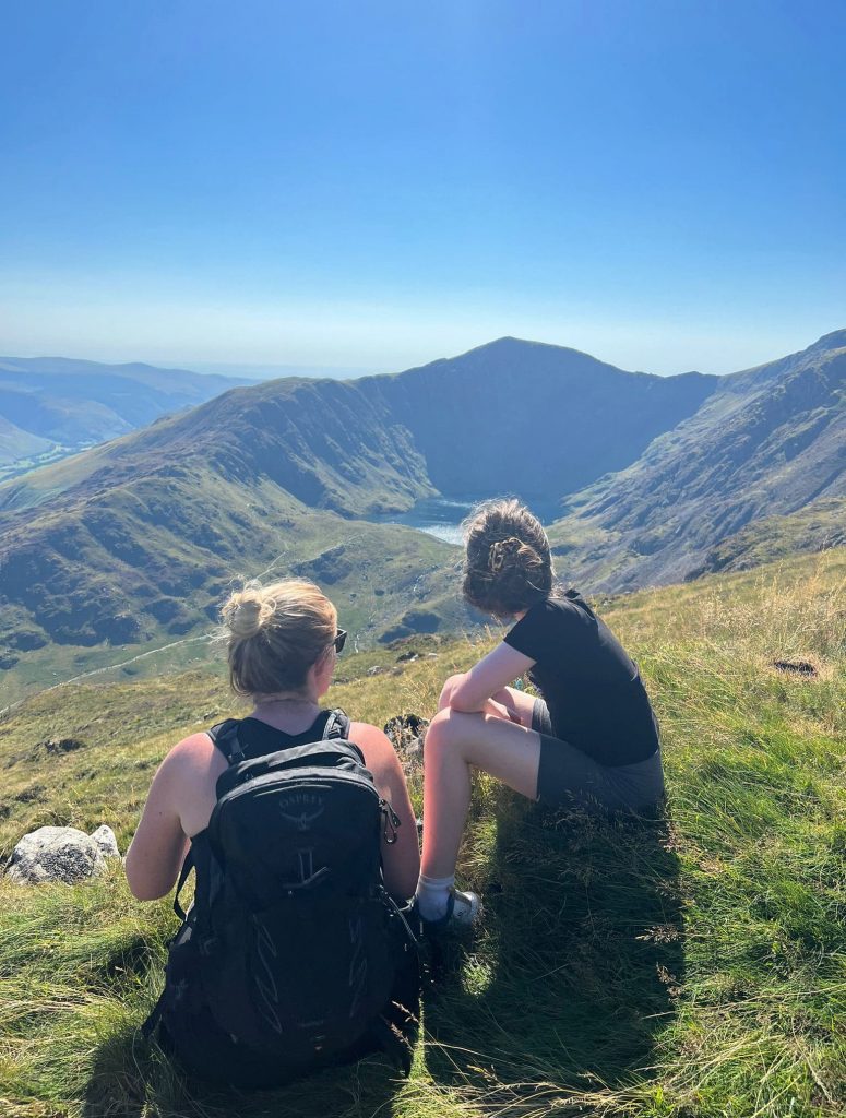
After a paddle, we carried on up the path to the summit of Craig Lwyd, a former Nuttall with a summit at 690m above sea level. There’s only a cairn marking the summit (and I didn’t even know it was the summit!). From here we carried on climbing up towards Craig Cwm Amarch (791m above sea level). This is the pointy one you can see from the lake shores. When we reached the summit, we climbed over the stile and were immediately surrounded by a swarm of flying ants!

Views of Craig Cwm Amarch

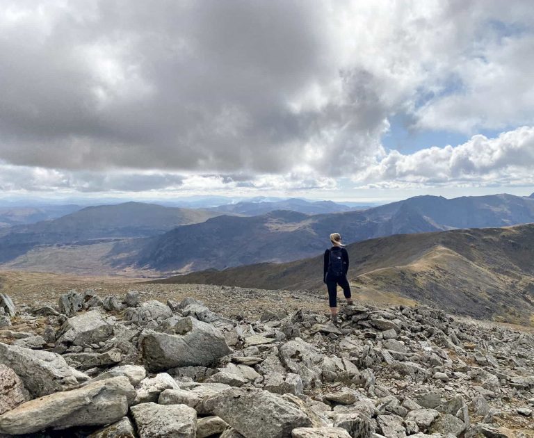
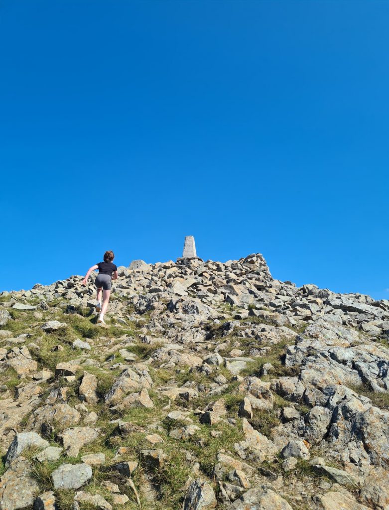
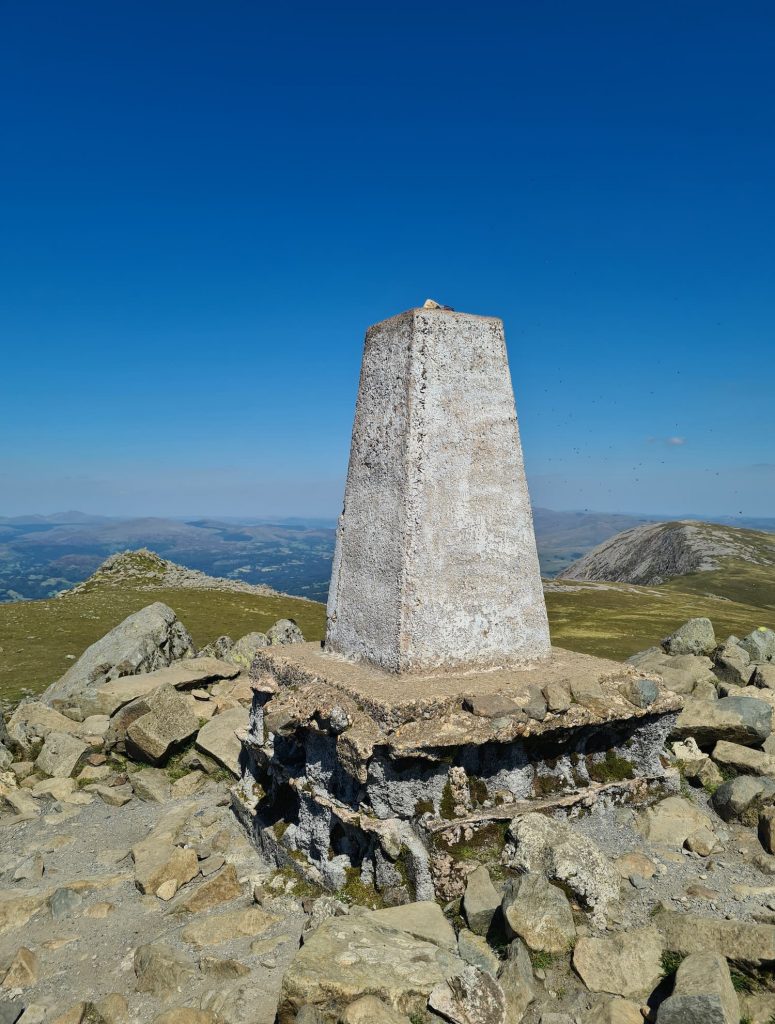
We followed the path down slightly and then started the climb back up to the summit of Penygadair (or Cadair Idris) at 893m above sea level. This is a rocky climb from this side, and the path is quite hard to see in places as it’s all rock on rock on rock – we just kept heading upwards. Eventually we reached the top where the trig point was, only to be greeted by yet another swarm of flying ants. Lucky us! We had a quick breather in the bothy (and Joel had his celebratory can of Kopparberg) and then we set off for Mynnydd Moel (863m above sea level). This is topped by a small wind shelter and yes, more flying ants!

Cadair Idris Summit

Llyn Cau - Cadair Idris wallk

Cadair Idris Summit

Cadair Idris Summit and trig point

By this time in the walk the heat was unbearable and we had the long, seemingly neverending trek back down the mountain, following the path that doesn’t seem to be on the OS map but was very much there in real life. We paused at the stile to get a lovely view over the horseshoe, before walking back down through the woods to the carĀ  park (and the cafe, for a well earned ice cream!).

Views over the Cadair Idris horseshoe walk

The heat made this quite a challenging walk. We’ve done a few mountains in Snowdonia now but this was one of the hardest because of the hot weather.


Cadair Idris Weather

Always check the weather before you go. I useĀ Mountain ForecastĀ to check the weather forecast at the summit as it can differ dramatically from that at ground level.

Cadair Idris Route Info:

Cadair Idris Route Map:


Walk Map (Opens in OS Maps):Ā Cadair Idris Walk Map

Parking: Dol Idris Car Park, Tywyn LL36 9AJ

Facilities: Public toilets at the car park and there is a cafe along the route.

Walk Time: 4-5 hours depending on your fitness (it took us nearly 7 hours with lots of rests and a swim stop)

Difficulty: ▲▲▲

Distance: 6.5 miles (10.5 km)


More Epic Walks in Snowdonia

You might also like to try:

Y Garn Via The Devil’s Kitchen

Snowdon Route via Rhyd Ddu Path

Pen yr Ole Wen to Carnedd Llewelyn

Tap to share with your hiking friends!

  • Facebook
  • Email
  • WhatsApp
Ā« Peak District Walks
5 Epic Peak District Scramble Walks Ā»

RELATED POSTS

  • Y Garn with Kids - Y Garn via the Devil's Kitchen Walk in Ogwen ValleyY Garn Via The Devil’s Kitchen | 5 Miles
  • Pen yr Ole Wen to Carnedd Llewelyn | 11 Miles
  • Glyder FachTryfan, Glyder Fach and Glyder Fawr via The Miners Track | 7 Miles
  • Snowdon Route via Rhyd Ddu Path | 10 Miles

Leave a Reply Cancel reply

Your email address will not be published. Required fields are marked *

FIND YOUR NEXT WALK:

ABOUT ME

Y Garn with Kids - Y Garn via the Devil's Kitchen Walk in Ogwen Valley

Hello! I’m Jo! Welcome to The Wandering Wildflower, an outdoors lifestyle blog focusing on family walks in the Peak District, a place we love exploring. I want to share the Peak District hidden gems and show you there’s so much more than the honeypot places. When I’m not dragging my husband and now 11 year old out on Peak District walks or up mountains, I can be found on planning my next moorland walk or plotting a Geocache walk (and seeing where the nearest pub is!). I love the hills but hate the heights, so trig bagging is – er- fun!


I hope this blog will give you some ideas of places to visit in the Peak District and inspire you and your family to head into the great outdoors.Ā  Thanks for stopping by!

CATEGORIES

  • CIRCULAR WALKS (193)
  • HOLMFIRTH WALKS (27)
  • ISLE OF SKYE WALKS (3)
  • LAKE DISTRICT WALKS (29)
  • LANCASHIRE WALKS (2)
  • LONG PEAK DISTRICT WALKS 10 MILES + (44)
  • MEDIUM WALKS 4-9 MILES (138)
  • PEAK DISTRICT SCRAMBLES (17)
  • PEAK DISTRICT WALKS (210)
  • PEAK DISTRICT WALKS WITH KIDS (76)
  • PEAK DISTRICT WALKS WITH PUBS (62)
  • SCOTLAND WALKS (6)
  • SHORT WALKS UNDER 3 MILES (41)
  • SNOWDONIA WALKS (5)
  • UK CAMPING (5)
  • YORKSHIRE WALKS (33)

Peak District Walks

List of Peak District Ethels

Peak District Peak Bagging

Peak District Trig Point Challenge

Peak District Walks with Pubs

Peak District Walks with Kids

Beautiful Walks in Holmfirth

Short Walks in the Peak District

Long Walks in the Peak District

AFFILIATE DISCLOSURE

This blog may contain affiliate links through which, at no additional cost to you, I may earn a small commission. I only recommend products I would use myself and all opinions expressed here are my own. As an Amazon Associate I earn from qualifying purchases. Read full privacy policyĀ here.

ARCHIVES

PEAK DISTRICT WEATHER

Peak District mountain weather on Met Office

Peak District Trig Points

Promo image for a blog post about the Peak District Trig Point Challenge With Map of Peak District Trig Points and Walking Routes by The Wandering Wildflower

Peak District Ethels Challenge

Promo image for a blog post about the Peak District Trig Point Challenge With Map of Peak District Ethels and Walking Routes by The Wandering Wildflower

WALKING ROUTES STRAIGHT TO YOUR INBOX

Want new walks in your inbox? Drop your email below and I'll send you some ideas for walks you can try.

You can unsubscribe anytime. For more details, review our Privacy Policy.

Thank you!

You have successfully joined our subscriber list.

RSS LATEST POSTS

  • Castleton Circular Walk via Cave Dale and Pin Dale | 5 Miles
  • How to Find Slater Bridge
  • Derbyshire 3 Peaks | 18 Miles
  • Holme Fell, Black Fell and Tarn Hows Waterfalls | 7 Miles
  • Winnats Pass Scramble Walk [+ Best View Points!] | 3 Miles

FOLLOW ON PINTEREST

Want new walks in your inbox? Drop your email below and I'll send you some ideas for walks you can try.

You can unsubscribe anytime. For more details, review our Privacy Policy.

Thank you!

You have successfully joined our subscriber list.

jo@thewanderingwildflower.co.uk

The Wandering Wildflower

  • Email
  • Facebook
  • Instagram
  • Pinterest
  • PRIVACY POLICY
  • TERMS & CONDITIONS
  • ABOUT

(c) The Wandering Wildflower. All Rights Reserved.

|| THEME BY ECLAIR DESIGNS