• 3 Mile Walks or Less
  • 4 Mile Walks
  • 5 Mile Walks
  • 6 Mile Walks
  • 7 Mile Walks
  • 8 Mile Walks
  • 9 Mile Walks
  • 10 Mile Walks
  • 11 Mile Walks
  • 12 Mile Walks
  • 14 Mile Walks
  • 15 Mile Walks
  • 20+ Mile Walks

The Wandering Wildflower

Peak District Hikes

  • PEAK DISTRICT WALKS
    • SHORT WALKS UNDER 3 MILES
    • MEDIUM WALKS 4-9 MILES
    • LONG PEAK DISTRICT WALKS 10 MILES +
  • PEAK DISTRICT WALKS WITH PUBS
  • PEAK DISTRICT WALKS WITH KIDS
  • HOLMFIRTH WALKS

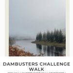
Derwent Reservoirs Circular (Dambusters Challenge Walk)

December 22, 2022 CIRCULAR WALKS, LONG PEAK DISTRICT WALKS 10 MILES +, PEAK DISTRICT WALKS, PEAK DISTRICT WALKS WITH PUBS

Pinterest Image for Dambusters Challenge Walk - Derwent Reservoirs Skyline - The Wandering Wildflower

This is an epic Peak District walk covering almost 24 miles of moorland above Ladybower, Derwent and Howden Reservoirs made famous by the Dambusters during World War 2. Taking in some of the more well known Peak District peaks such as Win Hill, Alport Castles, Back Tor and Lost Lad, this is a great long Peak District walk.

Win Hill trig point at sunrise

This walk is based on the Dambusters Challenge walk devised by Journeyman Guides and featuring in Dark Peak Challenges for Walkers and Fell Runners which is a brilliant book if you like a challenge walk. We added in a detour to Bridge-End Pastures and explored The Tower in Alport Castles but kept the rest of the route pretty much the same as the book.


During the Second World War the crews of 617 Squadron practiced their flying over the dams of Derwent in preparation for Operation Chastise, also known as the Dam Busters Raid.


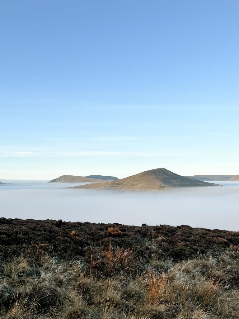
We were so incredibly lucky with this walk. We had booked a couple of nights stay at The Snake Inn which meant we could be up and out really early to make the most of the shorter amount of daylight. We were out of the house for 6.30am and when we got to the top of Win Hill we were met by a spectacular cloud inversion and a beautiful sunrise. The walk also showed us two fogbows and my first Brocken Spectre, which was really exciting!

Win Hill trig point at sunrise

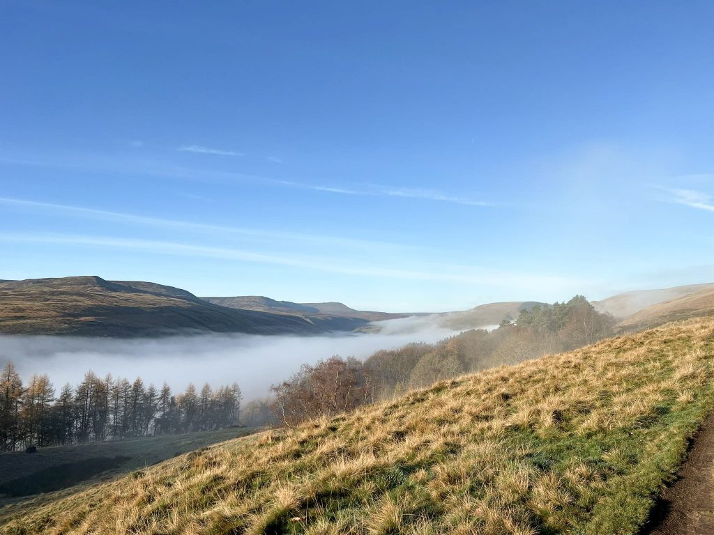
Our walk starts in a lay-by near to The Yorkshire Bridge Inn. We wanted to park near the pub so we didn’t have far to walk for a beer when we’d finished the walk! We crossed over the Ladybower dam wall past the Ladybower Reservoir plugholes and headed into the woods, to climb Win Hill via Parkin Clough. It was really misty when we set off, with really poor visibility, but as we climbed above the trees we were treated to the most spectacular sunrise and cloud inversion.

Steep track up Parkin Clough

Win Hill trig point at sunrise

Sunrise on Win Hill


After taking 11 billion photos and getting enough social media content to last me a lifetime, we headed off over Hope Brink, following the Roman Road to Hope Cross.


Mam Tor, Lose Hill and The Great Ridge as seen from Win Hill during a cloud inversion

Hope Cross at sunrise

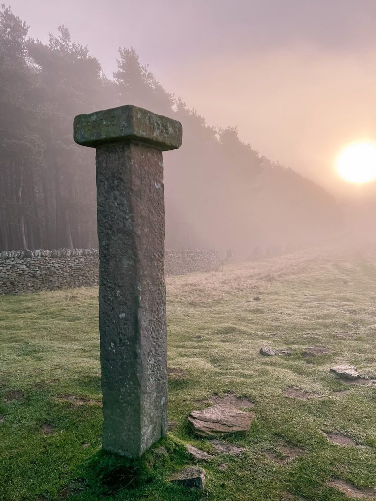
From Hope Cross we turned right and down into the woods, crossing the bridge and climbing up to meet the Snake Pass. We crossed the road and continued to climb up the hillside towards Hagg Farm. We took a detour to Bridge-End Pastures, following the path as it ran alongside the woods, to the rather unspectacular summit. Joel was happy though as it was one of his Peak District 75s that we could tick off! We were also treated to the first of the fogbows we would see on the day.

Fogbow over some pine trees

From Bridge-End Pastures we retraced our steps back along the path and then picked up the rough track to Rowlee Pastures. We left the track and climbed up the hill to the stile. We stopped for a cup of tea before heading over the stile and onto Rowlee Pastures.

A stile in a stone wall with a cloud inversion in the Peak District

A cup of tea in the foreground with a cloud inversion

The path winds along Rowlee Pastures for a lot longer than you think before reaching Alport Castles. We headed down into the main part of the landslip to explore around The Tower, then climbed back up onto the top to Birchen Hat. Here we headed down the hillside towards Ditch Clough Plantation.

Cloud inversion over Snake Woodlands

Cloud inversion over Snake Woodlands

Alport Castles

Alport Castles with a cloud inversion

There was lots of tree work going on when we did this walk, and the paths around the reservoir near Fox’s Piece were closed. We had to cross Ditch Clough following a footpath diversion and then pick up the path going clockwise around Howden Reservoir towards Slippery Stones.

Old packhorse bridge at Slippery Stones

At Slippery Stones we crossed the ancient packhorse bridge and chatted to a lady who had been for a dip. This is a brilliant place for wild swimming in the Peak District but I’m definitely not as brave as she was – it was freezing!

Howden Dam in the mist

Howden Dam in the mist

We continued to follow the reservoir path until we reached Abbey Tip Plantation. Here we started to climb up the hillside, past Abbey Brook which has some beautiful waterfalls (not that we could see them in the mist!) and Cogman Clough. We followed a track up near Sheepfold Clough to Lost Lad.

Cogman Clough and a steep track running downhill

The climb up to Lost Lad is very boggy in places, and seems to go on forever! From Lost Lad we headed south-west to Back Tor, then south past the Cakes of Bread, Dovestone Tor, the Salt Cellar, White Tor and then south past to the Wheel Stones and Whinstone Lee.

A fogbow over Back Tor, Derwent Edge

Back Tor trig point

Back Tor at dusk

Back Tor looking over Strines Moor

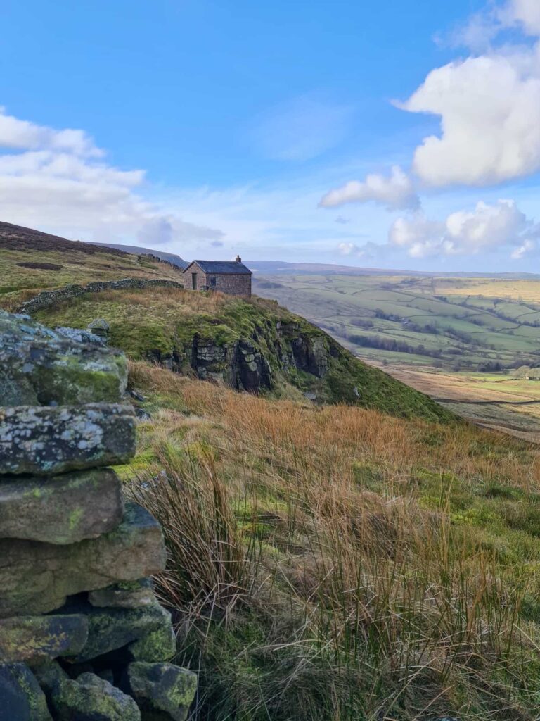
From Whinstone Lee we headed south over Lead Hill, following the path down the hillside to Ladybower Woods. The trail comes out behind The Ladybower Inn (sadly closed). From here we walked back over the Yorkshire Bridge then back along the edge of the reservoir to the car and pub for a well earned tea.


This was a really brilliant long walk in the Peak District, exploring the moors above Ladybower, Derwent and Howden Reservoirs. The Dambusters Challenge walk is definitely a challenge but there’s no better place to spend a day in the hills.


Dambusters Challenge Walk Map: 


Walk Map (Opens in OS Maps): Dambusters Challenge Walk Map

Dambusters Challenge Walk parking:

We parked in a lay-by near the Yorkshire Bridge Inn, Ashopton Rd, Bamford, Hope Valley S33 0AZ.  W3W:/// solving.blanking.boxing There is also the nearby Heatherdene car park which is pay and display but has some toilets.

Facilities: Toilets in the car park at Heatherdene

Walk Time: 8-10 hours

Difficulty: ▲▲▲

Distance: 23.8 miles (38.3km)

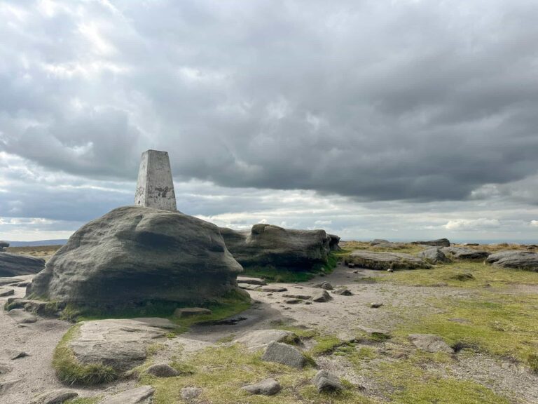
Trig Points Bagged: Win Hill, Back Tor

Peak District Peaks Bagged: Win Hill, Back Tor, Lost Lad

Peak District Ethels Bagged: Win Hill, Back Tor, Lost Lad


Tap to share with your hiking friends!

  • Facebook
  • Email
  • WhatsApp
« Winnats Pass and Mam Tor Circular Walk | 6 Miles
Black Hill, West Nab and Blackpool Bridge | 10 Miles »

RELATED POSTS

  • Hathersage Stepping StonesHathersage Stepping Stones Walk | 7 Miles
  • Ladybower ReservoirLadybower Walk | 6 Miles
  • Anvil Stone, GrindsbrookGrindsbrook Clough Scramble to Grindslow Knoll | 7 Miles
  • How to Find The B29 “Overexposed” Plane Crash Site on Bleaklow – A Guide

Leave a Reply Cancel reply

Your email address will not be published. Required fields are marked *

FIND YOUR NEXT WALK:

ABOUT ME

Y Garn with Kids - Y Garn via the Devil's Kitchen Walk in Ogwen Valley

Hello! I’m Jo! Welcome to The Wandering Wildflower, an outdoors lifestyle blog focusing on family walks in the Peak District, a place we love exploring. I want to share the Peak District hidden gems and show you there’s so much more than the honeypot places. When I’m not dragging my husband and now 11 year old out on Peak District walks or up mountains, I can be found on planning my next moorland walk or plotting a Geocache walk (and seeing where the nearest pub is!). I love the hills but hate the heights, so trig bagging is – er- fun!


I hope this blog will give you some ideas of places to visit in the Peak District and inspire you and your family to head into the great outdoors.  Thanks for stopping by!

CATEGORIES

  • CIRCULAR WALKS (189)
  • HOLMFIRTH WALKS (27)
  • ISLE OF SKYE WALKS (3)
  • LAKE DISTRICT WALKS (24)
  • LANCASHIRE WALKS (2)
  • LONG PEAK DISTRICT WALKS 10 MILES + (42)
  • MEDIUM WALKS 4-9 MILES (137)
  • PEAK DISTRICT SCRAMBLES (16)
  • PEAK DISTRICT WALKS (205)
  • PEAK DISTRICT WALKS WITH KIDS (76)
  • PEAK DISTRICT WALKS WITH PUBS (60)
  • SCOTLAND WALKS (6)
  • SHORT WALKS UNDER 3 MILES (40)
  • SNOWDONIA WALKS (5)
  • UK CAMPING (5)
  • YORKSHIRE WALKS (33)

Peak District Walks

List of Peak District Ethels

Peak District Peak Bagging

Peak District Trig Point Challenge

Peak District Walks with Pubs

Peak District Walks with Kids

Beautiful Walks in Holmfirth

Short Walks in the Peak District

Long Walks in the Peak District

AFFILIATE DISCLOSURE

This blog may contain affiliate links through which, at no additional cost to you, I may earn a small commission. I only recommend products I would use myself and all opinions expressed here are my own. As an Amazon Associate I earn from qualifying purchases. Read full privacy policy here.

ARCHIVES

PEAK DISTRICT WEATHER

Peak District mountain weather on Met Office

Peak District Trig Points

Promo image for a blog post about the Peak District Trig Point Challenge With Map of Peak District Trig Points and Walking Routes by The Wandering Wildflower

Peak District Ethels Challenge

Promo image for a blog post about the Peak District Trig Point Challenge With Map of Peak District Ethels and Walking Routes by The Wandering Wildflower

WALKING ROUTES STRAIGHT TO YOUR INBOX

Want new walks in your inbox? Drop your email below and I'll send you some ideas for walks you can try.

You can unsubscribe anytime. For more details, review our Privacy Policy.

Thank you!

You have successfully joined our subscriber list.

RSS LATEST POSTS

  • How to Find Three Shires Head
  • Burnbank Fell, Blake Fell and Gavel Fell | 8 Miles
  • Bretton Park Circular Walk | 3 Miles
  • Hathersage Stepping Stones Walk | 7 Miles
  • Peak District Caves

FOLLOW ON PINTEREST

Want new walks in your inbox? Drop your email below and I'll send you some ideas for walks you can try.

You can unsubscribe anytime. For more details, review our Privacy Policy.

Thank you!

You have successfully joined our subscriber list.

jo@thewanderingwildflower.co.uk

The Wandering Wildflower

  • Email
  • Facebook
  • Instagram
  • Pinterest
  • PRIVACY POLICY
  • TERMS & CONDITIONS
  • ABOUT

(c) The Wandering Wildflower. All Rights Reserved.

|| THEME BY ECLAIR DESIGNS