• 3 Mile Walks or Less
  • 4 Mile Walks
  • 5 Mile Walks
  • 6 Mile Walks
  • 7 Mile Walks
  • 8 Mile Walks
  • 9 Mile Walks
  • 10 Mile Walks
  • 11 Mile Walks
  • 12 Mile Walks
  • 14 Mile Walks
  • 15 Mile Walks
  • 20+ Mile Walks

The Wandering Wildflower

Peak District Hikes

  • PEAK DISTRICT WALKS
    • SHORT WALKS UNDER 3 MILES
    • MEDIUM WALKS 4-9 MILES
    • LONG PEAK DISTRICT WALKS 10 MILES +
  • PEAK DISTRICT WALKS WITH PUBS
  • PEAK DISTRICT WALKS WITH KIDS
  • HOLMFIRTH WALKS

Kinder Scout Dog Stone via Sandy Heys and Cluther Rocks | 8 Miles

January 23, 2023 CIRCULAR WALKS, MEDIUM WALKS 4-9 MILES, PEAK DISTRICT WALKS, PEAK DISTRICT WALKS WITH KIDS

This is a 7.6 mile Kinder Scout walk, starting in Bowden Bridge and climbing up Sandy Heys before heading along the plateau to The Edge trig point, Kinder Downfall and then down through Cluther Rocks in search of the Kinder Scout Dog Stone.

A woman looking down over Kinder Reservoir from Kinder Scout

This is a challenging walk in sections, especially the part through Cluther Rocks where the Kinder Scout Dog Stone is. We scrambled over some of the rocks, but there is a very faint path running through the rocks (which we didn’t stick to). The area is littered with deep holes in the peat which can be covered with heather, some of them which are really deep. On the day we visited Joel fell in one of the holes (a few moments after we were pretending to fall in them!) and he twisted his knee. I later read that a dog had gone missing in one of the holes nearer Grindsbrook Clough. Please take care if you visit!


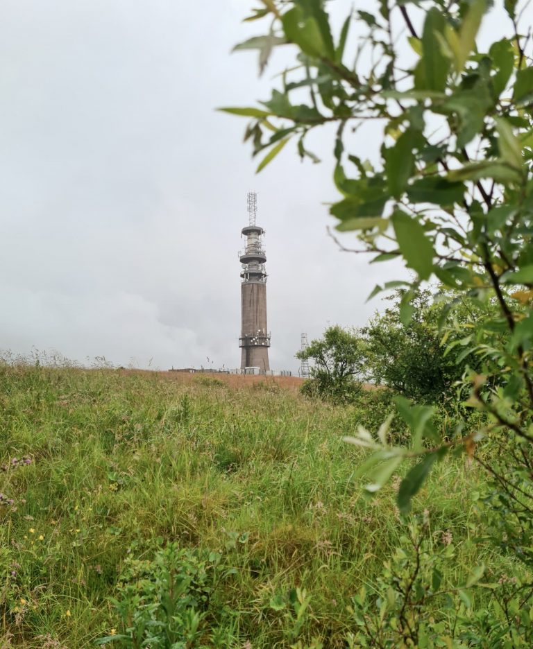
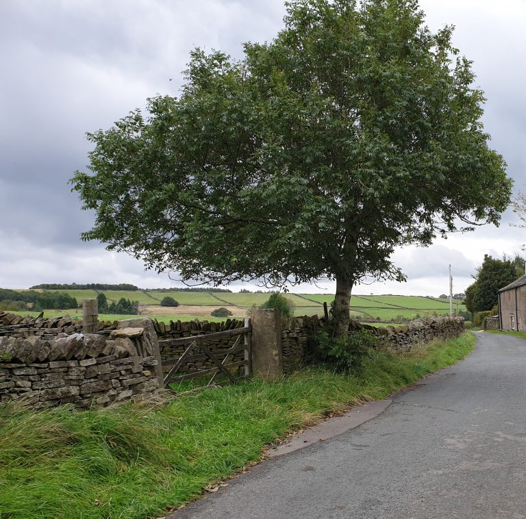
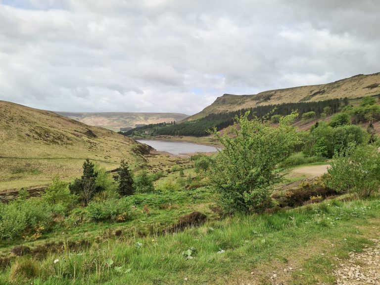
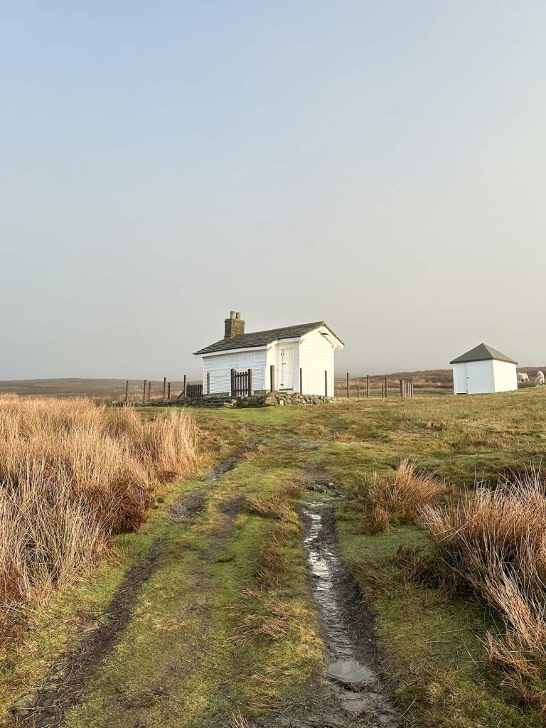
The walk starts in the car park at Bowden Bridge, near the Hayfield Campsite where there are public toilets. We headed along Kinder Road towards the Reservoir track gates, and followed the track to the gates of the old abandoned water treatment works. Here we headed up the steep cobbled White Brow past Marepiece Wood until we reached a path near a wall heading up the hillside. We followed this path up White Brow until the path levelled out then turned left to head to the shooting cabin near Kinder Scout. Sadly this is locked up and not accessible, so we headed back down to the green sign and then onward along White Brow, dropping down the hillside gradually to reach the bridge over William Clough where it joins Kinder Reservoir.

A dry stone wall leading up White Brow

Kinder Reservoir

A white shooting cabin on the moors near Kinder Scout

The shooting cabin near Kinder Scout, sadly locked

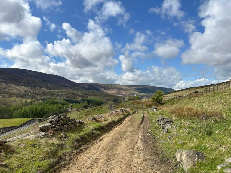
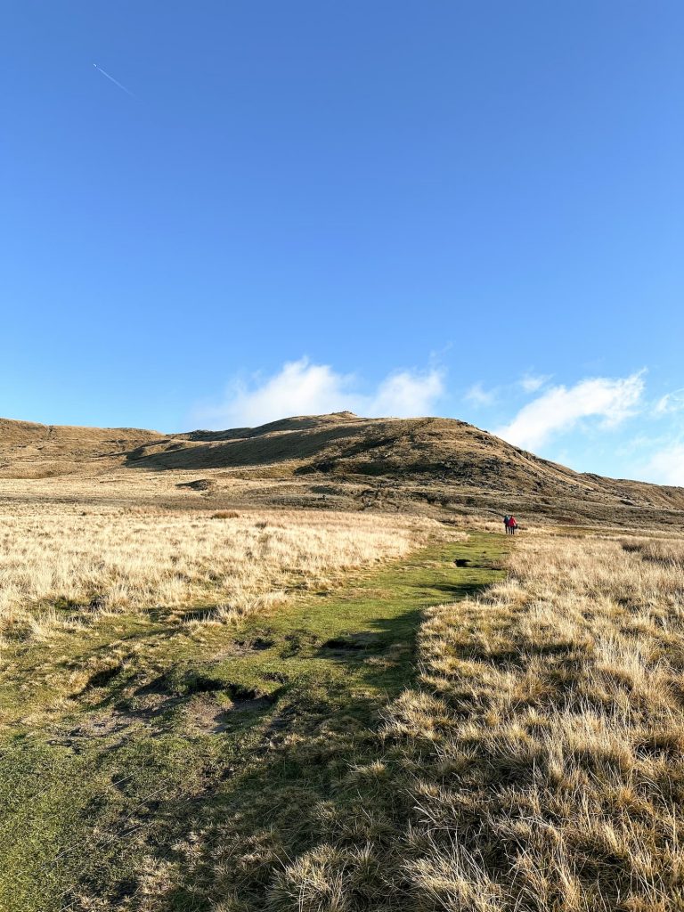
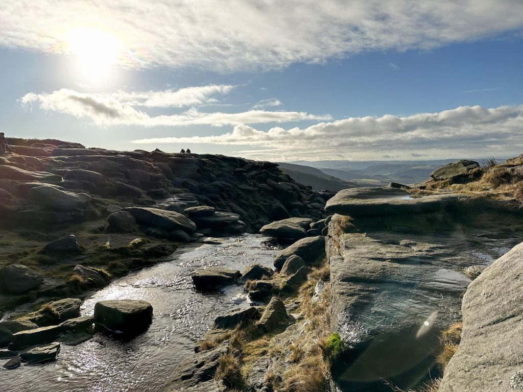
From here we took the steep path north-east up the hillside known as Sandy Heys. This is quite challenging in places but does level out! There are some rocks near the top near where it joins the Pennine Way running around the perimeter of Kinder Scout.

A steep moorland path up Sandy Heys on Kinder Scout

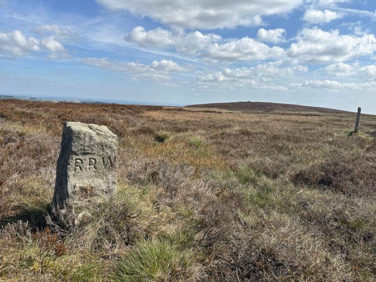
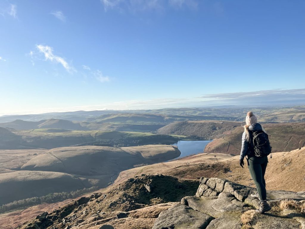
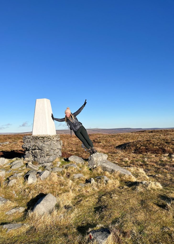
We headed right and followed the path around the edge, then took a detour off to find The Edge trig point. This is over the fence, so we found a stile and hopped over before heading to the trig point, or should I say trig pointS! There are actually 2 trig points here, with the old one being dumped on the ground next to the newer one. I’m not sure if there is anywhere else where you can touch 2 trig points at once!

View along the edge of Kinder Scout

A woman standing on one trig point whilst leaning to touch another.

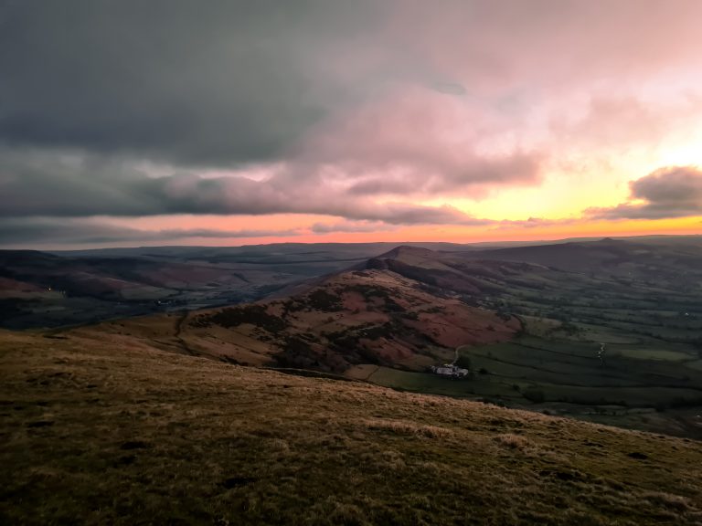
From The Edge we followed the fence line back to the main path and headed round to Kinder Downfall. If you’ve read some of my other Kinder Scout walks you’ll know I’ve not had much luck with seeing this apparently amazing waterfall. We’ve been up in all weathers but it’s either covered in mist or dry as a bone! My run of bad luck with the highest waterfall in the Peak District finally changed and I was able to see it, plus it was blowing backwards too!

Kinder Downfall on a sunny day

The top of the Kinder Downfall

Crossing the River Kinder at the top of Kinder Downfall

Kinder Downfall, the tallest waterfall in the Peak District

Kinder Downfall, the tallest waterfall in the Peak District

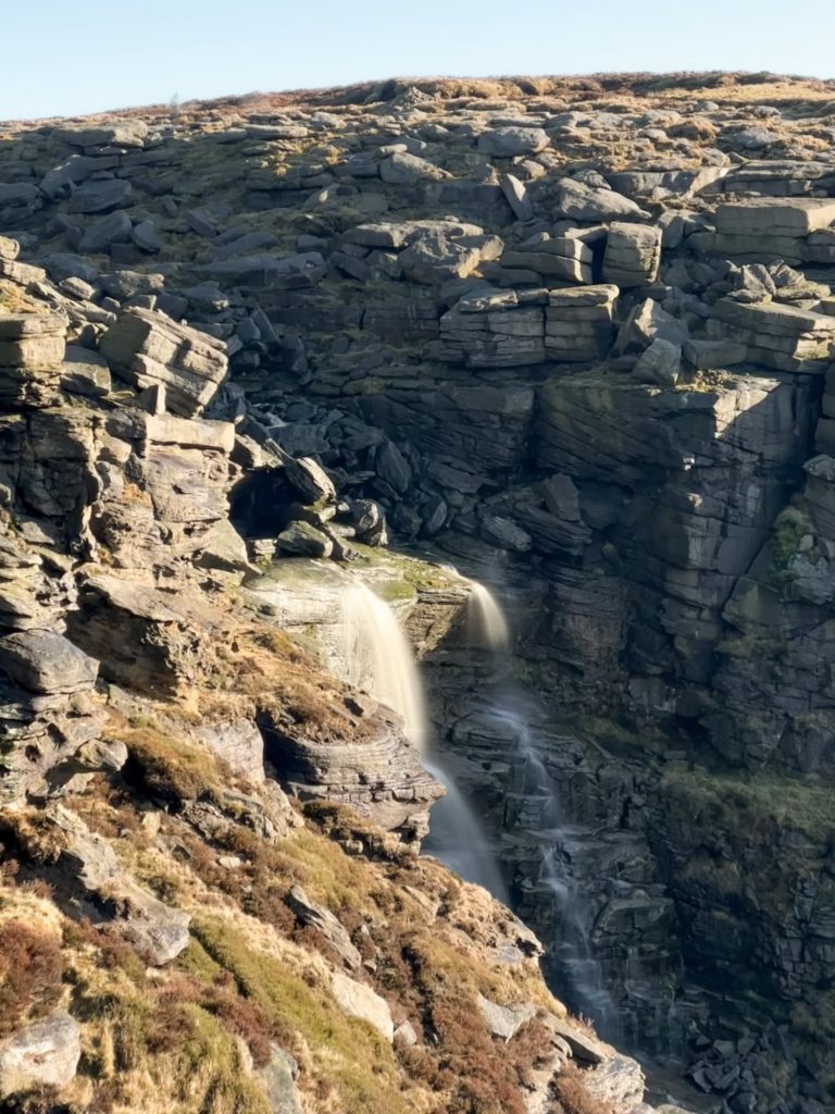
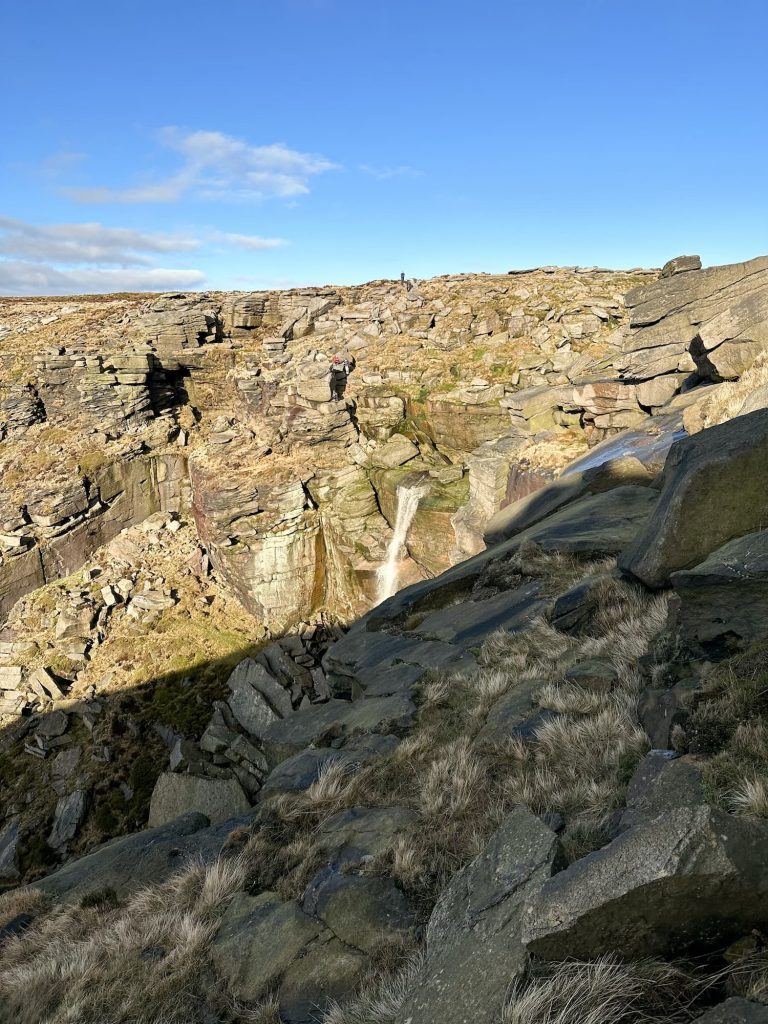
The Komoot route deviates off the path to get a better view of the waterfall, which I would only recommend doing in good weather.


We then crossed the River Kinder and headed around the other side of the Downfall, where again I left the path to get some pics. We then headed round to Red Brook, and just after Red Brook we picked up the path leading down the mountainside towards Cluther Rocks. We took a detour from the main path to scramble over the rocks and find the Dog Stone.

Looking over Cluther Rocks towards Kinder Reservoir

Kinder Scout Dog Stone

The mysterious Kinder Scout Dog Stone

We had planned to find the millstones and the Kinder Scout Dog Stone but we only found the Dog Stone. This is a rock carved with a secret message in Pigpen Cypher (which Hols loves) and a dog, plus some masonic symbols. It could be all mysterious but was probably carved by a stonemason who had some spare time! The message on the Dog Stone is thought to read “She may be small but she is of the best green stone”. We also watched a stoat playing nearby.


We didn’t manage to find the millstones unfortunately, as Joel twisted his knee while we were walking/scrambling through Cluther Rocks so we had to cut our walk short. We had planned to head back up onto the plateau and head to Kinder Low trig point before finding some of the plane crash sites up there, but we’ll have to go another time.

Wooden gate at the bottom of Broad Clough near Kinder Scout


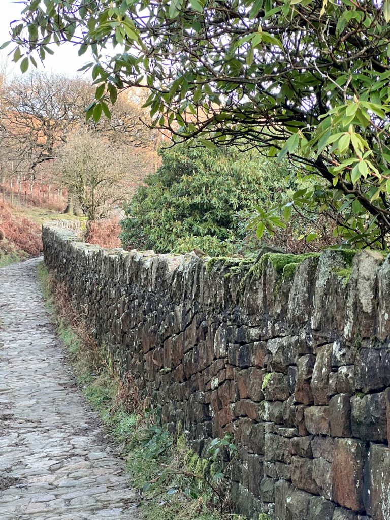
Instead we headed to the dry stone wall and then followed it to pick up a footpath alongside Broad Clough. We then walked along the edge of the pine plantation before dropping down the hill near the water treatment works. We took the road down past Farlands and the Booth sheep wash before heading back to the car.


Booth sheep wash, a historical place where shepherds washed sheep


This was a lovely walk but if you decide to head up to Cluther Rocks please be aware of the holes in the ground!


Kinder Scout Dog Stone Walking Route:


Walk Map (Opens in OS Maps): Kinder Scout and the Dog Stone at Cluther Rocks

Parking: Head to the car park on Kinder Road, SK22 2LE (W3W:///leap.spurted.edges).

Facilities: Public toilets and bike rack near the car park (at the entrance to the camp site).

Kinder Scout Walk Difficulty: ▲▲▲

Walk Time: 4-5 hours

Walk Distance: 7.6 miles (12.2km)

Trig Points Bagged: The Edge

Peak District Peaks Bagged: None

Peak District Ethels Bagged: None


For more Kinder Scout walks, why not try:

Kinder Scout Perimeter Walk

Oyster Clough and Blackden Brook to Kinder Plateau (Scramble with Waterfalls)

Best Kinder Scout Walks | Guides and GPX Files

Red Brook Scramble to Kinder Scout

Crowden Clough to Kinder Scout Walk

Kinder Downfall Walk via Nether Red Brook Scramble

Grindslow Knoll and True Kinder Scout Summit

Hayfield to Kinder Scout Circular Walk

Kinder Scout via Kinder Low

Tap to share with your hiking friends!

  • Facebook
  • Email
  • WhatsApp
« 10 Best Peak District Sunrise Spots
Whitwell Moor Trig Point | 4 Miles »

RELATED POSTS

  • Hathersage Stepping StonesHathersage Stepping Stones Walk | 7 Miles
  • Ladybower ReservoirLadybower Walk | 6 Miles
  • Anvil Stone, GrindsbrookGrindsbrook Clough Scramble to Grindslow Knoll | 7 Miles
  • Views from Grindslow Knoll down Grindsbrook CloughEdale to Grindslow Knoll Circular Walk | 4 Miles

Leave a Reply Cancel reply

Your email address will not be published. Required fields are marked *

FIND YOUR NEXT WALK:

ABOUT ME

Y Garn with Kids - Y Garn via the Devil's Kitchen Walk in Ogwen Valley

Hello! I’m Jo! Welcome to The Wandering Wildflower, an outdoors lifestyle blog focusing on family walks in the Peak District, a place we love exploring. I want to share the Peak District hidden gems and show you there’s so much more than the honeypot places. When I’m not dragging my husband and now 11 year old out on Peak District walks or up mountains, I can be found on planning my next moorland walk or plotting a Geocache walk (and seeing where the nearest pub is!). I love the hills but hate the heights, so trig bagging is – er- fun!


I hope this blog will give you some ideas of places to visit in the Peak District and inspire you and your family to head into the great outdoors.  Thanks for stopping by!

CATEGORIES

  • CIRCULAR WALKS (189)
  • HOLMFIRTH WALKS (27)
  • ISLE OF SKYE WALKS (3)
  • LAKE DISTRICT WALKS (26)
  • LANCASHIRE WALKS (2)
  • LONG PEAK DISTRICT WALKS 10 MILES + (42)
  • MEDIUM WALKS 4-9 MILES (137)
  • PEAK DISTRICT SCRAMBLES (16)
  • PEAK DISTRICT WALKS (206)
  • PEAK DISTRICT WALKS WITH KIDS (76)
  • PEAK DISTRICT WALKS WITH PUBS (60)
  • SCOTLAND WALKS (6)
  • SHORT WALKS UNDER 3 MILES (40)
  • SNOWDONIA WALKS (5)
  • UK CAMPING (5)
  • YORKSHIRE WALKS (33)

Peak District Walks

List of Peak District Ethels

Peak District Peak Bagging

Peak District Trig Point Challenge

Peak District Walks with Pubs

Peak District Walks with Kids

Beautiful Walks in Holmfirth

Short Walks in the Peak District

Long Walks in the Peak District

AFFILIATE DISCLOSURE

This blog may contain affiliate links through which, at no additional cost to you, I may earn a small commission. I only recommend products I would use myself and all opinions expressed here are my own. As an Amazon Associate I earn from qualifying purchases. Read full privacy policy here.

ARCHIVES

PEAK DISTRICT WEATHER

Peak District mountain weather on Met Office

Peak District Trig Points

Promo image for a blog post about the Peak District Trig Point Challenge With Map of Peak District Trig Points and Walking Routes by The Wandering Wildflower

Peak District Ethels Challenge

Promo image for a blog post about the Peak District Trig Point Challenge With Map of Peak District Ethels and Walking Routes by The Wandering Wildflower

WALKING ROUTES STRAIGHT TO YOUR INBOX

Want new walks in your inbox? Drop your email below and I'll send you some ideas for walks you can try.

You can unsubscribe anytime. For more details, review our Privacy Policy.

Thank you!

You have successfully joined our subscriber list.

RSS LATEST POSTS

  • How to Find Three Shires Head
  • Peak District Pub Walks
  • Burnbank Fell, Blake Fell and Gavel Fell | 8 Miles
  • Bretton Park Circular Walk | 3 Miles
  • Grasmere Weekend Break

FOLLOW ON PINTEREST

Want new walks in your inbox? Drop your email below and I'll send you some ideas for walks you can try.

You can unsubscribe anytime. For more details, review our Privacy Policy.

Thank you!

You have successfully joined our subscriber list.

jo@thewanderingwildflower.co.uk

The Wandering Wildflower

  • Email
  • Facebook
  • Instagram
  • Pinterest
  • PRIVACY POLICY
  • TERMS & CONDITIONS
  • ABOUT

(c) The Wandering Wildflower. All Rights Reserved.

|| THEME BY ECLAIR DESIGNS