• 3 Mile Walks or Less
  • 4 Mile Walks
  • 5 Mile Walks
  • 6 Mile Walks
  • 7 Mile Walks
  • 8 Mile Walks
  • 9 Mile Walks
  • 10 Mile Walks
  • 11 Mile Walks
  • 12 Mile Walks
  • 14 Mile Walks
  • 15 Mile Walks
  • 20+ Mile Walks

The Wandering Wildflower

Peak District Hikes

  • PEAK DISTRICT WALKS
    • SHORT WALKS UNDER 3 MILES
    • MEDIUM WALKS 4-9 MILES
    • LONG PEAK DISTRICT WALKS 10 MILES +
  • PEAK DISTRICT WALKS WITH PUBS
  • PEAK DISTRICT WALKS WITH KIDS
  • HOLMFIRTH WALKS

Castleton, Mam Tor and The Great Ridge Walk | 7 Miles

October 1, 2021 CIRCULAR WALKS, MEDIUM WALKS 4-9 MILES, PEAK DISTRICT WALKS, PEAK DISTRICT WALKS WITH KIDS, PEAK DISTRICT WALKS WITH PUBS

Pin Image for Mam Tor and The Great Ridge Walk from The Wandering Wildflower

This Castleton, Mam Tor and The Great Ridge walk also takes you to Lose Hill and back into Castleton. It’s a circular Peak District walk with a pub and is also really family friendly. Here’s the route for this Mam Tor walk!


View of Mam Tor from Lose Hill

View of Mam Tor from Lose Hill

See this blog post for a Mam Tor short walk.


Landslides on Mam Tor above the Broken Road

Landslides on Mam Tor above the Broken Road

Mam Tor Peak District

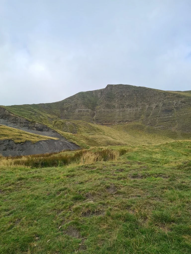
Mam Tor or the Mother Hill is a peak in the Peak District that stands 517m above sea level. Known as the Mother Hill because its landslides cause there to be lots of baby peaks nearby, it’s also known as The Shivering Mountain, again because of the number of landslides that have taken place over the years. These landslides were responsible for the famous Broken Road which is the former A625. This was a road which was damaged repeatedly over the years and has since been abandoned to nature. It makes for quite an apocalyptic scene!


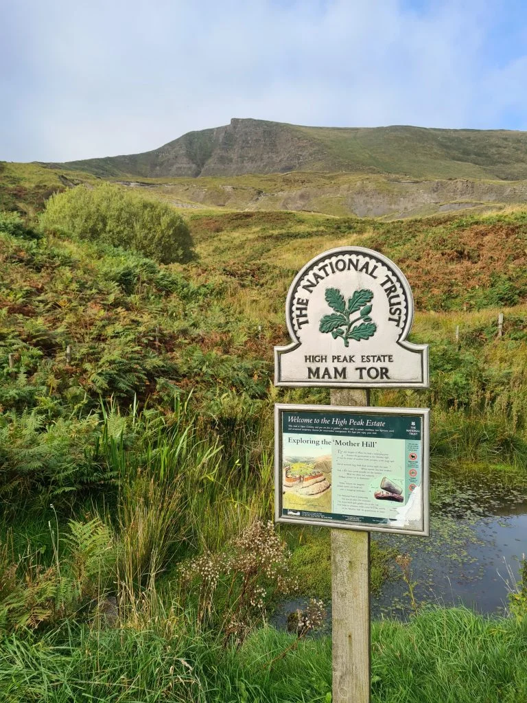
We set out to park in the National Trust car park however we couldn’t find it despite the satnav guiding us to the postcode. We were due to meet friends there and as luck would have it they couldn’t find it either, and were on the same road as us so we decided to park there in and amongst the wild campers and campervans. This turned out to be a great starting point for our Mam Tor walk, as it was at the bottom of the Broken Road.


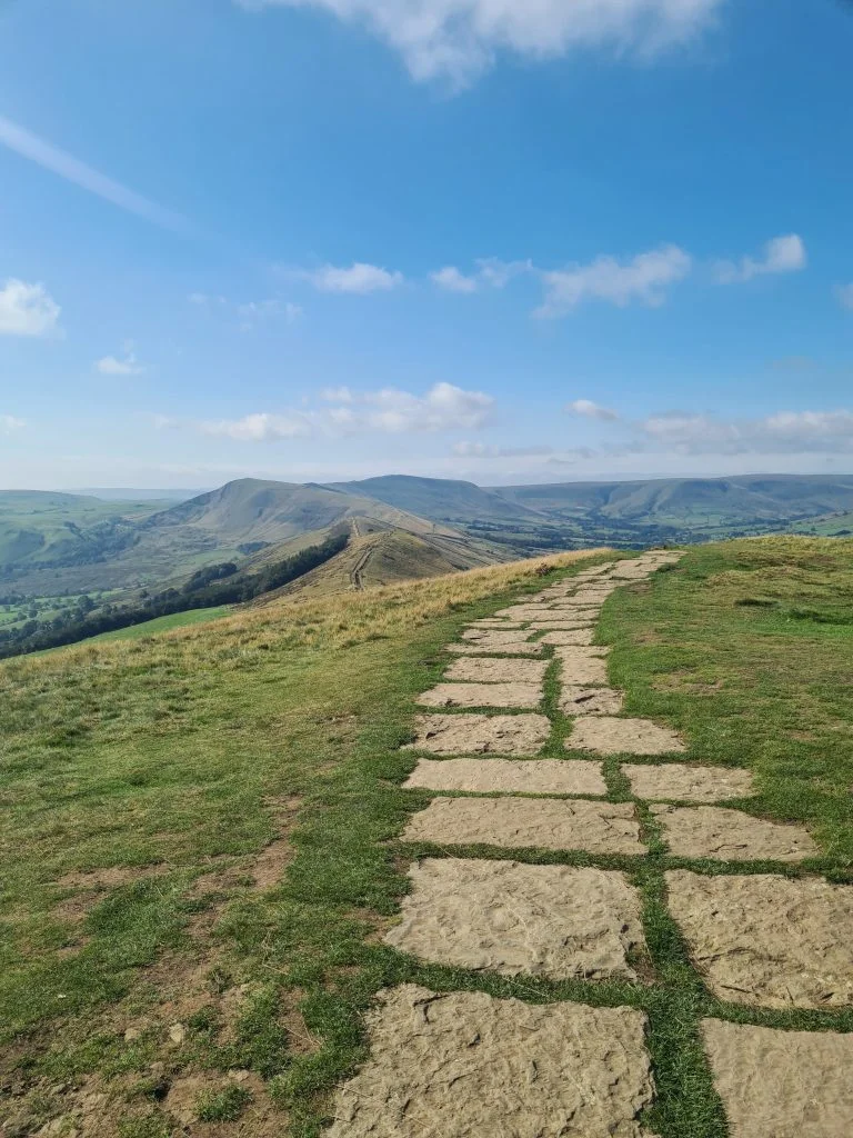
After walking over the Broken Road we headed up the hill past Blue John Cavern. The route is really well signposted and there was a steady stream of people walking up Mam Tor so it would be really hard to get lost. There is a steep paved path up the side of Mam Tor but it’s a relatively short climb. There are amazing views down over the valley on the way up.


View from Mam Tor trig Point

Mam Tor trig point view

Mam Tor trig point - The Wandering Wildflower

Mam Tor trig point - The Wandering Wildflower


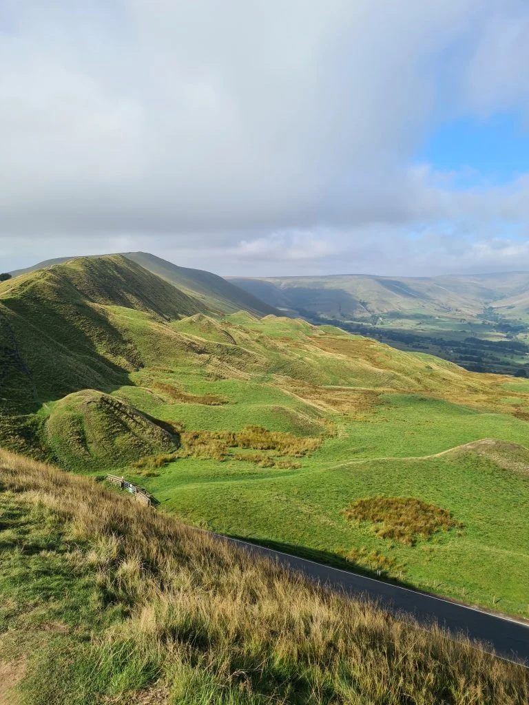
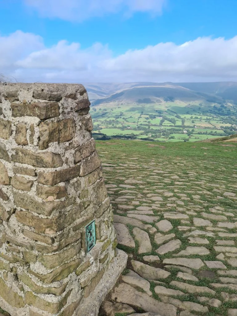
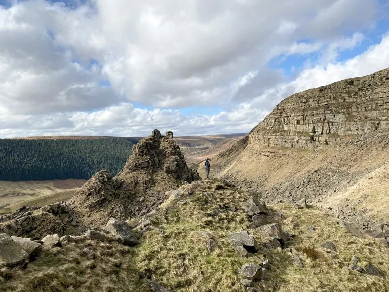
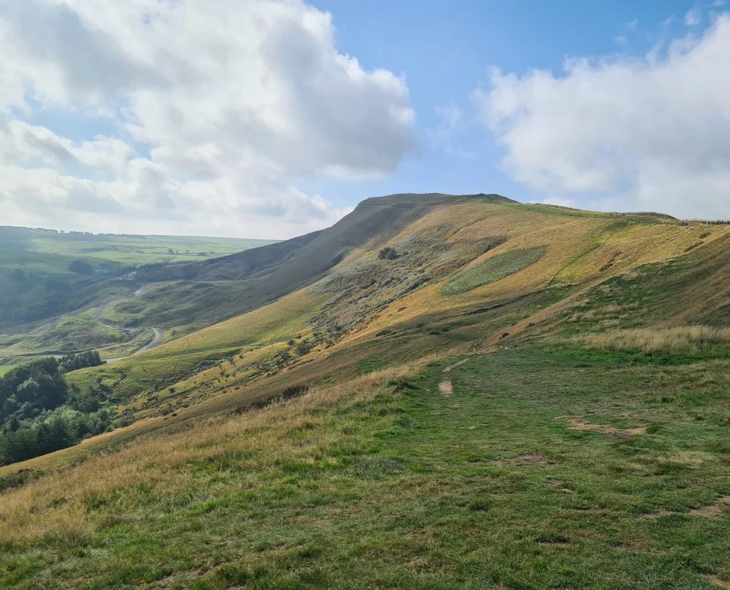
After queueing at the trig point for the obligatory photo we set off along The Great Ridge to the next peak. Well, it’s not so much a peak as a meeting of paths at Hollins Cross. There is a marker, and from here there are many other paths going off in every direction.


View along The Great Ridge to Lose Hill

View along The Great Ridge to Lose Hill


View back to Mam Tor from near Lose Hill - The Wandering Wildflower

View back to Mam Tor from near Lose Hill


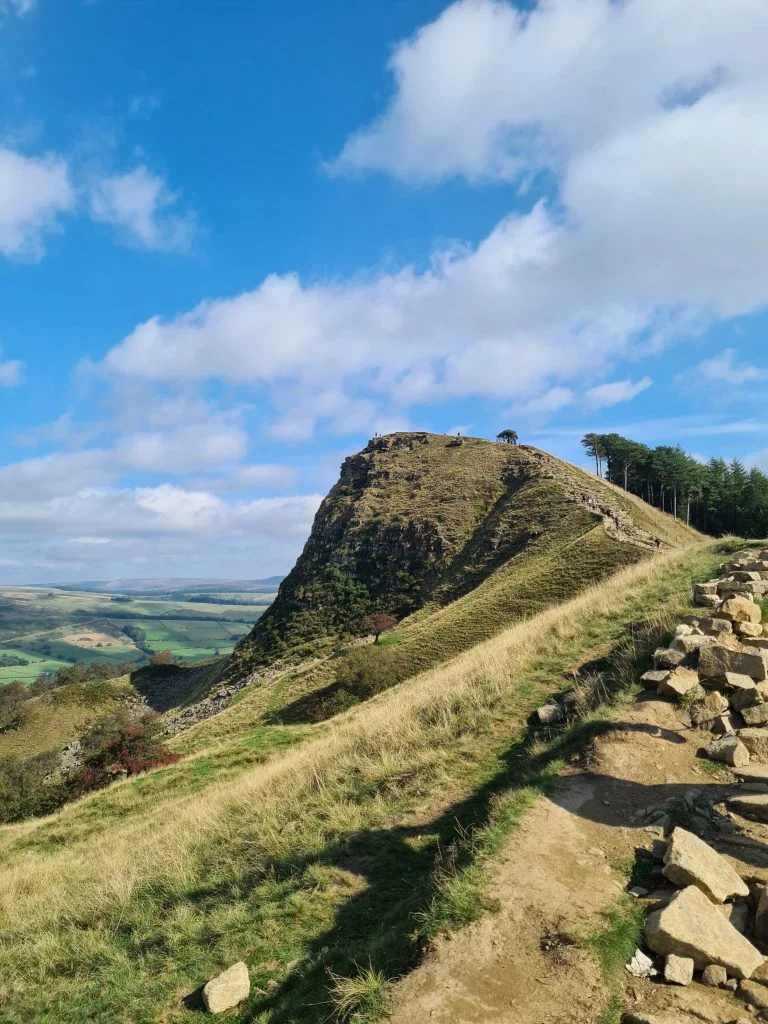
We followed The Great Ridge across to Back Tor for another short steep climb. Back Tor is another Peak District peak which stands at 476m above sea level. At the top of Back Tor are loads of mini cairns which people have built. Unfortunately it was way too busy for me to take a photo of the cairns as there were people all over, but they look good. There’s also a very Instagrammable boulder you can stand on and take a picture looking back towards Mam Tor but again there were so many people on it I couldn’t be bothered queuing for it. Update! I got on The Boulder when we did the mini Edale Skyline walk!


Back Tor


Lose Hill summit stone, with lovely compass detail

Looking back to Mam Tor

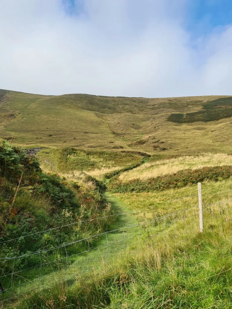
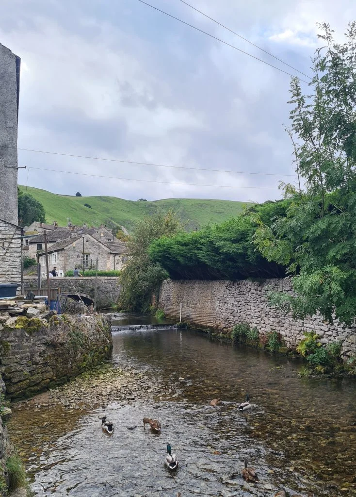
Our route then heads down the hill through farmland towards the pretty village of Castleton. We had booked in lunch at 1pm at the Castle Inn but were late (we did ring and let them know we were running late).


We had a lovely lunch then went to have a look around the intriguingly named The Devil’s Arse cave. It looked impressive from the outside but I was loathed to pay £16 each to go into a cave – I hate caves.


The entrance to The Devil's Arse

The entrance to The Devil’s Arse

We then set off from Castleton back to where we had parked the cars.


All in all this circular walk was 11.4km and was nicely broken up by the pub lunch. It meant that Hols and her friend had chance for a rest and an ice cream refuel before tackling the last part back to the car.

Here’s the route for this Mam Tor – Castleton Walk:


Route Map (Opens in OS Maps): Castleton to Mam Tor and The Great Ridge Walk

Parking: On street at the bottom of Mam Tor. Alternatively you can park in the National Trust car park S33 8WA.

Facilities: There are pubs in Castleton

Walk Time: 2-3 hours

Distance: 7 miles (11km) approximately

Trig Points Bagged: Mam Tor

Peak District Peaks Bagged: Mam Tor, Lose Hill

Peak District Ethels Bagged: Mam Tor, Lose Hill


If you decide to go on this Castleton, Mam Tor and The Great Ridge walk I’d pick a day that wasn’t as busy as when we went! We had blue skies and lovely weather so should have gone early or on another day to avoid the crowds. It does get really busy with people watching the Mam Tor sunrise as well.

Views towards Mam Tor with the Broken Road to the left of the image


How long is the Mam Tor walk?

This Mam Tor circular walk was 11.4km but you could just climb Mam Tor and go back down again, which apparently takes just 15 minutes. There are many different routes you can take to climb Mam Tor and many different lengths of walk you can do.


Is Mam Tor kid friendly?

Yes, Mam Tor is kid friendly. The paths are paved and relatively easy for little legs to climb up. It is steep however.


How long does it take to climb Mam Tor?

It took us roughly 45 minutes to get from the cars, over the Broken Road and up to the summit of Mam Tor. I think there was only one snack stop on the way, plus a bin run to Blue John Cavern, so it would probably have taken around 35 minutes. It’s a relatively easy Peak District walk.


You can park nearer in Mam Nick Car Park and just do part of this Mam Tor walk, just climbing Mam Tor up and down again. This wouldn’t take long at all, and is probably the reason Mam Tor is so popular! It’s a great place to watch sunrises in the Peak District.


Mam Tor is one of those rare beasts in the Peak District – a hill which has a trig point, is an Ethel and is a peak! Wahoo! It features on the Peak Bagging challenge list, the List of Peak District Ethels and the Trig Bagging Checklist so I’m very happy.


There are some lovely walks in Castleton, and the village itself is well worth a trip out.


You might also like: Lose Hill and Win Hill


Tap to share with your hiking friends!

  • Facebook
  • Email
  • WhatsApp
« Pule Hill Circular Walk | 6 Miles
Langsett Reservoir Walk | 4 Miles »

RELATED POSTS

  • Three Shires HeadHow to Find Three Shires Head
  • Hathersage Stepping StonesHathersage Stepping Stones Walk | 7 Miles
  • Ladybower ReservoirLadybower Walk | 6 Miles
  • Crowden Clough Scramble Walk - The Wandering WildflowerCrowden Clough to Kinder Scout Walk | 8 Miles

Leave a Reply Cancel reply

Your email address will not be published. Required fields are marked *

FIND YOUR NEXT WALK:

ABOUT ME

Y Garn with Kids - Y Garn via the Devil's Kitchen Walk in Ogwen Valley

Hello! I’m Jo! Welcome to The Wandering Wildflower, an outdoors lifestyle blog focusing on family walks in the Peak District, a place we love exploring. I want to share the Peak District hidden gems and show you there’s so much more than the honeypot places. When I’m not dragging my husband and now 11 year old out on Peak District walks or up mountains, I can be found on planning my next moorland walk or plotting a Geocache walk (and seeing where the nearest pub is!). I love the hills but hate the heights, so trig bagging is – er- fun!


I hope this blog will give you some ideas of places to visit in the Peak District and inspire you and your family to head into the great outdoors.  Thanks for stopping by!

CATEGORIES

  • CIRCULAR WALKS (189)
  • HOLMFIRTH WALKS (27)
  • ISLE OF SKYE WALKS (3)
  • LAKE DISTRICT WALKS (26)
  • LANCASHIRE WALKS (2)
  • LONG PEAK DISTRICT WALKS 10 MILES + (42)
  • MEDIUM WALKS 4-9 MILES (137)
  • PEAK DISTRICT SCRAMBLES (16)
  • PEAK DISTRICT WALKS (206)
  • PEAK DISTRICT WALKS WITH KIDS (76)
  • PEAK DISTRICT WALKS WITH PUBS (60)
  • SCOTLAND WALKS (6)
  • SHORT WALKS UNDER 3 MILES (40)
  • SNOWDONIA WALKS (5)
  • UK CAMPING (5)
  • YORKSHIRE WALKS (33)

Peak District Walks

List of Peak District Ethels

Peak District Peak Bagging

Peak District Trig Point Challenge

Peak District Walks with Pubs

Peak District Walks with Kids

Beautiful Walks in Holmfirth

Short Walks in the Peak District

Long Walks in the Peak District

AFFILIATE DISCLOSURE

This blog may contain affiliate links through which, at no additional cost to you, I may earn a small commission. I only recommend products I would use myself and all opinions expressed here are my own. As an Amazon Associate I earn from qualifying purchases. Read full privacy policy here.

ARCHIVES

PEAK DISTRICT WEATHER

Peak District mountain weather on Met Office

Peak District Trig Points

Promo image for a blog post about the Peak District Trig Point Challenge With Map of Peak District Trig Points and Walking Routes by The Wandering Wildflower

Peak District Ethels Challenge

Promo image for a blog post about the Peak District Trig Point Challenge With Map of Peak District Ethels and Walking Routes by The Wandering Wildflower

WALKING ROUTES STRAIGHT TO YOUR INBOX

Want new walks in your inbox? Drop your email below and I'll send you some ideas for walks you can try.

You can unsubscribe anytime. For more details, review our Privacy Policy.

Thank you!

You have successfully joined our subscriber list.

RSS LATEST POSTS

  • How to Find Three Shires Head
  • Peak District Pub Walks
  • Burnbank Fell, Blake Fell and Gavel Fell | 8 Miles
  • Bretton Park Circular Walk | 3 Miles
  • Grasmere Weekend Break

FOLLOW ON PINTEREST

Want new walks in your inbox? Drop your email below and I'll send you some ideas for walks you can try.

You can unsubscribe anytime. For more details, review our Privacy Policy.

Thank you!

You have successfully joined our subscriber list.

jo@thewanderingwildflower.co.uk

The Wandering Wildflower

  • Email
  • Facebook
  • Instagram
  • Pinterest
  • PRIVACY POLICY
  • TERMS & CONDITIONS
  • ABOUT

(c) The Wandering Wildflower. All Rights Reserved.

|| THEME BY ECLAIR DESIGNS