• 3 Mile Walks or Less
  • 4 Mile Walks
  • 5 Mile Walks
  • 6 Mile Walks
  • 7 Mile Walks
  • 8 Mile Walks
  • 9 Mile Walks
  • 10 Mile Walks
  • 11 Mile Walks
  • 12 Mile Walks
  • 14 Mile Walks
  • 15 Mile Walks
  • 20+ Mile Walks

The Wandering Wildflower

Peak District Hikes

  • PEAK DISTRICT WALKS
    • SHORT WALKS UNDER 3 MILES
    • MEDIUM WALKS 4-9 MILES
    • LONG PEAK DISTRICT WALKS 10 MILES +
  • PEAK DISTRICT WALKS WITH PUBS
  • PEAK DISTRICT WALKS WITH KIDS
  • HOLMFIRTH WALKS

Marsden Moor Circular Walk | 11 Miles

February 21, 2023 PEAK DISTRICT WALKS, YORKSHIRE WALKS

This Marsden Moor walk explores the beautiful waterfalls in Wessenden Valley before heading up onto the Marsden Moors via Swellands and Black Moss Reservoir, and then over to Standedge, Broadstone Edge and then back down into Marsden via the iconic Eastergate Bridge. It’s just over 11 miles long.

Eastergate Bridge in Marsden

If you are looking for a nice, peaceful walk on the Marsden Moors, with amazing views, this is the walk for you! This 11.3 mile walk is a route inspired by @mellywellywoo. I’ve been doing more trail running over the last few months, and this is a great route to run but it also makes a lovely walk. I should call it something like the 5 Reservoirs Walk (a baby brother to the 10 Reservoirs Walk!) but I’ll stick with Marsden Moor walk for now!


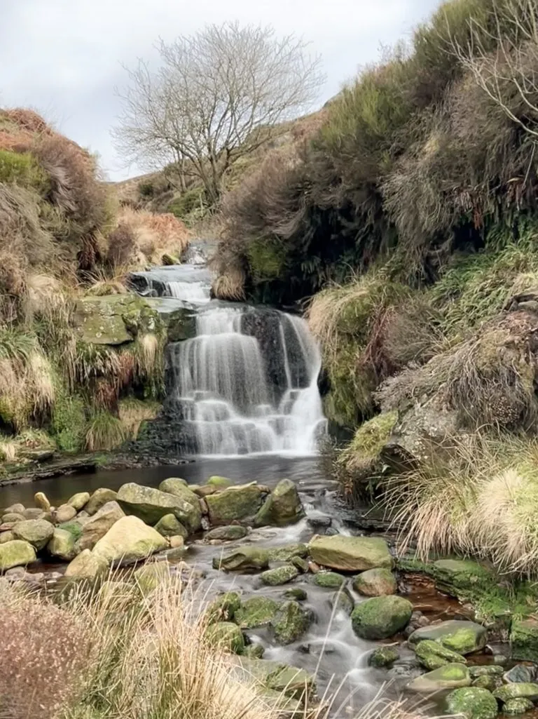
I parked on Binn Lane in Marsden, near the entrance to Butterley Reservoir, where there is a small layby. I then ran along the track (Wessenden Lane) next to Butterley Reservoir and Blakely Reservoir before reaching the deer farm. Across from the deer farm is one of the amazing waterfalls in the Wessenden Valley. You can climb carefully down to Wessenden Brook in the valley bottom and if the water’s not too high, there are some stepping stones to get you across to the actual waterfall. I’d picked a very wet day and the brook was too high for me to cross safely (or without getting soaked).

Blake Clough waterfall

This blog may contain affiliate links through which, at no additional cost to you, I may earn a small commission. I only recommend products I would use myself and all opinions expressed here are my own. Read full privacy policy here.


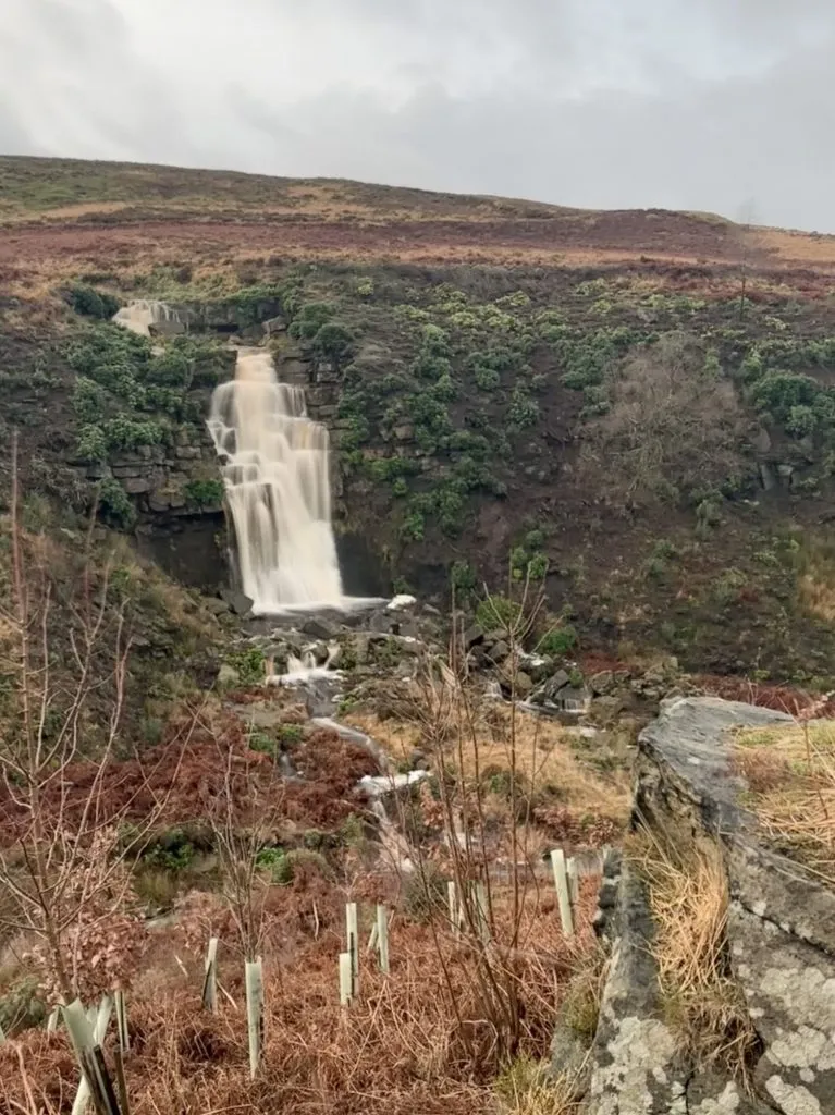
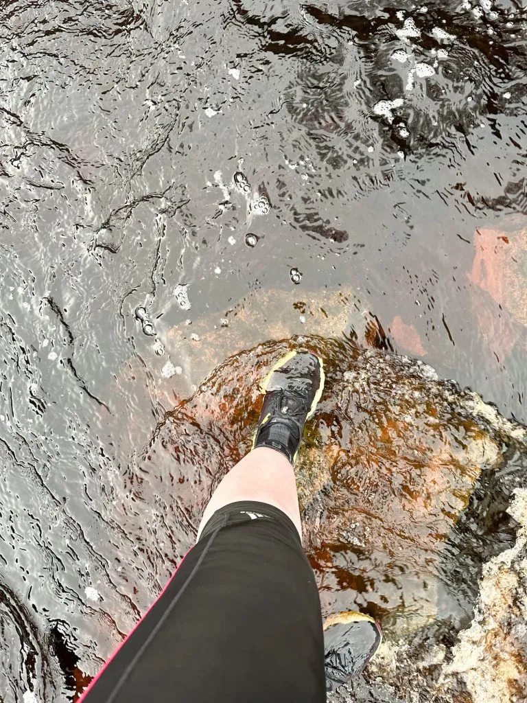
I then climbed back up the banking and carried on over the dam wall for Wessenden Reservoir, the next one in the chain of 4 reservoirs in this valley. Turning right after the dam wall, the path winds around the hillside until you come to yet another amazing waterfall. This is Blake Clough and it tumbles over into some manmade structure – presumably a weir or something – I’m not up on my reservoir engineering jargon unfortunately! Again, there are stepping stones to get across and if the water is high you’ll get wet feet as there’s no other way to cross unfortunately. I got wet trainers but had waterproof socks on. They also stock waterproof socks in Peak Footwear in Holmfirth if you prefer to shop local.

Blakely Clough waterfall

Someone crossing a river on stepping stones - the water level is higher than the trainers!

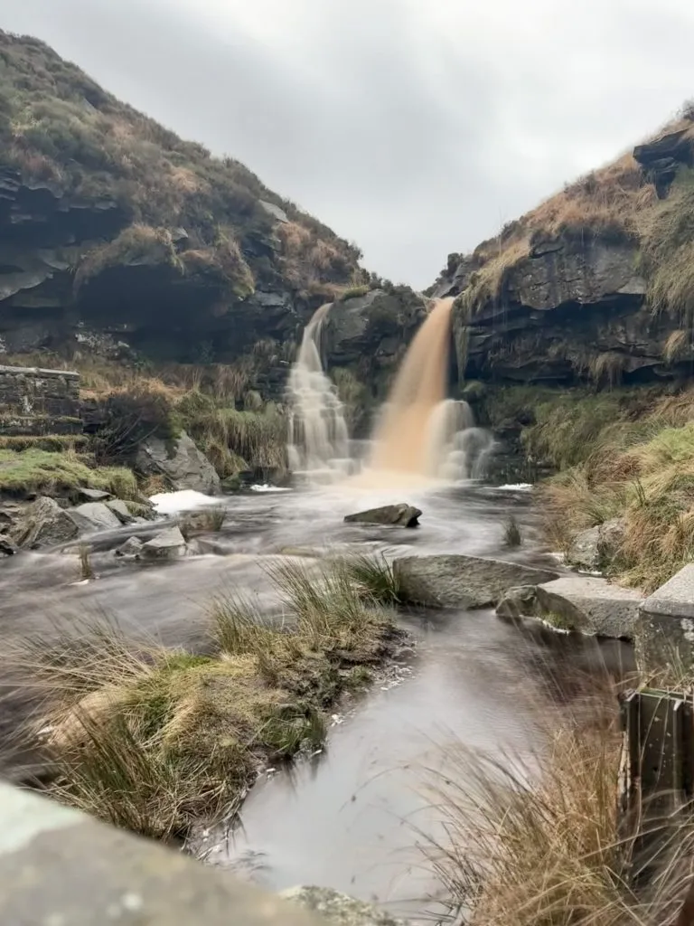
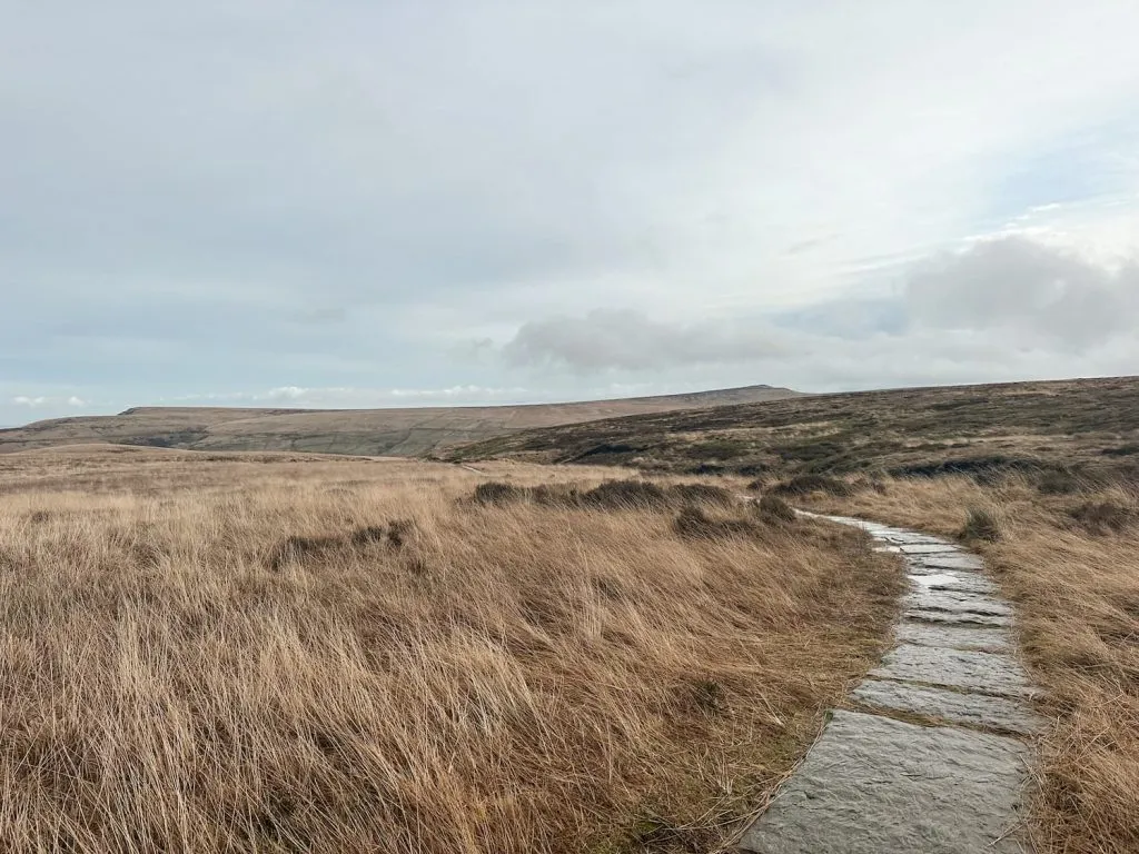
The path continues round the hillside and crosses Blakely Clough, then heads up some steps onto a paved section of the Pennine Way. The route continues out onto the moors, running alongside Blakely Clough, until it reached Black Moss Reservoir. I ran along the edge of the reservoir and had to detour from the path a little as there were some engineering works going on, but then turned left to head along the top edge of the reservoir.

Looking back along the Pennine Way

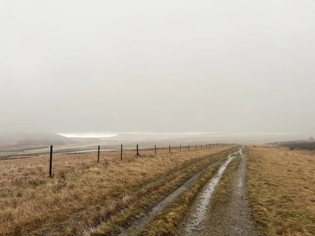
The path turns left and heads over the moors, where you have amazing views over to Pule Hill and Redbrook Reservoir. There’s a fork in the path and I ran along the gamekeepers/reservoir engineers track to Manchester Road.

A track leading to Manchester Road

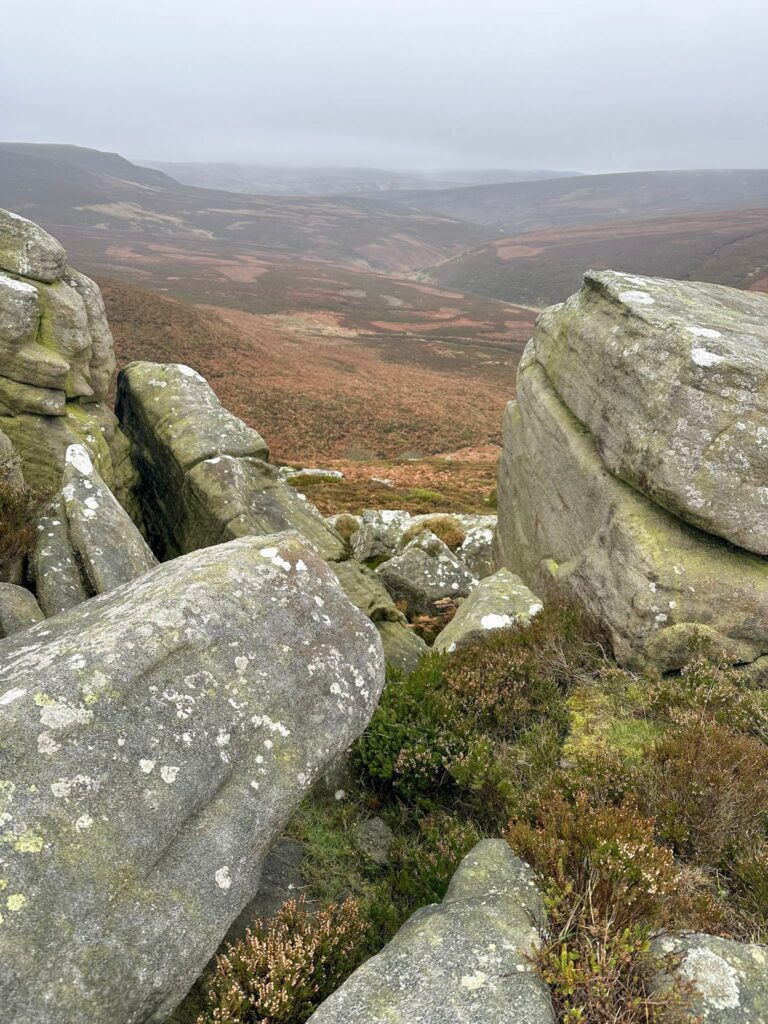
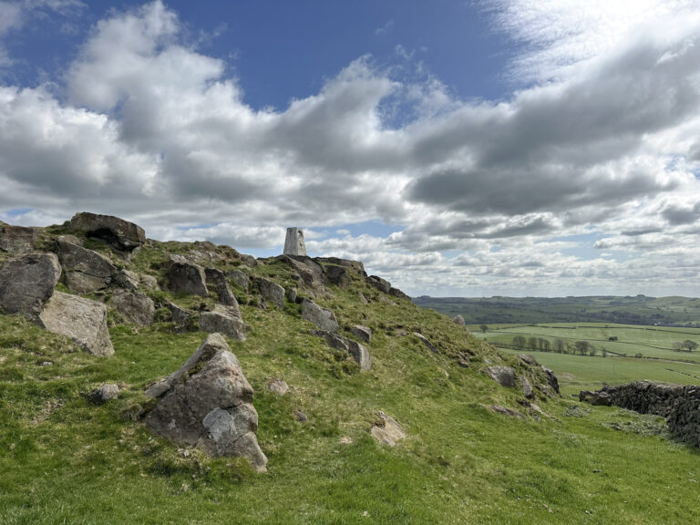
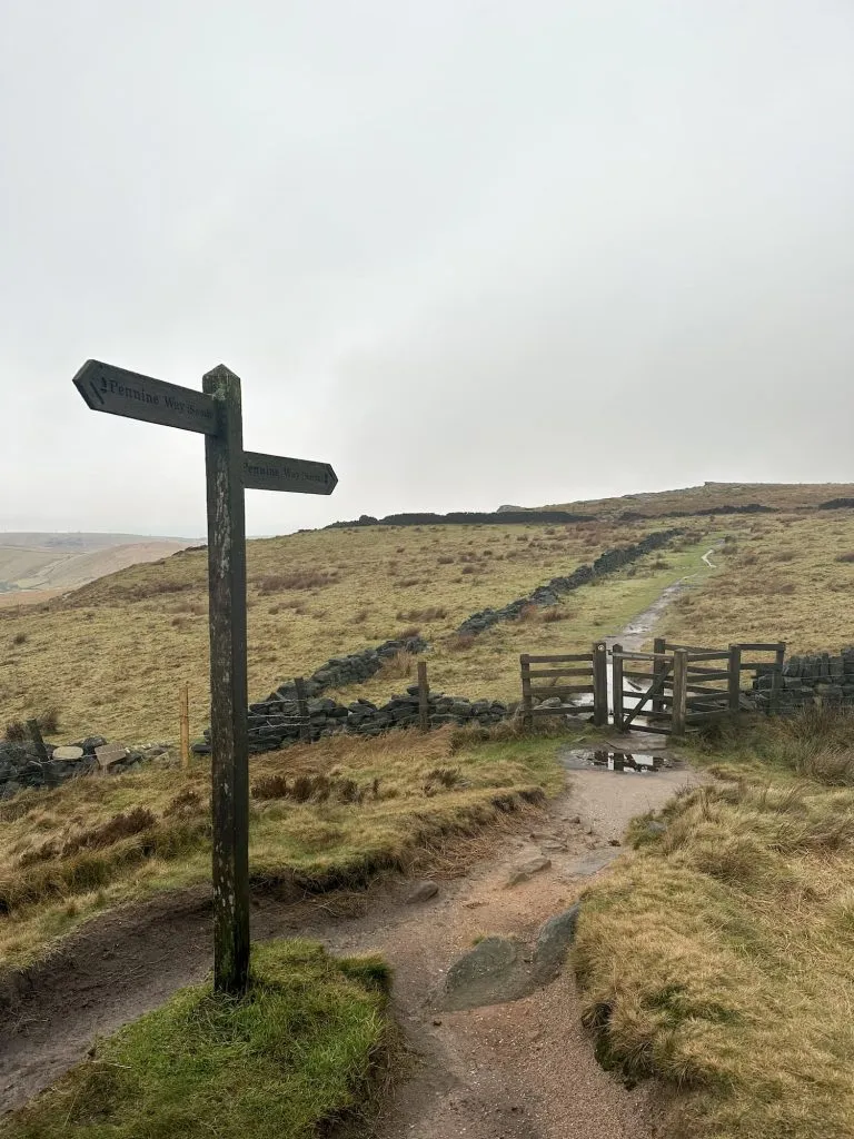
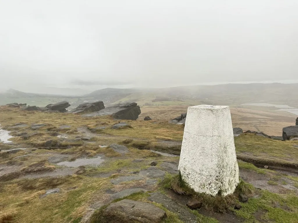
After crossing the busy road, I then headed off along the Pennine Way again along Broadstone Edge to the trig point. On a clear day there are great views from here!

A wooden signpost on the Pennine Way

Broadstone Hill trig point

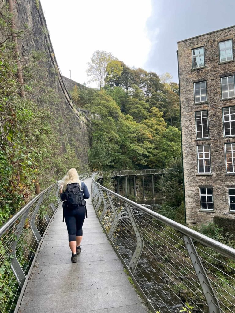
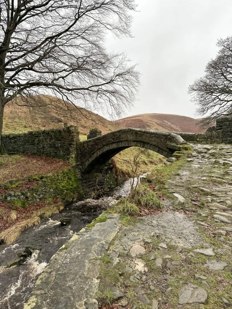
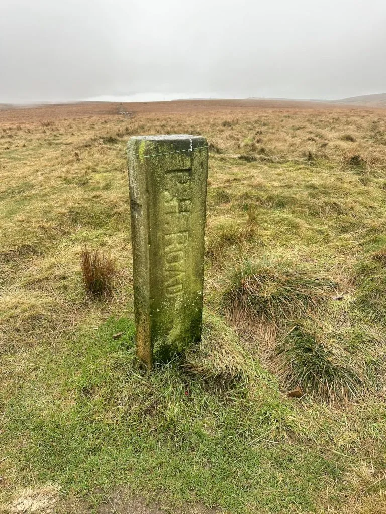
The route then continues along the former packhorse route down into Marsden, passing the P H Road markers on the way to the iconic Eastergate Bridge. This bridge is actually known as Close Gate Bridge, but is thought to have been named as Eastergate because of a lady named Esther who lived in an inn nearby.

Ancient Packhorse Route Marker

Eastergate Bridge in Marsden

From Eastergate Bridge, the route heads along the road for a short while before heading past Standedge Tunnel Visitor Centre and then along the canal, back into Marsden centre and then back to the car.


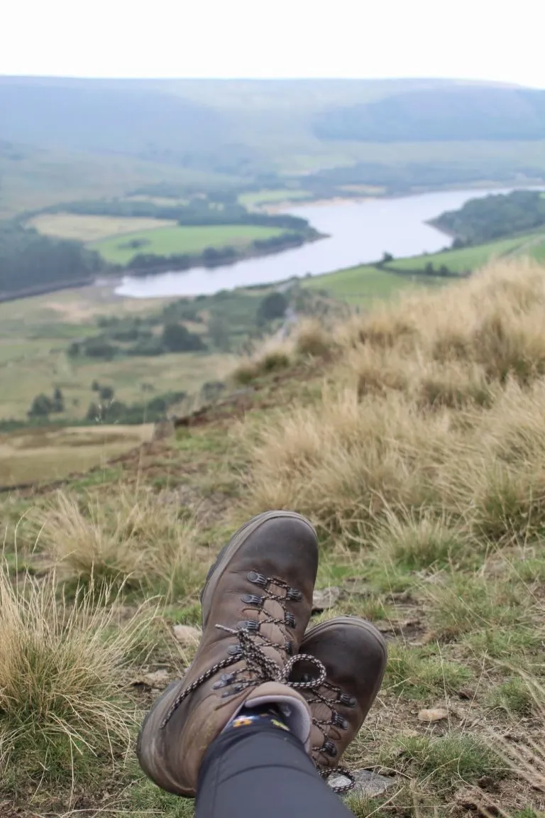
I picked a very wet and murky day for this Marsden Moor walk, so I apologise for the photos! You can see how beautiful the Wessenden Valley here: Circular Walk from Marsden to Wessenden Head and Eastergate Bridge here: Walk to Eastergate Bridge.


Marsden Moor Walk Map: 


Walk Map (Opens in OS Maps): Marsden Moors Circular Walk

Parking: A layby on Binn Road, Marsden

Facilities: None (there are cafes and shops in Marsden)

Walk Time: 3-4 hours

Difficulty: ▲▲▲

Distance: 11.3 miles (18.2km)

Trig Points Bagged: Broadstone Hill (it’s not on the Peak District trig point list though)

Peak District Peaks Bagged: None

Peak District Ethels Bagged: None


Tap to share with your hiking friends!

  • Facebook
  • Email
  • WhatsApp
« Steall Falls – A Waterfall Walk in Glen Nevis | 3 Miles
Old Man of Storr Walk | 5 Miles »

RELATED POSTS

  • Hathersage Stepping StonesHathersage Stepping Stones Walk | 7 Miles
  • Ladybower ReservoirLadybower Walk | 6 Miles
  • Anvil Stone, GrindsbrookGrindsbrook Clough Scramble to Grindslow Knoll | 7 Miles
  • Circular Walk from Marsden to Wessenden Head | 6 Miles

Leave a Reply Cancel reply

Your email address will not be published. Required fields are marked *

FIND YOUR NEXT WALK:

ABOUT ME

Y Garn with Kids - Y Garn via the Devil's Kitchen Walk in Ogwen Valley

Hello! I’m Jo! Welcome to The Wandering Wildflower, an outdoors lifestyle blog focusing on family walks in the Peak District, a place we love exploring. I want to share the Peak District hidden gems and show you there’s so much more than the honeypot places. When I’m not dragging my husband and now 11 year old out on Peak District walks or up mountains, I can be found on planning my next moorland walk or plotting a Geocache walk (and seeing where the nearest pub is!). I love the hills but hate the heights, so trig bagging is – er- fun!


I hope this blog will give you some ideas of places to visit in the Peak District and inspire you and your family to head into the great outdoors.  Thanks for stopping by!

CATEGORIES

  • CIRCULAR WALKS (189)
  • HOLMFIRTH WALKS (27)
  • ISLE OF SKYE WALKS (3)
  • LAKE DISTRICT WALKS (26)
  • LANCASHIRE WALKS (2)
  • LONG PEAK DISTRICT WALKS 10 MILES + (42)
  • MEDIUM WALKS 4-9 MILES (137)
  • PEAK DISTRICT SCRAMBLES (16)
  • PEAK DISTRICT WALKS (206)
  • PEAK DISTRICT WALKS WITH KIDS (76)
  • PEAK DISTRICT WALKS WITH PUBS (60)
  • SCOTLAND WALKS (6)
  • SHORT WALKS UNDER 3 MILES (40)
  • SNOWDONIA WALKS (5)
  • UK CAMPING (5)
  • YORKSHIRE WALKS (33)

Peak District Walks

List of Peak District Ethels

Peak District Peak Bagging

Peak District Trig Point Challenge

Peak District Walks with Pubs

Peak District Walks with Kids

Beautiful Walks in Holmfirth

Short Walks in the Peak District

Long Walks in the Peak District

AFFILIATE DISCLOSURE

This blog may contain affiliate links through which, at no additional cost to you, I may earn a small commission. I only recommend products I would use myself and all opinions expressed here are my own. As an Amazon Associate I earn from qualifying purchases. Read full privacy policy here.

ARCHIVES

PEAK DISTRICT WEATHER

Peak District mountain weather on Met Office

Peak District Trig Points

Promo image for a blog post about the Peak District Trig Point Challenge With Map of Peak District Trig Points and Walking Routes by The Wandering Wildflower

Peak District Ethels Challenge

Promo image for a blog post about the Peak District Trig Point Challenge With Map of Peak District Ethels and Walking Routes by The Wandering Wildflower

WALKING ROUTES STRAIGHT TO YOUR INBOX

Want new walks in your inbox? Drop your email below and I'll send you some ideas for walks you can try.

You can unsubscribe anytime. For more details, review our Privacy Policy.

Thank you!

You have successfully joined our subscriber list.

RSS LATEST POSTS

  • How to Find Three Shires Head
  • Peak District Pub Walks
  • Burnbank Fell, Blake Fell and Gavel Fell | 8 Miles
  • Bretton Park Circular Walk | 3 Miles
  • Grasmere Weekend Break

FOLLOW ON PINTEREST

Want new walks in your inbox? Drop your email below and I'll send you some ideas for walks you can try.

You can unsubscribe anytime. For more details, review our Privacy Policy.

Thank you!

You have successfully joined our subscriber list.

jo@thewanderingwildflower.co.uk

The Wandering Wildflower

  • Email
  • Facebook
  • Instagram
  • Pinterest
  • PRIVACY POLICY
  • TERMS & CONDITIONS
  • ABOUT

(c) The Wandering Wildflower. All Rights Reserved.

|| THEME BY ECLAIR DESIGNS