• 3 Mile Walks or Less
  • 4 Mile Walks
  • 5 Mile Walks
  • 6 Mile Walks
  • 7 Mile Walks
  • 8 Mile Walks
  • 9 Mile Walks
  • 10 Mile Walks
  • 11 Mile Walks
  • 12 Mile Walks
  • 14 Mile Walks
  • 15 Mile Walks
  • 20+ Mile Walks

The Wandering Wildflower

Peak District Hikes

  • PEAK DISTRICT WALKS
    • SHORT WALKS UNDER 3 MILES
    • MEDIUM WALKS 4-9 MILES
    • LONG PEAK DISTRICT WALKS 10 MILES +
  • PEAK DISTRICT WALKS WITH PUBS
  • PEAK DISTRICT WALKS WITH KIDS
  • HOLMFIRTH WALKS

Winnats Pass and Mam Tor Circular Walk | 6 Miles

December 27, 2022 CIRCULAR WALKS, MEDIUM WALKS 4-9 MILES, PEAK DISTRICT WALKS

Pinterest image -Winnats Pass, Mam Tor and The Great Ridge Walk - The Wandering Wildflower

This Winnats Pass walk is a short walk along Winnats Pass and then heads off over The Broken Road to Hollins Cross before heading along The Great Ridge to Back Tor and Lose Hill, before returning along the ridge to Mam Tor. This walk is 6.3 miles.

A woman walking along the top of Winnats Pass with a mist in the background

After our amazing sunrise at Win Hill, we got up extra early again and headed to Winnats Pass, eager for another stunning sunrise. Unfortunately the weather wasn’t on our side and we ended up with just mist, fog and more mist as the sun came up. We had planned to walk along The Broken Road and up to Hollins Cross before walking back up Mam Tor as a little walk before we set off home from our staycation, but we ended up walking along the whole ridge to Back Tor and Lose Hill before heading back along the ridge to Mam Tor. After we’d walked the ridge and got back to the car, the mist looked like it was clearing so we headed back to Winnats Pass, just in time to catch the last of the mist as it rolled away down to Castleton. The map only shows one trip along Winnats Pass though!


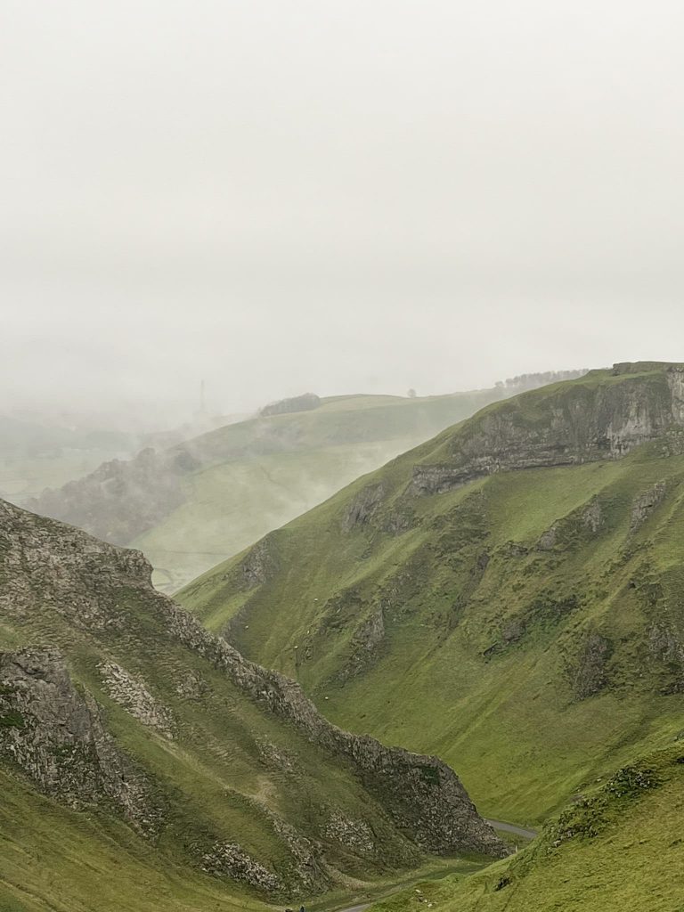
We parked in a lay-by near the top of Winnats Pass and walked down the road to the cattle grid. To the lower side of the cattle grid is a muddy path which climbs up onto the top of the Pass, giving you amazing views down the road towards Castleton.

Winnats Pass cloud inversion - The Wandering Wildflower

From Winnats Pass we headed back down to the cattle grid and across the road to Winnats Head Farm and followed the path through the fields. The path leads past the Blue John Cavern, up onto the non-broken part of The Broken Road. We then turned right to follow The Broken Road, which is really eerie. The Broken Road is the former A625 which collapsed numerous times in the 1970s due to landslides and was finally abandoned in 1979.

The Broken Road near Mam Tor

The Broken Road near Mam Tor

A woman standing on The Broken Road near Mam Tor

The Broken Road near Mam Tor

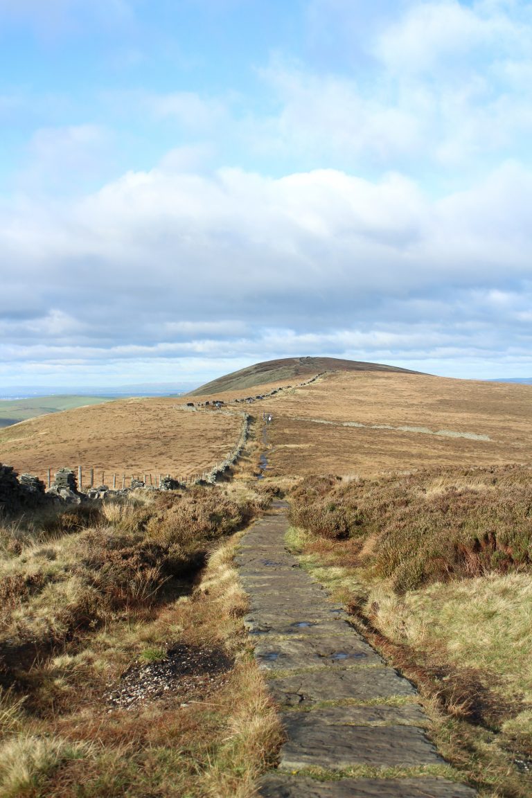
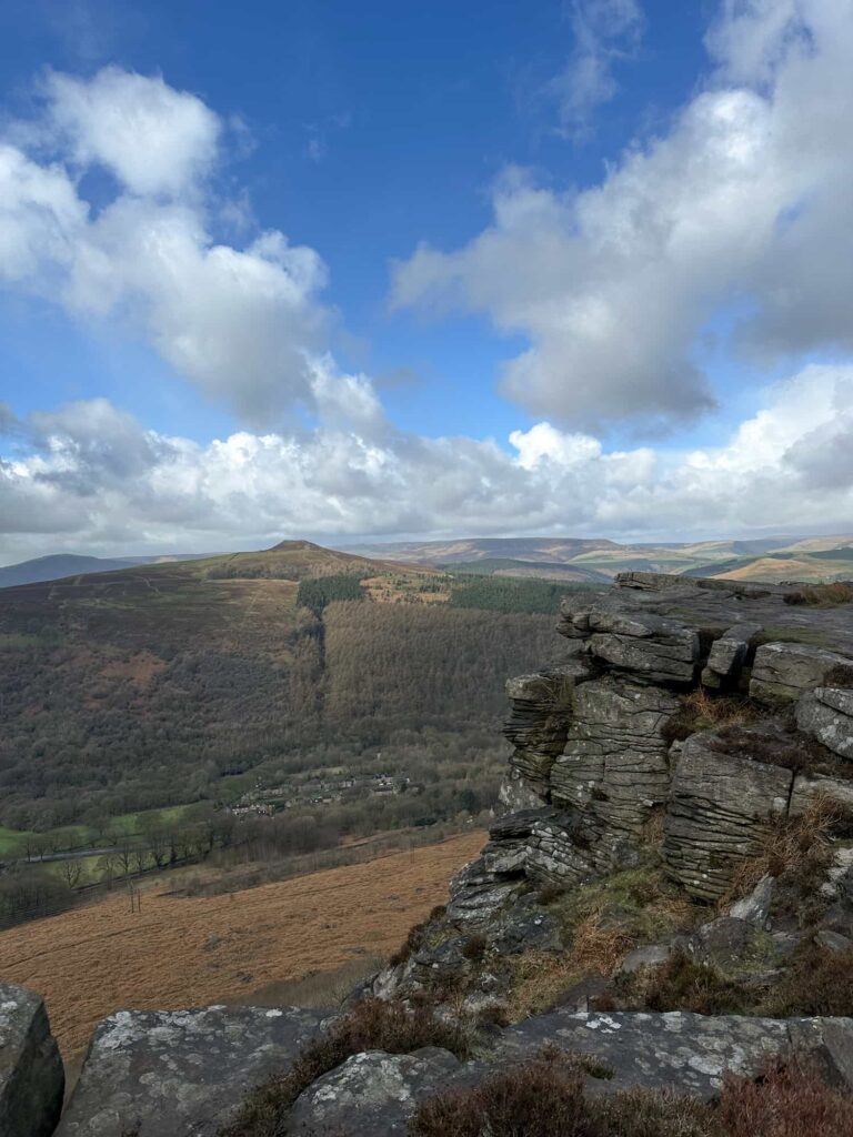
We wandered along the road until we reached Mam Farm then headed up the hillside towards Hollins Cross.  We joined the path that runs along the ridge at one of the gates along The Great Ridge and then walked along past Hollins Cross, climbed up Back Tor and on to Lose Hill before turning around and walking back along The Great Ridge to Mam Tor. It’s really easy to follow the path along here. Large parts are now paved.

Mist near Mam Farm

Back Tor in a cloud inversion

A woman standing on a rock on Back Tor looking along The Great Ridge

The Great Ridge in the mist

Gate on The Great Ridge in the mist

Mam Tor trig point in the mist

From Mam Tor we walked down the steps to the car park, then headed across the fields back to the car. From here we headed off to Winnats Pass again (much to Joel’s annoyance) and managed to watch the mist rolling away down the valley!

Cloud inversion at Winnats Pass

From here you could walk down into Castleton to one of the pubs or cafes.


Walk Map: 


Walk Map (Opens in OS Maps): Winnats Pass, Mam Tor and The Great Ridge

Parking: Lay-by near the top of Winnats Pass – be sure to park in the one with a dashed white line and not the one with a double yellow line! W3W:/// salmon.founders.unzips

Facilities: None

Walk Time: 3-4 hours

Difficulty: ▲▲

Distance: 6.35 miles (10km)

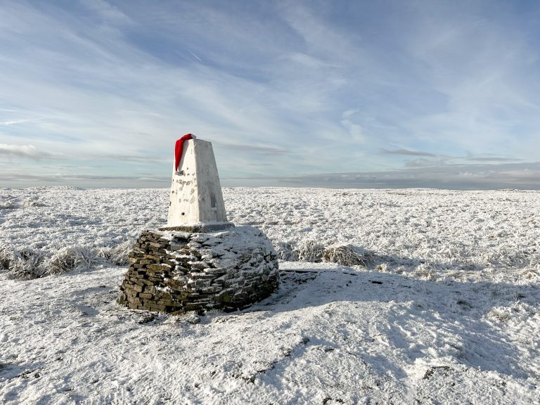
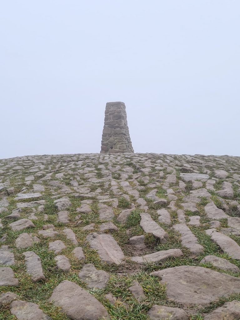
Trig Points Bagged: Mam Tor

Peak District Peaks Bagged: Mam Tor, Lose Hill

Peak District Ethels Bagged: Mam Tor, Lose Hill


For more Mam Tor walks, why not try:


Castleton to Mam Tor Circular Walk via Cave Dale

Mam Tor and Rushup Edge Circular Walk

Mam Tor Short Walk

Castleton, Mam Tor and The Great Ridge Walk

Mini Edale Skyline Circular Walk

Edale Skyline [With GPX File]

Tap to share with your hiking friends!

  • Facebook
  • Email
  • WhatsApp
« Teggs Nose Country Park Short Walk | 2 Miles
Derwent Reservoirs Circular (Dambusters Challenge Walk) »

RELATED POSTS

  • Hathersage Stepping StonesHathersage Stepping Stones Walk | 7 Miles
  • Ladybower ReservoirLadybower Walk | 6 Miles
  • Anvil Stone, GrindsbrookGrindsbrook Clough Scramble to Grindslow Knoll | 7 Miles
  • A very moody rainswept Back Tor, a large collection of gritstone bouldersLost Lad and Back Tor with Abbey Brook | 10 Miles

Leave a Reply Cancel reply

Your email address will not be published. Required fields are marked *

FIND YOUR NEXT WALK:

ABOUT ME

Y Garn with Kids - Y Garn via the Devil's Kitchen Walk in Ogwen Valley

Hello! I’m Jo! Welcome to The Wandering Wildflower, an outdoors lifestyle blog focusing on family walks in the Peak District, a place we love exploring. I want to share the Peak District hidden gems and show you there’s so much more than the honeypot places. When I’m not dragging my husband and now 11 year old out on Peak District walks or up mountains, I can be found on planning my next moorland walk or plotting a Geocache walk (and seeing where the nearest pub is!). I love the hills but hate the heights, so trig bagging is – er- fun!


I hope this blog will give you some ideas of places to visit in the Peak District and inspire you and your family to head into the great outdoors.  Thanks for stopping by!

CATEGORIES

  • CIRCULAR WALKS (189)
  • HOLMFIRTH WALKS (27)
  • ISLE OF SKYE WALKS (3)
  • LAKE DISTRICT WALKS (26)
  • LANCASHIRE WALKS (2)
  • LONG PEAK DISTRICT WALKS 10 MILES + (42)
  • MEDIUM WALKS 4-9 MILES (137)
  • PEAK DISTRICT SCRAMBLES (16)
  • PEAK DISTRICT WALKS (206)
  • PEAK DISTRICT WALKS WITH KIDS (76)
  • PEAK DISTRICT WALKS WITH PUBS (60)
  • SCOTLAND WALKS (6)
  • SHORT WALKS UNDER 3 MILES (40)
  • SNOWDONIA WALKS (5)
  • UK CAMPING (5)
  • YORKSHIRE WALKS (33)

Peak District Walks

List of Peak District Ethels

Peak District Peak Bagging

Peak District Trig Point Challenge

Peak District Walks with Pubs

Peak District Walks with Kids

Beautiful Walks in Holmfirth

Short Walks in the Peak District

Long Walks in the Peak District

AFFILIATE DISCLOSURE

This blog may contain affiliate links through which, at no additional cost to you, I may earn a small commission. I only recommend products I would use myself and all opinions expressed here are my own. As an Amazon Associate I earn from qualifying purchases. Read full privacy policy here.

ARCHIVES

PEAK DISTRICT WEATHER

Peak District mountain weather on Met Office

Peak District Trig Points

Promo image for a blog post about the Peak District Trig Point Challenge With Map of Peak District Trig Points and Walking Routes by The Wandering Wildflower

Peak District Ethels Challenge

Promo image for a blog post about the Peak District Trig Point Challenge With Map of Peak District Ethels and Walking Routes by The Wandering Wildflower

WALKING ROUTES STRAIGHT TO YOUR INBOX

Want new walks in your inbox? Drop your email below and I'll send you some ideas for walks you can try.

You can unsubscribe anytime. For more details, review our Privacy Policy.

Thank you!

You have successfully joined our subscriber list.

RSS LATEST POSTS

  • How to Find Three Shires Head
  • Peak District Pub Walks
  • Burnbank Fell, Blake Fell and Gavel Fell | 8 Miles
  • Bretton Park Circular Walk | 3 Miles
  • Grasmere Weekend Break

FOLLOW ON PINTEREST

Want new walks in your inbox? Drop your email below and I'll send you some ideas for walks you can try.

You can unsubscribe anytime. For more details, review our Privacy Policy.

Thank you!

You have successfully joined our subscriber list.

jo@thewanderingwildflower.co.uk

The Wandering Wildflower

  • Email
  • Facebook
  • Instagram
  • Pinterest
  • PRIVACY POLICY
  • TERMS & CONDITIONS
  • ABOUT

(c) The Wandering Wildflower. All Rights Reserved.

|| THEME BY ECLAIR DESIGNS