• 3 Mile Walks or Less
  • 4 Mile Walks
  • 5 Mile Walks
  • 6 Mile Walks
  • 7 Mile Walks
  • 8 Mile Walks
  • 9 Mile Walks
  • 10 Mile Walks
  • 11 Mile Walks
  • 12 Mile Walks
  • 14 Mile Walks
  • 15 Mile Walks
  • 20+ Mile Walks

The Wandering Wildflower

Peak District Hikes

  • PEAK DISTRICT WALKS
    • SHORT WALKS UNDER 3 MILES
    • MEDIUM WALKS 4-9 MILES
    • LONG PEAK DISTRICT WALKS 10 MILES +
  • PEAK DISTRICT WALKS WITH PUBS
  • PEAK DISTRICT WALKS WITH KIDS
  • HOLMFIRTH WALKS

Higher Shelf Stones via Ashton Clough Scramble | 6 Miles

June 23, 2022 CIRCULAR WALKS, MEDIUM WALKS 4-9 MILES, PEAK DISTRICT SCRAMBLES, PEAK DISTRICT WALKS, PEAK DISTRICT WALKS WITH KIDS

This Higher Shelf Stones walk explores some of the quieter parts of the Peak District as well as one of the other Peak District plane crash sites, the Dakota C47. This walk involves a couple of Grade 1 scrambles up Ashton Clough to James’s Thorn, down Wigan Clough and up  Dowstones Clough  before heading to the Higher Shelf Stones trig point and the B29 Super Fortress plane crash site near Bleaklow if you fancy a small detour. This walk is 5.7 miles long.

A father and daughter scrambling up a rock face in Ashton Clough, The Peak District - Higher Shelf Stones scramble walk from The Wandering Wildflower

This Higher Shelf Stones walk should only be attempted if you’re comfortable with scrambling over rock using your hands to pull yourself up. There are some very steep sections and parts where the rock is loose.

This blog may contain affiliate links through which, at no additional cost to you, I may earn a small commission. I only recommend products I would use myself and all opinions expressed here are my own. As an Amazon Associate I earn from qualifying purchases. Read full privacy policy here.


I recently bought the book Scrambles in the Dark Peak by Tom Corker and Terry Sleaford which is full of amazing scrambles to do in the north of the Peak District. In the book it mentions a scramble up Ashton Clough to James’s Thorn and a scramble up Dowstones Clough onto Shelf Moor. We added them together to make a longer walk and to be able to spend more time on the moors.


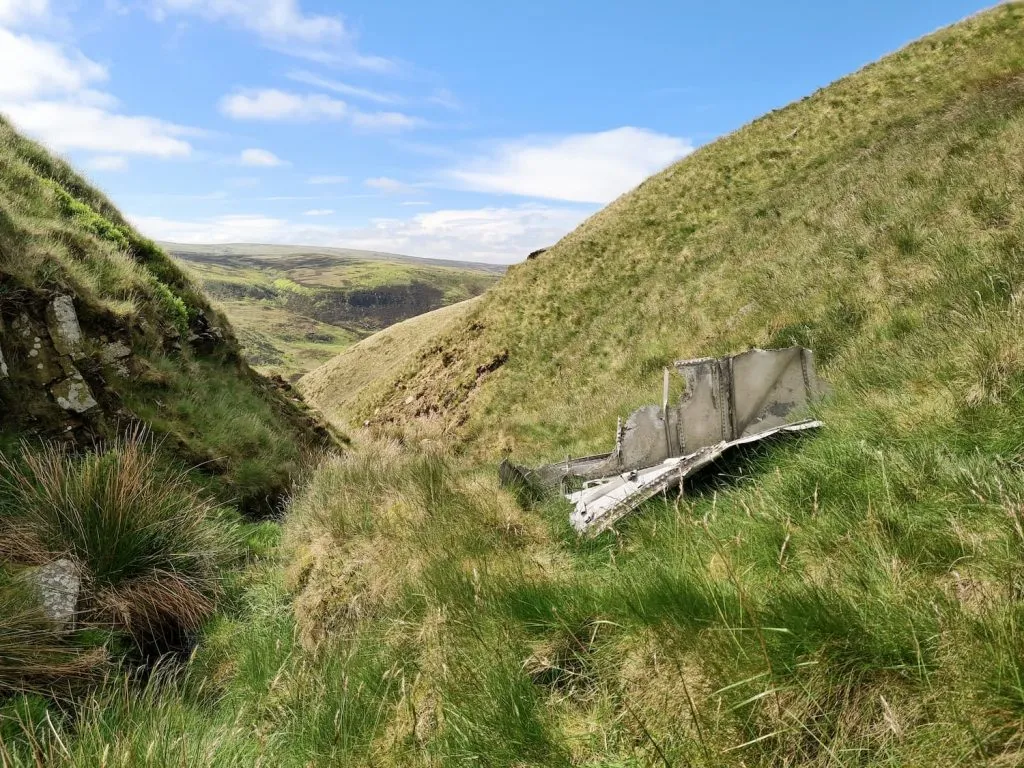
There are about 150 plane crash sites in the Peak District, and there are a fair few of them on Bleaklow and Shelf Moor. Whilst climbing up Ashton Clough you will pass parts of the wreckage of an American C47 Skytrain 2108982 transport plane Dakota which crashed on 24 July 1945, tragically killing everyone on board. Aircrashsites.co.uk has lots of information about the plane crash and the crew members.  The plane crashed on James’s Thorn, just feet away from where a Lancaster Bomber had crashed a few months earlier, and the wreckage was pushed down into Ashton Clough by recovery crews.


The coordinates for part of the C47 Skytrain Dakota crash site are SK 08052 94734. The wreckage was pushed down into the clough and the coordinates are SK 08052 94333.


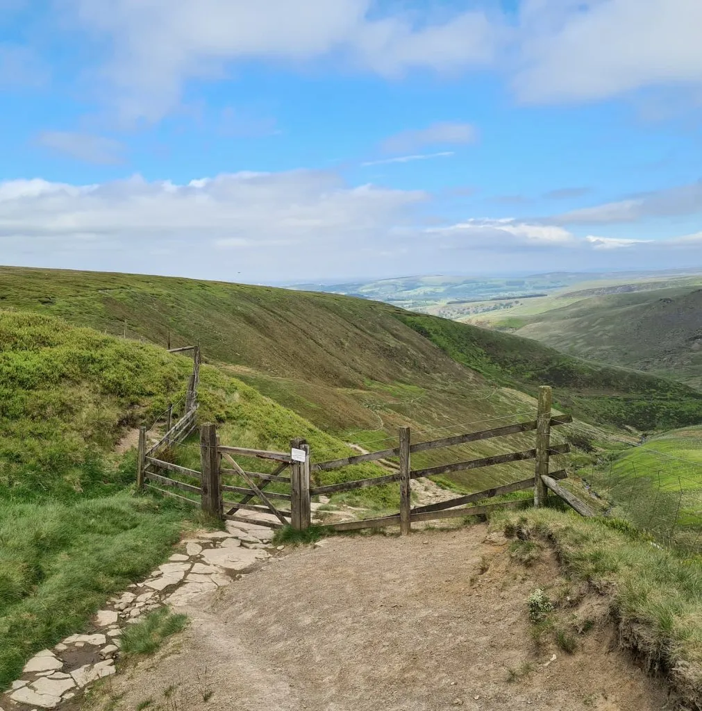
Our walk starts from the car parking lay by on Snake Road, A57. We followed the Pennine Way to Old Woman, then took the left hand turning down Doctors Gate and the old Roman road down towards Glossop. Passing through the gate, we followed the path as it wound through the valley down to Shelf Brook for about 0.8 miles until we saw a pond down in the bottom of the valley, which is just before Ashton Clough.

A wooden gate leading to a trackway through a moorland valley - Doctors Gate path near Higher Shelf Stones

I don’t think this is the actual Doctor’s Gate, but this is a gate on the Doctor’s Gate path!

A moorland view of Ashton Clough and Shelf Moor.

The small pool – I don’t know if it has a name. You can see Ashton Clough on the right hand side of the image.

A moorland clough with spring vegetation.

The base of Ashton Clough. Expect mini waterfalls, rocks to scramble and small pools as you climb up.

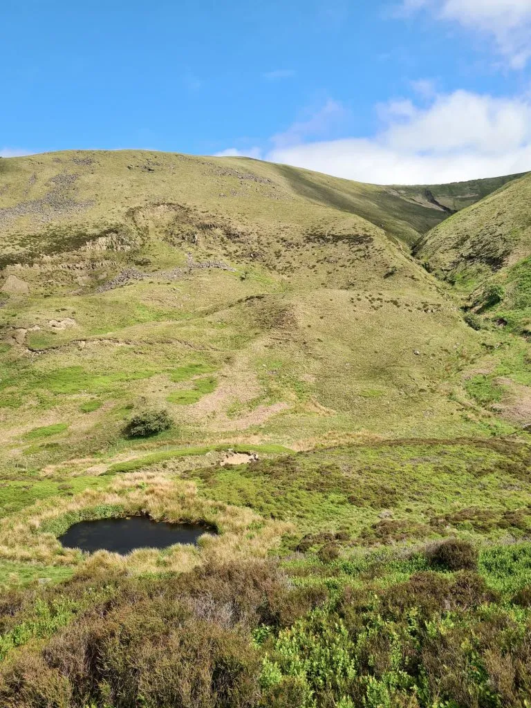
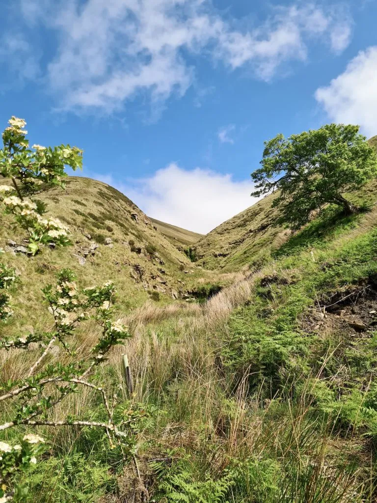
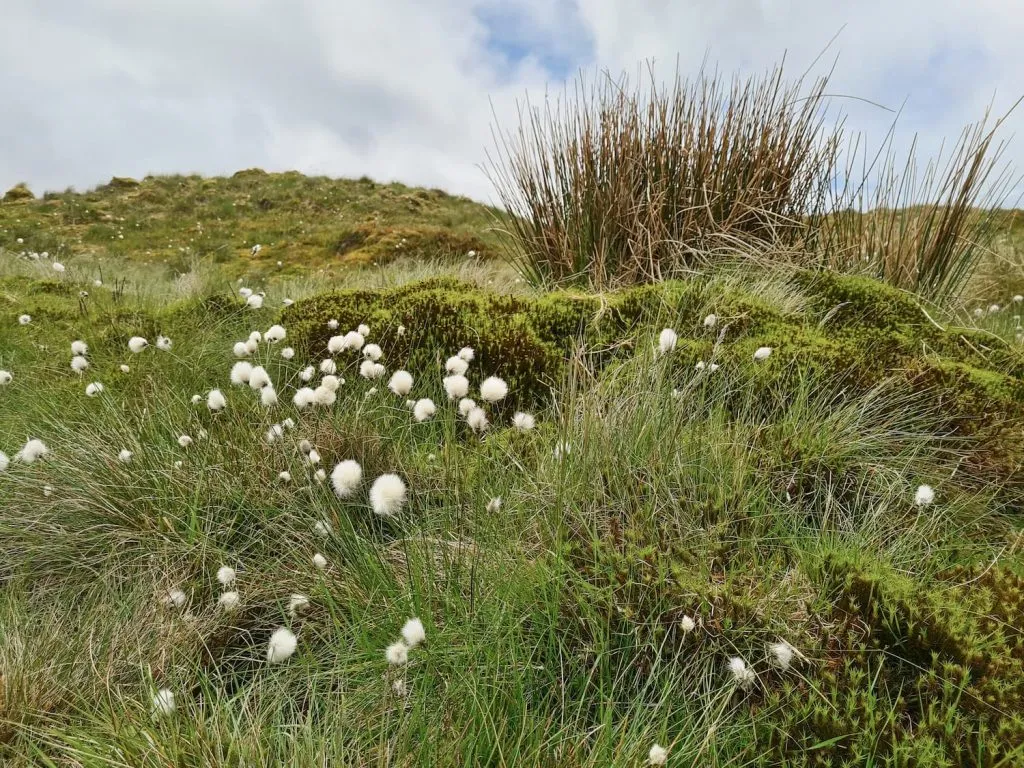
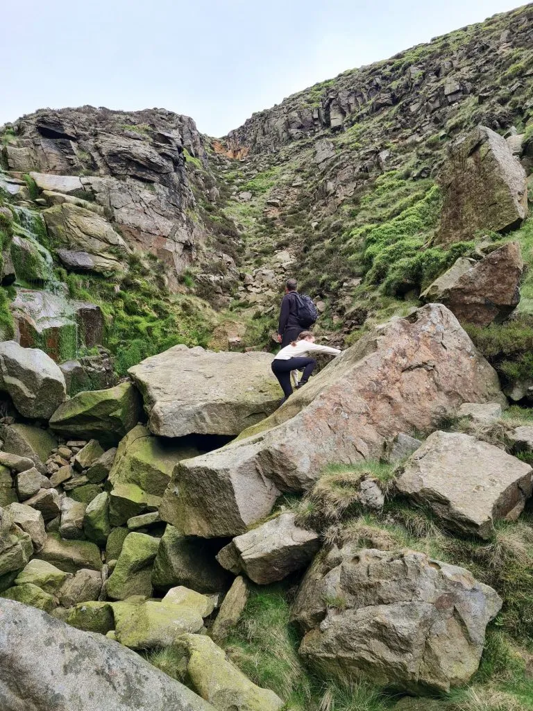
We followed a very faint path through the heather and bilberries down to Shelf Brook and crossed over, before having a quick snack break at the bottom of Ashton Clough.

A small moorland waterfall with plunge pool

A small moorland waterfall with plunge pool

A piece of aircraft wreckage in Ashton Clough from the C47 Dakota

Parts of the C47 Dakota

A piece of aircraft wreckage in Ashton Clough from the C47 Dakota


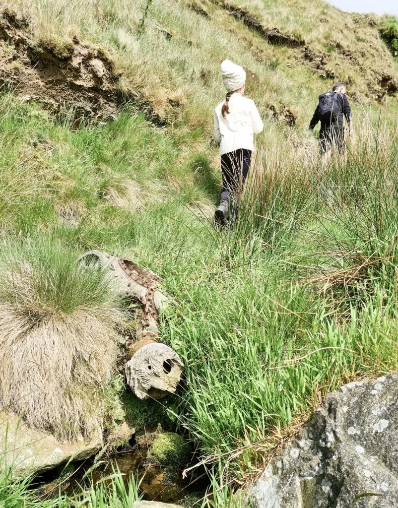
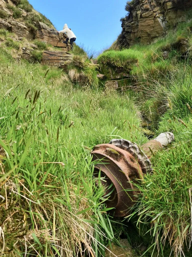
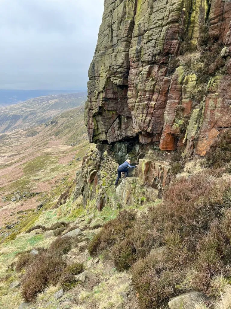
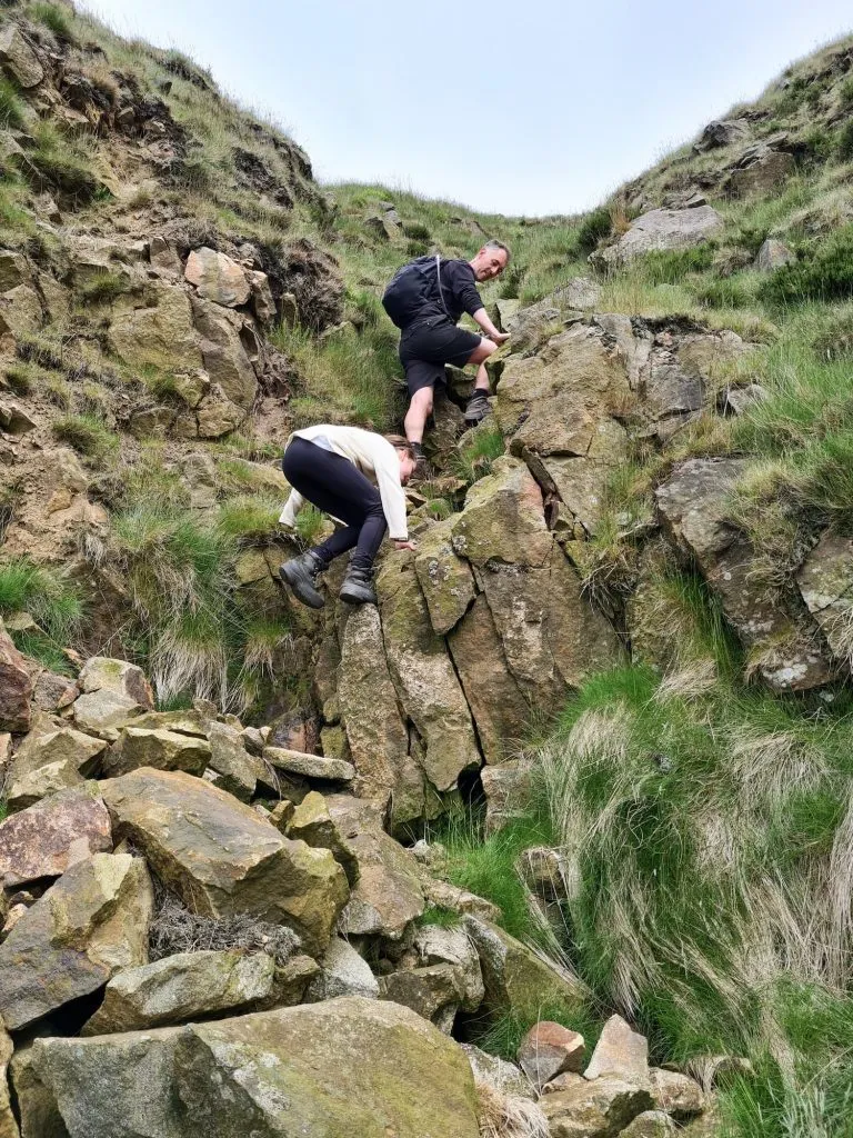
We scrambled up Ashton Clough, finding bits of plane wreckage along the way including wheels, parts of the wing and plane undercarriage strewn in the Clough. Parts have been buried or “reclaimed” over time, but the bits that remain are a poignant reminder of the tragedy. I’m sure someone far more knowledgeable than me will know what all the pieces are!


A piece of aircraft wreckage in Ashton Clough from the C47 Dakota

A piece of aircraft wreckage in Ashton Clough from the C47 Dakota

A piece of aircraft wreckage in Ashton Clough from the C47 Dakota

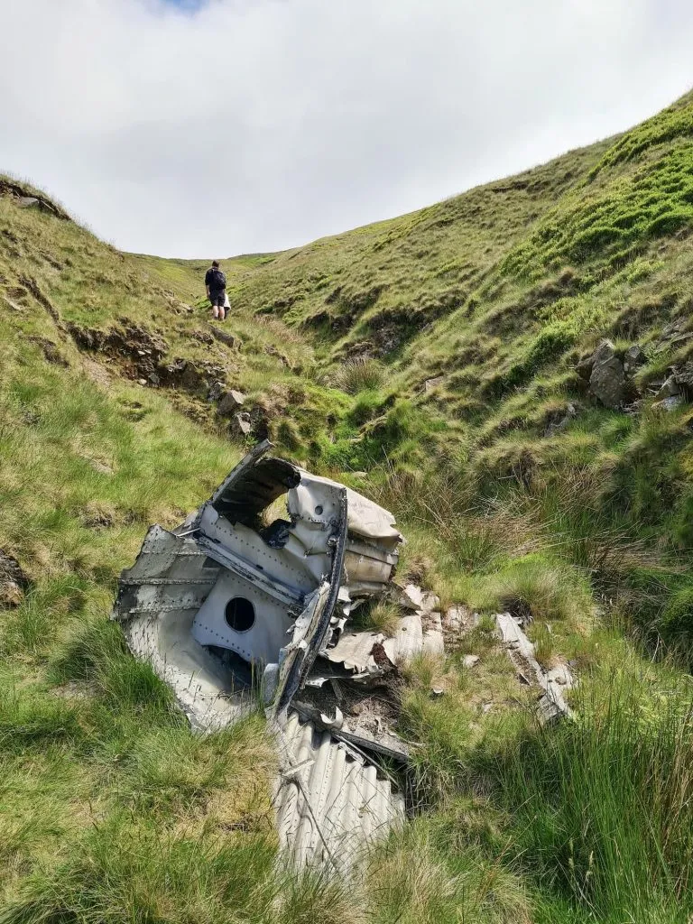
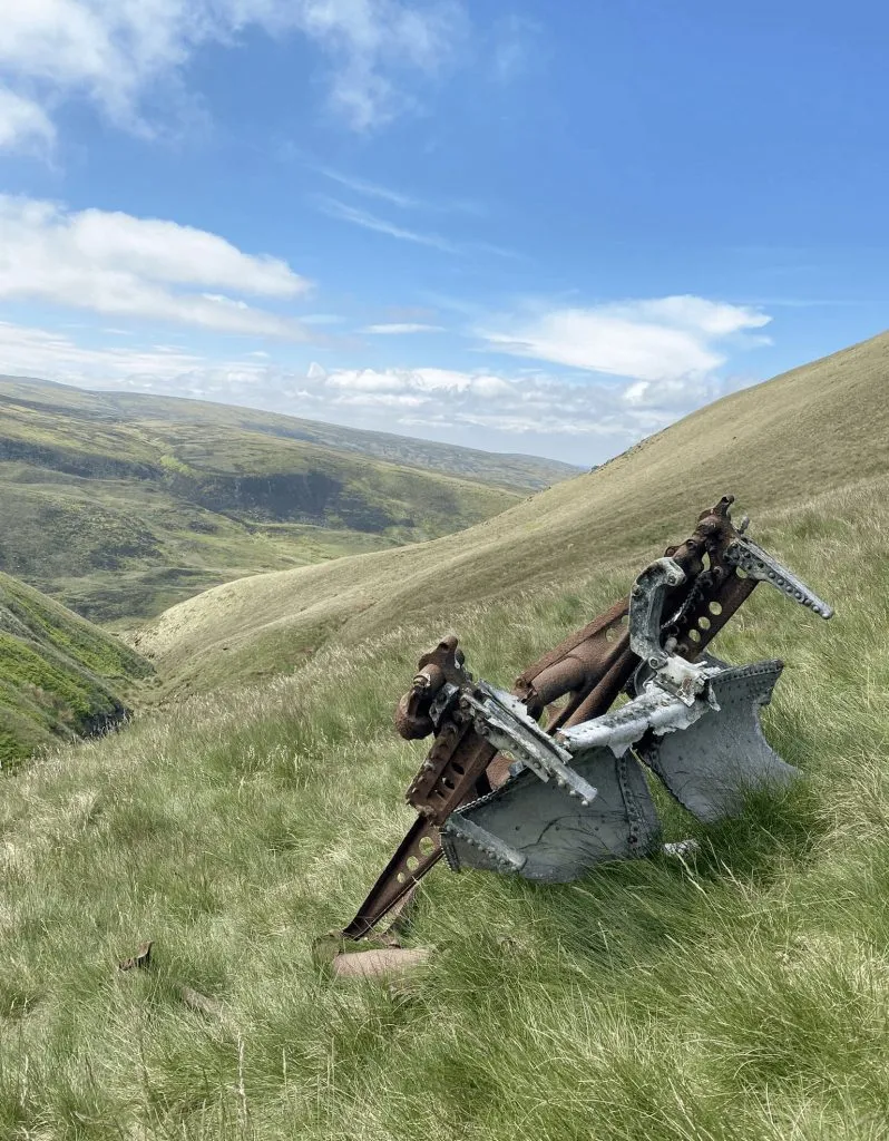
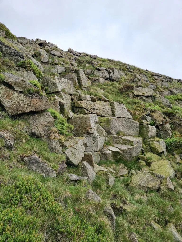
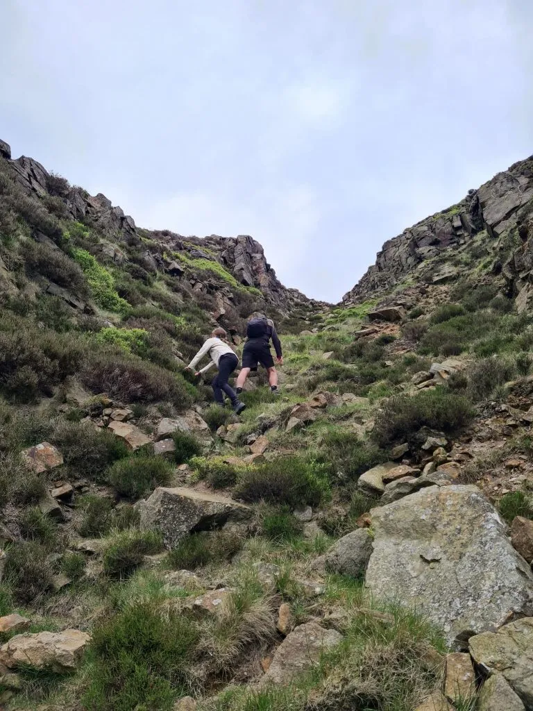
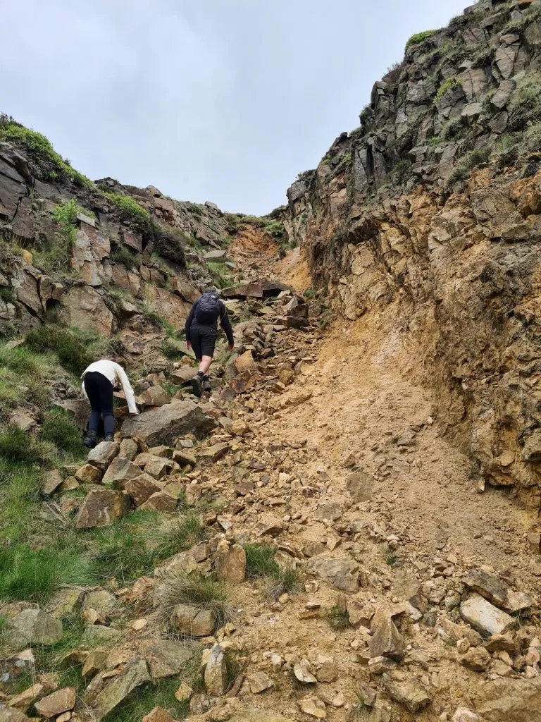
The scramble up Ashton Clough isn’t too challenging, but does get steeper towards the top. The Clough forks, and we took the left fork to head up towards the fence. I think that if you take the right fork you’ll come to the actual plane crash site of the C47 Dakota and a Lancaster bomber which crashed a few months earlier in almost the same place. There are memorial plaques there as can be seen in this image.

Spring moorland vegetation including hares-tail cotton grass and bilberries

Spring moorland vegetation including hares-tail cotton grass and bilberries

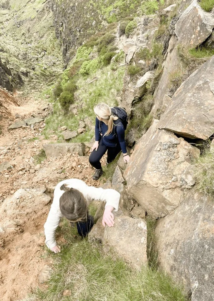
From the top of James’s Thorn we headed south-east along the fence line to a stile, then headed north-west over the moors, then north-west to start to descend the hillside down Wigan Clough. This is quite a steep climb down a rock face, so again care needs to be taken. Here we saw curlew and meadow pipits, and lots of sheep and lambs. With this being a quieter part of the moors, the wildlife is amazing.


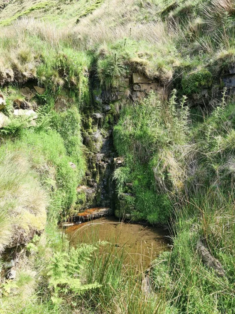
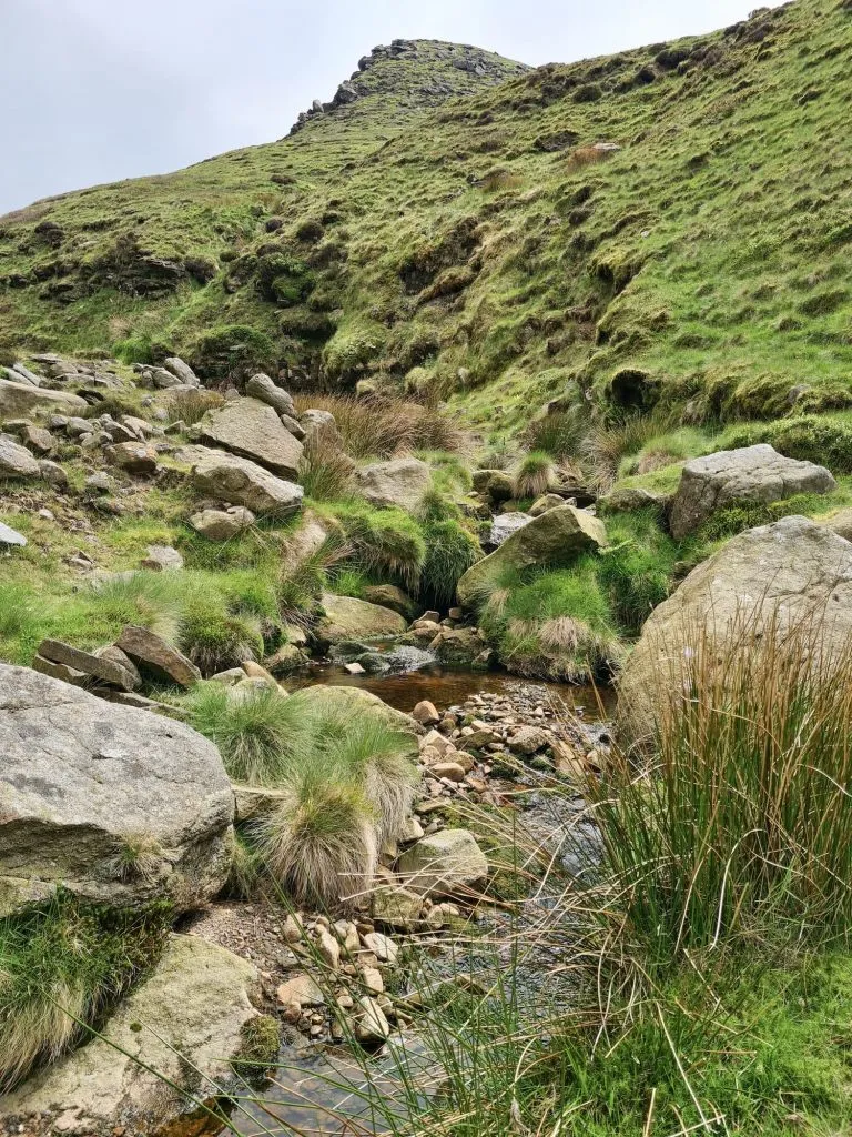
After we climbed down Wigan Clough we headed down towards Dowstone Clough, which again is a beautiful brook with lots of small pools and waterfalls. We scrambled up the Clough, climbing up over the rocks. Joel got a shock when he almost put his hand on a rabbit, which suddenly leaped up as we got closer!

A rock face

The scramble down Wigan Clough

A moorland stream with a pool of water

Where Dowstone Clough becomes Yellowslacks Brook

A father and daughter climbing up some large boulders - Dowstone Clough, Peak District scrambles

Near the base of the climb up Dowstone Clough. It doesn’t take long to reach the sandy patch at the top!

A father and daughter climbing up some large boulders - Dowstone Clough, Peak District scrambles

The rocks get smaller as you get nearer the top of Dowstone Clough.

A father and daughter climbing up Dowstone Clough, Peak District scrambles

A mother and daughter climbing up some large boulders - Dowstone Clough, Peak District scrambles

I’m always at the back!

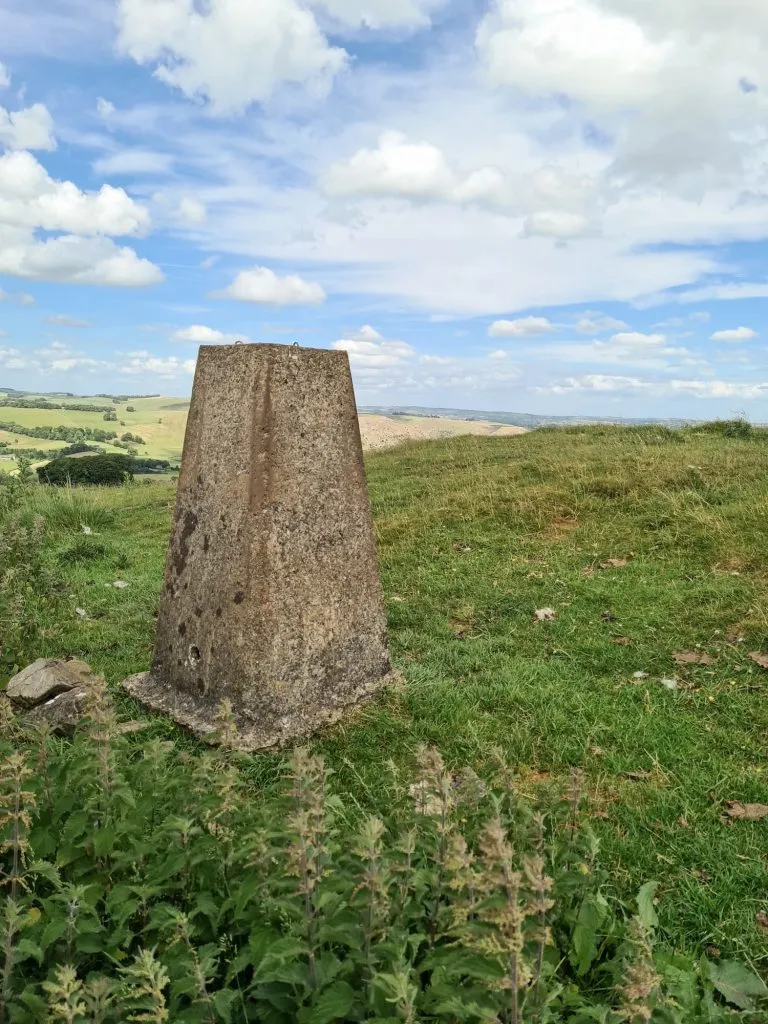
Once at the top we had another snack break then headed off over the moors to pick up the path to Higher Shelf Stones. Up until this part of the walk we had barely seen anyone other than another family who climbed straight up the hill onto Shelf Moor, but you will be able to tell when you’re near the Higher Shelf Stones trig point and the B29 crash site as it will get so busy!


We didn’t go to the B29 crash site near Bleaklow as we’ve been before, and you can read a guide to visiting the B29 crash site here. It’s a very small detour (0.1 miles to the north-east) from the Higher Shelf Stones trig point though so you can visit a couple of Peak District plane crash sites in this walk if you wanted to.

Higher Shelf Stones trig point - Higher Shelf Stones scramble walk from The Wandering Wildflower

Higher Shelf Stones trig point

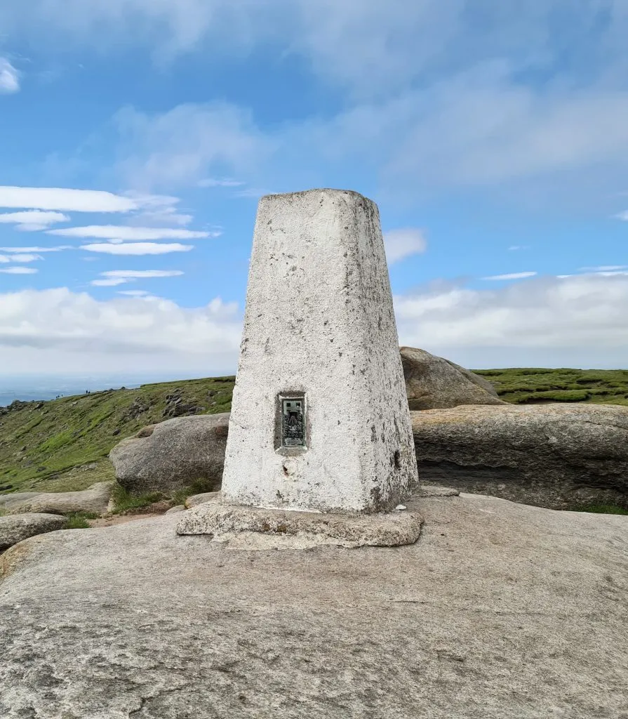
After a quick pic of the trig point, we headed off back over Gathering Hill and crossed Crooked Clough before heading back along the track to Old Woman and back along the Pennine Way to the car.


For more Peak District scrambles, you might like to try Edale to Grindslow Knoll Circular Walk or Kinder Downfall Walk via Nether Red Brook Scramble. 


This Higher Shelf Stones scramble walk is a lovely one to do on a spring day with good visibility, but should only be attempted if you are confident navigating over bleak, featureless moorland. It can be easy to get lost on Shelf Moor and Bleaklow as the weather changes quickly. Make sure you are prepared, and don’t go wearing crocs or some other horrors. 


Higher Shelf Stones Scramble Walk

Higher Shelf Stones Map:


Walk Route in OS Maps: C47 Dakota Site Walk – Higher Shelf Stones and Dowstone Clough

Parking: A lay-by on the A57 Snake Road SK13 7PQ. Get there early as it fills up quickly, and traffic wardens have handed out tickets to people parked where the double yellow lines are.

Facilities: None

Walk Time: 3-4 hours

Difficulty: ▲▲▲ – this route involves scrambling and is navigationally challenging

Distance: 5.7 miles (9 km)

Trig Points Bagged: Higher Shelf Stones

Peak District Peaks Bagged: Higher Shelf Stones

Peak District Ethels Bagged: Higher Shelf Stones


You might also like:

Peak District Plane Crashes

5 Epic Peak District Scramble Walks

Tap to share with your hiking friends!

  • Facebook
  • Email
  • WhatsApp
« Walk from Castleton to Bradwell Moor Trig Point via Cave Dale | 5 Miles
Aleck Low and Wolfscote Hill | 9 Miles »

RELATED POSTS

  • Hathersage Stepping StonesHathersage Stepping Stones Walk | 7 Miles
  • Ladybower ReservoirLadybower Walk | 6 Miles
  • Anvil Stone, GrindsbrookGrindsbrook Clough Scramble to Grindslow Knoll | 7 Miles
  • A view down over Ladybower from Whinstone Lee TorDerwent Edge Walk | 8 Miles

Leave a Reply Cancel reply

Your email address will not be published. Required fields are marked *

FIND YOUR NEXT WALK:

ABOUT ME

Y Garn with Kids - Y Garn via the Devil's Kitchen Walk in Ogwen Valley

Hello! I’m Jo! Welcome to The Wandering Wildflower, an outdoors lifestyle blog focusing on family walks in the Peak District, a place we love exploring. I want to share the Peak District hidden gems and show you there’s so much more than the honeypot places. When I’m not dragging my husband and now 11 year old out on Peak District walks or up mountains, I can be found on planning my next moorland walk or plotting a Geocache walk (and seeing where the nearest pub is!). I love the hills but hate the heights, so trig bagging is – er- fun!


I hope this blog will give you some ideas of places to visit in the Peak District and inspire you and your family to head into the great outdoors.  Thanks for stopping by!

CATEGORIES

  • CIRCULAR WALKS (189)
  • HOLMFIRTH WALKS (27)
  • ISLE OF SKYE WALKS (3)
  • LAKE DISTRICT WALKS (26)
  • LANCASHIRE WALKS (2)
  • LONG PEAK DISTRICT WALKS 10 MILES + (42)
  • MEDIUM WALKS 4-9 MILES (137)
  • PEAK DISTRICT SCRAMBLES (16)
  • PEAK DISTRICT WALKS (206)
  • PEAK DISTRICT WALKS WITH KIDS (76)
  • PEAK DISTRICT WALKS WITH PUBS (60)
  • SCOTLAND WALKS (6)
  • SHORT WALKS UNDER 3 MILES (40)
  • SNOWDONIA WALKS (5)
  • UK CAMPING (5)
  • YORKSHIRE WALKS (33)

Peak District Walks

List of Peak District Ethels

Peak District Peak Bagging

Peak District Trig Point Challenge

Peak District Walks with Pubs

Peak District Walks with Kids

Beautiful Walks in Holmfirth

Short Walks in the Peak District

Long Walks in the Peak District

AFFILIATE DISCLOSURE

This blog may contain affiliate links through which, at no additional cost to you, I may earn a small commission. I only recommend products I would use myself and all opinions expressed here are my own. As an Amazon Associate I earn from qualifying purchases. Read full privacy policy here.

ARCHIVES

PEAK DISTRICT WEATHER

Peak District mountain weather on Met Office

Peak District Trig Points

Promo image for a blog post about the Peak District Trig Point Challenge With Map of Peak District Trig Points and Walking Routes by The Wandering Wildflower

Peak District Ethels Challenge

Promo image for a blog post about the Peak District Trig Point Challenge With Map of Peak District Ethels and Walking Routes by The Wandering Wildflower

WALKING ROUTES STRAIGHT TO YOUR INBOX

Want new walks in your inbox? Drop your email below and I'll send you some ideas for walks you can try.

You can unsubscribe anytime. For more details, review our Privacy Policy.

Thank you!

You have successfully joined our subscriber list.

RSS LATEST POSTS

  • How to Find Three Shires Head
  • Peak District Pub Walks
  • Burnbank Fell, Blake Fell and Gavel Fell | 8 Miles
  • Bretton Park Circular Walk | 3 Miles
  • Grasmere Weekend Break

FOLLOW ON PINTEREST

Want new walks in your inbox? Drop your email below and I'll send you some ideas for walks you can try.

You can unsubscribe anytime. For more details, review our Privacy Policy.

Thank you!

You have successfully joined our subscriber list.

jo@thewanderingwildflower.co.uk

The Wandering Wildflower

  • Email
  • Facebook
  • Instagram
  • Pinterest
  • PRIVACY POLICY
  • TERMS & CONDITIONS
  • ABOUT

(c) The Wandering Wildflower. All Rights Reserved.

|| THEME BY ECLAIR DESIGNS