15+ Best Kinder Scout Walks | Guides and GPX Files


Are you looking for inspiration for your next Peak District walk? Here’s a collection of the best Kinder Scout walks to give you some ideas for your next walk in the Peak District.
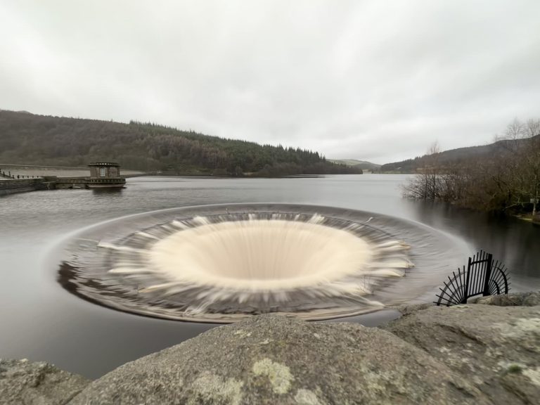
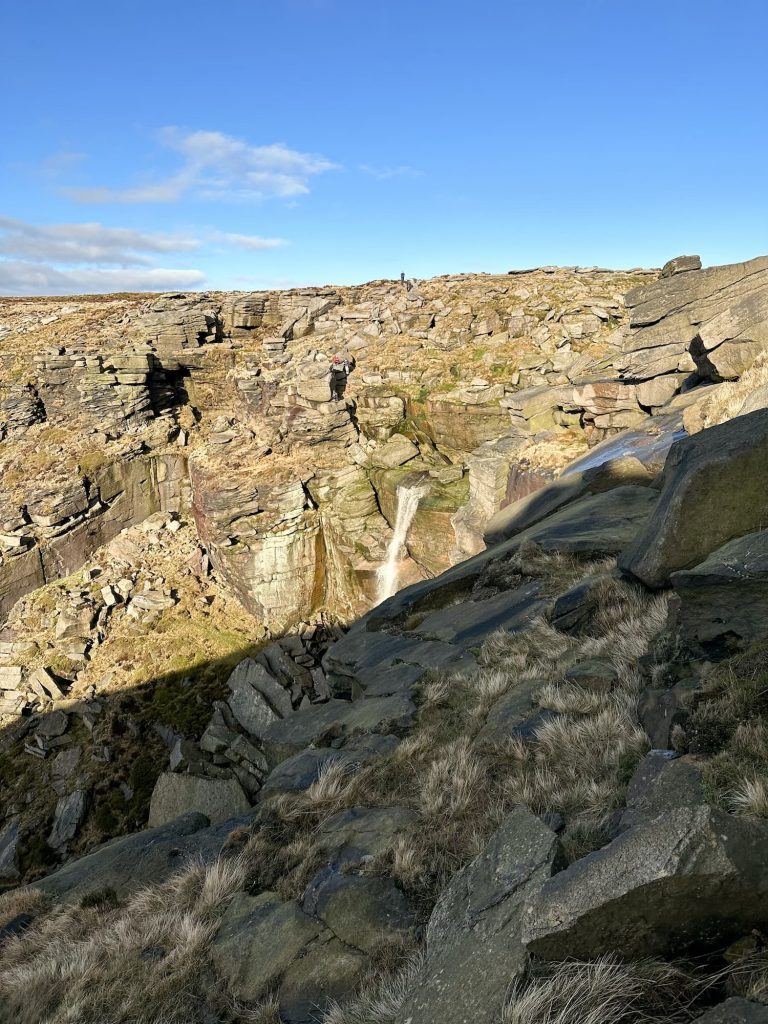
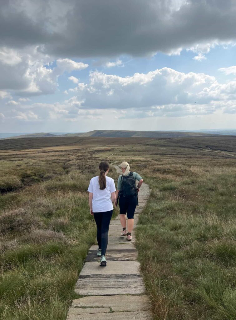
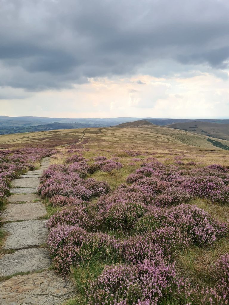
Kinder Scout is a huge plateau and nature reserve in the Peak District. It is a spectacular area which is one of the most popular places to walk in the Peak District. The summit of Kinder Scout, at 636m above sea level, is the highest point in the Peak District and Kinder Scout is home to Kinder Downfall, the highest waterfall in the Peak District. The northern side of the plateau is definitely wilder and less accessible than the southern side, with the route via Jacob’s Ladder from Edale being on of the most popular (and busier) routes.
In 1932 Kinder Scout was the location of a mass trespass, where 500-ish walkers walked from Hayfield to Kinder Scout to secure access to open countryside for everyone forever. Before this, land access was restricted and the average person couldn’t access these amazing places.
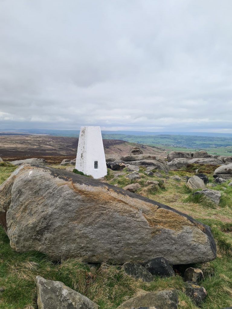
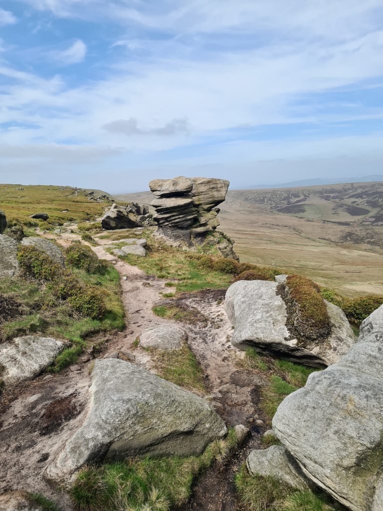
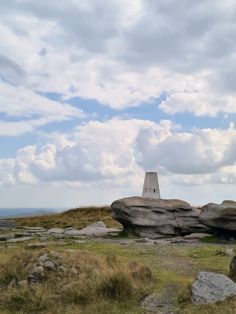
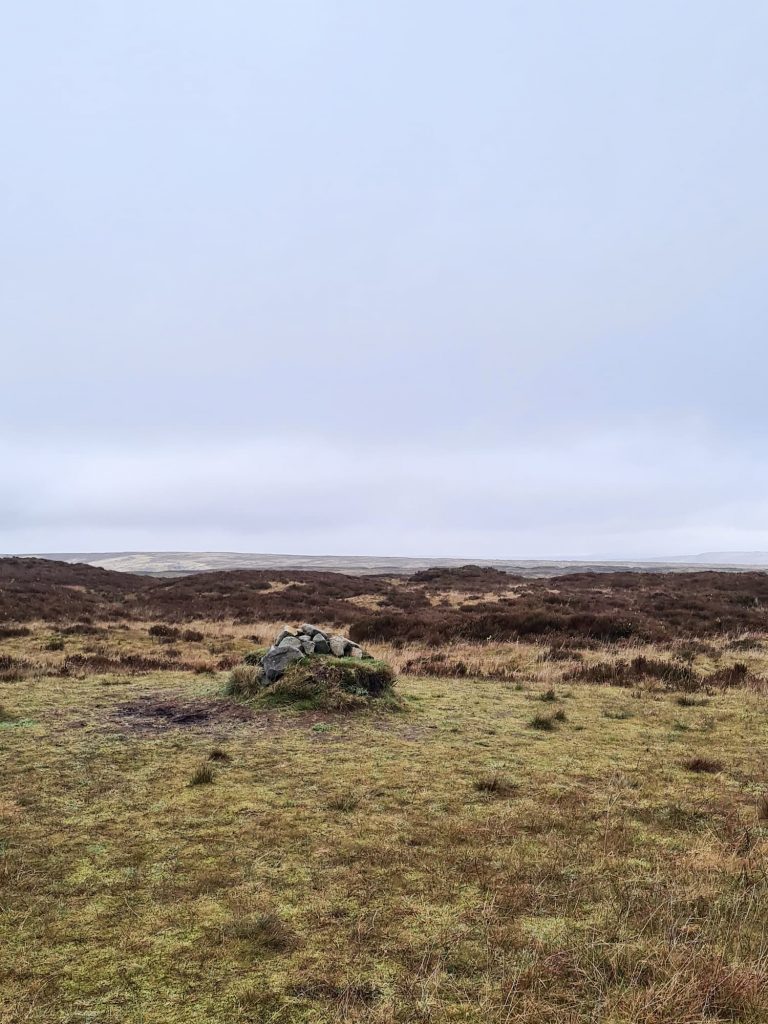
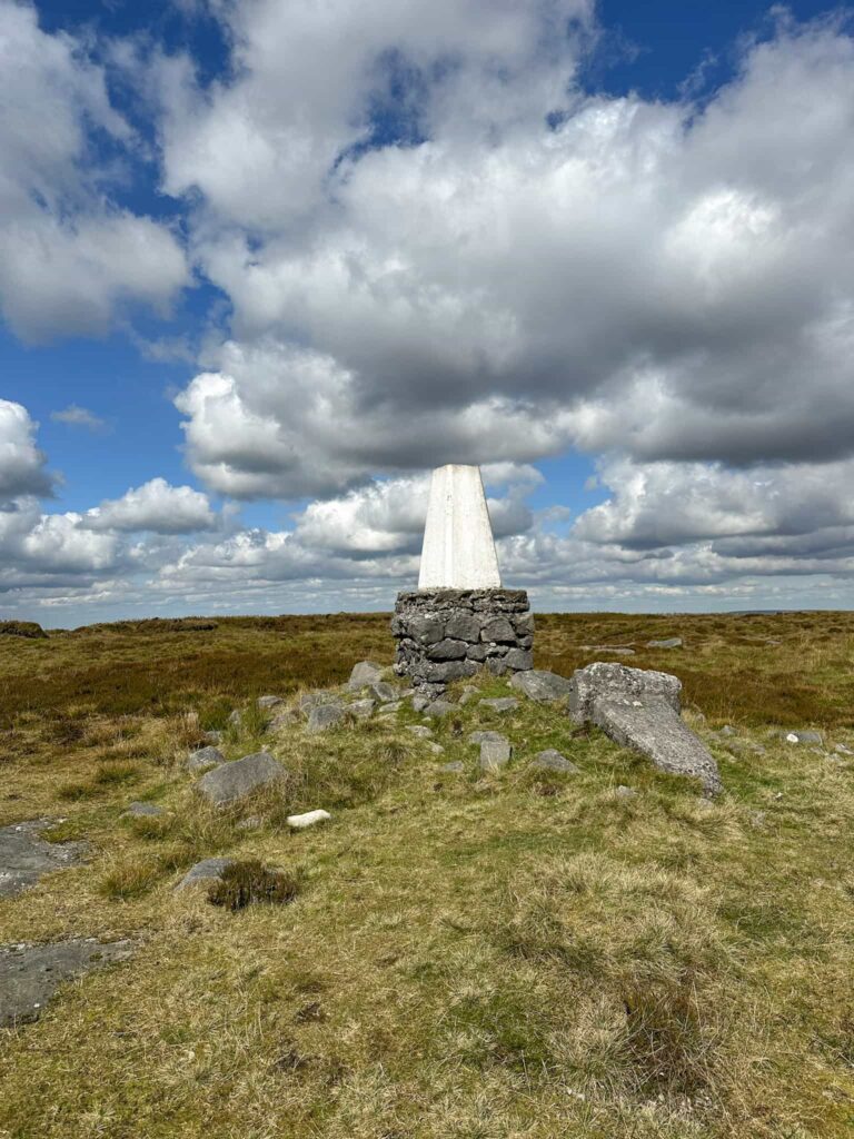
There are 3 trig points on the Kinder Scout plateau itself, although the summit is only marked by a small cairn. There are many Kinder Scout walks which are really varied, taking you via rocky scrambles, beautiful waterfalls, scenic countryside and more.
Tips for Hiking Kinder Scout
Before you hike up Kinder Scout, and to avoid becoming another Mountain Rescue statistic, make sure you:
a) know where you’re going. Kinder Scout is a huge place (some 2500+ acres), and it’s easy to get lost up there. Plan your route before you go, and take a map and compass (and have the skills to use them). You don’t want to descend from the plateau thinking you’re in Edale, but you’re actually in Hayfield!
b) have the right kit. The weather on Kinder Scout can change in an instant, and I’ve been up there and had all the weathers in one day. When the fog rolls in, it can be hard to see the path and you might end up miles from where you wanted to go. Be sure to take warm layers, a waterproof coat and suitable footwear for dealing with rocky paths and boggy patches.
c) have the right skills to take on the walk. If you’re not confident with a hands-on scramble, don’t head up Grindsbrook Clough or any of these walks with ‘scramble’ in the name! While steep, Jacob’s Ladder is a more beginner-friendly route up to Kinder Scout.
Navigation on the plateau can be very challenging as there are few paths and the weather and visibility can change quickly. Don’t rely on other people to help you navigate. Always check the weather before you go as it can change quickly, and make sure you’re prepared in case you need rescue. You’ll soon get cold sitting waiting for an hour on the moors.
Here are some of my favourite Kinder Scout walks, in no particular order as they’re all pretty amazing.
Hayfield to Kinder Scout Walk Route | 10 Miles
Following in the footsteps of the Kinder Scout mass trespass, this walk from Hayfield starts at the car park at Bowden Quarry (where there is a commemorative plaque). Heading up past Kinder Reservoir then up the beautiful William Clough, past waterfalls and small pools, this walk is almost 10 miles and takes in 2 of the 3 Kinder Scout trig points. It also bags the Peak District Ethel of Mill Hill.

Crowden Clough to Kinder Scout Walk | 8 Miles
Edale is a very popular place to start a walk to Kinder Scout (The Old Nags Head is the official starting point for the Pennine Way). To escape the crowds heading up Jacob’s Ladder, this walk takes you up Crowden Clough onto the plateau. You can either take the footpath up the side of the Clough or scramble up the Clough itself. This walk heads over to Kinder Downfall and the Kinder Low trig point before winding back down Jacob’s Ladder into Edale.

Red Brook Scramble onto Kinder Scout | 9.5 Miles
The southern edge of Kinder Scout has a few scrambles, most of which aren’t really for beginners, however this Red Brook scramble is a lovely way to get up to the summit. The route heads up past Kinder Reservoir, The Mermaid’s Pool, up to the Kinder Low Trig Point and then over to Brown Knoll, South Head and Mount Famine in an epic 3 Ethels, 2 trig point walk. This is a longer walk at 9.5 miles and involves some hands-on scrambling, but makes for an epic day out in the Peak District.

Nether Red Brook and Fair Brook Scramble | 7 Miles
This is a much quieter way to get up onto the plateau, using the bleaker northern edge of the Kinder plateau and follows the course of Ashop Clough before scrambling up Nether Red Brook. The walk meanders around the beautiful northern edge of the plateau before heading across the moors to The Edge trig point and Kinder Downfall. It then heads over the bleak plateau to Fair Brook before following the brook down to the starting point, past waterfalls and pools. This route involves hands-on scrambling, and good navigation is essential as you’re crossing the Kinder Scout plateau.

Edale to Kinder Scout via Ringing Roger Scramble | 5 Miles
This Edale to Kinder Scout walk scrambles up Ringing Roger on the southern side of the Kinder plateau before heading along Upper Tor and Nether Tor and scrambling back down Grindsbrook Clough into Edale. This walk is a great one for avoiding the crowds on Kinder Scout! Again, this route involves hands-on scrambling.

Edale to the True Summit of Kinder Scout | 7.5 Miles
Most walkers use the trig point at Kinder Low as their summit marker for Kinder Scout. As the plateau is so huge, there isn’t a defined peak and the Kinder Low trig point is just 3m lower than the actual summit, so I can see why they do. We took a trip to the actual proper summit of Kinder Scout, which is off the main path and on the bleak plateau, where it can be very hard to navigate in bad weather.
This 7.5 mile walk starts in Barber Booth and heads up Grindslow Knoll before exploring the Peak District’s highest mountain and the true Kinder Scout summit. With amazing rock formations and spectacular views, this is a classic Peak District walk.
Kinder Scout Dog Stone Walk | 7.5 Miles
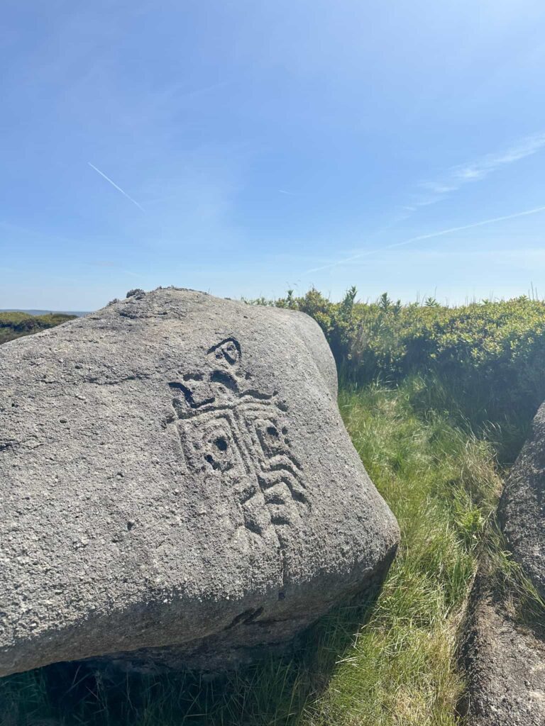
This is a 7.6 mile Kinder Scout walk, starting in Bowden Bridge and climbing up Sandy Heys before heading along the plateau to The Edge trig point, Kinder Downfall and then down through Cluther Rocks in search of the Kinder Scout Dog Stone. This route traverses some very rough terrain in Cluther Rocks and includes off-path sections to find the mysterious Dog Stone.

Kinder Scout via Kinder Low and Kinder Downfall | 9 Miles
This Kinder Scout walk starts from the beautiful village of Hayfield and heads away from the crowds to Kinder Low before climbing up onto the plateau. It then winds around the southern edge path towards Kinder Downfall, the highest waterfall in the Peak District, before heading back down over the Swine’s Back to Edale Cross and then back down Oaken Clough to Hayfield.
Kinder Scout Perimeter Walk | 16 Miles
This Kinder Scout Perimeter walk winds its way around the edges of the plateau forming the highest mountain in the Peak District, Kinder Scout, exploring the gritstone edges and admiring the spectacular views (views not guaranteed!). This walk is 16.3 miles long and follows the edge of Kinder Scout. Purists will also say to add in the summit of Grindslow Knoll, but we were rushing to get done before school pick up so we didn’t.

Edale to Kinder Scout and Mam Tor | 12 Miles
This 12 mile Kinder Scout and Mam Tor circular walk starts from Barber Booth car park in Edale and heads up Crowden Clough onto Kinder Scout. The route then explores the southern edge of Kinder Scout, with stunning views over Edale itself, and heads around to Brown Knoll and Rushup Edge. It then visits the ever-popular Mam Tor before dropping back down into Edale. It’s a great one to train for the Edale Skyline challenge walk.
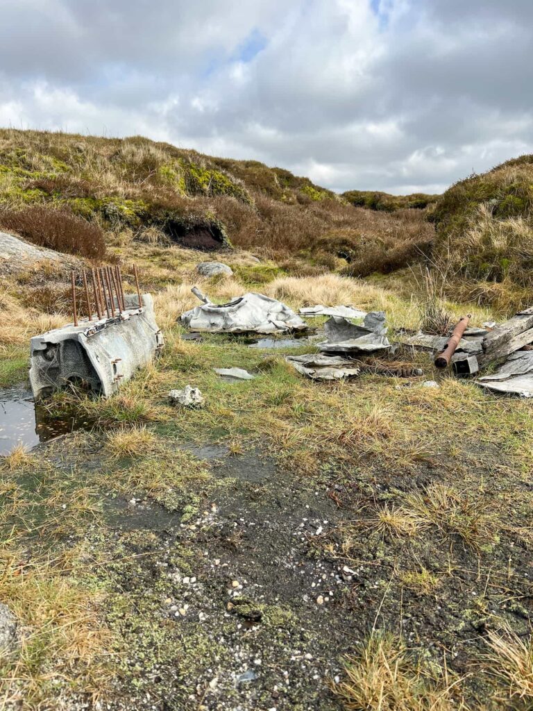
Edale to the Dragon Rapide Plane Wreck on Kinder Scout | 7.5 Miles
Leaving the beautiful village of Edale, this Peak District walk climbs Grindslow Knoll before heading off over the Kinder Scout plateau to discover the wreck of the Dragon Rapide on Edale Moor, the Seal Stones on the northern edge of the plateau and returning via the ‘Seven Minute Crossing’ across the plateau. This is a challenging 7.5 mile walk and good navigational skills are essential.
Kinder Scout, Brown Knoll, South Head and Mount Famine | 8 Miles
This walk explores the moorland to the south-west of the Kinder Scout Nature Reserve. It visits the trig points at Kinder Low and Brown Knoll as well as the 4 Ethels of Kinder Scout, Brown Knoll, South Head and Mount Famine. Not bad for a walk under 8 miles! It’s a beautiful walk to do when the heather is in full bloom in late summer.
Kinder Scout 3 Trig Points Walk | 13 Miles
This Kinder Scout 3 trig point walk starts from Edale and bags the 3 Kinder Scout trig points. It’s 13 miles and involves crossing the plateau twice, but it’s a great day out on the hills. It goes without saying that good navigation skills are needed for this walk.
Jaggers Clough Scramble to Kinder Scout | 8 Miles
This route took us via Jaggers Clough, a lesser known scramble, onto the Kinder Scout plateau and then follows the edge paths around Nether Tor and Upper Tor before descending via Grinds Brook. This 8 mile walk is ideal for those who love a scramble!
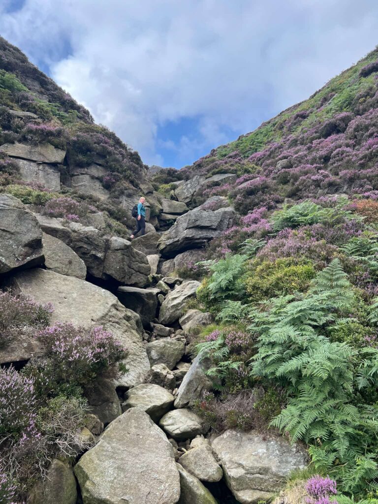
Fair Brook Scramble to Kinder Scout | 9 Miles
If you’re looking for a fun Peak District walk, with a scramble up Fair Brook, waterfalls galore, mystical rock formations and a wander through the beautiful Snake Woodlands, this is the walk for you! This Fair Brook scramble takes you up onto the northern edges of Kinder Scout and then back down along Ashop Moor to Snake Woodlands and is just over 9 miles long.
Blackden Brook Scramble to Kinder Scout Aztec Rock | 7.5 Miles
This walk starts with a brilliant scramble up Blackden Brook, packed with waterfalls, and heads over to the Aztec Rock, Edale Moor trig point and Madwoman’s Stones. This is a challenging 7.6 mile Peak District walk, with sections of off-path exploring in the heart of the Kinder plateau.
Kinder Scout is such an amazing place to explore. Whether it’s the remote northern edge or the southern edge with amazing views over Kinder Reservoir, there’s bound to be a walk on Kinder Scout that suits you.