• 3 Mile Walks or Less
  • 4 Mile Walks
  • 5 Mile Walks
  • 6 Mile Walks
  • 7 Mile Walks
  • 8 Mile Walks
  • 9 Mile Walks
  • 10 Mile Walks
  • 11 Mile Walks
  • 12 Mile Walks
  • 14 Mile Walks
  • 15 Mile Walks
  • 20+ Mile Walks

The Wandering Wildflower

Peak District Hikes

  • PEAK DISTRICT WALKS
    • SHORT WALKS UNDER 3 MILES
    • MEDIUM WALKS 4-9 MILES
    • LONG PEAK DISTRICT WALKS 10 MILES +
  • PEAK DISTRICT WALKS WITH PUBS
  • PEAK DISTRICT WALKS WITH KIDS
  • HOLMFIRTH WALKS

Black Hill, West Nab and Blackpool Bridge | 10 Miles

December 18, 2022 CIRCULAR WALKS, LONG PEAK DISTRICT WALKS 10 MILES +, PEAK DISTRICT WALKS, PEAK DISTRICT WALKS WITH PUBS

Pinterest Image for Black Hill, West Nab and Blackpool Bridge Walk - The Wandering Wildflower

This Dark Peak walk starts in the pretty village of Holme and heads up to Soldier’s Lump, Black Hill via Issue Clough waterfall before a trip along the Pennine Way to West Nab, then back via Blackpool Bridge to Holme. This walk is just over 10 miles.

An iron gate with a view over snowy fields to Black Hill, Holmfirth


This walk will bag you two Ethels, West Nab and Black Hill, as well as trig points at each, a beautiful waterfall at Issue Clough and a wild dip spot at Blackpool Bridge.

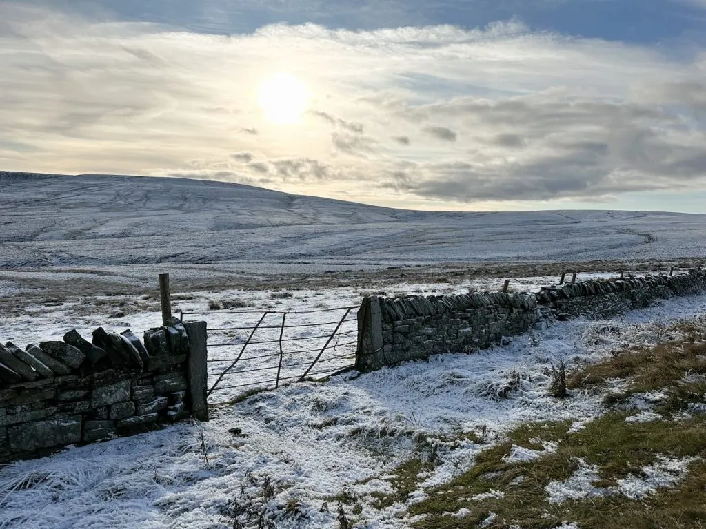
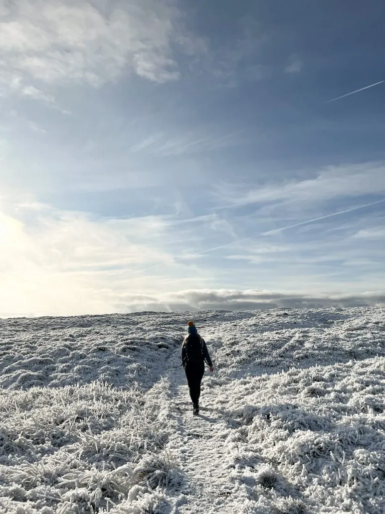
Black Hill in the Dark Peak is one of my favourite places to walk – it’s rugged, bleak but so peaceful, and some days you can be out for hours and not see anyone else. At 582m above sea level, the Black Hill plateau looms over nearby Holmfirth and it can be a challenging place to walk in poor weather conditions, so please make sure you’re prepared.


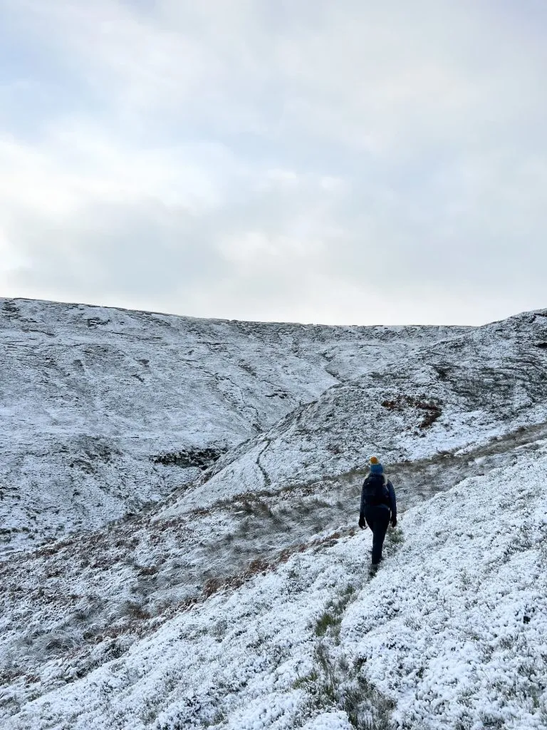
We decided to start our walk from Holme, a quaint village nestled at the foot of the moors. We headed up Meal Hill Road, past the bus stop, playground and school, then followed the track until it becomes Issues Road. Issues Road is a really straight track which goes out onto the moors.


Issues Road, near Blackpool Bridge Holmfirth

I love the layer of cloud following the hilltop!

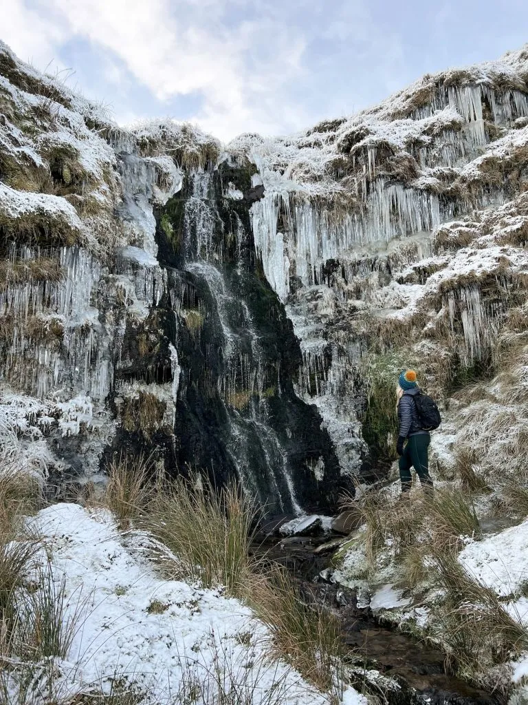
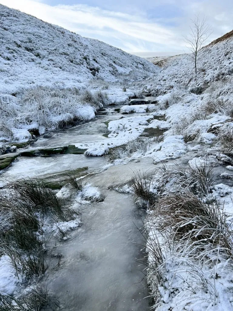
After about a mile, the path forks, with the right hand fork heading off to Blackpool Bridge and the left fork leading up to Black Hill. We took the left hand fork and started to climb up the hill, crossing Issue Clough. After another 0.15 miles we left the main path and followed the contour of the hill round to the south. In clear visibility there is a faint path leading round to the waterfall but the ground was covered in snow when we visited. If in doubt, stick to the lower sections of the hill as there is a boggy pond a bit further up the hill!

A woman walking on a snowy moor near Black Hill, Holmfirth

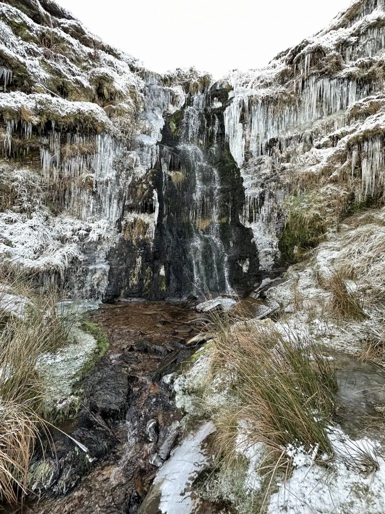
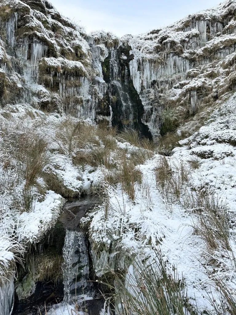
We traced the Clough south-east for a short distance to reach the main waterfall at Issue Clough, which looked like something from Narnia! The icicles and snow were just stunning.

A woman standing looking at a frozen Issue Clough waterfall, Holmfirth

A frozen Issue Clough waterfall near Black Hill

A frozen Issue Clough waterfall near Black Hill


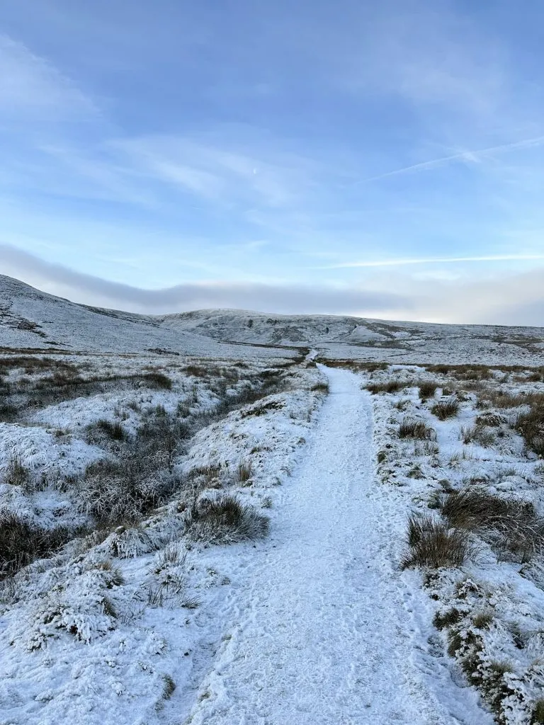
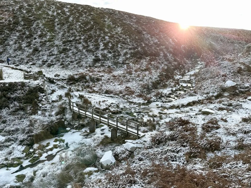
After we’d taken a lifetime’s supply of frozen waterfall pictures, we headed back round to rejoin the path to climb up Black Hill. The path joins the Pennine Way, which climbs steeply for a short distance before levelling out as you reach the top of the plateau. The going is much easier here, and the Pennine Way is paved for much of the route to the Black Hill trig point.

A woman walking on a snow covered moorland Black Hill


This blog may contain affiliate links through which, at no additional cost to you, I may earn a small commission. I only recommend products I would use myself and all opinions expressed here are my own. As an Amazon Associate I earn from qualifying purchases. Read full privacy policy here.


Black Hill, Holmfirth in the snow

Soldier's Lump, Black Hill trig point, Holmfirth in the snow

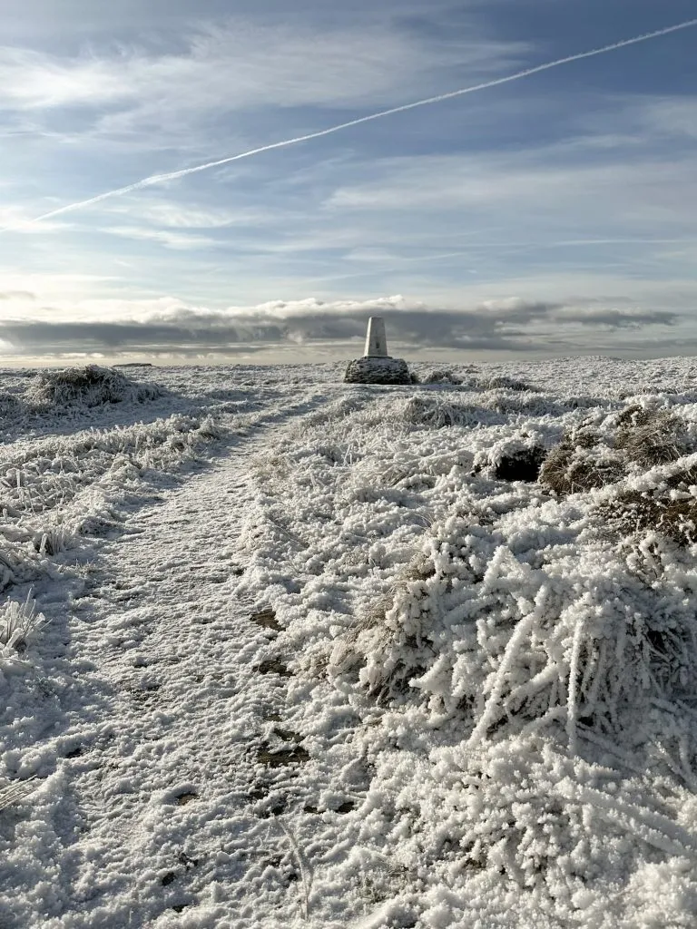
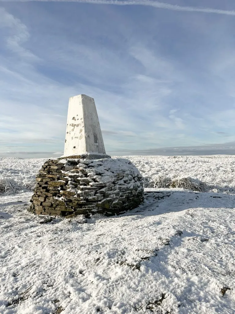
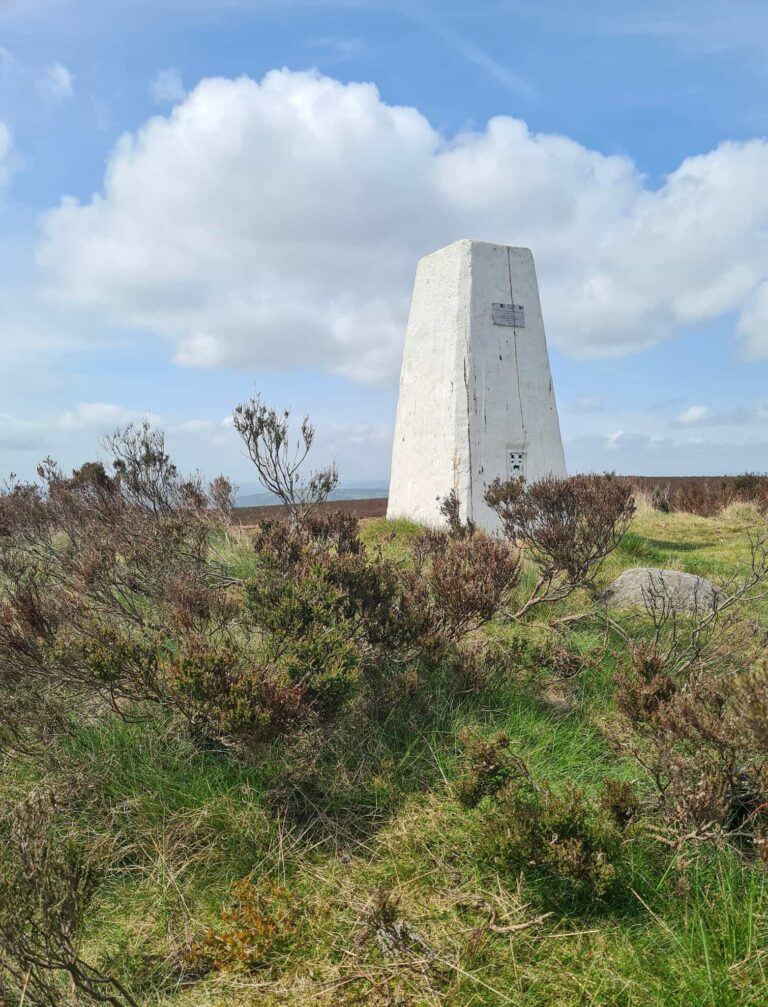
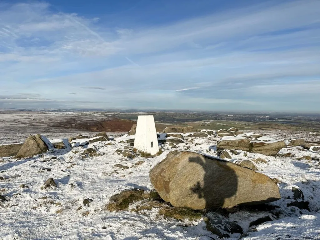
The Black Hill trig point at 582m above sea level is sat on Soldier’s Lump, which was used in the original Ordnance Survey. According to Alfred Wainwright, who described Black Hill as “The broad top really is black. It is not the only fell with a summit of peat, but no other shows such a desolate and hopeless quagmire to the sky. This is peat naked and unashamed” and “a brute in any weather” in his Pennine Way Companion, the support timbers for the Ramsden theodolite were still to be found here many years later. Presumably this was before the construction of the paved Pennine Way and no-one wanted to brave the peat bogs to go and retrieve them!


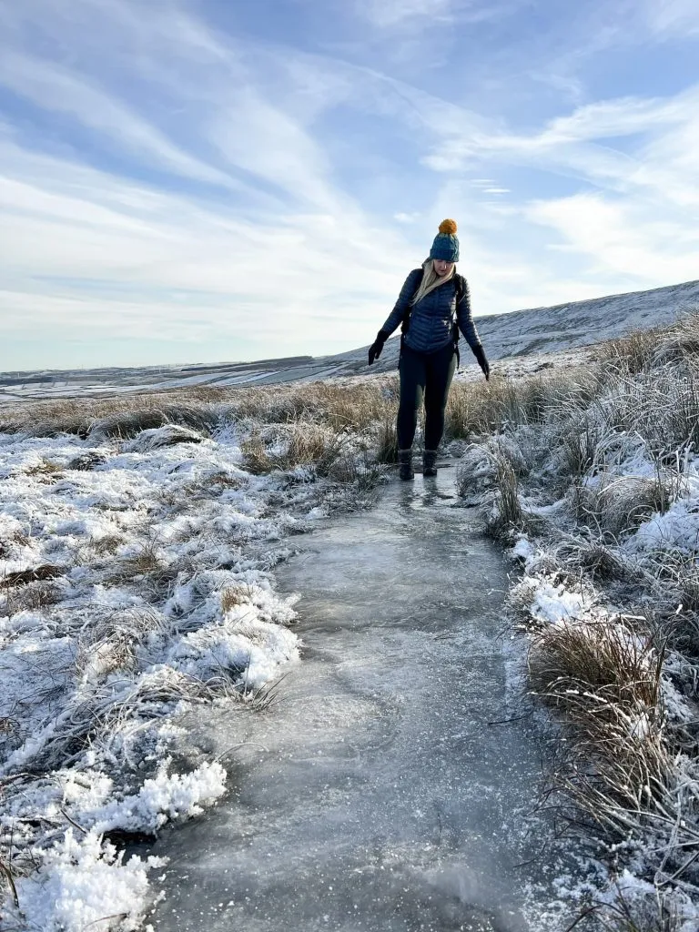
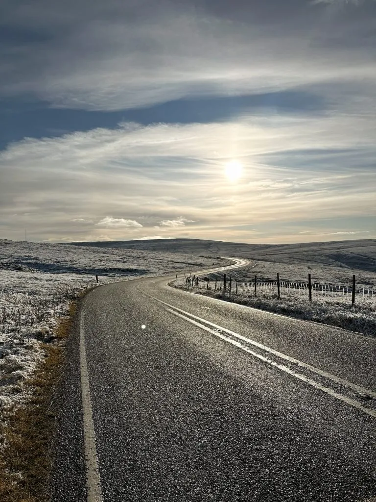
From the trig point, we headed back north-east along the Pennine Way, braving icy sections and treacherous crossings of Dean Clough and Marsden Clough before climbing up to meet Greenfield Road. Crossing the road, we set off along Wessenden Head Road towards West Nab.

A woman treading carefully on an icy moorland path

This is the Pennine Way! The ice was over an inch thick in places

A frozen Dean Clough near Black Hill

Dean Clough, upstream from Blackpool Bridge Holmfirth

Walking along the road for just under a mile, we then crossed the stile and headed through the (normally boggy) frozen peat and climbed up to the summit of West Nab.
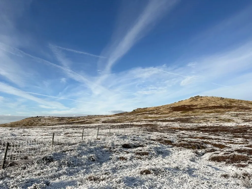
A winding Wessenden Head Road

View along Wessenden Head Road to Black Hill

West Nab, a rocky peak, in the winter sunshine with blue skies

West Nab in the winter sunshine

The West Nab trig point is surrounded by rocks, some of which are thought to have a mystical past. There was a rocking stone here at one time, which was destroyed as it was presumed to be dangerous, and the large rock with bowls in it is thought to be a druids stone. Nowadays it’s my little girl’s favourite seat to eat her hiking snack!

West Nab trig point in the snow

From West Nab we headed back down to the road, then along Wessenden Head Road to Greenfield Road. Crossing the road, we climbed over the stile past the site of the former Isle of Skye Hotel, then down the Kirklees Way towards Reap Hill Clough.


The path winds through a small woodland and then over a stile onto a farm track. On the right hand side, before Good Bents Farm, there is a foopath leading over the fields. The path descends steeply and leads to Blackpool Bridge, a crossing where Dean Clough and Reap Hill Clough meet to flow downstream into Marsden Clough.


Blackpool Bridge, Holmfirth

The original Blackpool Bridge was a large stone bridge wide enough for horses and carts to pass over, but the modern bridge is only wide enough for pedestrians. The name apparently comes from the black pools of water downstream where locals used to swim (there are a few deep enough for a dip), rather than the seaside town of the same name!


Blackpool Bridge, Holmfirth in the snow

An icy track leading from Blackpool Bridge

The track up to Holme was very icy!

From Blackpool Bridge the track climbs up relatively steeply to wind back round Stopes Moor to Issues Road, and then it’s a case of following Issues Road back to Meal Hill Road and then back into Holme, where The Fleece Inn is (I can recommend their food, it’s delicious after a long walk).

Issues Road leading to Black Hill in the snow

Views back towards Black Hill on the way to Holme

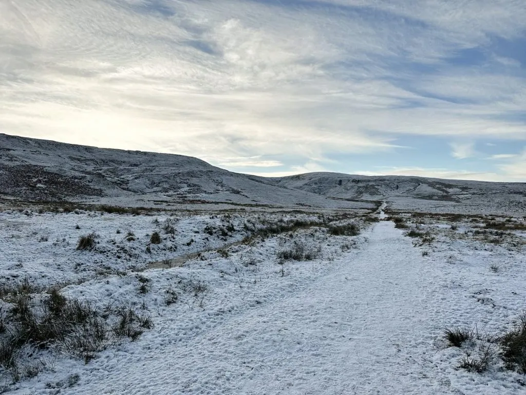
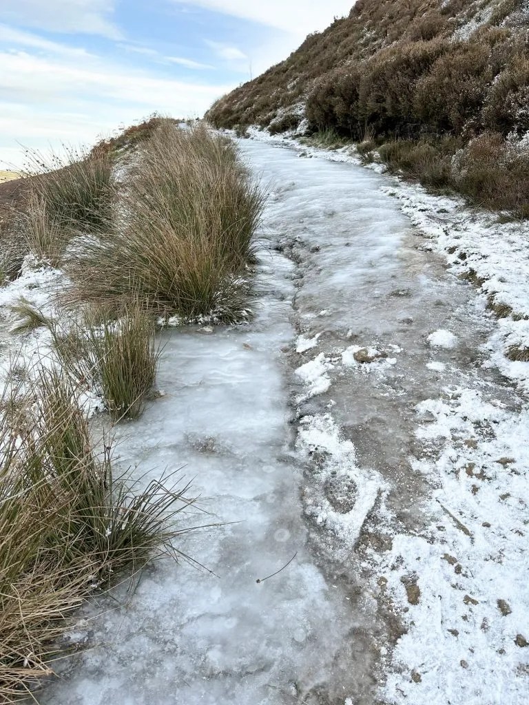
This is one of my favourite areas to explore, and the snowy conditions made it extra special. It was very icy in places however, especially in those valleys and cloughs which don’t get much winter sun.


Holme to Blackpool Bridge Walk: 


Walk Map (Opens in OS Maps): Holme, Blackpool Bridge, West Nab and Black Hill Walk

Parking: On street in Holme village. Please be considerate to local residents.

Facilities: Public toilets in Holme

Walk Time: 4-5 hours

Difficulty: ▲▲▲

Distance: 10.6 miles (17km)

Trig Points Bagged: Black Hill, West Nab

Peak District Peaks Bagged: Black Hill, West Nab

Peak District Ethels Bagged: Black Hill, West Nab


For more Black Hill walks, why not try

Holme Moss to Black Hill Trig Point

Black Hill Peak District Walk

Holme to Black Hill to Crowden Circular Walk

Holme to Black Hill Circular Walk

Black Hill Circular Walk, Holmfirth – Yorkshire Walks

10 Reservoirs Walk

Black Hill via Crowden Little Brook

Tap to share with your hiking friends!

  • Facebook
  • Email
  • WhatsApp
« Derwent Reservoirs Circular (Dambusters Challenge Walk)
Bleaklow Plane Crash Walk | 15 Miles »

RELATED POSTS

  • Hathersage Stepping StonesHathersage Stepping Stones Walk | 7 Miles
  • Ladybower ReservoirLadybower Walk | 6 Miles
  • Anvil Stone, GrindsbrookGrindsbrook Clough Scramble to Grindslow Knoll | 7 Miles
  • Bleaklow to Higher Shelf Stones Circular Hike | 6 Miles

Leave a Reply Cancel reply

Your email address will not be published. Required fields are marked *

FIND YOUR NEXT WALK:

ABOUT ME

Y Garn with Kids - Y Garn via the Devil's Kitchen Walk in Ogwen Valley

Hello! I’m Jo! Welcome to The Wandering Wildflower, an outdoors lifestyle blog focusing on family walks in the Peak District, a place we love exploring. I want to share the Peak District hidden gems and show you there’s so much more than the honeypot places. When I’m not dragging my husband and now 11 year old out on Peak District walks or up mountains, I can be found on planning my next moorland walk or plotting a Geocache walk (and seeing where the nearest pub is!). I love the hills but hate the heights, so trig bagging is – er- fun!


I hope this blog will give you some ideas of places to visit in the Peak District and inspire you and your family to head into the great outdoors.  Thanks for stopping by!

CATEGORIES

  • CIRCULAR WALKS (189)
  • HOLMFIRTH WALKS (27)
  • ISLE OF SKYE WALKS (3)
  • LAKE DISTRICT WALKS (26)
  • LANCASHIRE WALKS (2)
  • LONG PEAK DISTRICT WALKS 10 MILES + (42)
  • MEDIUM WALKS 4-9 MILES (137)
  • PEAK DISTRICT SCRAMBLES (16)
  • PEAK DISTRICT WALKS (206)
  • PEAK DISTRICT WALKS WITH KIDS (76)
  • PEAK DISTRICT WALKS WITH PUBS (60)
  • SCOTLAND WALKS (6)
  • SHORT WALKS UNDER 3 MILES (40)
  • SNOWDONIA WALKS (5)
  • UK CAMPING (5)
  • YORKSHIRE WALKS (33)

Peak District Walks

List of Peak District Ethels

Peak District Peak Bagging

Peak District Trig Point Challenge

Peak District Walks with Pubs

Peak District Walks with Kids

Beautiful Walks in Holmfirth

Short Walks in the Peak District

Long Walks in the Peak District

AFFILIATE DISCLOSURE

This blog may contain affiliate links through which, at no additional cost to you, I may earn a small commission. I only recommend products I would use myself and all opinions expressed here are my own. As an Amazon Associate I earn from qualifying purchases. Read full privacy policy here.

ARCHIVES

PEAK DISTRICT WEATHER

Peak District mountain weather on Met Office

Peak District Trig Points

Promo image for a blog post about the Peak District Trig Point Challenge With Map of Peak District Trig Points and Walking Routes by The Wandering Wildflower

Peak District Ethels Challenge

Promo image for a blog post about the Peak District Trig Point Challenge With Map of Peak District Ethels and Walking Routes by The Wandering Wildflower

WALKING ROUTES STRAIGHT TO YOUR INBOX

Want new walks in your inbox? Drop your email below and I'll send you some ideas for walks you can try.

You can unsubscribe anytime. For more details, review our Privacy Policy.

Thank you!

You have successfully joined our subscriber list.

RSS LATEST POSTS

  • How to Find Three Shires Head
  • Peak District Pub Walks
  • Burnbank Fell, Blake Fell and Gavel Fell | 8 Miles
  • Bretton Park Circular Walk | 3 Miles
  • Grasmere Weekend Break

FOLLOW ON PINTEREST

Want new walks in your inbox? Drop your email below and I'll send you some ideas for walks you can try.

You can unsubscribe anytime. For more details, review our Privacy Policy.

Thank you!

You have successfully joined our subscriber list.

jo@thewanderingwildflower.co.uk

The Wandering Wildflower

  • Email
  • Facebook
  • Instagram
  • Pinterest
  • PRIVACY POLICY
  • TERMS & CONDITIONS
  • ABOUT

(c) The Wandering Wildflower. All Rights Reserved.

|| THEME BY ECLAIR DESIGNS