• 3 Mile Walks or Less
  • 4 Mile Walks
  • 5 Mile Walks
  • 6 Mile Walks
  • 7 Mile Walks
  • 8 Mile Walks
  • 9 Mile Walks
  • 10 Mile Walks
  • 11 Mile Walks
  • 12 Mile Walks
  • 14 Mile Walks
  • 15 Mile Walks
  • 20+ Mile Walks

The Wandering Wildflower

Peak District Hikes

  • PEAK DISTRICT WALKS
    • SHORT WALKS UNDER 3 MILES
    • MEDIUM WALKS 4-9 MILES
    • LONG PEAK DISTRICT WALKS 10 MILES +
  • PEAK DISTRICT WALKS WITH PUBS
  • PEAK DISTRICT WALKS WITH KIDS
  • HOLMFIRTH WALKS

Kinder Scout Perimeter Walk | 16 Miles

December 2, 2022 LONG PEAK DISTRICT WALKS 10 MILES +, PEAK DISTRICT WALKS, PEAK DISTRICT WALKS WITH PUBS

Pinterest pin image for Kinder Scout perimeter walk from The Wandering Wildflower

This Kinder Scout Perimeter walk winds it’s way around the edges of the plateau forming the highest mountain in the Peak District, Kinder Scout. This walk is 16.3 miles long and explores the perimeter of Kinder Scout.

The Druid's Stone on Kinder Scout near Crookstone Knoll

It’s slightly shorter than some other Kinder Scout Edge perimeter routes as it doesn’t head up to Grindslow Knoll, but you can add this on really easily if you wish. We were against it timewise so chose to miss this out, especially as Grindslow Knoll is it’s own separate peak.


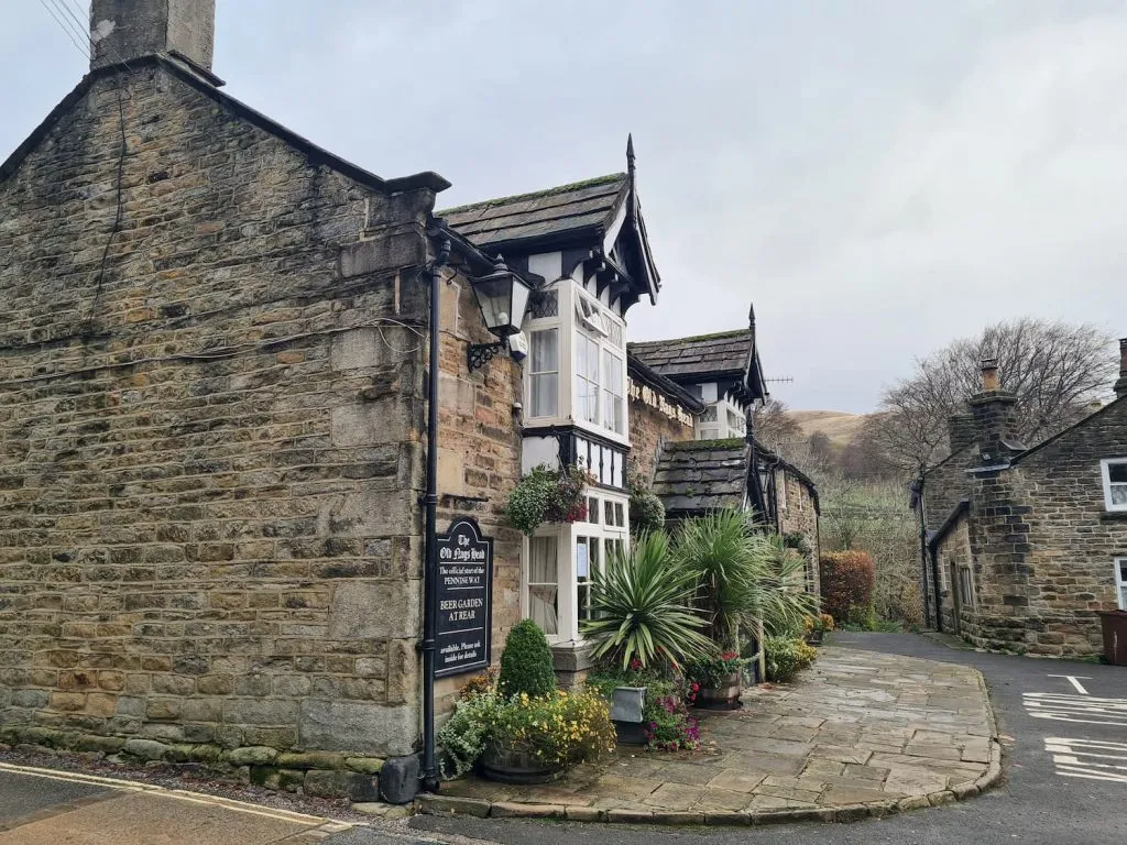
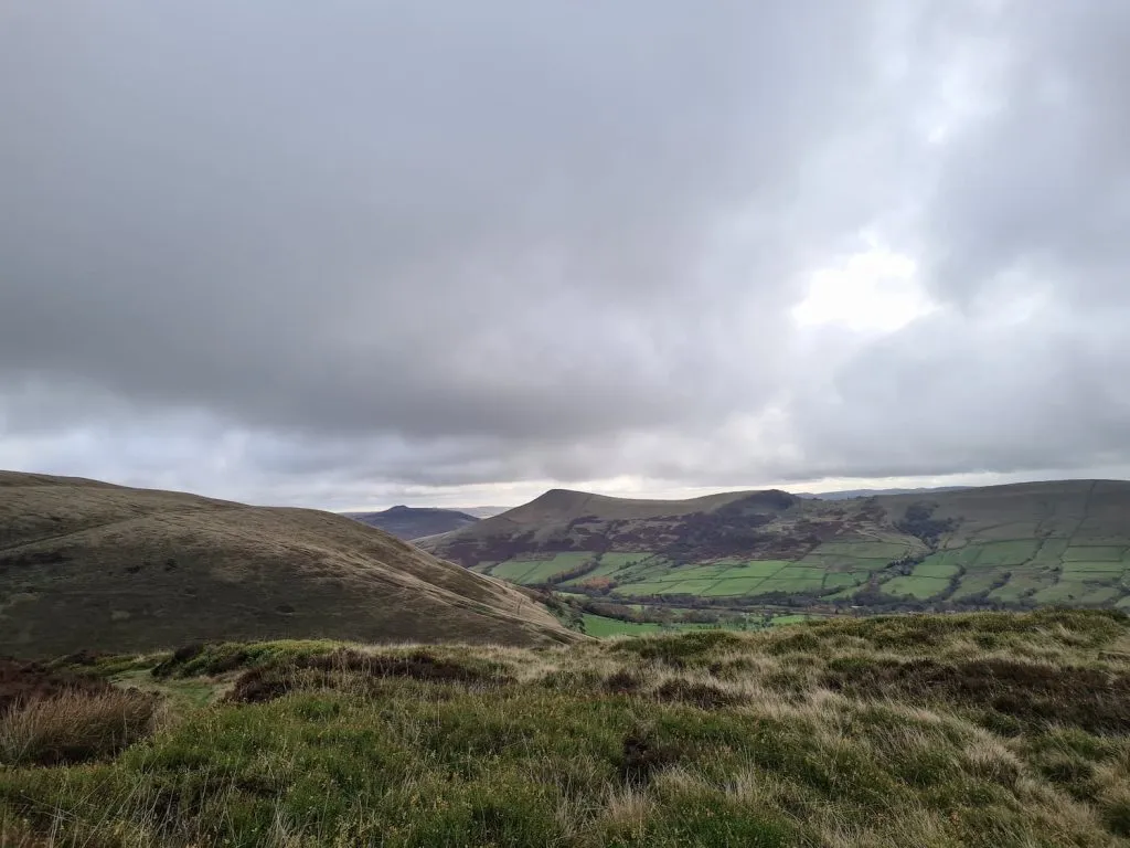
Our Kinder Scout edge walk starts in the Edale car park and heads up the road through the pretty village of Edale, past the start of the Pennine Way, The Old Nags Head. We then followed the footpath through the wood, over the bridge and then forked right. We chose to climb up Ringing Roger and go for a short, sharp steep ascent onto the plateau.

The Old Nags Head pub in Edale, the start of the Pennine Way

An autumnal lane in Edale

The path leading to Ringing Roger, a stony outcrop on Kinder Scout

We decided to set off anti-clockwise and so headed towards Crookstone Knoll. We took the higher path which follows the contours of the plateau around to the Druid’s Stone, a gritstone outcrop once believed to be the site of druid sacrifices. The marks and hollows on the surface of the stone are supposed to be holders for offerings to the gods, but they were only full of water when we visited!

The Druid's Stone on Kinder Scout

From the Druid’s Stone we set off roughly north-east towards Crookstone Knoll, the eastern most point of the plateau, crossing Jaggers Clough on the way. From here there are amazing views over The Great Ridge, with Win Hill and Lose Hill, as well as Derwent Reservoir and Howden Reservoir and over Alport Moor.

Views from Kinder Scout over to Lose Hill, Win Hill and Crook Hill

Views from Crookstone Knoll over to Win Hill and Lose Hill

View down Jagger Clough over to Alport Moor

View down Jagger Clough over to Alport Moor

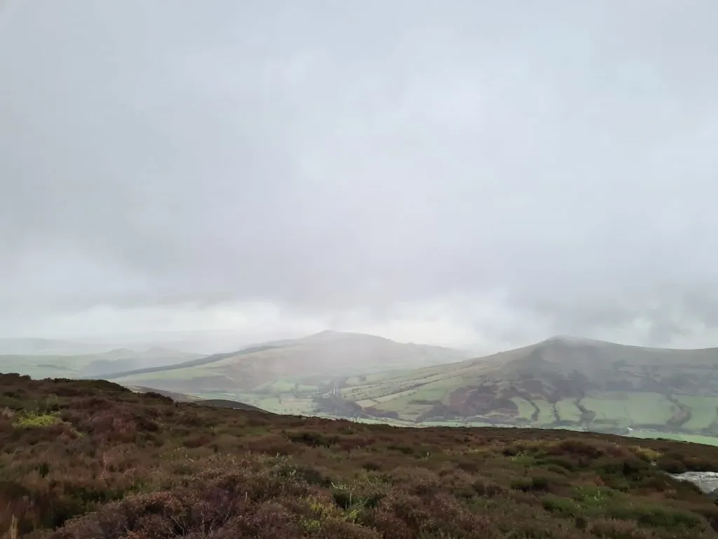
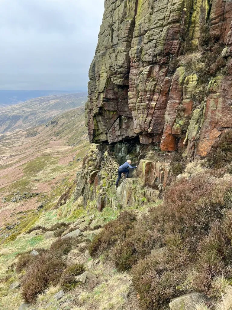
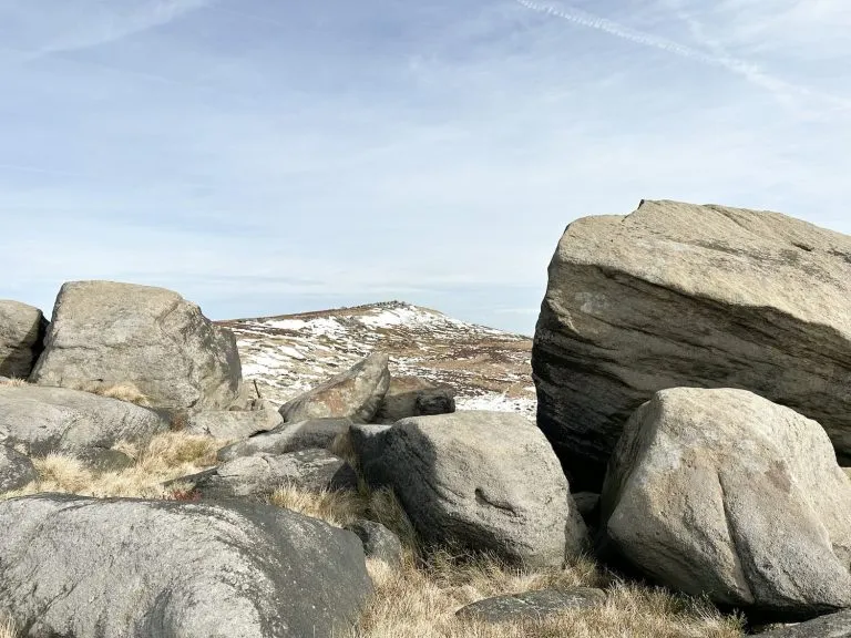
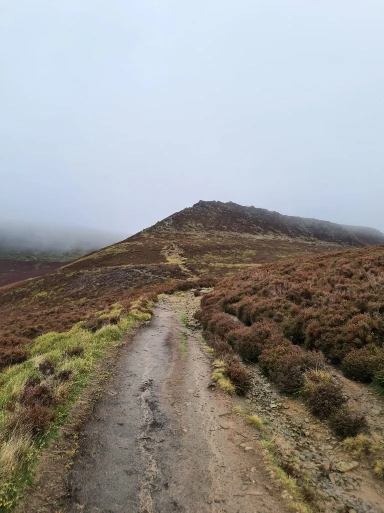
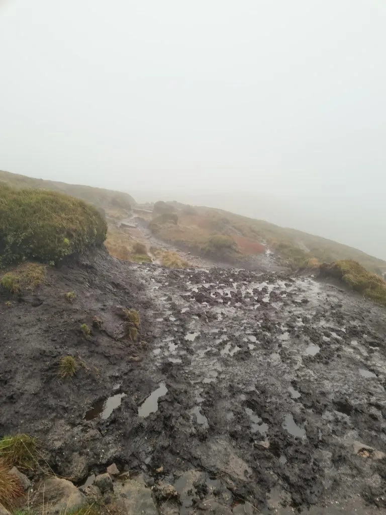
From Crookstone Knoll we turned west and set off along Blackden Edge, which again has amazing views over Alport Moor (including Oyster Clough), passing Madwoman’s Stones on the horizon. A short distance after Madwoman’s Stones you could add on a short yomp to the Edale Moor trig point (it was no weather for us to be doing that when we did this walk though!). We passed Blackden Brook, which is an excellent scramble, and then wound our way past the Seal Stones and onto Seal Edge. The paths on here were extremely peaty and boggy, which made the going really tough – in some parts it was like wading through treacle!

A very wet and peaty path on Kinder Scout

Dodging the bogs – gaitors and waterproof socks were essential!

View along The Edge on the northern side of Kinder Scout

Looking along The Edge, with a very faint Manchester in the background

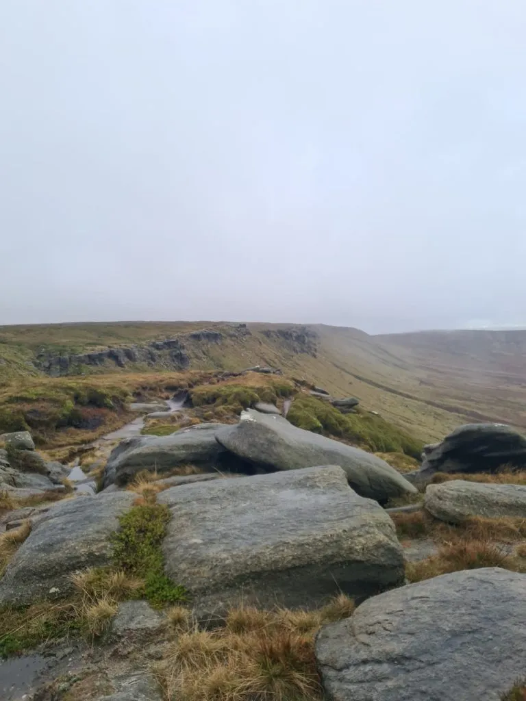
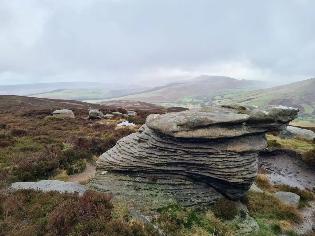
The next point to pass was Fair Brook, where we had a quick stop off for lunch, then carried on round Fairbrook Naze and it’s amazing rock formations.

The Boxing Gloves stones on Kinder Scout

The Boxing Gloves, located between Fairbrook Naze and Ashop Head. One of the most recognisable rock features on Kinder Scout

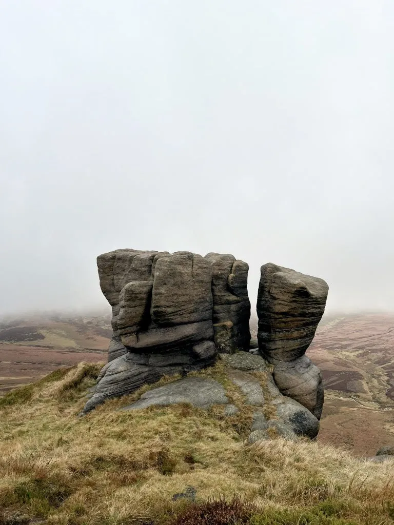
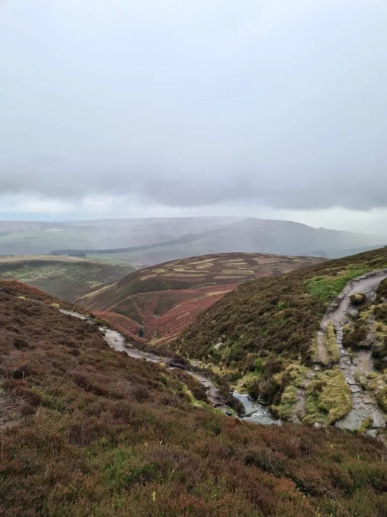
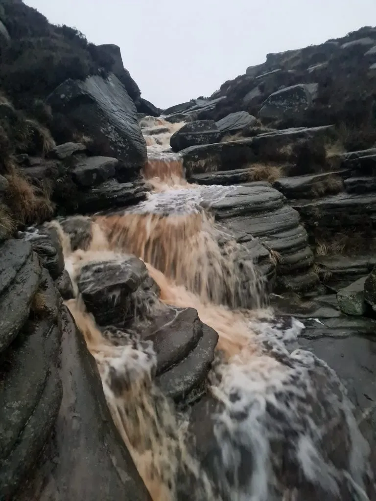
We wandered along The Edge, passing Nether Red Brook (another brilliant scramble), and many amazing rock formations, before eventually picking up the Pennine Way. We followed the Pennine Way to the south-east towards Sandy Heys, heading towards the River Kinder and the Kinder Downfall.

Kinder Downfall on Kinder Scout

Kinder Downfall – it does exist!

A woman crossing the River Kinder using stepping stones

Crossing the River Kinder using stepping stones

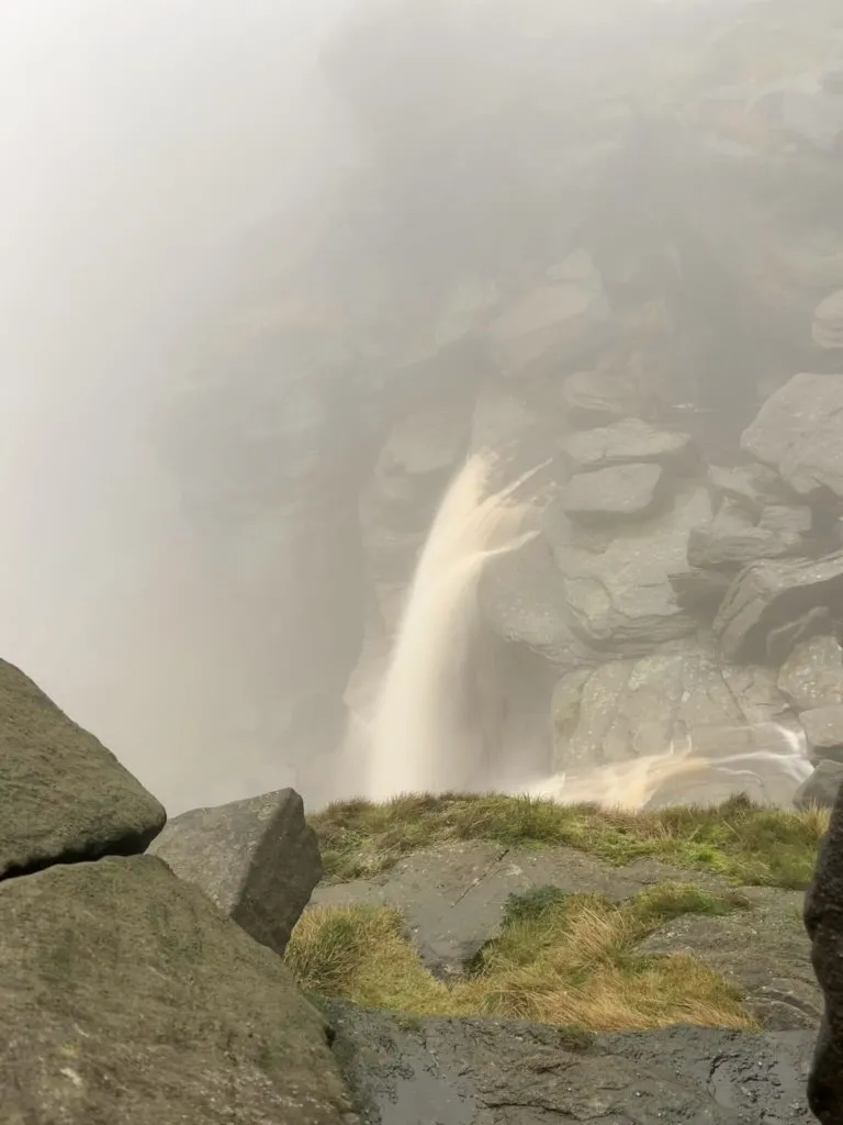
In all the times we’ve explored Kinder Scout I’ve never managed to see Kinder Downfall flowing – it’s either been way too misty or the river has been dry. This time however we saw the highest waterfall in the Peak District and had it all to ourselves!


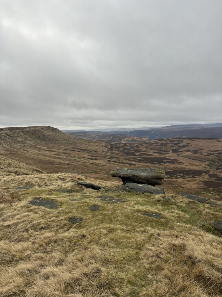
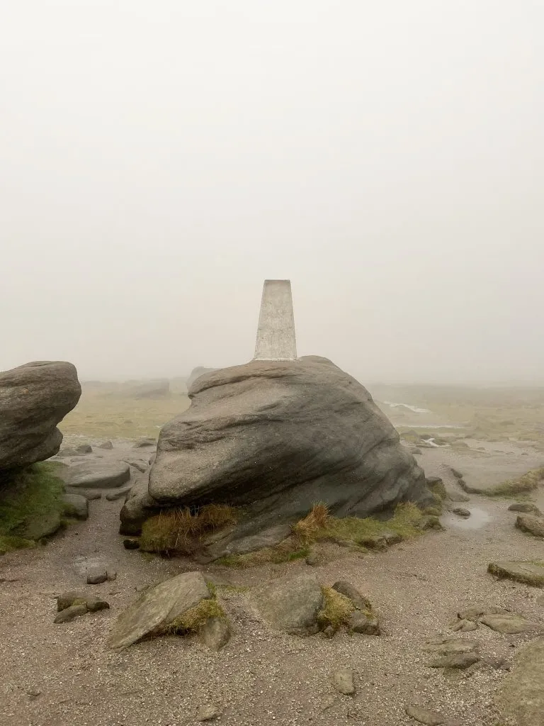
From Kinder Downfall we continued south along the Pennine Way to Red Brook (again, another scramble!) and then to Kinder Low. A lot of walkers use the trig point at Kinder Low as the summit of Kinder Scout, as it’s only 3m lower than the actual summit. Trig bagged, we headed towards Edale Rocks on the way to Swine’s Back, where we headed north-east towards Noe Stool.

Kinder Low trig point

Following the path east, we followed the path past Pym Chair and The Wool Packs and which is very wet and claggy after a period of heavy rain. Picking our way through The Wool Packs, we then headed towards Crowden Tower and further east towards Fox Holes.

A very wet and peaty path on Kinder Scout

Here you can decide whether to head up Grindslow Knoll or not, but the weather wasn’t on our side, we were against it timewise to get back to pick Hols up and it was coming dark so we decided not to. It’s a separate Ethel anyway, so I don’t mind too much. To get the 18 mile Kinder Scout perimeter walk you should probably add this on if you have time!

A very full Grinds Brook Clough

A very full Grinds Brook Clough

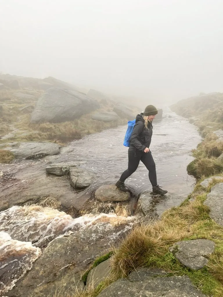
We skirted around the top of Grindsbrook Clough, having to head further upstream to cross Grinds Brook as it was in spate, making crossing very tricky. We then headed off along Upper Tor and Nether Tor before returning back down Ringing Roger to Edale.


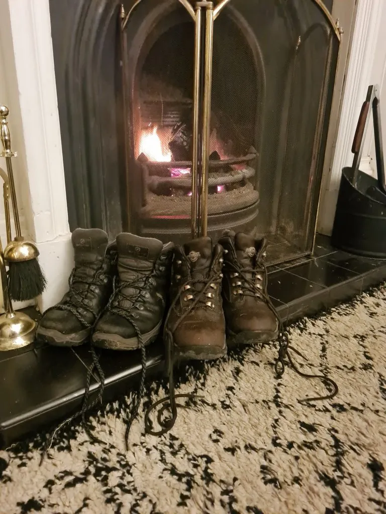
I would definitely recommend a drink in The Old Nags Head pub as a reward for this challenging walk! We however didn’t have time, as we had to collect Hols, so it was home to dry our boots!


Walking boots drying in front of an open coal fire


Is Kinder Scout a difficult walk?

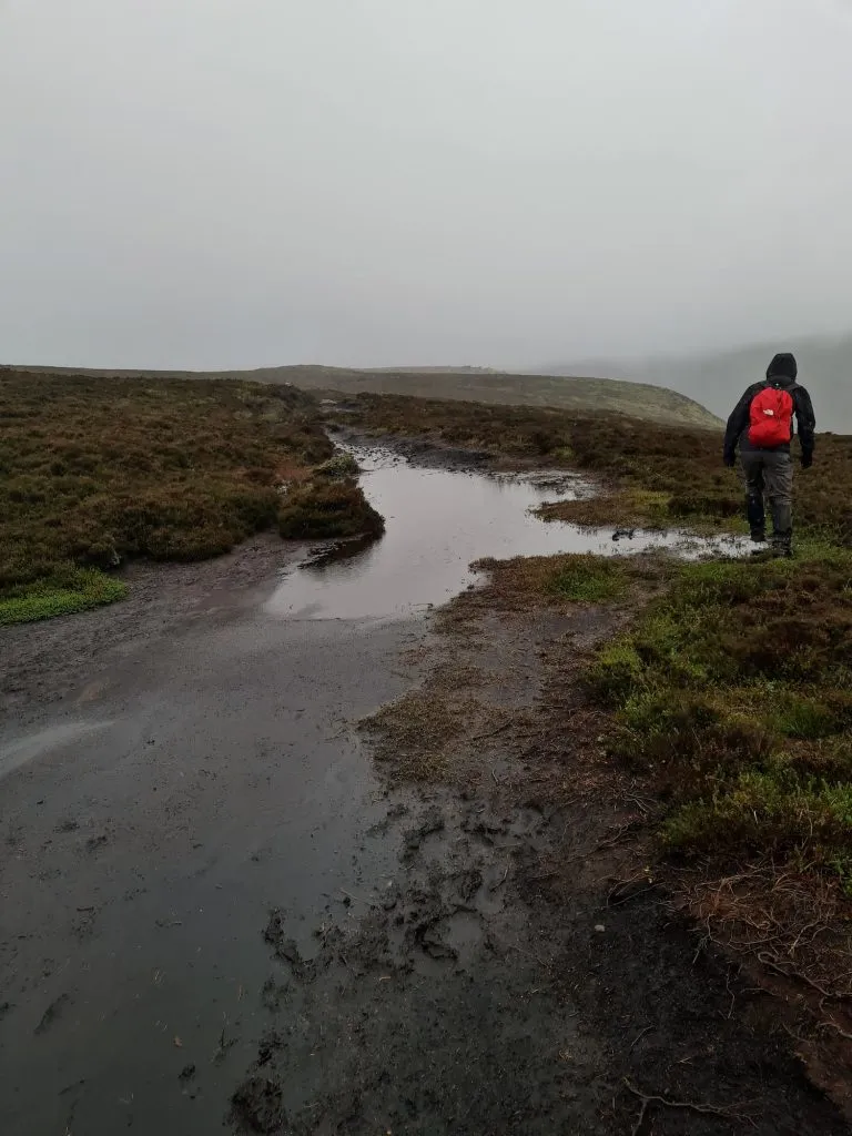
Yes. The terrain makes it very hard going in places, and it can be a challenge navigationally as well. There are paths heading off in all directions, some heading further “inland” on the plateau, which is undulating and pretty featureless so it can be easy to get lost. The weather changes very quickly up on Kinder Scout so make sure you are prepared for all weathers. The weather forecast always lies! Because of it’s gritstone centre, the Kinder plateau doesn’t absorb the water and it gets very wet and boggy underfoot.


How long does it take to walk Kinder Scout?

This walk took us 6 hours but we were moving fast and only had a very quick lunch stop. I would allow a whole day for this walk as the terrain can slow you down, and winding your way through the peat bogs can add on some extra mileage! There are obviously shorter walks which take less time than walking the whole of the Kinder Scout perimeter.


Is Kinder Scout a good walk?

Yes! Whilst challenging, Kinder Scout is one of the best places for walking in the Peak District. With ever changing, far reaching views, amazing mysterious rock formations and the title of the highest mountain in the Peak District, Kinder Scout is an amazing place to explore. We’ve been a few times now and every time we go there is something new to see and explore. It’s a place that never get boring and there are so many different walks to explore it.


Walk Map: 


Walk Map (Opens in OS Maps): Kinder Scout Perimeter Walk

Kinder Scout walk parking:

We parked in the Edale car park, Hope Road, Edale, Hope Valley S33 7ZQ W3W:/// translate.blotches.stiff It cost £6 for the full day to park and there are toilets and a cafe nearby.

Facilities: Toilets in the car park and the walk passes through Edale village where there are cafes, pubs and a shop.

Walk Time: 7-8 hours

Difficulty: ▲▲▲ (just for the bogs! It’s very wet in places)

Distance: 16.3 miles (26.85km)

Trig Points Bagged: Kinder Low

Peak District Peaks Bagged: None

Peak District Ethels Bagged: None


For some more Kinder Scout walks, why not try:


Best Kinder Scout Walks | Guides and GPX Files

Hayfield to Kinder Scout Circular Walk

Grindslow Knoll and True Kinder Scout Summit

Crowden Clough to Kinder Scout Walk

Kinder Downfall Walk via Nether Red Brook Scramble

Red Brook Scramble to Kinder Scout

Tap to share with your hiking friends!

  • Facebook
  • Email
  • WhatsApp
« Surprise View Circular Walk | 2 Miles
Best Peak District Walks for Boxing Day »

RELATED POSTS

  • Hathersage Stepping StonesHathersage Stepping Stones Walk | 7 Miles
  • Ladybower ReservoirLadybower Walk | 6 Miles
  • Anvil Stone, GrindsbrookGrindsbrook Clough Scramble to Grindslow Knoll | 7 Miles
  • Three Shires Head Walk via Axe Edge Trig Point - Peak District Circular Walk - The Wandering WildflowerAxe Edge Trig Point and Three Shires Head Walk | 10 Miles

Leave a Reply Cancel reply

Your email address will not be published. Required fields are marked *

FIND YOUR NEXT WALK:

ABOUT ME

Y Garn with Kids - Y Garn via the Devil's Kitchen Walk in Ogwen Valley

Hello! I’m Jo! Welcome to The Wandering Wildflower, an outdoors lifestyle blog focusing on family walks in the Peak District, a place we love exploring. I want to share the Peak District hidden gems and show you there’s so much more than the honeypot places. When I’m not dragging my husband and now 11 year old out on Peak District walks or up mountains, I can be found on planning my next moorland walk or plotting a Geocache walk (and seeing where the nearest pub is!). I love the hills but hate the heights, so trig bagging is – er- fun!


I hope this blog will give you some ideas of places to visit in the Peak District and inspire you and your family to head into the great outdoors.  Thanks for stopping by!

CATEGORIES

  • CIRCULAR WALKS (188)
  • HOLMFIRTH WALKS (27)
  • ISLE OF SKYE WALKS (3)
  • LAKE DISTRICT WALKS (24)
  • LANCASHIRE WALKS (2)
  • LONG PEAK DISTRICT WALKS 10 MILES + (42)
  • MEDIUM WALKS 4-9 MILES (136)
  • PEAK DISTRICT SCRAMBLES (16)
  • PEAK DISTRICT WALKS (202)
  • PEAK DISTRICT WALKS WITH KIDS (75)
  • PEAK DISTRICT WALKS WITH PUBS (60)
  • SCOTLAND WALKS (6)
  • SHORT WALKS UNDER 3 MILES (40)
  • SNOWDONIA WALKS (5)
  • UK CAMPING (5)
  • YORKSHIRE WALKS (33)

Peak District Walks

List of Peak District Ethels

Peak District Peak Bagging

Peak District Trig Point Challenge

Peak District Walks with Pubs

Peak District Walks with Kids

Beautiful Walks in Holmfirth

Short Walks in the Peak District

Long Walks in the Peak District

AFFILIATE DISCLOSURE

This blog may contain affiliate links through which, at no additional cost to you, I may earn a small commission. I only recommend products I would use myself and all opinions expressed here are my own. As an Amazon Associate I earn from qualifying purchases. Read full privacy policy here.

ARCHIVES

PEAK DISTRICT WEATHER

Peak District mountain weather on Met Office

Peak District Trig Points

Promo image for a blog post about the Peak District Trig Point Challenge With Map of Peak District Trig Points and Walking Routes by The Wandering Wildflower

Peak District Ethels Challenge

Promo image for a blog post about the Peak District Trig Point Challenge With Map of Peak District Ethels and Walking Routes by The Wandering Wildflower

WALKING ROUTES STRAIGHT TO YOUR INBOX

Want new walks in your inbox? Drop your email below and I'll send you some ideas for walks you can try.

You can unsubscribe anytime. For more details, review our Privacy Policy.

Thank you!

You have successfully joined our subscriber list.

RSS LATEST POSTS

  • Burnbank Fell, Blake Fell and Gavel Fell | 8 Miles
  • Bretton Park Circular Walk | 3 Miles
  • Hathersage Stepping Stones Walk | 7 Miles
  • Ladybower Walk | 6 Miles
  • Derbyshire Peak District Walks

FOLLOW ON PINTEREST

Want new walks in your inbox? Drop your email below and I'll send you some ideas for walks you can try.

You can unsubscribe anytime. For more details, review our Privacy Policy.

Thank you!

You have successfully joined our subscriber list.

jo@thewanderingwildflower.co.uk

The Wandering Wildflower

  • Email
  • Facebook
  • Instagram
  • Pinterest
  • PRIVACY POLICY
  • TERMS & CONDITIONS
  • ABOUT

(c) The Wandering Wildflower. All Rights Reserved.

|| THEME BY ECLAIR DESIGNS