• 3 Mile Walks or Less
  • 4 Mile Walks
  • 5 Mile Walks
  • 6 Mile Walks
  • 7 Mile Walks
  • 8 Mile Walks
  • 9 Mile Walks
  • 10 Mile Walks
  • 11 Mile Walks
  • 12 Mile Walks
  • 14 Mile Walks
  • 15 Mile Walks
  • 20+ Mile Walks

The Wandering Wildflower

Peak District Hikes

  • PEAK DISTRICT WALKS
    • SHORT WALKS UNDER 3 MILES
    • MEDIUM WALKS 4-9 MILES
    • LONG PEAK DISTRICT WALKS 10 MILES +
  • PEAK DISTRICT WALKS WITH PUBS
  • PEAK DISTRICT WALKS WITH KIDS
  • HOLMFIRTH WALKS

Ashway Moss and The Trinnacle Circular Walk | 9 Miles

February 1, 2022 CIRCULAR WALKS, LONG PEAK DISTRICT WALKS 10 MILES +, MEDIUM WALKS 4-9 MILES, PEAK DISTRICT WALKS, PEAK DISTRICT WALKS WITH PUBS

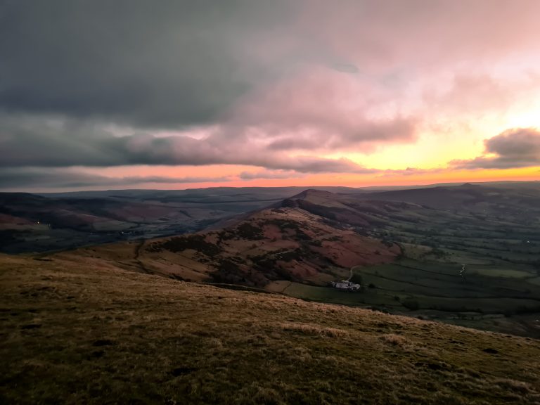
This Ashway Moss circular walk takes in stunning views (not when we went!) over Dovestone Reservoir and The Trinnacle. At 14km (8.7 miles) it’s a challenging Peak District walk over moorland and with a steep, rocky scramble up Birchen Clough to get to The Trinnacle. Here’s the route for this circular walk around Ashway Moss and The Trinnacle, set on the edge of the Peak District.

A woman standing in front of The Trinnacle above Dovestone Reservoir in the mist - The Wandering Wildflower

Not quite the amazing views everyone else gets!

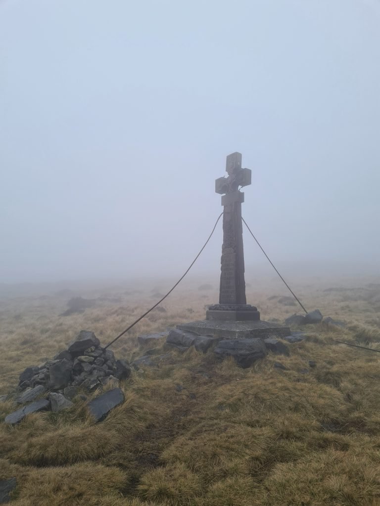
Ashway Moss is a summit at 497m above sea level, high on the moors at the edge of the Peak District. There is nothing to mark the summit, however there is the remains of a cairn nearby and the summit is not far from the Ashway Cross. This is a rather grand memorial to James Platt, an Oldham MP who died in a shooting accident.


As well as Ashway Moss and The Trinnacle, this walk also takes in the stunning rock formations at Raven Stones, Dean Rocks, Great Dove Stone Rocks and Bramley’s Cot before heading round to Dish Stone Brow and heading back down the Chew Road. The views are incredible from here (on a clear day, not when we went!).

Mist rolling up over the moors with Dovestone Reservoir down in the valley bottom

Mist rolling up over Saddleworth moors with Dovestone Reservoir down in the valley bottom


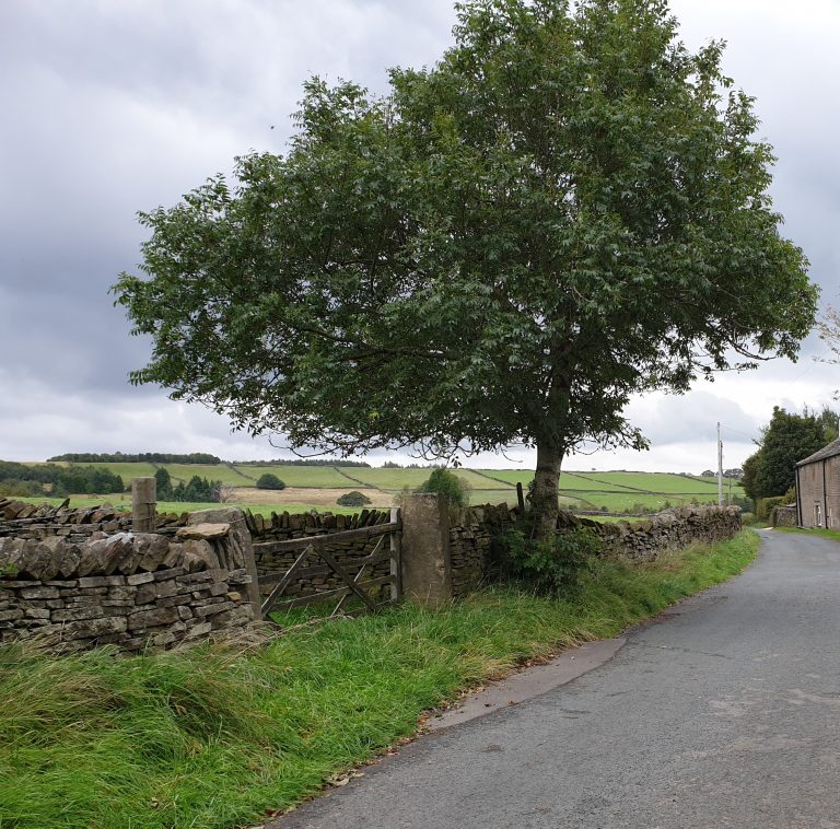
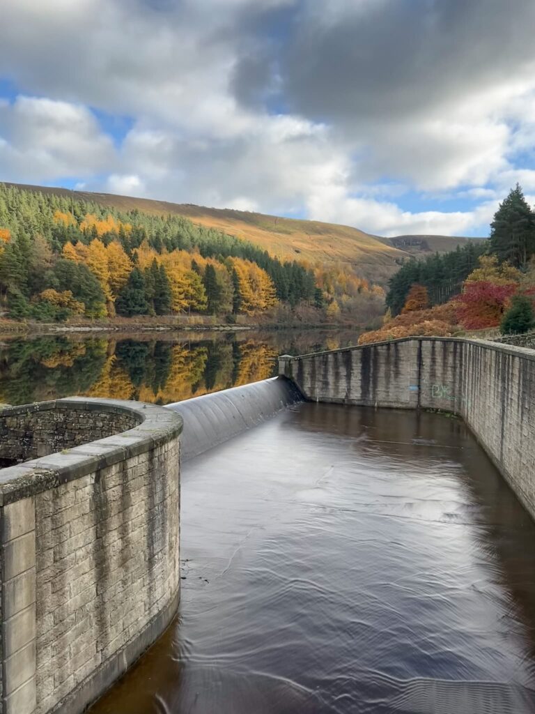
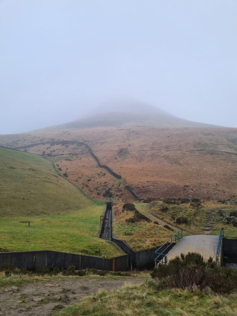
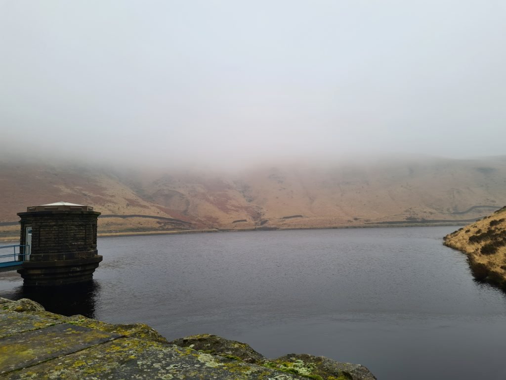
The route starts at Binn Green car park and follows the side of Yeoman Hey Reservoir before crossing the embankment and climbing up to Greenfield Reservoir. There is a much easier path though! You can see this on my How to Find The Trinnacle route post. We didn’t know this! There is a track along the edge of Greenfield Reservoir however, which leads you to the head of the reservoir where Greenfield Brook flows into it. There are stepping stones to cross just before the weir, which is rather beautiful, even on a misty day.

Skinny gateway in the wall at Binn Green

Skinny gateway in the wall at Binn Green – go through and turn left


The road down to Yeoman Hey Reservoir

Skinny gateway in the wall at Binn Green

Fork in the road around Yeoman Hey Reservoir

Fork in the road around Yeoman Hey Reservoir – we took the right hand path but the easier path is the left hand one

Looking up to Ashway Rocks from Yeoman Hey Reservoir

Looking up to Ashway Rocks from Yeoman Hey Reservoir – you can just see the path up the side of the embankment, where the grass changes from brown to green.

Views over a misty Greenfield Reservoir on the way to The Trinnacle

Views over a misty Greenfield Reservoir on the way to The Trinnacle


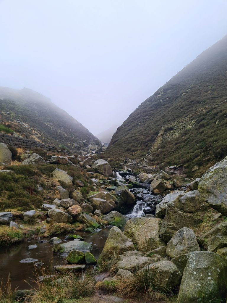
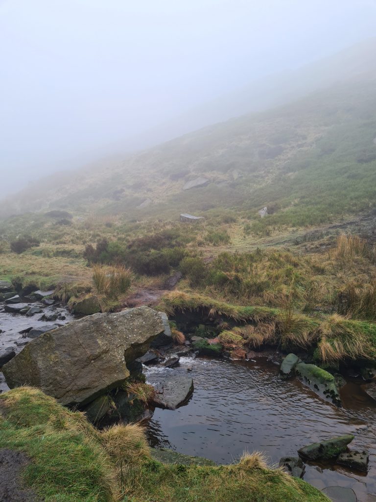
The path follows the route of Greenfield Brook until it meets Birchen Clough. Here there is a waterfall where Birchen Clough flows into Greenfield Brook, and a bridge. Cross the bridge and go through the gate. You’ll be able to see the Clough in front of you, and there’s a faint path up through the Clough which starts on the right hand side and crosses over to the left. It starts off steep and gradually levels out and becomes less scrambly as you get higher. Be sure to have waterproof boots on, as it can be very wet! It was really murky and icy when we went up.

Birchen Clough, on the way to The Trinnacle

Birchen Clough, on the way to The Trinnacle

Birchen Clough, on the way to The Trinnacle

Birchen Clough, on the way to The Trinnacle

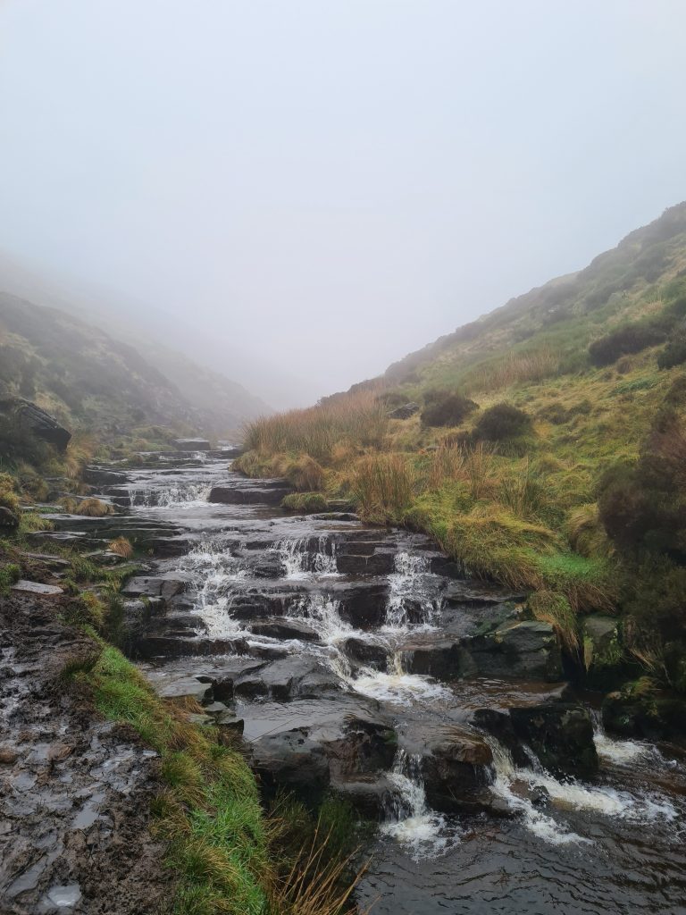
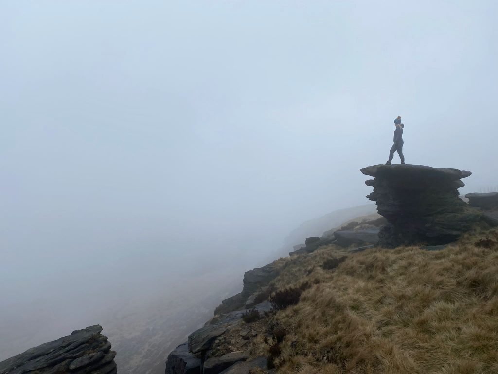
As the Clough levels out, you’ll be on the left as you go up. You need to be on the right hand side of the Clough and there is a big rock and stepping stones. Climb up the hillside, following the path round to the north-west. Follow the ridge of the hill and you’ll start to see some rock formations at Raven Stones, which is where The Trinnacle is.

How to Find The Trinnacle - The Wandering Wildflower

The Trinnacle, looking all moody and atmospheric

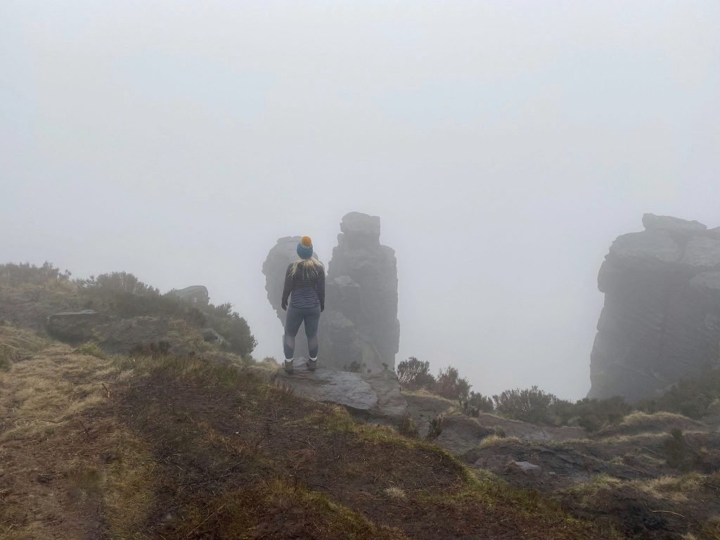
Some people like to climb The Trinnacle. If you decide to do this, please take care. If the weather is bad or the rocks are slippery don’t try it – Oldham Mountain Rescue have already had to come out to deal with people falling from The Trinnacle! Climb it at your own risk. It was way too slippery and icy when we went so we didn’t bother.


Mud and ice on the paths near The Trinnacle

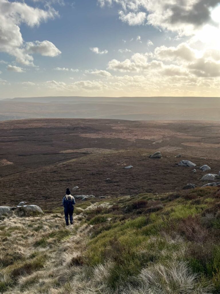
After we’d taken some photos of The Trinnacle (which looks like something out of Lord of The Rings) we headed up the hill to find Ashway Moss. This involves a trek over open moorland, and can be very wet underfoot. You’ll come to the remains of a large cairn which has been hollowed out in the middle, presumably to act as a wind shelter. Not far from this is the actual summit of Ashway Moss but there isn’t a marker or anything – we relied on the OS GPS to tell us when we got to the top.

A woman in the mist at the summit of Ashway Moss - Peak District Ethels walks from The Wandering Wildflower

The summit of Ashway Moss

From here, we headed towards the Ashway Cross. Visibility was terrible, so we couldn’t see the views from the cross, and it just loomed out of the mist at us.

Ashway Cross - Peak District Ethels walks from The Wandering Wildflower

Ashway Cross - Peak District Ethels walks from The Wandering Wildflower

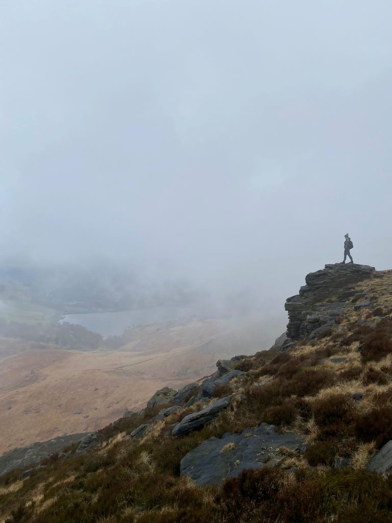
Photos of the Cross duly taken, we headed along the path towards Dean Rocks and Great Dove Stone Rocks. There are apparently incredible views over Dove Stone Reservoir and Yeoman Hey Reservoir from here, but we only saw mist!

Bramley's Cot, near Dovestone Reservoir - Peak District Ethels walks from The Wandering Wildflower

Bramley’s Cot

View through the window of Bramley's Cot, near Dovestone Reservoir - Peak District Ethels walks from The Wandering Wildflower


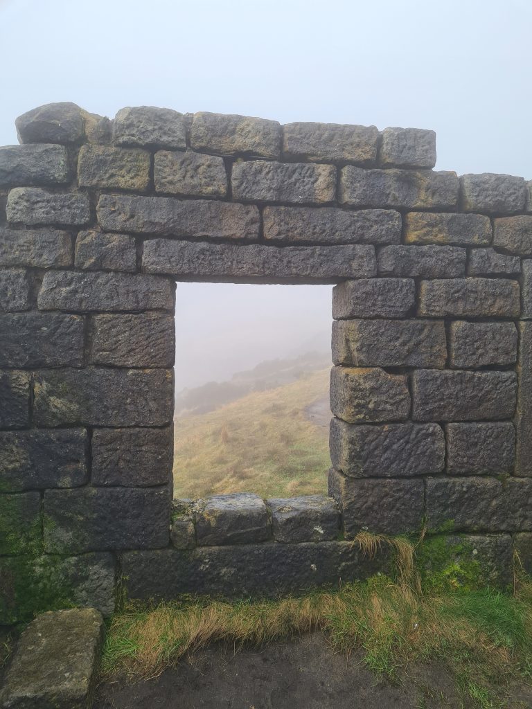
The path takes you along the ridge and you’ll eventually come to Bramley’s Cot, a small ruined building set back into the rock face. According to The Saddleworth Independent, “It is believed to have been built between 1857 and 1889 possibly by workers from Greenfield Mill (now Fletchers) for one-time owner Bramley Bottomley. Bramley and wife Sarah are buried at St Chad’s Church, Uppermill.

Alternatively, it has been suggested tragic MP James Platt, who was killed in a shooting accident at Ashway Gap in 1857, or cotton manufacturer Abel Buckley MP JP, who bought the estate and moor around 1880, had the hut built.” Whatever it’s use, it’s a really cool place!


As we followed the path round the head of the ridge, the mist started to lift in places and gave us glimpses of the views below. We only got glimpses though! We’ll have to come back in summer when the weather is better. It didn’t stop us having a really lovely walk though.

Rock formations on the ridge above Dovestone Reservoir

Rock formations on the ridge above Dovestone Reservoir

I did a lot of standing on the rocks in the mist!

Rock formations on the ridge above Dovestone Reservoir

Rock formations on the ridge at Dish Stone Rocks above Dovestone Reservoir

The mist slowly starting to clear at Dish Stone Rocks


We got to the road just below Chew Reservoir and headed down the side of the old quarry to join it. This road takes you all the way back down to Dovestone Reservoir, and you can follow whichever way around you like to get back to the car park at Binn Green.

Chew Brook

Chew Brook

We had the choice between extending the walk to include the Alphin Pike trig point or heading back for a pub lunch – the pub lunch won! We headed to our old favourite The Huntsman Inn and had a delicious lunch (huge thanks to Cat and her team for fitting us in as they were really busy!).


You might like this slightly longer The Trinnacle Trail and Alphin Pike,  Dove Stone Reservoir Skyline Walk or Wilderness Gully West Scramble | 5 Miles.


Here’s the route details for this Ashway Moss and The Trinnacle circular walk.


Ashway Moss and The Trinnacle Walk Route Map: (click the image to download the gpx file for your device)


Parking: Binn Green Car Park OL3 7NN

Facilities: There are toilets at the Dove Stone Reservoir car park but nothing on this route.

Walk Time: 3-4 hours depending on your speed and fitness

Difficulty: ▲▲▲

Distance: 14km (8.7 miles)

Trig Points Bagged: None

Peak District Peaks Bagged: Ashway Moss

Peak District Ethels Bagged: Ashway Moss


For more walks from Dovestone Reservoir, check out Dovestone Reservoir to Alphin Pike Circular Walk, Dovestone Circular Walk and Aldermans Hill to Broadstone Hill Trig Point Walk.

Tap to share with your hiking friends!

  • Facebook
  • Email
  • WhatsApp
« Digley Reservoir Circular Walk | 3 Miles
Corbar Hill, Black Edge and Combs Head Circular Walk | 7 Miles »

RELATED POSTS

  • Hathersage Stepping StonesHathersage Stepping Stones Walk | 7 Miles
  • Ladybower ReservoirLadybower Walk | 6 Miles
  • Anvil Stone, GrindsbrookGrindsbrook Clough Scramble to Grindslow Knoll | 7 Miles
  • The ruins of Errwood HallErrwood Hall and Shining Tor Plane Wreck | 7 Miles

Leave a Reply Cancel reply

Your email address will not be published. Required fields are marked *

FIND YOUR NEXT WALK:

ABOUT ME

Y Garn with Kids - Y Garn via the Devil's Kitchen Walk in Ogwen Valley

Hello! I’m Jo! Welcome to The Wandering Wildflower, an outdoors lifestyle blog focusing on family walks in the Peak District, a place we love exploring. I want to share the Peak District hidden gems and show you there’s so much more than the honeypot places. When I’m not dragging my husband and now 11 year old out on Peak District walks or up mountains, I can be found on planning my next moorland walk or plotting a Geocache walk (and seeing where the nearest pub is!). I love the hills but hate the heights, so trig bagging is – er- fun!


I hope this blog will give you some ideas of places to visit in the Peak District and inspire you and your family to head into the great outdoors.  Thanks for stopping by!

CATEGORIES

  • CIRCULAR WALKS (189)
  • HOLMFIRTH WALKS (27)
  • ISLE OF SKYE WALKS (3)
  • LAKE DISTRICT WALKS (26)
  • LANCASHIRE WALKS (2)
  • LONG PEAK DISTRICT WALKS 10 MILES + (42)
  • MEDIUM WALKS 4-9 MILES (137)
  • PEAK DISTRICT SCRAMBLES (16)
  • PEAK DISTRICT WALKS (206)
  • PEAK DISTRICT WALKS WITH KIDS (76)
  • PEAK DISTRICT WALKS WITH PUBS (60)
  • SCOTLAND WALKS (6)
  • SHORT WALKS UNDER 3 MILES (40)
  • SNOWDONIA WALKS (5)
  • UK CAMPING (5)
  • YORKSHIRE WALKS (33)

Peak District Walks

List of Peak District Ethels

Peak District Peak Bagging

Peak District Trig Point Challenge

Peak District Walks with Pubs

Peak District Walks with Kids

Beautiful Walks in Holmfirth

Short Walks in the Peak District

Long Walks in the Peak District

AFFILIATE DISCLOSURE

This blog may contain affiliate links through which, at no additional cost to you, I may earn a small commission. I only recommend products I would use myself and all opinions expressed here are my own. As an Amazon Associate I earn from qualifying purchases. Read full privacy policy here.

ARCHIVES

PEAK DISTRICT WEATHER

Peak District mountain weather on Met Office

Peak District Trig Points

Promo image for a blog post about the Peak District Trig Point Challenge With Map of Peak District Trig Points and Walking Routes by The Wandering Wildflower

Peak District Ethels Challenge

Promo image for a blog post about the Peak District Trig Point Challenge With Map of Peak District Ethels and Walking Routes by The Wandering Wildflower

WALKING ROUTES STRAIGHT TO YOUR INBOX

Want new walks in your inbox? Drop your email below and I'll send you some ideas for walks you can try.

You can unsubscribe anytime. For more details, review our Privacy Policy.

Thank you!

You have successfully joined our subscriber list.

RSS LATEST POSTS

  • How to Find Three Shires Head
  • Peak District Pub Walks
  • Burnbank Fell, Blake Fell and Gavel Fell | 8 Miles
  • Bretton Park Circular Walk | 3 Miles
  • Grasmere Weekend Break

FOLLOW ON PINTEREST

Want new walks in your inbox? Drop your email below and I'll send you some ideas for walks you can try.

You can unsubscribe anytime. For more details, review our Privacy Policy.

Thank you!

You have successfully joined our subscriber list.

jo@thewanderingwildflower.co.uk

The Wandering Wildflower

  • Email
  • Facebook
  • Instagram
  • Pinterest
  • PRIVACY POLICY
  • TERMS & CONDITIONS
  • ABOUT

(c) The Wandering Wildflower. All Rights Reserved.

|| THEME BY ECLAIR DESIGNS